PaleoGIS Overview & Update by Karen Meinstein, Rothwell: 2013/Third Annual PaleoGIS & PaleoClimate Users Conference
•Download as PPTX, PDF•
1 like•1,373 views


Recommended
More Related Content
What's hot
What's hot (20)
Viewers also liked
Viewers also liked (20)
Similar to PaleoGIS Overview & Update by Karen Meinstein, Rothwell: 2013/Third Annual PaleoGIS & PaleoClimate Users Conference
Similar to PaleoGIS Overview & Update by Karen Meinstein, Rothwell: 2013/Third Annual PaleoGIS & PaleoClimate Users Conference (20)
More from The Rothwell Group, L.P.
More from The Rothwell Group, L.P. (13)
Recently uploaded
Recently uploaded (20)
PaleoGIS Overview & Update by Karen Meinstein, Rothwell: 2013/Third Annual PaleoGIS & PaleoClimate Users Conference
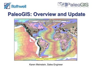
- 1. PaleoGIS: Overview and Update Karen Meinstein, Sales Engineer
- 2. What is PaleoGIS? A GIS application that performs spatial analyses of plate tectonic motion over time Provides fast, easy-to-use, dynamic plate-tectonic reconstructions An industry standard software package - Used by most of the world's largest global oil, gas and mineral exploration companies Operates on ESRI's ArcMAP platform as a fully integrated extension
- 3. Reconstructions "Reconstruct" plate models to any specified age within the model's range Reconstruct any user data to the desired age - Visualize vector and raster data in a paleogeographic context “Un-reconstruct” data from known paleo-location to present day position Present Day 80 MYA
- 4. Animations Create high-quality animations for use in presentations and other media
- 5. Analysis Tools Includes tools for performing specialized plate motion analyses: - Point Path Visualization and Azimuth & Rate vs. Time - show a plate’s direction and speed over time - Instantaneous Motion - shows relative plate motion at a specified age Custom analysis solutions available on a consulting basis
- 6. Plate Models PaleoGIS is compatible with major commercial and academic published plate models - Provides a unified platform for plate tectonic analysis Supports rigid and deformable models Supports plate-model-vendor time slices Includes tools for plate model editing and development
- 7. Upcoming Releases PaleoGIS v4.2.1 - Compatible with ArcGIS 10.1 - Currently in Beta testing - Release date: End of Q4 2013 PaleoGIS v4.2.2 - Compatible with ArcGIS 10.2 - Release date: Q1 2014 Note: v4.2.x requires Dot Net Framework 4.0, which is available as a free download
- 8. New Raster Method Converts raster to point feature class and then reconstructs the points Raster is re-sampled to user-specified resolution before conversion Converts reconstructed points back to a single raster
- 9. New Raster Method Works on rasters that cover large areas, including global rasters Provides results that are consistent with vector reconstructions Accepts all coordinate systems, not just WGS 84 Old method is still available
- 10. New Raster Method Raster size = 798 MB, Cell size = 0.017 x 0.017 degrees
- 11. New Raster Method Resampled to 1% of original resolution (cell size = 0.17 x 0.17 degrees)
- 12. Un-Reconstruct Improvements Rasters now supported! - Allows scanned images to be un-reconstructed Results can be saved by saving the reconstruction data frame that contained the original layer Original symbology (vector and raster) is preserved
- 13. Other New Features New data frame added when models are loaded - Existing layers are no longer removed from map All user settings are persisted between sessions One-click enable/disable of proxy server settings - Simplifies work environment transitions Ability to change output name when saving reconstructions Two updated demo models - Scotese Model v2d3 - Earthbyte (Seton 2012)
- 14. Other New Features Ability to change feature symbology based on age using time-dependent joins PaleoClimate launcher added to Analysis Tools toolbar Assorted bug fixes including: - Ability to save reconstructions that contain time slices - WMS time slice layers are only added to map once - Undo/Redo functions work correctly for Enter Pole tool
- 15. Questions?