2. 2
Contents
About AAM................................................................................................................................................................................................................................3
Why Use Geocirrus Cities ..........................................................................................................................................................................................................4
Smart, integrated, multi-dimensional 3D web solution...........................................................................................................................................................5
Scalable & Flexible....................................................................................................................................................................................................................6
Powerful Capabilities – Core Support......................................................................................................................................................................................7
Full Cloud ...................................................................................................................................................................................................................................9
Streamlined Site Setup and Maintenance............................................................................................................................................................................10
3. 3
About AAM
AAM is an Australian based geospatial services company. AAM captures,
measures and presents the real world, in order to support intelligent planning and
management of the natural and built environment.
With decades of experience and advancements in built environment models, 3D
visualisation and Smart technologies, to help you make faster and more accurate
location decisions. In operation for 50+ years, AAM employs over 300 geospatial
professionals ready to serve you and offer unique end to end solutions.
AAM captures the full range of geospatial information, including multi-resolution
imagery and high density LiDAR, mobile and terrestrial laser scanning; using a wide
range of data capture sensors and a fleet of custom equipped aircraft, vessels
and vehicles operating across Australia, New Zealand, South East Asia, Middle East and Africa.
We create Building Information Models, reality cityscapes, time-enabled basemaps, urban forests, optimal solar surfaces and dynamic IoT mobile and sensor
data streams. We integrate bi-directionally with multiple business systems to streamline your operations and build tools to easily view, present, analyse, edit,
maintain and share your data. We help you get the most out of your spatial data and technology investments through Professional and Managed Services across
multiple platforms, applications and formats.
Rapid and easy access to these integrated data and tools, through our cloud platform Geocirrus, improves productivity and outcomes by enabling you to make
faster and informed location decisions. Whether you need data collection, GIS-enabled workflows, complex analysis, or to visualise a transport network,
visit www.aamgroup.com to find out more about our capabilities or contact us info@aamgroup.com to discuss how we can help you.
4. 4
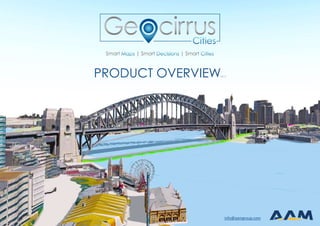
Why Use Geocirrus Cities
As our cities become ever more populated, we need smarter solutions to better plan and manage our cities and built environment. In increasingly complex
urban environments, Geocirrus Cities provides the platform for informed decision making by providing user friendly, visualisation, analysis and collaboration
tools. Geocirrus Cities is 3D web application that brings together various elements of a city scape providing to provide a unified, holistic and end-to-end
integration to help city administrators, planning agencies and property developers to plan and manage increasingly complex urban environments.
Providing intelligent and intuitive visualisation and analysis of the real world, Geocirrus Cities incorporates easy to use navigation and analysis tools, with
information rich, time-enabled geospatial information for managing and planning the urban environment.
Intuitive smart analytic tools provide support for complex decision making and scenario analysis. Geocirrus Cities is fully cloud based, so your 3D web site and
private data are safe and secure, and not dependent on complex internal hardware or software systems and in-house GIS and BIM experts.
Geocirrus Cities also supports visualising neighbourhoods over time, the integration of IoT and ‘live data feeds’ thus ensuring that Geocirrus Cities sites are
activated (alive) and constantly evolving and not just a static view of a point in time.
Geocirrus Cities Snapshot
✓ Display, interrogate and analyse complex urban Digital Twins
✓ Supports a vast range of common 2D and 3D GIS and BIM data
✓ Visualise and contextualise faster & more efficiently with a 3D view of the real world
✓ Intelligent, evidence based support for urban planning and city management
✓ Engage internal & external stakeholders by way of intuitive and secure web technology to any device, anytime, anywhere
5. 5
Smart, integrated, multi-dimensional 3D web solution
Think Spatially
Geocirrus Cities gives your data spatial context with 3D visualisation and allows you to identify and analyse patterns that can only
been seen in 3d, to solve real problems …
Plan Smarter
Geocirrus Cities delivers spatially integrated information and tools, to easily manage and maintain your city’s infrastructure. For
better understanding of services and assets, and better decision making for your stakeholders and the community …
Share and Collaborate
Geocirrus Cities is designed to support sharing and collaboration. Non-technical users can easily add, manipulate and view
multiple CAD or BIM Models, in order to access new developments and to share and consult with stakeholders …
Engage Your Community
Geocirrus Cities promotes transparency between government, business and the public communities in an open manner
Minimal Training
Geocirrus Cities makes it easy for non-technical users to use, to mark-up maps, to perform analysis, to query and to search for data.
Simple Solutions for Complex Issues
Geocirrus Cities incorporates a simple, yet powerful interface. And provides all of this without the cost, risk and headache of
managing on premise IT and GIS infrastructure …
6. 6
Scalable & Flexible
Quick to Deploy
3D app accessible through your
browser with minimum fuss. No
need for investment in complex
infrastructure or highly specialised
technical staff.
Content Rich
Designed to make information
rich, time-enabled 3D
geospatial & IoT data
accessible.
Powerful Integration
Link to external spatial and a-
spatial databases, files or web
services, with integration options
that allow you to visualize and
interact with key 3rd party business
data directly in the app.
Intuitive User Interface
Easy to use web solution with
minimal training, designed to
maximise visualisation,
management and reporting
around urban centric 3D data
and processes
7. 7
Powerful Capabilities – Core Support
2D and 3D Point and Vector Data
Direct support for all common 2D and 3D GIS data sets
3D ‘Reality’ Mesh Models
Support for very high-resolution 3D Mesh Models as well as City or Regional Wide 3D Mesh Models
Terrain data
Full support for very high-resolution LiDAR (Las) and gridded terrain data
Point Cloud Data:
Full support for airborne LiDAR, mobile (vehicle based) LiDAR and static Terrestrial Laser
Scanning data at very high point densities.
High Resolution Aerial Imagery:
Includes support for subscription services (eg Nearmap) and Open Geospatial Consortium
(OGC) Imagery services
8. 8
Adding in new Development Proposals or Precinct Designs
With Geocirrus Cities authorised users have the ability to add in new development proposals, create new projects, import, place, add supporting imagery, text
and links independent of AAM staff.
Refer Geocirrus Cities Feature Guide.pdf for further details.
9. 9
Full Cloud
Geocirrus Cities, Full Cloud, is a complete AAM hosted solution for geospatial data including our 3D web application, Geocirrus Cities. The solution allows for
the publishing of geospatial data, via the AAM Geocloud (AWS) environment for consumption in the Geocirrus Cities web application.
In the Geocirrus Cities ‘Full Cloud’ option, both the software and data components are hosted in the AAM Geocloud (AWS) cloud. The advantage for the
client is that AAM provides the optimisation, storage and maintenance of the core 3D GIS data sets that provide the backbone for each Geocirrus Cities site.
The Full Cloud option is ideal for clients who have a ‘cloud first’ or ‘cloud always’ policy. The Full Cloud approach ‘frees’ the client to concentrate on the
business applications as opposed to maintaining and publishing often large and complex 2D and 3D GIS data sets and maintaining a complex in house GIS
environment.
10. 10
Streamlined Site Setup and Maintenance
AAM has developed a 10 point workflow from initial consultation to delivery and support:
1. Establish a private instance of Geocirrus Cities.
2. Register / authenticate named users to Geocirrus Cities application.
3. Establish Geocirrus Cities secure database to manage the creation of projects within Geocirrus Cities.
4. Setup the hosting environment to receive project data correctly.
5. Review the initial client data, discuss the correct use of 3D vs 2D for data representations, optimise and publish the data.
6. Set up the Geocirrus Cities base data layers comprising the client data, correct grouping, symbology, access rights and slides.
7. Configure Geocirrus Cities to the client base data layers and appropriate tools from those available.
8. Review the performance of the system.
9. Provide training on the use of Geocirrus Cities and the support mechanism that AAM provides for quick reliable customer assistance.
10. AAM will provision two additional base data layers uploads per year if/as required.
11. 11
Requirements
Client Requirements for
acceptable user
experience
Operating System Windows 7/8/10 (64 bit)
Browser Chrome, Edge, Firefox - HTML5 compatible web
browser
Graphics Hardware Late model intel onboard with latest Intel drivers for 3D
/ Discrete GPU (Nvidia or AMD)
Mobile Modern late model mobile device support is currently
possible through Chrome, AAM is developing a
dedicated user interface for better mobile support
Supported Data
Supported Data Supported sources for web publishing
Terrain Esri Grid, Esri ASCII Grid, ASCII XYZ, GeoTIFF, TIFF, LERC
Basemaps Custom ESRI Basemaps, Georeferenced Aerial
Imagery TiFF, JP2, ECW
Imagery GeoTiFF, JP2, ECW
Features Esri Geodatabase, shapefile
Mesh SLPK from 3D Mesh
3D Objects ESRI Multipatch
BIM RVT
3D Model 3DS, DAE, OBJ, FBX, GLTF
Point Clouds LAS
Supported Data Supported sources for web services
ESRI Compatible ESRI compatible LLWGS84 or Web Mercator map,
feature and image services
www.aamgroup.com
2/23, 6-10, O'Connell Street
Sydney
NSW 2000
Australia
+61 7 3620 3111
info@aamgroup.com