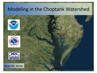
2. Modeling in the Choptank Watershed
Ryan M. Jones
NHD HUC 8 Watershed
Code: 02060005
3. Project Objectives
Explore ways to leverage the MARFC’s hydrologic
modeling and forecasting expertise to support
Choptank Habitat Focus Area Objectives.
Specifically evaluate modeling techniques to
support:
- Gridded runoff simulations and forecasts
- Fertilizer application decision support
- Sediment simulations and forecasts
4. Previous Work: Choptank Literature Review
• Time Series Analysis
• Models
– General Water Loading Function (GWLF)
– Hydrologic Simulation Program – Fortran (HSPF)
5. HSPF – Hydrologic Simulation Program -- Fortran
• Simulates hydrology, nutrients, and sediment
• Used to model the entire Chesapeake Bay
Watershed
• Used for regulatory purposes, evaluating the
impacts of land use change and the impacts of
best management practices (BMPs)
6. GWLF – Generalized Water Loading Function
• Comparable to HSPF
• Typically use coarser temporal data
• Developed by Dr. Douglas Haith at Cornell
University in collaboration with the USEPA
• Used for assessing Total Maximum Daily Loads
(TMDL)
7. What is new to our approach?
• High Resolution Multi-sensor Precipitation
Estimates from gages and radar: 4 km2, 1 hour
resolution
• Gridded, spatially-distributed hydrologic
model
• Hydraulic Routing
• Ability to forecast – deterministic or
probabilistic
9. Hydrologic Models Run Using the Office of
Hydrologic Development (OHD) Research
Distributed Hydrologic Modeling (RDHM)
Software
• Gridded NWS Snow – 17
• Gridded Sacramento model with Soil Moisture
Accounting (SAC – SMA)
• Hill-slope and Channel Kinematic Wave Routing
10. Why we expect success
• RDHM models performed well in OHD’s Distributed
Model Intercomparison Projects
• RDHM land-use and soil-based parameterization
techniques have proven viable
• RDHM runoff estimates correlate well with USDA
runoff estimates in the Mahantango Creek
experimental watershed in PA
• Fertilizer Forecaster Capability – Collaborating with
Penn State and the USDA
• Wisconsin Department of Agriculture, Trade,
and Consumer Protection already has a
similar runoff advisory tool that uses NWS
forecasts
http://pa.water.usgs.gov/rechar
ge/station_landuse/01555500_l
anduse.html
11. A lumped Model, such as the Sacramento Model, simulates the
hydrology of a region of interest with homogeneous or “lumped”
parameters.
Watersheds boundaries were created
from HUC 14 watersheds to match
gage locations
12. Distributed hydrologic models discretize the area of interest
into uniform cells. Each cell is like a small lumped model. We
are currently using a 2km by 2km grid.
14. ___ Observation Data from USGS gage 01491000
___ SAC-SMA simulation with a priori parameters
___ Calibrated SAC-SMA simulation
15. ___ Observation Data from USGS gage 01491000
___ Calibrated SAC-SMA simulation without calibrated routing
___ Calibrated HL-RDHM simulation with calibrated routing
Time series is reported
at an hourly resolution
19. CSSAS DEM Metadata
Horizontal Datum: NAD 83
Vertical Datum: NAVD 88
Grid Resolution: 1/3 arc- seconds (~10 m)
Vertical Units: meters
Year Released: 2011
From: the Hydrologic Engineering Center and
the Coastal and Hydraulics Laboratory
CSSAS DEM
There were some issues with this DEM that we
tried to overcome with the NHD DEM. There is
some great bathymetry data here, but it does
not extend upstream as far as we need.
20. What is HEC-RAS?
• USACE Hydrologic Engineering Center – River Analysis System
(HEC-RAS)
– A multi-purpose 1D river modeling system for steady flow,
unsteady flow, sediment transport, and water quality
modeling.
• Steady flow
– engineering design
– static inundation maps
• Unsteady flow
– real time forecasting
– characterizes dynamic effects, e.g.
• Rapid flow changes
• backwater due to river confluences
• tides
• gate opening/closing, levee overtopping, etc.
21. Why we expect success
• HEC – RAS is an industry standard river
hydraulic model
• NWS has collaborated with USACE to integrate
HEC-RAS components into the MARFC’s
operational forecasting software – The
Community Hydrologic Prediction System
(CHPS)
22.
23.
24. USGS Gage 01491500
The Tuckahoe River at Ruthsburg MD
LAT: 38.9668 Long: -75.9430
Horizontal Datum: NAD 83
Vertical Datum: NAVD88
Elevation: 9.85ft
Drainage Area: 85.2 mi2
USGS Gage 01491000
The Choptank River at Greensboro MD
Lat: 38.9972 Long: -75.7858
Horizontal Datum: NAD 83
Vertical Datum: NAVD 88
Elevation: 2.73ft
Drainage Area: 113 mi2
NOS Tidal Gage 8571892
Choptank River at Cambridge MD
Lat: 38.5733 Long: -76.0683
Horizontal Datum: NAD 83
Vertical Datum: NAVD 88
25. Lateral Inflows
Using the downstream boundary condition
as an outlet point, RDHM was used to
determine the hydrologic flows to the river
network modeled. These outputs were
processed and then used as HEC-RAS model
inputs for each reach averaged over the full
length of each respective reach.
30. Risks with our HEC-RAS model
• Limited Data to calibrate HEC-RAS model
• May need more accurate bathymetry data
• More complex models may be desired for
some users
• Don’t yet know the required accuracy for the
model applications
32. Who Cares?
• Farmers – save money on fertilizer and
potentially avoid fines for nutrient loading
• Oyster Restoration Planners – reduction of risk
in oyster restoration projects
• Fisherman – better catch, increased
biodiversity
• Recreationists – improved water quality will
allow them to enjoy the estuary