Military Mapmakers of Fortuna
•
0 likes•33 views

This presentation describes activities at the Australian Army Survey Regiment, Fortuna, Bendigo, Victoria related to the introduction of digital mapping in the 1970s and 80s.

Recommended
More Related Content
Similar to Military Mapmakers of Fortuna
Similar to Military Mapmakers of Fortuna (20)
More from Robert (Bob) Williams
More from Robert (Bob) Williams (20)
Recently uploaded
Recently uploaded (20)
Military Mapmakers of Fortuna
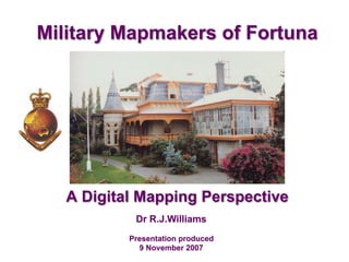
- 1. Dr R.J.Williams Presentation produced 9 November 2007 Military Mapmakers of Fortuna A Digital Mapping Perspective
- 2. An Odyssey … v FORTUNA v The wartime home of Allied (then Land) Headquarters Cartographic Company v EMBRACING CHANGE v From analogue to analytical techniques v COMPUTER - ASSISTED MAPPING v World leading technology v THE INFORMATION REVOLUTION v Innovation along with reviews, project delays, etc, etc … v REFERENCES Slide 1
- 3. Fortuna 1942 - … By late 1941 as Japan extended its control throughout Indo-China, resolving the accommodation problem of Allied Headquarters Cartographic Company became more urgent. Suddenly, the threat of invasion was very real, and the security of vital assets a top priority. The dangers of over concentration of military installations had been revealed in Britain during German bombing raids in autumn 1940. Among many buildings severely damaged in raids on Southhampton in England were those occupied by Ordnance Survey. Fortunately, much of the original material relating to the survey of Great Britain had been duplicated and safely stored underground, but duplication wasn’t complete and much valuable material had been lost. Now the steady Japanese advance made the bombing of Melbourne no longer a remote possibility, and in accordance with a general policy of dispersion, the Deputy Chief of the General Staff, Major General Rowell instructed Major Sarll, “in the interests of security of plant and to provide against possible damage of air attack’, to investigate suitable safer accommodation for AHQ Cartographic Company. In late 1941 Fortuna was chosen as the site for the AHQ Cartographic Company. The unit’s movement to Fortuna was completed by 11th June 1942. AHQ Cartographic was renamed Land Headquarters Cartographic Company during 1942, then renamed Army Headquarters Cartographic Company in 1946. In October 1955, in recognition of ‘survey’s’ national role, the AHQ Survey Regiment was established. In 1973, a further name change occurred with establishment of the Army Survey Regiment. G OFFICE AHQ CARTO COMPANY Once George Lansell’s dressing room. Draughting room AHQ CARTO COMPANY Slide 2 §
- 4. Embracing Change 1968 - 1975 “Without the AUTOMAP I system we wouldn’t have gone to AUTOMAP II. And if we hadn’t gone to AUTOMAP II they wouldn’t be putting PARARE in now. The Regiment played a big part in developing digital cartography for all of Australia and perhaps in some part, the world”. Colonel Don Swiney MBE EMBRACING CHANGE - Digital Mapping 1975-1985 IBM MINI COMPUTER – IBM 1130 Allowed programs to be written for the automatic plotting of grids and graticules 1969 CAMBRIDGE STEREO-COMPARATOR Permitted accurate observations to be measured on aerial photography for the purpose of aero-triangulation of strips of photography. Used as ‘proof of concept’ for analytical photogrammetry. First invented in the UK in 1930s 1968 CARL ZEISS JENA STEREO-COMPARATOR Used to measure three dimensional photo coordinates from film diapositives. The capability was needed to provide aero-triangulation data for WILD B8 stereo-plotters. 1969 Slide 3 §
- 5. Automap I DIGITIZATION OF STEREO PHOTOGRAPHY DIGITISATION OF EXISTING DOCUMENTS DIGITISATION OF EXISTING DOCUMENTS DISK STORAGE EDITING OF DIGITIZED DATA GRAPHICAL VERIFICATION OF DIGITAL DATA DATA BASE Magnetic Tapes MAP GENERATION DATA MANIPULATION FINAL GRAPHIC OUTPUT 1976 - 1984 Computer - assisted mapping Slide 4 1976-1984 AUTOMAP 1
- 6. Automap 1 1976 - 1984 Standard Products Future Applications of the Database 1: 25 000 scale topographic maps 1: 50 000 scale topographic maps 1:100 000 scale topographic maps 1:250 000 Joint Operations Graphic [1 only] Terrain modelling Command support systems Enhanced force effectiveness BROCHURES PUBLISHED 1978-1982 DEF/MISC/5157A December 1978 DEF/MISC/5157C August 1980 3665-III STRICKLAND was the first map published using the AUTOMAP I system. Compilation was by digital photogrammetric methods. “AUTOMAP I initiated automated cartography in Australia and heralded the future for mapping. It engendered such excitement in defence, mapping and academic circles within Australia and overseas that many international and Australian visitors came to the Regiment to study the new system in action”. Computer - assisted mapping Slide 5 §
- 7. Automap 1 1976 - 1984 Computer - assisted mapping “The real importance of Automap 1 was ‘the experience it gave to go on to the next step’. Automap initiated automated cartography in Australia and heralded the future for mapping. It engendered such excitement in defence, mapping and academic circles within Australia and overseas that many international and Australian visitors came to the Regiment to study the new system in action, and other organisations followed the lead of the Survey Corps. According to John Cattell, OC of Air Survey Squadron when Automap 1 was introduced, Regiment leadership was reflected in the number and quality of technical papers presented at national mapping conferences and those leaving the army were keenly sought for jobs in wider industry where they now influence mapping development in Australia”. § During the period 1977 to 1979 there were many visits to the Regiment, including visits by Hon. D.J. Killen, Minister for Defence; Prof. Kamecny, Uni of Hanover; Dr. G. Bervoets, Uni of Melbourne; Dr. R. Boyle, Uni of Saskatoon; Dr. Berling, Managing Director of Zeiss Jena; Hon. H.R. Hamer, Premier of Victoria and 5 MPs; Maj Gen R.A. Grey, Chief of Operations – Army; Lt Gen D.B. Dunstan, Chief of the General Staff; Lt Gen Bulrit, Director of Education Research, Thailand Col E.K. Johnson, Military attache US Embassy. § Slide 6
- 8. Automap 2 DEF/MISC/5157E December 1982 1981 - 1993 STEREO-PLOTTER with GRAPHIC SUPERIMPOSITION GRAPHIC EDIT WORKSTATION Computer - assisted mapping Slide 7
- 9. Automap 2 1981 - 1993 Standard Products Future Applications of the Database 1: 25 000 scale topographic maps 1: 50 000 scale topographic maps 1:100 000 scale topographic maps Digital Terrain Elevation Data (DTED) This map was produced on Automap II and shows the award winning computer generated stipples developed at the Survey Regiment. The text was also digitally generated and positioned. Future applications of the database: v “Permit the transportation Officer to point to a bridge and have the system return the width, allowable load and structural components of the bridge v Permit the Medical Officer to point to all hospitals in an area and have the number of beds currently available v Permit the Commander to point to a geographical area and have the system return enemy unit designations, location, strength and equipment status, and have the system designed to permit data base update so that the information returned is current and accurate” MAJOR John Charland (USA) Military Applications of Digital Data presented to Austra Carto - ICA Conference Perth 1984 AUTOMAP II was intended to have a RDMS (Relational Database Management System). This would have permitted a ‘new’ range of applications, as demonstrated by: Expectations are high that digital terrain models have a significant role to play in a number of diverse areas of interest to the Defence Force. Areas of immediate impact are command, control and communications; artillery and other weapon systems; training, simulation and war gaming; terrain analysis; manned and unmanned navigation systems; and map production. (para. 605) Royal Australian Survey Corps Digital Terrain Modelling: An Overview 15 April 1985 Computer - assisted mapping Slide 8
- 10. Automap 2 1981 - 1993 Computer - assisted mapping 603. Applications. Perhaps the most significant military breakthrough related to computer technology of the future will be the rendering of integrated circuitry invulnerable to enemy sabotage. This, combined with high speed, secure data communications to the field, will permit the transfer of vital information about the terrain and its effects in real time to the ground commander currently operating on that terrain. Intervisibility and mobility computations and realistic computer-generated views will be components of this information. 604. A more profound area of application is expected in the field of airborne navigation systems. It will include both military and civilian aircraft, particularly low-flying manned and unmanned weapon systems. In all these cases, DTMs will afford real time information about the terrain below and the effects of distant terrain on the aircraft whether it is using terrain matching for navigation or making use of natural cover to avoid enemy detection. Royal Australian Survey Corps Digital Terrain Modelling: An Overview 15 April 1985 Slide 9
- 11. Projects …. The information revolution 1986 - 1993 AUTOMAP 2 had numerous innovations. The project had many amendments to contract and (probably in early 1985) a decision was made (probably by Mat Br - Army) to remove the RDMS from the acquisition as a cost saving option. A Purchase Description for AUTOMAP 3 was written in 1986. Significant content was dedicated to describing “database design” issues and “areas of application”. The project was rejected by Mat Br – Army and this led to the initiation of PROJECT PARARE. The decision also highlighted the need to address old fashioned management processes. In 1985 an in-house software system, Army Survey Topographic Support System (ASTIS), was developed. Although relatively primitive, it was the first tentative step towards collecting, storing and displaying geographic information. Further computerisation followed in 1989 with the Army Survey Management and Planning System (ASMAPS) which could monitor map production. (Automap 3, ASTIS, ASMAPS, New-heart) By 1992 the outmoded technology of AUTOMAP 2 made maintenance increasingly difficult and expensive. A solution had to be found to extend the productive life of AUTOMAP 2until PARARE was introduced. Defence accepted a proposal to extend AUTOMAP II’s ‘life’ by delivering PROJECT NEWHEART in January 1993. AUTOMAP 3 Slide 10 § §
- 12. Project Parare … The information revolution 1988 - 1996 PROJECT PARARE was named in 1988 from the Corps motto, videre parare est, and planning began in 1989. It was hard for many “to grasp the revolutionary new way of thinking about topographic information in which their primary goal, the printed map, became just one of many products from a topographic database that would provide a vastly increased military capability for the Australian Defence Force. PROJECT PARARE was to be a digital system that could produce a variety of products from a spatially related topographic database. Maps and charts, reports, photo products, statistics and topologically structured spatial data would provide the topographical base reference layers for a military geographic information system. The topographic information provided would assist with terrain analysis, command and control systems, weapons systems, and war gaming”. “The Defence Force was slow to realise the potential offered by PARARE. While the Regiment had the advantage of American exchange officers bringing their knowledge to bear on research in the Technical Services Section, and officers within the Survey Corps who had brought back new ideas from overseas exchange postings [and tertiary education through Long Term Schooling], it was difficult to influence or interest senior officers in Canberra who still thought of topographic data in terms of maps”. “A model based on phenomenology and cognition” in Robert John Williams, Analysis of Geographic Information: A Cognitive Approach, A thesis submitted for the degree of Doctor of Philosophy, the University of New South Wales, 1989 Slide 11 § §
- 13. CSP, the Regiment & Parare … The information revolution 1991 - 1996 “In May 1991, the Government introduced a Commercial Support Program (CSP) to promote the transfer of non-core support activities from Defence to industry, emphasising that the CSP must be understood as part of wider initiatives to strengthen civil- military relations, which would foster Australia’s strategic defence interests and its policy of self-reliance. A Defence CSP Manual setting out a three tier implementation policy was released in November 1991. The Regiment was identified to undergo two separate commercial support reviews: one logistic (Tier One), the other technical (Tier Two)”. Tier One included base support operations and “the Army Survey Regiment was included in the CSP Base Support Contract for the Central Victorian Region”. “Regiment members found coming to terms with the technical Tier Two CSP review far more traumatic. As land surveying and mapping, and the collection of geographic information had been identified for possible civilianisation or commercialisation it followed logically that the Force Structure Policy and Programming Committee in considering PROJECT PARARE in May 1992 should instruct army to conduct a review ‘to determine the most cost-effective and operationally feasible means of providing topographic support to the ADF’. The terms of reference required core and non-core capabilities to be defined and functional support non-core activities subjected to CSP review”. “Corp survey activities were divided into tactical and strategic level functions. Tactical level functions included the sorts of survey and mapping tasks that survey units had carried out in wartime. The First Topographic Survey Squadron had that responsibility. Core strategic functions were non-sovereign territory tasks carried out by the Defence Intelligence Organisation, or other intelligence gathering survey tasks important for Australia’s security in the region, (those survey activities that pertained to ‘denied (or potentially denied) areas’). These activities had been carried out as Defence Cooperation or rapid response tasks by the Fourth Field Survey Squadron and the Army Survey Regiment, which also undertook non-core activities, broadly defined as ‘topographic support covering Australian sovereign territory’. Only non-core activities would be subject to CSP review, as core activities were vital for operational readiness and had to remain under military control”. Three commercial tenders were submitted. The In-House Option was selected as the Preferred Commercial Option and the contract awarded in April 1994. The implementation of the second CSP would prove to be “painful” … A Defence decision in November 1994 to introduce PROJECT PARARE in two phases dramatically narrowed options. Phase One would establish the Army Topographical Support Establishment (ATSE) staffed by defence civilians to conduct digital topographic tasks of Australian sovereign territory. It was decided that a study would be conducted to determine the ADF’s total digital requirement including examination of core strategic non-sovereign tasks and another major capability submission would precede the implementation of Phase Two. Slide 12 §
- 14. The end of an era … & Recognition … The information revolution 1995 - 1996 “The Army Topographical Support Establishment was raised on 1 July 1995, eighty years to the day after the formation of the Australian Survey Corps. From that day no further military appointments were made, and the process of disbandment began. Until ATSE became fully operational, responsibility for provision of topographic support to the ADF was to be shared between the Army Survey Regiment and the ATSE with a gradual transfer of technical functions to the ATSE by 29 April 1996. Disbandment of the Army Survey Regiment was to be completed by 1 December 1996 when it would be removed from the Order of Battle. Yet another shock awaited Survey Regiment members. Numbers were so reduced by the disbandment of the Fourth Field Survey Squadron and the Army Survey Regiment that the Survey Corps was no longer considered viable. In September 1995, the Chief of the General Staff directed that the Royal Australian Survey Corps was to integrate into the Corps of Royal Australian Engineers on 1 July 1996”. “Since 1915 the Survey Corps has not just been a major contributor to the tactical success of the Australian Army in two World Wars and other conflicts, it has played a role in the building of this nation – the Commonwealth of Australia – and the building of other nations such as Papua New Guinea. Without the impetus of military survey, much of this continent would have remained unmapped, and hence much of civil infrastructure, which we take granted for today, would have been retarded in its development”. Chief of the General Staff LTGEN Sanderson on the occasion on the integration of RASVY into RAE “Australians as a whole might still be blissfully unaware and hence unappreciative of the debt of gratitude owed to the generations of surveyors who have helped make possible the enviable standard of living generally enjoyed today across the country. Should that situation ever change, and the story receive the wider recognition that it deserves, then the part within that tale occupied by military mapmakers is worthy of special acclaim by a grateful nation”. C.D. Coulthard-Clark “Australia’s Military Mapmakers” 2000 Slide 13 § ¶ ¶
- 15. References … Christopher Coulthard-Clark’s Australia’s Military Mapmakers Oxford University Press, Melbourne, 2000 ISBN 0 19 551343 6 Valerie Lovejoy’s Mapmakers of Fortuna A History of the Army Survey Regiment Ex-Fortuna Association, Bendigo, 2003 ISBN 0 646 42120 4 Primary Reference Slide 14 Text [marked by § ]and photos on Slides 2, 3, 4, 8, 9 (excluding Figure), 10, and 11 Other References Text [marked by ¶ ] on Slide 11 ADDRESS BY HIS EXCELLENCY MAJOR GENERAL MICHAEL JEFFERY AC CVO MC GOVERNOR-GENERAL OF THE COMMONWEALTH OF AUSTRALIA ON THE OCCASION OF THE UNVEILING OF A MEMORIAL PLAQUE COMMEMORATING THE ROYAL AUSTRALIAN SURVEY CORPS UNITS WHICH SERVED IN WAR AUSTRALIAN WAR MEMORIAL 9 JULY 2007 https://www.gg.gov.au/speech/unveiling-memorial-plaque-commemorating-royal-australian-survey-corps-units-which-served-war