SlideShare a Scribd company logo
1 of 26
Download to read offline
Without maps and charts, civilisation could not have progressed!
Without geospatial information and imagery, decision support systems cannot function!
The
Future Defence
Geospatial Environment
From maps to a virtual world
a presentation by
Dr R.J.Williams
Information Technology Division, Defence Science and Technology Organisation
2000
2000
2010
2005
2020
SEA 1430 Phase 1
PARARE Phase 1
Project Johnson
JP2064
PARARE Phase 2B
• A Virtual World
Intelligent systems
Authority
Intelligence
Resource & asset
management
Command
Support
Surveillance
Command
• Knowledge-based systems
as an integral part of the C2 capability
PARARE Phase 2A
Project Toposs
• Legacy
Repositories of digital data in various forms and formats
Warehouses of maps and charts
Paper-based libraries, catalogues and directories
Limited acquisition and surveying capability
• Major capability deficiency
Defence Planning and Operations
ADO
MGI ASDI
www
ADO
Users
• Geospatial information infrastructure
Source
acquisition
Imagery
preparation
Data
extraction
Product
construction
Distribution
Database
management
• Single service/agency GIS systems
EGICS
From the current legacy to the virtual world
1973
1976
1975
1984
Early digitisation
Digital mapping prototype
Automap 1
Automap 2
1968
1967
Early analytical photogrammetry
Surveying by airborne trilateration techniques
Other Data Sources
Imagery
Non-imagery
Data Acquisition
Readiness assessment
Common Operational Picture
Mission Specific Views
Interoperability
Information Applications
Framework Information
Framework Services
Interfaces
Information Management and
Dissemination
Commercial sources
Out-sourcing
Co-production
Geo Support Capability
DTA
RAN HYDRO - other
RAAF AIS
Information Production
Needs assessment
Area Requirements
Crisis Support
Mission Profiles
Requirements Management
Technical assessment
Value
Add
Planning and
operational needs
-National security
-Planning
-Surveillance
-Operations
-National defence
-Special operations
-Obligations
An operational architecture to achieve a Geospatial Information Infrastructure
Scientific Adviser Team
• Geomatics (science and technology)
• National initiatives
• Multi-national initiatives
• Interface with academia and industry
Strategic
Operational
Tactical
DIE and C4ISR
Web-based technology
Defence
MGI
Agencies
Acquisition
Compilation
Production
Data management
Civilian
GI Agencies
ASDI
Australian National
Spatial Data
Infrastructure
Defence Planning and Operational
needs assessment
access
Authorised
Electronic
Library/Atlas
Archives
User community
Clearinghouse
Coalition
Agencies
Training
establishments
Deployable
MGI
Sections
The 2005 goal - A Geospatial Information Infrastructure
DIGEST
Digital Geographic Information
Exchange Standard
United States Imagery
and
Geospatial Information Service
USIGS
Defense Modeling
and
Simulation Office
Scientific Advice
Strategic Operational Tactical
DIE and C4ISR Web-based technology
Defence
MGI
Agencies
Civilian
GI Agencies
Defence Planning and Operational needs assessment
Authorised
Electronic
Library/Atlas
Archives
Clearinghouse
Coalition Agencies
Training
Deployable
MGI
Sections
User community
Improvement of user services
Help Desk advice
•  MC&G S&T topics
•  Library services
•  Environmental analysis
•  Operational analysis
•  Modelling and simulation
•  et cetera
?
Interoperability
via
conformance
Intelligence, surveillance, reconnaissance
Command, control and communications
Navigation and guidance
Targeting and weapons employment
Mobility and manoeuvre
Health and survival
Electronic library
•  Illustrated atlases
•  Infrastructure directories
CD-ROM
Needs assessment
through
e-Business
strategies
Needs assessment
Scientific Advice
Strategic Operational Tactical
Defence
MGI
Agencies
Defence Planning and Operational needs assessment
Authorised
Electronic
Library/Atlas
Clearinghouse Coalition Agencies
Training
Deployable
MGI
Sections
User community
DIE and C4ISR Web-based technology
Civilian
GI Agencies
Parare
The Next Generation
Defining requirements based on needs and readiness
assessment of the scope of Military Activities,
activities that are related to:
The image cannot be displayed.
Your computer may not have
enough memory to open the image,
or the image may have been
corrupted. Restart your computer,
and then open the file again. If the
T
h
The image cannot
be displayed. Your
computer may not
have enough
The image cannot
be displayed. Your
computer may not
have enough
memory to open the
image, or the image
•  Intelligence, surveillance, reconnaissance
•  Command, control and communications
•  Targeting and weapons employment
•  Navigation and guidance
•  Mobility and manoeuvre
•  Health and survival
Are your activities or applications concerned with:
Environmental Analysis
 Avenues of approach
 Critical link analysis
 Cross-country movement
 Fording analysis
 Intervisibility analysis
 Terrain modelling
 Weapon ballistics
Base Operations
 Facilities management
 Environmental applications
 Range management
 Training management
 Water and food resources
 Medical facilities
 Airfield defence
Intelligence
 Situation Monitoring
 Geographic information
 Target analysis
 Weapon production tracking
 Image management
 Counter terrorism
Command Support
 Situation monitoring
 Situation display & briefing
 Simulation
Mission Planning
 Integrated theatre planning
 Invasion planning
 Evacuation planning
 Targeting
 Trajectory modelling
 Missile support
Operational Planning
 Battlefield management
 Battlefield systems
 Division planning
 Landing and beach operations
 Logistics
 Mine warfare
 Simulation
 Special force operations
Navigation
 Air navigation
 Air traffic control
 Land navigation
 Ocean surface navigation
 Ocean subsurface navigation
On the modern day battlefield, everything is spatially related and, if you don’t understand the relationships, you will never win the war!
Are your resolution and accuracy requirements at the:
Strategic level
Operational level
Tactical level
Focal area level
Target level
Is your purpose for:
Situation awareness and visualisation
Operational planning and rehearsal
Precision force
Modelling and simulation
Operational analysis
Strategic Operational Tactical
Defence
MGI
Agencies
Defence Planning and Operational needs assessment
Authorised
Electronic
Library/Atlas
Archives
Clearinghouse Coalition Agencies
Deployable
MGI
Sections
User community
DIE and C4ISR Web-based technology
Civilian
GI Agencies
?
•  MC&G S&T topics
•  Library services
•  Environmental analysis
•  Operational analysis
•  Modelling and simulation
•  et cetera
RAN Hydrographic Service DIGEST Product
VMap Level 1
- Background Display Dataset (BDD) -
Boundaries
Population
Transportation
Industry
Utilities
Hydrography
Physiography
Elevation
Vegetation
Data quality
Scientific Advice
Training
Services
Products
Science and technology topics
Electronic Help Desk
Parare
The Next Generation
CD-ROM
Scientific Advice
Strategic Operational Tactical
Defence
MGI
Agencies
Defence Planning and Operational needs assessment
Authorised
Electronic
Library/Atlas
Archives
Clearinghouse Coalition Agencies
Training
Deployable
MGI
Sections
User community
DIE and C4ISR Web-based technology
Civilian
GI Agencies
Links to
Owners and
operators
Airfield
infrastructure
Prototypes … …
Location
Profile TOWNSVILLE AIRPORT
Intended use: Transport & Logistics
Tactical ops (Level 2)
Aero info
RAAF AIS
Phone 03 9282 6924
User profile Region / location identification Purpose of use and resolution / precision
Accrediting authority
Links to government / commercial WWW sites Links to directories / databases
•  MC&G S&T topics
•  Library services
•  Environmental analysis
•  Operational analysis
•  Modelling and simulation
•  et cetera
•  Illustrated atlases
•  Infrastructure
directories
Electronic Help Desk
Parare
The Next Generation
Note: The following slides are for DEMONSTRATION OF CONCEPT PURPOSES only
and may, or may not, represent the actual status of information, or sources
Location
Profile PORT OF TOWNSVILLE
Intended use: Operational planning
Infrastructure (Level 1)
CALTEX Australia Limited
Terminal 07 4771 4071
SHELL Australia Limited
Herbert St 07 4746 3135
Gogas Emergency Line 1800 802 666
Mobil Oil Australia Limited
Emergencies 1800 023 005
4
5
6
7
8
9
10
3
Regional
Harbour
Master
The Port of Townsville has 8 operational berths.
No. 1 Berth (isolated) is used exclusively by tankers for
bulk oil, gas and sulphuric acid discharge and by all type of vessels for distillate bunkering.
No. 2 Berth is used for unloading nickel ore, it is equiped with an ore unloading gantry crane.
No. 3 Berth is leased to M.I.M Holdings Ltd, it has a container gantry crane with a lift capacity of 55.9 tonnes, maximum height
of lift above wharf deck is 27 meters. The crane traverses the full length of theberth, except for a length of rail occupied by a
25.4 tonne, 32 metre radius, travelling jib crane for container and unit load handling.
No. 4 Berth has a landing pad, supported by steel piling, to service stern angle ramp RORO vessels. The molasses pipeline to
this berth is capable of loading up to 400 tonnes / hour. The berth has been upgraded to import bulk cement and is also
equipped with pipelines for the import of caustic soda.
No. 7 Berth supports a bulk shiploader for mineral concentrates, phosphate rock and ores up to 102mm aggregate at the rate of
1,000 tonnes / hour. This berth is also equipped with bulk molasses and bunker pipeline.
No. 8 Berth services the export frozen beef trade with cargoes drawn from freezer stores adjacent to the port. It also serves as
a general purpose berth with scrap metal, fertiliser and frozen meat being handled over this wharf. The berth is equipped with a
stationary 25 tonne, 30 metre radius, 400 HLT crane.
No. 9 Berth is the raw sugar loading berth. A bulk shiploader delivers sugar to carriers at the rate of 2000 tonnes / hour. The
berth is also equipped with a bunker and molasses pipeline.
No. 10 Berth is a general purpose berth equipped with a 30 tonne crane with a 32 metre maximum radius. A stern RORO ramp
is also available.
Storage facilities at the Port of Townsville
Oil All major oil companies operate
terminals in close proximity to the port.
Raw Sugar Two storage sheds of 285,000 tonnes
total capacity.
Molasses Four bulk storage tanks of 35,000
tonnes total capacity.
Concentrates 170,000 tonnes covered storage
area.
Cement One 30,000 tonne bulk cement storage
silo.
Chemicals Two sulphuric acid storage tanks of
17,000 tonnes total capacity.
LP Gas Five LPG storage tanks with a total
capacity of 1,250 tonnes
Townsville is located on the north eastern coast of Queensland, 550 kilometres north of the Tropic of Capricorn and
2,300 kilometres south of the equator. Townsville lies 1,500 kilometres north of the State Capital Brisbane.
A prosperous coastal city, Townsville has a culturally diverse population of around 130,000 and a sound economy
built upon mining, manufacturing, industry, tourism and transportation. This, together with the concentration of
educational, administrative, cultural, commercial and industrial services has ensured that Townsville is, and will
remain, both the largest provincial city in Queensland and the Capital of North Queensland.
Location
Profile PORT OF TOWNSVILLE
Intended use: Transport & Logistics
Tactical ops (Level 2)
Road access
Port authority
Townsville Port Authority
Phone 07 4790 2111
Hydrographic info
RAN Hydrographic Service
Phone 02 4221 8500
Berth 1
Petroleum products
One 150mm pipeline
Two 300mm pipelines
Storage capacity - 165,000 tonnes
LPG
One 250mm pipeline
Storage capacity - 1,250 tonnes
Berth 2
General cargo
One travelling jib crane
Berth 3
One travelling gantry container crane
Heavy lift capacity - 56 tonnes
Storage area - 2.8ha
Roll-on / roll-off
Stern ramp available
Berth 6
General cargo
LPG Depot
CALTEX Depot
SHELL Depot
MOBIL Depot
S19 15
E146
50
Berth 10
Containers
Mobile crawler crane
Lift capacity - 130 tonnes
Storage area - 2.6ha
Roll-on / roll-off
Stern / bow ramp available
Platypus Channel
Dredged to 10.3 metres
Dredged to
9.5m
Swinging basin
dredged to 10.5m
Berth 9
Passenger cruise vessels
Scale bar [KM]
1
0
Hotel
Casino
Marina
Links to
Owners and
operators
Wharf
infrastructure
Navigation
aids
Power and
fuel facilities
Communications
and
emergency services
Location
Profile TOWNSVILLE AIRPORT
Intended use: Transport & Logistics
Tactical ops (Level 2)
Air traffic management
Airservices Australia
Phone 1300 300 719
Military operations
RAAF Garbutt
Phone 07 4752 2111
Aero info
RAAF AIS
Phone 03 9282 6924
Suitable for C130 Hercules and
Russian Antinov cargo planes
TOWNSVILLE/Townsville INTL
ELEV 18
AVFAX CODE 4402
MOVEMENT AREA
01/19 017 80a
07/25 067 36a F27 PCN8/F/A/580/U Asphalt
Pavement ratings
- Concrete apron: PCN 58/R/D/1750/U
- Asphalt apron: PCN 77/F/D/1750/U
- Light ACFT apron: PCN 13/F/D/580/U
LIGHTING
L1 RWY 01/19 & 07/25
L4 RWY 01/19 3 stage AVBL
L5 RWY 01
L9 RWY 01/19
NAVIGATION AIDS
TACAN VOR NDB DME ILS ASR/SSR
GROUND SERVICES
AMS(MIL) AVBL on 361.6
REPLEN
BP Phone 07 47794346
For fuel H24 0412 777160,
VHF 126.4 Callsign Air BP.
AVGAS, JET A1, O117, O125
RFF CAT 6 2000-1100, CAT 4 1100-2000
MET Elaboration of MET H24,
WSO or 07 47795999
H
01/19
07/25
Townsville
2NM
Links to
Owners and
operators
Airfield
infrastructure
Navigation
aids
Power and
fuel facilities
Communications
and
emergency services
Airservices Australia
E146
46
S19 15
Strategic Operational Tactical
Defence
MGI
Agencies
Defence Planning and Operational needs assessment
Authorised
Electronic
Library/Atlas
Archives
Clearinghouse Coalition Agencies
Deployable
MGI
Sections
User community
DIE and C4ISR Web-based technology
Civilian
GI Agencies
Prototype (scenario planning) … …
?
•  MC&G S&T topics
•  Library services
•  Environmental analysis
•  Operational analysis
•  Modelling and simulation
•  et cetera
Training
Scientific Advice
Location
Profile DILI, EAST TIMOR
Intended use: Situation Awareness
Strategic intell (Level 1)
User profile Region / location identification Purpose of use and
resolution / precision
Accrediting authority
Imagery Landsat 7
9:40AM 8 Sept 1999
Processed by
BLACK GRID LINES ARE 25 METRE INTERVALS
OF THE
UNIVERSAL TRANSVERSE MERCATOR (UTM) GRID
ZONE 51
WORLD GEODETIC SYSTEM 1984 (WGS84) ELLIPSOID
Horizontal accuracy +/-5 metres
MAP GRID
Error ellipse
Error and accuracy statements
Electronic Help Desk
Parare
The Next Generation
Note: The following slides are for DEMONSTRATION OF CONCEPT PURPOSES only
and may, or may not, represent the actual status of information, or sources
Location
Cf
INDONESIA
MEDITERRANEAN SEA
Profile
Intended use: Geography brief
Strategic geography
(Level 0)
i
A presentation by Dr Bob, Cartographer
To be be used for briefing purposes only
NOT AUTHORITIVE
For further information refer to
Approximate distance in kilometres
ACEH
JAYAPURA
TIMOR
AMBON
BIAK
0 1000 2000 3000 4000 5000
Jakarta
Area:
total: 1,919,440 sq km
land: 1,826,440 sq km
water: 93,000 sq km
Country name: Republic of Indonesia
Cf Mediterranean Sea
Area: 2,505,000 sq km
Population:
216,108,345 (July 1999 est.)
Ethnic groups:
Javanese 45%, Sundanese 14%, Madurese 7.5%,
coastal Malays 7.5%, other 26%
Religions:
Muslim 88%, Protestant 5%, Roman Catholic 3%,
Hindu 2%, Buddhist 1%, other 1% (1998)
Languages:
Bahasa Indonesia (official, modified form of Malay),
English, Dutch,
local dialects, the most widely spoken of which is Javanese
Ports and harbors:
Cilacap, Cirebon, Jakarta, Kupang,
Palembang, Semarang, Surabaya, Ujungpandang
Airports: 443 (1998 est.)
Airports—with paved runways:
total: 125
Airports—with unpaved runways:
total: 318
Heliports: 4 (1998 est.)
Current areas of unrest
Indonesian flag
NOTE: This map shows an outline of Indonesia and parts of its near neighbours
The background map shows the extent of the Mediterranean Sea.
Neither map is in a standard map projection; being displayed in Plate Carree
and, as such, scale is only approximate and shape distortions occur
Location
Profile
Intended use: Situation awareness
Strategic intell (Level 1)
Imagery
Landsat 7
9:40AM 8 Sept 1999
Processed by
Dili Airport Terminal
DILI (Komoro) Airport
(Control Point)
Coordinates 125° 31’ 19.2454”E
8° 32’ 57.3507”S
* (Spheroidal height) 56.7736M
* Elevation 10FT
DILI, EAST TIMOR
* NOTE: Elevation refers to height above the geoid (or sea surface level)
Spheroidal height refers to a mathematical height and is the height relative to a reference ellipsoid.
Satellite surveying and satellite navigation systems produce a spheroidal height as a part of their output.
Pillars
House
100
25 50 75
0
Metres
POS
POLISI
MOTTAAIN
Boom gate
SELAT OMBAI
Boundary follows the
thalweg of Rib Motabico
Rock retaining wall
Bridge
Canal
Bridge
PROPINSI
TIMOR TIMUR
PROPINSI NUSA
TENGARRA TIMUR
Batas Propinsi
[Provincial Limit]
Boundary agreed by Portugal
and the Netherlands
Portuguese explorers land on Timor
The Portuguese colonise Timor
The Dutch colonise the western half of the island
Treaty of Demarcation between Portugal and
the Netherlands signed
Centre island boundary surveyed
Formal transfer of sovereignty from the Netherlands
to the Republic of Indonesia
The United Nations General Assembly places East
Timor on its list of Non-Self Governing Territories
Portugal admits it has lost control of East Timor
[21 August]
Foreign Ministers of Portugal and Indonesia meet
in Rome and agree that Portugal constitutes the
legitimate authority in East Timor [3rd November]
Indonesian forces invade East Timor and establish
a provisional Government and requests integration
with Indonesia
Portugal breaks off diplomatic relations with
Indonesia [7th December]
UN General Assembly passes a resolution calling on
Indonesia to withdraw from East Timor immediately
[12th December]
East Timor is integrated into Indonesia as its 27th
province - Loro Sae
Australia’s Foreign Minister announces his
Government’s recognition of incorporation of East
Timor into Indonesia [20th January]
New Zealand gives support to Indonesian line on
non-interference [20th July]
Australia formally recognises Indonesian take-over
of East Timor [15th December]
An agreement is signed at the United Nations in
New York between the UN, Portugal and Indonesia
allowing for a vote on whether to accept a special
autonomy arrangement with Indonesia or to move
towards independence[5th May]
President Habibie of Indonesia endorses the
referendum result which is in favour of
independence [6th September]
Violence rages in East Timor
UN confirms that a peacekeeping force will be sent
to East Timor [13th September]
UN force led by Australia arrives in Dili
[20th September]
Indonesian Parliament ratifies the result of East
Timor referendum. The United Nations takes over
the immediate control of the territory [20th October]
1520
1701
1700s
1859
1915
1949
1960
1975
1976
1977
1999
CHRONOLOGY
The United Nations has never
recognized integration of East
Timor with Indonesia.
Probable recognition of
province boundary as border
The UK Foreign & Commonwealth
Office position is that the boundary
on the Island of Timor is a full
international, de jure boundary,
which was delimited by agreement
between Portugal and the Netherlands
signed in 1904 and clarified by the
decision of the Permanent Court of
Arbitration in 1914
Location MOTAAIN BORDER CROSSING
Profile
Intended use: Border assessment
Focal area (Level 3)
Location
Profile
INDONESIA - EAST TIMOR
BORDER (North)
Intended use: Aerial surveillance
Tactical ops (Level 2)
Motaain
Belaka
Batugade
Mangrove
Border
crossing
INDONESIA
(West Timor)
EAST TIMOR
Imagery
Australian Imagery Office
October 1999
Annotation
Bakosurtanal
October 1982-1992
CAUTION
9010 000
09
08
07
7
13
000
14
15
16
17
18
BLACK GRID LINES ARE 1000 METRE INTERVALS
OF THE
UNIVERSAL TRANSVERSE MERCATOR (UTM) GRID
ZONE 51
WORLD GEODETIC SYSTEM 1984 (WGS84) ELLIPSOID
Horizontal accuracy +/-25 metres
MAP GRID
Error ellipse
CAUTION
Area of uncertainty
(due to differing border delineation)
CAUTION - NOT VERIFIED
Location
E714300
E714400
E714500
Site plan
Detailed site survey
16 October 1999
Territorial advice
Australian Defence Headquarters
Directorate of Strategic Military Geographic Information
25 November 1999
Rock retaining wall
Boom gate
Pillars
House Bridge
Check point
Culvert
SELAT OMBAI
Bridge House
House
Shed
Shed
Rock retaining wall
INDONESIA
Canal
POS
POLISI
MOTAAIN
Profile MOTAAIN BORDER CROSSING
Intended use: Border patrol/defence
Focal area (Level 3)
BLACK GRID LINES ARE 25 METRE INTERVALS
OF THE
UNIVERSAL TRANSVERSE MERCATOR (UTM) GRID
ZONE 51
WORLD GEODETIC SYSTEM 1984 (WGS84) ELLIPSOID
Horizontal accuracy +/-5 metres
MAP GRID
Error ellipse
KEY POINT REGISTER
Motaain Police Station 714295 9009100
Bridge (Mota Bico) 714475 9009114
Bridge (Motaain) 714365 9009058
Check point 714303 9009081
Road block 714307 9009075
Boom gate 714287 9009087
CAUTION
INDONESIA (West Timor)
Area of uncertainty
(due to differing border delineation)
Road block
N9009200
N9009100
Typical TNI
check point
Dutch establish a settlement at Triton Bay and annex
New Guinea west of 141° E [24 August]
A secret declaration by the Dutch, after a request
from Britain, redefines border
Secret declaration made public
Border described as a straight line by Dutch, prior to
Britain and Germany acquiring colonies on island
Germany claims New Guinea
Britain claims Papua
Germany and Britain draw a boundary from Mitre
Rock on east coast to intersection of 5°S and 141° E
Anglo-Dutch negotiations begin after raids by
headhunters. British and Dutch officials visit south
coast and identify Bensbach River at 141° 01’47.9”E
as logical point for boundary. This meant that Britain
concedes a strip 1.8 mile wide to 5° S. Britain argues
and gains Fly River bulge as compensation. Agree-
ment finalised on 20 July 1895.
Australia succeeds Britain in Papua
Negotiations and surveys begin by Netherlands
and Germany on northern coast. War intervened
prior to completion
Australia succeeds Germany in New Guinea
Australia and Netherlands commence settlement
of boundary. Australian surveyor, AG Harrison,
placed a marker near Wutong on meridian
141°0’13.5” E and recorded that Dutch border lay
1312FT to west.
Joint determination occurred and discovered a gap
of 1306FT between Australian and Dutch locations
of 141° E. A simple split was not possible for a
marker and so one was placed 550Ft from Dutch
location and 756Ft from Australian location
Australian and Dutch governments agree boundary
should follow the great circle passing through the
obelisk to intersection of 141° E with Fly River, along
Fly River to meridian passing through the mouth of
Bensbach River then to coast.
Monuments were erected at Fly River intersections
Indonesia succeeds Dutch in Irian Jaya
Indonesia and Australia agree to defined border
Work began on erecting markers
Agreement reached on border 26 January 1973.
Fourteen markers established, ten north of Fly River
Meridian south of Fly changed to 141° 01’10E, being
the new determination of mouth of Bensbach River.
Signs placed near villages and tracks
CAUTION: Fluctuations of Fly River NOT clarified
1828
1848
1865
1875
1884
1885
1893
1905
1910
1919
1919
1933
1960
1962
1962
1966
1973
CHRONOLOGY OF A BORDER
An agreement between
Indonesia and Australia,
dated 26 January 1973, listed
14 boundary markers. Ten
marked 141°E to the north of
the Fly River. Four marked
141°01’10”E south of the Fly
River, being the mouth of the Bensbach River
Papua New Guinea gained
independence on 16 September 1975
from the Australian-administered
UN trusteeship
The border was [partially] resurveyed
through OP KUMUL, a Defence
Cooperation Project (DCP), in 1989
Location
INDONESIA
PAPUA NEW GUINEA
BORDER
Profile
Intended use: Border assessment
Bulletin: Thu, Jun 8 2000 15:44 AEST
The Prime Minister, John Howard, is moving
to reassure Indonesia that he will not be
supporting secessionist moves in the
province of Papua.
The Prime Minister has made the commit-
ment ahead of talks with the Indonesian
President Abdurrahman Wahid.
Mr Howard says he will tell the Indonesian
President he respects Indonesia’s present
borders.
Strategic geography
(Level 0)
Boigu I. AUSTRALIAN
SOVEREIGN TERRITORY
x
x
x
x
x
x
x
x
x
x
x
x
x
x
Fly R.
Bensbach R.
Province of Papua
(formerly Irian Jaya)
Jayapura
Timika
Biak
Ambon
Ok Tedi
Port Moresby
Tembagapura Township
Location
TEMBAGAPURA,
Irian Jaya
Profile
i
Intended use: Geography brief
Strategic geography
(Level 0)
Tembagapura
Jayapura
Timika
Merauke
Biak
Sorong
Fakfak
Location
July 2000
Grasberg Mine
Puncak Jaya has massive ice bodies
including the Meren, Carstensz,and Eastern
Northwall glaciers, as well as the Western
Northwall Ice Cap. The glaciers and Puncak
Jaya are outside the PT Freeport Indonesia
mining area.
Puncak Jaya
Key environmental features
Reserves total over 2.48 billion tonnes of ore,
which contains:
•  World’s largest gold reserve
- 64.2 million payable ounces
•  World’s third largest copper reserve
- 51.3 billion payable pounds
Mining resources
Tembagapura location
S 4º8’ E 137º5’ [approx.]
http://www.fcx.com/mr/fast-facts/ff-overview.html
church on ridge
high terrain
bowl
15
33
Location
Profile MAKKI, Irian Jaya
Intended use: Evacuation planning
Tactical ops (Level 2)
Aero info
RAAF AIS
Phone 03 9282 6924
Profile
Tactical ops (Level 2)
NOT
KNOWN
Air traffic management
Airservices Australia
Phone 1300 300 719
Typical mountainous terrain The Dani People
Terminal chart
Flight Information
August 2000
MAKKI MAK GBIJ/ABMS Class 3
Coordinates S 03 58.26 E 138 37.68 VHF 120.0
Length/Width 633m / 19m Elevation 6250’ Slope 9%
CAUTION Sketch map - Not to scale
Tembagapura
Jayapura
Timika
Merauke
Biak
Sorong
Fakfak
.Makki
Location
NO
Avgas NO
Avtur
SURFACE
Thick heavy sod over dirt. Moderate crown. Soft and slippery
when wet. Soft shoulders. Sideslope toward river.
OBSTRUCTIONS
Hills at entrance to valley.
ABORT - LANDING
Left turn just before entering bowl. If unable to stop landing roll,
swerve to right at upper end.
ABORT - TAKEOFF
About 150M into takeoff roll. If unable to stop, continue straight
off lower end.
WEATHER PATTERN
Morning fog and cloud close valley during rainy season. Mid morning valley winds
strong, gusty. Weather and wind often different than main valley outside bowl.
HAZARDS - REMARKS
Wind Curfew 10:00. Wind sock not always good indicator. Can be surprisingly
turbulent inside abort point. Check turbulence; make low pass/drag. Confirm approach
path clear of clouds before committed on approach. Blind takeoff; requires signaler.
Stay in center. Crowd control problems.
The Dani( often referred to as Lani) live in the highlands
of east Ilaga near the edge of the Grand Baliem Valley.
The Dani of the centre high islands, perhaps the best-
known of the Irianese, live in communities of tidy little
thatch-and-wood huts, surrounded by neatly kept
gardens of sweet potato vines.Two of the Dani's most
distinguishing traits are their cultural costumes of penis
gourds for men, and fiber skirts for women. Efforts by the
Indonesian government have failed to convince Dani
men that pants were superior to their horim. Ancestral
beliefs remain strong among the Grand Valley Dani.
+6900FT
6250FT
6450FT
2%
TDZ
10%
15
33
+
Cessna Caravan
Strategic Operational Tactical
Defence
MGI
Agencies
Defence Planning and Operational needs assessment
Authorised
Electronic
Library/Atlas
Archives
Clearinghouse Coalition Agencies
Deployable
MGI
Sections
User community
DIE and C4ISR Web-based technology
Civilian
GI Agencies
?
•  MC&G S&T topics
•  Library services
•  Environmental analysis
•  Operational analysis
•  Modelling and simulation
•  et cetera
Scientific Advice
Training
Electronic Help Desk
Parare
The Next Generation
DGIWG Stragey Sub-Group
Advanced Concept Technology Demonstrator
Common Gateway Services
for the Delivery of
Geospatial Imagery and Intelligence Information
Advanced Concept
Technology Demonstrator
NSDI
Clearinghouses
FGDC/CEONet
OGC/WMT
Map/Catalog Servers
Geospatial Clients
USIGS
DIGEST
BDD (VMap)
TLD (transport/logistics)
TAD (terrain analysis)
#
Civilian GI Agencies
through ASDI
Scientific Advice
Strategic Operational Tactical
Defence
MGI
Agencies
Defence Planning and Operational needs assessment
Authorised
Electronic
Library/Atlas
Archives
Clearinghouse Coalition Agencies
Training
Deployable
MGI
Sections
User community
DIE and C4ISR Web-based
technology
Civilian
GI Agencies
#
Interoperability
via
conformance
DIGEST
USIGS
Electronic dissemination of GI3
Parare
The Next Generation
Development of new products and services
Scientific Advice
Strategic Operational Tactical
DIE and C4ISR Web-based technology
Defence
MGI
Agencies
Civilian
GI Agencies
Defence Planning and Operational needs assessment
Authorised
Electronic
Library/Atlas
Archives
Clearinghouse
Coalition Agencies
Training
Deployable
MGI
Sections
User community
Databases of infrastructure
and environmental information
Warehouse / clearinghouse
as maps, charts,
publications,
reports, etc
as standard digital products,
geospatial services, etc
distributed via electronic media
and networks
as customised operational databases,
contingency support packages, etc
distributed via electronic media and networks
terrain analysis packages
transport and logistics databases
littoral operations databases
electronic aeronautical publications
electronic maritime publications
Decision support systems
Feedback in the form of
reports, analyses, and
value-added products
User community
e.g.
Palm pads
- GPS, GIS
& mobile comms
Improvement in availability of foundation geospatial information
Production Support Capability
Co-production
Commercial sources
Out-sourcing
DTA
RAN HYDRO
RAAF AIS
AODC
DOM
AIO
Scientific Advice
Strategic Operational Tactical
DIE and C4ISR Web-based technology
Defence
MGI
Agencies
Civilian
GI Agencies
Defence Planning and Operational needs assessment
Authorised
Electronic
Library/Atlas
Archives
Clearinghouse
Coalition Agencies
Training
Deployable
MGI
Sections
User community
Analyse current and new capabilities
•  Parare
•  SEA1430
•  JP2064
Review bilateral and multilateral commitments
Review National Support commitments
Investigate commercial support capabilities
Improvement of management of databases and archives
Scientific Advice
Strategic Operational Tactical
DIE and C4ISR Web-based technology
Defence
MGI
Agencies
Defence Planning and Operational needs assessment
Archives
Training
0
Strategic Level
1
Operational Level
2
Tactical Level
3
Focal area/urban
4
Facility / target
R
E
S
O
L
U
T
I
O
N
TERRAIN ENVIRONMENT
Spatial data model
Lineage
Currency
Datum/s
Reference system
Positional accuracy
Relative accuracy
Accreditation
THE DOMAIN OF MILITARY GEOGRAPHIC INFORMATION
1 2 3 4 1 2 3 4
1 Physiography
2 Hydrology
3 Hydrography / bathymetry
4 Vegetation/cultivation
1 Atmosphere / weather
2 Climate
3 Astronomy
3 Oceanography
4 Isogonic information
Measures
of
Trust
1 Administration/institution
2 Population/habitation
3 Road infrastructure
4 Rail infrastructure
5 Air infrastructure
6 Sea infrastructure
7 Telecommunications
8 Power/fuel
9 Water resources
10 Industry/commerce
11 Health/medical
12 Tourism/recreation
INFRASTRUCTURE
1 2 3 4 5 6 7 8 9 10 11 12
The MGI data cube
Develop more advanced formal models for representing the geographic environment in time and space
Develop techniques for maintaining, revising and managing geospatial information
Any questions, opinions and views on
the Future Defence Geospatial Environment?
Dr R.J.Williams
Information Technology Division,
Defence Science and Technology Organisation

More Related Content

Similar to Future Defence Geospatial Environment Future [2000]

Dare to Change - Geographic Intelligence - 2002
Dare to Change - Geographic Intelligence - 2002Dare to Change - Geographic Intelligence - 2002
Dare to Change - Geographic Intelligence - 2002Robert (Bob) Williams
 
Presentation of YARIS platform
Presentation of YARIS platformPresentation of YARIS platform
Presentation of YARIS platformEU GoGIN Project
 
NDGeospatialSummit2022 - UAS Lidar Mission Planning and Applications
NDGeospatialSummit2022 - UAS Lidar Mission Planning and ApplicationsNDGeospatialSummit2022 - UAS Lidar Mission Planning and Applications
NDGeospatialSummit2022 - UAS Lidar Mission Planning and ApplicationsNorth Dakota GIS Hub
 
RFIDforDefense2006.pdf.
RFIDforDefense2006.pdf.RFIDforDefense2006.pdf.
RFIDforDefense2006.pdf.Jeff Meredith
 
Big Data Landscape 2018
Big Data Landscape 2018Big Data Landscape 2018
Big Data Landscape 2018Leanne Hwee
 
The Inside Story: How the IIC’s Connectivity Framework Guides IIoT Connectivi...
The Inside Story: How the IIC’s Connectivity Framework Guides IIoT Connectivi...The Inside Story: How the IIC’s Connectivity Framework Guides IIoT Connectivi...
The Inside Story: How the IIC’s Connectivity Framework Guides IIoT Connectivi...Real-Time Innovations (RTI)
 
Worknet smart pole overview
Worknet smart pole overviewWorknet smart pole overview
Worknet smart pole overviewMike Maziarka
 
Digital Agriculture, Virtual reality, Agricultural Robotics
Digital Agriculture, Virtual reality, Agricultural RoboticsDigital Agriculture, Virtual reality, Agricultural Robotics
Digital Agriculture, Virtual reality, Agricultural RoboticsRedmond R. Shamshiri
 
2008 remote mining
2008 remote mining2008 remote mining
2008 remote miningElliot Duff
 
Barga ACM DEBS 2013 Keynote
Barga ACM DEBS 2013 KeynoteBarga ACM DEBS 2013 Keynote
Barga ACM DEBS 2013 KeynoteRoger Barga
 
e-mining Increasing visibility and efficiency of Mining Operations
e-mining Increasing visibility and efficiency of Mining Operationse-mining Increasing visibility and efficiency of Mining Operations
e-mining Increasing visibility and efficiency of Mining OperationsGiorgos Papapanagiotakis
 
Aerial Data Management and The Digital Enterprise
Aerial Data Management and The Digital EnterpriseAerial Data Management and The Digital Enterprise
Aerial Data Management and The Digital EnterpriseAdvisian
 

Similar to Future Defence Geospatial Environment Future [2000] (20)

Dare to Change - Geographic Intelligence - 2002
Dare to Change - Geographic Intelligence - 2002Dare to Change - Geographic Intelligence - 2002
Dare to Change - Geographic Intelligence - 2002
 
Introduction to big data
Introduction to big dataIntroduction to big data
Introduction to big data
 
Military radar Summit
Military radar Summit Military radar Summit
Military radar Summit
 
Presentation-2.pptx
Presentation-2.pptxPresentation-2.pptx
Presentation-2.pptx
 
Presentation of YARIS platform
Presentation of YARIS platformPresentation of YARIS platform
Presentation of YARIS platform
 
Ipso facto drones an invaluable project management tool
Ipso facto drones   an invaluable project management toolIpso facto drones   an invaluable project management tool
Ipso facto drones an invaluable project management tool
 
NDGeospatialSummit2022 - UAS Lidar Mission Planning and Applications
NDGeospatialSummit2022 - UAS Lidar Mission Planning and ApplicationsNDGeospatialSummit2022 - UAS Lidar Mission Planning and Applications
NDGeospatialSummit2022 - UAS Lidar Mission Planning and Applications
 
Global LiDAR Market
Global LiDAR MarketGlobal LiDAR Market
Global LiDAR Market
 
DATAD-R: Criteria for Trusted African Institutional Repositories
DATAD-R: Criteria for Trusted African Institutional RepositoriesDATAD-R: Criteria for Trusted African Institutional Repositories
DATAD-R: Criteria for Trusted African Institutional Repositories
 
RFIDforDefense2006.pdf.
RFIDforDefense2006.pdf.RFIDforDefense2006.pdf.
RFIDforDefense2006.pdf.
 
NSDI_ Concepts and Components
NSDI_ Concepts and ComponentsNSDI_ Concepts and Components
NSDI_ Concepts and Components
 
Big Data Landscape 2018
Big Data Landscape 2018Big Data Landscape 2018
Big Data Landscape 2018
 
The Inside Story: How the IIC’s Connectivity Framework Guides IIoT Connectivi...
The Inside Story: How the IIC’s Connectivity Framework Guides IIoT Connectivi...The Inside Story: How the IIC’s Connectivity Framework Guides IIoT Connectivi...
The Inside Story: How the IIC’s Connectivity Framework Guides IIoT Connectivi...
 
Worknet smart pole overview
Worknet smart pole overviewWorknet smart pole overview
Worknet smart pole overview
 
Digital Agriculture, Virtual reality, Agricultural Robotics
Digital Agriculture, Virtual reality, Agricultural RoboticsDigital Agriculture, Virtual reality, Agricultural Robotics
Digital Agriculture, Virtual reality, Agricultural Robotics
 
2008 remote mining
2008 remote mining2008 remote mining
2008 remote mining
 
T-Kartor overview 2014
T-Kartor overview 2014T-Kartor overview 2014
T-Kartor overview 2014
 
Barga ACM DEBS 2013 Keynote
Barga ACM DEBS 2013 KeynoteBarga ACM DEBS 2013 Keynote
Barga ACM DEBS 2013 Keynote
 
e-mining Increasing visibility and efficiency of Mining Operations
e-mining Increasing visibility and efficiency of Mining Operationse-mining Increasing visibility and efficiency of Mining Operations
e-mining Increasing visibility and efficiency of Mining Operations
 
Aerial Data Management and The Digital Enterprise
Aerial Data Management and The Digital EnterpriseAerial Data Management and The Digital Enterprise
Aerial Data Management and The Digital Enterprise
 

More from Robert (Bob) Williams

Dare to Change 1980Reflections of one of Australia's Military Mapmakers
Dare to Change 1980Reflections of one of Australia's Military MapmakersDare to Change 1980Reflections of one of Australia's Military Mapmakers
Dare to Change 1980Reflections of one of Australia's Military MapmakersRobert (Bob) Williams
 
An Overview of a Cartographic Package
An Overview of a Cartographic PackageAn Overview of a Cartographic Package
An Overview of a Cartographic PackageRobert (Bob) Williams
 
Geospatial Intelligence in Support of the Australian Approach to Warfare
Geospatial Intelligence in Support of the Australian Approach to WarfareGeospatial Intelligence in Support of the Australian Approach to Warfare
Geospatial Intelligence in Support of the Australian Approach to WarfareRobert (Bob) Williams
 
Land Information Systems and Terrain Intelligence
Land Information Systems and Terrain Intelligence Land Information Systems and Terrain Intelligence
Land Information Systems and Terrain Intelligence Robert (Bob) Williams
 
Land Information Systems and Terrain Intelligence
Land Information Systems and Terrain IntelligenceLand Information Systems and Terrain Intelligence
Land Information Systems and Terrain IntelligenceRobert (Bob) Williams
 
Back to the future: A Personal Experience
Back to the future: A Personal ExperienceBack to the future: A Personal Experience
Back to the future: A Personal ExperienceRobert (Bob) Williams
 
Back to the Future: Capability Development
Back to the Future: Capability DevelopmentBack to the Future: Capability Development
Back to the Future: Capability DevelopmentRobert (Bob) Williams
 
Back to the Future: The Climate for Change and the Hydrographer of the Future
Back to the Future: The Climate for Change and the Hydrographer of the FutureBack to the Future: The Climate for Change and the Hydrographer of the Future
Back to the Future: The Climate for Change and the Hydrographer of the FutureRobert (Bob) Williams
 
Back to the Future: A proud heritage
Back to the Future: A proud heritageBack to the Future: A proud heritage
Back to the Future: A proud heritageRobert (Bob) Williams
 
Regional Geospatial Information and Services (ReGIS)
Regional Geospatial Information and Services (ReGIS)Regional Geospatial Information and Services (ReGIS)
Regional Geospatial Information and Services (ReGIS)Robert (Bob) Williams
 
Vision and innovation Bob Williams 1976 84
Vision and innovation Bob Williams 1976 84Vision and innovation Bob Williams 1976 84
Vision and innovation Bob Williams 1976 84Robert (Bob) Williams
 
Deciphering a historic image - Back to the Future
Deciphering a historic image - Back to the FutureDeciphering a historic image - Back to the Future
Deciphering a historic image - Back to the FutureRobert (Bob) Williams
 

More from Robert (Bob) Williams (20)

Dare to Change 1980Reflections of one of Australia's Military Mapmakers
Dare to Change 1980Reflections of one of Australia's Military MapmakersDare to Change 1980Reflections of one of Australia's Military Mapmakers
Dare to Change 1980Reflections of one of Australia's Military Mapmakers
 
An Overview of a Cartographic Package
An Overview of a Cartographic PackageAn Overview of a Cartographic Package
An Overview of a Cartographic Package
 
Geospatial Intelligence in Support of the Australian Approach to Warfare
Geospatial Intelligence in Support of the Australian Approach to WarfareGeospatial Intelligence in Support of the Australian Approach to Warfare
Geospatial Intelligence in Support of the Australian Approach to Warfare
 
Land Information Systems and Terrain Intelligence
Land Information Systems and Terrain Intelligence Land Information Systems and Terrain Intelligence
Land Information Systems and Terrain Intelligence
 
Land Information Systems and Terrain Intelligence
Land Information Systems and Terrain IntelligenceLand Information Systems and Terrain Intelligence
Land Information Systems and Terrain Intelligence
 
Back to the future: A Personal Experience
Back to the future: A Personal ExperienceBack to the future: A Personal Experience
Back to the future: A Personal Experience
 
Back to the Future: Policy
Back to the Future: PolicyBack to the Future: Policy
Back to the Future: Policy
 
Back to the Future: Capability Development
Back to the Future: Capability DevelopmentBack to the Future: Capability Development
Back to the Future: Capability Development
 
Back to the Future: Rosetta
Back to the Future: RosettaBack to the Future: Rosetta
Back to the Future: Rosetta
 
Back to the Future: The Climate for Change and the Hydrographer of the Future
Back to the Future: The Climate for Change and the Hydrographer of the FutureBack to the Future: The Climate for Change and the Hydrographer of the Future
Back to the Future: The Climate for Change and the Hydrographer of the Future
 
Back to the Future: A proud heritage
Back to the Future: A proud heritageBack to the Future: A proud heritage
Back to the Future: A proud heritage
 
Regional Geospatial Information and Services (ReGIS)
Regional Geospatial Information and Services (ReGIS)Regional Geospatial Information and Services (ReGIS)
Regional Geospatial Information and Services (ReGIS)
 
Geographic intelligence 2002
Geographic intelligence 2002Geographic intelligence 2002
Geographic intelligence 2002
 
eGeoBriefAfghanistan facilities
eGeoBriefAfghanistan facilitieseGeoBriefAfghanistan facilities
eGeoBriefAfghanistan facilities
 
DCW Data Quality 1992
DCW Data Quality 1992DCW Data Quality 1992
DCW Data Quality 1992
 
Military Mapmakers of Fortuna
Military Mapmakers of FortunaMilitary Mapmakers of Fortuna
Military Mapmakers of Fortuna
 
Vision and innovation Bob Williams 1976 84
Vision and innovation Bob Williams 1976 84Vision and innovation Bob Williams 1976 84
Vision and innovation Bob Williams 1976 84
 
But what about IMAGINATION?
But what about IMAGINATION?But what about IMAGINATION?
But what about IMAGINATION?
 
Deciphering a historic image - Back to the Future
Deciphering a historic image - Back to the FutureDeciphering a historic image - Back to the Future
Deciphering a historic image - Back to the Future
 
Welcome to Te Ika a Maui OIESS 2020
Welcome to Te Ika a Maui OIESS 2020Welcome to Te Ika a Maui OIESS 2020
Welcome to Te Ika a Maui OIESS 2020
 

Recently uploaded

CTAC 2024 Valencia - Sven Zoelle - Most Crucial Invest to Digitalisation_slid...
CTAC 2024 Valencia - Sven Zoelle - Most Crucial Invest to Digitalisation_slid...CTAC 2024 Valencia - Sven Zoelle - Most Crucial Invest to Digitalisation_slid...
CTAC 2024 Valencia - Sven Zoelle - Most Crucial Invest to Digitalisation_slid...henrik385807
 
Simulation-based Testing of Unmanned Aerial Vehicles with Aerialist
Simulation-based Testing of Unmanned Aerial Vehicles with AerialistSimulation-based Testing of Unmanned Aerial Vehicles with Aerialist
Simulation-based Testing of Unmanned Aerial Vehicles with AerialistSebastiano Panichella
 
call girls in delhi malviya nagar @9811711561@
call girls in delhi malviya nagar @9811711561@call girls in delhi malviya nagar @9811711561@
call girls in delhi malviya nagar @9811711561@vikas rana
 
The Ten Facts About People With Autism Presentation
The Ten Facts About People With Autism PresentationThe Ten Facts About People With Autism Presentation
The Ten Facts About People With Autism PresentationNathan Young
 
Navi Mumbai Call Girls Service Pooja 9892124323 Real Russian Girls Looking Mo...
Navi Mumbai Call Girls Service Pooja 9892124323 Real Russian Girls Looking Mo...Navi Mumbai Call Girls Service Pooja 9892124323 Real Russian Girls Looking Mo...
Navi Mumbai Call Girls Service Pooja 9892124323 Real Russian Girls Looking Mo...Pooja Nehwal
 
SBFT Tool Competition 2024 -- Python Test Case Generation Track
SBFT Tool Competition 2024 -- Python Test Case Generation TrackSBFT Tool Competition 2024 -- Python Test Case Generation Track
SBFT Tool Competition 2024 -- Python Test Case Generation TrackSebastiano Panichella
 
Presentation for the Strategic Dialogue on the Future of Agriculture, Brussel...
Presentation for the Strategic Dialogue on the Future of Agriculture, Brussel...Presentation for the Strategic Dialogue on the Future of Agriculture, Brussel...
Presentation for the Strategic Dialogue on the Future of Agriculture, Brussel...Krijn Poppe
 
NATIONAL ANTHEMS OF AFRICA (National Anthems of Africa)
NATIONAL ANTHEMS OF AFRICA (National Anthems of Africa)NATIONAL ANTHEMS OF AFRICA (National Anthems of Africa)
NATIONAL ANTHEMS OF AFRICA (National Anthems of Africa)Basil Achie
 
Open Source Camp Kubernetes 2024 | Running WebAssembly on Kubernetes by Alex ...
Open Source Camp Kubernetes 2024 | Running WebAssembly on Kubernetes by Alex ...Open Source Camp Kubernetes 2024 | Running WebAssembly on Kubernetes by Alex ...
Open Source Camp Kubernetes 2024 | Running WebAssembly on Kubernetes by Alex ...NETWAYS
 
Genesis part 2 Isaiah Scudder 04-24-2024.pptx
Genesis part 2 Isaiah Scudder 04-24-2024.pptxGenesis part 2 Isaiah Scudder 04-24-2024.pptx
Genesis part 2 Isaiah Scudder 04-24-2024.pptxFamilyWorshipCenterD
 
OSCamp Kubernetes 2024 | Zero-Touch OS-Infrastruktur für Container und Kubern...
OSCamp Kubernetes 2024 | Zero-Touch OS-Infrastruktur für Container und Kubern...OSCamp Kubernetes 2024 | Zero-Touch OS-Infrastruktur für Container und Kubern...
OSCamp Kubernetes 2024 | Zero-Touch OS-Infrastruktur für Container und Kubern...NETWAYS
 
Call Girls in Rohini Delhi 💯Call Us 🔝8264348440🔝
Call Girls in Rohini Delhi 💯Call Us 🔝8264348440🔝Call Girls in Rohini Delhi 💯Call Us 🔝8264348440🔝
Call Girls in Rohini Delhi 💯Call Us 🔝8264348440🔝soniya singh
 
Exploring protein-protein interactions by Weak Affinity Chromatography (WAC) ...
Exploring protein-protein interactions by Weak Affinity Chromatography (WAC) ...Exploring protein-protein interactions by Weak Affinity Chromatography (WAC) ...
Exploring protein-protein interactions by Weak Affinity Chromatography (WAC) ...Salam Al-Karadaghi
 
OSCamp Kubernetes 2024 | A Tester's Guide to CI_CD as an Automated Quality Co...
OSCamp Kubernetes 2024 | A Tester's Guide to CI_CD as an Automated Quality Co...OSCamp Kubernetes 2024 | A Tester's Guide to CI_CD as an Automated Quality Co...
OSCamp Kubernetes 2024 | A Tester's Guide to CI_CD as an Automated Quality Co...NETWAYS
 
Mathan flower ppt.pptx slide orchids ✨🌸
Mathan flower ppt.pptx slide orchids ✨🌸Mathan flower ppt.pptx slide orchids ✨🌸
Mathan flower ppt.pptx slide orchids ✨🌸mathanramanathan2005
 
Genshin Impact PPT Template by EaTemp.pptx
Genshin Impact PPT Template by EaTemp.pptxGenshin Impact PPT Template by EaTemp.pptx
Genshin Impact PPT Template by EaTemp.pptxJohnree4
 
OSCamp Kubernetes 2024 | SRE Challenges in Monolith to Microservices Shift at...
OSCamp Kubernetes 2024 | SRE Challenges in Monolith to Microservices Shift at...OSCamp Kubernetes 2024 | SRE Challenges in Monolith to Microservices Shift at...
OSCamp Kubernetes 2024 | SRE Challenges in Monolith to Microservices Shift at...NETWAYS
 
Event 4 Introduction to Open Source.pptx
Event 4 Introduction to Open Source.pptxEvent 4 Introduction to Open Source.pptx
Event 4 Introduction to Open Source.pptxaryanv1753
 
Open Source Camp Kubernetes 2024 | Monitoring Kubernetes With Icinga by Eric ...
Open Source Camp Kubernetes 2024 | Monitoring Kubernetes With Icinga by Eric ...Open Source Camp Kubernetes 2024 | Monitoring Kubernetes With Icinga by Eric ...
Open Source Camp Kubernetes 2024 | Monitoring Kubernetes With Icinga by Eric ...NETWAYS
 
Work Remotely with Confluence ACE 2.pptx
Work Remotely with Confluence ACE 2.pptxWork Remotely with Confluence ACE 2.pptx
Work Remotely with Confluence ACE 2.pptxmavinoikein
 

Recently uploaded (20)

CTAC 2024 Valencia - Sven Zoelle - Most Crucial Invest to Digitalisation_slid...
CTAC 2024 Valencia - Sven Zoelle - Most Crucial Invest to Digitalisation_slid...CTAC 2024 Valencia - Sven Zoelle - Most Crucial Invest to Digitalisation_slid...
CTAC 2024 Valencia - Sven Zoelle - Most Crucial Invest to Digitalisation_slid...
 
Simulation-based Testing of Unmanned Aerial Vehicles with Aerialist
Simulation-based Testing of Unmanned Aerial Vehicles with AerialistSimulation-based Testing of Unmanned Aerial Vehicles with Aerialist
Simulation-based Testing of Unmanned Aerial Vehicles with Aerialist
 
call girls in delhi malviya nagar @9811711561@
call girls in delhi malviya nagar @9811711561@call girls in delhi malviya nagar @9811711561@
call girls in delhi malviya nagar @9811711561@
 
The Ten Facts About People With Autism Presentation
The Ten Facts About People With Autism PresentationThe Ten Facts About People With Autism Presentation
The Ten Facts About People With Autism Presentation
 
Navi Mumbai Call Girls Service Pooja 9892124323 Real Russian Girls Looking Mo...
Navi Mumbai Call Girls Service Pooja 9892124323 Real Russian Girls Looking Mo...Navi Mumbai Call Girls Service Pooja 9892124323 Real Russian Girls Looking Mo...
Navi Mumbai Call Girls Service Pooja 9892124323 Real Russian Girls Looking Mo...
 
SBFT Tool Competition 2024 -- Python Test Case Generation Track
SBFT Tool Competition 2024 -- Python Test Case Generation TrackSBFT Tool Competition 2024 -- Python Test Case Generation Track
SBFT Tool Competition 2024 -- Python Test Case Generation Track
 
Presentation for the Strategic Dialogue on the Future of Agriculture, Brussel...
Presentation for the Strategic Dialogue on the Future of Agriculture, Brussel...Presentation for the Strategic Dialogue on the Future of Agriculture, Brussel...
Presentation for the Strategic Dialogue on the Future of Agriculture, Brussel...
 
NATIONAL ANTHEMS OF AFRICA (National Anthems of Africa)
NATIONAL ANTHEMS OF AFRICA (National Anthems of Africa)NATIONAL ANTHEMS OF AFRICA (National Anthems of Africa)
NATIONAL ANTHEMS OF AFRICA (National Anthems of Africa)
 
Open Source Camp Kubernetes 2024 | Running WebAssembly on Kubernetes by Alex ...
Open Source Camp Kubernetes 2024 | Running WebAssembly on Kubernetes by Alex ...Open Source Camp Kubernetes 2024 | Running WebAssembly on Kubernetes by Alex ...
Open Source Camp Kubernetes 2024 | Running WebAssembly on Kubernetes by Alex ...
 
Genesis part 2 Isaiah Scudder 04-24-2024.pptx
Genesis part 2 Isaiah Scudder 04-24-2024.pptxGenesis part 2 Isaiah Scudder 04-24-2024.pptx
Genesis part 2 Isaiah Scudder 04-24-2024.pptx
 
OSCamp Kubernetes 2024 | Zero-Touch OS-Infrastruktur für Container und Kubern...
OSCamp Kubernetes 2024 | Zero-Touch OS-Infrastruktur für Container und Kubern...OSCamp Kubernetes 2024 | Zero-Touch OS-Infrastruktur für Container und Kubern...
OSCamp Kubernetes 2024 | Zero-Touch OS-Infrastruktur für Container und Kubern...
 
Call Girls in Rohini Delhi 💯Call Us 🔝8264348440🔝
Call Girls in Rohini Delhi 💯Call Us 🔝8264348440🔝Call Girls in Rohini Delhi 💯Call Us 🔝8264348440🔝
Call Girls in Rohini Delhi 💯Call Us 🔝8264348440🔝
 
Exploring protein-protein interactions by Weak Affinity Chromatography (WAC) ...
Exploring protein-protein interactions by Weak Affinity Chromatography (WAC) ...Exploring protein-protein interactions by Weak Affinity Chromatography (WAC) ...
Exploring protein-protein interactions by Weak Affinity Chromatography (WAC) ...
 
OSCamp Kubernetes 2024 | A Tester's Guide to CI_CD as an Automated Quality Co...
OSCamp Kubernetes 2024 | A Tester's Guide to CI_CD as an Automated Quality Co...OSCamp Kubernetes 2024 | A Tester's Guide to CI_CD as an Automated Quality Co...
OSCamp Kubernetes 2024 | A Tester's Guide to CI_CD as an Automated Quality Co...
 
Mathan flower ppt.pptx slide orchids ✨🌸
Mathan flower ppt.pptx slide orchids ✨🌸Mathan flower ppt.pptx slide orchids ✨🌸
Mathan flower ppt.pptx slide orchids ✨🌸
 
Genshin Impact PPT Template by EaTemp.pptx
Genshin Impact PPT Template by EaTemp.pptxGenshin Impact PPT Template by EaTemp.pptx
Genshin Impact PPT Template by EaTemp.pptx
 
OSCamp Kubernetes 2024 | SRE Challenges in Monolith to Microservices Shift at...
OSCamp Kubernetes 2024 | SRE Challenges in Monolith to Microservices Shift at...OSCamp Kubernetes 2024 | SRE Challenges in Monolith to Microservices Shift at...
OSCamp Kubernetes 2024 | SRE Challenges in Monolith to Microservices Shift at...
 
Event 4 Introduction to Open Source.pptx
Event 4 Introduction to Open Source.pptxEvent 4 Introduction to Open Source.pptx
Event 4 Introduction to Open Source.pptx
 
Open Source Camp Kubernetes 2024 | Monitoring Kubernetes With Icinga by Eric ...
Open Source Camp Kubernetes 2024 | Monitoring Kubernetes With Icinga by Eric ...Open Source Camp Kubernetes 2024 | Monitoring Kubernetes With Icinga by Eric ...
Open Source Camp Kubernetes 2024 | Monitoring Kubernetes With Icinga by Eric ...
 
Work Remotely with Confluence ACE 2.pptx
Work Remotely with Confluence ACE 2.pptxWork Remotely with Confluence ACE 2.pptx
Work Remotely with Confluence ACE 2.pptx
 

Future Defence Geospatial Environment Future [2000]

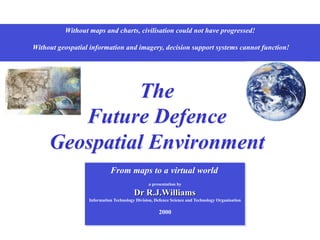
  • 1. Without maps and charts, civilisation could not have progressed! Without geospatial information and imagery, decision support systems cannot function! The Future Defence Geospatial Environment From maps to a virtual world a presentation by Dr R.J.Williams Information Technology Division, Defence Science and Technology Organisation 2000
  • 2. 2000 2010 2005 2020 SEA 1430 Phase 1 PARARE Phase 1 Project Johnson JP2064 PARARE Phase 2B • A Virtual World Intelligent systems Authority Intelligence Resource & asset management Command Support Surveillance Command • Knowledge-based systems as an integral part of the C2 capability PARARE Phase 2A Project Toposs • Legacy Repositories of digital data in various forms and formats Warehouses of maps and charts Paper-based libraries, catalogues and directories Limited acquisition and surveying capability • Major capability deficiency Defence Planning and Operations ADO MGI ASDI www ADO Users • Geospatial information infrastructure Source acquisition Imagery preparation Data extraction Product construction Distribution Database management • Single service/agency GIS systems EGICS From the current legacy to the virtual world 1973 1976 1975 1984 Early digitisation Digital mapping prototype Automap 1 Automap 2 1968 1967 Early analytical photogrammetry Surveying by airborne trilateration techniques
  • 3. Other Data Sources Imagery Non-imagery Data Acquisition Readiness assessment Common Operational Picture Mission Specific Views Interoperability Information Applications Framework Information Framework Services Interfaces Information Management and Dissemination Commercial sources Out-sourcing Co-production Geo Support Capability DTA RAN HYDRO - other RAAF AIS Information Production Needs assessment Area Requirements Crisis Support Mission Profiles Requirements Management Technical assessment Value Add Planning and operational needs -National security -Planning -Surveillance -Operations -National defence -Special operations -Obligations An operational architecture to achieve a Geospatial Information Infrastructure
  • 4. Scientific Adviser Team • Geomatics (science and technology) • National initiatives • Multi-national initiatives • Interface with academia and industry Strategic Operational Tactical DIE and C4ISR Web-based technology Defence MGI Agencies Acquisition Compilation Production Data management Civilian GI Agencies ASDI Australian National Spatial Data Infrastructure Defence Planning and Operational needs assessment access Authorised Electronic Library/Atlas Archives User community Clearinghouse Coalition Agencies Training establishments Deployable MGI Sections The 2005 goal - A Geospatial Information Infrastructure
  • 5. DIGEST Digital Geographic Information Exchange Standard United States Imagery and Geospatial Information Service USIGS Defense Modeling and Simulation Office Scientific Advice Strategic Operational Tactical DIE and C4ISR Web-based technology Defence MGI Agencies Civilian GI Agencies Defence Planning and Operational needs assessment Authorised Electronic Library/Atlas Archives Clearinghouse Coalition Agencies Training Deployable MGI Sections User community Improvement of user services Help Desk advice •  MC&G S&T topics •  Library services •  Environmental analysis •  Operational analysis •  Modelling and simulation •  et cetera ? Interoperability via conformance Intelligence, surveillance, reconnaissance Command, control and communications Navigation and guidance Targeting and weapons employment Mobility and manoeuvre Health and survival Electronic library •  Illustrated atlases •  Infrastructure directories CD-ROM Needs assessment through e-Business strategies
  • 6. Needs assessment Scientific Advice Strategic Operational Tactical Defence MGI Agencies Defence Planning and Operational needs assessment Authorised Electronic Library/Atlas Clearinghouse Coalition Agencies Training Deployable MGI Sections User community DIE and C4ISR Web-based technology Civilian GI Agencies Parare The Next Generation Defining requirements based on needs and readiness assessment of the scope of Military Activities, activities that are related to: The image cannot be displayed. Your computer may not have enough memory to open the image, or the image may have been corrupted. Restart your computer, and then open the file again. If the T h The image cannot be displayed. Your computer may not have enough The image cannot be displayed. Your computer may not have enough memory to open the image, or the image •  Intelligence, surveillance, reconnaissance •  Command, control and communications •  Targeting and weapons employment •  Navigation and guidance •  Mobility and manoeuvre •  Health and survival Are your activities or applications concerned with: Environmental Analysis  Avenues of approach  Critical link analysis  Cross-country movement  Fording analysis  Intervisibility analysis  Terrain modelling  Weapon ballistics Base Operations  Facilities management  Environmental applications  Range management  Training management  Water and food resources  Medical facilities  Airfield defence Intelligence  Situation Monitoring  Geographic information  Target analysis  Weapon production tracking  Image management  Counter terrorism Command Support  Situation monitoring  Situation display & briefing  Simulation Mission Planning  Integrated theatre planning  Invasion planning  Evacuation planning  Targeting  Trajectory modelling  Missile support Operational Planning  Battlefield management  Battlefield systems  Division planning  Landing and beach operations  Logistics  Mine warfare  Simulation  Special force operations Navigation  Air navigation  Air traffic control  Land navigation  Ocean surface navigation  Ocean subsurface navigation On the modern day battlefield, everything is spatially related and, if you don’t understand the relationships, you will never win the war! Are your resolution and accuracy requirements at the: Strategic level Operational level Tactical level Focal area level Target level Is your purpose for: Situation awareness and visualisation Operational planning and rehearsal Precision force Modelling and simulation Operational analysis
  • 7. Strategic Operational Tactical Defence MGI Agencies Defence Planning and Operational needs assessment Authorised Electronic Library/Atlas Archives Clearinghouse Coalition Agencies Deployable MGI Sections User community DIE and C4ISR Web-based technology Civilian GI Agencies ? •  MC&G S&T topics •  Library services •  Environmental analysis •  Operational analysis •  Modelling and simulation •  et cetera RAN Hydrographic Service DIGEST Product VMap Level 1 - Background Display Dataset (BDD) - Boundaries Population Transportation Industry Utilities Hydrography Physiography Elevation Vegetation Data quality Scientific Advice Training Services Products Science and technology topics Electronic Help Desk Parare The Next Generation
  • 8. CD-ROM Scientific Advice Strategic Operational Tactical Defence MGI Agencies Defence Planning and Operational needs assessment Authorised Electronic Library/Atlas Archives Clearinghouse Coalition Agencies Training Deployable MGI Sections User community DIE and C4ISR Web-based technology Civilian GI Agencies Links to Owners and operators Airfield infrastructure Prototypes … … Location Profile TOWNSVILLE AIRPORT Intended use: Transport & Logistics Tactical ops (Level 2) Aero info RAAF AIS Phone 03 9282 6924 User profile Region / location identification Purpose of use and resolution / precision Accrediting authority Links to government / commercial WWW sites Links to directories / databases •  MC&G S&T topics •  Library services •  Environmental analysis •  Operational analysis •  Modelling and simulation •  et cetera •  Illustrated atlases •  Infrastructure directories Electronic Help Desk Parare The Next Generation Note: The following slides are for DEMONSTRATION OF CONCEPT PURPOSES only and may, or may not, represent the actual status of information, or sources
  • 9. Location Profile PORT OF TOWNSVILLE Intended use: Operational planning Infrastructure (Level 1) CALTEX Australia Limited Terminal 07 4771 4071 SHELL Australia Limited Herbert St 07 4746 3135 Gogas Emergency Line 1800 802 666 Mobil Oil Australia Limited Emergencies 1800 023 005 4 5 6 7 8 9 10 3 Regional Harbour Master The Port of Townsville has 8 operational berths. No. 1 Berth (isolated) is used exclusively by tankers for bulk oil, gas and sulphuric acid discharge and by all type of vessels for distillate bunkering. No. 2 Berth is used for unloading nickel ore, it is equiped with an ore unloading gantry crane. No. 3 Berth is leased to M.I.M Holdings Ltd, it has a container gantry crane with a lift capacity of 55.9 tonnes, maximum height of lift above wharf deck is 27 meters. The crane traverses the full length of theberth, except for a length of rail occupied by a 25.4 tonne, 32 metre radius, travelling jib crane for container and unit load handling. No. 4 Berth has a landing pad, supported by steel piling, to service stern angle ramp RORO vessels. The molasses pipeline to this berth is capable of loading up to 400 tonnes / hour. The berth has been upgraded to import bulk cement and is also equipped with pipelines for the import of caustic soda. No. 7 Berth supports a bulk shiploader for mineral concentrates, phosphate rock and ores up to 102mm aggregate at the rate of 1,000 tonnes / hour. This berth is also equipped with bulk molasses and bunker pipeline. No. 8 Berth services the export frozen beef trade with cargoes drawn from freezer stores adjacent to the port. It also serves as a general purpose berth with scrap metal, fertiliser and frozen meat being handled over this wharf. The berth is equipped with a stationary 25 tonne, 30 metre radius, 400 HLT crane. No. 9 Berth is the raw sugar loading berth. A bulk shiploader delivers sugar to carriers at the rate of 2000 tonnes / hour. The berth is also equipped with a bunker and molasses pipeline. No. 10 Berth is a general purpose berth equipped with a 30 tonne crane with a 32 metre maximum radius. A stern RORO ramp is also available. Storage facilities at the Port of Townsville Oil All major oil companies operate terminals in close proximity to the port. Raw Sugar Two storage sheds of 285,000 tonnes total capacity. Molasses Four bulk storage tanks of 35,000 tonnes total capacity. Concentrates 170,000 tonnes covered storage area. Cement One 30,000 tonne bulk cement storage silo. Chemicals Two sulphuric acid storage tanks of 17,000 tonnes total capacity. LP Gas Five LPG storage tanks with a total capacity of 1,250 tonnes Townsville is located on the north eastern coast of Queensland, 550 kilometres north of the Tropic of Capricorn and 2,300 kilometres south of the equator. Townsville lies 1,500 kilometres north of the State Capital Brisbane. A prosperous coastal city, Townsville has a culturally diverse population of around 130,000 and a sound economy built upon mining, manufacturing, industry, tourism and transportation. This, together with the concentration of educational, administrative, cultural, commercial and industrial services has ensured that Townsville is, and will remain, both the largest provincial city in Queensland and the Capital of North Queensland.
  • 10. Location Profile PORT OF TOWNSVILLE Intended use: Transport & Logistics Tactical ops (Level 2) Road access Port authority Townsville Port Authority Phone 07 4790 2111 Hydrographic info RAN Hydrographic Service Phone 02 4221 8500 Berth 1 Petroleum products One 150mm pipeline Two 300mm pipelines Storage capacity - 165,000 tonnes LPG One 250mm pipeline Storage capacity - 1,250 tonnes Berth 2 General cargo One travelling jib crane Berth 3 One travelling gantry container crane Heavy lift capacity - 56 tonnes Storage area - 2.8ha Roll-on / roll-off Stern ramp available Berth 6 General cargo LPG Depot CALTEX Depot SHELL Depot MOBIL Depot S19 15 E146 50 Berth 10 Containers Mobile crawler crane Lift capacity - 130 tonnes Storage area - 2.6ha Roll-on / roll-off Stern / bow ramp available Platypus Channel Dredged to 10.3 metres Dredged to 9.5m Swinging basin dredged to 10.5m Berth 9 Passenger cruise vessels Scale bar [KM] 1 0 Hotel Casino Marina Links to Owners and operators Wharf infrastructure Navigation aids Power and fuel facilities Communications and emergency services
  • 11. Location Profile TOWNSVILLE AIRPORT Intended use: Transport & Logistics Tactical ops (Level 2) Air traffic management Airservices Australia Phone 1300 300 719 Military operations RAAF Garbutt Phone 07 4752 2111 Aero info RAAF AIS Phone 03 9282 6924 Suitable for C130 Hercules and Russian Antinov cargo planes TOWNSVILLE/Townsville INTL ELEV 18 AVFAX CODE 4402 MOVEMENT AREA 01/19 017 80a 07/25 067 36a F27 PCN8/F/A/580/U Asphalt Pavement ratings - Concrete apron: PCN 58/R/D/1750/U - Asphalt apron: PCN 77/F/D/1750/U - Light ACFT apron: PCN 13/F/D/580/U LIGHTING L1 RWY 01/19 & 07/25 L4 RWY 01/19 3 stage AVBL L5 RWY 01 L9 RWY 01/19 NAVIGATION AIDS TACAN VOR NDB DME ILS ASR/SSR GROUND SERVICES AMS(MIL) AVBL on 361.6 REPLEN BP Phone 07 47794346 For fuel H24 0412 777160, VHF 126.4 Callsign Air BP. AVGAS, JET A1, O117, O125 RFF CAT 6 2000-1100, CAT 4 1100-2000 MET Elaboration of MET H24, WSO or 07 47795999 H 01/19 07/25 Townsville 2NM Links to Owners and operators Airfield infrastructure Navigation aids Power and fuel facilities Communications and emergency services Airservices Australia E146 46 S19 15
  • 12. Strategic Operational Tactical Defence MGI Agencies Defence Planning and Operational needs assessment Authorised Electronic Library/Atlas Archives Clearinghouse Coalition Agencies Deployable MGI Sections User community DIE and C4ISR Web-based technology Civilian GI Agencies Prototype (scenario planning) … … ? •  MC&G S&T topics •  Library services •  Environmental analysis •  Operational analysis •  Modelling and simulation •  et cetera Training Scientific Advice Location Profile DILI, EAST TIMOR Intended use: Situation Awareness Strategic intell (Level 1) User profile Region / location identification Purpose of use and resolution / precision Accrediting authority Imagery Landsat 7 9:40AM 8 Sept 1999 Processed by BLACK GRID LINES ARE 25 METRE INTERVALS OF THE UNIVERSAL TRANSVERSE MERCATOR (UTM) GRID ZONE 51 WORLD GEODETIC SYSTEM 1984 (WGS84) ELLIPSOID Horizontal accuracy +/-5 metres MAP GRID Error ellipse Error and accuracy statements Electronic Help Desk Parare The Next Generation Note: The following slides are for DEMONSTRATION OF CONCEPT PURPOSES only and may, or may not, represent the actual status of information, or sources
  • 13. Location Cf INDONESIA MEDITERRANEAN SEA Profile Intended use: Geography brief Strategic geography (Level 0) i A presentation by Dr Bob, Cartographer To be be used for briefing purposes only NOT AUTHORITIVE For further information refer to Approximate distance in kilometres ACEH JAYAPURA TIMOR AMBON BIAK 0 1000 2000 3000 4000 5000 Jakarta Area: total: 1,919,440 sq km land: 1,826,440 sq km water: 93,000 sq km Country name: Republic of Indonesia Cf Mediterranean Sea Area: 2,505,000 sq km Population: 216,108,345 (July 1999 est.) Ethnic groups: Javanese 45%, Sundanese 14%, Madurese 7.5%, coastal Malays 7.5%, other 26% Religions: Muslim 88%, Protestant 5%, Roman Catholic 3%, Hindu 2%, Buddhist 1%, other 1% (1998) Languages: Bahasa Indonesia (official, modified form of Malay), English, Dutch, local dialects, the most widely spoken of which is Javanese Ports and harbors: Cilacap, Cirebon, Jakarta, Kupang, Palembang, Semarang, Surabaya, Ujungpandang Airports: 443 (1998 est.) Airports—with paved runways: total: 125 Airports—with unpaved runways: total: 318 Heliports: 4 (1998 est.) Current areas of unrest Indonesian flag NOTE: This map shows an outline of Indonesia and parts of its near neighbours The background map shows the extent of the Mediterranean Sea. Neither map is in a standard map projection; being displayed in Plate Carree and, as such, scale is only approximate and shape distortions occur
  • 14. Location Profile Intended use: Situation awareness Strategic intell (Level 1) Imagery Landsat 7 9:40AM 8 Sept 1999 Processed by Dili Airport Terminal DILI (Komoro) Airport (Control Point) Coordinates 125° 31’ 19.2454”E 8° 32’ 57.3507”S * (Spheroidal height) 56.7736M * Elevation 10FT DILI, EAST TIMOR * NOTE: Elevation refers to height above the geoid (or sea surface level) Spheroidal height refers to a mathematical height and is the height relative to a reference ellipsoid. Satellite surveying and satellite navigation systems produce a spheroidal height as a part of their output.
  • 15. Pillars House 100 25 50 75 0 Metres POS POLISI MOTTAAIN Boom gate SELAT OMBAI Boundary follows the thalweg of Rib Motabico Rock retaining wall Bridge Canal Bridge PROPINSI TIMOR TIMUR PROPINSI NUSA TENGARRA TIMUR Batas Propinsi [Provincial Limit] Boundary agreed by Portugal and the Netherlands Portuguese explorers land on Timor The Portuguese colonise Timor The Dutch colonise the western half of the island Treaty of Demarcation between Portugal and the Netherlands signed Centre island boundary surveyed Formal transfer of sovereignty from the Netherlands to the Republic of Indonesia The United Nations General Assembly places East Timor on its list of Non-Self Governing Territories Portugal admits it has lost control of East Timor [21 August] Foreign Ministers of Portugal and Indonesia meet in Rome and agree that Portugal constitutes the legitimate authority in East Timor [3rd November] Indonesian forces invade East Timor and establish a provisional Government and requests integration with Indonesia Portugal breaks off diplomatic relations with Indonesia [7th December] UN General Assembly passes a resolution calling on Indonesia to withdraw from East Timor immediately [12th December] East Timor is integrated into Indonesia as its 27th province - Loro Sae Australia’s Foreign Minister announces his Government’s recognition of incorporation of East Timor into Indonesia [20th January] New Zealand gives support to Indonesian line on non-interference [20th July] Australia formally recognises Indonesian take-over of East Timor [15th December] An agreement is signed at the United Nations in New York between the UN, Portugal and Indonesia allowing for a vote on whether to accept a special autonomy arrangement with Indonesia or to move towards independence[5th May] President Habibie of Indonesia endorses the referendum result which is in favour of independence [6th September] Violence rages in East Timor UN confirms that a peacekeeping force will be sent to East Timor [13th September] UN force led by Australia arrives in Dili [20th September] Indonesian Parliament ratifies the result of East Timor referendum. The United Nations takes over the immediate control of the territory [20th October] 1520 1701 1700s 1859 1915 1949 1960 1975 1976 1977 1999 CHRONOLOGY The United Nations has never recognized integration of East Timor with Indonesia. Probable recognition of province boundary as border The UK Foreign & Commonwealth Office position is that the boundary on the Island of Timor is a full international, de jure boundary, which was delimited by agreement between Portugal and the Netherlands signed in 1904 and clarified by the decision of the Permanent Court of Arbitration in 1914 Location MOTAAIN BORDER CROSSING Profile Intended use: Border assessment Focal area (Level 3)
  • 16. Location Profile INDONESIA - EAST TIMOR BORDER (North) Intended use: Aerial surveillance Tactical ops (Level 2) Motaain Belaka Batugade Mangrove Border crossing INDONESIA (West Timor) EAST TIMOR Imagery Australian Imagery Office October 1999 Annotation Bakosurtanal October 1982-1992 CAUTION 9010 000 09 08 07 7 13 000 14 15 16 17 18 BLACK GRID LINES ARE 1000 METRE INTERVALS OF THE UNIVERSAL TRANSVERSE MERCATOR (UTM) GRID ZONE 51 WORLD GEODETIC SYSTEM 1984 (WGS84) ELLIPSOID Horizontal accuracy +/-25 metres MAP GRID Error ellipse CAUTION Area of uncertainty (due to differing border delineation) CAUTION - NOT VERIFIED
  • 17. Location E714300 E714400 E714500 Site plan Detailed site survey 16 October 1999 Territorial advice Australian Defence Headquarters Directorate of Strategic Military Geographic Information 25 November 1999 Rock retaining wall Boom gate Pillars House Bridge Check point Culvert SELAT OMBAI Bridge House House Shed Shed Rock retaining wall INDONESIA Canal POS POLISI MOTAAIN Profile MOTAAIN BORDER CROSSING Intended use: Border patrol/defence Focal area (Level 3) BLACK GRID LINES ARE 25 METRE INTERVALS OF THE UNIVERSAL TRANSVERSE MERCATOR (UTM) GRID ZONE 51 WORLD GEODETIC SYSTEM 1984 (WGS84) ELLIPSOID Horizontal accuracy +/-5 metres MAP GRID Error ellipse KEY POINT REGISTER Motaain Police Station 714295 9009100 Bridge (Mota Bico) 714475 9009114 Bridge (Motaain) 714365 9009058 Check point 714303 9009081 Road block 714307 9009075 Boom gate 714287 9009087 CAUTION INDONESIA (West Timor) Area of uncertainty (due to differing border delineation) Road block N9009200 N9009100 Typical TNI check point
  • 18. Dutch establish a settlement at Triton Bay and annex New Guinea west of 141° E [24 August] A secret declaration by the Dutch, after a request from Britain, redefines border Secret declaration made public Border described as a straight line by Dutch, prior to Britain and Germany acquiring colonies on island Germany claims New Guinea Britain claims Papua Germany and Britain draw a boundary from Mitre Rock on east coast to intersection of 5°S and 141° E Anglo-Dutch negotiations begin after raids by headhunters. British and Dutch officials visit south coast and identify Bensbach River at 141° 01’47.9”E as logical point for boundary. This meant that Britain concedes a strip 1.8 mile wide to 5° S. Britain argues and gains Fly River bulge as compensation. Agree- ment finalised on 20 July 1895. Australia succeeds Britain in Papua Negotiations and surveys begin by Netherlands and Germany on northern coast. War intervened prior to completion Australia succeeds Germany in New Guinea Australia and Netherlands commence settlement of boundary. Australian surveyor, AG Harrison, placed a marker near Wutong on meridian 141°0’13.5” E and recorded that Dutch border lay 1312FT to west. Joint determination occurred and discovered a gap of 1306FT between Australian and Dutch locations of 141° E. A simple split was not possible for a marker and so one was placed 550Ft from Dutch location and 756Ft from Australian location Australian and Dutch governments agree boundary should follow the great circle passing through the obelisk to intersection of 141° E with Fly River, along Fly River to meridian passing through the mouth of Bensbach River then to coast. Monuments were erected at Fly River intersections Indonesia succeeds Dutch in Irian Jaya Indonesia and Australia agree to defined border Work began on erecting markers Agreement reached on border 26 January 1973. Fourteen markers established, ten north of Fly River Meridian south of Fly changed to 141° 01’10E, being the new determination of mouth of Bensbach River. Signs placed near villages and tracks CAUTION: Fluctuations of Fly River NOT clarified 1828 1848 1865 1875 1884 1885 1893 1905 1910 1919 1919 1933 1960 1962 1962 1966 1973 CHRONOLOGY OF A BORDER An agreement between Indonesia and Australia, dated 26 January 1973, listed 14 boundary markers. Ten marked 141°E to the north of the Fly River. Four marked 141°01’10”E south of the Fly River, being the mouth of the Bensbach River Papua New Guinea gained independence on 16 September 1975 from the Australian-administered UN trusteeship The border was [partially] resurveyed through OP KUMUL, a Defence Cooperation Project (DCP), in 1989 Location INDONESIA PAPUA NEW GUINEA BORDER Profile Intended use: Border assessment Bulletin: Thu, Jun 8 2000 15:44 AEST The Prime Minister, John Howard, is moving to reassure Indonesia that he will not be supporting secessionist moves in the province of Papua. The Prime Minister has made the commit- ment ahead of talks with the Indonesian President Abdurrahman Wahid. Mr Howard says he will tell the Indonesian President he respects Indonesia’s present borders. Strategic geography (Level 0) Boigu I. AUSTRALIAN SOVEREIGN TERRITORY x x x x x x x x x x x x x x Fly R. Bensbach R. Province of Papua (formerly Irian Jaya) Jayapura Timika Biak Ambon Ok Tedi Port Moresby
  • 19. Tembagapura Township Location TEMBAGAPURA, Irian Jaya Profile i Intended use: Geography brief Strategic geography (Level 0) Tembagapura Jayapura Timika Merauke Biak Sorong Fakfak Location July 2000 Grasberg Mine Puncak Jaya has massive ice bodies including the Meren, Carstensz,and Eastern Northwall glaciers, as well as the Western Northwall Ice Cap. The glaciers and Puncak Jaya are outside the PT Freeport Indonesia mining area. Puncak Jaya Key environmental features Reserves total over 2.48 billion tonnes of ore, which contains: •  World’s largest gold reserve - 64.2 million payable ounces •  World’s third largest copper reserve - 51.3 billion payable pounds Mining resources Tembagapura location S 4º8’ E 137º5’ [approx.] http://www.fcx.com/mr/fast-facts/ff-overview.html
  • 20. church on ridge high terrain bowl 15 33 Location Profile MAKKI, Irian Jaya Intended use: Evacuation planning Tactical ops (Level 2) Aero info RAAF AIS Phone 03 9282 6924 Profile Tactical ops (Level 2) NOT KNOWN Air traffic management Airservices Australia Phone 1300 300 719 Typical mountainous terrain The Dani People Terminal chart Flight Information August 2000 MAKKI MAK GBIJ/ABMS Class 3 Coordinates S 03 58.26 E 138 37.68 VHF 120.0 Length/Width 633m / 19m Elevation 6250’ Slope 9% CAUTION Sketch map - Not to scale Tembagapura Jayapura Timika Merauke Biak Sorong Fakfak .Makki Location NO Avgas NO Avtur SURFACE Thick heavy sod over dirt. Moderate crown. Soft and slippery when wet. Soft shoulders. Sideslope toward river. OBSTRUCTIONS Hills at entrance to valley. ABORT - LANDING Left turn just before entering bowl. If unable to stop landing roll, swerve to right at upper end. ABORT - TAKEOFF About 150M into takeoff roll. If unable to stop, continue straight off lower end. WEATHER PATTERN Morning fog and cloud close valley during rainy season. Mid morning valley winds strong, gusty. Weather and wind often different than main valley outside bowl. HAZARDS - REMARKS Wind Curfew 10:00. Wind sock not always good indicator. Can be surprisingly turbulent inside abort point. Check turbulence; make low pass/drag. Confirm approach path clear of clouds before committed on approach. Blind takeoff; requires signaler. Stay in center. Crowd control problems. The Dani( often referred to as Lani) live in the highlands of east Ilaga near the edge of the Grand Baliem Valley. The Dani of the centre high islands, perhaps the best- known of the Irianese, live in communities of tidy little thatch-and-wood huts, surrounded by neatly kept gardens of sweet potato vines.Two of the Dani's most distinguishing traits are their cultural costumes of penis gourds for men, and fiber skirts for women. Efforts by the Indonesian government have failed to convince Dani men that pants were superior to their horim. Ancestral beliefs remain strong among the Grand Valley Dani. +6900FT 6250FT 6450FT 2% TDZ 10% 15 33 + Cessna Caravan
  • 21. Strategic Operational Tactical Defence MGI Agencies Defence Planning and Operational needs assessment Authorised Electronic Library/Atlas Archives Clearinghouse Coalition Agencies Deployable MGI Sections User community DIE and C4ISR Web-based technology Civilian GI Agencies ? •  MC&G S&T topics •  Library services •  Environmental analysis •  Operational analysis •  Modelling and simulation •  et cetera Scientific Advice Training Electronic Help Desk Parare The Next Generation
  • 22. DGIWG Stragey Sub-Group Advanced Concept Technology Demonstrator Common Gateway Services for the Delivery of Geospatial Imagery and Intelligence Information Advanced Concept Technology Demonstrator NSDI Clearinghouses FGDC/CEONet OGC/WMT Map/Catalog Servers Geospatial Clients USIGS DIGEST BDD (VMap) TLD (transport/logistics) TAD (terrain analysis) # Civilian GI Agencies through ASDI Scientific Advice Strategic Operational Tactical Defence MGI Agencies Defence Planning and Operational needs assessment Authorised Electronic Library/Atlas Archives Clearinghouse Coalition Agencies Training Deployable MGI Sections User community DIE and C4ISR Web-based technology Civilian GI Agencies # Interoperability via conformance DIGEST USIGS Electronic dissemination of GI3 Parare The Next Generation
  • 23. Development of new products and services Scientific Advice Strategic Operational Tactical DIE and C4ISR Web-based technology Defence MGI Agencies Civilian GI Agencies Defence Planning and Operational needs assessment Authorised Electronic Library/Atlas Archives Clearinghouse Coalition Agencies Training Deployable MGI Sections User community Databases of infrastructure and environmental information Warehouse / clearinghouse as maps, charts, publications, reports, etc as standard digital products, geospatial services, etc distributed via electronic media and networks as customised operational databases, contingency support packages, etc distributed via electronic media and networks terrain analysis packages transport and logistics databases littoral operations databases electronic aeronautical publications electronic maritime publications Decision support systems Feedback in the form of reports, analyses, and value-added products User community e.g. Palm pads - GPS, GIS & mobile comms
  • 24. Improvement in availability of foundation geospatial information Production Support Capability Co-production Commercial sources Out-sourcing DTA RAN HYDRO RAAF AIS AODC DOM AIO Scientific Advice Strategic Operational Tactical DIE and C4ISR Web-based technology Defence MGI Agencies Civilian GI Agencies Defence Planning and Operational needs assessment Authorised Electronic Library/Atlas Archives Clearinghouse Coalition Agencies Training Deployable MGI Sections User community Analyse current and new capabilities •  Parare •  SEA1430 •  JP2064 Review bilateral and multilateral commitments Review National Support commitments Investigate commercial support capabilities
  • 25. Improvement of management of databases and archives Scientific Advice Strategic Operational Tactical DIE and C4ISR Web-based technology Defence MGI Agencies Defence Planning and Operational needs assessment Archives Training 0 Strategic Level 1 Operational Level 2 Tactical Level 3 Focal area/urban 4 Facility / target R E S O L U T I O N TERRAIN ENVIRONMENT Spatial data model Lineage Currency Datum/s Reference system Positional accuracy Relative accuracy Accreditation THE DOMAIN OF MILITARY GEOGRAPHIC INFORMATION 1 2 3 4 1 2 3 4 1 Physiography 2 Hydrology 3 Hydrography / bathymetry 4 Vegetation/cultivation 1 Atmosphere / weather 2 Climate 3 Astronomy 3 Oceanography 4 Isogonic information Measures of Trust 1 Administration/institution 2 Population/habitation 3 Road infrastructure 4 Rail infrastructure 5 Air infrastructure 6 Sea infrastructure 7 Telecommunications 8 Power/fuel 9 Water resources 10 Industry/commerce 11 Health/medical 12 Tourism/recreation INFRASTRUCTURE 1 2 3 4 5 6 7 8 9 10 11 12 The MGI data cube Develop more advanced formal models for representing the geographic environment in time and space Develop techniques for maintaining, revising and managing geospatial information
  • 26. Any questions, opinions and views on the Future Defence Geospatial Environment? Dr R.J.Williams Information Technology Division, Defence Science and Technology Organisation