SlideShare a Scribd company logo
1 of 26
TAAL VOLCANO UPDATE June 2010 JAIME S. SINCIOCO OIC, Volcano Monitoring and Eruption Prediction Division Philippine Institute of Volcanology and Seismology Department of Science and Technology
TAAL VOLCANO ISLAND:  23 sq km in area; highest point of the island: 311 m asl (SW rim of the Main Crater) MAIN CRATER:  1.9 km in dia.; blue-green in color; 4 m asl; deepest point: 76 m; site of 12 eruptions from 1749 to 1911 TAAL CALDERA:  25 km across; formed between 140,000 to 5,380 B.P.; major adjacent volcanic edifices: Mt. Sungay, Mt. Batulao, Mt. Macolod, Mt. Malepunyo & Mt. Makiling No. of recorded eruptions of Taal: 33 since 1572 Latest eruption: 03 October 1977 Source: HIGP, Univ. Hawaii
NATURE OF ERUPTION ,[object Object],[object Object],[object Object],PHREATIC 1976 ,[object Object],[object Object],STROMBOLIAN 1966 1969 PHREATOMAGMATIC ,[object Object],[object Object],PLINIAN 1991 Pinatubo eruption (Plinian) ,[object Object],[object Object],[object Object]
Eruption centers of Taal Volcano
Historical Eruption Centers ,[object Object],[object Object],[object Object],[object Object],[object Object],[object Object],1965 eruption site (Mt. Tabaro) 1911 eruption site (Main Crater)
[object Object],[object Object],[object Object],[object Object],[object Object],[object Object],[object Object],[object Object],[object Object],[object Object],[object Object],[object Object],[object Object],[object Object]
Current Status ,[object Object],[object Object],[object Object],[object Object],[object Object],[object Object],[object Object],[object Object]
 
Epicentral map as of June 18, 2010
TAAL EPICENTRAL MAP January-June 2010 LEGEND: Seismic Station Epicenters Prepared by: L. Bañes 06/20/10


Taal Volcano Alert Signals Alert Level Criteria Interpretation 0 Background, quiet No eruption in foreseeable future. 1 Low level seismicity, fumarolic, other activity Magmatic, tectonic or hydrothermal disturbance; no eruption imminent. 2 Low to moderate level of seismicity, persistence of local but unfelt earthquakes.  Ground deformation measurements above baseline levels.  Increased water and/or ground probe hole temperatures, increased bubbling at Crater Lake. A) Probable magmatic intrusion; could eventually lead to an eruption.   B) If trend shows further decline, volcano may soon go to level 1 3 Relatively high unrest manifested by seismic swarms including increasing occurrence of low frequency earthquakes and/or harmonic tremor (some events felt).  Sudden or increasing changes in temperature or bubbling activity or radon gas emission or crater lake pH.  Bulging of the edifice and fissuring may accompany  seismicity. A) If trend is one of increasing unrest, eruption  is possible within days to weeks.   B) If trend is one of decreasing unrest, volcano may soon go to level 2 4 Intense unrest, continuing seismic swarms, including harmonic tremor and/or “low frequency earthquakes” which are usually felt, profuse steaming along existing and perhaps new vents and fissures. Hazardous explosive eruption is possible within days. 5 Base surges accompanied by eruption columns or lava fountaining or lava flows. Hazardous eruption in progress.  Extreme hazards to communities west of the volcano and ashfalls on downwind sectors.
    TAAL HAZARD WARNINGS BASED ON ALERT SIGNALS Expansion of risk areas depending on the magnitude of eruption. Alert Level 5 Total evacuation of the Volcano Island. Flank eruption –  lakeshore barangays facing eruption sitel Eruption site: Main Crater – lakeshore barangays of Talisay, Tanauan, Agoncillo, Balete, San Nicolas and Laurel. Additional areas to be evacuated shall be determined based on the development of escalating activity and possible location of eruption site. Alert Level 4 Selective evacuation – women, children and elderly at the Volcano Island are advised to transfer to their relatives at the mainland. Alert Level 3 Main Crater, Daang Kastila and 1965-1977 Mt. Tabaro Eruption Site are off limits to the public.  Alert Level 2 Main Crater is off limits to the public because sudden explosions may occur or toxic gases may accumulate.  Volcano Island residents and visitors must be aware and vigilant of the volcano’s condition. Alert Level 1   ACTIVITIES   ALERT LEVELS
RAISING/LOWERING OF ALERT LEVEL Slight seismic unrest Alert Level 1 23 November 2005 EVENT ALERT LEVEL DATE Increasing trends in monitoring parameters Alert Level 2 08 June 2010 Alert Level 0 30 June 2005 Series of volcanic earthquakes recorded; some felt at Intensity II-III at Volcano Island (Pira-piraso) Alert Level 1 (reiterated) 09 January 2005 Significant increase in daily seismic count Alert Level 1 29 October 2004 Advisory issued due to unfounded rumors of an impending eruption 29 September 2004 Alert Level 0 06 April 2000
[object Object],[object Object],[object Object],[object Object],[object Object],[object Object],[object Object],Hazards Associated with  Eruption of Taal Volcano 1965 base surge 1969 lava flow Thermal area inside Main Crater
Impacts of Volcanic Hazards People who perished at the Volcano Island due to base surge Houses buried by ash during the 1965 eruption 1965 BASE SURGE TEPHRA  FALL 1911 ground fissures Lemery, Batangas Daang Kastila fissure and landslide


VOLCANIC UNRESTS pH values ranged from 2.5 to 2.37; intense bubbling inside the MCL; lake temperature increased from 30   to 32  C; geysering at the NNE wall of MCL w/ temp. ranging from 97-100°C; more steaming vents were formed due to fissuring along the thermal area No significant inflation or deflation was measured Earthquake count up to 45 events a day. Quakes occasionally felt at volcano island  (RF I-V). Epicenters at MCL to ENE of  Taal.  March to July 1991 Small bubbles observed at MCL; no significant change in lake temperature and pH. Slight inflation at MC and Mt. Tabaro Ave. of 6 events a day. Epicenters were scattered at MCL to NE of  Taal. June to October 1989 Slight inflation (water tube tiltmeter) Several small amplitude (ave. of 2 mm) high frequency August (two-week period) 1988 pH w/in the baseline of 2.5-3 No significant change in lake temp No significant change, within noise level. Earthquakes felt at the SSW of Taal Lake  30 Oct. to 04 Nov. 1987 ALERT STATUS MAIN CRATER LAKE OBSERVATION GROUND DEFORMATION SEISMICITY DURATION YEAR
VOLCANIC UNRESTS No significant change in Main Crater Lake No significant change Seismic swarm; 59 located earthquakes; epicenters covered E and SE of MCL with depths of 2-5 km 19 July to 31 October 2000 Alert Level 3 (evacuation of women, children and the elderly from TVI) pH values of 2.18 to 2.20; intense bubbling at the E & NE sector of  MCL; lake temp. gradually increased from 34  C to 39  C. Inflation of 16 cm at Daang Kastila and 9.8 cm at Calauit, SE of Taal.  Two ground fissures formed at Calauit approx. 70 m apart (8.0 mm and 10 mm wide) Escalating increase; total of 1,550 events detected within 24 hours with several felt events (RF I-II); epicenters clustered at the E and SE sides of Taal with depths of <5 km. 11 March to 31 May 1994 Alert Level 2-3 (total evacuation of TVI ) Intense bubbling inside the MCL (detected by acoustic pressure sensor); abrupt increase of 2° in lake temp. as detected by telemetered sensor)  Volcano island uplifted up to about 20 cm. Fissuring at Daang Kastila (5-50 mm wide  & 20-400 m long; E-W trends and parallel to MC) and at Pira-piraso (2.6 mm wide and 1-2 m long – 5 fissures) Dramatic increase. Total of 2,550 events  detected within 24 hours with several felt events but  decreased  to the baseline in less than two weeks.  14-28 February 1992 ALERT STATUS MAIN CRATER LAKE OBSERVATION GROUND DEFORMATION SEISMICITY DURATION YEAR
VOLCANIC UNRESTS Alert Level 1 November 17 - Geysering activity near the shoreline of Main Crater Lake; muddy water spewed 2-3 m high; sulfur stench also observed; MCL temp at 35°C; slight increase in bubbling activity the crater lake  January – high level of seismicity; quakes clustered mainly at the East and Southeast sectors of Volcano Island covering the Main Crater and Calauit areas; depths of 2 - 4 km January,  November 2006 Alert Level 1 reiterated in January; (AL lowered to 0 on 30 June 2005; AL 1 raised on 23 Nov. 2005) No significant change No significant change Series of volcanic earthquakes recorded; some felt at Intensity II-III at Volcano Island (Pira-piraso); epicenters located within Main Crater and SSE near Calauit; depths of less than 1.0 to 4.0 km Jan. to Feb.; 21 Nov 2005 Alert Level 1 (29 October 2004) No significant change in Main Crater Lake; steaming activity at the thermal areas inside the crater also remained weak Slight inflation of the volcanic edifice Significant increase in daily seismic count; large amplitude earthquakes; epicenters scattered within vicinity of Main Crater, near Binintiang Malaki (NNW) and near Calauit area (SSE); depths of less than 1.0 to 4.0 km beneath the volcano 23 Sept. to November 2004 ALERT STATUS MAIN CRATER LAKE OBSERVATION GROUND DEFORMATION SEISMICITY DURATION YEAR
VOLCANIC UNRESTS Advisory issued to notify concerned authorities and the public of the volcano’s unrest.  Investigation conducted on 29 August 2008 showed that there are remarkable changes in the thermal areas at the northeastern and eastern sectors of Main Crater.  Deflation – based on Jan, Feb., April & Sept. 2008 measurements Still inflated – based on 2004 measurements Volcanic quakes on 28 Aug. 2008 (12:33 PM and 12:46 PM) were felt at Int. II in Bgy. Pira-piraso with depths of 0.6 to 0.8 km.; epicenters were located at Daang Kastila. Another quake occurred on 30 Sept. 2008 felt at Pira-piraso, Alas-as & Banyaga (Int. I) with epicenters located 650 m west of the Island and depth of 1.7 km. August & Sept.  2008 Alert Level 1  June survey – inflation of the volcano edifice June – Increase in seismic activity; felt at Int. II-III at Pira-piraso; felt also at Calauit; depths of 2.8-3.4 km June 2007 ALERT STATUS MAIN CRATER LAKE OBSERVATION GROUND DEFORMATION SEISMICITY DURATION YEAR
THANK YOU! www.phivolcs.dost.gov.ph PHIVOLCS Building, CP Garcia Ave. UP Campus, Diliman, Quezon City Tel 426-1468; Fax 9298366

More Related Content

What's hot

3.4.1 Earthquake Hazards
3.4.1 Earthquake Hazards3.4.1 Earthquake Hazards
3.4.1 Earthquake Hazards
tudorgeog
 
Sara Arif - EDSC 304 - Teacher Lecture & Guided Notes - Plate Tectonics and E...
Sara Arif - EDSC 304 - Teacher Lecture & Guided Notes - Plate Tectonics and E...Sara Arif - EDSC 304 - Teacher Lecture & Guided Notes - Plate Tectonics and E...
Sara Arif - EDSC 304 - Teacher Lecture & Guided Notes - Plate Tectonics and E...
sararif16
 
Global Hazards Patterns
Global Hazards PatternsGlobal Hazards Patterns
Global Hazards Patterns
total
 
Convergent boundaries
Convergent boundariesConvergent boundaries
Convergent boundaries
MissST
 
Precautionary and safety measures for hydrometeorological hazard
Precautionary and safety measures for hydrometeorological hazardPrecautionary and safety measures for hydrometeorological hazard
Precautionary and safety measures for hydrometeorological hazard
JherbyKyleTeodoro1
 
Divergent plate boundaries
Divergent plate boundariesDivergent plate boundaries
Divergent plate boundaries
Nigina98
 
Grade 11 Chapter 4 Module Earth Science : Water Resources
Grade 11 Chapter 4 Module Earth Science : Water ResourcesGrade 11 Chapter 4 Module Earth Science : Water Resources
Grade 11 Chapter 4 Module Earth Science : Water Resources
yeshynegarin
 

What's hot (20)

3.4.1 Earthquake Hazards
3.4.1 Earthquake Hazards3.4.1 Earthquake Hazards
3.4.1 Earthquake Hazards
 
3.2 understanding tsunami
3.2 understanding tsunami3.2 understanding tsunami
3.2 understanding tsunami
 
Volcanoes In the Philippines
Volcanoes In the PhilippinesVolcanoes In the Philippines
Volcanoes In the Philippines
 
Plate boundaries ppt
Plate boundaries pptPlate boundaries ppt
Plate boundaries ppt
 
Sea-Floor Spreading
Sea-Floor SpreadingSea-Floor Spreading
Sea-Floor Spreading
 
Plate Tectonics Earth
Plate Tectonics   EarthPlate Tectonics   Earth
Plate Tectonics Earth
 
Sara Arif - EDSC 304 - Teacher Lecture & Guided Notes - Plate Tectonics and E...
Sara Arif - EDSC 304 - Teacher Lecture & Guided Notes - Plate Tectonics and E...Sara Arif - EDSC 304 - Teacher Lecture & Guided Notes - Plate Tectonics and E...
Sara Arif - EDSC 304 - Teacher Lecture & Guided Notes - Plate Tectonics and E...
 
Global Hazards Patterns
Global Hazards PatternsGlobal Hazards Patterns
Global Hazards Patterns
 
Study of earthquake hazards or disaster
Study of earthquake hazards or disaster Study of earthquake hazards or disaster
Study of earthquake hazards or disaster
 
Ocean basins
Ocean basinsOcean basins
Ocean basins
 
Convergent boundaries
Convergent boundariesConvergent boundaries
Convergent boundaries
 
Continental Drift Theory
Continental Drift TheoryContinental Drift Theory
Continental Drift Theory
 
GEOGRAPHY YEAR 10: VOLCANIC ACTIVITY
GEOGRAPHY YEAR 10: VOLCANIC ACTIVITYGEOGRAPHY YEAR 10: VOLCANIC ACTIVITY
GEOGRAPHY YEAR 10: VOLCANIC ACTIVITY
 
Introduction to disaster concepts
Introduction to disaster conceptsIntroduction to disaster concepts
Introduction to disaster concepts
 
G10 mountain belts
G10 mountain beltsG10 mountain belts
G10 mountain belts
 
Precautionary and safety measures for hydrometeorological hazard
Precautionary and safety measures for hydrometeorological hazardPrecautionary and safety measures for hydrometeorological hazard
Precautionary and safety measures for hydrometeorological hazard
 
Earthquake
EarthquakeEarthquake
Earthquake
 
DRRR - Earthquake Hazards
DRRR - Earthquake HazardsDRRR - Earthquake Hazards
DRRR - Earthquake Hazards
 
Divergent plate boundaries
Divergent plate boundariesDivergent plate boundaries
Divergent plate boundaries
 
Grade 11 Chapter 4 Module Earth Science : Water Resources
Grade 11 Chapter 4 Module Earth Science : Water ResourcesGrade 11 Chapter 4 Module Earth Science : Water Resources
Grade 11 Chapter 4 Module Earth Science : Water Resources
 

Similar to T A A L V O L C A N O U P D A T E 21june2010

Slideshare url for_article_3
Slideshare url for_article_3Slideshare url for_article_3
Slideshare url for_article_3
s1180198
 
Plate Tectonics, Earthquake & Volcano
Plate Tectonics, Earthquake & VolcanoPlate Tectonics, Earthquake & Volcano
Plate Tectonics, Earthquake & Volcano
Malia Damit
 
Unit ii disaster types and earthquake
Unit ii   disaster types and earthquakeUnit ii   disaster types and earthquake
Unit ii disaster types and earthquake
jagadish108
 

Similar to T A A L V O L C A N O U P D A T E 21june2010 (20)

04VolcanicRelief.ppt
04VolcanicRelief.ppt04VolcanicRelief.ppt
04VolcanicRelief.ppt
 
Volcanoes by James Aquilina, 4.03
Volcanoes by James Aquilina, 4.03Volcanoes by James Aquilina, 4.03
Volcanoes by James Aquilina, 4.03
 
EALS 11 Midterm 4.pptxccccccccccccccccccccccccccccccccccccccccccccccccccccccc
EALS 11 Midterm 4.pptxcccccccccccccccccccccccccccccccccccccccccccccccccccccccEALS 11 Midterm 4.pptxccccccccccccccccccccccccccccccccccccccccccccccccccccccc
EALS 11 Midterm 4.pptxccccccccccccccccccccccccccccccccccccccccccccccccccccccc
 
Tectonics: Volcanic hazards
Tectonics: Volcanic hazardsTectonics: Volcanic hazards
Tectonics: Volcanic hazards
 
Volcano-Eruption.pptx
Volcano-Eruption.pptxVolcano-Eruption.pptx
Volcano-Eruption.pptx
 
Slideshare url for_article_3
Slideshare url for_article_3Slideshare url for_article_3
Slideshare url for_article_3
 
Volcanic Hazard
Volcanic HazardVolcanic Hazard
Volcanic Hazard
 
VolcanoesII.ppt
VolcanoesII.pptVolcanoesII.ppt
VolcanoesII.ppt
 
ΠΕΡΙΒΑΛΛΟΝΤΙΚΗ ΜΟΛΥΝΣΗ
ΠΕΡΙΒΑΛΛΟΝΤΙΚΗ ΜΟΛΥΝΣΗΠΕΡΙΒΑΛΛΟΝΤΙΚΗ ΜΟΛΥΝΣΗ
ΠΕΡΙΒΑΛΛΟΝΤΙΚΗ ΜΟΛΥΝΣΗ
 
3
33
3
 
volcano
volcanovolcano
volcano
 
Plate Tectonics, Earthquake & Volcano
Plate Tectonics, Earthquake & VolcanoPlate Tectonics, Earthquake & Volcano
Plate Tectonics, Earthquake & Volcano
 
Active and inactive faults
Active and inactive faultsActive and inactive faults
Active and inactive faults
 
Volcanology of Costa Rica - NSTA 2010
Volcanology of Costa Rica - NSTA 2010Volcanology of Costa Rica - NSTA 2010
Volcanology of Costa Rica - NSTA 2010
 
De asaster
De asasterDe asaster
De asaster
 
Mount etna case study
Mount etna case studyMount etna case study
Mount etna case study
 
Presentation of volcanoes
Presentation of volcanoesPresentation of volcanoes
Presentation of volcanoes
 
Unit ii disaster types and earthquake
Unit ii   disaster types and earthquakeUnit ii   disaster types and earthquake
Unit ii disaster types and earthquake
 
Volcanic Hazards
Volcanic HazardsVolcanic Hazards
Volcanic Hazards
 
Geohazards
GeohazardsGeohazards
Geohazards
 

More from Psdmn Phil

Foundation For Sight Inc Presentation 1
Foundation For  Sight  Inc   Presentation 1Foundation For  Sight  Inc   Presentation 1
Foundation For Sight Inc Presentation 1
Psdmn Phil
 
U P C S W C D Case Study
U P  C S W C D  Case  StudyU P  C S W C D  Case  Study
U P C S W C D Case Study
Psdmn Phil
 
T L C Phil Newsletter
T L C  Phil  NewsletterT L C  Phil  Newsletter
T L C Phil Newsletter
Psdmn Phil
 
School Safety Module T L C India
School Safety Module   T L C  IndiaSchool Safety Module   T L C  India
School Safety Module T L C India
Psdmn Phil
 
Micro Insurance Module T L C India
Micro  Insurance Module    T L C  IndiaMicro  Insurance Module    T L C  India
Micro Insurance Module T L C India
Psdmn Phil
 
Integrating Gender Into C B D R M Training Manual
Integrating  Gender Into  C B D R M   Training  ManualIntegrating  Gender Into  C B D R M   Training  Manual
Integrating Gender Into C B D R M Training Manual
Psdmn Phil
 
C S S A C Case Study
C S S A C  Case  StudyC S S A C  Case  Study
C S S A C Case Study
Psdmn Phil
 
A Strategic Model On A Competitive Biodiesel Enterprise Txtfile
A  Strategic  Model On A  Competitive  Biodiesel  Enterprise TxtfileA  Strategic  Model On A  Competitive  Biodiesel  Enterprise Txtfile
A Strategic Model On A Competitive Biodiesel Enterprise Txtfile
Psdmn Phil
 
17 Dec 2009 L L C D A Presentation At Astoria.Ppt Final
17  Dec 2009  L L  C D A  Presentation At  Astoria.Ppt Final17  Dec 2009  L L  C D A  Presentation At  Astoria.Ppt Final
17 Dec 2009 L L C D A Presentation At Astoria.Ppt Final
Psdmn Phil
 
A T T Y D U Q U E L L W S O P S Mechanics
A T T Y  D U Q U E  L L W S  O P S  MechanicsA T T Y  D U Q U E  L L W S  O P S  Mechanics
A T T Y D U Q U E L L W S O P S Mechanics
Psdmn Phil
 
F I N A L O P S L L W Mngt Grp Guide Rev16 Dec
F I N A L  O P S  L L W  Mngt  Grp  Guide Rev16 DecF I N A L  O P S  L L W  Mngt  Grp  Guide Rev16 Dec
F I N A L O P S L L W Mngt Grp Guide Rev16 Dec
Psdmn Phil
 
Workshop Results
Workshop  ResultsWorkshop  Results
Workshop Results
Psdmn Phil
 
P I N G O N 25.03.10
P I N G O N 25.03.10P I N G O N 25.03.10
P I N G O N 25.03.10
Psdmn Phil
 
Pe N F I N A L 04 20 09
Pe N  F I N A L 04 20 09Pe N  F I N A L 04 20 09
Pe N F I N A L 04 20 09
Psdmn Phil
 
P A G A S A N D C C June2310
P A G A S A  N D C C June2310P A G A S A  N D C C June2310
P A G A S A N D C C June2310
Psdmn Phil
 
O P S L L W Mngt Grp Guide
O P S  L L W  Mngt  Grp  GuideO P S  L L W  Mngt  Grp  Guide
O P S L L W Mngt Grp Guide
Psdmn Phil
 
Millenium School Bldg 04 20 09
Millenium  School  Bldg 04 20 09Millenium  School  Bldg 04 20 09
Millenium School Bldg 04 20 09
Psdmn Phil
 
H I S T O R Y For Paper File
H I S T O R Y  For Paper FileH I S T O R Y  For Paper File
H I S T O R Y For Paper File
Psdmn Phil
 

More from Psdmn Phil (20)

P S D M N Presentation S E P T 2011
P S D M N  Presentation  S E P T 2011P S D M N  Presentation  S E P T 2011
P S D M N Presentation S E P T 2011
 
Foundation For Sight Inc Presentation 1
Foundation For  Sight  Inc   Presentation 1Foundation For  Sight  Inc   Presentation 1
Foundation For Sight Inc Presentation 1
 
U P C S W C D Case Study
U P  C S W C D  Case  StudyU P  C S W C D  Case  Study
U P C S W C D Case Study
 
T L C Phil Newsletter
T L C  Phil  NewsletterT L C  Phil  Newsletter
T L C Phil Newsletter
 
School Safety Module T L C India
School Safety Module   T L C  IndiaSchool Safety Module   T L C  India
School Safety Module T L C India
 
Micro Insurance Module T L C India
Micro  Insurance Module    T L C  IndiaMicro  Insurance Module    T L C  India
Micro Insurance Module T L C India
 
Integrating Gender Into C B D R M Training Manual
Integrating  Gender Into  C B D R M   Training  ManualIntegrating  Gender Into  C B D R M   Training  Manual
Integrating Gender Into C B D R M Training Manual
 
C S S A C Case Study
C S S A C  Case  StudyC S S A C  Case  Study
C S S A C Case Study
 
A Strategic Model On A Competitive Biodiesel Enterprise Txtfile
A  Strategic  Model On A  Competitive  Biodiesel  Enterprise TxtfileA  Strategic  Model On A  Competitive  Biodiesel  Enterprise Txtfile
A Strategic Model On A Competitive Biodiesel Enterprise Txtfile
 
17 Dec 2009 L L C D A Presentation At Astoria.Ppt Final
17  Dec 2009  L L  C D A  Presentation At  Astoria.Ppt Final17  Dec 2009  L L  C D A  Presentation At  Astoria.Ppt Final
17 Dec 2009 L L C D A Presentation At Astoria.Ppt Final
 
A T T Y D U Q U E L L W S O P S Mechanics
A T T Y  D U Q U E  L L W S  O P S  MechanicsA T T Y  D U Q U E  L L W S  O P S  Mechanics
A T T Y D U Q U E L L W S O P S Mechanics
 
F I N A L O P S L L W Mngt Grp Guide Rev16 Dec
F I N A L  O P S  L L W  Mngt  Grp  Guide Rev16 DecF I N A L  O P S  L L W  Mngt  Grp  Guide Rev16 Dec
F I N A L O P S L L W Mngt Grp Guide Rev16 Dec
 
N I E D
N I E DN I E D
N I E D
 
Workshop Results
Workshop  ResultsWorkshop  Results
Workshop Results
 
P I N G O N 25.03.10
P I N G O N 25.03.10P I N G O N 25.03.10
P I N G O N 25.03.10
 
Pe N F I N A L 04 20 09
Pe N  F I N A L 04 20 09Pe N  F I N A L 04 20 09
Pe N F I N A L 04 20 09
 
P A G A S A N D C C June2310
P A G A S A  N D C C June2310P A G A S A  N D C C June2310
P A G A S A N D C C June2310
 
O P S L L W Mngt Grp Guide
O P S  L L W  Mngt  Grp  GuideO P S  L L W  Mngt  Grp  Guide
O P S L L W Mngt Grp Guide
 
Millenium School Bldg 04 20 09
Millenium  School  Bldg 04 20 09Millenium  School  Bldg 04 20 09
Millenium School Bldg 04 20 09
 
H I S T O R Y For Paper File
H I S T O R Y  For Paper FileH I S T O R Y  For Paper File
H I S T O R Y For Paper File
 

Recently uploaded

Cloud Frontiers: A Deep Dive into Serverless Spatial Data and FME
Cloud Frontiers:  A Deep Dive into Serverless Spatial Data and FMECloud Frontiers:  A Deep Dive into Serverless Spatial Data and FME
Cloud Frontiers: A Deep Dive into Serverless Spatial Data and FME
Safe Software
 
Why Teams call analytics are critical to your entire business
Why Teams call analytics are critical to your entire businessWhy Teams call analytics are critical to your entire business
Why Teams call analytics are critical to your entire business
panagenda
 
+971581248768>> SAFE AND ORIGINAL ABORTION PILLS FOR SALE IN DUBAI AND ABUDHA...
+971581248768>> SAFE AND ORIGINAL ABORTION PILLS FOR SALE IN DUBAI AND ABUDHA...+971581248768>> SAFE AND ORIGINAL ABORTION PILLS FOR SALE IN DUBAI AND ABUDHA...
+971581248768>> SAFE AND ORIGINAL ABORTION PILLS FOR SALE IN DUBAI AND ABUDHA...
?#DUbAI#??##{{(☎️+971_581248768%)**%*]'#abortion pills for sale in dubai@
 

Recently uploaded (20)

"I see eyes in my soup": How Delivery Hero implemented the safety system for ...
"I see eyes in my soup": How Delivery Hero implemented the safety system for ..."I see eyes in my soup": How Delivery Hero implemented the safety system for ...
"I see eyes in my soup": How Delivery Hero implemented the safety system for ...
 
Artificial Intelligence Chap.5 : Uncertainty
Artificial Intelligence Chap.5 : UncertaintyArtificial Intelligence Chap.5 : Uncertainty
Artificial Intelligence Chap.5 : Uncertainty
 
Apidays New York 2024 - APIs in 2030: The Risk of Technological Sleepwalk by ...
Apidays New York 2024 - APIs in 2030: The Risk of Technological Sleepwalk by ...Apidays New York 2024 - APIs in 2030: The Risk of Technological Sleepwalk by ...
Apidays New York 2024 - APIs in 2030: The Risk of Technological Sleepwalk by ...
 
Cloud Frontiers: A Deep Dive into Serverless Spatial Data and FME
Cloud Frontiers:  A Deep Dive into Serverless Spatial Data and FMECloud Frontiers:  A Deep Dive into Serverless Spatial Data and FME
Cloud Frontiers: A Deep Dive into Serverless Spatial Data and FME
 
CNIC Information System with Pakdata Cf In Pakistan
CNIC Information System with Pakdata Cf In PakistanCNIC Information System with Pakdata Cf In Pakistan
CNIC Information System with Pakdata Cf In Pakistan
 
Exploring Multimodal Embeddings with Milvus
Exploring Multimodal Embeddings with MilvusExploring Multimodal Embeddings with Milvus
Exploring Multimodal Embeddings with Milvus
 
Navigating the Deluge_ Dubai Floods and the Resilience of Dubai International...
Navigating the Deluge_ Dubai Floods and the Resilience of Dubai International...Navigating the Deluge_ Dubai Floods and the Resilience of Dubai International...
Navigating the Deluge_ Dubai Floods and the Resilience of Dubai International...
 
MS Copilot expands with MS Graph connectors
MS Copilot expands with MS Graph connectorsMS Copilot expands with MS Graph connectors
MS Copilot expands with MS Graph connectors
 
Polkadot JAM Slides - Token2049 - By Dr. Gavin Wood
Polkadot JAM Slides - Token2049 - By Dr. Gavin WoodPolkadot JAM Slides - Token2049 - By Dr. Gavin Wood
Polkadot JAM Slides - Token2049 - By Dr. Gavin Wood
 
Elevate Developer Efficiency & build GenAI Application with Amazon Q​
Elevate Developer Efficiency & build GenAI Application with Amazon Q​Elevate Developer Efficiency & build GenAI Application with Amazon Q​
Elevate Developer Efficiency & build GenAI Application with Amazon Q​
 
MINDCTI Revenue Release Quarter One 2024
MINDCTI Revenue Release Quarter One 2024MINDCTI Revenue Release Quarter One 2024
MINDCTI Revenue Release Quarter One 2024
 
DBX First Quarter 2024 Investor Presentation
DBX First Quarter 2024 Investor PresentationDBX First Quarter 2024 Investor Presentation
DBX First Quarter 2024 Investor Presentation
 
Biography Of Angeliki Cooney | Senior Vice President Life Sciences | Albany, ...
Biography Of Angeliki Cooney | Senior Vice President Life Sciences | Albany, ...Biography Of Angeliki Cooney | Senior Vice President Life Sciences | Albany, ...
Biography Of Angeliki Cooney | Senior Vice President Life Sciences | Albany, ...
 
Why Teams call analytics are critical to your entire business
Why Teams call analytics are critical to your entire businessWhy Teams call analytics are critical to your entire business
Why Teams call analytics are critical to your entire business
 
Vector Search -An Introduction in Oracle Database 23ai.pptx
Vector Search -An Introduction in Oracle Database 23ai.pptxVector Search -An Introduction in Oracle Database 23ai.pptx
Vector Search -An Introduction in Oracle Database 23ai.pptx
 
Apidays New York 2024 - Passkeys: Developing APIs to enable passwordless auth...
Apidays New York 2024 - Passkeys: Developing APIs to enable passwordless auth...Apidays New York 2024 - Passkeys: Developing APIs to enable passwordless auth...
Apidays New York 2024 - Passkeys: Developing APIs to enable passwordless auth...
 
Web Form Automation for Bonterra Impact Management (fka Social Solutions Apri...
Web Form Automation for Bonterra Impact Management (fka Social Solutions Apri...Web Form Automation for Bonterra Impact Management (fka Social Solutions Apri...
Web Form Automation for Bonterra Impact Management (fka Social Solutions Apri...
 
+971581248768>> SAFE AND ORIGINAL ABORTION PILLS FOR SALE IN DUBAI AND ABUDHA...
+971581248768>> SAFE AND ORIGINAL ABORTION PILLS FOR SALE IN DUBAI AND ABUDHA...+971581248768>> SAFE AND ORIGINAL ABORTION PILLS FOR SALE IN DUBAI AND ABUDHA...
+971581248768>> SAFE AND ORIGINAL ABORTION PILLS FOR SALE IN DUBAI AND ABUDHA...
 
Strategize a Smooth Tenant-to-tenant Migration and Copilot Takeoff
Strategize a Smooth Tenant-to-tenant Migration and Copilot TakeoffStrategize a Smooth Tenant-to-tenant Migration and Copilot Takeoff
Strategize a Smooth Tenant-to-tenant Migration and Copilot Takeoff
 
[BuildWithAI] Introduction to Gemini.pdf
[BuildWithAI] Introduction to Gemini.pdf[BuildWithAI] Introduction to Gemini.pdf
[BuildWithAI] Introduction to Gemini.pdf
 

T A A L V O L C A N O U P D A T E 21june2010

  • 1. TAAL VOLCANO UPDATE June 2010 JAIME S. SINCIOCO OIC, Volcano Monitoring and Eruption Prediction Division Philippine Institute of Volcanology and Seismology Department of Science and Technology
  • 2. TAAL VOLCANO ISLAND: 23 sq km in area; highest point of the island: 311 m asl (SW rim of the Main Crater) MAIN CRATER: 1.9 km in dia.; blue-green in color; 4 m asl; deepest point: 76 m; site of 12 eruptions from 1749 to 1911 TAAL CALDERA: 25 km across; formed between 140,000 to 5,380 B.P.; major adjacent volcanic edifices: Mt. Sungay, Mt. Batulao, Mt. Macolod, Mt. Malepunyo & Mt. Makiling No. of recorded eruptions of Taal: 33 since 1572 Latest eruption: 03 October 1977 Source: HIGP, Univ. Hawaii
  • 3.
  • 4. Eruption centers of Taal Volcano
  • 5.
  • 6.
  • 7.
  • 8.  
  • 9. Epicentral map as of June 18, 2010
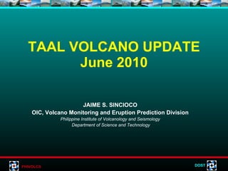
  • 10. TAAL EPICENTRAL MAP January-June 2010 LEGEND: Seismic Station Epicenters Prepared by: L. Bañes 06/20/10
  • 11.  
  • 12.  
  • 13.  
  • 14. Taal Volcano Alert Signals Alert Level Criteria Interpretation 0 Background, quiet No eruption in foreseeable future. 1 Low level seismicity, fumarolic, other activity Magmatic, tectonic or hydrothermal disturbance; no eruption imminent. 2 Low to moderate level of seismicity, persistence of local but unfelt earthquakes. Ground deformation measurements above baseline levels. Increased water and/or ground probe hole temperatures, increased bubbling at Crater Lake. A) Probable magmatic intrusion; could eventually lead to an eruption.   B) If trend shows further decline, volcano may soon go to level 1 3 Relatively high unrest manifested by seismic swarms including increasing occurrence of low frequency earthquakes and/or harmonic tremor (some events felt). Sudden or increasing changes in temperature or bubbling activity or radon gas emission or crater lake pH. Bulging of the edifice and fissuring may accompany seismicity. A) If trend is one of increasing unrest, eruption is possible within days to weeks.   B) If trend is one of decreasing unrest, volcano may soon go to level 2 4 Intense unrest, continuing seismic swarms, including harmonic tremor and/or “low frequency earthquakes” which are usually felt, profuse steaming along existing and perhaps new vents and fissures. Hazardous explosive eruption is possible within days. 5 Base surges accompanied by eruption columns or lava fountaining or lava flows. Hazardous eruption in progress. Extreme hazards to communities west of the volcano and ashfalls on downwind sectors.
  • 15.     TAAL HAZARD WARNINGS BASED ON ALERT SIGNALS Expansion of risk areas depending on the magnitude of eruption. Alert Level 5 Total evacuation of the Volcano Island. Flank eruption – lakeshore barangays facing eruption sitel Eruption site: Main Crater – lakeshore barangays of Talisay, Tanauan, Agoncillo, Balete, San Nicolas and Laurel. Additional areas to be evacuated shall be determined based on the development of escalating activity and possible location of eruption site. Alert Level 4 Selective evacuation – women, children and elderly at the Volcano Island are advised to transfer to their relatives at the mainland. Alert Level 3 Main Crater, Daang Kastila and 1965-1977 Mt. Tabaro Eruption Site are off limits to the public. Alert Level 2 Main Crater is off limits to the public because sudden explosions may occur or toxic gases may accumulate. Volcano Island residents and visitors must be aware and vigilant of the volcano’s condition. Alert Level 1 ACTIVITIES ALERT LEVELS
  • 16. RAISING/LOWERING OF ALERT LEVEL Slight seismic unrest Alert Level 1 23 November 2005 EVENT ALERT LEVEL DATE Increasing trends in monitoring parameters Alert Level 2 08 June 2010 Alert Level 0 30 June 2005 Series of volcanic earthquakes recorded; some felt at Intensity II-III at Volcano Island (Pira-piraso) Alert Level 1 (reiterated) 09 January 2005 Significant increase in daily seismic count Alert Level 1 29 October 2004 Advisory issued due to unfounded rumors of an impending eruption 29 September 2004 Alert Level 0 06 April 2000
  • 17.
  • 18. Impacts of Volcanic Hazards People who perished at the Volcano Island due to base surge Houses buried by ash during the 1965 eruption 1965 BASE SURGE TEPHRA FALL 1911 ground fissures Lemery, Batangas Daang Kastila fissure and landslide
  • 19.  
  • 20.  
  • 21.  
  • 22. VOLCANIC UNRESTS pH values ranged from 2.5 to 2.37; intense bubbling inside the MCL; lake temperature increased from 30  to 32  C; geysering at the NNE wall of MCL w/ temp. ranging from 97-100°C; more steaming vents were formed due to fissuring along the thermal area No significant inflation or deflation was measured Earthquake count up to 45 events a day. Quakes occasionally felt at volcano island (RF I-V). Epicenters at MCL to ENE of Taal. March to July 1991 Small bubbles observed at MCL; no significant change in lake temperature and pH. Slight inflation at MC and Mt. Tabaro Ave. of 6 events a day. Epicenters were scattered at MCL to NE of Taal. June to October 1989 Slight inflation (water tube tiltmeter) Several small amplitude (ave. of 2 mm) high frequency August (two-week period) 1988 pH w/in the baseline of 2.5-3 No significant change in lake temp No significant change, within noise level. Earthquakes felt at the SSW of Taal Lake 30 Oct. to 04 Nov. 1987 ALERT STATUS MAIN CRATER LAKE OBSERVATION GROUND DEFORMATION SEISMICITY DURATION YEAR
  • 23. VOLCANIC UNRESTS No significant change in Main Crater Lake No significant change Seismic swarm; 59 located earthquakes; epicenters covered E and SE of MCL with depths of 2-5 km 19 July to 31 October 2000 Alert Level 3 (evacuation of women, children and the elderly from TVI) pH values of 2.18 to 2.20; intense bubbling at the E & NE sector of MCL; lake temp. gradually increased from 34  C to 39  C. Inflation of 16 cm at Daang Kastila and 9.8 cm at Calauit, SE of Taal. Two ground fissures formed at Calauit approx. 70 m apart (8.0 mm and 10 mm wide) Escalating increase; total of 1,550 events detected within 24 hours with several felt events (RF I-II); epicenters clustered at the E and SE sides of Taal with depths of <5 km. 11 March to 31 May 1994 Alert Level 2-3 (total evacuation of TVI ) Intense bubbling inside the MCL (detected by acoustic pressure sensor); abrupt increase of 2° in lake temp. as detected by telemetered sensor) Volcano island uplifted up to about 20 cm. Fissuring at Daang Kastila (5-50 mm wide & 20-400 m long; E-W trends and parallel to MC) and at Pira-piraso (2.6 mm wide and 1-2 m long – 5 fissures) Dramatic increase. Total of 2,550 events detected within 24 hours with several felt events but decreased to the baseline in less than two weeks. 14-28 February 1992 ALERT STATUS MAIN CRATER LAKE OBSERVATION GROUND DEFORMATION SEISMICITY DURATION YEAR
  • 24. VOLCANIC UNRESTS Alert Level 1 November 17 - Geysering activity near the shoreline of Main Crater Lake; muddy water spewed 2-3 m high; sulfur stench also observed; MCL temp at 35°C; slight increase in bubbling activity the crater lake January – high level of seismicity; quakes clustered mainly at the East and Southeast sectors of Volcano Island covering the Main Crater and Calauit areas; depths of 2 - 4 km January, November 2006 Alert Level 1 reiterated in January; (AL lowered to 0 on 30 June 2005; AL 1 raised on 23 Nov. 2005) No significant change No significant change Series of volcanic earthquakes recorded; some felt at Intensity II-III at Volcano Island (Pira-piraso); epicenters located within Main Crater and SSE near Calauit; depths of less than 1.0 to 4.0 km Jan. to Feb.; 21 Nov 2005 Alert Level 1 (29 October 2004) No significant change in Main Crater Lake; steaming activity at the thermal areas inside the crater also remained weak Slight inflation of the volcanic edifice Significant increase in daily seismic count; large amplitude earthquakes; epicenters scattered within vicinity of Main Crater, near Binintiang Malaki (NNW) and near Calauit area (SSE); depths of less than 1.0 to 4.0 km beneath the volcano 23 Sept. to November 2004 ALERT STATUS MAIN CRATER LAKE OBSERVATION GROUND DEFORMATION SEISMICITY DURATION YEAR
  • 25. VOLCANIC UNRESTS Advisory issued to notify concerned authorities and the public of the volcano’s unrest. Investigation conducted on 29 August 2008 showed that there are remarkable changes in the thermal areas at the northeastern and eastern sectors of Main Crater. Deflation – based on Jan, Feb., April & Sept. 2008 measurements Still inflated – based on 2004 measurements Volcanic quakes on 28 Aug. 2008 (12:33 PM and 12:46 PM) were felt at Int. II in Bgy. Pira-piraso with depths of 0.6 to 0.8 km.; epicenters were located at Daang Kastila. Another quake occurred on 30 Sept. 2008 felt at Pira-piraso, Alas-as & Banyaga (Int. I) with epicenters located 650 m west of the Island and depth of 1.7 km. August & Sept. 2008 Alert Level 1 June survey – inflation of the volcano edifice June – Increase in seismic activity; felt at Int. II-III at Pira-piraso; felt also at Calauit; depths of 2.8-3.4 km June 2007 ALERT STATUS MAIN CRATER LAKE OBSERVATION GROUND DEFORMATION SEISMICITY DURATION YEAR
  • 26. THANK YOU! www.phivolcs.dost.gov.ph PHIVOLCS Building, CP Garcia Ave. UP Campus, Diliman, Quezon City Tel 426-1468; Fax 9298366