SlideShare a Scribd company logo
1 of 25
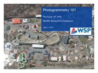
Photogrammetry 101
Ted Covill, CP, PPS
NEARC Spring 2015 Conference
May 11, 2015
OVERVIEW
๏ƒ˜ History of
Photogrammetry
๏ƒ˜ What is Photogrammetry
๏ƒ˜ Accuracy Standards
๏ƒ˜ Aerial Imagery
๏ƒ˜ Imagery Control
๏ƒ˜ Analytical Triangulation
๏ƒ˜ Planimetric Mapping
๏ƒ˜ Topographic Mapping
๏ƒ˜ Digital Orthophotography
๏ƒ˜ Data Formats
HISTORY OF PHOTOGRAMMETRY
๏ƒ˜ 1839: First photographs were produced
๏ƒ˜ 1849: Aime Laussedat proved that photography could be used to produce
maps
๏ƒ˜ 1862: The Union Army used aerial cameras on balloons to observe the
Confederate Army
๏ƒ˜ 1909: Wilbur Wright takes the first aerial photo over Centocelli, Italy
๏ƒ˜ 1914-1945: Due to high demands on defense intelligence, great advances
were made in both Europe and the US
๏ƒ˜ 1942: Bausch & Lomb became the chief supplier of aerial cameras
and mapping equipment worldwide
๏ƒ˜ Today: Photo missions are flown by aircraft (fixed wing and helicopter) with
cameras, digital sensors and LiDAR sensors attached to the
underside of an aircraft. The development of systems for producing
accurate measurements has continued to advance from an aerial
platform.
WHAT IS PHOTOGRAMMETRY
๏ƒ˜ Photogrammetry and
Remote Sensing is the
Art, Science and
Technology of Obtaining
Reliable Information from
Non-contact Imaging and
Sensor Systems About
the Earth and itโ€™s
Environment and Other
Physical Objects and
Processes Through
Recording, Measuring,
Analysing and
Representation.
~ ISPRS
WHAT IS PHOTOGRAMMETRY (IN ENGLISH)
๏ƒ˜ Photogrammetry
Involves
Estimating Real
World Coordinates
(X, Y & Z) for
Ground Bases
Objects in Two or
More 2D Images
Based on the
Approximate
Perspective and
Location of the
Sensor
ACCURACY STANDARDS
๏ƒ˜ National Map
Accuracy
Standards
(NMAS)
๏ƒ˜ American Society
of
Photogrammetry
& Remote
Sensing (ASPRS)
Accuracy
Standards
PROJECT PLANNING
๏ƒ˜ Define Project
Area
๏ƒ˜ Define the
Accuracy
Specification,
Both Horizontal
and Vertical
๏ƒ˜ Determine
Control
Location
Requirements
๏ƒ˜ Targets vs.
Photo ID
๏ƒ˜ Will Airborne
GPS (AbGPS)
be used
AERIAL IMAGERY
Aerial Imagery:
๏ƒ˜ Fixed Wing or
Helicopter
๏ƒ˜ Traditional Film (Color
& BW) or Digital (Color
& Infrared)
๏ƒ˜ Stereo Coverage (60%
Forward Overlap/ 30%
Side Overlap)
๏ƒ˜ Fly at the Proper
Altitude to Insure
Accuracy
๏ƒ˜ Fall/Spring Flying
Season (Leaf-off
Conditions)
๏ƒ˜ Fly at the Right Time of
Day (High Sun Angle)
AERIAL IMAGERY
Types of Sensors
๏ƒ˜ Film Cameras
๏ƒ˜ Digital Sensors
๏ƒ˜ LiDAR Sensors
AERIAL IMAGERY โ€“ Film Cameras
Film Types
๏ƒ˜ Black & White Film
๏ƒ˜ Color Film
๏ƒ˜ Infrared Film
AERIAL IMAGERY โ€“ FILM CAMERAS
Commons Camera
Systems
๏ƒ˜ Wild RC20/30
๏ƒ˜ Zeiss Top
๏ƒ˜ Zeiss/Jena LMK
AERIAL IMAGERY โ€“ DIGITAL SENSORS
๏ƒ˜ Push Broom
Sensors
๏ƒ˜ Frame Sensors
AERIAL IMAGERY- PUSH BROOM SENSORS
๏ƒ˜ Seamless Strip
Imagery
๏ƒ˜ Utilizes AbGPS and
IMU
๏ƒ˜ Forward, Nadir and
Backward Scanning
๏ƒ˜ Leica ADS80 (Push
Broom)
๏ƒ˜ Jena (Push Broom)
AERIAL IMAGERY- FRAME SENSORS
๏ƒ˜ Individual Flight Lines with
Overlapping Images
๏ƒ˜ Utilizes AbGPS & IMU
๏ƒ˜ Microsoft UltraCAM (Frame)
๏ƒ˜ Z/I DMC (Frame)
AERIAL IMAGERY โ€“ ADVANTAGES OF DIGITAL
SENSORS
๏ƒ˜ No Need for Film (If you can find it)
๏ƒ˜ No Chemical Processing or
Chemical Waste
๏ƒ˜ No Need to Scan Negatives (No
Dust, Lint or Scratches)
๏ƒ˜ More Efficient Work Flow โ€“ True
Digital Throughput
๏ƒ˜ Improved Automated Techniques
and Processing
๏ƒ˜ Superior Image Quality (8 bit vs. 16
bit)
GROUND CONTROL
๏ƒ˜ Establishes
Reference System
to tie the Imagery to
Project Coordinate
System
๏ƒ˜ Targets (Paints
โ€œXโ€โ€™s) or Photo ID
(Visible Features
Such as CBs, MHs
& Poles)
๏ƒ˜ Can Utilize Airborne
GPS to Reduce
Number of Control
Points or Control
Remote Areas
AERIAL MAPPING (PHOTOGRAMMETRY)
Analytical Triangulation
๏ƒ˜ Ties all the Imagery
Together
๏ƒ˜ Extends Control
Points Between Un-
Controlled Images
๏ƒ˜ Densifies the Photo
Control
๏ƒ˜ Validates the
Accuracy of the
Photo Control
๏ƒ˜ Provides Setup
Parameters for
Imagery (Model
Setups)
PHOTOGRAMMETRIC MAPPING โ€“
STEREO COMPILATION
๏ƒ˜ Workstation Operators View
Stereo Imagery on a High
Resolution Monitor
๏ƒ˜ Stereo Viewing is Achieved via
an Active or Passive Viewing
System
๏ƒ˜ Active: Stereo Pair Images are
Alternately โ€œFlashedโ€ on the
Monitor. The Left or Right
Image is Synced with the Left
or Right Lens of the Glasses
๏ƒ˜ Passive: Both Images are on
the Monitor Simultaneously.
Stereo View is Achieved with
Polarized or Anaglyph (Red
Blue)
PHOTOGRAMMETRIC MAPPING โ€“
STEREO COMPILATION
๏ƒ˜ Workstation Operator Utilizes
a 3D Cursors Called a
โ€œMeasuring Markโ€
๏ƒ˜ The Operator can Move the
Measuring Mark Through 3D
Space
๏ƒ˜ To Digitize an Object, the
Operator Places the
Measuring Mark on the
Feature and Digitizes the
Feature
๏ƒ˜ X, Y, Z Coordinates are
Recorded Along With
Appropriate Level/Layer
PLANIMETRIC MAPPING
๏ƒ˜ All Planimetric/DTM
Data Collected in 3D
from the Imagery
๏ƒ˜ Data is Collected on
Specific Layers
(Buildings, Pavement,
Hydro etc.)
๏ƒ˜ Mapping Should be
Done at the Proper
Scale (Project
Dependent)
๏ƒ˜ Final Data Delivered to
Clients Specifications
TOPOGRAPHIC MAPPING
Digital Terrain Model
(DTM)
๏ƒ˜ DTM comprised of
Mass Points & Break
Lines
๏ƒ˜ Break Lines (Hard or
Soft) Indicates
Either a Natural or
Man-made Change
in the Terrain
๏ƒ˜ Mass Points are
used to supplement
Break Lines
๏ƒ˜ Mass Points are
Placed at High &
Low Areas
TOPOGRAPHIC MAPPING
Contours
๏ƒ˜ Old School โ€“ Ground
Was Traced at a
Constant Elevation
by the
Photogrammetrist.
Spot Elevations were
Measured in areas
where Contours were
far apart.
๏ƒ˜ Current Process โ€“
Contours Computer
Generated. A TIN is
Created from the
DTM and the
Contours are
Threaded
Throughout the TIN
DIGITAL ORTHOPHOTOGRAPHY
Digital Orthophotography
๏ƒ˜ Digital Imagery with Spatial Intelligence
๏ƒ˜ Combines Imagery with AT and DTM
๏ƒ˜ Hybrid Map. Can be used as a
Backdrop with Mapping Data
DATA FORMATS
๏ƒ˜ AutoCAD (.dwg &
.dxf)
๏ƒ˜ MicroStation
๏ƒ˜ ESRI Geodatabase
๏ƒ˜ XML
๏ƒ˜ Standard or Custom
ASCII Formats
๏ƒ˜ LAS
๏ƒ˜ Raster (GeoTiff, SID,
JP2)
QUESTIONS?
Ted Covill, CP, PPS
508 248 1970
ted.covill@wspgroup.com
April 30, 2015

More Related Content

What's hot

Digital photogrammetry
Digital photogrammetryDigital photogrammetry
Digital photogrammetryMr Amol Ghogare
ย 
Remote Sensing.ppt
Remote Sensing.pptRemote Sensing.ppt
Remote Sensing.pptAbidHayat9
ย 
Lecture 6 vertical photographs
Lecture 6  vertical photographsLecture 6  vertical photographs
Lecture 6 vertical photographsSarhat Adam
ย 
Orthorectification and triangulation
Orthorectification and triangulationOrthorectification and triangulation
Orthorectification and triangulationMesfin Yeshitla
ย 
Photogrammetry 1.
Photogrammetry 1.Photogrammetry 1.
Photogrammetry 1.Naveen Kumar
ย 
Photogrammetry.pdf
Photogrammetry.pdfPhotogrammetry.pdf
Photogrammetry.pdfBSuresh26
ย 
Accuracy of UAV Photogrammetry
Accuracy of UAV PhotogrammetryAccuracy of UAV Photogrammetry
Accuracy of UAV Photogrammetrybaselinesurvey
ย 
Stereoscopic Parallax
Stereoscopic ParallaxStereoscopic Parallax
Stereoscopic ParallaxSiva Subramanian M
ย 
Photogrammetry - areaotriangulation
Photogrammetry - areaotriangulationPhotogrammetry - areaotriangulation
Photogrammetry - areaotriangulationjayan_sri
ย 
Height measurement of aerial photograph
Height measurement of aerial photographHeight measurement of aerial photograph
Height measurement of aerial photographvidyasagar university
ย 
Photogrammetry
PhotogrammetryPhotogrammetry
PhotogrammetryMaersk Line
ย 
Digital orthophoto
Digital orthophotoDigital orthophoto
Digital orthophotoSumant Diwakar
ย 
chapter19. Terrestrial and Close-Range Photogrammetry.pdf
chapter19. Terrestrial and Close-Range Photogrammetry.pdfchapter19. Terrestrial and Close-Range Photogrammetry.pdf
chapter19. Terrestrial and Close-Range Photogrammetry.pdfssuser3f7a17
ย 
Introduction of photogrammetry
Introduction of photogrammetryIntroduction of photogrammetry
Introduction of photogrammetryJayantha Samarasinghe
ย 
Drone flight data processing
Drone flight data processingDrone flight data processing
Drone flight data processingDany Laksono
ย 
LiDAR Technology and Geospatial Services
LiDAR Technology and Geospatial Services LiDAR Technology and Geospatial Services
LiDAR Technology and Geospatial Services MattBethel1
ย 
Fundamentals of Remote Sensing
Fundamentals of Remote Sensing Fundamentals of Remote Sensing
Fundamentals of Remote Sensing Pallab Jana
ย 
BASIC CONCEPTS OF PHOTOGRAMMETRY
BASIC CONCEPTS OF PHOTOGRAMMETRYBASIC CONCEPTS OF PHOTOGRAMMETRY
BASIC CONCEPTS OF PHOTOGRAMMETRYNamitha M R
ย 

What's hot (20)

Digital photogrammetry
Digital photogrammetryDigital photogrammetry
Digital photogrammetry
ย 
Remote Sensing.ppt
Remote Sensing.pptRemote Sensing.ppt
Remote Sensing.ppt
ย 
Lecture 6 vertical photographs
Lecture 6  vertical photographsLecture 6  vertical photographs
Lecture 6 vertical photographs
ย 
Orthorectification and triangulation
Orthorectification and triangulationOrthorectification and triangulation
Orthorectification and triangulation
ย 
Photogrammetry 1.
Photogrammetry 1.Photogrammetry 1.
Photogrammetry 1.
ย 
Photogrammetry.pdf
Photogrammetry.pdfPhotogrammetry.pdf
Photogrammetry.pdf
ย 
Accuracy of UAV Photogrammetry
Accuracy of UAV PhotogrammetryAccuracy of UAV Photogrammetry
Accuracy of UAV Photogrammetry
ย 
Stereoscopic Parallax
Stereoscopic ParallaxStereoscopic Parallax
Stereoscopic Parallax
ย 
Photogrammetry - areaotriangulation
Photogrammetry - areaotriangulationPhotogrammetry - areaotriangulation
Photogrammetry - areaotriangulation
ย 
Height measurement of aerial photograph
Height measurement of aerial photographHeight measurement of aerial photograph
Height measurement of aerial photograph
ย 
Unit 5
Unit 5Unit 5
Unit 5
ย 
Photogrammetry
PhotogrammetryPhotogrammetry
Photogrammetry
ย 
Digital orthophoto
Digital orthophotoDigital orthophoto
Digital orthophoto
ย 
chapter19. Terrestrial and Close-Range Photogrammetry.pdf
chapter19. Terrestrial and Close-Range Photogrammetry.pdfchapter19. Terrestrial and Close-Range Photogrammetry.pdf
chapter19. Terrestrial and Close-Range Photogrammetry.pdf
ย 
Introduction of photogrammetry
Introduction of photogrammetryIntroduction of photogrammetry
Introduction of photogrammetry
ย 
Drone flight data processing
Drone flight data processingDrone flight data processing
Drone flight data processing
ย 
Photogrammetry
PhotogrammetryPhotogrammetry
Photogrammetry
ย 
LiDAR Technology and Geospatial Services
LiDAR Technology and Geospatial Services LiDAR Technology and Geospatial Services
LiDAR Technology and Geospatial Services
ย 
Fundamentals of Remote Sensing
Fundamentals of Remote Sensing Fundamentals of Remote Sensing
Fundamentals of Remote Sensing
ย 
BASIC CONCEPTS OF PHOTOGRAMMETRY
BASIC CONCEPTS OF PHOTOGRAMMETRYBASIC CONCEPTS OF PHOTOGRAMMETRY
BASIC CONCEPTS OF PHOTOGRAMMETRY
ย 

Viewers also liked

Digibury Weekender - lifelong learning through the idiom of Westeros
Digibury Weekender - lifelong learning through the idiom of WesterosDigibury Weekender - lifelong learning through the idiom of Westeros
Digibury Weekender - lifelong learning through the idiom of WesterosDavid Walker
ย 
Digibury - Lifelong Learning through the Idiom of Westeros
Digibury - Lifelong Learning through the Idiom of WesterosDigibury - Lifelong Learning through the Idiom of Westeros
Digibury - Lifelong Learning through the Idiom of WesterosDavid Walker
ย 
Friends teasing
Friends teasingFriends teasing
Friends teasingmessagestock786
ย 
ะฟั€ะตะทะตะฝั‚ะฐั†ะธั
ะฟั€ะตะทะตะฝั‚ะฐั†ะธัะฟั€ะตะทะตะฝั‚ะฐั†ะธั
ะฟั€ะตะทะตะฝั‚ะฐั†ะธัNataliyaNataliya
ย 
Making enterprise mobility a success.
Making enterprise mobility a success.Making enterprise mobility a success.
Making enterprise mobility a success.Olive Communications
ย 
ฮ— ฮตฮบฯ€ฯŒฮฝฮทฯƒฮท ฯ€ฮฟฮปฮนฯ„ฮนฯƒฯ„ฮนฮบฮฟฯ ฯ‡ฮฌฯฯ„ฮท ฯ„ฮทฯ‚ ฮ‘ฮธฮฎฮฝฮฑฯ‚ ฮผฮต ฮฑฯ†ฮฟฯฮผฮฎ ฯ„ฮทฮฝ ฮตฯ€ฮฏฯƒฮบฮตฯˆฮท ฯƒฯ‡ฮฟฮปฮตฮฏฯ‰ฮฝ ฯ„ฮทฯ‚ ...
ฮ— ฮตฮบฯ€ฯŒฮฝฮทฯƒฮท ฯ€ฮฟฮปฮนฯ„ฮนฯƒฯ„ฮนฮบฮฟฯ ฯ‡ฮฌฯฯ„ฮท ฯ„ฮทฯ‚ ฮ‘ฮธฮฎฮฝฮฑฯ‚ ฮผฮต ฮฑฯ†ฮฟฯฮผฮฎ ฯ„ฮทฮฝ ฮตฯ€ฮฏฯƒฮบฮตฯˆฮท ฯƒฯ‡ฮฟฮปฮตฮฏฯ‰ฮฝ ฯ„ฮทฯ‚ ...ฮ— ฮตฮบฯ€ฯŒฮฝฮทฯƒฮท ฯ€ฮฟฮปฮนฯ„ฮนฯƒฯ„ฮนฮบฮฟฯ ฯ‡ฮฌฯฯ„ฮท ฯ„ฮทฯ‚ ฮ‘ฮธฮฎฮฝฮฑฯ‚ ฮผฮต ฮฑฯ†ฮฟฯฮผฮฎ ฯ„ฮทฮฝ ฮตฯ€ฮฏฯƒฮบฮตฯˆฮท ฯƒฯ‡ฮฟฮปฮตฮฏฯ‰ฮฝ ฯ„ฮทฯ‚ ...
ฮ— ฮตฮบฯ€ฯŒฮฝฮทฯƒฮท ฯ€ฮฟฮปฮนฯ„ฮนฯƒฯ„ฮนฮบฮฟฯ ฯ‡ฮฌฯฯ„ฮท ฯ„ฮทฯ‚ ฮ‘ฮธฮฎฮฝฮฑฯ‚ ฮผฮต ฮฑฯ†ฮฟฯฮผฮฎ ฯ„ฮทฮฝ ฮตฯ€ฮฏฯƒฮบฮตฯˆฮท ฯƒฯ‡ฮฟฮปฮตฮฏฯ‰ฮฝ ฯ„ฮทฯ‚ ...1epal-ag-anarg
ย 
ั‚ะตั…ะฐั
ั‚ะตั…ะฐัั‚ะตั…ะฐั
ั‚ะตั…ะฐัKristina Polaynskay
ย 
Anniversary sms
Anniversary smsAnniversary sms
Anniversary smsmessagestock786
ย 
ะ”ะตะปะฐะตะผ ะฟั€ะตะทะตะฝั‚ะฐั†ะธัŽ!
ะ”ะตะปะฐะตะผ ะฟั€ะตะทะตะฝั‚ะฐั†ะธัŽ!ะ”ะตะปะฐะตะผ ะฟั€ะตะทะตะฝั‚ะฐั†ะธัŽ!
ะ”ะตะปะฐะตะผ ะฟั€ะตะทะตะฝั‚ะฐั†ะธัŽ!NataliyaNataliya
ย 

Viewers also liked (20)

Forget sms
Forget smsForget sms
Forget sms
ย 
Digibury Weekender - lifelong learning through the idiom of Westeros
Digibury Weekender - lifelong learning through the idiom of WesterosDigibury Weekender - lifelong learning through the idiom of Westeros
Digibury Weekender - lifelong learning through the idiom of Westeros
ย 
Drones in Academia - Challenges and Opportunities
Drones in Academia - Challenges and OpportunitiesDrones in Academia - Challenges and Opportunities
Drones in Academia - Challenges and Opportunities
ย 
Kartik Article
Kartik ArticleKartik Article
Kartik Article
ย 
Digibury - Lifelong Learning through the Idiom of Westeros
Digibury - Lifelong Learning through the Idiom of WesterosDigibury - Lifelong Learning through the Idiom of Westeros
Digibury - Lifelong Learning through the Idiom of Westeros
ย 
April fool sms
April fool smsApril fool sms
April fool sms
ย 
Chhaiya
ChhaiyaChhaiya
Chhaiya
ย 
Friends teasing
Friends teasingFriends teasing
Friends teasing
ย 
Advice sms
Advice smsAdvice sms
Advice sms
ย 
Boss sms
Boss smsBoss sms
Boss sms
ย 
ะฟั€ะตะทะตะฝั‚ะฐั†ะธั
ะฟั€ะตะทะตะฝั‚ะฐั†ะธัะฟั€ะตะทะตะฝั‚ะฐั†ะธั
ะฟั€ะตะทะตะฝั‚ะฐั†ะธั
ย 
Buying Planimetric Data with ITS53
Buying Planimetric Data with ITS53Buying Planimetric Data with ITS53
Buying Planimetric Data with ITS53
ย 
MAGICโ€™s Connecticut Digital Air Photography Collection
MAGICโ€™s Connecticut Digital Air Photography CollectionMAGICโ€™s Connecticut Digital Air Photography Collection
MAGICโ€™s Connecticut Digital Air Photography Collection
ย 
Diwali sms
Diwali smsDiwali sms
Diwali sms
ย 
Making enterprise mobility a success.
Making enterprise mobility a success.Making enterprise mobility a success.
Making enterprise mobility a success.
ย 
ฮ— ฮตฮบฯ€ฯŒฮฝฮทฯƒฮท ฯ€ฮฟฮปฮนฯ„ฮนฯƒฯ„ฮนฮบฮฟฯ ฯ‡ฮฌฯฯ„ฮท ฯ„ฮทฯ‚ ฮ‘ฮธฮฎฮฝฮฑฯ‚ ฮผฮต ฮฑฯ†ฮฟฯฮผฮฎ ฯ„ฮทฮฝ ฮตฯ€ฮฏฯƒฮบฮตฯˆฮท ฯƒฯ‡ฮฟฮปฮตฮฏฯ‰ฮฝ ฯ„ฮทฯ‚ ...
ฮ— ฮตฮบฯ€ฯŒฮฝฮทฯƒฮท ฯ€ฮฟฮปฮนฯ„ฮนฯƒฯ„ฮนฮบฮฟฯ ฯ‡ฮฌฯฯ„ฮท ฯ„ฮทฯ‚ ฮ‘ฮธฮฎฮฝฮฑฯ‚ ฮผฮต ฮฑฯ†ฮฟฯฮผฮฎ ฯ„ฮทฮฝ ฮตฯ€ฮฏฯƒฮบฮตฯˆฮท ฯƒฯ‡ฮฟฮปฮตฮฏฯ‰ฮฝ ฯ„ฮทฯ‚ ...ฮ— ฮตฮบฯ€ฯŒฮฝฮทฯƒฮท ฯ€ฮฟฮปฮนฯ„ฮนฯƒฯ„ฮนฮบฮฟฯ ฯ‡ฮฌฯฯ„ฮท ฯ„ฮทฯ‚ ฮ‘ฮธฮฎฮฝฮฑฯ‚ ฮผฮต ฮฑฯ†ฮฟฯฮผฮฎ ฯ„ฮทฮฝ ฮตฯ€ฮฏฯƒฮบฮตฯˆฮท ฯƒฯ‡ฮฟฮปฮตฮฏฯ‰ฮฝ ฯ„ฮทฯ‚ ...
ฮ— ฮตฮบฯ€ฯŒฮฝฮทฯƒฮท ฯ€ฮฟฮปฮนฯ„ฮนฯƒฯ„ฮนฮบฮฟฯ ฯ‡ฮฌฯฯ„ฮท ฯ„ฮทฯ‚ ฮ‘ฮธฮฎฮฝฮฑฯ‚ ฮผฮต ฮฑฯ†ฮฟฯฮผฮฎ ฯ„ฮทฮฝ ฮตฯ€ฮฏฯƒฮบฮตฯˆฮท ฯƒฯ‡ฮฟฮปฮตฮฏฯ‰ฮฝ ฯ„ฮทฯ‚ ...
ย 
ั‚ะตั…ะฐั
ั‚ะตั…ะฐัั‚ะตั…ะฐั
ั‚ะตั…ะฐั
ย 
Cute sms
Cute smsCute sms
Cute sms
ย 
Anniversary sms
Anniversary smsAnniversary sms
Anniversary sms
ย 
ะ”ะตะปะฐะตะผ ะฟั€ะตะทะตะฝั‚ะฐั†ะธัŽ!
ะ”ะตะปะฐะตะผ ะฟั€ะตะทะตะฝั‚ะฐั†ะธัŽ!ะ”ะตะปะฐะตะผ ะฟั€ะตะทะตะฝั‚ะฐั†ะธัŽ!
ะ”ะตะปะฐะตะผ ะฟั€ะตะทะตะฝั‚ะฐั†ะธัŽ!
ย 

Similar to Photogrammetry 101

PhotogrammetryArcGIS_V202108.pdf
PhotogrammetryArcGIS_V202108.pdfPhotogrammetryArcGIS_V202108.pdf
PhotogrammetryArcGIS_V202108.pdfRobertoReinoVargas
ย 
Aerial Photography.pptx
Aerial Photography.pptxAerial Photography.pptx
Aerial Photography.pptxanjalisingh320458
ย 
๋ผ์ด๋ธŒ๋“œ๋ก ๋งต (Live Drone Map) - ์‹ค์‹œ๊ฐ„ ๋“œ๋ก  ๋งคํ•‘ ์†”๋ฃจ์…˜
๋ผ์ด๋ธŒ๋“œ๋ก ๋งต (Live Drone Map) - ์‹ค์‹œ๊ฐ„ ๋“œ๋ก  ๋งคํ•‘ ์†”๋ฃจ์…˜๋ผ์ด๋ธŒ๋“œ๋ก ๋งต (Live Drone Map) - ์‹ค์‹œ๊ฐ„ ๋“œ๋ก  ๋งคํ•‘ ์†”๋ฃจ์…˜
๋ผ์ด๋ธŒ๋“œ๋ก ๋งต (Live Drone Map) - ์‹ค์‹œ๊ฐ„ ๋“œ๋ก  ๋งคํ•‘ ์†”๋ฃจ์…˜Impyeong Lee
ย 
DSD-INT 2015 - Photogrammetric workflows and use of UA VS, Francesco nex, E-s...
DSD-INT 2015 - Photogrammetric workflows and use of UA VS, Francesco nex, E-s...DSD-INT 2015 - Photogrammetric workflows and use of UA VS, Francesco nex, E-s...
DSD-INT 2015 - Photogrammetric workflows and use of UA VS, Francesco nex, E-s...Deltares
ย 
DroneSurvey.pdf
DroneSurvey.pdfDroneSurvey.pdf
DroneSurvey.pdfParthPotdar4
ย 
PHOTOGRAMMETRY (REMOTE SENSING & GIS).pptx
PHOTOGRAMMETRY  (REMOTE SENSING & GIS).pptxPHOTOGRAMMETRY  (REMOTE SENSING & GIS).pptx
PHOTOGRAMMETRY (REMOTE SENSING & GIS).pptxBSuresh26
ย 
Keynote at Tracking Workshop during ISMAR 2014
Keynote at Tracking Workshop during ISMAR 2014Keynote at Tracking Workshop during ISMAR 2014
Keynote at Tracking Workshop during ISMAR 2014Darius Burschka
ย 
IRJET- Inspection of Components with the Support of the Drones
IRJET- Inspection of Components with the Support of the DronesIRJET- Inspection of Components with the Support of the Drones
IRJET- Inspection of Components with the Support of the DronesIRJET Journal
ย 
Sensor Robotics.ppt
Sensor Robotics.pptSensor Robotics.ppt
Sensor Robotics.pptSofitriRahayu1
ย 
Critical Infrastructure Monitoring Using UAV Imagery
Critical Infrastructure Monitoring Using UAV ImageryCritical Infrastructure Monitoring Using UAV Imagery
Critical Infrastructure Monitoring Using UAV Imageryaditess
ย 
Aerial photography abraham thomas
Aerial photography abraham thomasAerial photography abraham thomas
Aerial photography abraham thomasSumant Diwakar
ย 
Aerial photography-for-aerial-mapping
Aerial photography-for-aerial-mappingAerial photography-for-aerial-mapping
Aerial photography-for-aerial-mappingHigh Exposure
ย 
Optical remote sensing
Optical remote sensingOptical remote sensing
Optical remote sensingMohsin Siddique
ย 
Introduction to Aerial Photogrammetry
Introduction to Aerial PhotogrammetryIntroduction to Aerial Photogrammetry
Introduction to Aerial PhotogrammetryMalla Reddy University
ย 
Total station and its application to civil engineering
Total station and its application to civil engineeringTotal station and its application to civil engineering
Total station and its application to civil engineeringTushar Dholakia
ย 
Poster Presentation "Generation of High Resolution DSM Usin UAV Images"
Poster Presentation "Generation of High Resolution DSM Usin UAV Images"Poster Presentation "Generation of High Resolution DSM Usin UAV Images"
Poster Presentation "Generation of High Resolution DSM Usin UAV Images"Nepal Flying Labs
ย 
Team SNUSAT ARLISS 2015
Team SNUSAT ARLISS 2015Team SNUSAT ARLISS 2015
Team SNUSAT ARLISS 2015snusat
ย 
Open-Source Based Direct Georeferencing Thermal Camera System
Open-Source Based Direct Georeferencing Thermal Camera SystemOpen-Source Based Direct Georeferencing Thermal Camera System
Open-Source Based Direct Georeferencing Thermal Camera SystemCentre of Geographic Sciences (COGS)
ย 
Unmanned Aerial Systems for Precision Mapping
Unmanned Aerial Systems for Precision MappingUnmanned Aerial Systems for Precision Mapping
Unmanned Aerial Systems for Precision MappingUAS Colorado
ย 
Introduction on Photogrammetry.pdf
Introduction on Photogrammetry.pdfIntroduction on Photogrammetry.pdf
Introduction on Photogrammetry.pdfBSuresh26
ย 

Similar to Photogrammetry 101 (20)

PhotogrammetryArcGIS_V202108.pdf
PhotogrammetryArcGIS_V202108.pdfPhotogrammetryArcGIS_V202108.pdf
PhotogrammetryArcGIS_V202108.pdf
ย 
Aerial Photography.pptx
Aerial Photography.pptxAerial Photography.pptx
Aerial Photography.pptx
ย 
๋ผ์ด๋ธŒ๋“œ๋ก ๋งต (Live Drone Map) - ์‹ค์‹œ๊ฐ„ ๋“œ๋ก  ๋งคํ•‘ ์†”๋ฃจ์…˜
๋ผ์ด๋ธŒ๋“œ๋ก ๋งต (Live Drone Map) - ์‹ค์‹œ๊ฐ„ ๋“œ๋ก  ๋งคํ•‘ ์†”๋ฃจ์…˜๋ผ์ด๋ธŒ๋“œ๋ก ๋งต (Live Drone Map) - ์‹ค์‹œ๊ฐ„ ๋“œ๋ก  ๋งคํ•‘ ์†”๋ฃจ์…˜
๋ผ์ด๋ธŒ๋“œ๋ก ๋งต (Live Drone Map) - ์‹ค์‹œ๊ฐ„ ๋“œ๋ก  ๋งคํ•‘ ์†”๋ฃจ์…˜
ย 
DSD-INT 2015 - Photogrammetric workflows and use of UA VS, Francesco nex, E-s...
DSD-INT 2015 - Photogrammetric workflows and use of UA VS, Francesco nex, E-s...DSD-INT 2015 - Photogrammetric workflows and use of UA VS, Francesco nex, E-s...
DSD-INT 2015 - Photogrammetric workflows and use of UA VS, Francesco nex, E-s...
ย 
DroneSurvey.pdf
DroneSurvey.pdfDroneSurvey.pdf
DroneSurvey.pdf
ย 
PHOTOGRAMMETRY (REMOTE SENSING & GIS).pptx
PHOTOGRAMMETRY  (REMOTE SENSING & GIS).pptxPHOTOGRAMMETRY  (REMOTE SENSING & GIS).pptx
PHOTOGRAMMETRY (REMOTE SENSING & GIS).pptx
ย 
Keynote at Tracking Workshop during ISMAR 2014
Keynote at Tracking Workshop during ISMAR 2014Keynote at Tracking Workshop during ISMAR 2014
Keynote at Tracking Workshop during ISMAR 2014
ย 
IRJET- Inspection of Components with the Support of the Drones
IRJET- Inspection of Components with the Support of the DronesIRJET- Inspection of Components with the Support of the Drones
IRJET- Inspection of Components with the Support of the Drones
ย 
Sensor Robotics.ppt
Sensor Robotics.pptSensor Robotics.ppt
Sensor Robotics.ppt
ย 
Critical Infrastructure Monitoring Using UAV Imagery
Critical Infrastructure Monitoring Using UAV ImageryCritical Infrastructure Monitoring Using UAV Imagery
Critical Infrastructure Monitoring Using UAV Imagery
ย 
Aerial photography abraham thomas
Aerial photography abraham thomasAerial photography abraham thomas
Aerial photography abraham thomas
ย 
Aerial photography-for-aerial-mapping
Aerial photography-for-aerial-mappingAerial photography-for-aerial-mapping
Aerial photography-for-aerial-mapping
ย 
Optical remote sensing
Optical remote sensingOptical remote sensing
Optical remote sensing
ย 
Introduction to Aerial Photogrammetry
Introduction to Aerial PhotogrammetryIntroduction to Aerial Photogrammetry
Introduction to Aerial Photogrammetry
ย 
Total station and its application to civil engineering
Total station and its application to civil engineeringTotal station and its application to civil engineering
Total station and its application to civil engineering
ย 
Poster Presentation "Generation of High Resolution DSM Usin UAV Images"
Poster Presentation "Generation of High Resolution DSM Usin UAV Images"Poster Presentation "Generation of High Resolution DSM Usin UAV Images"
Poster Presentation "Generation of High Resolution DSM Usin UAV Images"
ย 
Team SNUSAT ARLISS 2015
Team SNUSAT ARLISS 2015Team SNUSAT ARLISS 2015
Team SNUSAT ARLISS 2015
ย 
Open-Source Based Direct Georeferencing Thermal Camera System
Open-Source Based Direct Georeferencing Thermal Camera SystemOpen-Source Based Direct Georeferencing Thermal Camera System
Open-Source Based Direct Georeferencing Thermal Camera System
ย 
Unmanned Aerial Systems for Precision Mapping
Unmanned Aerial Systems for Precision MappingUnmanned Aerial Systems for Precision Mapping
Unmanned Aerial Systems for Precision Mapping
ย 
Introduction on Photogrammetry.pdf
Introduction on Photogrammetry.pdfIntroduction on Photogrammetry.pdf
Introduction on Photogrammetry.pdf
ย 

More from Northeast Arc Users Group Presentations

More from Northeast Arc Users Group Presentations (9)

8 critical skills you need to be a successful gis professional
8 critical skills you need to be a successful gis professional8 critical skills you need to be a successful gis professional
8 critical skills you need to be a successful gis professional
ย 
To be or not to be...a certified GISP
To be or not to be...a certified GISPTo be or not to be...a certified GISP
To be or not to be...a certified GISP
ย 
GIS in Higher Education: Realities and Opportunities
GIS in Higher Education: Realities and OpportunitiesGIS in Higher Education: Realities and Opportunities
GIS in Higher Education: Realities and Opportunities
ย 
The Incredible Potential of Unmanned Aerial Systems Technology...and Why You ...
The Incredible Potential of Unmanned Aerial Systems Technology...and Why You ...The Incredible Potential of Unmanned Aerial Systems Technology...and Why You ...
The Incredible Potential of Unmanned Aerial Systems Technology...and Why You ...
ย 
Public Safety Implications of Publishing Floorplans
Public Safety Implications of Publishing FloorplansPublic Safety Implications of Publishing Floorplans
Public Safety Implications of Publishing Floorplans
ย 
Data Management in Emergency Prevention and Response
Data Management in Emergency Prevention and ResponseData Management in Emergency Prevention and Response
Data Management in Emergency Prevention and Response
ย 
Geospatial Condition Analysis
Geospatial Condition AnalysisGeospatial Condition Analysis
Geospatial Condition Analysis
ย 
Identifying Top Massachusetts Crash Corridors
Identifying Top Massachusetts Crash CorridorsIdentifying Top Massachusetts Crash Corridors
Identifying Top Massachusetts Crash Corridors
ย 
Making Use of Query Layers & Spatial Views
Making Use of Query Layers & Spatial ViewsMaking Use of Query Layers & Spatial Views
Making Use of Query Layers & Spatial Views
ย 

Recently uploaded

Boost PC performance: How more available memory can improve productivity
Boost PC performance: How more available memory can improve productivityBoost PC performance: How more available memory can improve productivity
Boost PC performance: How more available memory can improve productivityPrincipled Technologies
ย 
From Event to Action: Accelerate Your Decision Making with Real-Time Automation
From Event to Action: Accelerate Your Decision Making with Real-Time AutomationFrom Event to Action: Accelerate Your Decision Making with Real-Time Automation
From Event to Action: Accelerate Your Decision Making with Real-Time AutomationSafe Software
ย 
Artificial Intelligence Chap.5 : Uncertainty
Artificial Intelligence Chap.5 : UncertaintyArtificial Intelligence Chap.5 : Uncertainty
Artificial Intelligence Chap.5 : UncertaintyKhushali Kathiriya
ย 
MINDCTI Revenue Release Quarter One 2024
MINDCTI Revenue Release Quarter One 2024MINDCTI Revenue Release Quarter One 2024
MINDCTI Revenue Release Quarter One 2024MIND CTI
ย 
Exploring the Future Potential of AI-Enabled Smartphone Processors
Exploring the Future Potential of AI-Enabled Smartphone ProcessorsExploring the Future Potential of AI-Enabled Smartphone Processors
Exploring the Future Potential of AI-Enabled Smartphone Processorsdebabhi2
ย 
Apidays Singapore 2024 - Building Digital Trust in a Digital Economy by Veron...
Apidays Singapore 2024 - Building Digital Trust in a Digital Economy by Veron...Apidays Singapore 2024 - Building Digital Trust in a Digital Economy by Veron...
Apidays Singapore 2024 - Building Digital Trust in a Digital Economy by Veron...apidays
ย 
Cloud Frontiers: A Deep Dive into Serverless Spatial Data and FME
Cloud Frontiers:  A Deep Dive into Serverless Spatial Data and FMECloud Frontiers:  A Deep Dive into Serverless Spatial Data and FME
Cloud Frontiers: A Deep Dive into Serverless Spatial Data and FMESafe Software
ย 
Apidays New York 2024 - The Good, the Bad and the Governed by David O'Neill, ...
Apidays New York 2024 - The Good, the Bad and the Governed by David O'Neill, ...Apidays New York 2024 - The Good, the Bad and the Governed by David O'Neill, ...
Apidays New York 2024 - The Good, the Bad and the Governed by David O'Neill, ...apidays
ย 
๐Ÿฌ The future of MySQL is Postgres ๐Ÿ˜
๐Ÿฌ  The future of MySQL is Postgres   ๐Ÿ˜๐Ÿฌ  The future of MySQL is Postgres   ๐Ÿ˜
๐Ÿฌ The future of MySQL is Postgres ๐Ÿ˜RTylerCroy
ย 
2024: Domino Containers - The Next Step. News from the Domino Container commu...
2024: Domino Containers - The Next Step. News from the Domino Container commu...2024: Domino Containers - The Next Step. News from the Domino Container commu...
2024: Domino Containers - The Next Step. News from the Domino Container commu...Martijn de Jong
ย 
Strategies for Landing an Oracle DBA Job as a Fresher
Strategies for Landing an Oracle DBA Job as a FresherStrategies for Landing an Oracle DBA Job as a Fresher
Strategies for Landing an Oracle DBA Job as a FresherRemote DBA Services
ย 
Axa Assurance Maroc - Insurer Innovation Award 2024
Axa Assurance Maroc - Insurer Innovation Award 2024Axa Assurance Maroc - Insurer Innovation Award 2024
Axa Assurance Maroc - Insurer Innovation Award 2024The Digital Insurer
ย 
Partners Life - Insurer Innovation Award 2024
Partners Life - Insurer Innovation Award 2024Partners Life - Insurer Innovation Award 2024
Partners Life - Insurer Innovation Award 2024The Digital Insurer
ย 
presentation ICT roal in 21st century education
presentation ICT roal in 21st century educationpresentation ICT roal in 21st century education
presentation ICT roal in 21st century educationjfdjdjcjdnsjd
ย 
Manulife - Insurer Innovation Award 2024
Manulife - Insurer Innovation Award 2024Manulife - Insurer Innovation Award 2024
Manulife - Insurer Innovation Award 2024The Digital Insurer
ย 
Understanding Discord NSFW Servers A Guide for Responsible Users.pdf
Understanding Discord NSFW Servers A Guide for Responsible Users.pdfUnderstanding Discord NSFW Servers A Guide for Responsible Users.pdf
Understanding Discord NSFW Servers A Guide for Responsible Users.pdfUK Journal
ย 
Real Time Object Detection Using Open CV
Real Time Object Detection Using Open CVReal Time Object Detection Using Open CV
Real Time Object Detection Using Open CVKhem
ย 
A Domino Admins Adventures (Engage 2024)
A Domino Admins Adventures (Engage 2024)A Domino Admins Adventures (Engage 2024)
A Domino Admins Adventures (Engage 2024)Gabriella Davis
ย 
Connector Corner: Accelerate revenue generation using UiPath API-centric busi...
Connector Corner: Accelerate revenue generation using UiPath API-centric busi...Connector Corner: Accelerate revenue generation using UiPath API-centric busi...
Connector Corner: Accelerate revenue generation using UiPath API-centric busi...DianaGray10
ย 
AWS Community Day CPH - Three problems of Terraform
AWS Community Day CPH - Three problems of TerraformAWS Community Day CPH - Three problems of Terraform
AWS Community Day CPH - Three problems of TerraformAndrey Devyatkin
ย 

Recently uploaded (20)

Boost PC performance: How more available memory can improve productivity
Boost PC performance: How more available memory can improve productivityBoost PC performance: How more available memory can improve productivity
Boost PC performance: How more available memory can improve productivity
ย 
From Event to Action: Accelerate Your Decision Making with Real-Time Automation
From Event to Action: Accelerate Your Decision Making with Real-Time AutomationFrom Event to Action: Accelerate Your Decision Making with Real-Time Automation
From Event to Action: Accelerate Your Decision Making with Real-Time Automation
ย 
Artificial Intelligence Chap.5 : Uncertainty
Artificial Intelligence Chap.5 : UncertaintyArtificial Intelligence Chap.5 : Uncertainty
Artificial Intelligence Chap.5 : Uncertainty
ย 
MINDCTI Revenue Release Quarter One 2024
MINDCTI Revenue Release Quarter One 2024MINDCTI Revenue Release Quarter One 2024
MINDCTI Revenue Release Quarter One 2024
ย 
Exploring the Future Potential of AI-Enabled Smartphone Processors
Exploring the Future Potential of AI-Enabled Smartphone ProcessorsExploring the Future Potential of AI-Enabled Smartphone Processors
Exploring the Future Potential of AI-Enabled Smartphone Processors
ย 
Apidays Singapore 2024 - Building Digital Trust in a Digital Economy by Veron...
Apidays Singapore 2024 - Building Digital Trust in a Digital Economy by Veron...Apidays Singapore 2024 - Building Digital Trust in a Digital Economy by Veron...
Apidays Singapore 2024 - Building Digital Trust in a Digital Economy by Veron...
ย 
Cloud Frontiers: A Deep Dive into Serverless Spatial Data and FME
Cloud Frontiers:  A Deep Dive into Serverless Spatial Data and FMECloud Frontiers:  A Deep Dive into Serverless Spatial Data and FME
Cloud Frontiers: A Deep Dive into Serverless Spatial Data and FME
ย 
Apidays New York 2024 - The Good, the Bad and the Governed by David O'Neill, ...
Apidays New York 2024 - The Good, the Bad and the Governed by David O'Neill, ...Apidays New York 2024 - The Good, the Bad and the Governed by David O'Neill, ...
Apidays New York 2024 - The Good, the Bad and the Governed by David O'Neill, ...
ย 
๐Ÿฌ The future of MySQL is Postgres ๐Ÿ˜
๐Ÿฌ  The future of MySQL is Postgres   ๐Ÿ˜๐Ÿฌ  The future of MySQL is Postgres   ๐Ÿ˜
๐Ÿฌ The future of MySQL is Postgres ๐Ÿ˜
ย 
2024: Domino Containers - The Next Step. News from the Domino Container commu...
2024: Domino Containers - The Next Step. News from the Domino Container commu...2024: Domino Containers - The Next Step. News from the Domino Container commu...
2024: Domino Containers - The Next Step. News from the Domino Container commu...
ย 
Strategies for Landing an Oracle DBA Job as a Fresher
Strategies for Landing an Oracle DBA Job as a FresherStrategies for Landing an Oracle DBA Job as a Fresher
Strategies for Landing an Oracle DBA Job as a Fresher
ย 
Axa Assurance Maroc - Insurer Innovation Award 2024
Axa Assurance Maroc - Insurer Innovation Award 2024Axa Assurance Maroc - Insurer Innovation Award 2024
Axa Assurance Maroc - Insurer Innovation Award 2024
ย 
Partners Life - Insurer Innovation Award 2024
Partners Life - Insurer Innovation Award 2024Partners Life - Insurer Innovation Award 2024
Partners Life - Insurer Innovation Award 2024
ย 
presentation ICT roal in 21st century education
presentation ICT roal in 21st century educationpresentation ICT roal in 21st century education
presentation ICT roal in 21st century education
ย 
Manulife - Insurer Innovation Award 2024
Manulife - Insurer Innovation Award 2024Manulife - Insurer Innovation Award 2024
Manulife - Insurer Innovation Award 2024
ย 
Understanding Discord NSFW Servers A Guide for Responsible Users.pdf
Understanding Discord NSFW Servers A Guide for Responsible Users.pdfUnderstanding Discord NSFW Servers A Guide for Responsible Users.pdf
Understanding Discord NSFW Servers A Guide for Responsible Users.pdf
ย 
Real Time Object Detection Using Open CV
Real Time Object Detection Using Open CVReal Time Object Detection Using Open CV
Real Time Object Detection Using Open CV
ย 
A Domino Admins Adventures (Engage 2024)
A Domino Admins Adventures (Engage 2024)A Domino Admins Adventures (Engage 2024)
A Domino Admins Adventures (Engage 2024)
ย 
Connector Corner: Accelerate revenue generation using UiPath API-centric busi...
Connector Corner: Accelerate revenue generation using UiPath API-centric busi...Connector Corner: Accelerate revenue generation using UiPath API-centric busi...
Connector Corner: Accelerate revenue generation using UiPath API-centric busi...
ย 
AWS Community Day CPH - Three problems of Terraform
AWS Community Day CPH - Three problems of TerraformAWS Community Day CPH - Three problems of Terraform
AWS Community Day CPH - Three problems of Terraform
ย 

Photogrammetry 101

  • 1. Photogrammetry 101 Ted Covill, CP, PPS NEARC Spring 2015 Conference May 11, 2015
  • 2. OVERVIEW ๏ƒ˜ History of Photogrammetry ๏ƒ˜ What is Photogrammetry ๏ƒ˜ Accuracy Standards ๏ƒ˜ Aerial Imagery ๏ƒ˜ Imagery Control ๏ƒ˜ Analytical Triangulation ๏ƒ˜ Planimetric Mapping ๏ƒ˜ Topographic Mapping ๏ƒ˜ Digital Orthophotography ๏ƒ˜ Data Formats
  • 3. HISTORY OF PHOTOGRAMMETRY ๏ƒ˜ 1839: First photographs were produced ๏ƒ˜ 1849: Aime Laussedat proved that photography could be used to produce maps ๏ƒ˜ 1862: The Union Army used aerial cameras on balloons to observe the Confederate Army ๏ƒ˜ 1909: Wilbur Wright takes the first aerial photo over Centocelli, Italy ๏ƒ˜ 1914-1945: Due to high demands on defense intelligence, great advances were made in both Europe and the US ๏ƒ˜ 1942: Bausch & Lomb became the chief supplier of aerial cameras and mapping equipment worldwide ๏ƒ˜ Today: Photo missions are flown by aircraft (fixed wing and helicopter) with cameras, digital sensors and LiDAR sensors attached to the underside of an aircraft. The development of systems for producing accurate measurements has continued to advance from an aerial platform.
  • 4. WHAT IS PHOTOGRAMMETRY ๏ƒ˜ Photogrammetry and Remote Sensing is the Art, Science and Technology of Obtaining Reliable Information from Non-contact Imaging and Sensor Systems About the Earth and itโ€™s Environment and Other Physical Objects and Processes Through Recording, Measuring, Analysing and Representation. ~ ISPRS
  • 5. WHAT IS PHOTOGRAMMETRY (IN ENGLISH) ๏ƒ˜ Photogrammetry Involves Estimating Real World Coordinates (X, Y & Z) for Ground Bases Objects in Two or More 2D Images Based on the Approximate Perspective and Location of the Sensor
  • 6. ACCURACY STANDARDS ๏ƒ˜ National Map Accuracy Standards (NMAS) ๏ƒ˜ American Society of Photogrammetry & Remote Sensing (ASPRS) Accuracy Standards
  • 7. PROJECT PLANNING ๏ƒ˜ Define Project Area ๏ƒ˜ Define the Accuracy Specification, Both Horizontal and Vertical ๏ƒ˜ Determine Control Location Requirements ๏ƒ˜ Targets vs. Photo ID ๏ƒ˜ Will Airborne GPS (AbGPS) be used
  • 8. AERIAL IMAGERY Aerial Imagery: ๏ƒ˜ Fixed Wing or Helicopter ๏ƒ˜ Traditional Film (Color & BW) or Digital (Color & Infrared) ๏ƒ˜ Stereo Coverage (60% Forward Overlap/ 30% Side Overlap) ๏ƒ˜ Fly at the Proper Altitude to Insure Accuracy ๏ƒ˜ Fall/Spring Flying Season (Leaf-off Conditions) ๏ƒ˜ Fly at the Right Time of Day (High Sun Angle)
  • 9. AERIAL IMAGERY Types of Sensors ๏ƒ˜ Film Cameras ๏ƒ˜ Digital Sensors ๏ƒ˜ LiDAR Sensors
  • 10. AERIAL IMAGERY โ€“ Film Cameras Film Types ๏ƒ˜ Black & White Film ๏ƒ˜ Color Film ๏ƒ˜ Infrared Film
  • 11. AERIAL IMAGERY โ€“ FILM CAMERAS Commons Camera Systems ๏ƒ˜ Wild RC20/30 ๏ƒ˜ Zeiss Top ๏ƒ˜ Zeiss/Jena LMK
  • 12. AERIAL IMAGERY โ€“ DIGITAL SENSORS ๏ƒ˜ Push Broom Sensors ๏ƒ˜ Frame Sensors
  • 13. AERIAL IMAGERY- PUSH BROOM SENSORS ๏ƒ˜ Seamless Strip Imagery ๏ƒ˜ Utilizes AbGPS and IMU ๏ƒ˜ Forward, Nadir and Backward Scanning ๏ƒ˜ Leica ADS80 (Push Broom) ๏ƒ˜ Jena (Push Broom)
  • 14. AERIAL IMAGERY- FRAME SENSORS ๏ƒ˜ Individual Flight Lines with Overlapping Images ๏ƒ˜ Utilizes AbGPS & IMU ๏ƒ˜ Microsoft UltraCAM (Frame) ๏ƒ˜ Z/I DMC (Frame)
  • 15. AERIAL IMAGERY โ€“ ADVANTAGES OF DIGITAL SENSORS ๏ƒ˜ No Need for Film (If you can find it) ๏ƒ˜ No Chemical Processing or Chemical Waste ๏ƒ˜ No Need to Scan Negatives (No Dust, Lint or Scratches) ๏ƒ˜ More Efficient Work Flow โ€“ True Digital Throughput ๏ƒ˜ Improved Automated Techniques and Processing ๏ƒ˜ Superior Image Quality (8 bit vs. 16 bit)
  • 16. GROUND CONTROL ๏ƒ˜ Establishes Reference System to tie the Imagery to Project Coordinate System ๏ƒ˜ Targets (Paints โ€œXโ€โ€™s) or Photo ID (Visible Features Such as CBs, MHs & Poles) ๏ƒ˜ Can Utilize Airborne GPS to Reduce Number of Control Points or Control Remote Areas
  • 17. AERIAL MAPPING (PHOTOGRAMMETRY) Analytical Triangulation ๏ƒ˜ Ties all the Imagery Together ๏ƒ˜ Extends Control Points Between Un- Controlled Images ๏ƒ˜ Densifies the Photo Control ๏ƒ˜ Validates the Accuracy of the Photo Control ๏ƒ˜ Provides Setup Parameters for Imagery (Model Setups)
  • 18. PHOTOGRAMMETRIC MAPPING โ€“ STEREO COMPILATION ๏ƒ˜ Workstation Operators View Stereo Imagery on a High Resolution Monitor ๏ƒ˜ Stereo Viewing is Achieved via an Active or Passive Viewing System ๏ƒ˜ Active: Stereo Pair Images are Alternately โ€œFlashedโ€ on the Monitor. The Left or Right Image is Synced with the Left or Right Lens of the Glasses ๏ƒ˜ Passive: Both Images are on the Monitor Simultaneously. Stereo View is Achieved with Polarized or Anaglyph (Red Blue)
  • 19. PHOTOGRAMMETRIC MAPPING โ€“ STEREO COMPILATION ๏ƒ˜ Workstation Operator Utilizes a 3D Cursors Called a โ€œMeasuring Markโ€ ๏ƒ˜ The Operator can Move the Measuring Mark Through 3D Space ๏ƒ˜ To Digitize an Object, the Operator Places the Measuring Mark on the Feature and Digitizes the Feature ๏ƒ˜ X, Y, Z Coordinates are Recorded Along With Appropriate Level/Layer
  • 20. PLANIMETRIC MAPPING ๏ƒ˜ All Planimetric/DTM Data Collected in 3D from the Imagery ๏ƒ˜ Data is Collected on Specific Layers (Buildings, Pavement, Hydro etc.) ๏ƒ˜ Mapping Should be Done at the Proper Scale (Project Dependent) ๏ƒ˜ Final Data Delivered to Clients Specifications
  • 21. TOPOGRAPHIC MAPPING Digital Terrain Model (DTM) ๏ƒ˜ DTM comprised of Mass Points & Break Lines ๏ƒ˜ Break Lines (Hard or Soft) Indicates Either a Natural or Man-made Change in the Terrain ๏ƒ˜ Mass Points are used to supplement Break Lines ๏ƒ˜ Mass Points are Placed at High & Low Areas
  • 22. TOPOGRAPHIC MAPPING Contours ๏ƒ˜ Old School โ€“ Ground Was Traced at a Constant Elevation by the Photogrammetrist. Spot Elevations were Measured in areas where Contours were far apart. ๏ƒ˜ Current Process โ€“ Contours Computer Generated. A TIN is Created from the DTM and the Contours are Threaded Throughout the TIN
  • 23. DIGITAL ORTHOPHOTOGRAPHY Digital Orthophotography ๏ƒ˜ Digital Imagery with Spatial Intelligence ๏ƒ˜ Combines Imagery with AT and DTM ๏ƒ˜ Hybrid Map. Can be used as a Backdrop with Mapping Data
  • 24. DATA FORMATS ๏ƒ˜ AutoCAD (.dwg & .dxf) ๏ƒ˜ MicroStation ๏ƒ˜ ESRI Geodatabase ๏ƒ˜ XML ๏ƒ˜ Standard or Custom ASCII Formats ๏ƒ˜ LAS ๏ƒ˜ Raster (GeoTiff, SID, JP2)
  • 25. QUESTIONS? Ted Covill, CP, PPS 508 248 1970 ted.covill@wspgroup.com April 30, 2015