SlideShare a Scribd company logo
1 of 31
Torino, 2 – 4 February 2010
Gi4DM 2010 Conference
Geomatics for Crisis Management
GIS and Geomatics for disaster
management and emergency relief:
a proactive response
to natural hazards
M. Giardino, L. Perotti, M. Lanfranco, G. Perrone
GeoSITLab, University of Torino
Doctoral School in Strategic Sciences, University of Torino
Department of Earth Sciences, University of Torino
AGENDA
• Disasters
• Geomatics
• Remote sensing
• From the space
• On the ground
• Palm vs tablet
• Hyogo Declaration
• Post earthquakes
• Haiti
ENVIRONMENTAL DEGRADATION
TECHNOLOGICAL
HAZMAT
HAZARDSCLIMATOLOGICAL
METEROLOGICAL
HYDROGEOLOGICAL
GEOPHISICAL
BIOLOGICAL
TERRORISM
WMD
(CBRN-E)
CYBER-ATTACK
ECONOMIC CRACK
CLIMATOLOGICAL
METEROLOGICAL
HYDROGEOLOGICAL
GEOPHISICAL
BIOLOGICAL
ENVIRONMENTAL DEGRADATION
TECHNOLOGICAL
HAZMAT
TERRORISM
WMD
(CBRN-E)
CYBER-ATTACK
ECONOMIC CRACK
HAZARDS
CLIMATOLOGICAL
METEROLOGICAL
HYDROGEOLOGICAL
GEOPHISICAL
BIOLOGICAL
ENVIRONMENTAL DEGRADATION
TECHNOLOGICAL
HAZMAT
TERRORISM
WMD
(CBRN-E)
CYBER-ATTACK
ECONOMIC CRACK
HAZARDS
DISASTERS
natural
SLOW ONSETSLOW ONSET FAST ONSETFAST ONSET
cyclones
landslides
floods
earthquakes
volcanoes
…
famine
drought
pandemic
climate change
…
FAST DISASTERS NEED FAST RELIEFFAST DISASTERS NEED FAST RELIEF
1. CLIMATE RELATED DISASTERS
2. LANDSLIDES
3. EARTHQUAKES SEISMIC MICROZONATION
DAMAGE ASSESSMENT
HURRICANE
FLOODS
GEOMATICS PROVIDE BOOST TO GEOLOGICAL AND
GEOMORPHOLOGICAL MAPPING IN PREEMPTIVE
RESEARCHES
WHERE WE WORKspeed up
GEOMATICS SHOULD SPEED UP
RELIEF OPERATIONS
REMOTE SENSING
multispectral sensors and photos
DIRECT MAPPING ON THE GROUND
entity and attributes
going digital
WHAT WE DO
GEODATABASE / SDI
consistency – geoposition and shape
NO ANALOGIC / DIGITAL PASSAGE
less errors
FROM THE SPACEFROM THE SPACE
THE POLOCHIC VALLEYTHE POLOCHIC VALLEY
GUATEMALAGUATEMALAafter the hurricane Mitch - 1998
multitemporal analysis of satellite images
acquired before and after the catastrophic
flooding related to Hurricane Mitch
THE POLOCHIC VALLEYTHE POLOCHIC VALLEY
GUATEMALAGUATEMALAafter the hurricane Mitch - 1998
multitemporal analysis of satellite images
acquired before and after the catastrophic
flooding related to Hurricane Mitch
MORPHOLOGICAL CHANGESMORPHOLOGICAL CHANGESchannel adjustment and landslide
Landsat 5 TM
15/04/1998
(before Mitch)
false color RGB 754 image
Examples of environment modification
induced by hurricane Mitch
MORPHOLOGICAL CHANGESMORPHOLOGICAL CHANGESchannel adjustment and landslide
channel narrowing
meander cutoffdebris flow
flooded areaLandsat 7 ETM+
23/01/2000
(after Mitch)
false color RGB 754 image
Examples of environment modification
induced by hurricane Mitch
FLOODS IN DEVELOPING COUNTRIESFLOODS IN DEVELOPING COUNTRIES
appling remote sensing
ITHACA AND GEOSITLAB
COOPERATION
GEOGRAPHIC DATABASE (SDI)
pluviometric regimes
flood scenario
FLOODS EARLY WARNING SYSTEM
rainfall values
FLOODS EARLY IMPACT ANALISYS
data acquired during and after the event
FLOODPLAIN MODELING
hydrologic and hydraulic modelling
geomorphological aspects will
be considered to identify the
potentially floodable areas
Risk Management forecasting early impact analisys post emergency
SDI
scenario
flood early waring
flooded areas
disaster area
safe areas
3 days 7 days
FLOOD
mod. from ITHACA, 2007
2007 ZAMBESI FLOOD2007 ZAMBESI FLOODenhancing remote sensing
hydraulic evaluation of
flood extent
MozambiqueMozambique
channel and flood-plain morphology
GEOMORPHOLOGICAL
CONSTRAIN TO HYDRAULIC
EVALUATION
inputs and outputs of a regional inventory of landslide
AOSTA VALLEY IFFIAOSTA VALLEY IFFI
Italian Landslide Inventory
(IFFI Project):
• aimed at identifying and
mapping landslides over
the whole Italian territory
• based on standardized
criteria
• started in 1997
• results published in 2007
• last update may 2009
Mountain region
Total area (km2)
N landslides
2659
Landslide total
area (km2)
3262 579,98
Landslide Density
(N landslides/Region area)
Susceptibility index
(Landslides area/Region area)
1,60 0,18
TO THE GROUNDTO THE GROUND
FIRST STEP WAS SRG2
acronym from italian Supporto al Rilevamento Geologico e Geomorfologico
(Support to Geological and Geomorphological Mapping)
• POSITIONING
• INSTRUMENTS
• DATA
GPS
vector format with
dedicated forms
Pocket PC + ArcPad
.SHP.SHP.SHP
ARCPAD EXTENSIONARCPAD EXTENSION
• 16 layers (shape file format)
and associated databases
• toolbar
• selectable attributes to
shapefile
visual basic
2. HISTORICAL DATA
1. REMOTE SENSING
3. GEOLOGICAL MAPPING
DATA CONTROL
THROUGH BUFFER
ANALYSIS
NON-CORRELABLE DATA
DISTINCT RECORDS MANTEAINED
CORRELABLE DATA
RECORDS BEING FUSED
FINAL DATABASEFINAL DATABASE
AOSTA VALLEY LANDSLIDE INVENTORYworkplan for activities 2002-2006 and 2008-2012
hazard mapping
LANDSLIDE GENERAL STATISTICSLANDSLIDE GENERAL STATISTICS
N.D. 844
Falls 973
Slides 632
Flows (slow) 49
Flows (rapid) 345
Sinkholes 4
Complexes 443
DsGSDs 263
Falls-prone areas 224
Flows-prone areas 60
SEISMIC MICROZONATIONSEISMIC MICROZONATIONSRG2 improvement
FEATURE IMPROVEMENT OF SRG2 WITH GEOLOCICAL AND
GEOMORPHOLOGICAL SEISMIC TOPICS
activity
of faults
activation or
reactivation of
landslides
amplification phenomena
liquefaction phenomena
DRONERO TEST SITEDRONERO TEST SITESRG2 on the ground Northern Italy
Quaternary deposits
1 eluvial-colluvial deposits
2 recent and current fluvial deposits
3 landslide deposits
4 debris and slope-deposits
5 stream and alluvial fan deposits
6 ancient fluvial deposits
Pre-Quaternary substratum
7 dolomitic marble and dolomites
8 micascists and metabasites
Structural elements
9 fault
Hydrography-related elements
10 fluvial terrace < 10 metres
11 fluvial terrace > 10 metres
2 deeply incised valley
13 buried river bed
Slope elements
14 scarp < 10 metres
Other symbols
15 borehole
16 village boundary
17 geophysical investigation
18 trace of the geological section
geomorphological map for seismic microzonation
PALM VS TABLETPALM VS TABLETour philosophy
+ really light and easy to carry on
+ GPS
+ long life batteries
+ easy interface
+ a lot of scripts, applets e plugins
+ developing in Visual, Visual Basic and Java
- low graphic functionality
- low raster and ASCII data management
- slow processor
- little screen
LOW NEED OF GIS/IT KNOWLEDGE
+ full hardware
+ full GIS projecting
+ full raster / ASCII / vector data management
- heavy for continous work
- short life batteries
HIGH NEED OF GIS/IT KNOWLEDGE
EMERGENCY RELIEFEMERGENCY RELIEFtempo
Human Security approach focalised relief
effort on a people-centred recovery activity
that should guarantee not only the lives of
affected people but also their social ties and
economic capacities (UN/OCHA, 2009)
The Hyogo Declaration stressed that relief,
rehabilitation and reconstruction are windows of
opportunity for the rebuilding of livelihoods and
socio-economic structures to increase individual
and community resilience (UN/ISDR, 2005)
In complex emergencies, the knowledge management
increase exponentially the success of the emergency relief
1. Search and Rescue teams
2. First aid and health care facilities
3. Food and drinking water supply chain
4. Refugee camps organization
5. First rebuilding
WLAN
SATCOM
POST SEISMIC AREA SURVEYgeomorphological effects of earthquakes
The post seismic geomorphological mapping was aimed to the survey of
the different landforms characterizing the affected area
B.Hazard elements
3.Earthquake effects
fault and fracture
landslide (fall, slump, slide)
trench and notch
closed hollow
ground failure
river modification
new spring or pond
4.Instability bend elements
steep scarp
concave slope
rock block (on cliff or slope)
isolated ridge and peak
deep gorge and canyon
A.Geological/geomorphological context
1.Landforms
topography (plain, slope, ridge, incision)
slope angle (0-10°, 10-30°, >30°)
land cover (CORINE)
water (spring, in sink, pond, torrent, no-water)
2.Outcropping material
material type (rock, soil, debris)
rock type (i.e. Bieniawsky)
soil type (granulometry and condictions)
BUILDING DAMAGE INVENTORYBUILDING DAMAGE INVENTORYEarthquake Damage and Inhabitable Assessment Form
The Italian National Seismic Survey (SSN) developed in 2000 a
first level damage form (AeDES) utilized with minor revision
until the recent “l’Aquila” earthquake
GeoSITLab translate the form in English and modified some issues to
adapt it to Developing Countries building structures
building position building damage building risk
EDIAF IN HAITIEDIAF IN HAITI ongoing activity
Poor concrete frame house
Hut
Haitian tipical buildings
Masonry church
BEFOREHAITIEARTHQUAKE
AFTERHAITIEARTHQUAKE
EDIAF IN HAITIEDIAF IN HAITIon site test
earthquakes
landslides
floods
hurricanes
famine
winter storms
cyclonesdrought
thunderstorms
pandemic
volcanoes
wild fires
THE WAY AHEADTHE WAY AHEAD
THANX FOR YOUR
ATTENTION!
ANY THOUGHTS OR
QUESTIONS?

More Related Content

What's hot

Appendix G - Ecological Impact Report - La Cambuse Hotel
Appendix G - Ecological Impact Report - La Cambuse HotelAppendix G - Ecological Impact Report - La Cambuse Hotel
Appendix G - Ecological Impact Report - La Cambuse Hotelaknl-mauritius
 
Item 12: Preparation of global maps of soil salinity, soil erosion, and GLOSI...
Item 12: Preparation of global maps of soil salinity, soil erosion, and GLOSI...Item 12: Preparation of global maps of soil salinity, soil erosion, and GLOSI...
Item 12: Preparation of global maps of soil salinity, soil erosion, and GLOSI...FAO
 
Spatial analysis of flood disaster in Delta state, Nigeria
Spatial analysis of flood disaster in Delta state, NigeriaSpatial analysis of flood disaster in Delta state, Nigeria
Spatial analysis of flood disaster in Delta state, NigeriaGlory Enaruvbe
 
Spatial analysis of flooding in delta state,Nigeria
Spatial analysis of flooding in delta state,NigeriaSpatial analysis of flooding in delta state,Nigeria
Spatial analysis of flooding in delta state,NigeriaGlory Enaruvbe
 
IRJET-Investigation of Landslides and its Effects on Kothagiri
IRJET-Investigation of Landslides and its Effects on KothagiriIRJET-Investigation of Landslides and its Effects on Kothagiri
IRJET-Investigation of Landslides and its Effects on KothagiriIRJET Journal
 
The integration of space born and ground remotely sensed data
The integration of space born and ground remotely sensed dataThe integration of space born and ground remotely sensed data
The integration of space born and ground remotely sensed dataoilandgas24
 
The role of land use planning in the disaster risk reduction
The role of land use planning in the disaster risk reductionThe role of land use planning in the disaster risk reduction
The role of land use planning in the disaster risk reductionGlobal Risk Forum GRFDavos
 
Topographic attributes control groundwater flow and groundwater
Topographic attributes control groundwater flow and groundwaterTopographic attributes control groundwater flow and groundwater
Topographic attributes control groundwater flow and groundwaterAlexander Decker
 
Seismic behaviour of geosynthetic reinforced municipal solid waste landfills
Seismic behaviour of geosynthetic reinforced municipal solid waste landfillsSeismic behaviour of geosynthetic reinforced municipal solid waste landfills
Seismic behaviour of geosynthetic reinforced municipal solid waste landfillsDr. Naveen BP
 
160180106099 disaster management[1]
160180106099 disaster management[1]160180106099 disaster management[1]
160180106099 disaster management[1]Ronik Solanki
 
Imagery Interpretation for Coastal and Marine Spatial Planning
Imagery Interpretation for Coastal and Marine Spatial PlanningImagery Interpretation for Coastal and Marine Spatial Planning
Imagery Interpretation for Coastal and Marine Spatial PlanningKeith VanGraafeiland
 
WE1.L09 - AN OVERVIEW OF THE DESDYNI MISSION
WE1.L09 - AN OVERVIEW OF THE DESDYNI MISSIONWE1.L09 - AN OVERVIEW OF THE DESDYNI MISSION
WE1.L09 - AN OVERVIEW OF THE DESDYNI MISSIONgrssieee
 
Nepal & bhutan landslide risk assessment rural sector guidelines for best pra...
Nepal & bhutan landslide risk assessment rural sector guidelines for best pra...Nepal & bhutan landslide risk assessment rural sector guidelines for best pra...
Nepal & bhutan landslide risk assessment rural sector guidelines for best pra...Bhim Upadhyaya
 
Remote Sensing and GIS for Natural Hazards Assessment and Disaster Risk Manag...
Remote Sensing and GIS for Natural Hazards Assessment and Disaster Risk Manag...Remote Sensing and GIS for Natural Hazards Assessment and Disaster Risk Manag...
Remote Sensing and GIS for Natural Hazards Assessment and Disaster Risk Manag...Cees van Westen
 
Smp2 part b policy statements kingston seymour only_final
Smp2 part b policy statements kingston seymour only_finalSmp2 part b policy statements kingston seymour only_final
Smp2 part b policy statements kingston seymour only_finalSevern Estuary
 
Geologos-22-2-Moretti
Geologos-22-2-MorettiGeologos-22-2-Moretti
Geologos-22-2-Morettirosa scotti
 
Spatial variation in surface runoff at catchment scale, the case study of adi...
Spatial variation in surface runoff at catchment scale, the case study of adi...Spatial variation in surface runoff at catchment scale, the case study of adi...
Spatial variation in surface runoff at catchment scale, the case study of adi...Alexander Decker
 

What's hot (20)

Appendix G - Ecological Impact Report - La Cambuse Hotel
Appendix G - Ecological Impact Report - La Cambuse HotelAppendix G - Ecological Impact Report - La Cambuse Hotel
Appendix G - Ecological Impact Report - La Cambuse Hotel
 
Item 12: Preparation of global maps of soil salinity, soil erosion, and GLOSI...
Item 12: Preparation of global maps of soil salinity, soil erosion, and GLOSI...Item 12: Preparation of global maps of soil salinity, soil erosion, and GLOSI...
Item 12: Preparation of global maps of soil salinity, soil erosion, and GLOSI...
 
Spatial analysis of flood disaster in Delta state, Nigeria
Spatial analysis of flood disaster in Delta state, NigeriaSpatial analysis of flood disaster in Delta state, Nigeria
Spatial analysis of flood disaster in Delta state, Nigeria
 
Spatial analysis of flooding in delta state,Nigeria
Spatial analysis of flooding in delta state,NigeriaSpatial analysis of flooding in delta state,Nigeria
Spatial analysis of flooding in delta state,Nigeria
 
IRJET-Investigation of Landslides and its Effects on Kothagiri
IRJET-Investigation of Landslides and its Effects on KothagiriIRJET-Investigation of Landslides and its Effects on Kothagiri
IRJET-Investigation of Landslides and its Effects on Kothagiri
 
The integration of space born and ground remotely sensed data
The integration of space born and ground remotely sensed dataThe integration of space born and ground remotely sensed data
The integration of space born and ground remotely sensed data
 
Scert final
Scert finalScert final
Scert final
 
The role of land use planning in the disaster risk reduction
The role of land use planning in the disaster risk reductionThe role of land use planning in the disaster risk reduction
The role of land use planning in the disaster risk reduction
 
Topographic attributes control groundwater flow and groundwater
Topographic attributes control groundwater flow and groundwaterTopographic attributes control groundwater flow and groundwater
Topographic attributes control groundwater flow and groundwater
 
Seismic behaviour of geosynthetic reinforced municipal solid waste landfills
Seismic behaviour of geosynthetic reinforced municipal solid waste landfillsSeismic behaviour of geosynthetic reinforced municipal solid waste landfills
Seismic behaviour of geosynthetic reinforced municipal solid waste landfills
 
160180106099 disaster management[1]
160180106099 disaster management[1]160180106099 disaster management[1]
160180106099 disaster management[1]
 
Imagery Interpretation for Coastal and Marine Spatial Planning
Imagery Interpretation for Coastal and Marine Spatial PlanningImagery Interpretation for Coastal and Marine Spatial Planning
Imagery Interpretation for Coastal and Marine Spatial Planning
 
WE1.L09 - AN OVERVIEW OF THE DESDYNI MISSION
WE1.L09 - AN OVERVIEW OF THE DESDYNI MISSIONWE1.L09 - AN OVERVIEW OF THE DESDYNI MISSION
WE1.L09 - AN OVERVIEW OF THE DESDYNI MISSION
 
Silva&Cripps2011
Silva&Cripps2011Silva&Cripps2011
Silva&Cripps2011
 
Nepal & bhutan landslide risk assessment rural sector guidelines for best pra...
Nepal & bhutan landslide risk assessment rural sector guidelines for best pra...Nepal & bhutan landslide risk assessment rural sector guidelines for best pra...
Nepal & bhutan landslide risk assessment rural sector guidelines for best pra...
 
Remote Sensing and GIS for Natural Hazards Assessment and Disaster Risk Manag...
Remote Sensing and GIS for Natural Hazards Assessment and Disaster Risk Manag...Remote Sensing and GIS for Natural Hazards Assessment and Disaster Risk Manag...
Remote Sensing and GIS for Natural Hazards Assessment and Disaster Risk Manag...
 
Smp2 part b policy statements kingston seymour only_final
Smp2 part b policy statements kingston seymour only_finalSmp2 part b policy statements kingston seymour only_final
Smp2 part b policy statements kingston seymour only_final
 
Geologos-22-2-Moretti
Geologos-22-2-MorettiGeologos-22-2-Moretti
Geologos-22-2-Moretti
 
Spatial variation in surface runoff at catchment scale, the case study of adi...
Spatial variation in surface runoff at catchment scale, the case study of adi...Spatial variation in surface runoff at catchment scale, the case study of adi...
Spatial variation in surface runoff at catchment scale, the case study of adi...
 
Landslide work at ITC
Landslide work at ITCLandslide work at ITC
Landslide work at ITC
 

Similar to Gi4DM2010 GIS and geomatics for disaster relief

Disaster management landslide
Disaster management landslideDisaster management landslide
Disaster management landslidePramoda Raj
 
Geohydrological study of weathered basement aquifers in Oban Massif and envir...
Geohydrological study of weathered basement aquifers in Oban Massif and envir...Geohydrological study of weathered basement aquifers in Oban Massif and envir...
Geohydrological study of weathered basement aquifers in Oban Massif and envir...iosrjce
 
Landslide Investigation of Ikwette, Obudu Local Government Area of Cross Rive...
Landslide Investigation of Ikwette, Obudu Local Government Area of Cross Rive...Landslide Investigation of Ikwette, Obudu Local Government Area of Cross Rive...
Landslide Investigation of Ikwette, Obudu Local Government Area of Cross Rive...iosrjce
 
REMOTE SENSING & GIS APPLICATIONS IN WATERSHED MANAGEMENT
REMOTE SENSING & GIS APPLICATIONS IN WATERSHED MANAGEMENT REMOTE SENSING & GIS APPLICATIONS IN WATERSHED MANAGEMENT
REMOTE SENSING & GIS APPLICATIONS IN WATERSHED MANAGEMENT Sumant Diwakar
 
Identification Of Soil Erosion Prone Zones Using Geomatics Technology In Part...
Identification Of Soil Erosion Prone Zones Using Geomatics Technology In Part...Identification Of Soil Erosion Prone Zones Using Geomatics Technology In Part...
Identification Of Soil Erosion Prone Zones Using Geomatics Technology In Part...IJERA Editor
 
Com'è cambiato il Delta del Po
Com'è cambiato il Delta del PoCom'è cambiato il Delta del Po
Com'è cambiato il Delta del PoAlessiaDeMarchi2
 
Delta del Po e cambiamento climatico, lo studio della Regione
Delta del Po e cambiamento climatico, lo studio della RegioneDelta del Po e cambiamento climatico, lo studio della Regione
Delta del Po e cambiamento climatico, lo studio della RegioneAlessiaDeMarchi2
 
LANDSLIDES
LANDSLIDESLANDSLIDES
LANDSLIDESKYI KHIN
 
Farms, Floods And Fluvial Geomorphology: Making The Most of Our Natural Resou...
Farms, Floods And Fluvial Geomorphology: Making The Most of Our Natural Resou...Farms, Floods And Fluvial Geomorphology: Making The Most of Our Natural Resou...
Farms, Floods And Fluvial Geomorphology: Making The Most of Our Natural Resou...National Institute of Food and Agriculture
 
10.1080@01431161.2011.630331.pdf
10.1080@01431161.2011.630331.pdf10.1080@01431161.2011.630331.pdf
10.1080@01431161.2011.630331.pdfDanielPatio50
 
9oct 1 esposito-landslide risk reduction
9oct 1 esposito-landslide risk reduction9oct 1 esposito-landslide risk reduction
9oct 1 esposito-landslide risk reductionceriuniroma
 
gis in natural disaster management geo hazards
gis in natural disaster management  geo hazardsgis in natural disaster management  geo hazards
gis in natural disaster management geo hazardsSoumik Chakraborty
 
Collins_et_al_-_Monitoring_shallow_landslides_in_SFB_California
Collins_et_al_-_Monitoring_shallow_landslides_in_SFB_CaliforniaCollins_et_al_-_Monitoring_shallow_landslides_in_SFB_California
Collins_et_al_-_Monitoring_shallow_landslides_in_SFB_CaliforniaMichael Walker Whitman
 
January 24 ESP 179 GEO& Soils
January 24 ESP 179 GEO& SoilsJanuary 24 ESP 179 GEO& Soils
January 24 ESP 179 GEO& SoilsCEQAplanner
 

Similar to Gi4DM2010 GIS and geomatics for disaster relief (20)

Disaster management landslide
Disaster management landslideDisaster management landslide
Disaster management landslide
 
Geohydrological study of weathered basement aquifers in Oban Massif and envir...
Geohydrological study of weathered basement aquifers in Oban Massif and envir...Geohydrological study of weathered basement aquifers in Oban Massif and envir...
Geohydrological study of weathered basement aquifers in Oban Massif and envir...
 
Geohazards gmap yes camp
Geohazards gmap yes campGeohazards gmap yes camp
Geohazards gmap yes camp
 
Liquefaction hazard mapping
Liquefaction hazard mappingLiquefaction hazard mapping
Liquefaction hazard mapping
 
Landslide Investigation of Ikwette, Obudu Local Government Area of Cross Rive...
Landslide Investigation of Ikwette, Obudu Local Government Area of Cross Rive...Landslide Investigation of Ikwette, Obudu Local Government Area of Cross Rive...
Landslide Investigation of Ikwette, Obudu Local Government Area of Cross Rive...
 
REMOTE SENSING & GIS APPLICATIONS IN WATERSHED MANAGEMENT
REMOTE SENSING & GIS APPLICATIONS IN WATERSHED MANAGEMENT REMOTE SENSING & GIS APPLICATIONS IN WATERSHED MANAGEMENT
REMOTE SENSING & GIS APPLICATIONS IN WATERSHED MANAGEMENT
 
Identification Of Soil Erosion Prone Zones Using Geomatics Technology In Part...
Identification Of Soil Erosion Prone Zones Using Geomatics Technology In Part...Identification Of Soil Erosion Prone Zones Using Geomatics Technology In Part...
Identification Of Soil Erosion Prone Zones Using Geomatics Technology In Part...
 
Landslide aw
Landslide aw Landslide aw
Landslide aw
 
Com'è cambiato il Delta del Po
Com'è cambiato il Delta del PoCom'è cambiato il Delta del Po
Com'è cambiato il Delta del Po
 
Delta del Po e cambiamento climatico, lo studio della Regione
Delta del Po e cambiamento climatico, lo studio della RegioneDelta del Po e cambiamento climatico, lo studio della Regione
Delta del Po e cambiamento climatico, lo studio della Regione
 
LANDSLIDES
LANDSLIDESLANDSLIDES
LANDSLIDES
 
Farms, Floods And Fluvial Geomorphology: Making The Most of Our Natural Resou...
Farms, Floods And Fluvial Geomorphology: Making The Most of Our Natural Resou...Farms, Floods And Fluvial Geomorphology: Making The Most of Our Natural Resou...
Farms, Floods And Fluvial Geomorphology: Making The Most of Our Natural Resou...
 
10.1080@01431161.2011.630331.pdf
10.1080@01431161.2011.630331.pdf10.1080@01431161.2011.630331.pdf
10.1080@01431161.2011.630331.pdf
 
9oct 1 esposito-landslide risk reduction
9oct 1 esposito-landslide risk reduction9oct 1 esposito-landslide risk reduction
9oct 1 esposito-landslide risk reduction
 
gis in natural disaster management geo hazards
gis in natural disaster management  geo hazardsgis in natural disaster management  geo hazards
gis in natural disaster management geo hazards
 
Towards Pre-Earthquake Planning for Post-Earthquake Recovery 2015-2020
Towards Pre-Earthquake Planning for Post-Earthquake Recovery 2015-2020Towards Pre-Earthquake Planning for Post-Earthquake Recovery 2015-2020
Towards Pre-Earthquake Planning for Post-Earthquake Recovery 2015-2020
 
Collins_et_al_-_Monitoring_shallow_landslides_in_SFB_California
Collins_et_al_-_Monitoring_shallow_landslides_in_SFB_CaliforniaCollins_et_al_-_Monitoring_shallow_landslides_in_SFB_California
Collins_et_al_-_Monitoring_shallow_landslides_in_SFB_California
 
January 24 ESP 179 GEO& Soils
January 24 ESP 179 GEO& SoilsJanuary 24 ESP 179 GEO& Soils
January 24 ESP 179 GEO& Soils
 
Types of disaster
Types of disasterTypes of disaster
Types of disaster
 
Earthquake Hazard.ppt
Earthquake Hazard.pptEarthquake Hazard.ppt
Earthquake Hazard.ppt
 

More from Massimo Lanfranco

FP7 EDEN project demonstrations as example of Collaborative Crisis Management...
FP7 EDEN project demonstrations as example of Collaborative Crisis Management...FP7 EDEN project demonstrations as example of Collaborative Crisis Management...
FP7 EDEN project demonstrations as example of Collaborative Crisis Management...Massimo Lanfranco
 
Flood by design: challenges with governance of disaster risk in Liguria, Italy
Flood by design: challenges with governance of disaster risk in Liguria, ItalyFlood by design: challenges with governance of disaster risk in Liguria, Italy
Flood by design: challenges with governance of disaster risk in Liguria, ItalyMassimo Lanfranco
 
A missed window of opportunity
A missed window of opportunityA missed window of opportunity
A missed window of opportunityMassimo Lanfranco
 
Lanfranco (1994) titanclinohumite
Lanfranco (1994) titanclinohumiteLanfranco (1994) titanclinohumite
Lanfranco (1994) titanclinohumiteMassimo Lanfranco
 
Valgeo2011 rethinking tech edge
Valgeo2011 rethinking tech edgeValgeo2011 rethinking tech edge
Valgeo2011 rethinking tech edgeMassimo Lanfranco
 
la responsabilità di protezione civile a livello locale
la responsabilità di protezione civile a livello localela responsabilità di protezione civile a livello locale
la responsabilità di protezione civile a livello localeMassimo Lanfranco
 
Lanfranco (2012) La difesa civile nel XXI secolo
Lanfranco (2012) La difesa civile nel XXI secoloLanfranco (2012) La difesa civile nel XXI secolo
Lanfranco (2012) La difesa civile nel XXI secoloMassimo Lanfranco
 
From elité to collaboration
From elité to collaborationFrom elité to collaboration
From elité to collaborationMassimo Lanfranco
 
La difesa civile nel XXI secolo
La difesa civile nel XXI secoloLa difesa civile nel XXI secolo
La difesa civile nel XXI secoloMassimo Lanfranco
 
From élites to collaboration: towards a resilient approach to natural hazards...
From élites to collaboration: towards a resilient approach to natural hazards...From élites to collaboration: towards a resilient approach to natural hazards...
From élites to collaboration: towards a resilient approach to natural hazards...Massimo Lanfranco
 
Civil Defence 2.0 = human protection
Civil Defence 2.0 = human protectionCivil Defence 2.0 = human protection
Civil Defence 2.0 = human protectionMassimo Lanfranco
 
Presentazione OR CrisisCampItaly2011 Bologna
Presentazione OR CrisisCampItaly2011 BolognaPresentazione OR CrisisCampItaly2011 Bologna
Presentazione OR CrisisCampItaly2011 BolognaMassimo Lanfranco
 
Rapisardi, Lanfranco, Dilolli, Lombardo (2011) web and mobile emergencies net...
Rapisardi, Lanfranco, Dilolli, Lombardo (2011) web and mobile emergencies net...Rapisardi, Lanfranco, Dilolli, Lombardo (2011) web and mobile emergencies net...
Rapisardi, Lanfranco, Dilolli, Lombardo (2011) web and mobile emergencies net...Massimo Lanfranco
 
Security In Afghanistan Slideshare
Security In Afghanistan   SlideshareSecurity In Afghanistan   Slideshare
Security In Afghanistan SlideshareMassimo Lanfranco
 

More from Massimo Lanfranco (17)

FP7 EDEN project demonstrations as example of Collaborative Crisis Management...
FP7 EDEN project demonstrations as example of Collaborative Crisis Management...FP7 EDEN project demonstrations as example of Collaborative Crisis Management...
FP7 EDEN project demonstrations as example of Collaborative Crisis Management...
 
Flood by design: challenges with governance of disaster risk in Liguria, Italy
Flood by design: challenges with governance of disaster risk in Liguria, ItalyFlood by design: challenges with governance of disaster risk in Liguria, Italy
Flood by design: challenges with governance of disaster risk in Liguria, Italy
 
A missed window of opportunity
A missed window of opportunityA missed window of opportunity
A missed window of opportunity
 
Lanfranco (1994) titanclinohumite
Lanfranco (1994) titanclinohumiteLanfranco (1994) titanclinohumite
Lanfranco (1994) titanclinohumite
 
Valgeo2011 rethinking tech edge
Valgeo2011 rethinking tech edgeValgeo2011 rethinking tech edge
Valgeo2011 rethinking tech edge
 
la responsabilità di protezione civile a livello locale
la responsabilità di protezione civile a livello localela responsabilità di protezione civile a livello locale
la responsabilità di protezione civile a livello locale
 
Lanfranco (2012) La difesa civile nel XXI secolo
Lanfranco (2012) La difesa civile nel XXI secoloLanfranco (2012) La difesa civile nel XXI secolo
Lanfranco (2012) La difesa civile nel XXI secolo
 
From elité to collaboration
From elité to collaborationFrom elité to collaboration
From elité to collaboration
 
La difesa civile nel XXI secolo
La difesa civile nel XXI secoloLa difesa civile nel XXI secolo
La difesa civile nel XXI secolo
 
From élites to collaboration: towards a resilient approach to natural hazards...
From élites to collaboration: towards a resilient approach to natural hazards...From élites to collaboration: towards a resilient approach to natural hazards...
From élites to collaboration: towards a resilient approach to natural hazards...
 
Civil Defence 2.0 = human protection
Civil Defence 2.0 = human protectionCivil Defence 2.0 = human protection
Civil Defence 2.0 = human protection
 
Presentazione OR CrisisCampItaly2011 Bologna
Presentazione OR CrisisCampItaly2011 BolognaPresentazione OR CrisisCampItaly2011 Bologna
Presentazione OR CrisisCampItaly2011 Bologna
 
Rapisardi, Lanfranco, Dilolli, Lombardo (2011) web and mobile emergencies net...
Rapisardi, Lanfranco, Dilolli, Lombardo (2011) web and mobile emergencies net...Rapisardi, Lanfranco, Dilolli, Lombardo (2011) web and mobile emergencies net...
Rapisardi, Lanfranco, Dilolli, Lombardo (2011) web and mobile emergencies net...
 
Poster MAEGS2005-seismic
Poster MAEGS2005-seismicPoster MAEGS2005-seismic
Poster MAEGS2005-seismic
 
Poster CIRF2009
Poster CIRF2009Poster CIRF2009
Poster CIRF2009
 
Convegno Albenga 2011
Convegno Albenga 2011Convegno Albenga 2011
Convegno Albenga 2011
 
Security In Afghanistan Slideshare
Security In Afghanistan   SlideshareSecurity In Afghanistan   Slideshare
Security In Afghanistan Slideshare
 

Recently uploaded

Historical philosophical, theoretical, and legal foundations of special and i...
Historical philosophical, theoretical, and legal foundations of special and i...Historical philosophical, theoretical, and legal foundations of special and i...
Historical philosophical, theoretical, and legal foundations of special and i...jaredbarbolino94
 
POINT- BIOCHEMISTRY SEM 2 ENZYMES UNIT 5.pptx
POINT- BIOCHEMISTRY SEM 2 ENZYMES UNIT 5.pptxPOINT- BIOCHEMISTRY SEM 2 ENZYMES UNIT 5.pptx
POINT- BIOCHEMISTRY SEM 2 ENZYMES UNIT 5.pptxSayali Powar
 
CELL CYCLE Division Science 8 quarter IV.pptx
CELL CYCLE Division Science 8 quarter IV.pptxCELL CYCLE Division Science 8 quarter IV.pptx
CELL CYCLE Division Science 8 quarter IV.pptxJiesonDelaCerna
 
Presiding Officer Training module 2024 lok sabha elections
Presiding Officer Training module 2024 lok sabha electionsPresiding Officer Training module 2024 lok sabha elections
Presiding Officer Training module 2024 lok sabha electionsanshu789521
 
Computed Fields and api Depends in the Odoo 17
Computed Fields and api Depends in the Odoo 17Computed Fields and api Depends in the Odoo 17
Computed Fields and api Depends in the Odoo 17Celine George
 
Alper Gobel In Media Res Media Component
Alper Gobel In Media Res Media ComponentAlper Gobel In Media Res Media Component
Alper Gobel In Media Res Media ComponentInMediaRes1
 
How to Configure Email Server in Odoo 17
How to Configure Email Server in Odoo 17How to Configure Email Server in Odoo 17
How to Configure Email Server in Odoo 17Celine George
 
18-04-UA_REPORT_MEDIALITERAСY_INDEX-DM_23-1-final-eng.pdf
18-04-UA_REPORT_MEDIALITERAСY_INDEX-DM_23-1-final-eng.pdf18-04-UA_REPORT_MEDIALITERAСY_INDEX-DM_23-1-final-eng.pdf
18-04-UA_REPORT_MEDIALITERAСY_INDEX-DM_23-1-final-eng.pdfssuser54595a
 
Difference Between Search & Browse Methods in Odoo 17
Difference Between Search & Browse Methods in Odoo 17Difference Between Search & Browse Methods in Odoo 17
Difference Between Search & Browse Methods in Odoo 17Celine George
 
Proudly South Africa powerpoint Thorisha.pptx
Proudly South Africa powerpoint Thorisha.pptxProudly South Africa powerpoint Thorisha.pptx
Proudly South Africa powerpoint Thorisha.pptxthorishapillay1
 
AmericanHighSchoolsprezentacijaoskolama.
AmericanHighSchoolsprezentacijaoskolama.AmericanHighSchoolsprezentacijaoskolama.
AmericanHighSchoolsprezentacijaoskolama.arsicmarija21
 
Enzyme, Pharmaceutical Aids, Miscellaneous Last Part of Chapter no 5th.pdf
Enzyme, Pharmaceutical Aids, Miscellaneous Last Part of Chapter no 5th.pdfEnzyme, Pharmaceutical Aids, Miscellaneous Last Part of Chapter no 5th.pdf
Enzyme, Pharmaceutical Aids, Miscellaneous Last Part of Chapter no 5th.pdfSumit Tiwari
 
Framing an Appropriate Research Question 6b9b26d93da94caf993c038d9efcdedb.pdf
Framing an Appropriate Research Question 6b9b26d93da94caf993c038d9efcdedb.pdfFraming an Appropriate Research Question 6b9b26d93da94caf993c038d9efcdedb.pdf
Framing an Appropriate Research Question 6b9b26d93da94caf993c038d9efcdedb.pdfUjwalaBharambe
 
Painted Grey Ware.pptx, PGW Culture of India
Painted Grey Ware.pptx, PGW Culture of IndiaPainted Grey Ware.pptx, PGW Culture of India
Painted Grey Ware.pptx, PGW Culture of IndiaVirag Sontakke
 
Blooming Together_ Growing a Community Garden Worksheet.docx
Blooming Together_ Growing a Community Garden Worksheet.docxBlooming Together_ Growing a Community Garden Worksheet.docx
Blooming Together_ Growing a Community Garden Worksheet.docxUnboundStockton
 
MICROBIOLOGY biochemical test detailed.pptx
MICROBIOLOGY biochemical test detailed.pptxMICROBIOLOGY biochemical test detailed.pptx
MICROBIOLOGY biochemical test detailed.pptxabhijeetpadhi001
 
EPANDING THE CONTENT OF AN OUTLINE using notes.pptx
EPANDING THE CONTENT OF AN OUTLINE using notes.pptxEPANDING THE CONTENT OF AN OUTLINE using notes.pptx
EPANDING THE CONTENT OF AN OUTLINE using notes.pptxRaymartEstabillo3
 

Recently uploaded (20)

Historical philosophical, theoretical, and legal foundations of special and i...
Historical philosophical, theoretical, and legal foundations of special and i...Historical philosophical, theoretical, and legal foundations of special and i...
Historical philosophical, theoretical, and legal foundations of special and i...
 
POINT- BIOCHEMISTRY SEM 2 ENZYMES UNIT 5.pptx
POINT- BIOCHEMISTRY SEM 2 ENZYMES UNIT 5.pptxPOINT- BIOCHEMISTRY SEM 2 ENZYMES UNIT 5.pptx
POINT- BIOCHEMISTRY SEM 2 ENZYMES UNIT 5.pptx
 
CELL CYCLE Division Science 8 quarter IV.pptx
CELL CYCLE Division Science 8 quarter IV.pptxCELL CYCLE Division Science 8 quarter IV.pptx
CELL CYCLE Division Science 8 quarter IV.pptx
 
Presiding Officer Training module 2024 lok sabha elections
Presiding Officer Training module 2024 lok sabha electionsPresiding Officer Training module 2024 lok sabha elections
Presiding Officer Training module 2024 lok sabha elections
 
TataKelola dan KamSiber Kecerdasan Buatan v022.pdf
TataKelola dan KamSiber Kecerdasan Buatan v022.pdfTataKelola dan KamSiber Kecerdasan Buatan v022.pdf
TataKelola dan KamSiber Kecerdasan Buatan v022.pdf
 
Computed Fields and api Depends in the Odoo 17
Computed Fields and api Depends in the Odoo 17Computed Fields and api Depends in the Odoo 17
Computed Fields and api Depends in the Odoo 17
 
Alper Gobel In Media Res Media Component
Alper Gobel In Media Res Media ComponentAlper Gobel In Media Res Media Component
Alper Gobel In Media Res Media Component
 
How to Configure Email Server in Odoo 17
How to Configure Email Server in Odoo 17How to Configure Email Server in Odoo 17
How to Configure Email Server in Odoo 17
 
Model Call Girl in Bikash Puri Delhi reach out to us at 🔝9953056974🔝
Model Call Girl in Bikash Puri  Delhi reach out to us at 🔝9953056974🔝Model Call Girl in Bikash Puri  Delhi reach out to us at 🔝9953056974🔝
Model Call Girl in Bikash Puri Delhi reach out to us at 🔝9953056974🔝
 
18-04-UA_REPORT_MEDIALITERAСY_INDEX-DM_23-1-final-eng.pdf
18-04-UA_REPORT_MEDIALITERAСY_INDEX-DM_23-1-final-eng.pdf18-04-UA_REPORT_MEDIALITERAСY_INDEX-DM_23-1-final-eng.pdf
18-04-UA_REPORT_MEDIALITERAСY_INDEX-DM_23-1-final-eng.pdf
 
Difference Between Search & Browse Methods in Odoo 17
Difference Between Search & Browse Methods in Odoo 17Difference Between Search & Browse Methods in Odoo 17
Difference Between Search & Browse Methods in Odoo 17
 
9953330565 Low Rate Call Girls In Rohini Delhi NCR
9953330565 Low Rate Call Girls In Rohini  Delhi NCR9953330565 Low Rate Call Girls In Rohini  Delhi NCR
9953330565 Low Rate Call Girls In Rohini Delhi NCR
 
Proudly South Africa powerpoint Thorisha.pptx
Proudly South Africa powerpoint Thorisha.pptxProudly South Africa powerpoint Thorisha.pptx
Proudly South Africa powerpoint Thorisha.pptx
 
AmericanHighSchoolsprezentacijaoskolama.
AmericanHighSchoolsprezentacijaoskolama.AmericanHighSchoolsprezentacijaoskolama.
AmericanHighSchoolsprezentacijaoskolama.
 
Enzyme, Pharmaceutical Aids, Miscellaneous Last Part of Chapter no 5th.pdf
Enzyme, Pharmaceutical Aids, Miscellaneous Last Part of Chapter no 5th.pdfEnzyme, Pharmaceutical Aids, Miscellaneous Last Part of Chapter no 5th.pdf
Enzyme, Pharmaceutical Aids, Miscellaneous Last Part of Chapter no 5th.pdf
 
Framing an Appropriate Research Question 6b9b26d93da94caf993c038d9efcdedb.pdf
Framing an Appropriate Research Question 6b9b26d93da94caf993c038d9efcdedb.pdfFraming an Appropriate Research Question 6b9b26d93da94caf993c038d9efcdedb.pdf
Framing an Appropriate Research Question 6b9b26d93da94caf993c038d9efcdedb.pdf
 
Painted Grey Ware.pptx, PGW Culture of India
Painted Grey Ware.pptx, PGW Culture of IndiaPainted Grey Ware.pptx, PGW Culture of India
Painted Grey Ware.pptx, PGW Culture of India
 
Blooming Together_ Growing a Community Garden Worksheet.docx
Blooming Together_ Growing a Community Garden Worksheet.docxBlooming Together_ Growing a Community Garden Worksheet.docx
Blooming Together_ Growing a Community Garden Worksheet.docx
 
MICROBIOLOGY biochemical test detailed.pptx
MICROBIOLOGY biochemical test detailed.pptxMICROBIOLOGY biochemical test detailed.pptx
MICROBIOLOGY biochemical test detailed.pptx
 
EPANDING THE CONTENT OF AN OUTLINE using notes.pptx
EPANDING THE CONTENT OF AN OUTLINE using notes.pptxEPANDING THE CONTENT OF AN OUTLINE using notes.pptx
EPANDING THE CONTENT OF AN OUTLINE using notes.pptx
 

Gi4DM2010 GIS and geomatics for disaster relief

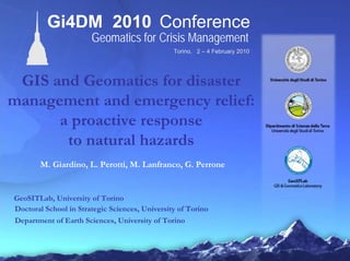
  • 1. Torino, 2 – 4 February 2010 Gi4DM 2010 Conference Geomatics for Crisis Management GIS and Geomatics for disaster management and emergency relief: a proactive response to natural hazards M. Giardino, L. Perotti, M. Lanfranco, G. Perrone GeoSITLab, University of Torino Doctoral School in Strategic Sciences, University of Torino Department of Earth Sciences, University of Torino
  • 2. AGENDA • Disasters • Geomatics • Remote sensing • From the space • On the ground • Palm vs tablet • Hyogo Declaration • Post earthquakes • Haiti
  • 6. DISASTERS natural SLOW ONSETSLOW ONSET FAST ONSETFAST ONSET cyclones landslides floods earthquakes volcanoes … famine drought pandemic climate change … FAST DISASTERS NEED FAST RELIEFFAST DISASTERS NEED FAST RELIEF
  • 7. 1. CLIMATE RELATED DISASTERS 2. LANDSLIDES 3. EARTHQUAKES SEISMIC MICROZONATION DAMAGE ASSESSMENT HURRICANE FLOODS GEOMATICS PROVIDE BOOST TO GEOLOGICAL AND GEOMORPHOLOGICAL MAPPING IN PREEMPTIVE RESEARCHES WHERE WE WORKspeed up GEOMATICS SHOULD SPEED UP RELIEF OPERATIONS
  • 8. REMOTE SENSING multispectral sensors and photos DIRECT MAPPING ON THE GROUND entity and attributes going digital WHAT WE DO GEODATABASE / SDI consistency – geoposition and shape NO ANALOGIC / DIGITAL PASSAGE less errors
  • 9. FROM THE SPACEFROM THE SPACE
  • 10. THE POLOCHIC VALLEYTHE POLOCHIC VALLEY GUATEMALAGUATEMALAafter the hurricane Mitch - 1998 multitemporal analysis of satellite images acquired before and after the catastrophic flooding related to Hurricane Mitch
  • 11. THE POLOCHIC VALLEYTHE POLOCHIC VALLEY GUATEMALAGUATEMALAafter the hurricane Mitch - 1998 multitemporal analysis of satellite images acquired before and after the catastrophic flooding related to Hurricane Mitch
  • 12. MORPHOLOGICAL CHANGESMORPHOLOGICAL CHANGESchannel adjustment and landslide Landsat 5 TM 15/04/1998 (before Mitch) false color RGB 754 image Examples of environment modification induced by hurricane Mitch
  • 13. MORPHOLOGICAL CHANGESMORPHOLOGICAL CHANGESchannel adjustment and landslide channel narrowing meander cutoffdebris flow flooded areaLandsat 7 ETM+ 23/01/2000 (after Mitch) false color RGB 754 image Examples of environment modification induced by hurricane Mitch
  • 14. FLOODS IN DEVELOPING COUNTRIESFLOODS IN DEVELOPING COUNTRIES appling remote sensing ITHACA AND GEOSITLAB COOPERATION GEOGRAPHIC DATABASE (SDI) pluviometric regimes flood scenario FLOODS EARLY WARNING SYSTEM rainfall values FLOODS EARLY IMPACT ANALISYS data acquired during and after the event FLOODPLAIN MODELING hydrologic and hydraulic modelling geomorphological aspects will be considered to identify the potentially floodable areas Risk Management forecasting early impact analisys post emergency SDI scenario flood early waring flooded areas disaster area safe areas 3 days 7 days FLOOD mod. from ITHACA, 2007
  • 15. 2007 ZAMBESI FLOOD2007 ZAMBESI FLOODenhancing remote sensing hydraulic evaluation of flood extent MozambiqueMozambique channel and flood-plain morphology GEOMORPHOLOGICAL CONSTRAIN TO HYDRAULIC EVALUATION
  • 16. inputs and outputs of a regional inventory of landslide AOSTA VALLEY IFFIAOSTA VALLEY IFFI Italian Landslide Inventory (IFFI Project): • aimed at identifying and mapping landslides over the whole Italian territory • based on standardized criteria • started in 1997 • results published in 2007 • last update may 2009 Mountain region Total area (km2) N landslides 2659 Landslide total area (km2) 3262 579,98 Landslide Density (N landslides/Region area) Susceptibility index (Landslides area/Region area) 1,60 0,18
  • 17. TO THE GROUNDTO THE GROUND
  • 18. FIRST STEP WAS SRG2 acronym from italian Supporto al Rilevamento Geologico e Geomorfologico (Support to Geological and Geomorphological Mapping) • POSITIONING • INSTRUMENTS • DATA GPS vector format with dedicated forms Pocket PC + ArcPad .SHP.SHP.SHP
  • 19. ARCPAD EXTENSIONARCPAD EXTENSION • 16 layers (shape file format) and associated databases • toolbar • selectable attributes to shapefile visual basic
  • 20. 2. HISTORICAL DATA 1. REMOTE SENSING 3. GEOLOGICAL MAPPING DATA CONTROL THROUGH BUFFER ANALYSIS NON-CORRELABLE DATA DISTINCT RECORDS MANTEAINED CORRELABLE DATA RECORDS BEING FUSED FINAL DATABASEFINAL DATABASE AOSTA VALLEY LANDSLIDE INVENTORYworkplan for activities 2002-2006 and 2008-2012
  • 21. hazard mapping LANDSLIDE GENERAL STATISTICSLANDSLIDE GENERAL STATISTICS N.D. 844 Falls 973 Slides 632 Flows (slow) 49 Flows (rapid) 345 Sinkholes 4 Complexes 443 DsGSDs 263 Falls-prone areas 224 Flows-prone areas 60
  • 22. SEISMIC MICROZONATIONSEISMIC MICROZONATIONSRG2 improvement FEATURE IMPROVEMENT OF SRG2 WITH GEOLOCICAL AND GEOMORPHOLOGICAL SEISMIC TOPICS activity of faults activation or reactivation of landslides amplification phenomena liquefaction phenomena
  • 23. DRONERO TEST SITEDRONERO TEST SITESRG2 on the ground Northern Italy Quaternary deposits 1 eluvial-colluvial deposits 2 recent and current fluvial deposits 3 landslide deposits 4 debris and slope-deposits 5 stream and alluvial fan deposits 6 ancient fluvial deposits Pre-Quaternary substratum 7 dolomitic marble and dolomites 8 micascists and metabasites Structural elements 9 fault Hydrography-related elements 10 fluvial terrace < 10 metres 11 fluvial terrace > 10 metres 2 deeply incised valley 13 buried river bed Slope elements 14 scarp < 10 metres Other symbols 15 borehole 16 village boundary 17 geophysical investigation 18 trace of the geological section geomorphological map for seismic microzonation
  • 24. PALM VS TABLETPALM VS TABLETour philosophy + really light and easy to carry on + GPS + long life batteries + easy interface + a lot of scripts, applets e plugins + developing in Visual, Visual Basic and Java - low graphic functionality - low raster and ASCII data management - slow processor - little screen LOW NEED OF GIS/IT KNOWLEDGE + full hardware + full GIS projecting + full raster / ASCII / vector data management - heavy for continous work - short life batteries HIGH NEED OF GIS/IT KNOWLEDGE
  • 25. EMERGENCY RELIEFEMERGENCY RELIEFtempo Human Security approach focalised relief effort on a people-centred recovery activity that should guarantee not only the lives of affected people but also their social ties and economic capacities (UN/OCHA, 2009) The Hyogo Declaration stressed that relief, rehabilitation and reconstruction are windows of opportunity for the rebuilding of livelihoods and socio-economic structures to increase individual and community resilience (UN/ISDR, 2005) In complex emergencies, the knowledge management increase exponentially the success of the emergency relief 1. Search and Rescue teams 2. First aid and health care facilities 3. Food and drinking water supply chain 4. Refugee camps organization 5. First rebuilding WLAN SATCOM
  • 26. POST SEISMIC AREA SURVEYgeomorphological effects of earthquakes The post seismic geomorphological mapping was aimed to the survey of the different landforms characterizing the affected area B.Hazard elements 3.Earthquake effects fault and fracture landslide (fall, slump, slide) trench and notch closed hollow ground failure river modification new spring or pond 4.Instability bend elements steep scarp concave slope rock block (on cliff or slope) isolated ridge and peak deep gorge and canyon A.Geological/geomorphological context 1.Landforms topography (plain, slope, ridge, incision) slope angle (0-10°, 10-30°, >30°) land cover (CORINE) water (spring, in sink, pond, torrent, no-water) 2.Outcropping material material type (rock, soil, debris) rock type (i.e. Bieniawsky) soil type (granulometry and condictions)
  • 27. BUILDING DAMAGE INVENTORYBUILDING DAMAGE INVENTORYEarthquake Damage and Inhabitable Assessment Form The Italian National Seismic Survey (SSN) developed in 2000 a first level damage form (AeDES) utilized with minor revision until the recent “l’Aquila” earthquake GeoSITLab translate the form in English and modified some issues to adapt it to Developing Countries building structures building position building damage building risk
  • 28. EDIAF IN HAITIEDIAF IN HAITI ongoing activity Poor concrete frame house Hut Haitian tipical buildings Masonry church BEFOREHAITIEARTHQUAKE AFTERHAITIEARTHQUAKE
  • 29. EDIAF IN HAITIEDIAF IN HAITIon site test
  • 31. THANX FOR YOUR ATTENTION! ANY THOUGHTS OR QUESTIONS?