GFD2015 Lecco Italy Geobricks Framework Overview Architecture Modules Case Study
•
0 likes•153 views

The document discusses the Geobricks framework, an open source modular architecture for building geospatial web services and applications. It consists of libraries, REST services, and backend modules. The architecture uses a 3-tier service oriented design. Example modules allow downloading data from various sources, processing it using OGR and GDAL, and distributing outputs through OGC standards and other methods. A 2008 Afghanistan drought case study demonstrates acquiring MODIS and TRMM data, processing it to show anomalies in temperature, rainfall, NDVI and other outputs to analyze the drought's impacts.

Recommended
Recommended
More Related Content
What's hot
What's hot (20)
Viewers also liked
Viewers also liked (20)
Similar to GFD2015 Lecco Italy Geobricks Framework Overview Architecture Modules Case Study
Similar to GFD2015 Lecco Italy Geobricks Framework Overview Architecture Modules Case Study (20)
Recently uploaded
Recently uploaded (20)
GFD2015 Lecco Italy Geobricks Framework Overview Architecture Modules Case Study
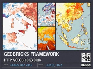
- 1. LECCO, ITALYWHEN WHERE GFOSS DAY 2015 GEOBRICKS FRAMEWORK HTTP://GEOBRICKS.ORG/
- 2. OVERVIEW HIGHLIGHTS OF THE FRAMEWORK Open Source Modular Architecture Libraries REST Services Back-end modules available on PyPi AMD front-end modules
- 3. ARCHITECTURE 3 TIERS SERVICE ORIENTED ARCHITECTURE
- 5. JSON SCHEMA FORMAL DEFINITION OF REST WEB SERVICES IETF internet draft Version 4 Equivalent to WSDL for JSON-based services Formal definition of inputs and outputs Formal definition of REST services
- 6. GEOBRICKS DOWNLOADER DATA ACQUISITION General purpose downloader capable to acquire remote resources on the web Multithreading Used combined with data wrappers Landsat MODIS TRMM ...
- 7. GEOBRICKS PROCESSING DATA MANIPULATION Interface with OGR Interface with GDAL Programmable processing Can be extended with custom functions
- 8. GEOBRICKS DISTRIBUTION DATA MANIPULATION OGC Standards (WMS, WFS, WCS) FTP API Timeseries Zonal Crops ...
- 10. 2008 AFGHANISTAN DROUGHT CASE STUDY Well-below normal rainfall and winter snowfall across the majority of Afghanistan during late 2007 and early 2008 have led to the worst drought conditions of the decade Wheat production dropped by 60% and flour import increased by 34%
- 11. DATA ACQUISITION MODULES: DOWNLOADER, DATA WRAPPERS TRMM: Rainfalls, Daily, 0.25deg MOD13A1: Vegetation, 16-Day, 500m MOD13A3: Vegetation, Monthly, 1km MYD11C3: Temperature, Monthly, 0.05deg MOD16: Evapotranspiration, 8-Day, 1km
- 12. DATA PROCESSING MODULES: PROCESSING Band extraction Mosaicing Reprojection Monthly aggregation Historical average Anomaly and Z-Score with the historical average Hotspots
- 13. OUTPUTS ANOMALIES: TEMPERATURE AND RAINFALLS TEMPERATURE RAINFALLS
- 14. OUTPUTS NDVI ANOMALY, CULTIVATE AREAS, PRODUCTION LOSS NDVI CULTIVATED AREAS STATISTICS (FAOSTAT DATA) tonnes Wheat production Wheat import Flour import 2007 4,484,000 273,188 645,688 2008 2,623,000 695,629 865,333
- 16. GEOBRICKS MODULES LIST OF AVAILABLE COMPONENTS CSS2SLD Downloader MODIS Data Wrapper MOD16 Data Wrapper Landsat Data Wrapper TRMM Data Wrapper REST Engine Scheduler Processing DBMS Raster Correlation GeoServer Cluster Manager Metadata Manager Data Manager Distribution Geocoding Spatial Queries Geostatistics Leaflet GeoJSON Map Classify
- 17. TECHNOLOGIES LIST OF OPEN SOURCE PROJECTS Python PyPi Flask OGR / GDAL GeoServer PostgreSQL PostGIS RasterIO JQuery Bootstrap Backbone Leaflet RequireJS Docker NGINX μWSGI TravisCI Coveralls