
Recommended
Recommended
More Related Content
Similar to Quality and quantity analysis of ground water and surface water
Similar to Quality and quantity analysis of ground water and surface water (20)
Recently uploaded
Recently uploaded (20)
Quality and quantity analysis of ground water and surface water
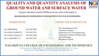
- 1. QUALITY AND QUANTITY ANALYSIS OF GROUND WATER AND SURFACE WATER A project submitted in partial fulfillment for the award of the degree in BACHELOR OF ENGINEERING IN DEPARTMENT OF CIVIL ENGINEERING Mr. ABHISHEK 1NC18CV003 Mr. BABU DARSHAN 1NC18CV012 Mr. GURUCHARAN S 1NC18CV028 Ms. LAKSHMI G N 1NC18CV037 SUBMITED BY UNDER THE GUIDANCE OF Mr. Sanath Kumar K R Assistant Professor Department of Civil Engineering Nagarjuna College of Engineering and Technology Bengaluru-562164 NAGARJUNA COLLEGE OF ENGINEERING AND TECHNOLOGY (An Autonomous College under VTU, Accredited by NBA and NAAC with “A” Grade) Mudugurki (V), Venkatagirikote (P), Devanahalli (T), Bengaluru-562164.
- 2. ABSTRACT • Water samples are collected from randomly selected 20 different sampling sites for analysing physicochemical parameters. • The work evaluated is the Ground Water Quality and Quantity analysis of Devanahalli area, Bangalore dist., Karnataka. • Here in this study, it is analysed the physiochemical parameters like pH, Turbidity, Total dissolved solids, Alkalinity, Total hardness, Calcium, Magnesium, Chloride, Sulphate, potassium, phosphate, Faceal coliforms. Spatial Analysis for all the parameters is done. • Quantity analysis Aquifer zone identification, Aquifer zone mapping, preparation of Thematic maps, Overlay analysis, calculation of aquifer zone Creation.
- 3. INTRODUCTION • Water is one of the most basic needs for all life on Earth. It occupies the vast bulk of our planet's space, accounting for roughly 71 percent of the planet's total surface area. • The study of the distribution, availability, consumption, and flow of ground water is known as hydrology. • There are three major types of surface water. Permanent (perennial) surface waters are present year- round, and includes lakes, rivers, and wetlands (marshes and swamps). • Semi-permanent (ephemeral) surface water refers to bodies of water that are only present at certain times of the year including seasonally dry channels such as creeks, lagoons, and waterholes. • Man-made surface water is water that can be continued by infrastructures that humans have assembled. This would be dammed artificial lakes, canals and artificial ponds (e.g., garden ponds) or swamps. • Devanahalli was originally part of Gang wadi and was later ruled by the Rashatrakutas, Nolambas, Pallavas, Cholas, Hoysalas, and Vijayanagara monarchs. • Devanahalli's recent history stretches back to the 15th century, when a family of refugees escaping Conjeevaram (modern-day Kanchi) settled at Ramaswami betta, east of the Nandi Hills.
- 4. OBJECTIVES OF THE PROJECT •Qualitative analysis of water Samples to understand the physicochemical condition of water in the taluk. •Seasonal variation quality and quantity of ground and Surface water. •Rejuvenation of surface water and Aquifers. •Implementation of integrated water management.
- 5. METHODOLOGY
- 6. Under water quality tests, we have 1. Physical parameters : Color ,Odor, Taste , Turbidity, Electrical conductivity 2. Chemical parameters : pH , Dissolved oxygen, Total hardness, Alkalinity, Total dissolved solids, Total suspended solids, Fluorides, Nitrates, Chlorides, Sulphates 3. Biological parameters : E COLI (M.P.N: - Most Probable Number)
- 8. RESULTS
- 12. TEST RESULTS
- 13. ADVANTAGES 1. Physicochemical analysis helps the improvement of the water quality of the area. 2. Aquifer zone mapping helps to identify the water zones present in the Borewell. 3. Thematic maps explain Exploratory spatial analysis, synthesizing spatial data by revealing patterns and relationship and data presentation.
- 14. DISADVANTAGES 1. Improper maintenance of the physicochemical analysis process. 2. Aquifer depletion from over pumping, the amount of local precipitation, water tanks can be very hard to clean. 3. A thematic map that are composed of a special purpose and a statical map that is based on the spatial variation, does not present exact values, it can be difficult to distinguish between distinct shades.
- 15. ACHIEVEMENTS 1. The project is sponsored by the Water Institute, Department of Civil Engineering, UVCE, Bangalore University Bengaluru. 2. The project is selected for project exhibition. 3. Publish the Journal paper.
- 16. SOCIAL IMPACT 1. This can increase the water potential in the area, which is helpful for the sustainable development of Groundwater. 2. Enriches the availability of the water. 3. Water management in the area
- 17. • Maximum areas which can hold a Moderate quantity of water and floodplain areas are the good potential zones of GW. Terrain belongs to the hard rock runoff is more and infiltration is very less hence tanks constructed across the stream to store the water. • Northern part of the terrain has very little groundwater as it contains the high slope and hilly terrain. Southern part of Devanahalli Taluk is having good potential zones of groundwater as it has more tanks and 7th order drainages. • Slope and aspect of the area reveals that the southern part of Devanahalli Taluk has a gentle slope compared with the northern part of the study area. The East and West part of Devanahalli Taluk have moderate groundwater potential zones, as they have moderate slopes. • International airport is located at the southern part of the study area which needs more quantity of water. • Rainwater harvesting is the only solution to recharge the aquifer, presently which is getting depleted due to the overexploitation of groundwater. • Output is validated with the Borehole depth data which reveals that, borewell depth in few cases mainly depends on the Lineament and apart from this water is available at the Greater Depth around 1200ft. • From the meteorological data it reveals that the source of Groundwater in Rainfall if failure in the seasonal rainfall hits directly the storage of GW intern results in the draught. • Decrease in the water levels of the tanks are due to the highest evaporation rate in the study area in the peak summer. CONCLUSION
- 18. REFERENCES Abijith, D.; Saravanan, S.; Singh, L.; Jennifer, J. J.; Saranya, T. & Parthasarathy, K., GIS-based multi-criteria analysis for identification of potential groundwater recharge zones-a case study from Ponnaniyaru watershed, Tamil Nadu, India HydroResearch, Elsevier, 2020, 3, 1-14. Adhikary, P. P.; Dash, C.; Chandrasekharan, H.; Rajput, T.; Dubey, S. & others., Evaluation of groundwater quality for irrigation and drinking using GIS and geostatistics in a peri-urban area of Delhi, India Arabian Journal of Geosciences, Springer, 2012, 5, 1423-1434. Asadi, S.; Vuppala, P. & Reddy, M. A., Remote sensing and GIS techniques for evaluation of groundwater quality in municipal corporation of Hyderabad (Zone-V), India International journal of environmental research and public health, Molecular Diversity Preservation International, 2007, 4, 45-52. Chegbeleh, L. P.; Akurugu, B. A. & Yidana, S. M., Assessment of groundwater quality in the Talensi District, Northern Ghana the Scientific World Journal, Hindawi, 2020, 2020. Fallahati, A.; Soleimani, H.; Alimohammadi, M.; Dehghanifard, E.; Askari, M.; Eslami, F. & Karami, L., Impacts of drought phenomenon on the chemical quality of groundwater resources in the central part of Iran—Application of GIS technique Environmental Monitoring and Assessment, Springer, 2020, 192, 1-19.
- 19. Jha, M. K.; Shekhar, A. & Jenifer, M. A., Assessing groundwater quality for drinking water supply using hybrid fuzzy-GIS-based water quality index, Water Research, Elsevier, 2020, 179, 115867. Safarbeiranvnd, M.; Amanipoor, H.; Battaleb-Looie, S.; Ghanemi, K. & Ebrahimi, B., Quality evaluation of groundwater resources using Geostatistical methods (case study: Central Lorestan plain, Iran) Water Resources Management, Springer, 2018, 32, 3611-3628. Saleem, M.; Hussain, A. & Mahmood, G., Analysis of groundwater quality using water quality index: A case study of greater Noida (Region), Uttar Pradesh (UP), India Cogent Engineering, Taylor & Francis, 2016 , 3 , 1237927. Srinivas, R.; Bhakar, P. & Singh, A. P., Groundwater quality assessment in some selected area of Rajasthan, India using fuzzy multi-criteria decision making tool Aquatic Procedia, Elsevier, 2015, 4 , 1023-1030. Subramani, T.; Krishnan, S. & Kumaresan, P., Study of groundwater quality with GIS application for Coonoor taluk in Nilgiri district, International Journal of Modern Engineering Research, 2012, 2, 586-592. Zhang, Q.; Qian, H.; Xu, P.; Hou, K. & Yang, F., Groundwater quality assessment using a new integrated- weight water quality index (IWQI) and driver analysis in the Jiaokou Irrigation District, China, Ecotoxicology and environmental safety, Elsevier, 2021, 212 , 111992.