SlideShare a Scribd company logo
1 of 64
Download to read offline
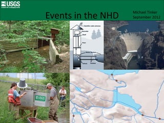
Michael Tinker
Events in the NHD   September 2012
Outline
1. Linear referencing
2. Network events
3. NHD events
4. Gages, water quality stations
    NWIS
    Indexing workflow
5. Dams
6. Divergences
7. Water quality stations
8. Future events in the NHD
9. Wrap up
Linear networks
•   Transportation
•   Railroad
•   Gas pipelines
•   Drinking water mains
•   Storm drain networks
•   Sewer networks
•   Rivers systems
Linear referencing
• Points on the network.
• One can always model points on the network
  using XY coordinates, however…
• It is desirable to model information
  without having to express it in XY terms.
• For example, route I-12, mile marker 47.
• Multiple attributes can be associated with
  linearly referenced features.
Network events
• An event is a linearly referenced feature
• Events must have:
  – Route
  – Measure
NHD point events
• In the NHD, events have:
  – ReachCode
  – Measure


                                EventType
                                    Gage
                                    Dam
Flowlines with ReachCode
Flowlines with Measure
Flowlines with ReachCodes,
   Events with Measures


                   NHDPointEventFC
                   EventType
                    #   Water Quality Station
                    "   Dam
                    !   Gaging Station
NHD point events
                                           Events reference outside information


National Water Information System (NWIS)
NHD point events
    Sept 19, 2012
    240,737 points
Point Event Attributes
• Permanent_Identifier
     unique identifier
• ReachCode
     unique reach id
• Measure
     0 to 100, for linear referencing
• EventType
     gage station, dam, diversion, water quality
     station
• EventDate
     date the event was created or last modified
Point Event Attributes
• Feature_Permanent_Identifier
      Permanent_Identifier of NHD feature an event is
      referenced to. Internal reference.
• Source_DataDescription
      Name of source data, e.g. NWIS, NID.
• Source_FeatureID
      ID of feature in the source data, e.g. NWIS site number, or
      NID ID.
• FeatureDetailURL
      link to detailed event data at the source e.g. NWIS web
      page for each unique site number.
Point Events Types in the NHD
            Sept 19, 2012
Event Type   Description                         Number of points

1            Gaging Station                                105,400

2            Dam                                            60,256

3            Withdrawing Divergence Structure                   25

4            General Divergence Structure                      818

5            Contributing Divergence Structure                  33

6            Water Quality Station                          74,205

                                                           240,737
Gages
Gaging Station
        Event Type =1
105,400 points, as of Sept 19 , 2012
Identify gage point events in ArcMap
National Water Information System (NWIS)
Snapshot of NWIS Stream gages,
  Water Quality (QW) stations,
     131,902 points, June 2011
Indexing workflow
Clip the NWIS points by HUC 4
NWIS Points in HUC 1201
Remove duplicates from NWIS clip
Hydrography Event Management Tool
Raw NWIS points
NWIS points snapped to NHD
100 meter snapping threshold
50 meter move threshold
1000 meter absolute threshold
In lakes > 1000 meter distance
     flowline is acceptable
Placement Issues
Placement Issues
Placement Issues
Placement Issues
Dams
Dam
      Event Type = 2
60,256 points as of Sept 19, 2012
National Inventory of Dams (NID)
Fish Passage Decision Support System
Divergences
General Divergence Structure
       Event Type = 3
   25 points as of Sept 19, 2012
Withdrawing Divergence Structure
        Event Type = 4
       818 points as of Sept 19, 2012
Contributing Divergence Structure
          Event Type = 5
       33 points as of Sept 19, 2012
Divergence data sources:
•   Bureau of reclamation
•   State office of engineer
•   State/local water districts
•   State/local water rights databases
Colorado Decision Support System
Water Quality Stations
Water Quality Station
  Event Type = 6
74,205 points as of Sept 19, 2012.
Water quality stations are often
    coincident with gages


                       NHDPointEventFC
                       EventType
                        #   Water Quality Station
                        "   Dam
                        !   Gaging Station
Stream Stats Application
Future Plans for Events
• HUC8 pour points
• “VIP” gages
  – HCDN gages
  – NSIP (National Streamflow Information Program)
  – GAGES II (Geospatial Attributes of Gages for
    Evaluating Streamflow, Version II)
• Area and line events
• Better integration with USTopo
Pour Points
Pour Points
Pour Points
Pour Points
Subbasin 01090002
Downstream Trace


Weweantic River
(Longest river –
27km)
Subbasin 01090002
Upstream Trace


Weweantic River
(Greatest number of
drainage kilometers –
472)
Subbasins 17040216 and
17040217
Area and line events
Summary
• NHD contains events which link the NHD to
  external information.
• The events can be used for modeling, such
  things as stream flows, barriers, water rights,
  pollution traces, heat pollution.
• Data  Information  Knowledge

More Related Content

Similar to 2012 USGS Track, Events in the National Hydrography Dataset, Michael Tinker

2017 Conservation Track: Streamlining the Development of a Statewide Water G...
2017 Conservation Track:  Streamlining the Development of a Statewide Water G...2017 Conservation Track:  Streamlining the Development of a Statewide Water G...
2017 Conservation Track: Streamlining the Development of a Statewide Water G...GIS in the Rockies
 
Geospatial data & Web Portals for IWRM:-NRSC Perspective By Dr. J.R. Sharma
Geospatial data &  Web Portals for IWRM:-NRSC Perspective  By Dr. J.R. SharmaGeospatial data &  Web Portals for IWRM:-NRSC Perspective  By Dr. J.R. Sharma
Geospatial data & Web Portals for IWRM:-NRSC Perspective By Dr. J.R. Sharmaindiawrm
 
SUSTAINABLE PRACTICES IN WATER LOSS MANAGEMENT AND NRW REDUCTION
SUSTAINABLE PRACTICES IN WATER LOSS MANAGEMENT AND NRW REDUCTIONSUSTAINABLE PRACTICES IN WATER LOSS MANAGEMENT AND NRW REDUCTION
SUSTAINABLE PRACTICES IN WATER LOSS MANAGEMENT AND NRW REDUCTIONiQHub
 
Real Time Event Processing and In-­memory analysis of Big Data - StampedeCon ...
Real Time Event Processing and In-­memory analysis of Big Data - StampedeCon ...Real Time Event Processing and In-­memory analysis of Big Data - StampedeCon ...
Real Time Event Processing and In-­memory analysis of Big Data - StampedeCon ...StampedeCon
 
2018 GIS in Conservation: An Introduction to NHDplus High Resolution Value Ad...
2018 GIS in Conservation: An Introduction to NHDplus High Resolution Value Ad...2018 GIS in Conservation: An Introduction to NHDplus High Resolution Value Ad...
2018 GIS in Conservation: An Introduction to NHDplus High Resolution Value Ad...GIS in the Rockies
 
Smart Water Management with Delft-FEWS, Tianjin Eco-city, China - Zhang
Smart Water Management with Delft-FEWS, Tianjin Eco-city, China - ZhangSmart Water Management with Delft-FEWS, Tianjin Eco-city, China - Zhang
Smart Water Management with Delft-FEWS, Tianjin Eco-city, China - ZhangDeltares
 
Directions OGC CHISP-1 Webinar Slides
Directions OGC CHISP-1 Webinar SlidesDirections OGC CHISP-1 Webinar Slides
Directions OGC CHISP-1 Webinar SlidesAlex Joseph
 
GISInManagementAndMaintenance
GISInManagementAndMaintenanceGISInManagementAndMaintenance
GISInManagementAndMaintenanceZeev Somer
 
Hydrological design aides surface water
Hydrological design aides surface waterHydrological design aides surface water
Hydrological design aides surface waterhydrologyproject2
 
Hydrological design aides surface water
Hydrological design aides surface waterHydrological design aides surface water
Hydrological design aides surface waterhydrologyproject0
 
Examples of how Blueback tools can expand and enhance your Petrel workflow
Examples of how Blueback tools can expand and enhance your Petrel workflowExamples of how Blueback tools can expand and enhance your Petrel workflow
Examples of how Blueback tools can expand and enhance your Petrel workflowMitch Sutherland
 
Waters {jal , pani}
Waters {jal , pani}Waters {jal , pani}
Waters {jal , pani}Rohan Desale
 
Semantic Discovery and Integration of Urban Data Streams
Semantic Discovery and Integration of Urban Data StreamsSemantic Discovery and Integration of Urban Data Streams
Semantic Discovery and Integration of Urban Data StreamsAli Intizar
 
DSD-INT 2017 Introduction to computational frameworks Example Ganga Basin - ...
DSD-INT 2017 Introduction to computational frameworks  Example Ganga Basin - ...DSD-INT 2017 Introduction to computational frameworks  Example Ganga Basin - ...
DSD-INT 2017 Introduction to computational frameworks Example Ganga Basin - ...Deltares
 
Chapter4 smart drinking water AUST 2015
Chapter4 smart drinking water AUST 2015Chapter4 smart drinking water AUST 2015
Chapter4 smart drinking water AUST 2015Isam Shahrour
 
22 - CSIRO - Water Data Management-Sep-17
22 - CSIRO - Water Data Management-Sep-1722 - CSIRO - Water Data Management-Sep-17
22 - CSIRO - Water Data Management-Sep-17indiawrm
 

Similar to 2012 USGS Track, Events in the National Hydrography Dataset, Michael Tinker (20)

2017 Conservation Track: Streamlining the Development of a Statewide Water G...
2017 Conservation Track:  Streamlining the Development of a Statewide Water G...2017 Conservation Track:  Streamlining the Development of a Statewide Water G...
2017 Conservation Track: Streamlining the Development of a Statewide Water G...
 
Geospatial data & Web Portals for IWRM:-NRSC Perspective By Dr. J.R. Sharma
Geospatial data &  Web Portals for IWRM:-NRSC Perspective  By Dr. J.R. SharmaGeospatial data &  Web Portals for IWRM:-NRSC Perspective  By Dr. J.R. Sharma
Geospatial data & Web Portals for IWRM:-NRSC Perspective By Dr. J.R. Sharma
 
Laura Slide
Laura SlideLaura Slide
Laura Slide
 
SUSTAINABLE PRACTICES IN WATER LOSS MANAGEMENT AND NRW REDUCTION
SUSTAINABLE PRACTICES IN WATER LOSS MANAGEMENT AND NRW REDUCTIONSUSTAINABLE PRACTICES IN WATER LOSS MANAGEMENT AND NRW REDUCTION
SUSTAINABLE PRACTICES IN WATER LOSS MANAGEMENT AND NRW REDUCTION
 
Real Time Event Processing and In-­memory analysis of Big Data - StampedeCon ...
Real Time Event Processing and In-­memory analysis of Big Data - StampedeCon ...Real Time Event Processing and In-­memory analysis of Big Data - StampedeCon ...
Real Time Event Processing and In-­memory analysis of Big Data - StampedeCon ...
 
Database Management Training
Database Management TrainingDatabase Management Training
Database Management Training
 
2018 GIS in Conservation: An Introduction to NHDplus High Resolution Value Ad...
2018 GIS in Conservation: An Introduction to NHDplus High Resolution Value Ad...2018 GIS in Conservation: An Introduction to NHDplus High Resolution Value Ad...
2018 GIS in Conservation: An Introduction to NHDplus High Resolution Value Ad...
 
Elevation hydrology tools kent pena
Elevation hydrology tools   kent penaElevation hydrology tools   kent pena
Elevation hydrology tools kent pena
 
Smart Water Management with Delft-FEWS, Tianjin Eco-city, China - Zhang
Smart Water Management with Delft-FEWS, Tianjin Eco-city, China - ZhangSmart Water Management with Delft-FEWS, Tianjin Eco-city, China - Zhang
Smart Water Management with Delft-FEWS, Tianjin Eco-city, China - Zhang
 
Directions OGC CHISP-1 Webinar Slides
Directions OGC CHISP-1 Webinar SlidesDirections OGC CHISP-1 Webinar Slides
Directions OGC CHISP-1 Webinar Slides
 
GISInManagementAndMaintenance
GISInManagementAndMaintenanceGISInManagementAndMaintenance
GISInManagementAndMaintenance
 
Hydrological design aides surface water
Hydrological design aides surface waterHydrological design aides surface water
Hydrological design aides surface water
 
Hydrological design aides surface water
Hydrological design aides surface waterHydrological design aides surface water
Hydrological design aides surface water
 
Examples of how Blueback tools can expand and enhance your Petrel workflow
Examples of how Blueback tools can expand and enhance your Petrel workflowExamples of how Blueback tools can expand and enhance your Petrel workflow
Examples of how Blueback tools can expand and enhance your Petrel workflow
 
Waters {jal , pani}
Waters {jal , pani}Waters {jal , pani}
Waters {jal , pani}
 
WDNR Hydrography Geodatabase
WDNR Hydrography GeodatabaseWDNR Hydrography Geodatabase
WDNR Hydrography Geodatabase
 
Semantic Discovery and Integration of Urban Data Streams
Semantic Discovery and Integration of Urban Data StreamsSemantic Discovery and Integration of Urban Data Streams
Semantic Discovery and Integration of Urban Data Streams
 
DSD-INT 2017 Introduction to computational frameworks Example Ganga Basin - ...
DSD-INT 2017 Introduction to computational frameworks  Example Ganga Basin - ...DSD-INT 2017 Introduction to computational frameworks  Example Ganga Basin - ...
DSD-INT 2017 Introduction to computational frameworks Example Ganga Basin - ...
 
Chapter4 smart drinking water AUST 2015
Chapter4 smart drinking water AUST 2015Chapter4 smart drinking water AUST 2015
Chapter4 smart drinking water AUST 2015
 
22 - CSIRO - Water Data Management-Sep-17
22 - CSIRO - Water Data Management-Sep-1722 - CSIRO - Water Data Management-Sep-17
22 - CSIRO - Water Data Management-Sep-17
 

More from GIS in the Rockies

GISCO Fall 2018: Bike Network Equity: A GIS and Qualitative Analysis of Ameri...
GISCO Fall 2018: Bike Network Equity: A GIS and Qualitative Analysis of Ameri...GISCO Fall 2018: Bike Network Equity: A GIS and Qualitative Analysis of Ameri...
GISCO Fall 2018: Bike Network Equity: A GIS and Qualitative Analysis of Ameri...GIS in the Rockies
 
GISCO Fall 2018: Colorado 811: Changes and Challenges – Brian Collison
GISCO Fall 2018: Colorado 811: Changes and Challenges – Brian CollisonGISCO Fall 2018: Colorado 811: Changes and Challenges – Brian Collison
GISCO Fall 2018: Colorado 811: Changes and Challenges – Brian CollisonGIS in the Rockies
 
GISCO Fall 2018: Senate Bill 18-167 and GIS – Dave Murray
GISCO Fall 2018: Senate Bill 18-167 and GIS – Dave MurrayGISCO Fall 2018: Senate Bill 18-167 and GIS – Dave Murray
GISCO Fall 2018: Senate Bill 18-167 and GIS – Dave MurrayGIS in the Rockies
 
2018 GIS in the Rockies Workshop: Coordinate Systems and Projections
2018 GIS in the Rockies Workshop: Coordinate Systems and Projections 2018 GIS in the Rockies Workshop: Coordinate Systems and Projections
2018 GIS in the Rockies Workshop: Coordinate Systems and Projections GIS in the Rockies
 
2018 GIS in Emergency Management: Denver Office of Emergency Management Overview
2018 GIS in Emergency Management: Denver Office of Emergency Management Overview2018 GIS in Emergency Management: Denver Office of Emergency Management Overview
2018 GIS in Emergency Management: Denver Office of Emergency Management OverviewGIS in the Rockies
 
2018 GIS in the Rockies Vendor Showcase (Th): The Data Driven Government
2018 GIS in the Rockies Vendor Showcase (Th): The Data Driven Government2018 GIS in the Rockies Vendor Showcase (Th): The Data Driven Government
2018 GIS in the Rockies Vendor Showcase (Th): The Data Driven GovernmentGIS in the Rockies
 
2018 GIS in the Rockies Vendor Showcase (Th): Solving Real World Issues With ...
2018 GIS in the Rockies Vendor Showcase (Th): Solving Real World Issues With ...2018 GIS in the Rockies Vendor Showcase (Th): Solving Real World Issues With ...
2018 GIS in the Rockies Vendor Showcase (Th): Solving Real World Issues With ...GIS in the Rockies
 
2018 GIS in the Rockies Vendor Showcase (Th): ERDAS Imagine What's New and Ti...
2018 GIS in the Rockies Vendor Showcase (Th): ERDAS Imagine What's New and Ti...2018 GIS in the Rockies Vendor Showcase (Th): ERDAS Imagine What's New and Ti...
2018 GIS in the Rockies Vendor Showcase (Th): ERDAS Imagine What's New and Ti...GIS in the Rockies
 
2018 GIS in the Rockies Vendor Showcase (Th): Building High Performance Gover...
2018 GIS in the Rockies Vendor Showcase (Th): Building High Performance Gover...2018 GIS in the Rockies Vendor Showcase (Th): Building High Performance Gover...
2018 GIS in the Rockies Vendor Showcase (Th): Building High Performance Gover...GIS in the Rockies
 
2018 GIS in Recreation: The Making of a Trail
2018 GIS in Recreation: The Making of a Trail2018 GIS in Recreation: The Making of a Trail
2018 GIS in Recreation: The Making of a TrailGIS in the Rockies
 
2018 GIS in Recreation: The Latest Trail Technology Crowdsourcing Maps and Apps
2018 GIS in Recreation: The Latest Trail Technology Crowdsourcing Maps and Apps2018 GIS in Recreation: The Latest Trail Technology Crowdsourcing Maps and Apps
2018 GIS in Recreation: The Latest Trail Technology Crowdsourcing Maps and AppsGIS in the Rockies
 
2018 GIS in the Rockies: Riparian Shrub Assessment of the Mancos River Canyon...
2018 GIS in the Rockies: Riparian Shrub Assessment of the Mancos River Canyon...2018 GIS in the Rockies: Riparian Shrub Assessment of the Mancos River Canyon...
2018 GIS in the Rockies: Riparian Shrub Assessment of the Mancos River Canyon...GIS in the Rockies
 
2018 GIS in Development: Partnerships Lead to Additional Recreational Content...
2018 GIS in Development: Partnerships Lead to Additional Recreational Content...2018 GIS in Development: Partnerships Lead to Additional Recreational Content...
2018 GIS in Development: Partnerships Lead to Additional Recreational Content...GIS in the Rockies
 
2018 GIS in Recreation: Adding Value to Colorado the Beautiful Initiative carr
2018 GIS in Recreation: Adding Value to Colorado the Beautiful Initiative carr2018 GIS in Recreation: Adding Value to Colorado the Beautiful Initiative carr
2018 GIS in Recreation: Adding Value to Colorado the Beautiful Initiative carrGIS in the Rockies
 
2018 GIS in Recreation: A Creek Runs Through It
2018 GIS in Recreation: A Creek Runs Through It2018 GIS in Recreation: A Creek Runs Through It
2018 GIS in Recreation: A Creek Runs Through ItGIS in the Rockies
 
2018 GIS in Recreation: Virtually Touring the National Trails
2018 GIS in Recreation: Virtually Touring the National Trails2018 GIS in Recreation: Virtually Touring the National Trails
2018 GIS in Recreation: Virtually Touring the National TrailsGIS in the Rockies
 
2018 GIS in the Rockies PLSC Track: Turning Towards the Future
2018 GIS in the Rockies PLSC Track: Turning Towards the Future2018 GIS in the Rockies PLSC Track: Turning Towards the Future
2018 GIS in the Rockies PLSC Track: Turning Towards the FutureGIS in the Rockies
 
2018 GIS in the Rockies PLSC: Intro to PLSS
2018 GIS in the Rockies PLSC: Intro to PLSS2018 GIS in the Rockies PLSC: Intro to PLSS
2018 GIS in the Rockies PLSC: Intro to PLSSGIS in the Rockies
 
2018 GIS in the Rockies PLSC Track: Grid to Ground NATRF2022
2018 GIS in the Rockies PLSC Track: Grid to Ground NATRF20222018 GIS in the Rockies PLSC Track: Grid to Ground NATRF2022
2018 GIS in the Rockies PLSC Track: Grid to Ground NATRF2022GIS in the Rockies
 
2018 GIS in Development: USGS and Citizen Science Success and Enhancements fo...
2018 GIS in Development: USGS and Citizen Science Success and Enhancements fo...2018 GIS in Development: USGS and Citizen Science Success and Enhancements fo...
2018 GIS in Development: USGS and Citizen Science Success and Enhancements fo...GIS in the Rockies
 

More from GIS in the Rockies (20)

GISCO Fall 2018: Bike Network Equity: A GIS and Qualitative Analysis of Ameri...
GISCO Fall 2018: Bike Network Equity: A GIS and Qualitative Analysis of Ameri...GISCO Fall 2018: Bike Network Equity: A GIS and Qualitative Analysis of Ameri...
GISCO Fall 2018: Bike Network Equity: A GIS and Qualitative Analysis of Ameri...
 
GISCO Fall 2018: Colorado 811: Changes and Challenges – Brian Collison
GISCO Fall 2018: Colorado 811: Changes and Challenges – Brian CollisonGISCO Fall 2018: Colorado 811: Changes and Challenges – Brian Collison
GISCO Fall 2018: Colorado 811: Changes and Challenges – Brian Collison
 
GISCO Fall 2018: Senate Bill 18-167 and GIS – Dave Murray
GISCO Fall 2018: Senate Bill 18-167 and GIS – Dave MurrayGISCO Fall 2018: Senate Bill 18-167 and GIS – Dave Murray
GISCO Fall 2018: Senate Bill 18-167 and GIS – Dave Murray
 
2018 GIS in the Rockies Workshop: Coordinate Systems and Projections
2018 GIS in the Rockies Workshop: Coordinate Systems and Projections 2018 GIS in the Rockies Workshop: Coordinate Systems and Projections
2018 GIS in the Rockies Workshop: Coordinate Systems and Projections
 
2018 GIS in Emergency Management: Denver Office of Emergency Management Overview
2018 GIS in Emergency Management: Denver Office of Emergency Management Overview2018 GIS in Emergency Management: Denver Office of Emergency Management Overview
2018 GIS in Emergency Management: Denver Office of Emergency Management Overview
 
2018 GIS in the Rockies Vendor Showcase (Th): The Data Driven Government
2018 GIS in the Rockies Vendor Showcase (Th): The Data Driven Government2018 GIS in the Rockies Vendor Showcase (Th): The Data Driven Government
2018 GIS in the Rockies Vendor Showcase (Th): The Data Driven Government
 
2018 GIS in the Rockies Vendor Showcase (Th): Solving Real World Issues With ...
2018 GIS in the Rockies Vendor Showcase (Th): Solving Real World Issues With ...2018 GIS in the Rockies Vendor Showcase (Th): Solving Real World Issues With ...
2018 GIS in the Rockies Vendor Showcase (Th): Solving Real World Issues With ...
 
2018 GIS in the Rockies Vendor Showcase (Th): ERDAS Imagine What's New and Ti...
2018 GIS in the Rockies Vendor Showcase (Th): ERDAS Imagine What's New and Ti...2018 GIS in the Rockies Vendor Showcase (Th): ERDAS Imagine What's New and Ti...
2018 GIS in the Rockies Vendor Showcase (Th): ERDAS Imagine What's New and Ti...
 
2018 GIS in the Rockies Vendor Showcase (Th): Building High Performance Gover...
2018 GIS in the Rockies Vendor Showcase (Th): Building High Performance Gover...2018 GIS in the Rockies Vendor Showcase (Th): Building High Performance Gover...
2018 GIS in the Rockies Vendor Showcase (Th): Building High Performance Gover...
 
2018 GIS in Recreation: The Making of a Trail
2018 GIS in Recreation: The Making of a Trail2018 GIS in Recreation: The Making of a Trail
2018 GIS in Recreation: The Making of a Trail
 
2018 GIS in Recreation: The Latest Trail Technology Crowdsourcing Maps and Apps
2018 GIS in Recreation: The Latest Trail Technology Crowdsourcing Maps and Apps2018 GIS in Recreation: The Latest Trail Technology Crowdsourcing Maps and Apps
2018 GIS in Recreation: The Latest Trail Technology Crowdsourcing Maps and Apps
 
2018 GIS in the Rockies: Riparian Shrub Assessment of the Mancos River Canyon...
2018 GIS in the Rockies: Riparian Shrub Assessment of the Mancos River Canyon...2018 GIS in the Rockies: Riparian Shrub Assessment of the Mancos River Canyon...
2018 GIS in the Rockies: Riparian Shrub Assessment of the Mancos River Canyon...
 
2018 GIS in Development: Partnerships Lead to Additional Recreational Content...
2018 GIS in Development: Partnerships Lead to Additional Recreational Content...2018 GIS in Development: Partnerships Lead to Additional Recreational Content...
2018 GIS in Development: Partnerships Lead to Additional Recreational Content...
 
2018 GIS in Recreation: Adding Value to Colorado the Beautiful Initiative carr
2018 GIS in Recreation: Adding Value to Colorado the Beautiful Initiative carr2018 GIS in Recreation: Adding Value to Colorado the Beautiful Initiative carr
2018 GIS in Recreation: Adding Value to Colorado the Beautiful Initiative carr
 
2018 GIS in Recreation: A Creek Runs Through It
2018 GIS in Recreation: A Creek Runs Through It2018 GIS in Recreation: A Creek Runs Through It
2018 GIS in Recreation: A Creek Runs Through It
 
2018 GIS in Recreation: Virtually Touring the National Trails
2018 GIS in Recreation: Virtually Touring the National Trails2018 GIS in Recreation: Virtually Touring the National Trails
2018 GIS in Recreation: Virtually Touring the National Trails
 
2018 GIS in the Rockies PLSC Track: Turning Towards the Future
2018 GIS in the Rockies PLSC Track: Turning Towards the Future2018 GIS in the Rockies PLSC Track: Turning Towards the Future
2018 GIS in the Rockies PLSC Track: Turning Towards the Future
 
2018 GIS in the Rockies PLSC: Intro to PLSS
2018 GIS in the Rockies PLSC: Intro to PLSS2018 GIS in the Rockies PLSC: Intro to PLSS
2018 GIS in the Rockies PLSC: Intro to PLSS
 
2018 GIS in the Rockies PLSC Track: Grid to Ground NATRF2022
2018 GIS in the Rockies PLSC Track: Grid to Ground NATRF20222018 GIS in the Rockies PLSC Track: Grid to Ground NATRF2022
2018 GIS in the Rockies PLSC Track: Grid to Ground NATRF2022
 
2018 GIS in Development: USGS and Citizen Science Success and Enhancements fo...
2018 GIS in Development: USGS and Citizen Science Success and Enhancements fo...2018 GIS in Development: USGS and Citizen Science Success and Enhancements fo...
2018 GIS in Development: USGS and Citizen Science Success and Enhancements fo...
 

2012 USGS Track, Events in the National Hydrography Dataset, Michael Tinker