Rationalization of soil legacy data for multiple applications
•
1 like•1,086 views

Rationalization and harmonization of soil legacy data involves 6 stages: 1) collation, curation and archiving, 2) cataloguing and indexing, 3) digital capture, 4) information extraction, 5) transformation and rationalization, and 6) resource integration. This process unlocks the potential of legacy soil data by fitting it into a common framework, translating and re-attributing the data to meet new requirements while addressing mismatches between old and new data sources. The output includes spatial and non-spatial soil data that can provide training data for digital soil mapping and be incorporated into new soil information systems.

Recommended
Recommended
More Related Content
What's hot
What's hot (7)
Similar to Rationalization of soil legacy data for multiple applications
Similar to Rationalization of soil legacy data for multiple applications (20)
More from FAO
More from FAO (20)
Recently uploaded
Recently uploaded (20)
Rationalization of soil legacy data for multiple applications
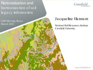
- 1. Rationalization and ha rmoniza tion of soil lega cy informa tion GSP Meeting Rome Ma rch 2012 Ja cqueline Ha nna m Na tiona l Soil Resources Institute Cra nfield University
- 2. Rationalization and harmonization of soil legacy data Digital soil assessment for class and property information (Thomas Mayr) Soil information systems meeting stakeholder requirements (Steve Hallett)
- 3. Overview • Legacy data issues • Rationalization process: collation, catalogue, capture • Rationalization process: extraction and translation • Links to DSA and information systems
- 4. Legacy data: primary issues Positives • Field observation – huge investment • Many surveys were conducted for resource assessment • Spatial and non-spatial data • Provides training data for DSA from SCORPAN covariates Negatives • Class and property data not standardised • Information is often just descriptive • Changes in scale between surveys • Not in digital format (from the analogue era..) • Original survey potentially not appropriate for new applications
- 5. Rationalization a nd ha rmoniza tion of soil lega cy informa tion Collation, curation and archive Catalogue and Index Digital capture Information extraction Transformation and rationalisation Resource integration Stage 1 Stage 2 Stage 3 Stage 4 Stage 5 Stage 6
- 6. Data collation, archive a nd ca ta logue WOSSAC 22,446 catalogued holdings, 293 territories worldwide www.wossac.com Dedicated soils resource at Cranfield University, UK
- 7. Sudan Data capture Ireland Scanning WOSSAC resources Tanzania Scanning and georeferencing INSPIRE compliance Spatial data capture and soil profile attributes
- 8. Rationalization a nd ha rmoniza tion of soil lega cy informa tion Collation, curation and archive Catalogue and Index Digital capture Information extraction Transformation and rationalisation Resource integration Stage 1 Stage 2 Stage 3 Stage 4 Stage 5 Stage 6
- 10. Suitability? Sri Lanka, 1946 (after Joachim) Haiti, 1969 (FAO)
- 11. Identify soil information requirement Suitability ? no yes Develop rationalisation framework [taxonomic / property / function] Mis-match in data sources? Rationalization not possible Soil information rationalized to common framework meeting initial requirements no Fit legacy information to framework [rules / expert judgement / auxiliary data] yes Harmonization process [correlation tools] Some examples…..
- 12. What and where are the potential soil effects on IED detection systems? Suitability ? yes Pedotransfer rules for soil properties and detector function Soil information presented as potential soil effects on detection systems Rationalization of soil, stratigraphic and physiographic information Mis-match in data sources? no User requires simple output for strategic level assessment
- 13. Pias, 1979
- 14. Rationalization process Translation Pedological interpretation Pedologic-physiographic- stratigraphic relationships Pedotransfer rules for detector effects Re-attribute and correct line work Spatial and non-spatial information of soil response to detector systems
- 15. AFG soil function mapping • Upscaling to account for differences in source data • Class and property data to function mapping • Legend and scale appropriate to end- users requirements
- 16. National soil map and information system to meet national and European legislative requirementss Suitability ? yes Develop a revised soil classification system for Republic of Ireland Mis-match in data sources? yes Harmonization process between environmental data sources Legacy soil information rationalized to common framework – mapping and non-spatial data Legacy mapping and monographs Fit legacy information to classification framework, generalise mapping to 1:250k [rules / expert judgement / auxiliary data] no
- 17. Ireland Original legacy data • Different class attributes • Different mapping scales • No cross border harmonization • Rationalized soil information to revised classification • Harmonization of attribute data • Linework generalized to common scale (1:250k) • Border harmonization Rationalized and harmonized legacy data
- 18. National soil map and information system to meet national and European legislative objectives Suitability ? yes Develop a revised soil classification system for Republic of Ireland Mis-match in data sources? yes Harmonization process between environmental data sources Legacy soil information rationalized to common framework – mapping and non-spatial data Legacy mapping and monographs Fit legacy information to classification framework, generalise mapping to 1:250k [rules / expert judgement / auxiliary data] no Spatial and non-spatial data in soil information system Training data for DSM including upscaled soilscapes for model stratificationFieldwork and evaluation
- 19. Summa ry • Rationalization and interpretation unlocks the potential of soil legacy data • Vector, point, class and property output • Spin-offs: revised ‘classification’ systems, soilscapes, pedotransfer rules • Provides training data platform for DSM • Issues with reconciling the initial aim of the legacy survey with the new application