1. Effect of Aspect on Soil Composition in a
North-South Transect of the Lower Boise Foothills
Evan Norman - Boise State University - GEOS 451 - Principles of Soil Science
Future Work:
• In a larger watershed area, clay and gravel percentages may show
stronger trends from the connectivity of higher subsurface flow from
precipitation events and melting.
• Samples taken at shallow depths aimed to remove the interference
of organic matter with measurements of sands, silts, clays and
gravels. With more horizon samples, characterizations of soil
thickness with changes in gravel and texture with distance from
ridgeline could be determined.
• There are many factors affecting field estimates of textural classes
that without experience overestimate sands, silt, or clay. With a
hydrometer particle size analysis completed in a controlled
laboratory setting for this project, human induced error is reduced.
References:
Lower Weather. (2015). Retrieved April 18, 2015, from
http://earth.boisestate.edu/drycreek/data/lower-weather/
Web Soil Survey. (2013). Retrieved April 18, 2015, from
http://websoilsurvey.sc.egov.usda.gov/App/HomePage.htm
Shervais, J.W., Gaurav Shroff, S.K. Vetter, Scott Matthews, B.B. Hanan, an J.J. McGee
(2002) Origin and evolution of the western Snake River Plain: Implications from stratigraphy,
faulting, and the geochemistry of basalts near Mountain Home, Idaho, in Bill Bonnichsen,
C.M. White, and Michael McCurry, eds., Tectonic and Magmatic Evolution of the Snake River
Plain Volcanic Province: Idaho Geological Survey Bulletin V. 30, p. 343-361.
Introduction:
Analysis of soil characteristics with changing aspect can be inferred by
exposure to sunlight, type of vegetation and slope. Further
understanding requires knowledge of pedology and biological,
chemistry, and physical processes. This study analyses how aspect and
hillslope position affect clay and gravel content in a semi-arid watershed
with elevation extremes of 1160 and 1091 meters respectively and 15.4
inches of average annual precipitation (Lower Weather, 2015). I
hypothesized increasing clay and decreasing gravel content on north
aspects, and decreasing clay and increasing gravel content on south
aspects as distance from ridgeline increased.
Methods:
• Along north and south aspects collect auger samples at depths of 15-
30 centimeters over intervals of approximately 35 feet as shown in
Fig. 2, with an AMS soil auger.
• Identify soil class through field textures noting approximate average
clay content and range of clay content per texture found.
• Determine gravel content with #10 soil sieve and the weight ratio of
particles>2mm and total sample collected. Results:
• South slopes show no trend in in clay percentages but have an increased
gravel percentage (>35%) for the latter half transect. (Fig. 3)
• North aspects have a positive correlation, R2=.873 for increasing clay content
with distance from ridgeline, but no trend in gravel content. (Fig. 4)
• Cumulative average for south slopes have 16% greater gravel content by
weight than north slopes. (Fig. 5)
• NRCS and field textures yield 9% higher average composition of clay on
north slopes compared to south slopes with field textures overestimating
published clay compositions by 2%. (Fig. 6)
Discussions and Conclusions:
• Increased moisture content in north facing slopes over south facing
slopes after a drying period, may have led to an overestimation of
clay content during textures analysis.
• Insolation plays an important role in soil moisture and available
water supply. Less exposure on north slopes decreases
evaporation, increases translocation of nutrients through plant
activity and decreases soil particle sizes at shallow auger depths.
Greater solar radiation on south slopes helps explain though a
similar process why we have less plant growth and a higher gravel
percentage. These feedback loops are keys to explain changes in
clay and gravel between N/S aspects.
• Visual evidence of large boulders on the lower south aspect
indicate a parent material of the Idaho batholith while ridgeline
elevations show “lacustrine and deltaic sediments” evidence of a
Pleistocene Lake Idaho (Shervais et al., 2002). This shift in parent
material corresponds to a relatively high gravel content between
250 and 400 feet from the south ridgeline shown in Fig. 3.
Vegetation cover masked any evidence of this on the north aspect.
Contact: evannorman@u.boisestate.edu
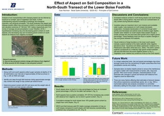
Figure 1: Study area location, north-northeast of downtown Boise.
Data:
0
10
20
30
40
50
60
0
10
20
30
40
50
60
70
0 50 100 150 200 250 300 350 400
WeightGravel(%)
Claycontent(%)
Distance from ridgeline (ft)
South Aspect Soil Characteristics 15-30 cm in depth
Clay
Content
Gravel
Content
y = 0.0864x + 9.3333
R² = 0.873
0
5
10
15
20
25
30
35
40
45
0
10
20
30
40
50
60
70
0 50 100 150 200 250 300 350 400
WeightGravel(%)
Claycontent(%)
Distance from ridgeline (ft)
North Aspect Soil Characteristics 15-30 cm in depth
Clay
Content
Gravel
Content
Linear
(Clay
Content)
36%
20%
0%
5%
10%
15%
20%
25%
30%
35%
40%
Average Percent Gravel Weight by Hillslope
Observed South Slope 15-30cm Observed North Slope 15-30cm
17%
26%
15%
24%
0%
5%
10%
15%
20%
25%
30%
35%
Average Percent Clay by Hillslope
Observed South Slope 15-30cm Observed North Slope 15-30cm
NRCS South Slope 0-30cm NRCS North Slope 0-30cm
Research questions:
A. How do clay and gravel contents change with distance from ridgeline?
B. What accounts for N/S changes in clay and gravel content?
Figure 3: Composition of south slopes with error bars for range of clay content for classified field textures.
Figure 4: Composition of north slopes with error bars for range of clay content for classified field textures.
Figure 5: North-south averaged gravel contents
from 12 auger samples on each hillslope.
Figure 6: North-south observed clay contents with
average range of percent clay from field textures
and published NRCS average clay content per
aspect (Web Soil Survey, 2013).
Figure 2: Auger transect locations from each north and south facing ridgeline in the
Lower Boise foothills.