
Recommended
Recommended
More Related Content
What's hot
What's hot (18)
Similar to Morphological Unit (1) (1)
Similar to Morphological Unit (1) (1) (20)
Morphological Unit (1) (1)
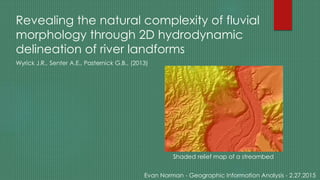
- 1. Revealing the natural complexity of fluvial morphology through 2D hydrodynamic delineation of river landforms Wyrick J.R., Senter A.E., Pasternick G.B., (2013) Evan Norman - Geographic Information Analysis - 2.27.2015 Shaded relief map of a streambed
- 2. What is a morphological unit (MU)? “Topographic forms within the river corridor that represent distinct form-process applications.” -Controlled by ecohydraulic variables -Near-census -In this study, applicable at lengths ~1-10 times W
- 3. How are MUs delineated? Hydraulics (water flow) + DEM and LiDAR data (Landforms) = MU
- 4. Why are MUs calculated? -Describes underlying landforms in a river with 2D modeling -Habitat assessments
- 5. -Subjectivity -Changing flow conditions -“Ideal” conditions -Increasing MU types -Overlap of zones -Flow direction Drawbacks
- 6. Example MU delineation procedure for a lowland gravel-cobble river -Spatial Analyst- Raster calculator -Irregular shapes -Precise -Thresholds are adjusted by discharge in model More about MU mapping..
- 7. Example MU delineation procedure for an upland cobble-boulder river
- 8. Conclusions: How do riffle-pool sequences correlate with discharge? How are MUs distributed? Lateral or longitudinal variability? Spatial scales. Riparian species.
Editor's Notes
- Ecohydraulic variables- depth, velocity, shear stress and substrate
- Subjectivity: vantage points, improper influences at times of measurement, visual qualitative observation of magnitudes of depth and velocity. Overlap of zones: Important to not base data off centroids and off corners to not have dominant river characteristics drown out the more subtle, important ones, densely pixelated areas. Flow direction: Assuming all flow is parallel to downhill slope, which it cannot be
- You need right hydraulics, discharge takes care of other ambiguities