
Recommended
More Related Content
What's hot
What's hot (18)
Similar to Eops 2016 06_27
Similar to Eops 2016 06_27 (19)
More from EOPS EOPS
More from EOPS EOPS (18)
Recently uploaded
Recently uploaded (20)
Eops 2016 06_27
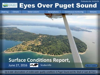
- 1. Surface Conditions Report, June 27, 2016 Eyes Over Puget Sound Field log Climate Water column Aerial photos Continuous monitoring Streams Publication No. 16-03-074 Up-to-date observations of visiblewater quality conditions in Puget Sound and the Strait of Juan de Fuca Start hereScuba info
- 2. Dr. Christopher Krembs (Editor) Personalimpressions p. 4 Media day kicks off the 2016 BEACH Programmonitoring season. Climateconditions p. 6 Air temperatures andsunlight are above normal. Precipitation is low andso are river flows. New: Underwater visibility was low. Watercolumn p. 7 Salinity is remarkably lower. Record-breakingwater temperatures occur anddissolvedoxygenis decreasing. At the Coast,upwellinghas coolingeffects. Aerialphotography p. 11 Jellyfishconfinedto EldandTottenInlets. Strongphytoplankton blooms in Budd, Carr, and HendersonInlets andaround Bainbridge Island. Abundant organic material coincides with phytoplanktonblooms. Noctiluca inunusual places. Continuous monitoring p. 30 Since May,temperatures are >15 °C. High phytoplankton biomass andlow river flows set the stage for anearly start of harmful algal blooms (HABs), parallelingthe year 2015. Streams p. 32 High June rainprovides a short-livedrespite for low river flows. Yet,snow pack-drivensystems are seeingsmall change in the north. LONG-TERMMARINEMONITORINGUNIT Skip Albertson Julia Bos Suzan Pool Editorial assistanceprovided by: Julianne Ruffner, Carol Maloy Marine conditionsfrom 6-27-2016at a glance Field log Climate Water column Aerial photos Continuous monitoring Streams Markus von Prause Debby Sargeant Julianne Ruffner I need a picture
- 3. Dany Burgess & Angela Eagleston Marine Sediment Monitoring Team Travisia pupa – The Pacific Stinkworm This month’s critter has a face (and smell) that only a mother could love. Meet the Stinkworm, an important member of Puget Sound’s benthic community. Fun StinkwormFacts! • Emits a foulrotting-garlic odor when disturbed • Functions as a bioturbator, turning over and aerating the sediment • Can be easily identified by the sizeof its vesicles (warts) Critter of the Month Personal Field Impression Field log Weather Water column Aerial photos Continuous monitoring Streams Eyes Under Puget Sound 6-27-2016 Field log Climate Water column Aerial photos Continuous monitoring Streams Learn more about the Stinkworm and othercritters on Ecology’s EcoConnect blog here.
- 4. Each year, between Memorial Day and Labor Day, the Washington State BEACH Programmonitors saltwater beaches for fecal bacteria to ensure that the water is safefor swimming and other recreational activities. 2016 Season Kick-Off! Media joined us to find out how people can stay healthy while playing at the beach and how to keep their favoritebeaches healthy. Follow us onFacebook andTwitter for beach water quality updates . We sample beaches weekly. If bacteria levels are high, we let the public know it isn’tsafe to swim.WSUBeach Watcher, Tim Ellis, demonstrates how we collect water samples for analysis. Is Your Beach Safe for Swimming this Summer? Video 1 Video 2 Personal Field Impression Field log Weather Water column Aerial photos Continuous monitoring Streams Personal Field Impression 6-27-2016 Field log Climate Water column Aerial photos Continuous monitoring Streams
- 5. This isa newfeatureandwearesolicitingfeedback (salb461@ecy.wa.gov). Eventuallywewill featurethemostrecentdata. good poor visibility Find depths with high and low visibility • Best visibility wasaround 20-30 feetor more. • Poor visibility occurred in many places of Puget Sound in the first10 feet of the surface. • In May, compared to April, visibility was lower due to the combined effect of phytoplankton and glacial flour fromrivers. • Many locations that reported 40-50 ft. of horizontalvisibility in April only reported 20-30 feet in May. • We usetransmissiometer readings fromour CTD packageand convertthem into horizontalvisibility. What is the visibility in the water for divers? Personal Field Impression Field log Weather Water column Aerial photos Continuous monitoring Streams The divers page, visibility 6-27-2016 Field log Climate Water column Aerial photos Continuous monitoring Streams
- 6. Field log Climate Water column Aerial photos Continuous monitoring Streams Natural Influence leadingto 6-27-2016 Climate and naturalinfluences,includingweather,rivers,and the adjacent ocean,canaffect our marine waters. Graphics are basedonprovisional data andare subject to change. http://www.ecy.wa.gov/programs/eap/mar_wat/weather.html,page 26. lowerhigher expected No data *UpwellingAnomalies(PFEL) ENSO = El Niño SouthernOscillation * Summary for May 2016: Air temperatures remain above normal in the Puget Sound lowlands. Precipitationlevels are below normal. Sunshine levels havebeen mostly above normal(low cloud cover) River flows aretrending downward. Upwelling is now above normal as are ENSO & PDO. El Niῆo trending downward.
- 7. We usea boatand a chartered float plane to access our monthly monitoring stations. We communicate data and environmental marine conditions using: 1. Marine Water Condition Index (MWCI) 2. Eyes OverPuget Sound (EOPS) 3. Anomaliesand sourcedata Field log Climate Water column Aerial photos Continuous monitoring Streams Ourlong-termmarinemonitoringstationsinWashington Starthere Isl. .
- 8. Field log Climate Water column Aerial photos Continuous monitoring Streams ArePugetSoundconditionsnormalizing? Year 2016 continues to have recordbreakingglobal temperatures. Inour region,the Fraser River has not been flowing as high as last year and now flows have plummeted. Estuarine circulationis important because water temperatures in Puget Sound are still warmer than what they should be andnow are breaking new records! The Fraser River is the largest freshwater source for the SalishSea,significantly affectingestuarine circulation. Inwinter andspring 2016, the Fraser River and other rivers dischargedprematurely. This year’s Fraser summer flow is extremely low in response to warmwinter temperatures and disappearing snowpack inBC. Very low summer flows inhibit the renewal of water inPuget Sound. Source: http://wateroffice.ec.gc.ca/index_e.html 0 2000 4000 6000 8000 10000 12000 Dec-13 Jan-14 Feb-14 Mar-14 Apr-14 May-14 Jun-14 Jul-14 Aug-14 Sep-14 Oct-14 Nov-14 Dec-14 Jan-15 Feb-15 Mar-15 Apr-15 May-15 Jun-15 Jul-15 Aug-15 Sep-15 Oct-15 Nov-15 Dec-15 Jan-16 Feb-16 Mar-16 Apr-16 May-16 Jun-16 Discharge(m3s-1) Higher than normal Lower than normal Expected Very low Fraser River flow this summer means stagnant water in the SalishSea and reducedexchange withthe coast. As a consequence,water warms andpollutionaccumulates. BC, Canada didn’t have much snow left by May 2016 Credit: Christopher Krembs http://bcrfc.env.gov.bc.ca/bulletins/watersupply/SnowIndexMap.htm See also NOAA
- 9. Physical conditionstracked in historicalcontext Field log Climate Water column Aerial photos Continuous monitoring Streams Explore profiles at all stations Still higher temperature in P. Sound Decreasing OxygenSalinity below normal A recordwarmspringbrought ample meltwater to Puget Sound. Salinity is remarkably lower. Record- breaking water temperatures alsoappear againinMay anddissolvedoxygenis decreasing. At the Coast, temperatures are expectedwhile salinity is higher and oxygenis lower,suggesting upwelling.
- 10. a) PacificDecadalOscillationIndex(PDO,temperature) (explanation) b) UpwellingIndex(anomalies)(Upwelling,low oxygen) (explanation) c) NorthPacificGyreOscillationIndex(NPGO, productivity) (explanation) Field log Climate Water column Aerial photos Continuous monitoring Streams Theoceanaffectswaterquality: OceanClimateIndices NPGO(x10) PDO/UpwellingIndex Three-year running average of PDO, Upwelling, and NPGO indices scores . Ocean boundaryconditions longterm variability: (a)water is still warm (PDO), (b) upwellingoflow oxygen and high nutrient ocean water are normal (UpwellingIndex anomaly),and (c) surface productivity alongthe coast is normalizing(NPGO). -25 -20 -15 -10 -5 0 5 10 15 20 25 -1.5 -1 -0.5 0 0.5 1 1.5 1945 1950 1955 1960 1965 1970 1975 1980 1985 1990 1995 2000 2005 2010 2015
- 11. Summary: Aerial photography6-27-2016 Jellyfish in high numbers confined to Eld and Totten Inlets. Strong phytoplankton blooms in Budd, Carr, and Henderson Inlets as well as east of Bainbridge Island and PortMadison. Abundantorganic material coincide with phytoplankton blooms except Henderson Inlet. Field log Climate Water column Aerial photos Continuous monitoring Streams Start here Mixing and Fronts: Tidal fronts in Budd Inlet, off PortMadison, Restoration Point, and Tacoma Narrows. Debris: Abundantorganic debris in Budd, Eld, and Carr Inlets, Oakland Bay, PortMadison, and east of Bainbridge Island. Noctiluca surfacing in unusualplaces (Oakland Bay, Budd Inlet, and Holmes Harbor). Visible blooms: Strong red-brown blooms in Budd and Eld Inlets. Strong green blooms in Henderson and Carr Inlets and Quartermaster Harbor. Green-brown blooms eastof Bainbridge Island. Jellyfish: Numerous jellyfish patches in Eld and Totten Inlets. BloomDebrisFront Suspendedsediment: A lot of suspended sediment fromthe Puyallup River. Little glacial flour in Nisqually Delta. Plume Front and two water masses.Tacoma Narrows. Front and two water masses.Carr Inlet(McNeil I.). Bloom Front
- 12. Strait of Juan de Fuca San Juan Islands Padilla Bay Main Basin Hood Canal South Sound Whidbey Basin Field log Climate Water column Aerial photos Continuous monitoring Streams Sunny,good visibility Flight Information: Aerial photography and navigation guide Flight route 9 3 2 8 Tide data (Seattle): Time Height(ft.) High/Low 05:22 AM 3.73 L 10:48 AM 7.93 H 04:46 PM 2.2 L 11:34 PM 12.02 H 6 10 11 14 4 1 Observation Maps: Central Sound South Sound 15 12 13 7 5
- 13. A. B. A. Red-brown bloom in narrow ribbons parallel to easternshore. B. Organic debris accumulating at surface. Location: A. Opposite Frye Cove State Park, B. Near Cooper Point,Eld Inlet (South Sound),12:51 PM. 1 Aerial photography 6-27-2016 Navigate Field log Climate Water column Aerial photos Continuous monitoring Streams boat boat Bloom Debris Bloom Bloom boat Debris
- 14. 2 NavigateAerial photography 6-27-2016 Field log Climate Water column Aerial photos Continuous monitoring Streams Organic material accumulating in large ribbons along tidal front at the entrance to Budd Inlet. Location: Across from Boston Harbor,Budd Inlet (South Sound),12:51 PM. boat Debris Debris Debris
- 15. Bloom boat jellyfish boat 3 NavigateAerial photography 6-27-2016 Red-brown bloom drifting in narrow ribbons parallel to easternshore. Location: Near Burfoot Park, Budd Inlet (South Sound),12:53 PM. Field log Climate Water column Aerial photos Continuous monitoring Streams Debris
- 16. 4 Navigate Field log Climate Water column Aerial photos Continuous monitoring Streams Aerial photography 6-27-2016 Red-brown bloom with intricate patterns. Location: South of Gull Harbor,Budd Inlet (South Sound),12:54 PM. Bloom Bloom Bloom boat boat
- 17. 5 NavigateAerial photography 6-27-2016 Field log Climate Water column Aerial photos Continuous monitoring Streams Large patches of jellyfishand organic debris. Location: Off Sunset Beach, Eld Inlet (South Sound),12:57 PM. Debris Debris jellyfishjellyfish jellyfish jellyfish jellyfish boat boat
- 18. Large patches of jellyfish,sediment-richriver plume,and red-brown bloom near easternshore. Location: Totten Inlet (South Sound),12:59 PM. 6 NavigateAerial photography 6-27-2016 Field log Climate Water column Aerial photos Continuous monitoring Streams Bloom jellyfish boat boat jellyfish jellyfish mussel rafts Plume
- 19. A. B. C. Patches of orange Noctiluca in unusual places. Location: A. Swantown Marine,Budd Inlet.B. Oakland Bay.C. Port Madison.(A.& B. South Sound.C. Central Sound). Pictureby Laura Hermanson on June 13th 7 NavigateAerial photography 6-27-2016 Field log Climate Water column Aerial photos Continuous monitoring Streams Noctiluca Noctiluca Noctiluca Debris Debris boat barge Bloom Bloom
- 20. A. B. C. A-C. Water rich in phytoplankton and B. organic material floating in large patches at the surface. Location: A. Forest Beach. B. Mayo Cove. C. Kopachuck Underwater Park (South Sound),1:15 PM. 8 NavigateAerial photography 6-27-2016 Field log Climate Water column Aerial photos Continuous monitoring Streams Debris Bloom Bloom boat Debris
- 21. A. B. A. Strong phytoplankton bloom. B. Large rafts of organic material of potentially spent Noctiluca at the surface in Port Madison. Location: Port Madison (Central Sound),1:32 PM. 9 NavigateAerial photography 6-27-2016 Field log Climate Water column Aerial photos Continuous monitoring Streams Debris Debris Bloom boat
- 22. 10 NavigateAerial photography 6-27-2016 Strong phytoplankton bloom and organic material rafts north of tidal front off RestorationPoint. Location: Decatur Reef, Bainbridge Island (Central Sound),1:38 PM. Field log Climate Water column Aerial photos Continuous monitoring Streams Bloom Debris boat Debris Debris
- 23. boat boat NavigateAerial photography 6-27-2016 Puyallup River plume rich in suspended sediment extendinginto Quartermaster Harbor. Internal waves. Location: Vashon Island (Central Sound),1:46 PM. Field log Climate Water column Aerial photos Continuous monitoring Streams 11 Ship internal waves Plume
- 24. A. B. NavigateAerial photography 6-27-2016 Large differences in glacial river flows in June in A. Puyallup, a free-flowing system and B. Nisqually River, with dams. Location: A. Commencement Bay,B. Nisquallydelta(Centraland South Sound),1:58 PM. Field log Climate Water column Aerial photos Continuous monitoring Streams 12 boat boat Plume cloud shadow
- 25. NavigateAerial photography 6-27-2016 Small amounts of water with glacial flour (in contrast to Puyallup River) enteringthrough the Nisqually River. Location: Off Golf Course, DuPont (South Sound),1:57 PM. Field log Climate Water column Aerial photos Continuous monitoring Streams 13 Plume
- 26. NavigateAerial photography 6-27-2016 Organic debris and a small bloom. Location: Oro Bay,Anderson Island (SouthSound),1:57 PM. Field log Climate Water column Aerial photos Continuous monitoring Streams 14 Bloom boat Debris
- 27. NavigateAerial photography 6-27-2016 Very strong green bloom on the easternside of inlet.Location: Henderson Inlet (South Sound),2:01 PM. Field log Climate Water column Aerial photos Continuous monitoring Streams 15 Bloom boat
- 28. n.a. Hood Canal Central Sound Numbers on map refer to picture numbers for spatial reference Date: 6-27-2016 Qualitative aerial observer map during transit Navigate Numbers on map refer to picture numbers for spatial reference 11 12 10 Field log Climate Water column Aerial photos Continuous monitoring Streams 9 7
- 29. Date: 6-27-2016 Qualitative aerial observer map during transit Numbers on map refer to picture numbers for spatial reference Navigate South Sound Field log Climate Water column Aerial photos Continuous monitoring Streams 1 2 3 4 5 6 12 8 14 13 15
- 30. C. B.A. D. notinservice dry-dock maintenance notinservice dry-dock maintenance notinservice dry-dock maintenance notinservice dry-dock maintenance The Victoria Clipper IV carries sensorsin its sea chest. The sensorsallow us to plot overtime transects of: A. Temperature B. Chlorophyll C. Turbidity D. CDOM Over time,we see the dynamics of these variables in surface water betweenSeattle and Victoria,BC. Field log Climate Water column Aerial photos Continuous monitoring Streams Continuousmonitoring 6-27-2016 Summary of Victoria Clipper IVferry data: FromDecember throughMay,we observeda seasonal shift in water properties. Water temperatures are >15 °C since May. Highin situ fluorescence (anindicator of high phytoplanktonbiomass)andlow river flows set the stage for anearly start of harmful algal blooms (HABs), similar to the year 2015.
- 31. A. C. Victoria Olympic Peninsula Seattle Victoria Olympic Peninsula Seattle Victoria Olympic Peninsula Seattle Victoria Olympic Peninsula Seattle D. B. Figures show daily sensor data installedonthe ferry which measure near-surface water at 5-sec intervals while the Victoria Clipper IV transits between Seattle andVictoria,BC. A. Sea Surface Temperature: Water continues to warmto about 15 °C,mainly in eastern Puget Sound. Maximum temperature was 16 °C. B. Chlorophyll: Concentrations were high just off Kitsap Peninsula and east side of Whidbey Island. C. Turbidity: Turbidity increased, particularly just off Kitsap Peninsula. D. Colored Dissolved Organic Matter(CDOM): Particulates in the water remainedlow except off KitsapPeninsula. Field log Climate Water column Aerial photos Continuous monitoring Streams Continuousmonitoring 6-27-2016
- 32. WA CurrentStreamflow summaryfor 6/28/2016 USGS Site Location for river flows in Washington Jun-15 Jun-16 NOOKSACK RIVER AT FERNDALE new min better SF NOOKSACK RIVER AT SAXON BRIDGE new min better MF NOOKSACK RIVER NEAR DEMING new min better NF NOOKSACK RIVER BL CASCADE CREEK NR GLACIER new min better SAMISH RIVER NEAR BURLINGTON <20% unchanged SKAGIT RIVER NEAR MOUNT VERunchanged new min better BAKER RIVER AT HENRY THOMPSON BR AT CONCRETE <20% unchanged SAUK RIVER NEAR SAUK new min better CASCADE RIVER AT MARBLEMOUNT new min better PILCHUCK RIVER NEAR SNOHOMISH new min better SNOHOMISH RIVER NEAR MONROE new min better TOLT RIVER NEAR CARNATION new min better RAGING RIVER NEAR FALL CITY <20% unchanged SF SNOQUALMIE RIVER AB ALICE CREEK NEAR GARCIA new min better NF SNOQUALMIE RIVER NEAR SNOQUALMIE FALLS new min better MIDDLE FORK SNOQUALMIE RIVER NEAR TANNER new min better SULTAN RIVER BELOW POWERPLANT NEAR SULTAN <20% unchanged SKYKOMISH RIVER NEAR GOLD BAR new min better ISSAQUAH CREEK NEAR MOUTH NEAR ISSAQUAH <20% better CEDAR RIVER AT RENTON <50% better ROCK CREEK NEAR MAPLE VALLEY new min better GREEN RIVER NEAR AUBURN <50% better BIG SOOS CREEK ABOVE HATCHERY NEAR AUBURN <20% unchanged NEWAUKUM CREEK NEAR BLACK DIAMOND <20% unchanged Table showsriverflowsat selectedstations(alsosee map) in 2015 compared to historical valuesforthe same month (% of normal).Compared to 2015, June flowsin 2016 are higherin response to recentrain. Snow waterequivalents, however,remainlow. Recentrain, a short-term gainfor June Field log Climate Water column Aerial photos Continuous monitoring Streams River flows in the Puget Sound region haveincreased in June 2016 as compared to the June 2015 droughtyear. Flow levels at most Ecology and USGS stream monitoring sites are temporarily close to normal levels in responseto recent rain in western Washington. Snow water equivalents, however, are low, providing little water in dry months, particularly towards thenorth of the state. Markusvon Prause, Ecology Go to map
- 33. Recentrain, a short-term gainfor June Field log Climate Water column Aerial photos Continuous monitoring Streams Snow waterequivalentsinWashingtonState were verylow in 2015 whenWashington was declaredto be in a drought.High precipitationimprovedconditionsinwinter2015/16, yetrecord warm temperaturesinspring 2016 meltedthe snowpack quickly. In the North PugetSound and Central Columbiabasins, snow water equivalentsstill remainverylow thisyear, evenwhen compared to the 2015 drought inJune. In southernand eastern Washington, conditionsare lesssevere thanlast year. June 2015 June 2016
- 34. Accessmooring data: ftp://www.ecy.wa.gov/ea p/Mooring_Raw/Puget_S ound/ Continuous monitoring : Suzan.Pool@ecy.wa.gov Get data from Ecology’sMarine MonitoringPrograms Long–Term MonitoringNetwork Real–Time Sensor Network Accesscore monitoringdata: https://fortress.wa.gov/ec y/eap/marinewq/mwdata set.asp christopher.krembs@ecy.w a.gov Ecology’s long-termmarine monitoring stations Continuous track Field log Climate Water column Aerial photos Continuous monitoring Streams Riverand Stream WaterQuality Monitoring http://www.ecy.wa.gov/programs/eap/fw_riv /rv_main.html Discontinued (fundingcuts)
- 35. You may subscribe or unsubscribe to the Eyes Over Puget Sound email listservby going to: http://listserv.wa.gov/cgi-bin/wa?A0=ECOLOGY-EYES-OVER-PUGET-SOUND Many thanks to our business partners: Clipper Navigation,SwantownMarina,andKenmore Air. We are looking forfeedbackto improve ourproducts. Dr. ChristopherKrembs christopher.krembs@ecy.wa.gov Marine Monitoring Unit EnvironmentalAssessment Program WA Department of Ecology Field log Climate Water column Aerial photos Continuous monitoring Streams