SlideShare a Scribd company logo
1 of 45
GIS BASED URBAN TRANSPORTATION
SYSTEM FOR ALLAHABAD CITY
Presented
by
Dinesh Kumar Azad
M. Tech. (GIS & Remote Sensing)
Supervised
by
Dr. A. K. Singh
Professor,CED, MNNIT Allahabad
OUTLINE OF THESIS
 Introduction
 Literature Review
 Methodology
 Design and Creation of Database
 Analysis and Results
 Conclusions and Recommendations
1. INTRODUCTION
 The urban transportation systems are very complex in nature,
they combine different modes of transportation over a limited
space in high density areas with increasing transport demand.
 With variety of information needed in the field of
Transportation, Geographic Information Systems (GIS) is used
as a valuable tool for the representation and analysis of
transportation systems.
SCOPE OF GIS
 GIS combines a powerful visualization environment with a
strong analytic and modeling framework that is rooted in the
science of geography.
 This combination has resulted in a technology that is science-
based, trusted, and easily communicated across cultures, social
classes, languages, and disciplines.
 Transportation data encompasses a wide range of spatial data
entities that are fundamental to many Geographic Information
System and cartographic applications.
Cont…..
OBJECTIVES
 To survey the transportation systems existed in Allahabad.
 To prepare GIS database based on the basis of survey for Allahabad
transportation.
 To prepare maps showing existing routes and stops for the city using
GIS.
 To present components of transport systems in a GIS environment.
 To analyze transportation system exists using GIS software.
 To suggest for applying GIS for the systems having spatial informations.
Cont…..
2. LITERATURE REVIEW
 A GIS is, “An organized collection of computer hardware,
software, geographic data, and personnel designed to
efficiently capture, store, update, manipulate, analyze, and
display all forms of geographically referenced information.”
 GIS is a systematic integration of Computer Hardware,
Software and Spatial Data, for capturing, storing, displaying,
updating manipulating and analyzing, in order to solve
complex management problems.
THREE VIEWS OF A GIS
Cont…..
 A map is only one way you can work with geographic data in a GIS, and only one
type of product generated by a GIS.
 A GIS can provide a great deal more problem-solving capabilities than using a
simple mapping program or adding data.
 To support this vision, a GIS needs to support 3 views for working with geographic
information.
 The Geodatabase view : It is a spatial database containing datasets that
represent geographic information in terms of a generic GIS data model—features,
rasters, attributes, topologies, networks, and so forth. Fundamentally, a GIS is based
on a structured database that describes the world in geographic terms.
 The Geovisualisation view: A GIS is a set of intelligent maps and other views
that show features and feature relationships on the earth’s surface. Various map
views of the underlying geographic information can be constructed and used as
“windows into the geographic database” to support query, analysis, and editing of
geographic information.
 The Geoprocessing view: A GIS is a set of information transformation tools that
derive new information from existing datasets. These geoprocessing functions take
information from existing datasets, apply analytic functions, and write results into
new derived datasets.
Cont…..
TRANSPORTATION
 Transport or transportation is the movement of people and
goods from one location to another.
 Transport is performed by various modes, such as air, rail,
road, water, cable, pipeline and space.
 The field can be divided into infrastructure, vehicles, and
operations.
Cont…..
 Infrastructure consists of the fixed installations necessary for
transport, and may be roads, railways, airways, waterways,
canals and pipelines.
 Vehicles traveling on these networks include vehicles of
appropriate types such as automobiles, bicycles, buses, trains,
trucks people, helicopters, and aircraft.
 Operations deal with the way the vehicles are operated, and
the procedures set for this purpose including financing,
legalities and policies.
Cont…..
CLASSIFICATION OF ROADS
1. Expressway
1. Arterial Roads
2. Collector Roads
3. Access Roads
Cont…..
1. Expressway : Function of expressways is to cater for movement of heavy
volumes of motor traffic at high speeds.
They are generally signal free by providing with grade separation at
intersections. Parking, loading and unloading of goods and pedestrian
traffic are not permitted on these roads.
2. Arterial roadways: IT consist of Federal or State highways or heavily
traveled streets that carry high volume of regional or intercommunity
traffic.
Arterial roads form the basic framework of the transportation network of
the Village.
Ideally, local streets should have limited access to arterials and curb
parking on arterials should be avoided except where vehicular volumes are
light.
Cont…..
3. Collector Roads: A collector road is a low or moderate-capacity road
which is below a highway or arterial road level of service.
Collector roads tend to lead traffic from local roads or sections of
neighbourhoods to activity areas within communities, arterial roads or
(occasionally) directly to expressways or freeways.
4. Access Roads: Any street or narrow stretch of paved surface that leads
to a specific destination, such as a main highway is an access road.
In urban areas, access roads are frequently one-way roads when they exist
on both sides of a highway.
Cont…..
3. METHODOLOGY
Updated Digital Map
Study Area
System Requirement Analysis
Identification of Spatial and Non-spatial Data
Database Design
Database Creation
SOI Maps & Engineering Drawings Statistical Registry of Roads
Scanning, Image Registration &
Digitization
Different Layers of Digital
Maps such as Roads, Stops &
Ward Boundaries
Data Collection Sheets with
Updated Road Statistics
Field Survey & Information
Collection
Additional Digitization
Quality Checking of spatial Data
Integration in GIS Environment
Analysis
Result
Final Updated Digital Maps in
GIS Environment
Attribute Database in MS Office Excel
2003
Spatial Non-spatial
4. DESIGN AND CREATION OF DATABASE
Database design is divided into three major activities:
1. Conceptual Design: Conceptual design is the first step in database design where
the contents of the intended database are identified and described. This step is
intended to describe “what the GIS will do.”
Georeferencing of the
Maps
Creation of Shape Files
Digitization of Layers
Preparation of
Geodatabases
2. Logical Design: It is a detailed layout that fills in the conceptual design in
accordance with a specific data model. It deals with “how the GIS will be
implemented?”
Cont…..
Public Transport:
Taxi Routes
Bus Routes
City Roads:
Arterial Roads
Collector Roads
Access Roads Stands
Bus Stands
Taxi Stands
Intermediate Stops
Common Stands
National Roads:
National
Highways
State Highways
Geographical Information System
Spatial Data Maps
3. Physical Design: In this logical data model was represented in the schema. In this
final layout of each geographic dataset and independent table has been made.
GIS Database
Spatial (Map Layers) Database:
• Land
use/Ward/Parcels/zones
• Roads & Routes
• Place of Interests/ Bus/Taxi
Stands
Attribute Database:
• Habitations-Census
details,
Area, population, Social
data structure.
• Road Details- Class,
subclass,
road width and Condition
data
• Parcel –building
categories,
name etc
Raster and Vectorisation
of maps
Integration of Data
Map for Urban
Transportation of
Allahabad City
Cont…..
Database for the system has been created in two steps:
1. Assembling of the data
i. Spatial Data
ii. Non-spatial Data
2. Preparation of Data for Analysis
Database Creation
Cont…..
Spatial Data
Allahabad Guide Map_1989
Allahabad Guide Map 1989
Cont…..
Cont…..
Allahabad Ward Map
Cont…..
4
Allahabad Google Map
Allahabad Google Earth Map ( mossaiced )
Non-spatial Data
Cont…..
DATABASE PREPARATION
 Creation of Shape files in ArcCatlog
2. Creation of Layers in ArcMap ( Digitization of Layers)
Cont…..
0 2.5 5
1.25
Kilometers
±
Allahabd Roads 2009
Legend
Allahabad_Roads_2009
Road Layers
Cont…..
Alen Ganj
Cantonment Board
Jahagirabad
Mundera
University Area
Karaila Bag
Harwara
Dara Ganj
Kareli
Civil Area II
Phapha Mau
Quazi Pur
Sadiabad
Jaintipur
Salori
Shiv Kuti
Beni Ganj
Neem Sarai
Azad Square
Govindpur
Ram Bagh
0 2 4
1
Kilometers
±
Allahabad Wards
Allahabd Ward Map
Cont…..
0 3 6
1.5
Kilometers
±
Allhabad Land-used
Legend
Education
Entertainment
Government
Habitational
Health
Historical/Cultural/Archeological
Industrial
Other
Public_uses & Services
Traffic & Transportation
Vocational
Allahabd Land Used Map
3. Creation of Routes: A route is simply a linear feature with measures, which are
created from existing lines in ArcGIS. Route editing toolbar is used for this work.
Procedure is given as under.
1. On the Editor toolbar, click Start Editing from the Editor menu.
2. Click the Target Layer dropdown arrow and click a route layer.
3. Click the Edit tool on the Editor toolbar, move the mouse pointer over a line feature, and
click the feature. Press the Shift key and continue to click all the features which is to be
created as route.
4. Click the Make Route button on the Route Editing toolbar.
5. Click the Start Point button.
6. Move the mouse over the selected linear features and click the map when the start point is
where I want the route measures to start.
7. Click the option for how I want the route measure values to be obtained.
8. Adjust the Multiply measures by and Start measure values if necessary.
9. Click Make Route.
.
Cont…..
4. Creation of File Geodatabase: File geodabase is needed for large
storage of data. There are a lot of data used in my thesis, I required the
File geodatabase.
The steps creating the file geodatabase are as follows:
 Right-click the Thesis folder in the ArcCatalog tree.
 Point to New.
 Click File Geodatabase.
 ArcCatalog creates a new file geodatabase in the Project folder.
 Rename the new file geodatabase as “Allahabad” by right-clicking on the new
file geodatabase name and choosing rename.
Cont…..
5. ANALYSIS AND RESULTS
Road Network:
The road network characteristics vary through the city. The network can be
divided into three major areas– the Old City, Civil Lines, and the Rest of
the City.
The Old City has an irregular road network comprising of major roads. All
are linked with the Major Arterial Road, the Grand Trunk Road, which
passes through the heart of the city and interlinked with each other.
The secondary roads are narrower and congested in Atarsuiya and Malvia
Nagar. There is an absence of broad roads in the south of the GT road.
Cont…..
Old City Roads
There is a Major Arterial road network of Zero Road, Leader Road, Swami
Vivekanand Road, Netaji Subhash Chandra Road etc. in the north of the
GT road.
Cont…..
The Civil Lines area is a well planned in the form of gridiron
pattern interspersed with open park like spaces.
 Kasturba Gandhi Marg, Mahatma Gandhi Marg, Nawab Yusuf
Road, Lal Bahadur Shastri Marg, Sardar Patel Marg,
Purshottamdas Tandon Marg etc are main roads of Civil Line
area.
 Purshottamdas Tandon Marg is playing a very important role
like G.T.Road. National Highway 96 is also passing through
this area.
Cont…..
Cont…..
Civil Line Roads
The Rest of the City comprises of Mumfordganj and Phaphamau in the north,
Allapur in the east, Sulem Sarai in the west and Naini in the south. The road
network in these areas varies from 2 lanes to a single lane.
Excluding Allapur, each area has a Hihghway. Mumfordganj and Phaphamau are
having NH 96, Sulem sarai and Mundera are having NH 2, and Naini is having
NH 27.
Cont…..
Government Bus Terminals:
There are three bus terminals in Allahabad – Civil Lines, Leader Road and Zero
Road, which are operated by Uttar Pradesh State Road Transport Corporation
(UPSRTC) .
These terminals, provides services for inter-cities as well as local transportations.
UPSRTC has a fleet size of 450 buses for inter-city trips and 120 buses for local
trips.
Intercity Transportation:
The civil lines terminal provides connectivity to Gorakhpur, Varanasi, Lucknow,
Faizabad, Nepal etc. Leader Road terminal connects Allahabad to Delhi, Kanpur
and Uttaranchal. Zero road links Allahabad to Rewa and other parts of Madhya
Pradesh.
Cont…..
Local Transportation by UPSRTC
Leader Road bus terminal connects to Manauri, Mundera, Sulem Sarai,
Subedar Ganj, Bamrauli, Pura Mufti etc. through NH 2 and Phaphamau,
Teliarganj, Nawab Ganj, Mansurabad etc through NH 96.
Civil Line bus terminal provides connectivity to Jhusi, Hanuman Ganj,
Saidabad, etc through NH 2.
Zero Road terminal links to Naini, Mza road, Manda Road, Zigana etc through
NH 27.
Cont…..
There are 8 routes through which these buses are passed.
Cont…..
Private Bus Terminals
In absence of an efficient public transportation system in the city, it has to operate by
private buses which operates from different parts of the city.
There are 6 routes on which these buses are operated from 6 terminals.
Cont…..
Cont…..
Taxi Terminals
There are 14 defined routes (route no 1 to route no 14) on which these three
wheelers are moved.
These modes are operated from Rambagh, Civil line, Govindpur, Jhusi,
Allahabad Jn, Kutchehari, and Bai ka Bagh.
Route 1 and Route 3 changes roads in their up and down movement.
Cont…..
Cont…..
Cont…..
Parking
Allahabad has four major commercial areas namely Chowk (old city), Katra, Zero
Road and Civil Lines area. A parking analysis is performed for the roads lying in
these areas.
Cont…..
Civil Lines area has a wide street network .There is a provision for on-
street parking along the linear commercial areas on either side of the road.
In case of old city area there are no parking provisions. The vehicles are
parked on the carriageway resulting in traffic jams and congestion. There is
no proper demarcated cycle rickshaw stand, which occupies a significant
share in the public transport.
In Katra the situation is more complicated because of narrow streets. The
vehicles are parked on the streets resulting in frequent traffic jams. Absence
of footpath force the pedestrians to walk on the carriageway resulting in
conflict between pedestrians and vehicular traffic.
There is a large mix of motorized and non-motorized traffic in the Zero
road area which results in low average speeds of 5-25 km/ hr and delays.
Cycle rickshaws, two wheelers and cycles occupy major share in traffic in
the old city.
Cont…..
6. CONCLUSIONS AND RECOMMENDATIONS
Conclusions
1. GT road (NH-2) crosses the city. This leads to the unwanted entry of heavy
vehicles within the city and creates accident-prone area throughout the stretch.
This problem shall be partially eliminated by the completion of Allahabad bye-
pass by NHAI.
2. Bus terminals are located in the core city area. Which are leading to acute the
problem of traffic jams accidents, congestion and degradation of urban character.
3. Allahabad city has a complex road network and route systems. It has a well planed
route for taxies where as no planning is done for Buses.
4. PD Tondon Marg playes an important role like a GT road in the City.
Recommendations
1. GIS should be used not only to analyze the transportation systems but also must
be used to analyze the system which has the spatial information.
2. Maps used for the analysis should be in a proper scale so as to correct
information can be extracted. Large scale will be beneficial for this purpose.
3. All the work should be performed after creating a File geodatabase, because it
has larger storage capacity than Personal geodatabase.
Cont…..

More Related Content

What's hot

Spatial interpolation techniques
Spatial interpolation techniquesSpatial interpolation techniques
Spatial interpolation techniquesManisha Shrivastava
 
Geographical information system in transportation planning
Geographical information system in transportation planning Geographical information system in transportation planning
Geographical information system in transportation planning shayiqRashid
 
Introduction to ArcGIS
Introduction to ArcGISIntroduction to ArcGIS
Introduction to ArcGISKate Dougherty
 
Network Analysis in ArcGIS
Network Analysis in ArcGISNetwork Analysis in ArcGIS
Network Analysis in ArcGISJohn Reiser
 
Network analysis in gis , part 4 transportation networks
Network analysis in gis , part 4 transportation networksNetwork analysis in gis , part 4 transportation networks
Network analysis in gis , part 4 transportation networksDepartment of Applied Geology
 
Application of GIS in Transportation Planning
Application of GIS in Transportation Planning Application of GIS in Transportation Planning
Application of GIS in Transportation Planning shrikrishna kesharwani
 
Application of Remote Sensing & GIS in Disaster Management
Application of Remote Sensing & GIS in Disaster ManagementApplication of Remote Sensing & GIS in Disaster Management
Application of Remote Sensing & GIS in Disaster ManagementAjayPatro
 
land suitability under R.S and G.I.S
land suitability under R.S and G.I.Sland suitability under R.S and G.I.S
land suitability under R.S and G.I.Shena parveen
 
Geographic information system
Geographic information systemGeographic information system
Geographic information systemDhaval Jalalpara
 
Remote Sensing: Change Detection
Remote Sensing: Change DetectionRemote Sensing: Change Detection
Remote Sensing: Change DetectionKamlesh Kumar
 
Projections and coordinate system
Projections and coordinate systemProjections and coordinate system
Projections and coordinate systemMohsin Siddique
 
Scale of photograph (Aerial Photogrammetry)
Scale of photograph (Aerial Photogrammetry)Scale of photograph (Aerial Photogrammetry)
Scale of photograph (Aerial Photogrammetry)Mr Amol Ghogare
 
Lecture01: Introduction to Photogrammetry
Lecture01: Introduction to PhotogrammetryLecture01: Introduction to Photogrammetry
Lecture01: Introduction to PhotogrammetrySarhat Adam
 
Application of gis and remote sensing in modern transport system
Application of gis and remote sensing in modern transport systemApplication of gis and remote sensing in modern transport system
Application of gis and remote sensing in modern transport systemSabhapathy Civil
 
Flood risk mapping using GIS and remote sensing
Flood risk mapping using GIS and remote sensingFlood risk mapping using GIS and remote sensing
Flood risk mapping using GIS and remote sensingRohan Tuteja
 
Remote Sensing and GIS in Land Use / Land Cover Mapping
Remote Sensing and GIS in Land Use / Land Cover MappingRemote Sensing and GIS in Land Use / Land Cover Mapping
Remote Sensing and GIS in Land Use / Land Cover MappingVenkatKamal1
 

What's hot (20)

Gis Application
Gis ApplicationGis Application
Gis Application
 
georeference
georeferencegeoreference
georeference
 
Spatial interpolation techniques
Spatial interpolation techniquesSpatial interpolation techniques
Spatial interpolation techniques
 
Geographical information system in transportation planning
Geographical information system in transportation planning Geographical information system in transportation planning
Geographical information system in transportation planning
 
Introduction to ArcGIS
Introduction to ArcGISIntroduction to ArcGIS
Introduction to ArcGIS
 
Network Analysis in ArcGIS
Network Analysis in ArcGISNetwork Analysis in ArcGIS
Network Analysis in ArcGIS
 
Introduction to GIS
Introduction to GISIntroduction to GIS
Introduction to GIS
 
Network analysis in gis , part 4 transportation networks
Network analysis in gis , part 4 transportation networksNetwork analysis in gis , part 4 transportation networks
Network analysis in gis , part 4 transportation networks
 
Application of GIS in Transportation Planning
Application of GIS in Transportation Planning Application of GIS in Transportation Planning
Application of GIS in Transportation Planning
 
Application of Remote Sensing & GIS in Disaster Management
Application of Remote Sensing & GIS in Disaster ManagementApplication of Remote Sensing & GIS in Disaster Management
Application of Remote Sensing & GIS in Disaster Management
 
land suitability under R.S and G.I.S
land suitability under R.S and G.I.Sland suitability under R.S and G.I.S
land suitability under R.S and G.I.S
 
Geographic information system
Geographic information systemGeographic information system
Geographic information system
 
Remote Sensing: Change Detection
Remote Sensing: Change DetectionRemote Sensing: Change Detection
Remote Sensing: Change Detection
 
Projections and coordinate system
Projections and coordinate systemProjections and coordinate system
Projections and coordinate system
 
Scale of photograph (Aerial Photogrammetry)
Scale of photograph (Aerial Photogrammetry)Scale of photograph (Aerial Photogrammetry)
Scale of photograph (Aerial Photogrammetry)
 
Basics to gis concepts unit i
Basics to gis concepts unit iBasics to gis concepts unit i
Basics to gis concepts unit i
 
Lecture01: Introduction to Photogrammetry
Lecture01: Introduction to PhotogrammetryLecture01: Introduction to Photogrammetry
Lecture01: Introduction to Photogrammetry
 
Application of gis and remote sensing in modern transport system
Application of gis and remote sensing in modern transport systemApplication of gis and remote sensing in modern transport system
Application of gis and remote sensing in modern transport system
 
Flood risk mapping using GIS and remote sensing
Flood risk mapping using GIS and remote sensingFlood risk mapping using GIS and remote sensing
Flood risk mapping using GIS and remote sensing
 
Remote Sensing and GIS in Land Use / Land Cover Mapping
Remote Sensing and GIS in Land Use / Land Cover MappingRemote Sensing and GIS in Land Use / Land Cover Mapping
Remote Sensing and GIS in Land Use / Land Cover Mapping
 

Similar to Gis based urban transportation system

IRJET- Bus Route Optimization in Jyothi Engineering College using ARC- GIS
IRJET- Bus Route Optimization in Jyothi Engineering College using ARC- GISIRJET- Bus Route Optimization in Jyothi Engineering College using ARC- GIS
IRJET- Bus Route Optimization in Jyothi Engineering College using ARC- GISIRJET Journal
 
Introduction to gis and arc gis
Introduction to gis and arc gis Introduction to gis and arc gis
Introduction to gis and arc gis Saad Raja
 
GEOGRAPHIC INFORMATION SYSTEM.pptx
GEOGRAPHIC INFORMATION SYSTEM.pptxGEOGRAPHIC INFORMATION SYSTEM.pptx
GEOGRAPHIC INFORMATION SYSTEM.pptxFizaNaaz8
 
Intro of geographic info system
Intro of geographic info systemIntro of geographic info system
Intro of geographic info systemJanak Parmar
 
76201909
7620190976201909
76201909IJRAT
 
What is Geography Information Systems (GIS)
What is Geography Information Systems (GIS)What is Geography Information Systems (GIS)
What is Geography Information Systems (GIS)John Lanser
 
PREPARATION OF ROAD NETWORK FROM SATELLITE IMAGERY
PREPARATION OF ROAD NETWORK FROM SATELLITE IMAGERYPREPARATION OF ROAD NETWORK FROM SATELLITE IMAGERY
PREPARATION OF ROAD NETWORK FROM SATELLITE IMAGERYPhilson Philipose
 
Application Of Gis In Transportation Engineering
Application Of Gis In Transportation EngineeringApplication Of Gis In Transportation Engineering
Application Of Gis In Transportation EngineeringEmily Smith
 
Unique methods of GIS in Transportation
Unique methods of GIS in TransportationUnique methods of GIS in Transportation
Unique methods of GIS in TransportationAndrew Harrison
 

Similar to Gis based urban transportation system (20)

FINAL 31,12,10
FINAL 31,12,10FINAL 31,12,10
FINAL 31,12,10
 
IRJET- Bus Route Optimization in Jyothi Engineering College using ARC- GIS
IRJET- Bus Route Optimization in Jyothi Engineering College using ARC- GISIRJET- Bus Route Optimization in Jyothi Engineering College using ARC- GIS
IRJET- Bus Route Optimization in Jyothi Engineering College using ARC- GIS
 
Introduction to gis and arc gis
Introduction to gis and arc gis Introduction to gis and arc gis
Introduction to gis and arc gis
 
GEOGRAPHIC INFORMATION SYSTEM.pptx
GEOGRAPHIC INFORMATION SYSTEM.pptxGEOGRAPHIC INFORMATION SYSTEM.pptx
GEOGRAPHIC INFORMATION SYSTEM.pptx
 
Intro of geographic info system
Intro of geographic info systemIntro of geographic info system
Intro of geographic info system
 
O33070076
O33070076O33070076
O33070076
 
Ck32540542
Ck32540542Ck32540542
Ck32540542
 
Ck32540542
Ck32540542Ck32540542
Ck32540542
 
76201909
7620190976201909
76201909
 
What is Geography Information Systems (GIS)
What is Geography Information Systems (GIS)What is Geography Information Systems (GIS)
What is Geography Information Systems (GIS)
 
Modon GIS final draft
Modon GIS final draftModon GIS final draft
Modon GIS final draft
 
K012437080
K012437080K012437080
K012437080
 
625413IJSETR2860-47.pdf
625413IJSETR2860-47.pdf625413IJSETR2860-47.pdf
625413IJSETR2860-47.pdf
 
digital map
digital mapdigital map
digital map
 
PREPARATION OF ROAD NETWORK FROM SATELLITE IMAGERY
PREPARATION OF ROAD NETWORK FROM SATELLITE IMAGERYPREPARATION OF ROAD NETWORK FROM SATELLITE IMAGERY
PREPARATION OF ROAD NETWORK FROM SATELLITE IMAGERY
 
Mrp Intrim
Mrp IntrimMrp Intrim
Mrp Intrim
 
Application Of Gis In Transportation Engineering
Application Of Gis In Transportation EngineeringApplication Of Gis In Transportation Engineering
Application Of Gis In Transportation Engineering
 
Unique methods of GIS in Transportation
Unique methods of GIS in TransportationUnique methods of GIS in Transportation
Unique methods of GIS in Transportation
 
29
2929
29
 
GIS-t
GIS-tGIS-t
GIS-t
 

Recently uploaded

Install Stable Diffusion in windows machine
Install Stable Diffusion in windows machineInstall Stable Diffusion in windows machine
Install Stable Diffusion in windows machinePadma Pradeep
 
SQL Database Design For Developers at php[tek] 2024
SQL Database Design For Developers at php[tek] 2024SQL Database Design For Developers at php[tek] 2024
SQL Database Design For Developers at php[tek] 2024Scott Keck-Warren
 
08448380779 Call Girls In Friends Colony Women Seeking Men
08448380779 Call Girls In Friends Colony Women Seeking Men08448380779 Call Girls In Friends Colony Women Seeking Men
08448380779 Call Girls In Friends Colony Women Seeking MenDelhi Call girls
 
CloudStudio User manual (basic edition):
CloudStudio User manual (basic edition):CloudStudio User manual (basic edition):
CloudStudio User manual (basic edition):comworks
 
GenCyber Cyber Security Day Presentation
GenCyber Cyber Security Day PresentationGenCyber Cyber Security Day Presentation
GenCyber Cyber Security Day PresentationMichael W. Hawkins
 
Slack Application Development 101 Slides
Slack Application Development 101 SlidesSlack Application Development 101 Slides
Slack Application Development 101 Slidespraypatel2
 
Advanced Test Driven-Development @ php[tek] 2024
Advanced Test Driven-Development @ php[tek] 2024Advanced Test Driven-Development @ php[tek] 2024
Advanced Test Driven-Development @ php[tek] 2024Scott Keck-Warren
 
Pigging Solutions in Pet Food Manufacturing
Pigging Solutions in Pet Food ManufacturingPigging Solutions in Pet Food Manufacturing
Pigging Solutions in Pet Food ManufacturingPigging Solutions
 
Integration and Automation in Practice: CI/CD in Mule Integration and Automat...
Integration and Automation in Practice: CI/CD in Mule Integration and Automat...Integration and Automation in Practice: CI/CD in Mule Integration and Automat...
Integration and Automation in Practice: CI/CD in Mule Integration and Automat...Patryk Bandurski
 
My Hashitalk Indonesia April 2024 Presentation
My Hashitalk Indonesia April 2024 PresentationMy Hashitalk Indonesia April 2024 Presentation
My Hashitalk Indonesia April 2024 PresentationRidwan Fadjar
 
SIEMENS: RAPUNZEL – A Tale About Knowledge Graph
SIEMENS: RAPUNZEL – A Tale About Knowledge GraphSIEMENS: RAPUNZEL – A Tale About Knowledge Graph
SIEMENS: RAPUNZEL – A Tale About Knowledge GraphNeo4j
 
Beyond Boundaries: Leveraging No-Code Solutions for Industry Innovation
Beyond Boundaries: Leveraging No-Code Solutions for Industry InnovationBeyond Boundaries: Leveraging No-Code Solutions for Industry Innovation
Beyond Boundaries: Leveraging No-Code Solutions for Industry InnovationSafe Software
 
AI as an Interface for Commercial Buildings
AI as an Interface for Commercial BuildingsAI as an Interface for Commercial Buildings
AI as an Interface for Commercial BuildingsMemoori
 
Automating Business Process via MuleSoft Composer | Bangalore MuleSoft Meetup...
Automating Business Process via MuleSoft Composer | Bangalore MuleSoft Meetup...Automating Business Process via MuleSoft Composer | Bangalore MuleSoft Meetup...
Automating Business Process via MuleSoft Composer | Bangalore MuleSoft Meetup...shyamraj55
 
IAC 2024 - IA Fast Track to Search Focused AI Solutions
IAC 2024 - IA Fast Track to Search Focused AI SolutionsIAC 2024 - IA Fast Track to Search Focused AI Solutions
IAC 2024 - IA Fast Track to Search Focused AI SolutionsEnterprise Knowledge
 
08448380779 Call Girls In Civil Lines Women Seeking Men
08448380779 Call Girls In Civil Lines Women Seeking Men08448380779 Call Girls In Civil Lines Women Seeking Men
08448380779 Call Girls In Civil Lines Women Seeking MenDelhi Call girls
 
Enhancing Worker Digital Experience: A Hands-on Workshop for Partners
Enhancing Worker Digital Experience: A Hands-on Workshop for PartnersEnhancing Worker Digital Experience: A Hands-on Workshop for Partners
Enhancing Worker Digital Experience: A Hands-on Workshop for PartnersThousandEyes
 
Making_way_through_DLL_hollowing_inspite_of_CFG_by_Debjeet Banerjee.pptx
Making_way_through_DLL_hollowing_inspite_of_CFG_by_Debjeet Banerjee.pptxMaking_way_through_DLL_hollowing_inspite_of_CFG_by_Debjeet Banerjee.pptx
Making_way_through_DLL_hollowing_inspite_of_CFG_by_Debjeet Banerjee.pptxnull - The Open Security Community
 
Breaking the Kubernetes Kill Chain: Host Path Mount
Breaking the Kubernetes Kill Chain: Host Path MountBreaking the Kubernetes Kill Chain: Host Path Mount
Breaking the Kubernetes Kill Chain: Host Path MountPuma Security, LLC
 
Understanding the Laravel MVC Architecture
Understanding the Laravel MVC ArchitectureUnderstanding the Laravel MVC Architecture
Understanding the Laravel MVC ArchitecturePixlogix Infotech
 

Recently uploaded (20)

Install Stable Diffusion in windows machine
Install Stable Diffusion in windows machineInstall Stable Diffusion in windows machine
Install Stable Diffusion in windows machine
 
SQL Database Design For Developers at php[tek] 2024
SQL Database Design For Developers at php[tek] 2024SQL Database Design For Developers at php[tek] 2024
SQL Database Design For Developers at php[tek] 2024
 
08448380779 Call Girls In Friends Colony Women Seeking Men
08448380779 Call Girls In Friends Colony Women Seeking Men08448380779 Call Girls In Friends Colony Women Seeking Men
08448380779 Call Girls In Friends Colony Women Seeking Men
 
CloudStudio User manual (basic edition):
CloudStudio User manual (basic edition):CloudStudio User manual (basic edition):
CloudStudio User manual (basic edition):
 
GenCyber Cyber Security Day Presentation
GenCyber Cyber Security Day PresentationGenCyber Cyber Security Day Presentation
GenCyber Cyber Security Day Presentation
 
Slack Application Development 101 Slides
Slack Application Development 101 SlidesSlack Application Development 101 Slides
Slack Application Development 101 Slides
 
Advanced Test Driven-Development @ php[tek] 2024
Advanced Test Driven-Development @ php[tek] 2024Advanced Test Driven-Development @ php[tek] 2024
Advanced Test Driven-Development @ php[tek] 2024
 
Pigging Solutions in Pet Food Manufacturing
Pigging Solutions in Pet Food ManufacturingPigging Solutions in Pet Food Manufacturing
Pigging Solutions in Pet Food Manufacturing
 
Integration and Automation in Practice: CI/CD in Mule Integration and Automat...
Integration and Automation in Practice: CI/CD in Mule Integration and Automat...Integration and Automation in Practice: CI/CD in Mule Integration and Automat...
Integration and Automation in Practice: CI/CD in Mule Integration and Automat...
 
My Hashitalk Indonesia April 2024 Presentation
My Hashitalk Indonesia April 2024 PresentationMy Hashitalk Indonesia April 2024 Presentation
My Hashitalk Indonesia April 2024 Presentation
 
SIEMENS: RAPUNZEL – A Tale About Knowledge Graph
SIEMENS: RAPUNZEL – A Tale About Knowledge GraphSIEMENS: RAPUNZEL – A Tale About Knowledge Graph
SIEMENS: RAPUNZEL – A Tale About Knowledge Graph
 
Beyond Boundaries: Leveraging No-Code Solutions for Industry Innovation
Beyond Boundaries: Leveraging No-Code Solutions for Industry InnovationBeyond Boundaries: Leveraging No-Code Solutions for Industry Innovation
Beyond Boundaries: Leveraging No-Code Solutions for Industry Innovation
 
AI as an Interface for Commercial Buildings
AI as an Interface for Commercial BuildingsAI as an Interface for Commercial Buildings
AI as an Interface for Commercial Buildings
 
Automating Business Process via MuleSoft Composer | Bangalore MuleSoft Meetup...
Automating Business Process via MuleSoft Composer | Bangalore MuleSoft Meetup...Automating Business Process via MuleSoft Composer | Bangalore MuleSoft Meetup...
Automating Business Process via MuleSoft Composer | Bangalore MuleSoft Meetup...
 
IAC 2024 - IA Fast Track to Search Focused AI Solutions
IAC 2024 - IA Fast Track to Search Focused AI SolutionsIAC 2024 - IA Fast Track to Search Focused AI Solutions
IAC 2024 - IA Fast Track to Search Focused AI Solutions
 
08448380779 Call Girls In Civil Lines Women Seeking Men
08448380779 Call Girls In Civil Lines Women Seeking Men08448380779 Call Girls In Civil Lines Women Seeking Men
08448380779 Call Girls In Civil Lines Women Seeking Men
 
Enhancing Worker Digital Experience: A Hands-on Workshop for Partners
Enhancing Worker Digital Experience: A Hands-on Workshop for PartnersEnhancing Worker Digital Experience: A Hands-on Workshop for Partners
Enhancing Worker Digital Experience: A Hands-on Workshop for Partners
 
Making_way_through_DLL_hollowing_inspite_of_CFG_by_Debjeet Banerjee.pptx
Making_way_through_DLL_hollowing_inspite_of_CFG_by_Debjeet Banerjee.pptxMaking_way_through_DLL_hollowing_inspite_of_CFG_by_Debjeet Banerjee.pptx
Making_way_through_DLL_hollowing_inspite_of_CFG_by_Debjeet Banerjee.pptx
 
Breaking the Kubernetes Kill Chain: Host Path Mount
Breaking the Kubernetes Kill Chain: Host Path MountBreaking the Kubernetes Kill Chain: Host Path Mount
Breaking the Kubernetes Kill Chain: Host Path Mount
 
Understanding the Laravel MVC Architecture
Understanding the Laravel MVC ArchitectureUnderstanding the Laravel MVC Architecture
Understanding the Laravel MVC Architecture
 

Gis based urban transportation system

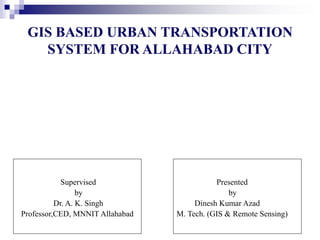
  • 1. GIS BASED URBAN TRANSPORTATION SYSTEM FOR ALLAHABAD CITY Presented by Dinesh Kumar Azad M. Tech. (GIS & Remote Sensing) Supervised by Dr. A. K. Singh Professor,CED, MNNIT Allahabad
  • 2. OUTLINE OF THESIS  Introduction  Literature Review  Methodology  Design and Creation of Database  Analysis and Results  Conclusions and Recommendations
  • 3. 1. INTRODUCTION  The urban transportation systems are very complex in nature, they combine different modes of transportation over a limited space in high density areas with increasing transport demand.  With variety of information needed in the field of Transportation, Geographic Information Systems (GIS) is used as a valuable tool for the representation and analysis of transportation systems.
  • 4. SCOPE OF GIS  GIS combines a powerful visualization environment with a strong analytic and modeling framework that is rooted in the science of geography.  This combination has resulted in a technology that is science- based, trusted, and easily communicated across cultures, social classes, languages, and disciplines.  Transportation data encompasses a wide range of spatial data entities that are fundamental to many Geographic Information System and cartographic applications. Cont…..
  • 5. OBJECTIVES  To survey the transportation systems existed in Allahabad.  To prepare GIS database based on the basis of survey for Allahabad transportation.  To prepare maps showing existing routes and stops for the city using GIS.  To present components of transport systems in a GIS environment.  To analyze transportation system exists using GIS software.  To suggest for applying GIS for the systems having spatial informations. Cont…..
  • 6. 2. LITERATURE REVIEW  A GIS is, “An organized collection of computer hardware, software, geographic data, and personnel designed to efficiently capture, store, update, manipulate, analyze, and display all forms of geographically referenced information.”  GIS is a systematic integration of Computer Hardware, Software and Spatial Data, for capturing, storing, displaying, updating manipulating and analyzing, in order to solve complex management problems.
  • 7. THREE VIEWS OF A GIS Cont…..  A map is only one way you can work with geographic data in a GIS, and only one type of product generated by a GIS.  A GIS can provide a great deal more problem-solving capabilities than using a simple mapping program or adding data.  To support this vision, a GIS needs to support 3 views for working with geographic information.
  • 8.  The Geodatabase view : It is a spatial database containing datasets that represent geographic information in terms of a generic GIS data model—features, rasters, attributes, topologies, networks, and so forth. Fundamentally, a GIS is based on a structured database that describes the world in geographic terms.  The Geovisualisation view: A GIS is a set of intelligent maps and other views that show features and feature relationships on the earth’s surface. Various map views of the underlying geographic information can be constructed and used as “windows into the geographic database” to support query, analysis, and editing of geographic information.  The Geoprocessing view: A GIS is a set of information transformation tools that derive new information from existing datasets. These geoprocessing functions take information from existing datasets, apply analytic functions, and write results into new derived datasets. Cont…..
  • 9. TRANSPORTATION  Transport or transportation is the movement of people and goods from one location to another.  Transport is performed by various modes, such as air, rail, road, water, cable, pipeline and space.  The field can be divided into infrastructure, vehicles, and operations. Cont…..
  • 10.  Infrastructure consists of the fixed installations necessary for transport, and may be roads, railways, airways, waterways, canals and pipelines.  Vehicles traveling on these networks include vehicles of appropriate types such as automobiles, bicycles, buses, trains, trucks people, helicopters, and aircraft.  Operations deal with the way the vehicles are operated, and the procedures set for this purpose including financing, legalities and policies. Cont…..
  • 11. CLASSIFICATION OF ROADS 1. Expressway 1. Arterial Roads 2. Collector Roads 3. Access Roads Cont…..
  • 12. 1. Expressway : Function of expressways is to cater for movement of heavy volumes of motor traffic at high speeds. They are generally signal free by providing with grade separation at intersections. Parking, loading and unloading of goods and pedestrian traffic are not permitted on these roads. 2. Arterial roadways: IT consist of Federal or State highways or heavily traveled streets that carry high volume of regional or intercommunity traffic. Arterial roads form the basic framework of the transportation network of the Village. Ideally, local streets should have limited access to arterials and curb parking on arterials should be avoided except where vehicular volumes are light. Cont…..
  • 13. 3. Collector Roads: A collector road is a low or moderate-capacity road which is below a highway or arterial road level of service. Collector roads tend to lead traffic from local roads or sections of neighbourhoods to activity areas within communities, arterial roads or (occasionally) directly to expressways or freeways. 4. Access Roads: Any street or narrow stretch of paved surface that leads to a specific destination, such as a main highway is an access road. In urban areas, access roads are frequently one-way roads when they exist on both sides of a highway. Cont…..
  • 14. 3. METHODOLOGY Updated Digital Map Study Area System Requirement Analysis Identification of Spatial and Non-spatial Data Database Design Database Creation SOI Maps & Engineering Drawings Statistical Registry of Roads Scanning, Image Registration & Digitization Different Layers of Digital Maps such as Roads, Stops & Ward Boundaries Data Collection Sheets with Updated Road Statistics Field Survey & Information Collection Additional Digitization Quality Checking of spatial Data Integration in GIS Environment Analysis Result Final Updated Digital Maps in GIS Environment Attribute Database in MS Office Excel 2003 Spatial Non-spatial
  • 15. 4. DESIGN AND CREATION OF DATABASE Database design is divided into three major activities: 1. Conceptual Design: Conceptual design is the first step in database design where the contents of the intended database are identified and described. This step is intended to describe “what the GIS will do.” Georeferencing of the Maps Creation of Shape Files Digitization of Layers Preparation of Geodatabases
  • 16. 2. Logical Design: It is a detailed layout that fills in the conceptual design in accordance with a specific data model. It deals with “how the GIS will be implemented?” Cont….. Public Transport: Taxi Routes Bus Routes City Roads: Arterial Roads Collector Roads Access Roads Stands Bus Stands Taxi Stands Intermediate Stops Common Stands National Roads: National Highways State Highways Geographical Information System Spatial Data Maps
  • 17. 3. Physical Design: In this logical data model was represented in the schema. In this final layout of each geographic dataset and independent table has been made. GIS Database Spatial (Map Layers) Database: • Land use/Ward/Parcels/zones • Roads & Routes • Place of Interests/ Bus/Taxi Stands Attribute Database: • Habitations-Census details, Area, population, Social data structure. • Road Details- Class, subclass, road width and Condition data • Parcel –building categories, name etc Raster and Vectorisation of maps Integration of Data Map for Urban Transportation of Allahabad City Cont…..
  • 18. Database for the system has been created in two steps: 1. Assembling of the data i. Spatial Data ii. Non-spatial Data 2. Preparation of Data for Analysis Database Creation Cont…..
  • 19. Spatial Data Allahabad Guide Map_1989 Allahabad Guide Map 1989 Cont…..
  • 21. Cont….. 4 Allahabad Google Map Allahabad Google Earth Map ( mossaiced )
  • 23. DATABASE PREPARATION  Creation of Shape files in ArcCatlog 2. Creation of Layers in ArcMap ( Digitization of Layers) Cont….. 0 2.5 5 1.25 Kilometers ± Allahabd Roads 2009 Legend Allahabad_Roads_2009 Road Layers
  • 24. Cont….. Alen Ganj Cantonment Board Jahagirabad Mundera University Area Karaila Bag Harwara Dara Ganj Kareli Civil Area II Phapha Mau Quazi Pur Sadiabad Jaintipur Salori Shiv Kuti Beni Ganj Neem Sarai Azad Square Govindpur Ram Bagh 0 2 4 1 Kilometers ± Allahabad Wards Allahabd Ward Map
  • 25. Cont….. 0 3 6 1.5 Kilometers ± Allhabad Land-used Legend Education Entertainment Government Habitational Health Historical/Cultural/Archeological Industrial Other Public_uses & Services Traffic & Transportation Vocational Allahabd Land Used Map
  • 26. 3. Creation of Routes: A route is simply a linear feature with measures, which are created from existing lines in ArcGIS. Route editing toolbar is used for this work. Procedure is given as under. 1. On the Editor toolbar, click Start Editing from the Editor menu. 2. Click the Target Layer dropdown arrow and click a route layer. 3. Click the Edit tool on the Editor toolbar, move the mouse pointer over a line feature, and click the feature. Press the Shift key and continue to click all the features which is to be created as route. 4. Click the Make Route button on the Route Editing toolbar. 5. Click the Start Point button. 6. Move the mouse over the selected linear features and click the map when the start point is where I want the route measures to start. 7. Click the option for how I want the route measure values to be obtained. 8. Adjust the Multiply measures by and Start measure values if necessary. 9. Click Make Route. . Cont…..
  • 27. 4. Creation of File Geodatabase: File geodabase is needed for large storage of data. There are a lot of data used in my thesis, I required the File geodatabase. The steps creating the file geodatabase are as follows:  Right-click the Thesis folder in the ArcCatalog tree.  Point to New.  Click File Geodatabase.  ArcCatalog creates a new file geodatabase in the Project folder.  Rename the new file geodatabase as “Allahabad” by right-clicking on the new file geodatabase name and choosing rename. Cont…..
  • 28. 5. ANALYSIS AND RESULTS Road Network: The road network characteristics vary through the city. The network can be divided into three major areas– the Old City, Civil Lines, and the Rest of the City. The Old City has an irregular road network comprising of major roads. All are linked with the Major Arterial Road, the Grand Trunk Road, which passes through the heart of the city and interlinked with each other. The secondary roads are narrower and congested in Atarsuiya and Malvia Nagar. There is an absence of broad roads in the south of the GT road.
  • 30. There is a Major Arterial road network of Zero Road, Leader Road, Swami Vivekanand Road, Netaji Subhash Chandra Road etc. in the north of the GT road. Cont…..
  • 31. The Civil Lines area is a well planned in the form of gridiron pattern interspersed with open park like spaces.  Kasturba Gandhi Marg, Mahatma Gandhi Marg, Nawab Yusuf Road, Lal Bahadur Shastri Marg, Sardar Patel Marg, Purshottamdas Tandon Marg etc are main roads of Civil Line area.  Purshottamdas Tandon Marg is playing a very important role like G.T.Road. National Highway 96 is also passing through this area. Cont…..
  • 33. The Rest of the City comprises of Mumfordganj and Phaphamau in the north, Allapur in the east, Sulem Sarai in the west and Naini in the south. The road network in these areas varies from 2 lanes to a single lane. Excluding Allapur, each area has a Hihghway. Mumfordganj and Phaphamau are having NH 96, Sulem sarai and Mundera are having NH 2, and Naini is having NH 27. Cont…..
  • 34. Government Bus Terminals: There are three bus terminals in Allahabad – Civil Lines, Leader Road and Zero Road, which are operated by Uttar Pradesh State Road Transport Corporation (UPSRTC) . These terminals, provides services for inter-cities as well as local transportations. UPSRTC has a fleet size of 450 buses for inter-city trips and 120 buses for local trips. Intercity Transportation: The civil lines terminal provides connectivity to Gorakhpur, Varanasi, Lucknow, Faizabad, Nepal etc. Leader Road terminal connects Allahabad to Delhi, Kanpur and Uttaranchal. Zero road links Allahabad to Rewa and other parts of Madhya Pradesh. Cont…..
  • 35. Local Transportation by UPSRTC Leader Road bus terminal connects to Manauri, Mundera, Sulem Sarai, Subedar Ganj, Bamrauli, Pura Mufti etc. through NH 2 and Phaphamau, Teliarganj, Nawab Ganj, Mansurabad etc through NH 96. Civil Line bus terminal provides connectivity to Jhusi, Hanuman Ganj, Saidabad, etc through NH 2. Zero Road terminal links to Naini, Mza road, Manda Road, Zigana etc through NH 27. Cont…..
  • 36. There are 8 routes through which these buses are passed. Cont…..
  • 37. Private Bus Terminals In absence of an efficient public transportation system in the city, it has to operate by private buses which operates from different parts of the city. There are 6 routes on which these buses are operated from 6 terminals. Cont…..
  • 39. Taxi Terminals There are 14 defined routes (route no 1 to route no 14) on which these three wheelers are moved. These modes are operated from Rambagh, Civil line, Govindpur, Jhusi, Allahabad Jn, Kutchehari, and Bai ka Bagh. Route 1 and Route 3 changes roads in their up and down movement. Cont…..
  • 42. Parking Allahabad has four major commercial areas namely Chowk (old city), Katra, Zero Road and Civil Lines area. A parking analysis is performed for the roads lying in these areas. Cont…..
  • 43. Civil Lines area has a wide street network .There is a provision for on- street parking along the linear commercial areas on either side of the road. In case of old city area there are no parking provisions. The vehicles are parked on the carriageway resulting in traffic jams and congestion. There is no proper demarcated cycle rickshaw stand, which occupies a significant share in the public transport. In Katra the situation is more complicated because of narrow streets. The vehicles are parked on the streets resulting in frequent traffic jams. Absence of footpath force the pedestrians to walk on the carriageway resulting in conflict between pedestrians and vehicular traffic. There is a large mix of motorized and non-motorized traffic in the Zero road area which results in low average speeds of 5-25 km/ hr and delays. Cycle rickshaws, two wheelers and cycles occupy major share in traffic in the old city. Cont…..
  • 44. 6. CONCLUSIONS AND RECOMMENDATIONS Conclusions 1. GT road (NH-2) crosses the city. This leads to the unwanted entry of heavy vehicles within the city and creates accident-prone area throughout the stretch. This problem shall be partially eliminated by the completion of Allahabad bye- pass by NHAI. 2. Bus terminals are located in the core city area. Which are leading to acute the problem of traffic jams accidents, congestion and degradation of urban character. 3. Allahabad city has a complex road network and route systems. It has a well planed route for taxies where as no planning is done for Buses. 4. PD Tondon Marg playes an important role like a GT road in the City.
  • 45. Recommendations 1. GIS should be used not only to analyze the transportation systems but also must be used to analyze the system which has the spatial information. 2. Maps used for the analysis should be in a proper scale so as to correct information can be extracted. Large scale will be beneficial for this purpose. 3. All the work should be performed after creating a File geodatabase, because it has larger storage capacity than Personal geodatabase. Cont…..