SlideShare a Scribd company logo
1 of 22
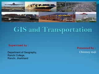
Presented by :
Chinmoy maji
Supervised by :
Department of Geography,
Ranchi College,
Ranchi, Jharkhand
Outline
Introduction: What is GIS-T?
Differences between GIS and other Systems
Unique Properties of Geographic Information
GIS Models Used in Transportation
Challenges for GIS-T
Conclusions
What is GIS-T
Geographic information systems for transportation (GIS-
T) are interconnected hardware, software, data, people,
organizations, and institutional arrangements for
collecting, storing, analyzing, and communicating
particular types of information about the Earth.
These particular types of information are transportation systems
and geographic regions.
What is GIS-T
GIS-T as the merger of an enhanced GIS and enhanced
transportation information system (TIS)
(Reference:Vonderhoe et al., 1993)
GIS TIS
GIS-T
Some applications:
infrastructure planning, design and management
traffic safety analysis
transportation impact analysis
public transit planning and operations
intelligent transportation systems (ITS)
 Advanced Traveller Information Systems (ATIS)
 Commercial Vehicle Operations (CVO)
 Incident Detection Management
Differences between GIS and other Systems
Multi-functionality
Geo-visualization capability
 makes GIS different from a usual database management
engine;
Analytical capability
 makes GIS different from an automated mapping application;
Database management features
 enables GIS to capture spatial and topological relationship
between geo-referenced entities if these relationships were not
pre-defined.
Differences between GIS and other Systems
The major difference between GIS and other database
management systems (DBMS) is mainly in the way
information is referenced rather than the nature of
information handled
 both systems may contain exactly the same information!
Road Map
Unique Properties of Geographic Information
Spatial dependency
The tendency for things closer in geographic space to
be more related
i.e., it is meaningful to record, organize and analyze
data by geographic location.
Spatial heterogeneity
The tendency of each location in geographic space to
show some degree of uniqueness
i.e., it is valuable to consider local geographic context
rather than just global generalities
GIS Models Used in Transportation
Field models of the continuous variation of a phenomenon over
space (e.g., land elevation)
 Discrete models, depending on which discrete entities (points, lines
or polygons) populate space (e.g., toll barriers, urbanized areas)
Network models to represent topologically-connected linear entities
(e.g., roads, rail lines) that are fixed in the continuous reference
surface
GIS Models Used in Transportation
All of these three models are useful in transportation
The network model built around the concept of arc and
node plays the key role in this application domain
because single- and multi-modal infrastructure networks
are vital in enabling and supporting passenger and
freight movement.
In fact, many transportation applications only require a
network model to represent data.
GIS Models Used in Transportation
The need for these and other extensions to the
base network model is not universal and is
dependent to the type of the project.
There are several data modelling, data
manipulation, and data analysis that were not
supported by conventional GIS and currently are
fulfilled by GIS-T software.
Challenges for GIS-T
Legacy data management system
Transportation agencies keep comprehensive inventories of the
transportation infrastructure, and its condition and usage by the
public.
Each TIS handles a single type of information (e.g., highway
planning network, pavement management system) with its own data
and its own hardware and software platform.
Shortcomings
 Data integration, i.e. to transfer disparate data into a unified data
management system.
Some of the options available
 generic relational data models, new dynamic segmentation data standards, and
object-oriented data models.
Challenges for GIS-T
Transportation data are maintained by different agencies and
private data providers
Each data source has its own data model
Accuracy across data sets is varied
Typical errors
 Data position, topology, naming and attributing
Shortcomings
 Algorithms for map matching
 Models of error and error spread in transportation data
 Data quality standards and data exchange standards
Typical applications
 Commercial Vehicle Operations (CVO)
 Advanced Traveller Information Systems (ATIS)
Challenges for GIS-T
Real-time GIS-T
Real-time traffic data is currently available in many areas
It can be a primary input of world-wide-web applications
However, it does not meet the needs of society when it comes to geo-
referenced data
Shortcomings
 Quicker access data models
 More powerful spatial data combination techniques
 More powerful dynamic routing algorithms
Challenges for GIS-T
Large data sets
Transportation problems are complex due to
 Large amounts of geo-referenced data
 Large networks
The complexity combines with difficulty to visualize information on
the single dimension of a network
Shortcomings
 pioneering system designs in order to optimizing
 speed and accuracy of the display of information
 the run time of algorithms and analytical tools of network analysis
Challenges for GIS-T
Distributed computing
Advances in Internet technology have made computing mobile,
distributed and widespread.
Internet GIS applications are currently accessible and common
 Real-time transit route and schedule information
 Traffic information
Shortcomings
 More powerful analytical tools to fit
 the limited distributed computing resources, and
 limited bandwidth on communication networks
 Novel design of system architectures to make efficient use of local and
remote computing resources
 Geo-referencing of remote service users and real-time tracking of their
movements
Conclusions
GIS-T provides the core technology for planning, deploying,
operating, and optimizing transportation systems.
It has opened up new horizons in transportation planning and
engineering.
It has developed an essential tool for the most effective use of spatial
data.
It provides a means of communication for an interactive
understanding between the public and transportation professionals.
Still, this technology is facing a lot of challenges to adjust itself with
the complexity of transportation data analyses.
Thank You!

More Related Content

What's hot

Bus Analytics Toolkit Demo
Bus Analytics Toolkit DemoBus Analytics Toolkit Demo
Bus Analytics Toolkit DemoYuwen Chang
 
Application of gis and remote sensing in modern transport system
Application of gis and remote sensing in modern transport systemApplication of gis and remote sensing in modern transport system
Application of gis and remote sensing in modern transport systemSabhapathy Civil
 
APISAT_Volkova_Comparison_Road_Extraction_Approaches_USYD
APISAT_Volkova_Comparison_Road_Extraction_Approaches_USYDAPISAT_Volkova_Comparison_Road_Extraction_Approaches_USYD
APISAT_Volkova_Comparison_Road_Extraction_Approaches_USYDAnastasiia Volkova
 
SC4 Workshop 1: Evangelos Mitsakis: Big data Sources for/from Intelligent Roa...
SC4 Workshop 1: Evangelos Mitsakis: Big data Sources for/from Intelligent Roa...SC4 Workshop 1: Evangelos Mitsakis: Big data Sources for/from Intelligent Roa...
SC4 Workshop 1: Evangelos Mitsakis: Big data Sources for/from Intelligent Roa...BigData_Europe
 
Big data Europe the transport pilot in Thessaloniki - Josep Maria Salanova
Big data Europe the transport pilot in Thessaloniki - Josep Maria SalanovaBig data Europe the transport pilot in Thessaloniki - Josep Maria Salanova
Big data Europe the transport pilot in Thessaloniki - Josep Maria SalanovaBigData_Europe
 
CK2017: Leveraging Open and Standardized Data for Land-Use and Transportation...
CK2017: Leveraging Open and Standardized Data for Land-Use and Transportation...CK2017: Leveraging Open and Standardized Data for Land-Use and Transportation...
CK2017: Leveraging Open and Standardized Data for Land-Use and Transportation...WRI Ross Center for Sustainable Cities
 
Data for Sustainable Mobility
Data for Sustainable MobilityData for Sustainable Mobility
Data for Sustainable MobilityMartin L
 
The role of open data in driving sustainable mobility in nine smart cities
The role of open data in driving sustainable mobility in nine smart citiesThe role of open data in driving sustainable mobility in nine smart cities
The role of open data in driving sustainable mobility in nine smart citiesPiyush Yadav
 
Big data analytics for transport
Big data analytics for transportBig data analytics for transport
Big data analytics for transportUKinItaly
 
Toward a Semantic Web of Vehicles
Toward a Semantic Web of VehiclesToward a Semantic Web of Vehicles
Toward a Semantic Web of VehiclesAmélie Gyrard
 
Technology and Big Data - Transforming Infrastructure Planning & Design - Pau...
Technology and Big Data - Transforming Infrastructure Planning & Design - Pau...Technology and Big Data - Transforming Infrastructure Planning & Design - Pau...
Technology and Big Data - Transforming Infrastructure Planning & Design - Pau...WRI Ross Center for Sustainable Cities
 
Visualizing Data with Geographic Information Systems (GIS)
Visualizing Data with Geographic Information Systems (GIS)Visualizing Data with Geographic Information Systems (GIS)
Visualizing Data with Geographic Information Systems (GIS)Kate Dougherty
 
FIWARE Global Summit - ROSY - Processing Dynamic Traffic Data
FIWARE Global Summit - ROSY - Processing Dynamic Traffic DataFIWARE Global Summit - ROSY - Processing Dynamic Traffic Data
FIWARE Global Summit - ROSY - Processing Dynamic Traffic DataFIWARE
 
Transport api smartertravel-2015 v2
Transport api smartertravel-2015 v2Transport api smartertravel-2015 v2
Transport api smartertravel-2015 v2Jonathan Raper
 
IRJET- An Overview on Indian its & Foreign its to Develop its in Nagpur City
IRJET- An Overview on Indian its & Foreign its to Develop its in Nagpur CityIRJET- An Overview on Indian its & Foreign its to Develop its in Nagpur City
IRJET- An Overview on Indian its & Foreign its to Develop its in Nagpur CityIRJET Journal
 

What's hot (20)

Bus Analytics Toolkit Demo
Bus Analytics Toolkit DemoBus Analytics Toolkit Demo
Bus Analytics Toolkit Demo
 
Application of gis and remote sensing in modern transport system
Application of gis and remote sensing in modern transport systemApplication of gis and remote sensing in modern transport system
Application of gis and remote sensing in modern transport system
 
Modon GIS final draft
Modon GIS final draftModon GIS final draft
Modon GIS final draft
 
APISAT_Volkova_Comparison_Road_Extraction_Approaches_USYD
APISAT_Volkova_Comparison_Road_Extraction_Approaches_USYDAPISAT_Volkova_Comparison_Road_Extraction_Approaches_USYD
APISAT_Volkova_Comparison_Road_Extraction_Approaches_USYD
 
CK2017: Unified Geospatial Centre to Manage Cities Better
CK2017: Unified Geospatial Centre to Manage Cities Better CK2017: Unified Geospatial Centre to Manage Cities Better
CK2017: Unified Geospatial Centre to Manage Cities Better
 
SC4 Workshop 1: Evangelos Mitsakis: Big data Sources for/from Intelligent Roa...
SC4 Workshop 1: Evangelos Mitsakis: Big data Sources for/from Intelligent Roa...SC4 Workshop 1: Evangelos Mitsakis: Big data Sources for/from Intelligent Roa...
SC4 Workshop 1: Evangelos Mitsakis: Big data Sources for/from Intelligent Roa...
 
Big data Europe the transport pilot in Thessaloniki - Josep Maria Salanova
Big data Europe the transport pilot in Thessaloniki - Josep Maria SalanovaBig data Europe the transport pilot in Thessaloniki - Josep Maria Salanova
Big data Europe the transport pilot in Thessaloniki - Josep Maria Salanova
 
5667
56675667
5667
 
CK2017: Leveraging Open and Standardized Data for Land-Use and Transportation...
CK2017: Leveraging Open and Standardized Data for Land-Use and Transportation...CK2017: Leveraging Open and Standardized Data for Land-Use and Transportation...
CK2017: Leveraging Open and Standardized Data for Land-Use and Transportation...
 
Data for Sustainable Mobility
Data for Sustainable MobilityData for Sustainable Mobility
Data for Sustainable Mobility
 
The role of open data in driving sustainable mobility in nine smart cities
The role of open data in driving sustainable mobility in nine smart citiesThe role of open data in driving sustainable mobility in nine smart cities
The role of open data in driving sustainable mobility in nine smart cities
 
Progress1013
Progress1013Progress1013
Progress1013
 
Big data analytics for transport
Big data analytics for transportBig data analytics for transport
Big data analytics for transport
 
Toward a Semantic Web of Vehicles
Toward a Semantic Web of VehiclesToward a Semantic Web of Vehicles
Toward a Semantic Web of Vehicles
 
Technology and Big Data - Transforming Infrastructure Planning & Design - Pau...
Technology and Big Data - Transforming Infrastructure Planning & Design - Pau...Technology and Big Data - Transforming Infrastructure Planning & Design - Pau...
Technology and Big Data - Transforming Infrastructure Planning & Design - Pau...
 
O33070076
O33070076O33070076
O33070076
 
Visualizing Data with Geographic Information Systems (GIS)
Visualizing Data with Geographic Information Systems (GIS)Visualizing Data with Geographic Information Systems (GIS)
Visualizing Data with Geographic Information Systems (GIS)
 
FIWARE Global Summit - ROSY - Processing Dynamic Traffic Data
FIWARE Global Summit - ROSY - Processing Dynamic Traffic DataFIWARE Global Summit - ROSY - Processing Dynamic Traffic Data
FIWARE Global Summit - ROSY - Processing Dynamic Traffic Data
 
Transport api smartertravel-2015 v2
Transport api smartertravel-2015 v2Transport api smartertravel-2015 v2
Transport api smartertravel-2015 v2
 
IRJET- An Overview on Indian its & Foreign its to Develop its in Nagpur City
IRJET- An Overview on Indian its & Foreign its to Develop its in Nagpur CityIRJET- An Overview on Indian its & Foreign its to Develop its in Nagpur City
IRJET- An Overview on Indian its & Foreign its to Develop its in Nagpur City
 

Similar to GIS-T Applications for Transportation Planning and Management

Geographical information system in transportation planning
Geographical information system in transportation planning Geographical information system in transportation planning
Geographical information system in transportation planning shayiqRashid
 
Application Of Gis In Transportation Engineering
Application Of Gis In Transportation EngineeringApplication Of Gis In Transportation Engineering
Application Of Gis In Transportation EngineeringEmily Smith
 
Integrated Intelligent Transportation Systems (ITS)
Integrated Intelligent Transportation Systems (ITS)Integrated Intelligent Transportation Systems (ITS)
Integrated Intelligent Transportation Systems (ITS)Babagana Sheriff
 
Application of GIS in Transportation Planning
Application of GIS in Transportation Planning Application of GIS in Transportation Planning
Application of GIS in Transportation Planning shrikrishna kesharwani
 
Urban Data Fusion
Urban Data Fusion Urban Data Fusion
Urban Data Fusion Umit Isikdag
 
What is GIS (PDF).pdf
What is GIS (PDF).pdfWhat is GIS (PDF).pdf
What is GIS (PDF).pdfKartikBhatt43
 
Intelligent Transport System
Intelligent Transport SystemIntelligent Transport System
Intelligent Transport SystemRajendra Naik
 
Density of route frequency for enforcement
Density of route frequency for enforcement Density of route frequency for enforcement
Density of route frequency for enforcement Conference Papers
 
Application of Big Data in Intelligent Traffic System
Application of Big Data in Intelligent Traffic SystemApplication of Big Data in Intelligent Traffic System
Application of Big Data in Intelligent Traffic SystemIOSR Journals
 
The development of a Geographic Information System for traffic route planni...
The development of a  Geographic  Information System for traffic route planni...The development of a  Geographic  Information System for traffic route planni...
The development of a Geographic Information System for traffic route planni...Matthew Pulis
 
Spatial Data Infrastructure (SDI) Is An Information...
Spatial Data Infrastructure (SDI) Is An Information...Spatial Data Infrastructure (SDI) Is An Information...
Spatial Data Infrastructure (SDI) Is An Information...Stacey Wilson
 
Standards Show
Standards ShowStandards Show
Standards Showmcusack
 
ITS development in Kajang city
ITS development in Kajang cityITS development in Kajang city
ITS development in Kajang cityengrasha
 

Similar to GIS-T Applications for Transportation Planning and Management (20)

Geographical information system in transportation planning
Geographical information system in transportation planning Geographical information system in transportation planning
Geographical information system in transportation planning
 
Ck32540542
Ck32540542Ck32540542
Ck32540542
 
Ck32540542
Ck32540542Ck32540542
Ck32540542
 
Application Of Gis In Transportation Engineering
Application Of Gis In Transportation EngineeringApplication Of Gis In Transportation Engineering
Application Of Gis In Transportation Engineering
 
Integrated Intelligent Transportation Systems (ITS)
Integrated Intelligent Transportation Systems (ITS)Integrated Intelligent Transportation Systems (ITS)
Integrated Intelligent Transportation Systems (ITS)
 
Application of GIS in Transportation Planning
Application of GIS in Transportation Planning Application of GIS in Transportation Planning
Application of GIS in Transportation Planning
 
C0848062312
C0848062312C0848062312
C0848062312
 
Urban Data Fusion
Urban Data Fusion Urban Data Fusion
Urban Data Fusion
 
What is GIS (PDF).pdf
What is GIS (PDF).pdfWhat is GIS (PDF).pdf
What is GIS (PDF).pdf
 
Intelligent Transport System
Intelligent Transport SystemIntelligent Transport System
Intelligent Transport System
 
Density of route frequency for enforcement
Density of route frequency for enforcement Density of route frequency for enforcement
Density of route frequency for enforcement
 
Gis in transportation
Gis in transportationGis in transportation
Gis in transportation
 
A017160104
A017160104A017160104
A017160104
 
Application of Big Data in Intelligent Traffic System
Application of Big Data in Intelligent Traffic SystemApplication of Big Data in Intelligent Traffic System
Application of Big Data in Intelligent Traffic System
 
The development of a Geographic Information System for traffic route planni...
The development of a  Geographic  Information System for traffic route planni...The development of a  Geographic  Information System for traffic route planni...
The development of a Geographic Information System for traffic route planni...
 
Spatial Data Infrastructure (SDI) Is An Information...
Spatial Data Infrastructure (SDI) Is An Information...Spatial Data Infrastructure (SDI) Is An Information...
Spatial Data Infrastructure (SDI) Is An Information...
 
Mrp Intrim
Mrp IntrimMrp Intrim
Mrp Intrim
 
Standards Show
Standards ShowStandards Show
Standards Show
 
ITS development in Kajang city
ITS development in Kajang cityITS development in Kajang city
ITS development in Kajang city
 
Adaboost Clustering In Defining Los Criteria of Mumbai City
Adaboost Clustering In Defining Los Criteria of Mumbai CityAdaboost Clustering In Defining Los Criteria of Mumbai City
Adaboost Clustering In Defining Los Criteria of Mumbai City
 

More from 9475618872

More from 9475618872 (6)

Forest
ForestForest
Forest
 
Water
WaterWater
Water
 
fractions and fractional
fractions and fractionalfractions and fractional
fractions and fractional
 
Khanij
KhanijKhanij
Khanij
 
Natural veg.
Natural veg.Natural veg.
Natural veg.
 
Soil
SoilSoil
Soil
 

Recently uploaded

Snow Chain-Integrated Tire for a Safe Drive on Winter Roads
Snow Chain-Integrated Tire for a Safe Drive on Winter RoadsSnow Chain-Integrated Tire for a Safe Drive on Winter Roads
Snow Chain-Integrated Tire for a Safe Drive on Winter RoadsHyundai Motor Group
 
Kotlin Multiplatform & Compose Multiplatform - Starter kit for pragmatics
Kotlin Multiplatform & Compose Multiplatform - Starter kit for pragmaticsKotlin Multiplatform & Compose Multiplatform - Starter kit for pragmatics
Kotlin Multiplatform & Compose Multiplatform - Starter kit for pragmaticscarlostorres15106
 
costume and set research powerpoint presentation
costume and set research powerpoint presentationcostume and set research powerpoint presentation
costume and set research powerpoint presentationphoebematthew05
 
SQL Database Design For Developers at php[tek] 2024
SQL Database Design For Developers at php[tek] 2024SQL Database Design For Developers at php[tek] 2024
SQL Database Design For Developers at php[tek] 2024Scott Keck-Warren
 
Scanning the Internet for External Cloud Exposures via SSL Certs
Scanning the Internet for External Cloud Exposures via SSL CertsScanning the Internet for External Cloud Exposures via SSL Certs
Scanning the Internet for External Cloud Exposures via SSL CertsRizwan Syed
 
Unlocking the Potential of the Cloud for IBM Power Systems
Unlocking the Potential of the Cloud for IBM Power SystemsUnlocking the Potential of the Cloud for IBM Power Systems
Unlocking the Potential of the Cloud for IBM Power SystemsPrecisely
 
Connect Wave/ connectwave Pitch Deck Presentation
Connect Wave/ connectwave Pitch Deck PresentationConnect Wave/ connectwave Pitch Deck Presentation
Connect Wave/ connectwave Pitch Deck PresentationSlibray Presentation
 
Unleash Your Potential - Namagunga Girls Coding Club
Unleash Your Potential - Namagunga Girls Coding ClubUnleash Your Potential - Namagunga Girls Coding Club
Unleash Your Potential - Namagunga Girls Coding ClubKalema Edgar
 
Pigging Solutions in Pet Food Manufacturing
Pigging Solutions in Pet Food ManufacturingPigging Solutions in Pet Food Manufacturing
Pigging Solutions in Pet Food ManufacturingPigging Solutions
 
Artificial intelligence in the post-deep learning era
Artificial intelligence in the post-deep learning eraArtificial intelligence in the post-deep learning era
Artificial intelligence in the post-deep learning eraDeakin University
 
Bun (KitWorks Team Study 노별마루 발표 2024.4.22)
Bun (KitWorks Team Study 노별마루 발표 2024.4.22)Bun (KitWorks Team Study 노별마루 발표 2024.4.22)
Bun (KitWorks Team Study 노별마루 발표 2024.4.22)Wonjun Hwang
 
Enhancing Worker Digital Experience: A Hands-on Workshop for Partners
Enhancing Worker Digital Experience: A Hands-on Workshop for PartnersEnhancing Worker Digital Experience: A Hands-on Workshop for Partners
Enhancing Worker Digital Experience: A Hands-on Workshop for PartnersThousandEyes
 
Streamlining Python Development: A Guide to a Modern Project Setup
Streamlining Python Development: A Guide to a Modern Project SetupStreamlining Python Development: A Guide to a Modern Project Setup
Streamlining Python Development: A Guide to a Modern Project SetupFlorian Wilhelm
 
Unblocking The Main Thread Solving ANRs and Frozen Frames
Unblocking The Main Thread Solving ANRs and Frozen FramesUnblocking The Main Thread Solving ANRs and Frozen Frames
Unblocking The Main Thread Solving ANRs and Frozen FramesSinan KOZAK
 
Key Features Of Token Development (1).pptx
Key  Features Of Token  Development (1).pptxKey  Features Of Token  Development (1).pptx
Key Features Of Token Development (1).pptxLBM Solutions
 
My Hashitalk Indonesia April 2024 Presentation
My Hashitalk Indonesia April 2024 PresentationMy Hashitalk Indonesia April 2024 Presentation
My Hashitalk Indonesia April 2024 PresentationRidwan Fadjar
 
New from BookNet Canada for 2024: BNC BiblioShare - Tech Forum 2024
New from BookNet Canada for 2024: BNC BiblioShare - Tech Forum 2024New from BookNet Canada for 2024: BNC BiblioShare - Tech Forum 2024
New from BookNet Canada for 2024: BNC BiblioShare - Tech Forum 2024BookNet Canada
 
Benefits Of Flutter Compared To Other Frameworks
Benefits Of Flutter Compared To Other FrameworksBenefits Of Flutter Compared To Other Frameworks
Benefits Of Flutter Compared To Other FrameworksSoftradix Technologies
 

Recently uploaded (20)

Snow Chain-Integrated Tire for a Safe Drive on Winter Roads
Snow Chain-Integrated Tire for a Safe Drive on Winter RoadsSnow Chain-Integrated Tire for a Safe Drive on Winter Roads
Snow Chain-Integrated Tire for a Safe Drive on Winter Roads
 
Kotlin Multiplatform & Compose Multiplatform - Starter kit for pragmatics
Kotlin Multiplatform & Compose Multiplatform - Starter kit for pragmaticsKotlin Multiplatform & Compose Multiplatform - Starter kit for pragmatics
Kotlin Multiplatform & Compose Multiplatform - Starter kit for pragmatics
 
costume and set research powerpoint presentation
costume and set research powerpoint presentationcostume and set research powerpoint presentation
costume and set research powerpoint presentation
 
SQL Database Design For Developers at php[tek] 2024
SQL Database Design For Developers at php[tek] 2024SQL Database Design For Developers at php[tek] 2024
SQL Database Design For Developers at php[tek] 2024
 
Scanning the Internet for External Cloud Exposures via SSL Certs
Scanning the Internet for External Cloud Exposures via SSL CertsScanning the Internet for External Cloud Exposures via SSL Certs
Scanning the Internet for External Cloud Exposures via SSL Certs
 
Unlocking the Potential of the Cloud for IBM Power Systems
Unlocking the Potential of the Cloud for IBM Power SystemsUnlocking the Potential of the Cloud for IBM Power Systems
Unlocking the Potential of the Cloud for IBM Power Systems
 
Connect Wave/ connectwave Pitch Deck Presentation
Connect Wave/ connectwave Pitch Deck PresentationConnect Wave/ connectwave Pitch Deck Presentation
Connect Wave/ connectwave Pitch Deck Presentation
 
Unleash Your Potential - Namagunga Girls Coding Club
Unleash Your Potential - Namagunga Girls Coding ClubUnleash Your Potential - Namagunga Girls Coding Club
Unleash Your Potential - Namagunga Girls Coding Club
 
Pigging Solutions in Pet Food Manufacturing
Pigging Solutions in Pet Food ManufacturingPigging Solutions in Pet Food Manufacturing
Pigging Solutions in Pet Food Manufacturing
 
DMCC Future of Trade Web3 - Special Edition
DMCC Future of Trade Web3 - Special EditionDMCC Future of Trade Web3 - Special Edition
DMCC Future of Trade Web3 - Special Edition
 
Artificial intelligence in the post-deep learning era
Artificial intelligence in the post-deep learning eraArtificial intelligence in the post-deep learning era
Artificial intelligence in the post-deep learning era
 
Bun (KitWorks Team Study 노별마루 발표 2024.4.22)
Bun (KitWorks Team Study 노별마루 발표 2024.4.22)Bun (KitWorks Team Study 노별마루 발표 2024.4.22)
Bun (KitWorks Team Study 노별마루 발표 2024.4.22)
 
Enhancing Worker Digital Experience: A Hands-on Workshop for Partners
Enhancing Worker Digital Experience: A Hands-on Workshop for PartnersEnhancing Worker Digital Experience: A Hands-on Workshop for Partners
Enhancing Worker Digital Experience: A Hands-on Workshop for Partners
 
Streamlining Python Development: A Guide to a Modern Project Setup
Streamlining Python Development: A Guide to a Modern Project SetupStreamlining Python Development: A Guide to a Modern Project Setup
Streamlining Python Development: A Guide to a Modern Project Setup
 
Unblocking The Main Thread Solving ANRs and Frozen Frames
Unblocking The Main Thread Solving ANRs and Frozen FramesUnblocking The Main Thread Solving ANRs and Frozen Frames
Unblocking The Main Thread Solving ANRs and Frozen Frames
 
Vulnerability_Management_GRC_by Sohang Sengupta.pptx
Vulnerability_Management_GRC_by Sohang Sengupta.pptxVulnerability_Management_GRC_by Sohang Sengupta.pptx
Vulnerability_Management_GRC_by Sohang Sengupta.pptx
 
Key Features Of Token Development (1).pptx
Key  Features Of Token  Development (1).pptxKey  Features Of Token  Development (1).pptx
Key Features Of Token Development (1).pptx
 
My Hashitalk Indonesia April 2024 Presentation
My Hashitalk Indonesia April 2024 PresentationMy Hashitalk Indonesia April 2024 Presentation
My Hashitalk Indonesia April 2024 Presentation
 
New from BookNet Canada for 2024: BNC BiblioShare - Tech Forum 2024
New from BookNet Canada for 2024: BNC BiblioShare - Tech Forum 2024New from BookNet Canada for 2024: BNC BiblioShare - Tech Forum 2024
New from BookNet Canada for 2024: BNC BiblioShare - Tech Forum 2024
 
Benefits Of Flutter Compared To Other Frameworks
Benefits Of Flutter Compared To Other FrameworksBenefits Of Flutter Compared To Other Frameworks
Benefits Of Flutter Compared To Other Frameworks
 

GIS-T Applications for Transportation Planning and Management

  • 1. Presented by : Chinmoy maji Supervised by : Department of Geography, Ranchi College, Ranchi, Jharkhand
  • 2.
  • 3. Outline Introduction: What is GIS-T? Differences between GIS and other Systems Unique Properties of Geographic Information GIS Models Used in Transportation Challenges for GIS-T Conclusions
  • 4. What is GIS-T Geographic information systems for transportation (GIS- T) are interconnected hardware, software, data, people, organizations, and institutional arrangements for collecting, storing, analyzing, and communicating particular types of information about the Earth. These particular types of information are transportation systems and geographic regions.
  • 5. What is GIS-T GIS-T as the merger of an enhanced GIS and enhanced transportation information system (TIS) (Reference:Vonderhoe et al., 1993) GIS TIS GIS-T
  • 6. Some applications: infrastructure planning, design and management traffic safety analysis transportation impact analysis public transit planning and operations intelligent transportation systems (ITS)  Advanced Traveller Information Systems (ATIS)  Commercial Vehicle Operations (CVO)  Incident Detection Management
  • 7.
  • 8. Differences between GIS and other Systems Multi-functionality Geo-visualization capability  makes GIS different from a usual database management engine; Analytical capability  makes GIS different from an automated mapping application; Database management features  enables GIS to capture spatial and topological relationship between geo-referenced entities if these relationships were not pre-defined.
  • 9. Differences between GIS and other Systems The major difference between GIS and other database management systems (DBMS) is mainly in the way information is referenced rather than the nature of information handled  both systems may contain exactly the same information!
  • 11.
  • 12. Unique Properties of Geographic Information Spatial dependency The tendency for things closer in geographic space to be more related i.e., it is meaningful to record, organize and analyze data by geographic location. Spatial heterogeneity The tendency of each location in geographic space to show some degree of uniqueness i.e., it is valuable to consider local geographic context rather than just global generalities
  • 13. GIS Models Used in Transportation Field models of the continuous variation of a phenomenon over space (e.g., land elevation)  Discrete models, depending on which discrete entities (points, lines or polygons) populate space (e.g., toll barriers, urbanized areas) Network models to represent topologically-connected linear entities (e.g., roads, rail lines) that are fixed in the continuous reference surface
  • 14. GIS Models Used in Transportation All of these three models are useful in transportation The network model built around the concept of arc and node plays the key role in this application domain because single- and multi-modal infrastructure networks are vital in enabling and supporting passenger and freight movement. In fact, many transportation applications only require a network model to represent data.
  • 15. GIS Models Used in Transportation The need for these and other extensions to the base network model is not universal and is dependent to the type of the project. There are several data modelling, data manipulation, and data analysis that were not supported by conventional GIS and currently are fulfilled by GIS-T software.
  • 16. Challenges for GIS-T Legacy data management system Transportation agencies keep comprehensive inventories of the transportation infrastructure, and its condition and usage by the public. Each TIS handles a single type of information (e.g., highway planning network, pavement management system) with its own data and its own hardware and software platform. Shortcomings  Data integration, i.e. to transfer disparate data into a unified data management system. Some of the options available  generic relational data models, new dynamic segmentation data standards, and object-oriented data models.
  • 17. Challenges for GIS-T Transportation data are maintained by different agencies and private data providers Each data source has its own data model Accuracy across data sets is varied Typical errors  Data position, topology, naming and attributing Shortcomings  Algorithms for map matching  Models of error and error spread in transportation data  Data quality standards and data exchange standards Typical applications  Commercial Vehicle Operations (CVO)  Advanced Traveller Information Systems (ATIS)
  • 18. Challenges for GIS-T Real-time GIS-T Real-time traffic data is currently available in many areas It can be a primary input of world-wide-web applications However, it does not meet the needs of society when it comes to geo- referenced data Shortcomings  Quicker access data models  More powerful spatial data combination techniques  More powerful dynamic routing algorithms
  • 19. Challenges for GIS-T Large data sets Transportation problems are complex due to  Large amounts of geo-referenced data  Large networks The complexity combines with difficulty to visualize information on the single dimension of a network Shortcomings  pioneering system designs in order to optimizing  speed and accuracy of the display of information  the run time of algorithms and analytical tools of network analysis
  • 20. Challenges for GIS-T Distributed computing Advances in Internet technology have made computing mobile, distributed and widespread. Internet GIS applications are currently accessible and common  Real-time transit route and schedule information  Traffic information Shortcomings  More powerful analytical tools to fit  the limited distributed computing resources, and  limited bandwidth on communication networks  Novel design of system architectures to make efficient use of local and remote computing resources  Geo-referencing of remote service users and real-time tracking of their movements
  • 21. Conclusions GIS-T provides the core technology for planning, deploying, operating, and optimizing transportation systems. It has opened up new horizons in transportation planning and engineering. It has developed an essential tool for the most effective use of spatial data. It provides a means of communication for an interactive understanding between the public and transportation professionals. Still, this technology is facing a lot of challenges to adjust itself with the complexity of transportation data analyses.