Daniel Alves, Using a GIS to reconstruct the 19th century Lisbon's parishes
•Download as PPT, PDF•
1 like•245 views

Presented at the XVIth international conference of the Association for History and Computing, Amsterdam, 2005.

Recommended
Recommended
More Related Content
Similar to Daniel Alves, Using a GIS to reconstruct the 19th century Lisbon's parishes
Similar to Daniel Alves, Using a GIS to reconstruct the 19th century Lisbon's parishes (20)
More from Universidade Nova de Lisboa
More from Universidade Nova de Lisboa (12)
Recently uploaded
Recently uploaded (20)
Daniel Alves, Using a GIS to reconstruct the 19th century Lisbon's parishes
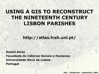
- 1. USING A GIS TO RECONSTRUCT THE NINETEENTH CENTURY LISBON PARISHES Daniel Alves Faculdade de Ciências Sociais e Humanas Universidade Nova de Lisboa Portugal AHC – Amsterdan – September, 2005 http://atlas.fcsh.unl.pt/
- 2. Introduction • Administrative reforms in Lisbon in XIXth and XXth century • Sources and methodology used on the work • Lisbon parishes in three distinct moments: 1826, 1864 e 1909
- 3. Administrative Reforms • First half of the XIXth century –Municipality with 70 parishes –Area close to 532 km2 • September 11, 1852 –Municipality with 34 parishes –Area close to 13 km2 –Urban limits only
- 4. Administrative Reforms • July 18, 1885 –Municipality with 44 parishes –Area close to 85km2 •July 22, 1886 –Municipality with 46 parishes • September 26, 1895 –Municipality with 44 parishes –Actual limits
- 5. Administrative Reforms • February 7, 1959 –New parishes were created –Significant changes in the limits of those that remained –Parishes with the limits we know today
- 6. Consequences • XIXth century: –Changes on municipality limits –Parishes’ limits were stable –Drawing the municipality limits presents no major problems
- 11. Consequences –Changes on parishes’ limits –No correspondence between the old and the new circumscriptions –Drawing the old parishes’ limits is a problematic task • XXth century:
- 12. 1885
- 13. 2005
- 14. Sources and Methodology • Sources: – Cartography of the XIXth century • Military Archive • National Library – Old guidebooks – Two digital charts (vectorial) • Portugal’s mainland parishes (1991) • Streets of Lisbon (1991)
- 15. •Identify the ancient streets that served as limits between parishes •Select the corresponding streets in the actual digital road map –Comparison between old and actual cartography Sources and Methodology • Methodology:
- 16. –Extensions •XTools and Geoprocessing Wizard –Drawing the polygons •Selected streets •Lines representing other limits not identify with actual streets Sources and Methodology • Methodology:
- 17. • Source: –Carta Topográfica da Cidade de Lisboa, e Bairro de Belém..., c.1820 –Military Archive • Parishes’ limits valid between 1780 and 1852 Lisbon in the first half of the XIXth century
- 20. • Source: –Frederico Perry Vidal, Planta da cidade de Lisboa contendo o aterro da Bôa Vista..., 1864 –National Library • Parishes’ limits valid between 1852 and 1885 Lisbon in mid XIXth century
- 23. • Source: –Caldeira Pires, Planta completa da cidade até ao limite da sua circunvalação, 1909. –National Library Lisbon by the end of the XIXth century • Parishes’ limits valid between 1885 and 1910
- 25. Thank you!