1. FACTSHEET
Piloting of Bay of Bengal depression and cyclone track and landfall projections
for enhanced warning accuracy and improved lead time for disaster risk
reduction in Nobo Jibon Program areas, Bangladesh
Meso-scale modeling using Weather
Research and Forecasting (WRF) model for
end-to-end early warning in Bangladesh
Enhancement of cyclone and hydro-
meteorological warning systems of the
Bangladesh Meteorological Department
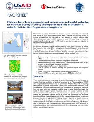
Pilot Unions: Noltona, Latachapli, Rangabali,
Char Kazal & Jaliapalong
Disaster risk reduction in coastal areas involves prevention, mitigation and prepared-
ness actions at local, national and regional levels. Effective early warning is vital to
disaster preparedness, and therefore is a key element in reducing disaster risks.
Communities at the coast should have access to timely risk-based early warning of all
coastal hazards, including heavy rainfall, cyclones and storm surge, and capacity to
respond to warning information.
In southern Bangladesh, USAID is supporting the “Nobo Jibon” program to reduce
food insecurity and vulnerability. Strengthening household capacity for cyclone and
flood preparedness is one of the program’s strategies to enhance livelihood security in
vulnerable communities. Current capacity in the early warning of and preparedness for
cyclone and associated coastal flooding, however, has the following gaps:
o Cyclone track prediction error is higher than the acceptable level of less than
100km
o Cyclone prediction remains subjective, using statistical methods
o Inadequate capability within the Bangladesh Meteorological Department (BMD)
in storm surge and coastal inundation forecasting
o Inadequate capability for warning dissemination
o Lack of capacity to translate warning into potential impacts and response
options
o Lack of cyclone risk maps on which to base evacuation mapping
o Absence of 24/7 emergency operations centers (EOCs) at union level
APPROACH
With recent advances in the science of cyclone forecasting, it is now possible to
monitor favorable conditions for cyclone formation, up to 7 days in advance. RIMES
shall integrate this information into its customized Weather Research Forecasting
(WRF) model to provide projections of cyclone track and landfall and associated surge
and rainfall at a horizontal resolution of 9km. These forecast information shall then
feed into storm surge and inundation model to generate water depth forecasts at the
coast. A decision-support system translates cyclone and coastal inundation forecast
information into an impact outlook to guide disaster managers in preparing response
options for minimizing potential losses in human life, livelihoods and property.
Experimental forecasts shall be generated for five coastal Unions under the Nobo Jibon
program, where their application in reducing disaster risks shall be tested. A cyclone
event within the project period would provide an opportunity to evaluate cyclone and
coastal inundation forecast accuracies, warning dissemination efficiency and effective-
ness of the decision and response systems at the demonstration sites. Outcomes of
the evaluation shall feed into the improvement of the forecasting and information
delivery and application systems.
2. For more information please contact:
A.R. Subbiah
Director, RIMES
subbiah@rimes.int
S.H.M. Fakhruddin
Team Leader- Hydrology
fakhruddin@rimes.int
GOAL AND OBJECTIVES
The project shall improve cyclone early warning and preparedness in Bangladesh by:
o Developing BMD capacity to forecast, up to 7 days in advance, cyclone for-
mation, track, and landfall, including associated surge and rainfall, with a 9km
resolution
o Enhancing BMD capacity in forecasting coastal inundation from surge and heavy
rainfall that are associated with cyclones
o Demonstrating the use of these experimental forecasts in reducing disaster
risks in Barisal Division in southern Bangladesh.
AREAS OF INTERVENTION
The project supports:
Technology development
o Continuous monitoring of depressions and cyclone formation at the Bay of
Bengal, including other severe weather events
o Customization of the Weather Research and Forecasting (WRF) meso-scale
model, combining risk thresholds and user requirements
o Establishment at BMD of 9km x 9km resolution cyclone tracking system using
WRF model
o Enhancement of storm surge forecasting using Japan Meteorological Agency’s
Medium Range Forecast (JMA-MRF) model
o Development of coastal inundation model that integrates GIS layers and storm
surge model outputs
o Development of risk-based decision-support system (DSS) for potential impact
assessment
Demonstration of technology application
o Demonstrations in 5 coastal unions for the application of risk-based warning
information in decision-making
Technology transfer and capacity building
o Capacity building of BMD on the use of models developed under the project
o Transfer of models to BMD
o Capacity building of national and local level institutions, including CPP volun-
teers and local NGOs to translate forecast information into impact outlooks
and menu of response options
o Capacity building of Save the Children staff and partner NGO, farmers, and
Upazila Disaster Management Committee members on forecast products for
weather, cyclone, storm surge, and coastal inundation, agro-meteorological
forecast products, DSS tool, and their application in planning and decision-
making, including data archiving and GIS-based risk mapping.
o Enhancement of observation system to increase data availability for forecasting
and warning
o Establishment of model EOC at union level
The Regional Integrated Multi-Hazard Early Warning System (RIMES) is an international and intergovernmental institution that is
owned and managed by its Member States for the generation and application of early warning information. RIMES interfaces with global cen-
ters of excellence to bring the best of science to the doorsteps of at-risk communities in 31 Member States and collaborating countries in
Africa and Asia. RIMES helps to build capacity of Member States in the observation and monitoring of seismic, tsunami, oceanic, meteorologi-
cal, hydrological, and climate phenomena, and in the communication of associated risks, for appropriate and timely responses to warnings.