
Recommended
More Related Content
What's hot
What's hot (20)
Similar to Pakistan's Geography and Its Modern Importance
Similar to Pakistan's Geography and Its Modern Importance (20)
More from Muhammad Asgar Hassan
Recently uploaded
Recently uploaded (20)
Pakistan's Geography and Its Modern Importance
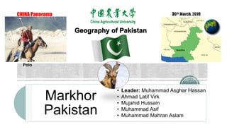
- 1. CHINA Panorama Markhor Pakistan • Leader: Muhammad Asghar Hassan • Ahmad Latif Virk • Mujahid Hussain • Muhammad Asif • Muhammad Mahran Aslam Polo
- 2. Over view Geography of Pakistan The Northern Highlands The Indus Plain Sistan Basis Traditional Geographical Importance of Pakistan Modern Geographical Importance of Pakistan Climate Agriculture Contents:
- 3. Over view Capital: Islamabad Borers: Afghanistan: 2,430 km (Durand Line) China: 523 km (Khunjerab Pass.) India: 2,912 km (Wagah Border) Iran: 909 km (Taftan border) Highest Point: K2 (8,611m) Lowest Point: Arabian Sea (0 m) Continent: Asia Religion: Islam (Islamic Republic of Pakistan) National Language: Urdu Population: 0.2 Billion (2017) Area: 796,096 square KM Provinces: Punjab, Sindh, K.P.K., Balochistan Administrative Regions: Gilgit Baltistan & Azad Kashmir Other Languages: Punjabi, Sindhi, Balochi, Pashto, Gilgiti, Phari and Balti.
- 4. Pakistan gained Independence on 14th August, 1947. China was Liberated on October 1st, 1949. In 1950, Pakistan was first amongst Muslim countries who recognized Peoples Republic of China in 1950, and started diplomatic relations in 1951, officially. INDEPENDENCE 4
- 7. Muhammad Ali Jinnah (Quaid e Azam) & Allama Muhammad Iqbal (Poet of East) National Heroes 7
- 9. Dr. Abdul Qadeer Khan (Nuclear Scientist) 9
- 10. Dr. Samar Mubarakmand (Nuclear Scientist) 10
- 11. Recently inducted as “Academician” of the Chinese Academy of Sciences (CAS), on 28th May, 2018. Prof. Atta Ur Rahman (FRS) 11
- 12. Nobel Prize Winner Nobel Prize in Physics (1979) 12
- 13. Nobel Prize Winner One child, one teacher, one book, and one pen can change the world. 13
- 14. Famous Personalities Edhi Foundation World’s largest volunteer ambulance network along with homeless shelters, animal shelters, and orphanages across Pakistan… Abdul Sattar Edhi (1928-2016) 14
- 15. Pakistan’s Culture: A Bird’s Eye View 15
- 16. Khewra Salt Mines, World’s oldest but 2nd largest, originated 800 million years ago 16
- 17. Minar e Pakistan: The National Monument 17
- 18. Badshahi Masjid: Mughal era mosque (1673) Interior of Mosque: Decorated with carved marble 18
- 19. Faisal Mosque (1976) Wadi e Hunza: A mountainous valley in Karakuram, bordered with Xinjian (China) 19
- 20. Kalash Valley: Indo-Aryan inhabited during 2nd century BC 20
- 22. GRAND THAR DESERT CHOLISTAN: GREAT INDIAN DESERT Darawar Fort (9th century) 22
- 24. 24
- 25. 25
- 26. 26
- 28. There are four main families of musical instruments in Pakistan and more than six hundred Pakistani musical instruments; the most well known are the sitar, tabla, rabab, dhool and bansuri. Pakistani Music 28
- 29. Main Geographical Features of Pakistan South Asia Geography of Pakistan The Northern Highlands The Indus Plain Deserts
- 30. The Junction Of The Three Mightiest Mountain Ranges Hindu Kush Pakistan and Afghanistan Highest point Tirich Mir (25,289 ft) Karakorum Range Pakistan, India, China borders Includes K2 Karakorum highway Connects Gilgit with Xinjiang Himalayas Pak, India, China, Nepal, Bhutan Indus river arise in the Himalayas. Mount Everest (Nepal and China) The Northern Highlands
- 31. Indus River The Indus Plain Indus River The Indus River, one of the great rivers of the world, rises in southwestern Tibet. It flows down through the Karakoram Mountains to enter the northern areas of Pakistan. Five Major Rivers Pakistan's major rivers the Indus, Jhelum, Chenab, Ravi, and Sutlej flow into it World largest irrigation network The world’s largest irrigation network are present in Pakistan.
- 32. Thal Desert Deserts Major Deserts in Pakistan The major deserts of Pakistan include Thar, Cholistan and Thall. Thar Desert Sind province: lies in the South east of Pakistan. Cholistan Desert Punjab: Bahawalpur. Thal Desert Punjab: located between the Jhelum and Sindh rivers near the Pothohar Plateau.
- 33. Pakistan’s North Western Border can be used as an access to the Central Asian Republics rich in natural resources. It’s a narrow strip of Afghan Territory between Tajikistan and Pakistan which if used as a transit route can benefit all the countries in trade. Pakistan’s South Western Border with Iran is of great significance in a trade with this oil-rich country. Eastern Border of Pakistan with India has been quite less utilized than the potential it carries. This can be a free trade route with India if the major conflicts between both the states are resolved. Northern Border of Pakistan with China provides another important route for access of Chinese products in Pakistan
- 34. Pakistan’s North Western Border Pakistan’s South Western Border Eastern Border of Pakistan Northern Border of Pakistan
- 35. China-Pakistan Economic Corridor The $46 billion ‘China-Pakistan Economic Corridor’ scheme, which is being demonstrated as a ‘Game-Changer’ is more than a network of roads to link Chinese city of Kashgar with the Gulf States via Gwadar of Pakistan.
- 36. The Persian Gulf and Pars Gas Field Pakistan’s Gwadar Port provides access to the ‘Gulf of Oman’ which extends via ‘Strait of Hormuz’ to form the ‘Persian Gulf’. This gulf is surrounded by Iran, UAE, Saudi Araba, Bahrain, Qatar, Kuwait and Iraq. Access to the Persian Gulf via Gwadar port means access to all these countries most of which are rich in energy resources.
- 37. Iran-Pakistan Gas Pipeline Also known as the ‘Peace Pipeline’ the project is another fruit of Pakistan’s geographic importance. The pipeline project was formally inaugurated in 2013, but it’s far from being operational due to several controversies.
- 38. North Eastren and North Westren Mountain Areas: Very High From Sea Level. Snow Fall During Winter Pleasant Weather During Summer 40 Inches Rain Per Year Plains of Sindh and Punjab: Climate Summer Very Hot Temp > 52 Degrees 30 Inches Rain Per Year Less Rain Dry Hot Summer Pleasant Weather Whole Year. 7 Inch Rain Per Year Baluchistan Pleatue Costal Areas
- 39. Agriculture in Pakistan Pakistan is well known country in sense of agriculture. Pakistan's principal natural resources are arable land and water. Pakistan's agriculture accounts for about 21% of GDP and employs about 43% of the labour force. In Pakistan, the most agricultural province is Punjab where wheat and cotton are the most grown. Mango orchards are mostly found in Sindh and Punjab provinces that make Pakistan the world's 4th largest producer of mangoes.
- 40. Major crops in Pakistan There are lot of minor and major and minor crops in Pakistan depending on 4 season but 7 following major crops in Pakistan are mentioned below. Wheat Rice Cotton Maize Sugarcane Barley Millet