
Recommended
More Related Content
Similar to Remote Sensing2.ppt
Similar to Remote Sensing2.ppt (20)
Recently uploaded
Recently uploaded (20)
Remote Sensing2.ppt
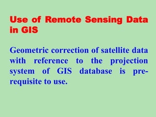
- 1. Use of Remote Sensing Data in GIS Geometric correction of satellite data with reference to the projection system of GIS database is pre- requisite to use.
- 2. 1. Use of Classified data Land cover map, vegetation maps or forest type maps... can be derived from remote sensing data through image processing techniques. These maps can be converted to the compatible formats of GIS system and can be overlaid onto other geographical data for spatial analyses and monitoring environmental changes.
- 4. 2. Use of Image data Remote sensing image can be classified or analyzed with other existing geographic information in order to obtain a higher accuracy of classification. Elevation map will be useful to discriminate mangrove and other kind of forests. Moreover, pine and hill evergreen forests can be separated by combining elevation map and image data.
- 5. 3. Satellite Orthophoto Maps (SOMs) By using the digital elevation model, and ground control points (GCPs), the aerial photos and satellite digital data (digital formats) can be orthorectified. These image map are called Orthophoto or Satellite Orthophoto maps (SOMs). The X,Y,Z distortions of original image data is corrected. These image map are used to overlay the political boundaries, roads and railways. Such an image map can be successfully used for visual interpretation. Digital elevation model is used with remote sensing data for shading corrections in mountainous areas can be made by dividing Cos q (where q is angle between sun light and the normal to the sloping surface).
- 6. 4.How we will move the RS data to GIS? Remote Sensing data is almost always processed and stored in raster data structures. When working simultaneously with an image processing system and a raster GIS, it is usually easy to move data between the two. Once the remote sensing data has been converted to a desired data type, transferring this data to a raster GIS is relatively easy. Most operational image processing and raster GIS systems provide mechanisms to read and write 8-bit-per pixel raster arrays.
- 7. 4. How we will move the RS data to GIS? More work is involved when transferring raster data derived from image processing system to a vector GIS. Continuos data such as vegetation abundance, involves extracting the contours of abundance (often call isolines), the vectors are passed to the GIS, along with labels to indicate values associated with the contour lines.
- 8. 4. How we will move the RS data to GIS? When working with discrete data such as land-use derived from image processing techniques, the pixels that form the boundaries of the areas are detected in order to isolate the implicit homogeneous polygons in the derived image. These are done by the skeletonization algorithms. Then the boundary pixels are used to develop the vectors surrounding the areas and attributes value and class name are assigned to the bounded areas. The analyst will often smooth the stair steps boundary between classes of spatial objects to make the vector plots appear more realistic. One should remember that the underlying data may have been irreversibly changed. It is important to understand that the conversion processes are limited by the underlying data, in terms of precision and accuracy.
- 61. NOAAAVHRR CH1 Red Band (0.58-0.68 micrometers)
- 62. NOAAAVHRR CH2 Near-Infrared Band (0.73 -1.10 micrometers)
- 63. NOAAAVHRR CH3 Intermediate Infrared Band (3.55 - 3.93 micrometers)
- 64. NOAAAVHRR CH4 Thermal Infrared Band (10.3 - 11.2 micrometers)
- 65. LANDSAT TM 432 1988 Oct 11
- 68. LANDSAT TM3 (0. 62-0.69)
- 70. LANDSAT TM5 (1.57 - 1.78)
- 71. LANDSAT TM6 (10.45 - 11.66)
- 72. LANDSAT TM7 (2.10 - 2.35)
- 73. TM321
- 74. TM532
- 75. 1984 Apr (MSS 431)
- 76. 1988 Oct (TM 432)
- 77. Murtiya forest, Sarlahi district, Nepal, 1978
- 78. Murtiya forest, Sarlahi district, Nepal, 1992
- 80. Aerial photograph of Nagarjun Kakani aera 1989 Scale 1:25000 (approx.)
- 81. Notice the mass-movement (19 Km landslide)
- 82. Aerial photograph of Nagarjun Kakani area 1992 Scale 1:50000 (approx.)
- 83. SPOT XS 224/294 right look 22 Oct 1986
- 84. SPOT XS 224/294 left look 12 Dec 1986
- 85. Geological Map of Central Nepal; DMG and UNDP; 1980