5. EL. 184.0 ft. EL. 239.0 ft. EL. 228.5 ft. EL. 238.9 ft. EL. 208.0 ft. EL. 201.6 ft. 30,905 AC - FT FLOOD CONTROL 2,498 AC - FT Joint FC and Water Supply Cross Over Weir Weir Separating East & West Pit EL. 188.0 ft. 31,742 AC - FT SPILLWAY SURCHARGE EL. 200.0 ft. Rio Hondo San Gabriel River Taking Line EL. 229.0 ft. 9 - 50’Wx29’H Spillway Gates 55 ft 4 - 30’Wx20H’ Outlet Gates 252 Acres 2,411 Acres 2,498 AC - FT 65,677 AC - FT EL. 213.5 ft. 532 AC - FT Joint FC and Water Supply Based on: WNSG - April 1978 Survey Data WNRH - August 1977 Survey Data EL. 220.15 ft. Parking Lot Ground Floor 3,622 Acres EL. 231.15 ft. Building Ground Floor 50 yr EL 221.8 100 yr EL 227.0 200 yr El 230.0 33,935 AC - FT Flood Basins or Something Else? EO 11988 – Floodplain Management?
11. Water Management Complications Storage in Thousand acre-feet Flood control reservation in thousand acre-feet (Negative values for use only with adjustment criteria). Rain Flood Snowmelt Flood Flood Control Diagram for: Friant Dam, Millerton Lake San Joaquin River, California Maximum Flood Control Reservation 390,000 ac-ft Precipitation Parameters 170,000 ac-ft
12. The Tulare Basin - A Typically Complex Basin FRI PNF TRM SCC ISB Buena Vista Lake Bed Mendota Pool Tulare Lakebed California Aqueduct San Joaquin R. Kings R. (8 kcfs) Kaweah R. Tule R. Kern R. Kern River Intertie (<1kcfs) Mammoth Pool (SCE) 123 kAF Wishon (PG&E) 123 kAF Courtright (PG&E) 128 kAF 390/520 kAF 1,637 sq.mi. 1,000kAF 1,545 sq.mi. 143 kAF 561 sq.mi. 82 kAF 391 sq.mi. 570 kAF 1,009 sq.mi. BDC 30/46 kAF 82 sq.mi. McKay’s Point Madera Canal (1kcfs) Friant-Kern Canal (4kcfs) Chowchilla Canal Eastside Bypass (5.5kcfs) (2.5 kcfs) (4.75 kcfs) (5.5 kcfs) (3.5 kcfs) (4.6 kcfs) (3.2 kcfs) Army Weir Crescent Weir St. John’s R. Cross Crk. 40 k 60-103 k San Joaquin R. Delta-Mendota Canal Porterville (10kcfs) Fresno (8 kcfs) Visalia Bakersfield (125y) (45y) (36y) (333y) Fresno Slough (25y) Cottonwood Crk Gould Canal Fresno Canal
13. Water Management Decisions for Balancing Impacts Associated Damages Release From Dam $ 2 M $ 400 K $ 100 K 10,000 cfs 3,000 cfs 1,000 cfs 2 ft Water Conservation
14. Glen Cyn Dam Hoover Dam Little Colorado River Clover Creek Mathews Cyn Dam Pine Cyn Dam Meadow Valley Wash ALMO DAM Bill Williams River Imperial Dam Salt River San Francisco River Stewart Mt. Dam Mormon Flat Dam Horse Mesa Dam Roosevelt Dam Tat Momolikot Dam Coolidge Dam Gila River Santa Cruz River San Pedro River PTRK DAM New Waddell Dam Bartlett Dam Horseshoe Dam Salt River Salt River Santa Rosa Wash Gila River Gila River Granite Reef Dam Verde River Agua Fria Coachella Canal All American Canal Parker Dam Headgate Rock Dam Las Vegas Holbrook Flagstaff Phoenix Yuma Lees Ferry Gila River Colorado River Gulf of California MWD Colorado River Aqueduct . Needles . Parker Palo Verde Div. Dam . Blythe Laguna Dam Morelos Dam . Tucson Salton Sea Davis Dam [ 45 K ] [ 28 K ] [ 40 K ] [ 28 K ] [ 20 K ] [ 180 K ] [ 180 K ] [ 7 K ] [ 4 K ] [ 35 K ] [ 7 K ] [ 0.3 K ] [ 10 K ] [ 5 K ] [ 20 K ] CA Mexico AZ UT NV Water Management – Risk Management 1983 1993
16. Painted Rock Dam Spillway Erosion Didn’t look bad during the flood!
17. Impacts of Vegetation on Levees Vegetation attracts burrowing animals which create tunnels and create piping and seepage problems
18. … from 1994 pub indicating species endangerment patterns in the U.S. greatest number next greatest least greatest minimal number Endangered Species Hot Spots
22. Balancing/Juggling Project Purposes and Public Values Flood Control Hydro- power Reservoir recreation Urban Runoff D/s levees D/s fish Reservoir fish D/s wildlife Reservoir Wildlife D/s Recreation Laws Dissolved Oxygen Temperature M&I Water Supply Agriculture Reservoir Easements Public Politicians Resource Agencies
28. Top-down View of Information Needs Meteorology Water levels Breach locations Flood mapping
29.
30. Inspection and Monitoring Data Continuous Electric Sounding Thermal Infrared Spectroscopy Laser Scanning
31. And Remote Levee Sensor Monitoring Data- “Smart Levees” **BOTDR = Brillouin Optical Time Domain Reflectometry
32. IJkdijk – Slope Stability test site IJkdijk – Slope Stability Test Site
33. Macro Stability Experiment The levee was subjected to natural forces by several activities under controlled circumstances and collapsed on Saturday the 27th of September at 16.02 PM.
34.
35. A Second Sensor System - HydroDetect Geotextile Fabric with Fiber Optics Water channel (hole, crack, root) WATER Leak detection : Warning! 2
36. A Third Sensor System – Ported Cable with Fiber Optics tested by ERDC 3
38. Leaky cable resistivity GeoBeads GeoDETECT Water depth & temperature Gold, Silver + Bronze “ Gold” “ Bronze” “ Silver”
39. SMART Levee Test System GeoBeads Pore Pressure, Temperature and Inclinometer MEMS GeoDETECT Fiber optic temperature and stress Leaky Cable Resistivity Water Depth and Temperature Sensors Meteorological data station LAN WAN Iridium or VSAT Monitoring and analysis center
61. Who is ARCADIS? ARCADIS offers project and construction management, design, engineering and consultancy services on issues in society relating to Infrastructure, Environment, Buildings and Water.
Water Management Whittier Narrow dam in southern california is a dry project… most of the time. About 12 years ago, that vacant land looked pretty valuable to numerous developers. Suddenly, a swarm of applicants wanted to build auto malls, hospitals, thaetres, etc. in this highly desirable location.
Our dams are old. The age of the dams increases the importance of dam safety awareness.
This slide shows a schematic of a typical complex system Especially with backwater effects, upstream dams, and changing development patterns In 1997, El Nino brought warm storms onto an above-average snowpack We faced the prospect of 14 dam spills in the central valley over one infamous weekend during the El Nino driven flood season. Note where Sacramento sits and where Olivehurst sits What if…
Many rural communities along a 125 mile stretch suffered from levee breaches Could have been an urban area like Sacramento
Water Management (1): JOINT FLOOD CONTROL(RAIN FLOOD)/WATER SUPPLY = 475,000 ac ft JOINT FLOOD CONTROL (SNOWMELT)/WATER SUPPLY =1,000,000 ac ft [FEB 1 -> AUG 1] (2)*: AVG. IRRIGATION DEMAND, FEB 1 -> JUN 10 = 731,000 ac ft, JUN 10 -> JUL 31=665,000 ac ft (3)*: CONTRACTED WATER USER: KING’S RIVER WATER ASSOCIATION (4)*: SPILLWAY CREST - 6 TAINTER GATES (5)*: TOP OF PARAPET WALL.
For our dams, there has been much planning done beforehand, and regulation plans were developed to account for many basin characteristics such as snowpack density , ground wetness, forecasted rainfalls and other human parameters, such as agricultural needs later in the year. These plans of how much water to release from the dam are codified in laws… but cannot account for every situation, so tough decisions are constantly being made.
11/08/09 SPD/Bigornia System complexities… Upstream projects New urban development Levee adequacy? Maintenance, floodfight, ICW/RIP. inventory Rotenone white bass Water supply at our projects vs flood control in Tulare Lakebed USBR and State Water Project Deviations
This is important because we need to forecast how much water will be able to be conatined in our reservoirs’ flood pools. While operating the dams, many conflicting interests need to be prioritized, with residual risk in mind. In this diagram, we need to figure out how much water to release from the dam, and when to do it. These decisions might be made hourly, or even more often. In a typical operation scenario, we could have endangered species nesting at the edge of the reservoir, and downstream , there could be agricultural fields, a bridge crossing and homes, all potentially damaged at different water levels. How much water needs to be released to minimize damage… and when…
Another complex system is the Colorado River. Our dry Painted Rock Dam filled its 2.5 MAF capacity with a 200-yr event in 1993. We held water back to avoid overtopping levees and nearly ended up with a catastrophe on our hands.
After several weeks of spill, we examined the spillway, and found that we were a little lucky. We came about this close to spillway failure. Had the spillway eroded a few more feet, a couple of million acre feet would have rushed into the Colorado River at Yuma and into Mexico
Another complication is that vegetation is home to many threatened and endangered species, especially in our region with over 300 TES in California alone.
NEPA is thought of as the umbrella overseeing all other environmental compliance.
Your roles as project managers is not enviable, in that you have to juggle so many different goals, with such limited resources. The water control team at the division is working to help your team balance and juggle all these competing interests under the scrutiny of each of those competing interests. We’re proud to be a part of your team.
So after the recovery, it is once again time for us to evaluate what has happened, to apply any lessons learned into being better positioned and prepared for future flood events. The evaluation and preparation really brings us back to the beginning of the cycle the planning, which leads to designing and building…
Nadruk op wat de beslisser kan doen, welke info heeft hij nodig? Wij kijken daar naar over alle disciplines heen en integreren waar nodig.
**More than 350 miles of levees in the southeast Louisiana area **41 miles sustained severe damage **128 miles of levee sustained minor damage 5 Parishes 350 Miles of Levee/Floodwall 68 Pumping Stations (Fed & Non-Fed) 4 Gated Outlets
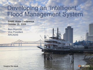
November 8, 2009
Precipitation Hydrology and hydraulics Hurricane tracks, wind and surge Infrastructure response to loadings Levee integrity and system response Real-time floodplan flows Evacuation Special motel considerations Levee system interrelationships Risk analysis November 8, 2009
Towards a smart, networked flood control organization Improve quality of decision making during emergencies Better knowledge of crisis decision making and uncertainties Fast and real time prediction of calculated risks Education and training, scenario studies, design, O&M Integration of Dutch flood control expertise and IBM IT knowledge November 8, 2009
Content is same as previous slide. Change background by changing Slide Color Scheme (Menu > Format > Slide Color Scheme...)
And we also work together on research. This is a plane that the NWS flies into El Nino storms to drop data-gathering electronics through the atmosphere and into the ocean to retrieve important meteorological and oceanographic information. We are very interested in other agencies’ improvements in forecasting technologies, as that will ultimately help our flood damage reduction mission.
**More than 350 miles of levees in the southeast Louisiana area **41 miles sustained severe damage **128 miles of levee sustained minor damage 5 Parishes 350 Miles of Levee/Floodwall 68 Pumping Stations (Fed & Non-Fed) 4 Gated Outlets
**More than 350 miles of levees in the southeast Louisiana area **41 miles sustained severe damage **128 miles of levee sustained minor damage 5 Parishes 350 Miles of Levee/Floodwall 68 Pumping Stations (Fed & Non-Fed) 4 Gated Outlets
**More than 350 miles of levees in the southeast Louisiana area **41 miles sustained severe damage **128 miles of levee sustained minor damage 5 Parishes 350 Miles of Levee/Floodwall 68 Pumping Stations (Fed & Non-Fed) 4 Gated Outlets