Josh MacFadyen, PhD, research profile
•
1 like•4,076 views

A visual presentation of new research in environment, historical GIS, and digital media, this research profile highlights my recent post-doctoral work.

Recommended
Recommended
More Related Content
What's hot
What's hot (20)
Viewers also liked
Viewers also liked (18)
Similar to Josh MacFadyen, PhD, research profile
Similar to Josh MacFadyen, PhD, research profile (20)
Recently uploaded
Recently uploaded (20)
Josh MacFadyen, PhD, research profile
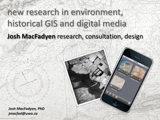
- 1. new research in environment, historical GIS and digital media Josh MacFadyen research, consultation, design Josh MacFadyen, PhD jmacfad@uwo.ca
- 2. locating my research and experience environmental history and other geospatial projects mapping frontier crops and land use patterns social and cultural values mapping; climate change adaptation research in early childhood development (RECD) ‘the fertile crescent’ - managing PEI soil and estuaries GeoWatch: Geospatial Workshops in Atlantic Canadian History ‘hewers of wood’ - biomass energy in Eastern Canada
- 4. Teaching: a Time and a Place environmental histories of Prince Edward Island, conference at UPEI, Charlottetown, June 2010 •co-organized speakers and field trips •taught environmental history http://niche-canada.org/pei2010
- 5. Teaching: GIS for community planning and cultural mapping With ARCIS Patagonia University in Chiloe and the Williche Council of Chiefs Chiloe, Chile, February 2011 •international development •liaising with NGOs, local governments, communities, indigenous groups •teaching GIS for socio-cultural values mapping •expanding Island Studies programs
- 6. Teaching: GeoWATCH Geospatial Workshops in Atlantic Canadian History At the NiCHE Canadian History and Environment Summer School, St. Andrews, NB, May 2011 •learning historical GIS •ground-truthing exercises in St Andrews salt marsh, golf course, & urban landscape http://niche-canada.org/geowatch
- 7. Teaching: GeoWATCH Geospatial Workshops in Atlantic Canadian History At the University of Prince Edward Island, Charlottetown, PE, October 2011 •learning historical GIS •ground-truthing exercises in urban land- scape, Charlottetown http://niche-canada.org/geowatch
- 8. Teaching: GeoWATCH Geospatial Workshops in Atlantic Canadian History At Dalhousie University’s College of Sustainability and Department of History, Halifax, NS, October 2011 •learning historical GIS •ground-truthing in Grand Pre salt marsh http://niche-canada.org/geowatch
- 9. Teaching: Environmental History Env 309: Environmental History and PEI University of Prince Edward Island’s Environmental Studies Program UPEI, Charlottetown, PE, Fall 2011 http://environment.upei.ca/ field trips to salt marshes, Acadian forest, urban landscapes mobile mapping brings historical land use maps into the field
- 10. Coasts socio-cultural values map, Stanhope, PEI under stress training people, building capacity •helping communities map social and cultural values http://discoveryspace.upei.ca/vmp/ •designing tools for climate change adaptation http://vertigo.revues.org/10644
- 11. Coasts under stress training people, building capacity •mobilizing historical data http://niche-canada.org/geowatch •historical map learning guides http://www.islandimagined.ca/guides taking static maps like this… Malpeque or “Richmond” Bay George Bayfield, 1845
- 12. … and producing accessible and dynamic community resources: Malpeque or “Richmond” Bay mobile map of Malpeque George Bayfield, 1845 – on Google Earth coastline showing erosion
- 13. identifying long-run changes in coastal… sand dune erosion and reclamation since 1845 ‘mussel mud’ digging for soil treatment
- 14. tracing historical land cover and land use change…
- 15. and identifying the roots of disturbance Source: MacFadyen and Glen, forthcoming 2012
- 16. making environmental history accessible, interpreting the data for communities mobile map of historic and 1935 topo map, Orwell, PEI, presented as an overlay on Google current woodlots, homes, properties and streams
- 17. measuring the early adoption of fossil fuels…
- 18. …and the areas that experienced biomass energy shortages Homes and forests, shading = fuel shortage Lot 43, PEI, 1935
- 19. urban landscapes, planning, and cultural mapping Panoramic View of Charlottetown, PEI (1878)
- 20. urban landscapes, planning, and cultural mapping …by design Aerial Oblique , Charlottetown, PEI
- 21. thank-you for your interest for more information contact: Josh MacFadyen , PhD 902-388-1283 jmacfad@uwo.ca joshmacfadyen@gmail.com