goGPS (March 2010)
•
2 likes•2,132 views

goGPS state-of-the-art on March 2010 http://www.gogps-project.org
![goGPS background
Aim: enhancing the accuracy of low-
cost GPS devices by means of
RTK positioning, Kalman
filtering, DTM aid, [...]
Geomatics Laboratory
Polytechnic of Milan Used to teach students about GPS
Como Campus positioning through Kalman filter in
Navigation Laboratory course
2007 – 2009: developed through
3 Master theses and 1 Ph.D. thesis
August 2009:
goGPS v0.1pre-alpha MATLAB code
was published as open source](data:image/gif;base64,R0lGODlhAQABAIAAAAAAAP///yH5BAEAAAAALAAAAAABAAEAAAIBRAA7)
Recommended
Recommended
More Related Content
What's hot
What's hot (20)
Similar to goGPS (March 2010)
Similar to goGPS (March 2010) (20)
Recently uploaded
Recently uploaded (20)
goGPS (March 2010)
- 1. goGPS open source software for low-cost RTK positioning Eugenio Realini Osaka City University, Japan March 2010
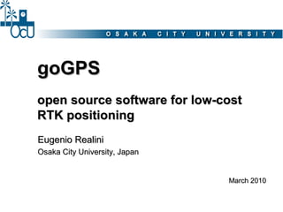
- 2. goGPS background Aim: enhancing the accuracy of low- cost GPS devices by means of RTK positioning, Kalman filtering, DTM aid, [...] Geomatics Laboratory Polytechnic of Milan Used to teach students about GPS Como Campus positioning through Kalman filter in Navigation Laboratory course 2007 – 2009: developed through 3 Master theses and 1 Ph.D. thesis August 2009: goGPS v0.1pre-alpha MATLAB code was published as open source
- 3. goGPS background September 2009: I came to Osaka City University as post-doc fellow, hosted by Prof. Media Center Raghavan Osaka City University October 2009: goGPS was presented at international FOSS4G2009 Sydney November 2009: goGPS was presented at local FOSS4G Osaka and FOSS4G Tokyo February 2010: goGPS v0.1alpha MATLAB code was published as open source
- 4. goGPS today Cryms http://www.cryms.com Applied Tech. goGPS http://www.apptec.co.jp OSGEO JP Polytechnic of Milan http://www.osgeo.jp http://www.polimi.it Galileian Plus Osaka City University http://www.galileianplus.it http://www.osaka-cu.ac.jp JSPS http://www.jsps.go.jp
- 5. goGPS niche ~ US $ 30000 ~ US $ 3000 ~ US $ 100 2-3 cm 15-30 cm 3-5 m RTK DGPS Stand-alone <1m goGPS L1 RTK positioning
- 6. Real-time processing Base station(s) NT RIP (RT CM 3.1 ) 3G Internet USB goGPS USB Real-time positioning
- 7. Post-mission processing Base station(s) NT RIP USB (RT CM 3.1 ) RINEX RINEX Internet goGPS Positioning
- 8. Kalman filter It is the core of the software. It updates the position of the receiver in real- time on the basis of: • new measurements • the state of the system at the previous epoch state variables To implement it, it is needed to define: observations dynamic model
- 9. State variables In goGPS state variables can be divided in two groups: goGPS state variables can be divided in two groups: xr ˙ xr ⋮ parameters describing yr ˙ the receiver motion z xr xr yr ˙ (position, velocity, Xt = ⋮ acceleration, etc.) y zr x zr ˙ ⋮ Pivot p Np1 rm phase ambiguities ⋮ (double differences) Np32 rm Master m Rover r
- 10. Observation equations goGPS is based on double difference observations with respect to a master base station: - ionosphere error - troposphere error deleted or negligible - satellite and receiver clock errors Prm (t) = ρps (t) ps rm + ν codice code λΦps (t) = ρps (t) + λNps (t) + ν fase rm rm rm phase linearization geometric distance, phase ambiguity function of xr, yr, zr for the satellite 's' (xm, ym, zm known a Kalman filter priori)
- 11. Dynamic model dynamics of the receiver (e.g. constant velocity) x r (t + 1) = x r (t) + ˙ x r (t) ˙ x r (t + 1) = 0 + x r (t) + ε xr (t) ˙ ˙ model error “dynamics” of phase ambiguities Np1 (t + 1) = Np1 (t) rm rm ambiguities are never fixed: goGPS keeps a float solution ⋮ which evolves with the Np32 (t + 1) = Np32 (t) Kalman filter rm rm
- 12. Phase ambiguities - Float estimate (never fixed) - Estimated for initialization, new satellites and cycle-slips detection by: ps ps P rm − rm ps * comparing code and phase ranges: N = rm OR * least squares estimate (weighted on SNR): [ ][ ][ ] [ ] sX s P ps Y s 0 ⋯ 0 ps ps rmT rm I rm ps rm Z X ⋮ ⋮ ⋮ ⋮ ⋮ ⋱ Y⋮ ⋮ pS P rm = SX S Y S Z 0 ⋯ 0 pS pS pS Z rm T rm I rm sX − ⋯ 0 N s s ps rm Y s Z ps ps ps rm T rm −I rm ⋮ ⋮ ⋮ ⋮ ⋮ ⋱ ⋮ ⋮ ⋮ S 0 ⋯ − N S S pS rm X Y S Z pS pS pS rm T rm − I rm
- 13. DTM observation In order to improve the heigth positioning quality, an additional observation from a DTM is introduced: A DTM obtained from a hDTM = h(x r , y r , zr ) + v DTM LiDAR DSM 2m x 2m produced by Lombardy Region (Italy) was used σv ≈ 30 cm during tests. DTM loading time was optimized by subdividing the DTM in buffered tiles. approx. Tile Detection of the 4 Interpolation KF position search nearest vertices
- 14. Constrained motion If the rover is moving along a path that is known a priori (e.g. road, railway, …) a linear constraint can be introduced, making the motion mono-dimensional The constraint is modeled as 3D interconnected segments and the motion is described by a curvilinear coordinate (c): cr (X2,Y2,Z2) (X3,Y3,Z3) ˙ (X1,Y1,Z1) cr c2 c new state ⋮ c1 variable: X t = (X0,Y0,Z0) p1 Nrm c0 ⋮ Nrm p32
- 15. Observation weighting 9 8 10 8 7 R M S E [m ] 6 6 4 5 30 2 35 4 30 35 40 40 45 45 3 50 50 C / N 0 s a t e llit e 2 [ d B H z ] C / N 0 s a t e llit e 1 [ d B H z ] 500 400 A weight function was defined 300 W e ig h t to take into account the 200 satellites signal-to-noise ratio 100 30 and elevation. 0 40 20 40 50 60 80 60 C /N 0 [d B H z ] E le va tio n [ d e g ]
- 16. Software/1 - developed in MATLAB environment - 1 Hz data acquisition rate by means of “Instrument Control” toolbox (standard TCP-IP and USB)
- 17. Software/2
- 18. Software/3
- 19. goGPS – ublox comparison Receiver: u-blox AEK-4T goGPS solution - RTK (VRS) - constant velocity dyn. model - observations weighted on SNR u-blox solution - stand-alone - pedestrian dynamic model
- 20. goGPS – ublox comparison goGPS solution AEK-4T EVK-5T - RTK (VRS) - constant velocity dyn. model - observations weighted on SNR u-blox solution AEK-4T EVK-5T - stand-alone - automotive dynamic model
- 21. goGPS – ublox comparison goGPS solution AEK-4T EVK-5T - RTK (VRS) - constant velocity dyn. model - observations weighted on SNR u-blox solution AEK-4T EVK-5T - stand-alone - automotive dynamic model LEA-5T firmware < 6.02 bug? “The field local time in RXM-RAW had insufficient resolution with FW6.0 causing a submillisecond mismatch between local time and pseudorange measurements. This limitation of FW6.0 has been fixed with FW6.02 […]”
- 22. Accuracy test Devices: - Leica GPS1200 - Leica GS20 - eBonTek eGPS 597 - ev. kit u-blox + goGPS goGPS Leica GS20 ebonTek (cutoff = 30°) (mod. “Max Accuracy”) (ANTARIS4) mean 0.78 m mean 0.30 m mean 4.03 m std 0.47 m std 0.15 m std 1.70 m RMSE 0.91 m RMSE 0.34 m RMSE 4.37 m
- 23. Future developments (positioning) 1) network-constrained navigation (with complex intersections) 2) adaptive Kalman filtering 3) improved cycle slips management 4) static solution 5) SBAS integration 6) GLONASS / GALILEO integration 7) odometer integration
- 24. Future developments (sw / hw) 1) Establishing a collaborative platform (versioning system, bug tracker, mailing list, forum, …) to coordinate goGPS as a true open source project (i.e. not just publishing code) 2) Porting goGPS from MATLAB to a widespread language 3) Provide goGPS accurate positioning as a web service 4) Hardware prototype
- 25. Porting goGPS Conversion from MATLAB to JAVA goGPS GUI GUI goGPS core Kalman filter MATLAB → JAVA - positioning func. goGPS libs - input/output - GPS formats - (...)
- 26. goGPS as a service goGPS will provide GPS data processing as a web processing service (WPS) to obtain accurate positioning from raw GPS observations accurate positioning raw observations ZOO Server providing Rovers just acquiring goGPS as WPS raw data http://www.zoo-project.org/
- 27. Hardware prototype/1 No positioning processor Lower cost goGPS No proprietary algorithms Greater freedom
- 28. Hardware prototype/2 hardware software Software-defined goGPS Radio front-end acquisition/tracking engine
- 29. Conclusions - goGPS L1 RTK positioning enhances the accuracy of low-cost GPS receivers (and low-cost antennas) to sub-meter level - goGPS is going to be converted to JAVA, managed as a collaborative open source project - goGPS processing will be provided as web service (e.g. WPS on ZOO platform) - goGPS MATLAB code is and will be publicly available to help collaborative research on low-cost GPS positioning
- 30. Code & contacts goGPS website: http://www.gogps-project.org ありがとうございました support@gogps-project.org