
Recommended
Recommended
More Related Content
What's hot
What's hot (20)
Similar to Falzon Das Se Ag Compressed
Similar to Falzon Das Se Ag Compressed (20)
Falzon Das Se Ag Compressed
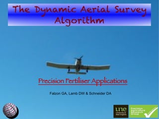
- 1. The Dynamic Aerial Survey Algorithm Precision Fertiliser Applications Falzon GA, Lamb DW & Schneider DA
- 2. Overview The Need for Top-dress Fertilisers. The Advent of Active Optical Sensors. Real-Time Aerial Crop Survey & its Challenges. The Solution: DAS. Future Developments.
- 3. Top-Dress Fertilisers Irrigated durum wheat: 2 applications of N/season 322 kg N/ha, $A309.84/ha (July 2011). 300 ha cereal feld requires $A92,952 N/application and $A185,904 total. Extra on-costs! Aircraft cost $A7000- $A10000/9ight. We need greater effciency!!!
- 4. Active-Optical Sensors CropCircleTM ACS210 'red head' & GeoSCOUT 400 data-logger λ 1=650nm (red) λ 2=880nm (NIR) 4.00m 2.28m m 0.44
- 5. Real-Time Aerial Survey Fletcher FU24954 aircraft Garmin GPS18 5Hz On-The-Go Sensing: 80 kts = 144 km/h Can we create an accurate prescription map after each pass?
- 6. The DAS Algorithm: Pt I Paddock Polygons cumulative passes Ragged Arrays geo-referenced samples: different dimensions
- 7. The DAS Algorithm: Pt II
- 8. The DAS Algorithm: Pt III Support Vector Machines Nk f ( z)=∑i=1 [β −β K ( z i , z)+β0 ] 1 i 2 i Kernels Polynomial Radial Sigmoid T n (γ z⋅z +κ) −∣z−z T∣ T tanh (γ z⋅z +κ) exp( 2 ) 2σ
- 9. The DAS Algorithm: Pt IV
- 10. The DAS Algorithm: Pt V Divide f ( z) into prescription zones M P =( M 1, P ,… , M N , P ) Pre-set Levels e.g. NDVI = {0.0,0.2,0.4,0.6,0.8} Divide into N levels e.g. n = 10 K-means clustering, e.g. cluster into three groups (low, med, high).
- 11. The DAS Algorithm: In Action
- 12. Future Developments Incorporate Prior Information Prior survey results Additional information such as soil surveys and yield maps Expert knowledge
- 13. Future Developments Joint Air-Ground Operations Extension of Prior Survey Models. Ground Validation, Small Scale Areas, Combined Air/Ground Fertiliser Teams. Field Calibration & Validations Wind shear, height, droplet size (I. Yule), servo latency. Compare drop zone to management map.
- 14. Thank you! M. Trotter (UNE PARG) SUPERAIR CRC for Spatial Information (CRCSI) Sugar Research & Development Corporation (SRDC) Nick Barton (Twynam Agriculture) Andrew Smart (Precision Cropping Technologies) Nick Gillingham (Sundown Pastoral Company) Dr. F. Honey (SpecTerra Services)