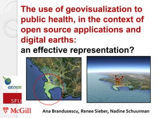
The use of geovisualization to public health, in the context of open source applications and digital earths: an effective representation?
•
1 like•589 views

Demo session at the Canadian Geomatics Conference. Toronto, Canada. 17 May 2011. The use of geographic visualization (geovisualization) has increased over recent years with the prevalence of digital earths (e.g., Google Earth). We investigate how well applications of digital earths employ geovisualization principles using the example of health data. We utilized trauma data from Cape Town, South Africa. We created a number of geovisualizations at both the coarse level and fine grained level of resolution. These utilized various application programming interfaces (APIs), Google Earth, and scripting languages. We based our applications on evaluation of geovisualization design principles and extant examples in health and epidemiology

Recommended
More Related Content
Viewers also liked
Viewers also liked (20)
Similar to The use of geovisualization to public health, in the context of open source applications and digital earths: an effective representation?
Similar to The use of geovisualization to public health, in the context of open source applications and digital earths: an effective representation? (20)
More from Independent Consultant | Research, data, tech policy
More from Independent Consultant | Research, data, tech policy (17)
Recently uploaded
Recently uploaded (20)
The use of geovisualization to public health, in the context of open source applications and digital earths: an effective representation?
- 1. The use of geovisualization to public health, in the context of open source applications and digital earths: an effective representation? Ana Brandusescu, Renee Sieber, Nadine Schuurman
- 2. Overview • background information • existing geovisualization in epidemiology • relevance • data • methods (based on geoviz criteria) • results • limitations • conclusion
- 3. Background and Relevance • what is geovisualization (geoviz)? • increased popularity of digital earths • geoviz and health • health data digital earths Web 2.0 • mashups in epidemiology • traditional GIS vs new platforms • innovative spatial data interaction
- 4. Existing geoviz applications in epidemiology •Avian influenza time series map (Butler) • Dengue surveillance system (ArcGIS and Google Earth) (Chang et al.) • Batch GeoCode and Mapalist (Cinnamon & Schuurman) • Pennsylvania Cancer Atlas, Health Map and BioDiaspora, ESTAT, Health GeoJunction
- 5. Data • coarse and sensitive data from Cape Town, South Africa • 4,269 injuries • 64% of data set • top 20 aggregate injury prone suburbs
- 6. Methods • Jamstec • Google Earth (GE) Graph (Ricardo Sgrillo) • Google SketchUp • geoviz principles: interoperability modifiability and collaborative work cost interactivity quality of application user interfaces
- 7. GE Graph, Google Charts API and Google Docs
- 9. Why GE Graph? • high interoperability levels • free • highly modifiable and flexible • polygon and point data • 2D and 3D visualizations • animation rendering • time or 4D representation
- 10. Google SketchUp
- 12. Why Google SketchUp? • connections between environmental form and traumas • Google Streetview and geocoded photographs • Google’s 3D warehouse • 3D vs 2.5D Limitations: • number of objects • problems with some computers and GE
- 13. More results • data accuracy and data confidence • misrepresentation • well-suited for resource-poor environments • learning curve • time • confidentiality issues in the Google cloud • uncertainties in development vs uncertainties in data
- 14. Conclusion • an effective representation? • data and misrepresentation • we have to start somewhere • importance of variety • the future of geoviz criteria and public health data
- 15. Thank You! • GEOIDE Project 54 • Renee Sieber • Nadine Schuurman • Prestige Makanga