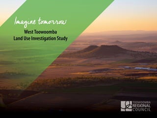
Think tank 1 - West Toowoomba land use investigation study
•Download as PPT, PDF•
2 likes•777 views


Recommended
More Related Content
What's hot
What's hot (20)
Viewers also liked
Viewers also liked (8)
Similar to Think tank 1 - West Toowoomba land use investigation study
Similar to Think tank 1 - West Toowoomba land use investigation study (20)
More from Toowoomba Region
More from Toowoomba Region (12)
Recently uploaded
Recently uploaded (20)
Think tank 1 - West Toowoomba land use investigation study
- 2. Stakeholder Engagement To GIVE information about the project, so that stakeholders can make informed comment. To GATHER stakeholder thoughts about the future and issues, challenges and opportunities.
- 3. Imagine Tomorrow …. Toowoomba Region Local Plan Program Current priority areas include: 1.Highfields/Meringandan/ Meringandan West (complete) 2.West Toowoomba (current) 3.Gowrie Junction/Kingsthorpe 4.Drayton/Wyreema 5.Hodgson Vale 6.City Centre Master Plan (complete) 1 2 3 4 5 Urban Footprint 6 Area Pop’n 2011 Pop’n 2036 TRC 155,444 216,269 Greater Toowoomba 126,426 182,937 West Toowoomba 11,737 33,254
- 4. • In 2100 the number of people aged 100 and over in Australia will increase from 4,500 to 129,000. 1.1 million will be over 90 with a total population of over 53 million (abs – med series). • The babies being born today will be 85 in the year 2100. • Planning for the year 2100 doesn’t mean we are planning for distant generations. • Planning for the next 100 years means planning for people who are here now. Imagine Tomorrow …. 15, 25, 50 or 100 years?
- 5. What is a Local Plan? Provide a vision (blueprint) for future development and investment that will occur over many years Plans can help: o guide growth and change, and facilitate economic development o coordinate new and/or improved infrastructure, o guide style of development to create liveable communities, o protect locally valuable features and enhance the character of the area, o address locally specific issues and opportunities that influence the future of the area.
- 6. West Toowoomba Land Use Investigation Area Less than 10km west of Toowoomba CBD Approx. 9000ha (90km²) Includes localities: Cotswold Hills Torrington Glenvale Westbrook Bounded by major transport corridors & urban Toowoomba Mix of land uses – rural, industrial, sporting, residential
- 7. Why West Toowoomba? Airport Intermodal freight terminal TSRC and Connections New refuse transfer facility Charlton Sports park Inland Rail Glenvale Cotswold Hills Torrington Westbrook Population Growth Housing demand Employment growth New major infrastructure Regional facilities Agricultural values Local environmental values Development
- 8. Key Project Objectives • Investigate long-term growth opportunities and options; • Strategic directions plan - a long-term vision for land use and settlement pattern to guide change over several decades; • Neighbourhood plans for smaller areas – more detailed and will guide urban form, infrastructure and development over the next 20-25 years; • Work collaboratively with stakeholders, community and Council.
- 9. Project Stages February to May 2015 May to July 2015 August to November 2015 November 2015 to February 2016 March to April 2016 Gathering background information and data. Confirming key issues and opportunities Investigating potential of study area. Determining an agreed long-term future land use direction. Detailed planning and design for key neighbourhoods –form, function and character, growth capacity and infrastructure. Confirming key directions and implementation strategy. Community review. Final plan document. Commence process to include plan in the Toowoomba Regional Planning Scheme.
- 10. Communications
- 11. Westbrook Glenvale Torrington Cotswold Hills • Whole study area • Long-term plan • Land capacity and infrastructure • Growth options • Broad land uses • Preferred settlement form Phase 2 – Strategic Directions Plan
- 12. Westbrook Glenvale Torrington Cotswold Hills • Focus on existing communities • Short to medium time (2036) • Refine preferred land use, urban pattern and form • Directions about what new development looks like & where • Direction for infrastructure (inform LGIP/capital works) Phase 3 – Neighbourhood Plans
- 13. Regional Planning Framework SEQ Regional Plan Boundary South East Qld Regional Plan 2009- 2031 – Urban Footprint Darling Downs Regional Plan – Priority Agricultural Area Darling Downs Regional Plan Boundary
- 14. Toowoomba Region Population Growth
- 16. West Toowoomba Land Use Investigation Area – Growth 2011 2031 2036 Change Population (QGSO medium series) 11,737 27,208 33,254 283% Population (TRC adopted) 11,737 24,355 - 111% Workforce (TRC adopted – including CWEA) 3,878 11,440 - 193%
- 17. Studies so far…… Currently available… Current underway… • Toowoomba Regional Planning Scheme – and previous planning studies (2009) • Greater Western Toowoomba Water Supply Study (2014) • Westbrook Sewerage Study (2014) • Industrial Land Supply Update Study (2014) • Commercial and Retail Land Needs Update Study (2013) • Sustainable Agriculture Study (2013) • Toowoomba Regional Housing Strategy (2013) • Toowoomba Region Sustainable Transport Strategy (2014) • Scenic amenity and landscape assessment • Community facilities infrastructure analysis • Demographic projections, and market profile assessment • Flood extension study • Urban stormwater catchment plans – Spring Creek & Dry Creek (Westbrook Creek to commence July) • Draft Greater Toowoomba Sewerage Study • Urban design & master planning
- 18. Issues • Natural environment • Landscape character / scenic amenity • Agricultural production • Open space, parks and recreation • Essential infrastructure – water, sewerage and drainage • Transport and movement • Brisbane ‘West Wellcamp’ Airport • Housing choice and built form • Economic Development
- 27. EssentialInfrastructure:Water+SewerageEssentialInfrastructure:Water+Sewerage Informs: •Capital works plans •Local Government Infrastructure Plan (LGIP)
- 32. KeyinfluencesonfutureplanningKeyinfluencesonfutureplanning 1. Green infrastructure network 2. Economic development land 3. Manage land use impacts 4. CBD-Airport PT + north- south roads
- 33. Questions
- 34. Imagine Tomorrow… “Someone's sitting in the shade today because someone planted a tree a long time ago.” (Warren Buffett 1930-)
- 35. Vision….. • You are a passenger on a plan about to land at the Brisbane West Wellcamp airport • Picture the view from your window • What type of place do you see? Imagine 50 years from now………..
- 36. Issues & Ideas
- 37. Next Steps Phase 2 - Strategic Directions Plan •Project team continue investigations for long- term growth options and develop some scenarios, including consideration of your comments today. •Think Tank 2 – review of scenarios (long-term options) and stakeholder feedback on the options. •TRC will then determine a preferred direction considering feedback received, which will inform Phase 3.
- 38. How can you be involved? Multiple opportunities to provide input throughout the investigation. ‘Meet a Planner’ o Appointments available 15 & 16 June o Phone 131 872 (131 TRC) On-line ‘Have your say’ o launching 23 June 2015 http://yoursay.toowoombarc.qld.gov.au/imaginetomorrow o Instagram challenge, survey etc Think Tank 2 – late July/early August 2015
Editor's Notes
- Slide 1 Toowoomba Regional Council Mayor, Councillor Paul Antonio opened the event with a welcome address.
- Slide 2 Councillor Bill Cahill, Planning and Development Committee Chair gave an address outlining Council’s commitment in stakeholder and community engagement, and why being involved in this project is important.
- Slide 3 Imagine tomorrow – Local Planning Investigations The Toowoomba region is experiencing continued population and economic growth. Imagine tomorrow is a series of local planning investigations by Toowoomba Regional Council to guide long-term sustainable growth - where and how we want to grow Toowoomba as a regional centre. Council has identified a number of priority local plan investigation areas. These areas are the focus of where most of the population growth is projected and where change is anticipated in the short term and where there are opportunities for growth in the long term. For this reason, not all areas in the Toowoomba region will have a local plan. As local planning investigations are completed, it will help inform the overall context of Toowoomba will grow and related issues.
- Slide 4 Why do we need to plan for the future? Raising a child may only take a decade or two; but he or she has a good change of seeing the next century. We need to take a long-tem approach to build a sustainable future for people to live in. Your help in planning for the future and taking a long-term view for what the future might be is important input for this study.
- Slide 5 Local Plans are a tool to guide land use change and development. Local Plans provide a vision (blueprint) for the future – they consider local social, environment and economic matters, as well as growth management issues. Local plans are developed in partnership with the community and other key stakeholders including: major land owners and businesses people; residents associations, community groups and other non-government organisations; development industry and peak professional groups; representatives of state government agencies; elected representatives, eg. Councillors; Council staff Local Plans can consider a range of matters such as: How to accommodate and manage growth – residential and/or employment; Infrastructure needed to support growth – utilities (water and sewerage, stormwater drainage), transport, parks and sporting/recreation facilities, and community facilities; Expression of regional planning policies for specific areas and at a local level Respond to locally specific issues and provide direction to: manage land use conflicts, protect valued environments and features, and character at a local level, manage risks such as flooding, what new development looks like.
- Slide 6 Imagine tomorrow – West Toowoomba land use investigation The West Toowoomba Land Use Investigation study will investigate the capability and suitability of the area to accommodate major new urban development. Council has no current commitments to expand West Toowoomba – this study is about investigating opportunities that will inform future growth options. Council will consider the outcomes of this study, together with the outcomes of other local planning investigations as they are undertaken, to inform long-term sustainable growth options for Toowoomba. Local planning investigations will ultimately inform amendments to the Toowoomba Regional Planning Scheme. Study area description: approximately 90km² in area - covers an area of approximately 9000ha; bounded by the railway line in the north, Boundary Street in the east, the Gore Highway in the south, and the Toowoomba by-pass corridor in the west; less than 10km from the Toowoomba CBD; close to and includes major employment areas such as the Torrington industrial area and Charlton Wellcamp Enterprise (industry) areas; includes existing residential communities of Cotswold Hills, Torrington, parts of Glenvale and Westbrook. Also includes Charlton and Wellcamp; comprises a mix of land uses/activities: large parts of the study area are rural and used for rural production and horse studs; parts of the area are used for industrial uses (Torrington Industrial area) and transport related activities in rural areas around Heinemann Road; there are a number of existing residential areas on the western fringe of Toowoomba. These localities are dispersed and vary in character and housing styles including rural residential style larger lots in the north-east around Cotswold Hills and smaller urban residential lots in the south-east around Westbrook. rural activities have significantly shaped the landscape character.
- Slide 7 There are a number of changes that are influencing the study area. In the context of this investigation, there are a number of key considerations including:- Population & Employment growth: As Toowoomba’s population increases, the West Toowoomba area is expected to accommodate a significant amount of this growth over 20 years and more with an anticipated population of 33,000 people by 2036. This growth will occur predominately in the existing residential communities of Westbrook, Glenvale, Cotswold Hills and Torrington as well as potential new residential areas. In addition, there is increasing employment opportunities from ongoing development of major industry area/employment area with access to skilled workers, supporting activities and amenities that Toowoomba can provide. Key infrastructure – new and enhanced: The Toowoomba Second Range Crossing (bypass), Inland rail line, Wellcamp Airport and the intermodal transport facility all exist within/in close proximity to the plan area. This places the West Toowoomba area at an advantage in terms of transport connections, economic growth options and land use potential. Additionally Council has committed new key regional infrastructure including the Charlton Sports Precinct, waste transfer facility and significant upgrades to local roads and utilities. Development demand: Development statistics show that there is a significant number of development applications being submitted for this within the study area. There has been significant development applications lodged in the Charlton Wellcamp Enterprise Area increasing employment opportunities, and the opening of the Wellcamp Airport is increasing the attractiveness and competitiveness of the area. Within the study area there have also been a significant increase in subdivisions – between March 2014 to May this year, 24 subdivision applications have been lodged proposing 835 new lots, with pressure to expand beyond existing urban zones. Clarity about the long-term direction and opportunities is import for future development. Diversity of land use: This area has a diverse range of land uses including rural activities and open landscapes, rural residential, industrial, residential and community uses. Many parts of the study area are identified as important agricultural lands (state planning policy) and currently used for a range of cropping and other agricultural activities. Additionally parts of the study area is used for animal keeping and in particular the south-west of the study area is used for horse studs. Natural vegetation is dispersed along creek lines and hills. Together with natural hills and ridgelines, and views to the open agricultural areas provide scenic and landscape values that need to be considered in the study. Clarity about the long-term land uses is important for management of land use conflicts, and protecting land for further development or other uses.
- Slide 8 The West Toowoomba Land Use Investigation Study is a comprehensive local planning project to investigate the suitability and capability of the area for major urban growth. Not all of the land in this investigation area is likely to be suitable, or will be required, for urban development purposes. Strategic directions plan It will investigate opportunities and growth options, and illustrate how growth could be accommodated and broadly preferred land uses within the study area. This long-term vision will provide direction for private & public investment, and provide the framework for infrastructure delivery that enhances the quality of existing and new communities through good urban design. The outcomes of the study will also identify other valuable resources and features that should be retained for non-urban purposes. This long-term vision will be expressed in a strategic directions plan that will cover the whole study area. Neighbourhood plans The investigation will also include preparation of a number of smaller neighbourhood plans. The neighbourhood plans will focus on existing residential communities of Cotswold Hills, Torrington, Glenvale (west) and Westbrook. The purpose of neighbourhood plans is to provide direction over the next 20-25 years by identifying land use types and intensity to guide infrastructure and development. It will also provide detailed urban design directions and standards for the smaller areas including street networks and design, open space locations, centre locations and design, and identify community facility needs.
- Slide 9 As this is a comprehensive and complex study, it will take some months to complete. This timeline provides an overview of the project phases. Phase 1 has been completed. It provides the background information/data, and confirms key issues and other matters that need to be considered in the investigation. The key plans to be developed include the preparation of a strategic directions plan in phase 2, and neighbourhood plans in phase 3. Phase 4 will involve compiling all the information and determinations made along the way into a consolidated local plan document that will be available for community review. Phase 5 will finalise the plan, incorporating community feedback. The final plan will inform changes to the Toowoomba Regional Planning Scheme which will be undertaken as a separate amendment process. The investigation is being undertaken by Council and involves multiple parts of Council working together. We also have engaged consultants, Jensen Planning +Design, to assist with the master planning and urban design aspects.
- Slide 10 Consultation/community engagement is embedded at each stage of the project – in a nutshell the three (3) main engagements highlights in this project are: Extensive face-to-face engagement consisting of four think tank sessions with key stakeholders and community representatives; A youth focus including a youth day and documentary event; Interactive online activities and social media events and information, including an Instagram challenge. We are now in Phase 2 of the project which includes a focus on: Face to face consultation with key stakeholders – Development industry professionals, major landowners and businesses, local community representatives, Council advisory committee representatives, State Agencies and other TRC internal representatives. On-line activities and Instagram challenge. Stages 3 & 4 will involve broader community consultation at future neighbourhood plan events to be held in local communities and on-line, as well as the youth day event.
- Slide 11 This plan will set the vision for the study area, and determine key land use planning principles and strategies required to achieve that vision. This plan bridges the gap between the whole of Toowoomba region strategic vision that is expressed in the planning scheme (strategic framework) and planning in greater detailed for smaller areas. It has a long-term focus – 2050 & beyond.
- Slide 12 Due to demand and existing commitments ie. existing zoned areas, these small area plans are will focus on the existing urban localities in the eastern part of the study area. The boundaries for neighbourhood plan areas will be refined from the strategic plan (phase 2) investigations and community consultation. These plans will provide more detailed information about land use type and intensity, infrastructure requirements, urban/built form design outcomes and standards. Neighbourhood plans provide direction for environmental, landscape & place-making values and features that contribute to the look and amenity of the local plan area. The plans provide direction about development potential of smaller areas, infrastructure requirements to service development and preferred sequence and timing of when development may occur.
- Slide 13 Toowoomba straddles two regional plan areas – the South East Queensland Regional Plan (SEQRP) and Darling Downs Regional Plan (DDRP). Toowoomba is the gateway between SEQ and the west. Toowoomba is ranked as the 10th largest growing local government area in QLD, and 6th largest in SEQ. The West Toowoomba area is identified as a growth area in the South East Queensland Regional Plan 2009-2031 (SEQRP), and in particular Westbrook is identified as an investigation area for future growth. One of the key planning aspects of the DDRP is to address specific conflicts, such as resources and urban development. Of note is that the DDRP identifies Toowoomba as surrounded by good quality agricultural land.
- Slide 14 So how much will West Toowoomba grow? The West Toowoomba area (statistical area) has been identified as a high growth area for Toowoomba over the next 20 years. It includes the area that is covered by this investigation study, and also existing parts of Glenvale and the Charlton Wellcamp Enterprise Area. By 2036 the area is anticipated to accommodate an additional 21,517 people – over 9,000 new households.
- Slide 15 The West Toowoomba statistical area including Charlton Wellcamp Enterprise Area (CWEA) and Torrington Industrial area are significant employment precincts. The area is second to Toowoomba CBD/central for employment by 2031 Total CWEA employment in 2031 is anticipated to be approximately 5,570
- Slide 16 The West Toowoomba statistical area is anticipated to be home to between over 33,000 people by 2036 based on current medium series Queensland Government Statistician Office (QGSO) projections, More recent TRC projections adopted for infrastructure planning purposes anticipate a population of nearly 25,000 by 2031 This growth is expected to be driven mainly be proximity to major driven mainly by proximity to major employment precincts and established services. TRC projections also identified that 95% of the existing urban zones will be built out by 2031. Increasingly, there is pressure to ‘grow’ in the west. Overall in Toowoomba, new residential lands can come from: Redevelopment at more intensive scale; Development of existing urban areas – currently vacant or underutilised (infill) Converting established rural residential areas for new urban housing; Developing rural land for new urban housing. This study will explore options to meet growth needs. Further population investigations and projections are being prepared for the study area.
- Slide 17 To date the study team has been collating and reviewing background information to inform the investigation; This has included initial issues identification. A number of information gaps were found and additional information is being sourced to address these matters. Some new studies are being prepared to inform this study, or to explore how regional planning aspects apply in the local context. Some of this work has been undertaken by Toowoomba Regional Council; while other studies have been or are being undertaken by external consultants due to specialist technical skills and/or resources available. The slide identifies a range of information sources.
- Slide 18 Key issues and opportunities have been identified. Today it is not possible to fully detail each aspect – so key issues have been presented in themes. Michael McKeown from Jensen Planning +Design presented the following slides information.
- Slide 19 A wide series of mapped data has been compiled to inform the West Toowoomba investigations. It includes physical information about the site and its landform, environmental mapping, land uses, property boundaries, services, transport corridors and the like. As is typical in studies like this mapped information varies in its origins and completeness. Many layers of information also overlap and their importance to the future of West Toowoomba is also variable. The slide here illustrates the complexity of information collected - other spatial issues exist but are not available as mapped information. Importantly, it is not possible (or sensible) just to overlay all the constraints mapping we can find and see what land is left over. Instead we must evaluate the inputs formed by available spatial data and other issues, polices and directions, and use all inputs to shape the future plan for West Toowoomba.
- Slide 20 Why can’t we just identify all constraints and design around them? This might ‘preserve’ the sensitive features we have identified, but squeezing development between constraints is unlikely to create a sustainable, well functioning urban pattern in the land ‘left over’ But back to the issues - the following slides highlight the important issues that we have identified in the process so far.
- Slide 21 Issues Remnant vegetation is dispersed and mainly contained to hills and creek lines For that reason remnant vegetation often coincides with steeper hillslopes (steep slopes, landslide and bushfire constraints) and biodiversity values (e.g. areas of ecological significance) Natural environment values are often ‘stacked’ on top of each other, rather than single issues existing alone, enhancing the importance of these areas. There is limited connectivity between green areas. Possible likelihood of ‘Blue Grass’ – a threatened ecological community (TEC) and critically endangered and listed under the Environmental Protection and Biodiversity Conservation Act (EPBC). Opportunities Plan and implement a green infrastructure network – founded on and growing from the hills and creeks Identify key areas and resources for protection – environmental and economic diversity Identify key corridors and isolated habitat values, and reinstate connections Incorporate natural features, views and vistas into the design of development to enhance the character and amenity of the area
- Slide 22 Issues A significant part of the study area is good quality agricultural land which has shaped the landscape character and natural environment we see today. There is a varied landform of hills and escarpment Toowoomba escarpment running north-south through the study area (whereas creeks run east-west) The existing landscape under pressure – development interest has increased and emerging urban areas are under development. The CWEA represents a significant land use and potential impact on view corridors to/from future development require consideration At this time, the impact of construction of the new by-pass on the views and vistas is not available (still under design development) To understand impacts there is need for more localised study which is currently underway – scenic amenity and landscape character analysis Opportunities Incorporate the Hills and Ridges in the green infrastructure network. Incorporate these features, as well as views and vistas, to enhance the character and amenity of the area Combine with natural features that may also contribute biodiversity values With the community identify key natural features and views.
- Slide 23 Much of the study area used for agriculture, which is an important industry to regional and local economy Toowoomba is at the edge of the Darling Downs and most of the land has some agricultural values – recognised in regional planning and mapped at high level In 2013 Council commissions the Sustainable Agricultural Study (SAS) – a key recommendation adopted by Council was that the information in that study inform local planning investigations. The SAS identifies “Agricultural Production Areas” – these areas are considered to represent highest quality and most viable agricultural and cropping land in the Toowoomba Region The area is based on detailed study on soil type and types of agriculture occurring on land. The Agricultural Production Area are aligns with 100ha Rural Zone precinct and Rural landscape aligns with 200hain the Toowoomba Regional Planning Scheme Method for delineating these areas involved overlaying different mapped information and undertaking a sieving exercise to identify areas that were suitable for particular uses. The information used included: Land use Holding size Black and grey soils GQAL class A SCL Slope greater than 5% The Value of ag production in 2006 for former LGA’s. The Rural Landscape area contains less fertile, hillier land that is largely vegetated. It is highly fragmented and has more rural residential uses. Suitable for, agri-tourism activities. Report recommends limiting intensifying agriculture due to poor soils, slopes and potential to cause conflict with people on rural res properties. Also suggests retaining vegetation through these areas for visual appeal, attractive lifestyle options, potential eco-tourism and to retain biodiversity links.
- Slide 24 Issues The Agricultural Production Area of the SAS study coincides with the south-west of the study area, representing high value agricultural land. However the existing agricultural uses extend beyond this area with a significant part of the central study area being used for cropping, whereas the land in the south-west is predominately used for horse studs. Further investigation, including soils and land consolidation/fragmentation analysis. Opportunities Plan for and retain the highest agricultural production areas for economic diversity and resource protection – based on SAS report the areas in the south-west of the study area.
- Slide 25 Issues Varied collection of existing and known future parks and recreational facilities in study area – New Charlton Sports Precinct – regional facility Mt Peel Bushland Park - bushland Showgrounds, cycling criterion facility – regional facility Local and creekside parks in developed and part-developed areas Harvey Court reserve - bushland Shooting/archery range, and speedway – buffer requirements These facilities serve both regional and local communities Opportunities Use of natural (creek) corridors for park provision - multi-function linear parks aligned with natural environment, storm water management, placemaking and other objectives. Large parts of study area within easy walking distance of these corridors – particularly Spring and Dry Creeks Connected open space network increases accessibility and supports a healthy active lifestyle for the community Green corridors and hilltops supporting visual amenity and character Opportunity for new regional park in longer term – a new ‘Queens Park’? HOWEVER - Challenges around sustainability (affordability) of open space network combined with changing developer/public expectations for quantity and quality of open space. These issues will reflect the standards of service for parks, and potential other sports facilities.
- Slide 26 Issues Four major creek systems influencing the study area (Spring, Dry, Westbrook, Gowrie) Need to understand stormwater impacts (flooding and water quality) of both rural and urban land use scenarios Flood risks is also influenced and determined by the proposed location and intensity of urban development Overland flow interaction with new Toowoomba by-pass not yet determined Catchment Management Plan studies are being undertaken for Spring and Dry Creek – and Westbrook Creek (July) Extension of Spring and Dry Creek flood studies to incorporate the plan area – will help to inform flood risk Opportunities Stormwater management – is there a desire to include a water feature/element, such as a detention basin, in the study area – perhaps as a park focus Opportunity to consider the quality of creek systems as well as the carrying capacity, and how these systems can be enhanced in the future
- Slide 27 Issues Limited trunk infrastructure in this area for water supply and sewerage that is limiting current development opportunities. Water Supply Current infrastructure will generally support growth until 2031 with relatively minor augmentation. Significant augmentation of water supply infrastructure, including additional reservoir storage is required for expected growth beyond 2031. Sewerage Pressures from population growth on sewerage capacity – there is currently no existing sewerage infrastructure to cater for growth. Significant infrastructure – trunk mains and numerous pump stations is required throughout the existing urban area to cater anticipated growth within the existing zoned land areas. Westbrook previously utilised a ‘pump’ out system and is a priority area for improved sewerage upgrades. Design of the sewer mains to serve the dwellings to be connected to the Westbrook Sewerage Scheme is being undertaken, with construction anticipated to start in late 2015/early 2016. Settlement Pattern Influences The length of this western corridor, and relatively separated/dispersed settlements, has impacts on utility services, particulary as new development occurs away from the existing trunk network. This will require significant works to cater for future development. Impact on the delivery of infrastructure – cost and timing impacts of providing new trunk infrastructure at various locations and sequence of development. Opportunities Potential for two additional trunk mains and reservoir to secure water supply Utilisation of existing network to its full capability – as areas are provided with new infrastructure there is additional capacity within existing areas to cater for new growth Sewering of the Torrington industrial area will improve possibility of further redevelopment and densification of this area – increasing employment and production capacity A clear settlement and sequencing plan will help guide rational development that is efficient and cost effective to the development community and ratepayers.
- Slide 28 Issues Existing transport connections mainly support east - west movements Future north - south movement (including bypass, north-south links within West Toowoomba area) Freight transport movements utilising existing local networks – originating within and outside the study area Rail and future inland rail passing study area to north Toowoomba bypass – limited interaction with local road network will impact on access to the area Existing road network will struggle with future population of study area travelling into the CBD Additional links will be required to connect to other areas of Toowoomba Toowoomba Region Sustainable Transport Strategy recently adopted by Council Opportunities Explore public transport opportunities and connectivity between airport + CBD. Public Transport could be supported by dense nodes of urban activity along public transport corridor(s) West Toowoomba sets a benchmark for new transport paradigm as envisaged by Sustainable Transport Strategy Grid of existing road reserves in study area provides a framework for local connecting grid of streets Development incorporates and supports active transport options – walking, cycling and opportunities to link with open space features 1) Transport – testing option on public transport corridor to airport; what type of urban development could develop around this? 2) Transport – north/south accessibility – testing options for a new link etc. What key activities needs to be accessed and/or linked? (where does traffic go) Boundary St as a major north/south link – wide enough for planting out & greening? Is there a need to provide an alternative New England Highway connection to the by-pass?
- Slide 29 Issues Immediately west of study area and Toowoomba bypass Flightpath affects south of study area Area of greatest impacts expected to be confined to 3km zone Impacts on urban and non-urban land use including potential development restrictions under planning scheme and/or state planning policy – which protect against noise, bird/bat strike, lighting conflicts, building heights, and types of uses that can locate within proximity to the airport Opportunities Flight path restrictions may overlay some of the agricultural production areas – multiple values and constraints Airport provides significant long-term employment opportunities (and economic growth) and those benefits could flow into the study area with colocation of other uses and workforce residents Opportunity for gateway ‘entrance & exits’ to Toowoomba – located in the study area improve connections and tourism opportunities Opportunity to connect airport and CBD via public transport through study area catalyst for other development opportunities and creating connected communities
- Slide 30 Issues Most of the existing housing supply is separate houses on large lots and this style continuing – in some newer development lots becoming smaller Large parts of the study area, particularly in north-east (around Cotswold Hills and Torrington) are larger rural residential lots Continued population and economic growth driving demand for additional urban land Future households in the region are changing – becoming smaller, and number of people living alone is increasing. We are also ageing. Housing development and types is also influenced by the type of households that are being created in the future. The demographics work underway for this project will consider both the household types/formations, as well as population growth. So, part of the question to consider is what type of housing will future residents require – and what will attract them to want to live in this area? Opportunities Create new urban settlement patterns and communities that are: connected, accessible and walkable use the landscape features and character to frame development provide a variety of housing styles for future population to cater for likely household changes including aging in place.
- Slide 31 Existing Characteristics Diverse and significant economic activity and developments in and around West Toowoomba Charlton Wellcamp Enterprise Area – significant and large industry, and of varying types Brisbane West Wellcamp Airport Torrington industry area Heinemann Rd transport cluster Two major quarries Equestrian businesses, west of Westbrook TRC Waste Transfer Station underway Charlton Sports Precinct – future major sporting precinct Future Economic Expansion Proposed intermodal precinct to north – future inland rail catalyst Airport business park – new commercial and entertainment uses as well as aviation facilities changing the nature of existing industry. Uses land currently zoned for industry purposes Possible industrial rezoning of land within the study area – to replace land lost in the airport development. Recent industrial land review study by TRC identifies opportunity for additional industrial land to be accommodated in part of the study area linking Torrington and Charlton Wellcamp industry areas and needs further investigation in this study. Residential Growth Existing urban and rural residential areas – Cotswold Hills, west Glenvale, Westbrook Development pressure emerging around and west of established areas Limited commercial centres – opportunity for new centres and other community facilities to cater for additional growth Issues Industrial area on Carrington Rd is underdeveloped due to sewerage constraints Heinemann Road transport hub expansion – most common development applications are for transport facilities Need for future direction as development applications are being lodged in the area – uncertainty over future Future of existing horse studs, and as emerging communities zoned land developed Opportunities Access to bypass and Wellcamp airport Expansion of equestrian facilities and potential for an equestrian precinct Catholic/independent school education expansion Centres to service new/expanded residential communities – type and location dependant on settlement pattern and urban form and opportunity to test: A large district style centre – centrally located and focus for community facilities, and co-located on public transport corridor; Urban villages, with small local centres and dispersed community facilities
- Slide 32 Synthesizing all of the inputs discussed previously, what are the most important influences on future planning including potential for urban growth areas? Some key issues/opportunities identified by the project team include: Building over time a connected network of green infrastructure focused on the creeks (east-west) and the hills/escarpment – supports environmental, stormwater, open space, lifestyle and placemaking objectives; 2. Supporting and benefiting from critical economic land: including agriculture in the south-west, Brisbane West (Wellcamp) Airport, Charlton Wellcamp Enterprise area and connecting east to Torrington industry; 3. Managing impacts where economic and environmental potential coincides, and managing land most affected by airport; 4. CBD-Airport public transport corridor a catalyst for West Toowoomba growth - and West Toowoomba growth catalyst for CBD-Airport public transport corridor (development density needed to support public transport). Bypass and new north-south road and street connections.
- Slide 33 At this point we will pause before starting some activities – to give you a chance to ask questions you may have.
- Slide 34 There are many significant and large trees in and around Toowoomba – planted many years ago. As a seed or seedling they have now grown and contributed to the character of ‘garden city’ that Toowoomba is known for today – an important legacy for the current and future generations. So today, we want to understand what are your values and your vision for the study area – the legacy to leave for children of today and tomorrow.
- Slide 35 Activity 1 – Vision and Values Working first individually participants were asked to identify the four (4) words on list provided that most resonated with them when thinking about the future – what they value most about the area and what they want to see in the future. Small group discussion about the words selected – why, what did they mean to you? This was reported back to the larger group.
- Slide 36 Activity 2 - Issues & Ideas Participants are asked to individually identify for the study area: Two (2) issues; and Two (2) ideas. Issues and ideas could be on a range on matters/themes raised in presentation or outside of presentation – attendees encouraged to raise other matters and ideas for exploration/investigation in the project. These issues and ideas were then discussed in small groups – the top three (3) issues and ideas as agreed by the group were collated and added to a poster. The small group issues and ideas were then discussed in the large group – similarities and differences were both noted.