Value Added Applications for Optech Sensors
•
0 likes•582 views

Josh Nimetz, Merrick's LiDAR / Imaging Technical Lead gave the following presentation at the Optech Imaging and LiDAR Solutions Conference (ILSC) in Toronto, Ontario on June 26, 2013.

Recommended
Recommended
More Related Content
What's hot
What's hot (20)
Similar to Value Added Applications for Optech Sensors
Similar to Value Added Applications for Optech Sensors (20)
More from Merrick & Company
More from Merrick & Company (15)
Recently uploaded
Recently uploaded (20)
Value Added Applications for Optech Sensors
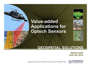
- 1. Value-added Applications for Optech Sensors GEOSPATIAL SOLUTIONS Optech ILSC June 26, 2013 Engineering | Architecture | Design-Build | Surveying | Planning | GeoSpatial Solutions
- 2. Presentation Overview Summary of Merrick & Company GeoSpatial Market Sector Team A brief background on the data - the 2011 NERC alert mandate The Merrick suite of remote sensors optimized for data collection of electric transmission facilities The MARS® tools designed for production and analyses of transmission facilities data Power line detection and QA/QC tools Power line LiDAR QC report - report on LAS statistics (by Tile) Optimum image selection tool PRE0101 2 Copyright © 2013 Merrick & Company - All rights reserved.
- 3. Merrick & Company Office Locations 500 employees at 12 National and 4 International offices PRE0101 3 Copyright © 2013 Merrick & Company - All rights reserved.
- 4. GeoSpatial Solutions & Capabilities LiDAR acquisition & processing (airborne) High Definition Scanning (terrestrial) Photogrammetric mapping Imagery acquisition & processing RGB Multispectral Satellite imagery MARS® software Application development Programming MARS® LiDAR processing software Unlimited Detail Data Visualization and Management - Euclideon Geoverse Surveying UAS mapping Hyperspectral Thermal Orthophoto processing Multi-sensor data fusion PRE0101 4 Copyright © 2013 Merrick & Company - All rights reserved.
- 5. GeoSpatial Solutions Market Sector Team Facts Number of Professionals: 56 BU Leader Brian Raber, CMS, GISP, GISS – Vice President Disciplines Photogrammetry, LiDAR, Satellite Imagery, GIS Solutions, Remote Sensing, Software Development & Sales Key Offices Greenwood Village, CO Colorado Springs, CO Guadalajara and Mexico City Albuquerque, NM Markets Local Government (11%) ($18.7 million Federal Government (9%) Sales – FY2013 Private (2%) ending 04/13) Core Clients Water (4%) Energy (40%) International: (34%) TVA, USGS, FEMA, TNRIS Xcel, Tri‐State, WAPA, Idaho Power, PNM SEMAR, INEGI CFE, PEMEX PRE0101 5 Copyright © 2013 Merrick & Company - All rights reserved. Cook County, IL., Tallahassee, FL NRCS Nebraska / Oklahoma USACE Mobile, Omaha Districts HDR,URS
- 6. National Electric Reliability Corporation (NERC) National Electric Reliability Corporation (NERC), entity empowered by the U.S. Federal Energy Regulatory Commission (FERC). Image courtesy of Argonne National Labs PRE0101 6 Copyright © 2013 Merrick & Company - All rights reserved.
- 7. NERC Mandate - April 2011 Electric power transmission owners survey actual field conditions to determine electric power transmission facilities (> 100 kV) are built as designed and to ensure compliance with reliability standards. Image courtesy of http://www.technet.pnnl.gov/sensors/electronics/projects/images/electronics477_large.jpg PRE0101 7 Copyright © 2013 Merrick & Company - All rights reserved.
- 8. NERC Mandate - April 2011 Electric power transmission owners survey actual field conditions to determine electric power transmission facilities (> 100 kV) are built as designed and to ensure compliance with reliability standards. Toronto, on evening of August 14, 2003 blackout Image courtesy Wikipedia PRE0101 8 Copyright © 2013 Merrick & Company - All rights reserved.
- 9. Why LiDAR Technology? Repeatable, accurate, and dependable technology Cost effective for system/large circuits Technology very good at collecting and measuring transmission features: structures, insulators, attachment points, vegetation, and ground PRE0101 9 Copyright © 2013 Merrick & Company - All rights reserved.
- 10. Typical LiDAR densities for electric power line collection range from 20-30+ points per square meter In general, the more density the better for feature collection, definition, and extraction PRE0101 10 Copyright © 2013 Merrick & Company - All rights reserved.
- 11. Merrick’s Helicopter Suite of Sensors 2010 - Merrick integrates a suite of sensors onboard a helicopter platform Designed to fulfill the aerial mapping needs of our electric transmission clients PRE0101 11 Copyright © 2013 Merrick & Company - All rights reserved.
- 12. Merrick’s Helicopter Suite of Sensors A TAC 60 MP nadir camera (for visible color orthos) (2) CS-4800 interline CCD cameras, forward oblique Orion C200 LiDAR system CS-MS1920 false color infrared interline transfer CCD (810, 550, 670 nm) PRE0101 12 Copyright © 2013 Merrick & Company - All rights reserved.
- 13. Merrick’s Helicopter Suite of Sensors AIMMS 20 meteorological sensor PRE0101 13 Copyright © 2013 Merrick & Company - All rights reserved. Cloud Cap gimbaled video camera
- 14. Merrick’s Helicopter Suite of Sensors PRE0101 14 Copyright © 2013 Merrick & Company - All rights reserved.
- 15. Merrick’s Advanced Remote Sensing (MARS®) software Data visualization, management & processing application Developed specifically for LiDAR data in 2002 Merrick’s Production Engine for processing LiDAR data MARS® license and technical support included with project PRE0101 15 Copyright © 2013 Merrick & Company - All rights reserved.
- 16. Merrick’s Advanced Remote Sensing Software (MARS®) Application Highlights Stand-alone software application, no third party software required No file size limitation Rapid response to customized programming needs Allows multi-core data processing to maximize performance of PC hardware Provides support for WMS imagery (ex. Bing Maps) Visualize & process airborne, terrestrial & mobile LiDAR datasets Natively supports LiDAR (LAS v1.1 – v1.4, imagery (RGB & hyperspectral, thermal) and GIS vector datasets – Data Fusion Robust QC Module for USGS specifications PRE0101 16 Copyright © 2013 Merrick & Company - All rights reserved.
- 17. Merrick MARS® software for electric transmission facilities data post-processing. Power line detection and QA/QC tools Power line LiDAR QC report - report on LAS statistics (by Tile) Optimum image selection tool PRE0101 17 Copyright © 2013 Merrick & Company - All rights reserved.
- 18. MARS® Power Line Tool For the point cloud classification of transmission facilities and QA / QC of classification results. PRE0101 18 Copyright © 2013 Merrick & Company - All rights reserved.
- 19. MARS® Power Line Tool For the point cloud classification of transmission facilities and QA / QC of classification results. Workflow Begin with centerline file and bare earth points to seed the process Test filter settings in localized area. Once optimized… Line / facilities detection filter over larger region QA / QC windows are launched for manual clean-up Attachment points are classified PRE0101 19 Copyright © 2013 Merrick & Company - All rights reserved.
- 20. MARS® Power Line Tool For the point cloud classification of transmission facilities and QA / QC of classification results. PRE0101 20 Copyright © 2013 Merrick & Company - All rights reserved.
- 21. MARS® Power Line Tool QA / QC Viewer Primary MARS® data window Copyright © 2013 Merrick & Company - All rights reserved. QA / QC tower front view QA / QC tower nadir view PRE0101 21 QA / QC tower side view QA / QC structure to structure span view
- 22. MARS® Power Line Tool QA / QC Viewer Each window is dynamic Points can be filtered and view extents, scale and rotation can be changed PRE0101 22 Copyright © 2013 Merrick & Company - All rights reserved.
- 23. MARS® Power Line QC report - Report on LAS Statistics (by Tile) PRE0101 23 Copyright © 2013 Merrick & Company - All rights reserved.
- 24. MARS® Power Line QC report - Report on LAS Statistics (by Tile) Black line items: Points exist on a required class. We expect to have points on this class. Teal line items: Points do not exist on a required class. This flags a potential issue. Classification of the transmission facilities is incomplete. Red line items: Points exist on a non-required class. Another potential issue. This may be okay for outlier or erroneous points. PRE0101 24 Copyright © 2013 Merrick & Company - All rights reserved.
- 25. MARS® Optimum Image Selection Tool PRE0101 25 Copyright © 2013 Merrick & Company - All rights reserved.
- 26. MARS® Optimum Image Selection Tool Begin with a calibrated camera model Create an exterior orientation file with position and attitude for each image exposure station Project the image footprint on to a surface Surface must be in same coordinate system / units as LiDAR bare earth In Optimum Image Selection Tool Image with shortest slant-range to given horizontal coordinate (E, N) is selected Image ID is either written to point shapefile attribute table or called up in viewer window PRE0101 26 Copyright © 2013 Merrick & Company - All rights reserved.
- 27. MARS® Optimum Image Selection Tool PRE0101 27 Copyright © 2013 Merrick & Company - All rights reserved.
- 28. MARS® Optimum Image Selection Tool Calibrated exterior orientation file for aft oblique camera. PRE0101 28 Copyright © 2013 Merrick & Company - All rights reserved.
- 29. MARS® Optimum Image Selection Tool PRE0101 29 Copyright © 2013 Merrick & Company - All rights reserved.
- 30. MARS® Optimum Image Selection Tool Projected aft oblique image footprints in OrthoMaster. PRE0101 30 Copyright © 2013 Merrick & Company - All rights reserved.
- 31. MARS® Optimum Image Selection Tool Projected aft oblique image footprints cleaned up for export. Note the images captured during the turn have been omitted PRE0101 31 Copyright © 2013 Merrick & Company - All rights reserved.
- 32. MARS® Optimum Image Selection Tool An image footprint file PRE0101 32 Copyright © 2013 Merrick & Company - All rights reserved.
- 33. MARS® Optimum Image Selection Tool PRE0101 33 Copyright © 2013 Merrick & Company - All rights reserved.
- 34. MARS® Optimum Image Selection Tool An output transmission tower shapefile attributed with the optimum oblique image pair The optimum oblique image captures the structure with the highest resolution possible (i.e. nearest to the heel of the oblique) PRE0101 34 Copyright © 2013 Merrick & Company - All rights reserved.
- 35. PRE0101 35 Copyright © 2013 Merrick & Company - All rights reserved.
- 36. PRE0101 36 Copyright © 2013 Merrick & Company - All rights reserved.
- 37. PRE0101 37 Copyright © 2013 Merrick & Company - All rights reserved.
- 38. Thank you….any questions? Josh Nimetz, CMS Merrick & Company 303-353-3650 josh.nimetz@merrick.com For MARS® sales and technical support, contact: Mark Stucky, GISP Merrick & Company 303-353-3662 mark.stucky@merrick.com www.merrick.com PRE0101 38 Copyright © 2013 Merrick & Company - All rights reserved.