Cars cars everywhere

Efforts to reduce the emissions from car travel have so far been hampered by a lack of specific information on car ownership and use. The Motoring and vehicle Ownership Trends in the UK (MOT) project seeks to address this by bringing together new sources of data to give a spatially and disaggregated diagnosis of car ownership and use in Great Britain and the associated energy demand and emissions. Data from annual car M.O.T tests, made available by the Department for Transport, will be used as a platform upon which to develop and undertake a set of inter-linked modelling and analysis tasks using multiple sources of vehicle-specific and area-based data. Through this the project will develop the capability to understand spatial and temporal differences in car ownership and use, the determinants of those differences, and how levels may change over time and in response to various policy measures. The relationship between fuel use and emissions, and the demographic, economic, infrastructural and socio-cultural factors influencing these will also be tested. Consequently, the MOT project has the potential to transform the way in which energy and emissions related to car use are quantified, understood and monitored to help refine future research and policy agendas and to inform transport and energy infrastructure planning. www.its.leeds.ac.uk/research/featured-projects/mot

Recommended
Recommended
More Related Content
What's hot
What's hot (20)
Similar to Cars cars everywhere
Similar to Cars cars everywhere (20)
More from Institute for Transport Studies (ITS)
More from Institute for Transport Studies (ITS) (20)
Recently uploaded
Recently uploaded (20)
Cars cars everywhere
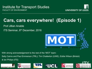
- 1. Institute for Transport Studies FACULTY OF ENVIRONMENT Cars, cars everywhere! (Episode 1) Prof Jillian Anable ITS Seminar, 6th December, 2016 With strong acknowledgement to the rest of the ‘MOT’ team: Sally Cairns and Paul Emmerson (TRL); Tim Chatterton (UWE), Eddie Wilson (Bristol) & Ian Philips (ITS)
- 2. Outline 1. Core project data (and the challenges ..) 2. Research topics overview 3. Examining variation 4. Celebrating variation (Clustering)
- 4. Ministry of Transport (MOT) Test • Annual safety inspection for all road vehicles older than 3yrs • Since 2005, results have been captured and stored digitally • Nov 2010, DfT published the first 5 years online
- 5. MOT data (DVSA) • 2005-2014 • 325 million tests • Varying intervals between tests • One row per test Vehicle stock data (DVLA) • 2003-2012 • 56 million vehicles • Annual or quarterly recording points • One row per vehicle Vehicles master table – one row per vehicle; columns contain quarterly attributes Local area tables – one row per LSOA or Data Zone; columns contain average or total values Aberdeen Data Safe Haven
- 6. MOT dataset (test data) • Test date • Test type and result • Odometer reading • Location of test (Postcode Area) MOT dataset (vehicle data) • First use date • Make, model and colour • Engine size • Fuel type • Vehicle class Stock tables (vehicle data) •Keeper location (LSOA/ Data Zone) •Private or commercial •CO2 value
- 7. Types of vehicles • Work reported here focuses on Class 4/4A vehicles in private use in 2011 – closest match to Census data on ‘cars or vans owned, or available for use, by members of this household’
- 8. The good news … • Comprehensive • Available to a fine spatial scale (units of approx 700 households) • Collected roughly annually (unlike Census) • Total annual mileage of vehicles • Private vs Business keepership • Detailed vehicle characteristics
- 9. Time limits on the data • MOT records began in 2005, robust data from 2007 only • For vehicles < 3 yrs old, we don’t know anything about them until they show up for their first test as we are only given vehicle information (from stock tables) once they appear in the MOT dataset • This means only three years usable at the moment 2003 2004 2005 2006 2007 2008 2009 2010 2011 2012 2013 2014 MOT test data Stock data for vehicles aged 3 years+ Stock data for vehicles aged <3 years
- 10. Other issues • No usage data for vehicles less than 3 years old – interpolate mileage evenly over first 3 yrs? • No information on when vehicles leave the fleet (e.g. that are scrapped or go abroad) • If vehicles arrive and disappear within the first three years we will never know about them … • No information on unlicensed vehicles • No information on foreign vehicles – only some take a test but they are still driving on UK roads! • About 30% vehicles don’t have a CO2 value (infer from engine size and fuel type) • 4% of vehicles don’t have a location (leave out as mostly ‘between keepers’) • ‘Clocked’ (rolled over) mileages –have no records ‘with confidence’ (about 4%) How aggressive should the cleaning algorithms be? Missing mileages – how should we fill them in?
- 11. Key challenges • Missing or inconsistent vehicle data between MOT tests • Converting odometer readings into usable mileage information Use of flags to identify consensus or lack of consensus Convert readings to regular census points – challenges with missing or erroneous odometer readings
- 12. Simplification processes • Focus on private vehicles to understand personal car ownership
- 13. Focus on generating a 2011 table of area statistics 41,729 LSOA/DZ rows, potentially hundreds of columns…. LSOA P.ALL.av_km P_ALL_tot_km P_ALL_med_km P_ALL_av_engine P_ALL_av_odo P_ALL_av_co2 P_ALL_av_fud E01000001 8.886015125 3216.737475 6.4574928 2069.069061 48226.17127 191.4078947 731262.5691 E01000002 9.051169099 3267.472045 6.3166752 2019.069252 49428.92244 196.0218341 731309.6787 E01000003 10.16558441 1555.334415 6.627278592 1628.594771 54496.73856 179.8488372 731235.8758 E01000005 11.09056427 1242.143198 7.025591232 1736.955357 63109.66964 187.5405405 731687.9196 E01000006 15.69251804 6465.317431 10.05196262 1679.441748 74335.29612 171.4271186 731668.6481 E01000007 12.44802015 2663.876312 9.746187264 1725.635514 76412.56075 170.8783784 731634.5421 E01000008 14.91905651 3401.544884 10.9491719 1744.631579 84965.74123 172.16 731434.7719 E01000009 12.81574705 4767.457901 10.05679066 1702.569892 73322.66935 169.3089431 731604.7984 E01000010 14.11702585 4390.395039 10.1533513 1681.045016 83460.1672 171.7061856 731522.9196 E01000011 16.83051041 5924.339664 11.2452912 1701.747159 78386.04545 172.8506787 731586.2727 E01000012 12.94207982 3856.739788 10.39072954 1689.738255 77655.3557 171.3435897 731585.0034 E01000013 12.17399428 5003.511651 9.322929792 1662.043796 67630.51338 171.7727273 731730.8613 E01000014 13.18887501 6488.926507 9.705953664 1652.327236 71498.79675 169.2107023 731599.6118 E01000015 12.45622582 6838.467977 10.1646167 1674.032787 76304.89071 169.9630682 731484.3424 E01000016 11.91133929 6003.315002 9.204643008 1635.246032 67193.38492 171.1965318 731557.9881 E01000017 11.33179817 5779.217068 9.493520256 1659.582353 72917.85882 170.8575668 731594.7176 E01000018 13.24891908 5922.266829 9.30200832 1644.959732 72014.23043 167.557554 731457.7539 E01000019 12.98602553 5389.200597 9.59169024 1618.036145 72167.88193 168.0606061 731566.441 E01000020 12.44321096 6594.901809 9.67215744 1633.160377 70815.6717 170.0410557 731552.4943 E01000021 13.35662214 5943.696853 9.789639552 1616.620225 75115.82022 167.1684982 731563.6292 E01000022 11.95601003 4674.79992 9.807342336 1656.762148 68202.85422 171.9538462 731750.4706 E01000023 12.48741649 4008.460693 10.12116442 1669.037383 69516.38318 169.2669683 731775.0561 E01000024 13.06312488 5016.239953 9.376038144 1615.328125 71028.63281 172.1373391 731488.5052
- 15. This slide will move on in 20 seconds! 15 This slide will move on in 20 seconds! Potential uses of the data Trends over time Differences between places Emissions: air quality and climate change Core MOT and DVLA dataset Vehicle types: technology diffusion Additional data sets Census, air quality, energy use, Experian data, indices of accessibility, deprivation etc. Car ownership and use: transport policy evaluation Fuel use: future energy scenariosLinks to socio- demographics
- 16. Analyses to date • Descriptive (the pretty stuff!) … • Variation in car use per person at a range of spatial scales • Understanding the contribution of car use to total household energy footprints • Considering the distribution of motoring costs, emissions and exposure, and associated social justice issues • How motoring costs vary with income • How pollution (exposure and ‘creation’) varies with income • Modelling the determinants of car ownership and use (regression (+spatial regression))
- 17. Near-term priorities • Developing techniques for benchmarking the performance of different areas for policy evaluation • Comparing insights from MOT/DVLA data and conventional home-based trip models • Exploring how and why vehicle age profiles vary • Temporal analysis of spatial changes over time • HARVEST: HARnessing emergent VEhicle data for Sustainable Transport (esrc proposal submitted today!)
- 19. Key parameters (PCA level)
- 20. Where are all the VW diesels?
- 21. Who emits and where?
- 23. Relative consumption from gas, electricity and car use
- 25. Relationship between average LSOA income, density & car ownership (TOP: LOESS curves; BOTTOM: Ave. cars per person/LSOA per banding) DENSITY INCOME INCOME X DENSITY
- 26. Total energy use more dependent on average mileages than types of vehicles owned Link to average car use R2 = 0.77 Link to average emissions Each dot represents an LSOA R2 = 0.016
- 28. Middle-layer super output areas (MSOAs) Local authority districts Regions Lower-layer super output areas (LSOAs) Spatial Units for analysis
- 29. Variation at the vehicle-level • Intra-areal mileage distributions are usually reasonably similar to each other. • Variation between areas is greater at smaller spatial scales. • Mileage distributions and mean mileages are reasonably closely related, BUT • To assess whether areas are different, it is useful to use measures in addition to mean averages, such as the share of household with no cars, or the number of high mileage vehicles.
- 30. Ultimate aim – local authority benchmarking and analysis tool for exploring car ownership and use 30 Local authority can input areas and time period of interest Output of changes in car ownership and use for that area Output of changes in car ownership and use for ‘similar’ areas Needs cluster analysis to define ‘similar’ areas
- 31. Measures of accessibility Available from the UK Department for Transport: • Connectivity index to major rail stations and road junctions • Measure of accessibility to 8 key services by car and non-car modes Generated through the project: • Distances to places of different sizes • Measure of connectivity to all rail stations • Measure of non-rail public transport provision Index of connections to major road junctions
- 33. Variables used in the analysis Domain Variables Source Car use Miles per person per year, Gini coefficient of distribution of vehicle use across MSOA population, high mileage vehicles per person, MOT project Car characteristics Vehicle age, engine size, % diesel, total particulate emissions , total CO2 emissions MOT project Car ownership Cars per person Census Mode share % car commute mode share, % bike commute mode share Census Accessibility Total travel time to 8 locations by car and by public transport / walk. total distance to 8 locations DfT Accessibility statistics Morphology and land-use Distance to work, distance to nearest settlement of: 5000, 25000, 50000, 100000, 250000 and 500000 residents. Derived from Ordnance Survey, census and UK Borders data Social and demographic % one adult households, % unemployed, % people in non-car owning households, % professional, % Intermediate occupations, % Routine / manual occupations, % work from home, % female, % children, mean income, % of population working over 31 hours per week Census, Office for National Statistics (ONS) Lots of regression analysis Lots of cluster analysis
- 34. Results - eye candy maps and graphs 0 0.1 0.2 0.3 0.4 0.5 0.6 0.7 0.8 0.9 cluster1 cluster2 cluster3 cluster4 cluster5 cluster6
- 35. Tier 1 clusters mapped “Quick and dirty validation” Does it look sensible?
- 36. What next from the MOT project? • Clustering / area typology/ benchmarking • HARVEST… • Work with DfT & CDRC to ensure a legacy product, open to others • The MOT Atlas coming to a screen near you … • … over to you..
- 37. Acknowledgements The work has been undertaken under EPSRC Grant EP/K000438/1. Grateful thanks to members of DfT, VOSA, DVLA and DECC, SPT, DSC and who have provided advice and support for this work Website is: http://www.motproject.net