SlideShare a Scribd company logo
1 of 22
Download to read offline
Field Survey using
Handheld GPS Receiver
Republic of the Philippines
DEPARTMENT OF ENVIRONMENT AND NATURAL RESOURCES
FOREST MANAGEMENT BUREAU
Field Survey using
Handheld GPS Receiver
Republic of the Philippines
DEPARTMENT OF ENVIRONMENT AND NATURAL RESOURCES
FOREST MANAGEMENT BUREAU
This Field Survey Using Handheld GPS Receivers manual was created with reference
to Garmin Montana 650 GPS receivers. Hence, the features and interface may vary
from other GPS receivers. BaseCampTM is also the recommended file transfer software
for Garmin GPS receivers.
It is with pride that I present to you this manual on Field Survey
using Handheld Global Positioning System (GPS) Receiver for
conducting area survey and shapefile rectification of tenurial
instruments as well as other forestry programs and projects.
The issuance of tenurial instruments to individuals and entities aims to
ensure the proper allocation of forestlands for responsible and effective management.
Through time, the delineation of these areas has seen major improvement - from the
use of analog maps to spatial data in various digital formats.
This manual shall provide guidance to the field personnel involved in the area
survey and shapefile rectification of proposed and existing tenurial instruments. We are
hoping that through the use of this manual, duplicates and overlaps of these areas shall
be eliminated and corrected.
Ricardo L. Calderon, CESO III
Director
Message
Table of Contents
Chapter Topic Page
Chapter I Introduction to Global Positioning System (GPS) 1
I.A Origin and Definition 2
I.B How Does the GPS Works 3
I.C The .GPX Format 10
Chapter II The GPS Receiver 12
II.A Parts and Hardware 13
II.B Interface 17
II.C Taking Care of Your GPS Receiver 23
Table of Contents
Chapter Topic Page
Chapter III Introduction to BaseCampTM 26
Chapter IV Preparatory Activities 35
IV.A GPS Calibration and Customization 36
IV.B Uploading Data using BaseCampTM 44
Chapter V Field Survey 50
V.A Field Surveyof aNew Project 53
V.B Field Surveyof anExisting Project 67
Chapter VI Post Field Survey
1
CHAPTER I
INTRODUCTION TO
GLOBAL POSITIONING
SYSTEM (GPS)
2
Global Positioning System (GPS) is a
navigation system consisting of 24
satellites, placed into orbit by the U.S.
Department of Defense. Originally
intended for military applications, it
was made available for civilian use
in the 1980s. It is free of charge,
works 24/7, anywhere in the world,
in any weather condition
Source: http://www8.garmin.com/aboutGPS/index.html
A. ORIGIN AND DEFINITION
FieldSurveyUsingHandheldGPSReceiver
3
B. HOW DOES THE GPS WORK?
• GPS satellites circle the Earth twice a day
in a very precise orbit, then transmit signal
information to the Earth.
• GPS receivers take this information and
use trilateration to calculate the user's exact
location.
• 3 satellites are needed to calculate a 2-D
position and track movement
Source: http://www8.garmin.com/aboutGPS/index.html
I.IntroductiontotheGlobalPositioningSystem (GPS)
4
How accurate is the GPS?
 The accuracy of the system depends on many
factors including the following:
 Type of receiver - i.e. recreational/
commercial, mapping/differential, and
survey grade
 Sources of errors - i.e. atmospheric effects
and obstructions
Source: Understanding the Global Positioning System (GPS); Cooksey, D. Department of
Land Resources and Environmental Sciences Montana State University-Bozeman
FieldSurveyUsingHandheldGPSReceiver
5
Types of GPS Receivers:
 Recreational/Commercial grade
- These receivers are available from
commercial retailers and are designed
for general navigation and simple
waypoint marking. The accuracy of
this type of unit is usually greater than
or equal to 3 meters.
Source: http://water.usgs.gov/osw/gps/
I.IntroductiontotheGlobalPositioningSystem (GPS)
6
Types of GPS Receivers:
 Mapping/differential grade
- Mapping grade receivers incorporate
higher quality antennas and
implement corrections that
improves the accuracy of the
location. Its maximum accuracy
can range up to less than one
meter.
Source: http://water.usgs.gov/osw/gps/
FieldSurveyUsingHandheldGPSReceiver
7
Types of GPS Receivers:
• Survey grade
- Survey grade receivers are the most accurate
and expensive. These are often used by
professional surveyors and excel in high
accuracy measurements of fixed positions.
The accuracy is within centimeters.
Source: https://articles.extension.org/pages/40145/what-is-the-difference-between
-a-recreational-grade-gps-a-mapping-grade-gps-and-a-survey-grade-gps
I.IntroductiontotheGlobalPositioningSystem (GPS)
8
Sources of Errors:
• Atmospheric effects
- Layers of the atmosphere
refract GPS signals. This
causes the speed of the
transmitted signal to be
different from the speed of
the GPS signal in space.
Source: http://www.montana.edu/gps/understd.html
FieldSurveyUsingHandheldGPSReceiver
9
• Obstructions
- Any object in the path of the GPS
signal can cause interference with
the reception. These objects
include buildings, large trees and
terrain features.
Source: http://www.cmtinc.com/gpsbook/#chap2
Sources of Errors:
I.IntroductiontotheGlobalPositioningSystem (GPS)
10
C. THE .GPX FILE FORMAT
• GPX (the GPS exchange Format) is a data format
for exchanging GPS data between programs, and
for sharing GPS data with other users.
• It allows you to exchange data with a growing list
of programs for Windows, MacOS, Linux etc.
• It can be transformed into other file formats using
a simple webpage or converter program.
Source: http://www.topografix.com/gpx_for_users.asp
FieldSurveyUsingHandheldGPSReceiver
11
• Data recorded in the GPS receiver
(waypoints, tracks etc.) are saved, by
default, in .GPX file format.
• Before uploading any data in your GPS
receiver, be sure to convert it first
to .GPX format.
I.IntroductiontotheGlobalPositioningSystem (GPS)
12
CHAPTER II
THE GPS RECEIVER
13
A. PARTS AND HARDWARE
 Camera lens
 Power
II.TheGPSReceiver
14
 MicroSD™ card slot (under
battery door)
 Auto mount power connector
 Stereo headphone jack
FieldSurveyUsingHandheldGPSReceiver
15
 Mini-USB port (under
weather cap)
 Battery cover D-ring
II.TheGPSReceiver
 MCX Port for external GPS
antenna (under weather cap)
16
 Lithium Battery
 AA Battery
Sources: http://gpsinformation.info/penrod/Montana/Montana.html
http://gpstracklog.com/2011/08/garmin-montana-600-review.html
FieldSurveyUsingHandheldGPSReceiver
17
B. INTERFACE
Main Menu page
Home Screen
Tip: You can save commonly used applications in the Home
Screen so you don’t have to re-select the Main Menu Page.
II.TheGPSReceiver
18
 Status bar
Found at the upper part of the screen which shows the status of
the satellite signal strength, battery and your current location/
geographic coordinates.
 Current time and date
 Application Drawer
Shows other applications that are not
saved in the home screen.
FieldSurveyUsingHandheldGPSReceiver
19
 Profile Change
Collection of settings that optimizes your device
based on how you are using it.
 Mark Waypoint
Used to record your current geographic coordinates/
location.
 Where To?/Go To
Used to find a destination you navigate to.
II.TheGPSReceiver
20
 Waypoint Manager
Used to access stored waypoints.
 Track Manager
Used to view and edit tracks stored on your device.
 Camera
Used to take photos embedded with geographic
coordinates.
FieldSurveyUsingHandheldGPSReceiver
21
 Satellite
Shows your current location, GPS accuracy,
satellite location and signal strength.
 Map
Shows your current location, elevation, saved
waypoints, tracks, roads, rivers and other
pertinent geographical information.
 Compass
Used to navigate to your destination.
II.TheGPSReceiver
22
 Trip Computer
Displays your current speed average speed, maximum
speed, trip odometer, and other helpful statistics.
 Elevation Plot
Displays the elevation for an elapsed time.
Sources: https://buy.garmin.com/en-US/US/into-sports/handheld/previous_models_handhelds/
montana-650/prod75227.html; http://www.tramsoft.ch/gps/garmin_montana600_en.html;
 Setup
Customizes the GPS settings based on your
preferences
FieldSurveyUsingHandheldGPSReceiver
23
Before Operation:
 Make sure that all sides of the battery
compartment cover are locked in place to
prevent any foreign matter/water from
entering the unit.
 The battery cover lock must be turned to
“locked” position.
 To avoid accidental drops,
secure the unit by putting the
strap in the slot. The strap
can be placed in the user’s
neck or wrist.
C. TAKING CARE OF YOUR GPS RECEIVER
II.TheGPSReceiver
24
During Operation:
 Each type of receiver has its own tolerance
to rain or liquids. Make sure to check the
manual before exposing it to rain. DO
NOT SOAK the unit in any liquid.
 Take extra caution not to let the unit hit
hard objects such as rocks
FieldSurveyUsingHandheldGPSReceiver
25
After Operation:
GPS Receiver Unit
 Clean the unit with a cloth moistened with mild
detergent solution.
 If necessary, use a soft brush to gently clean the
vent holes on the back of the unit.
 Thoroughly dry the device.
GPS Receiver Screen
 Clean the screen with a soft, lint-free cloth with
water, isopropyl alcohol or eyeglass lens cleaner.
 Thoroughly dry the screen.
 Store the device in a cool, dry place, away from
extreme temperatures.
II.TheGPSReceiver
26
CHAPTER III
INTRODUCTION TO
GARMIN BASECAMPTM
27
BaseCampTM is a software designed for Garmin
devices and mapping products. The software
allows users to plan and manage trips, routes,
tracks, and waypoints between the computer
and compatible devices.
Introduction to Garmin BaseCampTM
Source:: http://static.garmincdn.com/BaseCamp/4_2/en/
III.IntroductiontoGarminBaseCampTM
28
Unique Features of Garmin BaseCampTM
 Supports geotagged photos
 Organizes data in folder
 Allows users to view their data in Google Earth
 Converts files from .gpx format to .kml, .tct, .csv and .txt file
format or vice versa
 Allows users to create waypoints, tracks and routes and save it
as .kml or .gpx files
FieldSurveyUsingHandheldGPSReceiver
29
Source:: http://static.garmincdn.com/BaseCamp/4_2/en/Default.html
GARMIN BaseCampTM Interface (Version 4.6.2)
1 Menu
2 Toolbars
3 Find Result
4
Library and
Devices
5
North Indicator/
Map Controller
6 Map
7 Overview Map
8 Information Area
9 Status Bar
10 Search and Filter
III.IntroductiontoGarminBaseCampTM
30
Menus
Allow users to access various tasks such as create, import/
export data, save file to various formats (.gpx or .kml), send data
to other devices such as the GPS, measure distances and view
data in Google EarthTM.
Toolbars
Provide users quick access to various essential tools. The number
of toolbars in the interface can be customized depending on the
user’s preference.
Source: http://static.garmincdn.com/BaseCamp/4_2/en/Default.htm
FieldSurveyUsingHandheldGPSReceiver
31
Source: http://static.garmincdn.com/BaseCamp/4_2/en/Default.htm
Find Results
The feature displays results on queries in Find menu such as point
of interest, addresses, internal storage and Garmin Adventures.
Library and Devices Area
It help users to manage and organize their
data. This feature has two panes: the upper
pane displays list of collection in My library
and connected devices; the lower pane
displays the data on each list showed in the
upper pane.
III.IntroductiontoGarminBaseCampTM
32
North Indicator/Map Controller
This shows the orientation of the map
view. Users can change the orientation
and zoom in and out of the map using
the Map Controller. Map Controller
North
Indicator
Map
Displays the users map product and
shows the created or imported data
(waypoints or tracks). Through the
menu views, user can change the map
view into 2D or 3D depending on the
available map data.
2D view 3D view
Source: http://static.garmincdn.com/BaseCamp/4_2/en/Default.htm
FieldSurveyUsingHandheldGPSReceiver
33
Map Overview
The view shows a geographical context
of the main map by displaying broader
and less detailed map.
Information Area
This contains details/information of the
data found in the library and connected
devices. To access its dialog box, double
click on the waypoint or tracks that you
want to review.
Source: http://static.garmincdn.com/BaseCamp/4_2/en/Default.htm
III.IntroductiontoGarminBaseCampTM
34
Status bar
The status bar shows the number of
selected items in Library. It also
shows the coordinates of your mouse
cursor and distance measurement
while using measure tool.
Search Filter
Allows users to search and filter
saved data.
No. of tracks or waypoints
Distance
Coordinates
1 Search tool
2 Filter tool
Source: http://static.garmincdn.com/BaseCamp/4_2/en/Default.htm
FieldSurveyUsingHandheldGPSReceiver
35
CHAPTER IV
PREPARATORY ACTIVITIES
36
A. GPS CALIBRATION AND CUSTOMIZATION
It is important to calibrate/customize the GPS
receiver settings before starting the field survey. It
is recommended that the following settings are
customized:
 Display
 Map
 Tracks
 Units
 Position Format
 Heading
You can select Reset to restore the default
settings and delete saved waypoints and tracks in
your GPS receiver.
FieldSurveyUsingHandheldGPSReceiver
37
1. Tap Setup
menu
2. Tap Display
Display settings
3. Tap Calibrate
Screen to adjust
the touch screen
Interface of the
GPS
Tip: to save more battery power adjust your Backlight
Timeout to 30 seconds and also click Battery Save On.
4. Follow the
instructions
shown on the
GPS screen.
IV.PreparatoryActivities
38
1.On the Setup
menu select
Map
2.Select
Orientation
Map settings
3. Select North Up
or Track Up
Note: Map orientation
depends on the user
preference. The advantage
of “North Up” is that
the user can compare
between the GPS maps
and their analog maps.
FieldSurveyUsingHandheldGPSReceiver
39
Tracks settings (Track log)
1.On the Setup menu
select Tracks
2. Select
Track Log
3. Select Track
Recording Preference
IV.PreparatoryActivities
40
1.On the Setup menu
select Tracks
2. Select Interval
Tracks settings (Track Interval)
Note: Choosing “less
and least often” will
make the track point
interval less detail , while
using “most and more
often” gives you a de-
tailed track point however,
it will have a bigger file
size .
FieldSurveyUsingHandheldGPSReceiver
41
Units settings
1.On the Setup menu
select Units
2. Select Distance/Speed,
Elevation etc. for
preferred units
Note:
The Philippine
Government adopted
the metric system for
unit of measurement
as stated in Batas
Pambansa Bilang 8
(1972) and Chapter
8 of Executive
Order 292 (1987)
IV.PreparatoryActivities
42
1.On the Setup menu
click Position
Format
2. Select Degrees, Minutes, Seconds for
Position Format and WGS 84 as Map
Datum
Position Format
Note:
Google EarthTM is set to
WGS 84 map datum
FieldSurveyUsingHandheldGPSReceiver
43
Heading (Compass) settings
1. On the Setup menu
select Heading
2. Select Calibrate Compass
then Start. Follow the
succeeding instructions.
IV.PreparatoryActivities
44
B. UPLOADING DATA FROM GARMIN BASECAMPTM
TO GPS RECEIVER
1. Connect Garmin GPS
device to computer
using compatible
cable. In the Devices
pane, users can view
the available devices
(i.e. GPS receivers)
connected to the
computer.
Uploading Tracks and Waypoints
FieldSurveyUsingHandheldGPSReceiver
45
2. Under the Library > My
Collection folder, select
and right click on the data
that you want to upload
and select Send To...
3. Under the Devices tab,
select your GPS receiver
(ex. Montana 650 (Unit
ID)) then click OK. The
data can now be viewed in
your GPS receiver.
IV.PreparatoryActivities
46
Uploading KML or GPX Data to GPS Receiver
1. Import .gpx or .kml
file from the your
computer to My
C o l l e c t i o n o f
Garmin BaseCampTM
a) Click File menu
b) Click Import into
‘My Collection’...
Note: Make sure the GPS receiver is connected to
your computer through a compatible cable .
FieldSurveyUsingHandheldGPSReceiver
47
2. Browse the desired
data (should be
in .kml or .gpx file
format). Select and
click “Open”. The
imported data will
now be visible under
the My Collection
pane.
IV.PreparatoryActivities
48
3. Select the imported data,
right click and select
Send To... The Select
Destination dialog box
will appear.
4. Under the Devices tab,
select your GPS receiver
(ex. Montana 650 (Unit
ID)) then click OK. The
data can now be viewed
in your GPS receiver.
FieldSurveyUsingHandheldGPSReceiver
49
Viewing uploaded files from the GPS Receiver
1) Go to Track Manager
2) Select the uploaded track
from the file list
3) Tap Show on Map.
Once data are uploaded,
users can directly view the
waypoint or track data in
the map page of the GPS
by following these steps:
IV.PreparatoryActivities
50
CHAPTER V
FIELD SURVEY
51
GPS-based field survey is the collection of primary data
(waypoints, tracks, photos) at the field level using handheld
GPS receivers. It is further classified into surveys of new
projects and surveys of existing projects.
Kinds of Information Recorded by the GPS Receiver
 Location/Waypoints: The
geographical coordinates of
a single location or point
(the current coordinates of
where you are standing).
V.FieldSurvey
52
 Tracks: A series of geographical locations or points that
show the path traversed. It is useful for mapping objects that
are represented by lines or shapes, such as the course of a
road and river or the shape of a field.
 Geotagged Photos: Photo embedded with geographical
coordinates that indicate the position/location where the
photo was taken. It is useful for validation and
reconnaissance survey.
Source: http://learnosm.org/en/mobile-mapping/using-gps/
FieldSurveyUsingHandheldGPSReceiver
53
A. FIELD SURVEY OF A NEW PROJECT
1) GPS receivers determine geographic
coordinates by receiving signals
from satellites. To ensure accuracy
of the recorded coordinates, go to a
place that has a clear view of the sky
before you open on the GPS
receiver.
2) Press and hold the Power button on
the right side of your GPS receiver.
Opening the GPS Receiver
V.FieldSurvey
54
The Home Screen page is similar
to the screenshot shown. The
receiver will search for satellite
signals for a few seconds or minutes
depending on your location. Your
current location will be displayed on
the top portion of the screen once
GPS signal is established.
Tip: The five bars on the left shows signal
strength. Five green bars indicate very
strong signal while orange bars indicate the
device is still searching for signal.
FieldSurveyUsingHandheldGPSReceiver
55
 In the main menu of your
GPS receiver, browse and tap
the Mark Waypoint icon
( ).
2) There are two options in
saving: Save and Edit. If you
do not want to save the
waypoint, tap the Close icon
( ).
Reminder: In marking a waypoint make sure that the
accuracy of the GPS is stable (equal or less than to 10 m).
Marking Waypoints
V.FieldSurvey
56
a) Select Save if you want to
save your current location
without any changes. The
default name and waypoint
information will be saved.
b) Select Edit if you still want
to change or add some
information in the waypoint.
In the Edit Properties, you
can view the Name, Notes,
Location, Elevation and
Depth of the waypoint. Waypoint Edit Properties
FieldSurveyUsingHandheldGPSReceiver
57
Tap the Waypoint Name and
Note Box. Use the alphanumeric
keyboard (similar to cellular phones)
to change or add information. Other
information such as Location,
Elevation, Depth are automatically
detected by the GPS receiver and
cannot be changed. When finished,
tap Save.
Waypoint Name
Other Options
Close
Tip: Additional notes will help you identify each
waypoint at the end of the survey. This is very
useful when you have saved too many waypoints.
V.FieldSurvey
58
1) In the main menu, browse
and tap the Waypoint
Manager icon ( ). It
contains a list of saved
waypoints uniquely identified
by its name.
2) Browse for the waypoint you
want to verify. Tap the
waypoint name to view its
properties. Reminder: Bring a field note with you
and write down all the necessary things.
Verifying the Location/Waypoints
FieldSurveyUsingHandheldGPSReceiver
59
3) Select View Map to view its location in the map layout.
4) Select Go if you want see the direction from your current
location to that that waypoint. Otherwise tap the Back
icon ( ).
Waypoint Edit Properties
Map Page
V.FieldSurvey
60
1) In the Main Menu, browse and tap the
Setup icon ( ).
2) Inside the Setup menu, browse and select
Tracks to view and set the track
recording properties (i.e. Track Log,
Record Method, Interval, Auto Archive,
and Color).
Map Page
Note: Waypoints are
represented by pins while
tracks are represented by
lines.
Recording Tracks
FieldSurveyUsingHandheldGPSReceiver
61
3) Select the Track Log option and set it
to Record, Show on Map.
The Track Log sets whether you want to record
your track or not and if it will be shown on the
map page.
 Do Not Record : track is not saved in the
GPS receiver
 Record, Do Not Show : track is saved, but
not shown in the map page
 Record, Show on Map : track is saved and
shown in the map page
4) Tap the Record option and set it to
Auto.
V.FieldSurvey
62
The Record Method sets how your track or path
is recorded.
 Distance : track is recorded for every specified
distance.
 Time : track is recorded for every specified time
 Auto : create a rate of optimum representation
of the tracks. There are five categories that you
can select in recording method. Normal is the
most commonly used.
5) Select the Interval option and set it to
Normal.
The Interval property varies depending on
the record method (could be distance or
time measurement).
FieldSurveyUsingHandheldGPSReceiver
63
6) Select the Auto Archive option and
set it to Daily.
7) Tap the Color option and set it to
your preferred color.
Reminder: Don’t stay
too long in one area, it
may result to tracks that
are scattered.
V.FieldSurvey
The Auto Archive sets the saving schedule of
your track.
 When Full : tracks are not saved until
device memory is full.
 Daily : the tracks are automatically saved
everyday.
 Weekly : the tracks are automatically saved
every week
64
1) In your main menu, browse
and tap the Track Manager
icon ( ).
2) Select Current Track.
3) Select Save Track.
4) Use the alphanumeric keypad
to type your preferred name.
5) When finished, select Save
( ) icon.
Saving Tracks
A track that is being recorded is
called Current Track.
FieldSurveyUsingHandheldGPSReceiver
65
1) In the main menu, browse and
tap the Camera icon ( ).
2) Tap the shutter icon ( )to
capture photos.
3) You can tap the “+” or “–”
icons to zoom in and out.
Capturing Geotagged Photos
Note : Photos captured using GPS
receivers are automatically embedded
with geographical coordinates.
V.FieldSurvey
66
1) In the main menu, browse and
tap the Photo Viewer icon
( ). The thumbnails of all
the geotagged photos will be
appear.
2) Select the desired photo.
3) Tap the Options icon ( )
4) Tap Delete Photo
Deleting Wrong Photos
FieldSurveyUsingHandheldGPSReceiver
67
B. FIELD SURVEY OF AN EXISTING PROJECT
Before going to the field make sure that the Waypoints and
Tracks (line or polygon) are downloaded in your GPS (see
Chapter V.B). Bring all other documents that may help you in
the field survey such as analogue maps or technical descriptions.
1) In the main menu, browse
and tap the Waypoint
Manager icon ( ).
2) Browse and tap the waypoint
you want to locate from the
list of saved waypoints.
V.FieldSurvey
68
If you are having a hard time searching, tap the
“Options” icon ( ) then “Spell Search”. Type the
name of the desired waypoint. Tap “Ok” ( ) when
finished.
3) Tap the desired waypoint to view its properties.
FieldSurveyUsingHandheldGPSReceiver
69
 Tap “View Map” to view its location in the map layout.
The chosen waypoint is symbolized by the blue pushpin
while your current location is symbolized by the blue arrow.
5) Tap “Go” to view the direction from your current location
to that waypoint. You wan tap “+” or “-” icons to zoom in
and out.
V.FieldSurvey
70
6) To guide you in the direction of your
waypoint, go back to the main menu and
browse and tap the Compass icon ( ). A
pointed arrow will help and guide you navi-
gate the location of your waypoint.
For a more detailed description, choose the small dash-
board and change its properties to the following:
 Distance to Next : Indicate the distance between
the GPS and waypoint.
 Elevation : Indicate the meter above sea level of
elevation.
 Bearing : Pointed at what direction the waypoint is.
 GPS Accuracy : Indicate the accuracy of the GPS
(+-)
FieldSurveyUsingHandheldGPSReceiver
71
7) Once you have relocated the
corner, mark it with a new
waypoint and name it as an actual
mark (ex. Corner 1A).
8) Mark all the new corners of the
project to update the existing cor-
ners.
Reminder: At the end of your field survey make it
sure to download all the data in your laptop or computer.
V.FieldSurvey
72
CHAPTER VI
POST FIELD SURVEY
73
Data captured in a GPS receiver must first be transferred to
a computer before it can be used by a mapping or program.
There are different kinds software available for transferring
data. For this module, we are recommending the use of
Garmin BaseCampTM to transfer data to your computer.
Source: http://web.extension.illinois.edu/4hmapmakers/resources/3eb.pdf
VI.PostFieldSurvey
74
1) Download and install BaseCampTM in your computer (Link:
http://www.garmin.com/en-US/shop/downloads/basecamp).
2) Open BaseCampTM in your computer.
3) Connect the GPS receiver to your computer (using GPS axial
cord).
4) Click the Receive from Device icon ( )
Downloading Data from GPS Receivers to BaseCampTM
FieldSurveyUsingHandheldGPSReceiver
75
4) In the ‘Select Device’ window, select the device name (ex.
Montana 650 Unit) then click ‘OK’
5) The data such as photos, tracks and waypoints will now appear
in BaseCampTM.
VI.PostFieldSurvey
76
Saving Downloaded GPS Data to the Computer
1) In the Devices pane, click the folder named 'Internal
Storage' containing waypoints, tracks, and photos that was
imported from your GPS.
FieldSurveyUsingHandheldGPSReceiver
77
2) Select the Waypoints, Tracks, and Photos that you want to save.
3) Right click and select ‘Send To’.
4) Select ‘My Collection’. Click ‘OK’.
VI.PostFieldSurvey
78
5) To rename the file, select the file you just created under
the ‘My Collection’ folder. Right click and select ‘Rename’.
You can now rename the file to your preference (ex: DUM).
FieldSurveyUsingHandheldGPSReceiver
79
Your waypoints, tracks and geotagged photos are now saved in
your computer. You can now use this data for further GIS
analysis or use in another GPS devices.
VI.PostFieldSurvey
Republic of the Philippines
Department of Environment and Natural Resources
FOREST MANAGEMENT BUREAU
Visayas Avenue, Diliman, 1100 Quezon City, Philippines
Tel. No.: (632) 927-47-88 / Fax No. (632) 920-03-74
E-mail: fmbdenr@mozcom.com / fmb@denr.gov.ph

More Related Content

Similar to GPS_Manual_2016.pdf

Global positioning system
Global positioning systemGlobal positioning system
Global positioning systemdhara dattani
 
Necessity of GPS-based 'Proximity Warning System' in mining industry – a tool...
Necessity of GPS-based 'Proximity Warning System' in mining industry – a tool...Necessity of GPS-based 'Proximity Warning System' in mining industry – a tool...
Necessity of GPS-based 'Proximity Warning System' in mining industry – a tool...Roshan Kumar Patel
 
IRJET- Advanced Border Security Alert for Fishermen and Smart Data Transfer u...
IRJET- Advanced Border Security Alert for Fishermen and Smart Data Transfer u...IRJET- Advanced Border Security Alert for Fishermen and Smart Data Transfer u...
IRJET- Advanced Border Security Alert for Fishermen and Smart Data Transfer u...IRJET Journal
 
Quadcopter (uavs) for border security with gui system
Quadcopter (uavs) for border security with gui systemQuadcopter (uavs) for border security with gui system
Quadcopter (uavs) for border security with gui systemeSAT Journals
 
Quadcopter (uavs) for border security with gui system
Quadcopter (uavs) for border security with gui systemQuadcopter (uavs) for border security with gui system
Quadcopter (uavs) for border security with gui systemeSAT Publishing House
 
Fishermen Nautical Border Alert System
Fishermen Nautical Border Alert SystemFishermen Nautical Border Alert System
Fishermen Nautical Border Alert Systemijtsrd
 
Global Positioning System
Global Positioning SystemGlobal Positioning System
Global Positioning SystemSouravKundu23
 
Event Data Recorder in Automobile
Event Data Recorder in AutomobileEvent Data Recorder in Automobile
Event Data Recorder in AutomobileIRJET Journal
 
Global positioning system(GPS)
Global positioning system(GPS)Global positioning system(GPS)
Global positioning system(GPS)Arghaya Goswami
 
Parrot pro agro - Agro Innovations Forum 2018 by DroneUA
Parrot pro agro - Agro Innovations Forum 2018 by DroneUAParrot pro agro - Agro Innovations Forum 2018 by DroneUA
Parrot pro agro - Agro Innovations Forum 2018 by DroneUADroneUA Iakovenko
 
Remote Monitored Agricultural Vehicle
Remote Monitored Agricultural VehicleRemote Monitored Agricultural Vehicle
Remote Monitored Agricultural VehicleIRJET Journal
 
Advanced Anti Accidental Solution by Pre Analyzing, Tracking and Detection of...
Advanced Anti Accidental Solution by Pre Analyzing, Tracking and Detection of...Advanced Anti Accidental Solution by Pre Analyzing, Tracking and Detection of...
Advanced Anti Accidental Solution by Pre Analyzing, Tracking and Detection of...IRJET Journal
 
GLONASS and GSM based Vehicle Tracking System
GLONASS and GSM based Vehicle Tracking SystemGLONASS and GSM based Vehicle Tracking System
GLONASS and GSM based Vehicle Tracking SystemIRJET Journal
 

Similar to GPS_Manual_2016.pdf (20)

Radio aids & navigation
Radio aids & navigationRadio aids & navigation
Radio aids & navigation
 
Global positioning system
Global positioning systemGlobal positioning system
Global positioning system
 
Gps
GpsGps
Gps
 
Necessity of GPS-based 'Proximity Warning System' in mining industry – a tool...
Necessity of GPS-based 'Proximity Warning System' in mining industry – a tool...Necessity of GPS-based 'Proximity Warning System' in mining industry – a tool...
Necessity of GPS-based 'Proximity Warning System' in mining industry – a tool...
 
IRJET- Advanced Border Security Alert for Fishermen and Smart Data Transfer u...
IRJET- Advanced Border Security Alert for Fishermen and Smart Data Transfer u...IRJET- Advanced Border Security Alert for Fishermen and Smart Data Transfer u...
IRJET- Advanced Border Security Alert for Fishermen and Smart Data Transfer u...
 
Quadcopter (uavs) for border security with gui system
Quadcopter (uavs) for border security with gui systemQuadcopter (uavs) for border security with gui system
Quadcopter (uavs) for border security with gui system
 
Quadcopter (uavs) for border security with gui system
Quadcopter (uavs) for border security with gui systemQuadcopter (uavs) for border security with gui system
Quadcopter (uavs) for border security with gui system
 
Navigator pro
Navigator proNavigator pro
Navigator pro
 
Navigator pro
Navigator proNavigator pro
Navigator pro
 
Fishermen Nautical Border Alert System
Fishermen Nautical Border Alert SystemFishermen Nautical Border Alert System
Fishermen Nautical Border Alert System
 
Global Positioning System
Global Positioning SystemGlobal Positioning System
Global Positioning System
 
Event Data Recorder in Automobile
Event Data Recorder in AutomobileEvent Data Recorder in Automobile
Event Data Recorder in Automobile
 
Global positioning system(GPS)
Global positioning system(GPS)Global positioning system(GPS)
Global positioning system(GPS)
 
Global positioning system
Global positioning systemGlobal positioning system
Global positioning system
 
Parrot pro agro - Agro Innovations Forum 2018 by DroneUA
Parrot pro agro - Agro Innovations Forum 2018 by DroneUAParrot pro agro - Agro Innovations Forum 2018 by DroneUA
Parrot pro agro - Agro Innovations Forum 2018 by DroneUA
 
Remote Monitored Agricultural Vehicle
Remote Monitored Agricultural VehicleRemote Monitored Agricultural Vehicle
Remote Monitored Agricultural Vehicle
 
Advanced Anti Accidental Solution by Pre Analyzing, Tracking and Detection of...
Advanced Anti Accidental Solution by Pre Analyzing, Tracking and Detection of...Advanced Anti Accidental Solution by Pre Analyzing, Tracking and Detection of...
Advanced Anti Accidental Solution by Pre Analyzing, Tracking and Detection of...
 
GLONASS and GSM based Vehicle Tracking System
GLONASS and GSM based Vehicle Tracking SystemGLONASS and GSM based Vehicle Tracking System
GLONASS and GSM based Vehicle Tracking System
 
E045032833
E045032833E045032833
E045032833
 
A seminar on GPS Technology
A seminar on GPS TechnologyA seminar on GPS Technology
A seminar on GPS Technology
 

Recently uploaded

Porous Ceramics seminar and technical writing
Porous Ceramics seminar and technical writingPorous Ceramics seminar and technical writing
Porous Ceramics seminar and technical writingrakeshbaidya232001
 
VIP Call Girls Ankleshwar 7001035870 Whatsapp Number, 24/07 Booking
VIP Call Girls Ankleshwar 7001035870 Whatsapp Number, 24/07 BookingVIP Call Girls Ankleshwar 7001035870 Whatsapp Number, 24/07 Booking
VIP Call Girls Ankleshwar 7001035870 Whatsapp Number, 24/07 Bookingdharasingh5698
 
Booking open Available Pune Call Girls Koregaon Park 6297143586 Call Hot Ind...
Booking open Available Pune Call Girls Koregaon Park  6297143586 Call Hot Ind...Booking open Available Pune Call Girls Koregaon Park  6297143586 Call Hot Ind...
Booking open Available Pune Call Girls Koregaon Park 6297143586 Call Hot Ind...Call Girls in Nagpur High Profile
 
Call for Papers - African Journal of Biological Sciences, E-ISSN: 2663-2187, ...
Call for Papers - African Journal of Biological Sciences, E-ISSN: 2663-2187, ...Call for Papers - African Journal of Biological Sciences, E-ISSN: 2663-2187, ...
Call for Papers - African Journal of Biological Sciences, E-ISSN: 2663-2187, ...Christo Ananth
 
Call Girls Service Nashik Vaishnavi 7001305949 Independent Escort Service Nashik
Call Girls Service Nashik Vaishnavi 7001305949 Independent Escort Service NashikCall Girls Service Nashik Vaishnavi 7001305949 Independent Escort Service Nashik
Call Girls Service Nashik Vaishnavi 7001305949 Independent Escort Service NashikCall Girls in Nagpur High Profile
 
Introduction and different types of Ethernet.pptx
Introduction and different types of Ethernet.pptxIntroduction and different types of Ethernet.pptx
Introduction and different types of Ethernet.pptxupamatechverse
 
(PRIYA) Rajgurunagar Call Girls Just Call 7001035870 [ Cash on Delivery ] Pun...
(PRIYA) Rajgurunagar Call Girls Just Call 7001035870 [ Cash on Delivery ] Pun...(PRIYA) Rajgurunagar Call Girls Just Call 7001035870 [ Cash on Delivery ] Pun...
(PRIYA) Rajgurunagar Call Girls Just Call 7001035870 [ Cash on Delivery ] Pun...ranjana rawat
 
UNIT-II FMM-Flow Through Circular Conduits
UNIT-II FMM-Flow Through Circular ConduitsUNIT-II FMM-Flow Through Circular Conduits
UNIT-II FMM-Flow Through Circular Conduitsrknatarajan
 
Call Girls Pimpri Chinchwad Call Me 7737669865 Budget Friendly No Advance Boo...
Call Girls Pimpri Chinchwad Call Me 7737669865 Budget Friendly No Advance Boo...Call Girls Pimpri Chinchwad Call Me 7737669865 Budget Friendly No Advance Boo...
Call Girls Pimpri Chinchwad Call Me 7737669865 Budget Friendly No Advance Boo...roncy bisnoi
 
The Most Attractive Pune Call Girls Budhwar Peth 8250192130 Will You Miss Thi...
The Most Attractive Pune Call Girls Budhwar Peth 8250192130 Will You Miss Thi...The Most Attractive Pune Call Girls Budhwar Peth 8250192130 Will You Miss Thi...
The Most Attractive Pune Call Girls Budhwar Peth 8250192130 Will You Miss Thi...ranjana rawat
 
KubeKraft presentation @CloudNativeHooghly
KubeKraft presentation @CloudNativeHooghlyKubeKraft presentation @CloudNativeHooghly
KubeKraft presentation @CloudNativeHooghlysanyuktamishra911
 
Coefficient of Thermal Expansion and their Importance.pptx
Coefficient of Thermal Expansion and their Importance.pptxCoefficient of Thermal Expansion and their Importance.pptx
Coefficient of Thermal Expansion and their Importance.pptxAsutosh Ranjan
 
Call Girls in Nagpur Suman Call 7001035870 Meet With Nagpur Escorts
Call Girls in Nagpur Suman Call 7001035870 Meet With Nagpur EscortsCall Girls in Nagpur Suman Call 7001035870 Meet With Nagpur Escorts
Call Girls in Nagpur Suman Call 7001035870 Meet With Nagpur EscortsCall Girls in Nagpur High Profile
 
Processing & Properties of Floor and Wall Tiles.pptx
Processing & Properties of Floor and Wall Tiles.pptxProcessing & Properties of Floor and Wall Tiles.pptx
Processing & Properties of Floor and Wall Tiles.pptxpranjaldaimarysona
 
Online banking management system project.pdf
Online banking management system project.pdfOnline banking management system project.pdf
Online banking management system project.pdfKamal Acharya
 
High Profile Call Girls Nagpur Isha Call 7001035870 Meet With Nagpur Escorts
High Profile Call Girls Nagpur Isha Call 7001035870 Meet With Nagpur EscortsHigh Profile Call Girls Nagpur Isha Call 7001035870 Meet With Nagpur Escorts
High Profile Call Girls Nagpur Isha Call 7001035870 Meet With Nagpur Escortsranjana rawat
 
Sheet Pile Wall Design and Construction: A Practical Guide for Civil Engineer...
Sheet Pile Wall Design and Construction: A Practical Guide for Civil Engineer...Sheet Pile Wall Design and Construction: A Practical Guide for Civil Engineer...
Sheet Pile Wall Design and Construction: A Practical Guide for Civil Engineer...Dr.Costas Sachpazis
 

Recently uploaded (20)

Porous Ceramics seminar and technical writing
Porous Ceramics seminar and technical writingPorous Ceramics seminar and technical writing
Porous Ceramics seminar and technical writing
 
(INDIRA) Call Girl Aurangabad Call Now 8617697112 Aurangabad Escorts 24x7
(INDIRA) Call Girl Aurangabad Call Now 8617697112 Aurangabad Escorts 24x7(INDIRA) Call Girl Aurangabad Call Now 8617697112 Aurangabad Escorts 24x7
(INDIRA) Call Girl Aurangabad Call Now 8617697112 Aurangabad Escorts 24x7
 
VIP Call Girls Ankleshwar 7001035870 Whatsapp Number, 24/07 Booking
VIP Call Girls Ankleshwar 7001035870 Whatsapp Number, 24/07 BookingVIP Call Girls Ankleshwar 7001035870 Whatsapp Number, 24/07 Booking
VIP Call Girls Ankleshwar 7001035870 Whatsapp Number, 24/07 Booking
 
Booking open Available Pune Call Girls Koregaon Park 6297143586 Call Hot Ind...
Booking open Available Pune Call Girls Koregaon Park  6297143586 Call Hot Ind...Booking open Available Pune Call Girls Koregaon Park  6297143586 Call Hot Ind...
Booking open Available Pune Call Girls Koregaon Park 6297143586 Call Hot Ind...
 
Call for Papers - African Journal of Biological Sciences, E-ISSN: 2663-2187, ...
Call for Papers - African Journal of Biological Sciences, E-ISSN: 2663-2187, ...Call for Papers - African Journal of Biological Sciences, E-ISSN: 2663-2187, ...
Call for Papers - African Journal of Biological Sciences, E-ISSN: 2663-2187, ...
 
Call Girls Service Nashik Vaishnavi 7001305949 Independent Escort Service Nashik
Call Girls Service Nashik Vaishnavi 7001305949 Independent Escort Service NashikCall Girls Service Nashik Vaishnavi 7001305949 Independent Escort Service Nashik
Call Girls Service Nashik Vaishnavi 7001305949 Independent Escort Service Nashik
 
Introduction and different types of Ethernet.pptx
Introduction and different types of Ethernet.pptxIntroduction and different types of Ethernet.pptx
Introduction and different types of Ethernet.pptx
 
(PRIYA) Rajgurunagar Call Girls Just Call 7001035870 [ Cash on Delivery ] Pun...
(PRIYA) Rajgurunagar Call Girls Just Call 7001035870 [ Cash on Delivery ] Pun...(PRIYA) Rajgurunagar Call Girls Just Call 7001035870 [ Cash on Delivery ] Pun...
(PRIYA) Rajgurunagar Call Girls Just Call 7001035870 [ Cash on Delivery ] Pun...
 
UNIT-II FMM-Flow Through Circular Conduits
UNIT-II FMM-Flow Through Circular ConduitsUNIT-II FMM-Flow Through Circular Conduits
UNIT-II FMM-Flow Through Circular Conduits
 
Call Girls Pimpri Chinchwad Call Me 7737669865 Budget Friendly No Advance Boo...
Call Girls Pimpri Chinchwad Call Me 7737669865 Budget Friendly No Advance Boo...Call Girls Pimpri Chinchwad Call Me 7737669865 Budget Friendly No Advance Boo...
Call Girls Pimpri Chinchwad Call Me 7737669865 Budget Friendly No Advance Boo...
 
The Most Attractive Pune Call Girls Budhwar Peth 8250192130 Will You Miss Thi...
The Most Attractive Pune Call Girls Budhwar Peth 8250192130 Will You Miss Thi...The Most Attractive Pune Call Girls Budhwar Peth 8250192130 Will You Miss Thi...
The Most Attractive Pune Call Girls Budhwar Peth 8250192130 Will You Miss Thi...
 
KubeKraft presentation @CloudNativeHooghly
KubeKraft presentation @CloudNativeHooghlyKubeKraft presentation @CloudNativeHooghly
KubeKraft presentation @CloudNativeHooghly
 
Coefficient of Thermal Expansion and their Importance.pptx
Coefficient of Thermal Expansion and their Importance.pptxCoefficient of Thermal Expansion and their Importance.pptx
Coefficient of Thermal Expansion and their Importance.pptx
 
Call Girls in Nagpur Suman Call 7001035870 Meet With Nagpur Escorts
Call Girls in Nagpur Suman Call 7001035870 Meet With Nagpur EscortsCall Girls in Nagpur Suman Call 7001035870 Meet With Nagpur Escorts
Call Girls in Nagpur Suman Call 7001035870 Meet With Nagpur Escorts
 
Roadmap to Membership of RICS - Pathways and Routes
Roadmap to Membership of RICS - Pathways and RoutesRoadmap to Membership of RICS - Pathways and Routes
Roadmap to Membership of RICS - Pathways and Routes
 
Processing & Properties of Floor and Wall Tiles.pptx
Processing & Properties of Floor and Wall Tiles.pptxProcessing & Properties of Floor and Wall Tiles.pptx
Processing & Properties of Floor and Wall Tiles.pptx
 
DJARUM4D - SLOT GACOR ONLINE | SLOT DEMO ONLINE
DJARUM4D - SLOT GACOR ONLINE | SLOT DEMO ONLINEDJARUM4D - SLOT GACOR ONLINE | SLOT DEMO ONLINE
DJARUM4D - SLOT GACOR ONLINE | SLOT DEMO ONLINE
 
Online banking management system project.pdf
Online banking management system project.pdfOnline banking management system project.pdf
Online banking management system project.pdf
 
High Profile Call Girls Nagpur Isha Call 7001035870 Meet With Nagpur Escorts
High Profile Call Girls Nagpur Isha Call 7001035870 Meet With Nagpur EscortsHigh Profile Call Girls Nagpur Isha Call 7001035870 Meet With Nagpur Escorts
High Profile Call Girls Nagpur Isha Call 7001035870 Meet With Nagpur Escorts
 
Sheet Pile Wall Design and Construction: A Practical Guide for Civil Engineer...
Sheet Pile Wall Design and Construction: A Practical Guide for Civil Engineer...Sheet Pile Wall Design and Construction: A Practical Guide for Civil Engineer...
Sheet Pile Wall Design and Construction: A Practical Guide for Civil Engineer...
 

GPS_Manual_2016.pdf

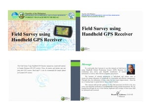
  • 1. Field Survey using Handheld GPS Receiver Republic of the Philippines DEPARTMENT OF ENVIRONMENT AND NATURAL RESOURCES FOREST MANAGEMENT BUREAU Field Survey using Handheld GPS Receiver Republic of the Philippines DEPARTMENT OF ENVIRONMENT AND NATURAL RESOURCES FOREST MANAGEMENT BUREAU This Field Survey Using Handheld GPS Receivers manual was created with reference to Garmin Montana 650 GPS receivers. Hence, the features and interface may vary from other GPS receivers. BaseCampTM is also the recommended file transfer software for Garmin GPS receivers. It is with pride that I present to you this manual on Field Survey using Handheld Global Positioning System (GPS) Receiver for conducting area survey and shapefile rectification of tenurial instruments as well as other forestry programs and projects. The issuance of tenurial instruments to individuals and entities aims to ensure the proper allocation of forestlands for responsible and effective management. Through time, the delineation of these areas has seen major improvement - from the use of analog maps to spatial data in various digital formats. This manual shall provide guidance to the field personnel involved in the area survey and shapefile rectification of proposed and existing tenurial instruments. We are hoping that through the use of this manual, duplicates and overlaps of these areas shall be eliminated and corrected. Ricardo L. Calderon, CESO III Director Message
  • 2. Table of Contents Chapter Topic Page Chapter I Introduction to Global Positioning System (GPS) 1 I.A Origin and Definition 2 I.B How Does the GPS Works 3 I.C The .GPX Format 10 Chapter II The GPS Receiver 12 II.A Parts and Hardware 13 II.B Interface 17 II.C Taking Care of Your GPS Receiver 23 Table of Contents Chapter Topic Page Chapter III Introduction to BaseCampTM 26 Chapter IV Preparatory Activities 35 IV.A GPS Calibration and Customization 36 IV.B Uploading Data using BaseCampTM 44 Chapter V Field Survey 50 V.A Field Surveyof aNew Project 53 V.B Field Surveyof anExisting Project 67 Chapter VI Post Field Survey 1 CHAPTER I INTRODUCTION TO GLOBAL POSITIONING SYSTEM (GPS) 2 Global Positioning System (GPS) is a navigation system consisting of 24 satellites, placed into orbit by the U.S. Department of Defense. Originally intended for military applications, it was made available for civilian use in the 1980s. It is free of charge, works 24/7, anywhere in the world, in any weather condition Source: http://www8.garmin.com/aboutGPS/index.html A. ORIGIN AND DEFINITION FieldSurveyUsingHandheldGPSReceiver
  • 3. 3 B. HOW DOES THE GPS WORK? • GPS satellites circle the Earth twice a day in a very precise orbit, then transmit signal information to the Earth. • GPS receivers take this information and use trilateration to calculate the user's exact location. • 3 satellites are needed to calculate a 2-D position and track movement Source: http://www8.garmin.com/aboutGPS/index.html I.IntroductiontotheGlobalPositioningSystem (GPS) 4 How accurate is the GPS?  The accuracy of the system depends on many factors including the following:  Type of receiver - i.e. recreational/ commercial, mapping/differential, and survey grade  Sources of errors - i.e. atmospheric effects and obstructions Source: Understanding the Global Positioning System (GPS); Cooksey, D. Department of Land Resources and Environmental Sciences Montana State University-Bozeman FieldSurveyUsingHandheldGPSReceiver 5 Types of GPS Receivers:  Recreational/Commercial grade - These receivers are available from commercial retailers and are designed for general navigation and simple waypoint marking. The accuracy of this type of unit is usually greater than or equal to 3 meters. Source: http://water.usgs.gov/osw/gps/ I.IntroductiontotheGlobalPositioningSystem (GPS) 6 Types of GPS Receivers:  Mapping/differential grade - Mapping grade receivers incorporate higher quality antennas and implement corrections that improves the accuracy of the location. Its maximum accuracy can range up to less than one meter. Source: http://water.usgs.gov/osw/gps/ FieldSurveyUsingHandheldGPSReceiver
  • 4. 7 Types of GPS Receivers: • Survey grade - Survey grade receivers are the most accurate and expensive. These are often used by professional surveyors and excel in high accuracy measurements of fixed positions. The accuracy is within centimeters. Source: https://articles.extension.org/pages/40145/what-is-the-difference-between -a-recreational-grade-gps-a-mapping-grade-gps-and-a-survey-grade-gps I.IntroductiontotheGlobalPositioningSystem (GPS) 8 Sources of Errors: • Atmospheric effects - Layers of the atmosphere refract GPS signals. This causes the speed of the transmitted signal to be different from the speed of the GPS signal in space. Source: http://www.montana.edu/gps/understd.html FieldSurveyUsingHandheldGPSReceiver 9 • Obstructions - Any object in the path of the GPS signal can cause interference with the reception. These objects include buildings, large trees and terrain features. Source: http://www.cmtinc.com/gpsbook/#chap2 Sources of Errors: I.IntroductiontotheGlobalPositioningSystem (GPS) 10 C. THE .GPX FILE FORMAT • GPX (the GPS exchange Format) is a data format for exchanging GPS data between programs, and for sharing GPS data with other users. • It allows you to exchange data with a growing list of programs for Windows, MacOS, Linux etc. • It can be transformed into other file formats using a simple webpage or converter program. Source: http://www.topografix.com/gpx_for_users.asp FieldSurveyUsingHandheldGPSReceiver
  • 5. 11 • Data recorded in the GPS receiver (waypoints, tracks etc.) are saved, by default, in .GPX file format. • Before uploading any data in your GPS receiver, be sure to convert it first to .GPX format. I.IntroductiontotheGlobalPositioningSystem (GPS) 12 CHAPTER II THE GPS RECEIVER 13 A. PARTS AND HARDWARE  Camera lens  Power II.TheGPSReceiver 14  MicroSD™ card slot (under battery door)  Auto mount power connector  Stereo headphone jack FieldSurveyUsingHandheldGPSReceiver
  • 6. 15  Mini-USB port (under weather cap)  Battery cover D-ring II.TheGPSReceiver  MCX Port for external GPS antenna (under weather cap) 16  Lithium Battery  AA Battery Sources: http://gpsinformation.info/penrod/Montana/Montana.html http://gpstracklog.com/2011/08/garmin-montana-600-review.html FieldSurveyUsingHandheldGPSReceiver 17 B. INTERFACE Main Menu page Home Screen Tip: You can save commonly used applications in the Home Screen so you don’t have to re-select the Main Menu Page. II.TheGPSReceiver 18  Status bar Found at the upper part of the screen which shows the status of the satellite signal strength, battery and your current location/ geographic coordinates.  Current time and date  Application Drawer Shows other applications that are not saved in the home screen. FieldSurveyUsingHandheldGPSReceiver
  • 7. 19  Profile Change Collection of settings that optimizes your device based on how you are using it.  Mark Waypoint Used to record your current geographic coordinates/ location.  Where To?/Go To Used to find a destination you navigate to. II.TheGPSReceiver 20  Waypoint Manager Used to access stored waypoints.  Track Manager Used to view and edit tracks stored on your device.  Camera Used to take photos embedded with geographic coordinates. FieldSurveyUsingHandheldGPSReceiver 21  Satellite Shows your current location, GPS accuracy, satellite location and signal strength.  Map Shows your current location, elevation, saved waypoints, tracks, roads, rivers and other pertinent geographical information.  Compass Used to navigate to your destination. II.TheGPSReceiver 22  Trip Computer Displays your current speed average speed, maximum speed, trip odometer, and other helpful statistics.  Elevation Plot Displays the elevation for an elapsed time. Sources: https://buy.garmin.com/en-US/US/into-sports/handheld/previous_models_handhelds/ montana-650/prod75227.html; http://www.tramsoft.ch/gps/garmin_montana600_en.html;  Setup Customizes the GPS settings based on your preferences FieldSurveyUsingHandheldGPSReceiver
  • 8. 23 Before Operation:  Make sure that all sides of the battery compartment cover are locked in place to prevent any foreign matter/water from entering the unit.  The battery cover lock must be turned to “locked” position.  To avoid accidental drops, secure the unit by putting the strap in the slot. The strap can be placed in the user’s neck or wrist. C. TAKING CARE OF YOUR GPS RECEIVER II.TheGPSReceiver 24 During Operation:  Each type of receiver has its own tolerance to rain or liquids. Make sure to check the manual before exposing it to rain. DO NOT SOAK the unit in any liquid.  Take extra caution not to let the unit hit hard objects such as rocks FieldSurveyUsingHandheldGPSReceiver 25 After Operation: GPS Receiver Unit  Clean the unit with a cloth moistened with mild detergent solution.  If necessary, use a soft brush to gently clean the vent holes on the back of the unit.  Thoroughly dry the device. GPS Receiver Screen  Clean the screen with a soft, lint-free cloth with water, isopropyl alcohol or eyeglass lens cleaner.  Thoroughly dry the screen.  Store the device in a cool, dry place, away from extreme temperatures. II.TheGPSReceiver 26 CHAPTER III INTRODUCTION TO GARMIN BASECAMPTM
  • 9. 27 BaseCampTM is a software designed for Garmin devices and mapping products. The software allows users to plan and manage trips, routes, tracks, and waypoints between the computer and compatible devices. Introduction to Garmin BaseCampTM Source:: http://static.garmincdn.com/BaseCamp/4_2/en/ III.IntroductiontoGarminBaseCampTM 28 Unique Features of Garmin BaseCampTM  Supports geotagged photos  Organizes data in folder  Allows users to view their data in Google Earth  Converts files from .gpx format to .kml, .tct, .csv and .txt file format or vice versa  Allows users to create waypoints, tracks and routes and save it as .kml or .gpx files FieldSurveyUsingHandheldGPSReceiver 29 Source:: http://static.garmincdn.com/BaseCamp/4_2/en/Default.html GARMIN BaseCampTM Interface (Version 4.6.2) 1 Menu 2 Toolbars 3 Find Result 4 Library and Devices 5 North Indicator/ Map Controller 6 Map 7 Overview Map 8 Information Area 9 Status Bar 10 Search and Filter III.IntroductiontoGarminBaseCampTM 30 Menus Allow users to access various tasks such as create, import/ export data, save file to various formats (.gpx or .kml), send data to other devices such as the GPS, measure distances and view data in Google EarthTM. Toolbars Provide users quick access to various essential tools. The number of toolbars in the interface can be customized depending on the user’s preference. Source: http://static.garmincdn.com/BaseCamp/4_2/en/Default.htm FieldSurveyUsingHandheldGPSReceiver
  • 10. 31 Source: http://static.garmincdn.com/BaseCamp/4_2/en/Default.htm Find Results The feature displays results on queries in Find menu such as point of interest, addresses, internal storage and Garmin Adventures. Library and Devices Area It help users to manage and organize their data. This feature has two panes: the upper pane displays list of collection in My library and connected devices; the lower pane displays the data on each list showed in the upper pane. III.IntroductiontoGarminBaseCampTM 32 North Indicator/Map Controller This shows the orientation of the map view. Users can change the orientation and zoom in and out of the map using the Map Controller. Map Controller North Indicator Map Displays the users map product and shows the created or imported data (waypoints or tracks). Through the menu views, user can change the map view into 2D or 3D depending on the available map data. 2D view 3D view Source: http://static.garmincdn.com/BaseCamp/4_2/en/Default.htm FieldSurveyUsingHandheldGPSReceiver 33 Map Overview The view shows a geographical context of the main map by displaying broader and less detailed map. Information Area This contains details/information of the data found in the library and connected devices. To access its dialog box, double click on the waypoint or tracks that you want to review. Source: http://static.garmincdn.com/BaseCamp/4_2/en/Default.htm III.IntroductiontoGarminBaseCampTM 34 Status bar The status bar shows the number of selected items in Library. It also shows the coordinates of your mouse cursor and distance measurement while using measure tool. Search Filter Allows users to search and filter saved data. No. of tracks or waypoints Distance Coordinates 1 Search tool 2 Filter tool Source: http://static.garmincdn.com/BaseCamp/4_2/en/Default.htm FieldSurveyUsingHandheldGPSReceiver
  • 11. 35 CHAPTER IV PREPARATORY ACTIVITIES 36 A. GPS CALIBRATION AND CUSTOMIZATION It is important to calibrate/customize the GPS receiver settings before starting the field survey. It is recommended that the following settings are customized:  Display  Map  Tracks  Units  Position Format  Heading You can select Reset to restore the default settings and delete saved waypoints and tracks in your GPS receiver. FieldSurveyUsingHandheldGPSReceiver 37 1. Tap Setup menu 2. Tap Display Display settings 3. Tap Calibrate Screen to adjust the touch screen Interface of the GPS Tip: to save more battery power adjust your Backlight Timeout to 30 seconds and also click Battery Save On. 4. Follow the instructions shown on the GPS screen. IV.PreparatoryActivities 38 1.On the Setup menu select Map 2.Select Orientation Map settings 3. Select North Up or Track Up Note: Map orientation depends on the user preference. The advantage of “North Up” is that the user can compare between the GPS maps and their analog maps. FieldSurveyUsingHandheldGPSReceiver
  • 12. 39 Tracks settings (Track log) 1.On the Setup menu select Tracks 2. Select Track Log 3. Select Track Recording Preference IV.PreparatoryActivities 40 1.On the Setup menu select Tracks 2. Select Interval Tracks settings (Track Interval) Note: Choosing “less and least often” will make the track point interval less detail , while using “most and more often” gives you a de- tailed track point however, it will have a bigger file size . FieldSurveyUsingHandheldGPSReceiver 41 Units settings 1.On the Setup menu select Units 2. Select Distance/Speed, Elevation etc. for preferred units Note: The Philippine Government adopted the metric system for unit of measurement as stated in Batas Pambansa Bilang 8 (1972) and Chapter 8 of Executive Order 292 (1987) IV.PreparatoryActivities 42 1.On the Setup menu click Position Format 2. Select Degrees, Minutes, Seconds for Position Format and WGS 84 as Map Datum Position Format Note: Google EarthTM is set to WGS 84 map datum FieldSurveyUsingHandheldGPSReceiver
  • 13. 43 Heading (Compass) settings 1. On the Setup menu select Heading 2. Select Calibrate Compass then Start. Follow the succeeding instructions. IV.PreparatoryActivities 44 B. UPLOADING DATA FROM GARMIN BASECAMPTM TO GPS RECEIVER 1. Connect Garmin GPS device to computer using compatible cable. In the Devices pane, users can view the available devices (i.e. GPS receivers) connected to the computer. Uploading Tracks and Waypoints FieldSurveyUsingHandheldGPSReceiver 45 2. Under the Library > My Collection folder, select and right click on the data that you want to upload and select Send To... 3. Under the Devices tab, select your GPS receiver (ex. Montana 650 (Unit ID)) then click OK. The data can now be viewed in your GPS receiver. IV.PreparatoryActivities 46 Uploading KML or GPX Data to GPS Receiver 1. Import .gpx or .kml file from the your computer to My C o l l e c t i o n o f Garmin BaseCampTM a) Click File menu b) Click Import into ‘My Collection’... Note: Make sure the GPS receiver is connected to your computer through a compatible cable . FieldSurveyUsingHandheldGPSReceiver
  • 14. 47 2. Browse the desired data (should be in .kml or .gpx file format). Select and click “Open”. The imported data will now be visible under the My Collection pane. IV.PreparatoryActivities 48 3. Select the imported data, right click and select Send To... The Select Destination dialog box will appear. 4. Under the Devices tab, select your GPS receiver (ex. Montana 650 (Unit ID)) then click OK. The data can now be viewed in your GPS receiver. FieldSurveyUsingHandheldGPSReceiver 49 Viewing uploaded files from the GPS Receiver 1) Go to Track Manager 2) Select the uploaded track from the file list 3) Tap Show on Map. Once data are uploaded, users can directly view the waypoint or track data in the map page of the GPS by following these steps: IV.PreparatoryActivities 50 CHAPTER V FIELD SURVEY
  • 15. 51 GPS-based field survey is the collection of primary data (waypoints, tracks, photos) at the field level using handheld GPS receivers. It is further classified into surveys of new projects and surveys of existing projects. Kinds of Information Recorded by the GPS Receiver  Location/Waypoints: The geographical coordinates of a single location or point (the current coordinates of where you are standing). V.FieldSurvey 52  Tracks: A series of geographical locations or points that show the path traversed. It is useful for mapping objects that are represented by lines or shapes, such as the course of a road and river or the shape of a field.  Geotagged Photos: Photo embedded with geographical coordinates that indicate the position/location where the photo was taken. It is useful for validation and reconnaissance survey. Source: http://learnosm.org/en/mobile-mapping/using-gps/ FieldSurveyUsingHandheldGPSReceiver 53 A. FIELD SURVEY OF A NEW PROJECT 1) GPS receivers determine geographic coordinates by receiving signals from satellites. To ensure accuracy of the recorded coordinates, go to a place that has a clear view of the sky before you open on the GPS receiver. 2) Press and hold the Power button on the right side of your GPS receiver. Opening the GPS Receiver V.FieldSurvey 54 The Home Screen page is similar to the screenshot shown. The receiver will search for satellite signals for a few seconds or minutes depending on your location. Your current location will be displayed on the top portion of the screen once GPS signal is established. Tip: The five bars on the left shows signal strength. Five green bars indicate very strong signal while orange bars indicate the device is still searching for signal. FieldSurveyUsingHandheldGPSReceiver
  • 16. 55  In the main menu of your GPS receiver, browse and tap the Mark Waypoint icon ( ). 2) There are two options in saving: Save and Edit. If you do not want to save the waypoint, tap the Close icon ( ). Reminder: In marking a waypoint make sure that the accuracy of the GPS is stable (equal or less than to 10 m). Marking Waypoints V.FieldSurvey 56 a) Select Save if you want to save your current location without any changes. The default name and waypoint information will be saved. b) Select Edit if you still want to change or add some information in the waypoint. In the Edit Properties, you can view the Name, Notes, Location, Elevation and Depth of the waypoint. Waypoint Edit Properties FieldSurveyUsingHandheldGPSReceiver 57 Tap the Waypoint Name and Note Box. Use the alphanumeric keyboard (similar to cellular phones) to change or add information. Other information such as Location, Elevation, Depth are automatically detected by the GPS receiver and cannot be changed. When finished, tap Save. Waypoint Name Other Options Close Tip: Additional notes will help you identify each waypoint at the end of the survey. This is very useful when you have saved too many waypoints. V.FieldSurvey 58 1) In the main menu, browse and tap the Waypoint Manager icon ( ). It contains a list of saved waypoints uniquely identified by its name. 2) Browse for the waypoint you want to verify. Tap the waypoint name to view its properties. Reminder: Bring a field note with you and write down all the necessary things. Verifying the Location/Waypoints FieldSurveyUsingHandheldGPSReceiver
  • 17. 59 3) Select View Map to view its location in the map layout. 4) Select Go if you want see the direction from your current location to that that waypoint. Otherwise tap the Back icon ( ). Waypoint Edit Properties Map Page V.FieldSurvey 60 1) In the Main Menu, browse and tap the Setup icon ( ). 2) Inside the Setup menu, browse and select Tracks to view and set the track recording properties (i.e. Track Log, Record Method, Interval, Auto Archive, and Color). Map Page Note: Waypoints are represented by pins while tracks are represented by lines. Recording Tracks FieldSurveyUsingHandheldGPSReceiver 61 3) Select the Track Log option and set it to Record, Show on Map. The Track Log sets whether you want to record your track or not and if it will be shown on the map page.  Do Not Record : track is not saved in the GPS receiver  Record, Do Not Show : track is saved, but not shown in the map page  Record, Show on Map : track is saved and shown in the map page 4) Tap the Record option and set it to Auto. V.FieldSurvey 62 The Record Method sets how your track or path is recorded.  Distance : track is recorded for every specified distance.  Time : track is recorded for every specified time  Auto : create a rate of optimum representation of the tracks. There are five categories that you can select in recording method. Normal is the most commonly used. 5) Select the Interval option and set it to Normal. The Interval property varies depending on the record method (could be distance or time measurement). FieldSurveyUsingHandheldGPSReceiver
  • 18. 63 6) Select the Auto Archive option and set it to Daily. 7) Tap the Color option and set it to your preferred color. Reminder: Don’t stay too long in one area, it may result to tracks that are scattered. V.FieldSurvey The Auto Archive sets the saving schedule of your track.  When Full : tracks are not saved until device memory is full.  Daily : the tracks are automatically saved everyday.  Weekly : the tracks are automatically saved every week 64 1) In your main menu, browse and tap the Track Manager icon ( ). 2) Select Current Track. 3) Select Save Track. 4) Use the alphanumeric keypad to type your preferred name. 5) When finished, select Save ( ) icon. Saving Tracks A track that is being recorded is called Current Track. FieldSurveyUsingHandheldGPSReceiver 65 1) In the main menu, browse and tap the Camera icon ( ). 2) Tap the shutter icon ( )to capture photos. 3) You can tap the “+” or “–” icons to zoom in and out. Capturing Geotagged Photos Note : Photos captured using GPS receivers are automatically embedded with geographical coordinates. V.FieldSurvey 66 1) In the main menu, browse and tap the Photo Viewer icon ( ). The thumbnails of all the geotagged photos will be appear. 2) Select the desired photo. 3) Tap the Options icon ( ) 4) Tap Delete Photo Deleting Wrong Photos FieldSurveyUsingHandheldGPSReceiver
  • 19. 67 B. FIELD SURVEY OF AN EXISTING PROJECT Before going to the field make sure that the Waypoints and Tracks (line or polygon) are downloaded in your GPS (see Chapter V.B). Bring all other documents that may help you in the field survey such as analogue maps or technical descriptions. 1) In the main menu, browse and tap the Waypoint Manager icon ( ). 2) Browse and tap the waypoint you want to locate from the list of saved waypoints. V.FieldSurvey 68 If you are having a hard time searching, tap the “Options” icon ( ) then “Spell Search”. Type the name of the desired waypoint. Tap “Ok” ( ) when finished. 3) Tap the desired waypoint to view its properties. FieldSurveyUsingHandheldGPSReceiver 69  Tap “View Map” to view its location in the map layout. The chosen waypoint is symbolized by the blue pushpin while your current location is symbolized by the blue arrow. 5) Tap “Go” to view the direction from your current location to that waypoint. You wan tap “+” or “-” icons to zoom in and out. V.FieldSurvey 70 6) To guide you in the direction of your waypoint, go back to the main menu and browse and tap the Compass icon ( ). A pointed arrow will help and guide you navi- gate the location of your waypoint. For a more detailed description, choose the small dash- board and change its properties to the following:  Distance to Next : Indicate the distance between the GPS and waypoint.  Elevation : Indicate the meter above sea level of elevation.  Bearing : Pointed at what direction the waypoint is.  GPS Accuracy : Indicate the accuracy of the GPS (+-) FieldSurveyUsingHandheldGPSReceiver
  • 20. 71 7) Once you have relocated the corner, mark it with a new waypoint and name it as an actual mark (ex. Corner 1A). 8) Mark all the new corners of the project to update the existing cor- ners. Reminder: At the end of your field survey make it sure to download all the data in your laptop or computer. V.FieldSurvey 72 CHAPTER VI POST FIELD SURVEY 73 Data captured in a GPS receiver must first be transferred to a computer before it can be used by a mapping or program. There are different kinds software available for transferring data. For this module, we are recommending the use of Garmin BaseCampTM to transfer data to your computer. Source: http://web.extension.illinois.edu/4hmapmakers/resources/3eb.pdf VI.PostFieldSurvey 74 1) Download and install BaseCampTM in your computer (Link: http://www.garmin.com/en-US/shop/downloads/basecamp). 2) Open BaseCampTM in your computer. 3) Connect the GPS receiver to your computer (using GPS axial cord). 4) Click the Receive from Device icon ( ) Downloading Data from GPS Receivers to BaseCampTM FieldSurveyUsingHandheldGPSReceiver
  • 21. 75 4) In the ‘Select Device’ window, select the device name (ex. Montana 650 Unit) then click ‘OK’ 5) The data such as photos, tracks and waypoints will now appear in BaseCampTM. VI.PostFieldSurvey 76 Saving Downloaded GPS Data to the Computer 1) In the Devices pane, click the folder named 'Internal Storage' containing waypoints, tracks, and photos that was imported from your GPS. FieldSurveyUsingHandheldGPSReceiver 77 2) Select the Waypoints, Tracks, and Photos that you want to save. 3) Right click and select ‘Send To’. 4) Select ‘My Collection’. Click ‘OK’. VI.PostFieldSurvey 78 5) To rename the file, select the file you just created under the ‘My Collection’ folder. Right click and select ‘Rename’. You can now rename the file to your preference (ex: DUM). FieldSurveyUsingHandheldGPSReceiver
  • 22. 79 Your waypoints, tracks and geotagged photos are now saved in your computer. You can now use this data for further GIS analysis or use in another GPS devices. VI.PostFieldSurvey Republic of the Philippines Department of Environment and Natural Resources FOREST MANAGEMENT BUREAU Visayas Avenue, Diliman, 1100 Quezon City, Philippines Tel. No.: (632) 927-47-88 / Fax No. (632) 920-03-74 E-mail: fmbdenr@mozcom.com / fmb@denr.gov.ph