A review of the current status of glaciers and sea ice in the Canadian Arctic and Greenland. An examination of the current retreat of glaciers and the fast disapearing sea ice.
This document is a letter from a mother to her daughter announcing an upcoming trip they will take together to Scotland from August 4th to August 13th. The letter provides an itinerary for their trip including visiting cities like Edinburgh and Inverness, landmarks like Eilean Donan Castle and Glencoe, and activities like attending a Highland Gathering. The mother expresses her excitement and says the trip will create memorable experiences for them to share.
Taylor Visconti moved to Austin's Colony in Texas with their family after leaving New Orleans due to a panic. The journey by ship was fun but the early years of the colony were difficult, with harsh winters killing cattle and crops. By 1824, the colony was thriving with a bumper cotton crop and high demand for beef, allowing Visconti to become well-off financially and ensure their family was safe and provided for.
This document provides a summary of sites seen on a field trip, including:
- The Cucamonga Alluvial Fan and debris flow areas in canyons.
- A cinder cone volcano that erupted 500 years ago, and nearby lava flows and obsidian flakes from Native Americans.
- Features formed by water such as metate holes, the Owens River bed, and alluvial fans.
- Sites related to Native Americans including petroglyphs, house rings, and obsidian tool preparation areas.
The document describes where the author spends their holidays. In July, the author and friends went to a campsite in the Tatry mountains in Poland where they climbed Góbałówka mountain. In August, the author and family went to the Baltic Sea where they swam in the very cold water and visited the large Malbork castle.
Fort Atkinson has a population of 11,365 people. Some points of interest in and around Fort Atkinson include the Hoard Museum, Fireside Theatre, an annual rendezvous event, parks and trails, and a city pool. The area is known for cheese, the Green Bay Packers football team, and housing the largest indoor waterpark in the US, the Kalahari Resort. Seasons include warm summers and cold, snowy winters. Nearby attractions include the Wisconsin Dells water parks and amusement areas, and lakes Michigan and Koshkonong, fed by the Rock River flowing through Fort Atkinson.
1) The document describes various rocks, geological features, and geological processes observed by the author. Samples include igneous basalt from Los Gatos Creek Park, sedimentary conglomerate and chert rocks, and metamorphic quartzite from La Rumorosa, Tijuana.
2) Additional observations include gravel from a creek bed, a dip-slip fault seen near the Kings River, stream erosion transporting rocks and sediment in Los Gatos Creek, rusting as an example of weathering on an outdoor metal tank, and a rock slide as an example of mass wasting along highway 198 near Coalinga, CA.
3) Details are provided on the location and descriptive features of each
This document provides a summary of sites seen on a field trip, including:
- The Cucamonga Alluvial Fan and debris flow areas.
- A cinder cone volcano that erupted 500 years ago.
- Lava flows and the Owens River.
- Native American artifacts like petroglyphs, obsidian flakes, and house rings.
- Geological features like the Sierra Nevada mountains, faults, and lakes.
- Historical locations like Manzanar internment camp and the LA Aqueduct.
- Current scenery including Joshua trees, tufa formations, and Convict Lake.
Mormon Rocks are sandstone rock formations named for Mormon pioneers who would camp near them after crossing the Mojave Desert. They were created by movements along the San Andreas Fault. The San Andreas Fault is a major fracture zone in California's crust that has caused many earthquakes as the tectonic plates move along it. Joshua Trees were probably named by Mormons during their 1851 trek from Utah to Southern California.
The document discusses different types of glacial ice formations including glaciers, ice caps, ice sheets, and niche ice. It provides examples of each type through photographs of glaciers in locations like Wyoming, Ecuador, Alaska, and New Zealand. The text also examines glacial landforms created by erosion and deposition as glaciers advance and retreat, such as moraines, eskers, drumlins, and outwash plains.
The document discusses coastal environments and Fiordland in New Zealand. It describes how glaciers during the ice age carved out the Southern Alps mountain range and formed the fiords in Fiordland over 500,000 years ago. Fiords are U-shaped valleys that were deepened and extended into the sea by advancing glaciers. The document also provides information about the Moeraki Boulders, large spherical stones found on beaches in New Zealand that are actually fossilized concretions formed over lime and minerals that date back 60 million years.
Peter Knight photographed various glaciers around the world including niche glaciers in Wyoming that are sensitive to climate change, the ice cap on Cotopaxi volcano in Ecuador which extends further on the windward side due to higher snowfall, and valley, mountain, and ice sheet glaciers in locations such as Alaska, Greenland, and New Zealand. The photos show glacial landforms and features including moraines, crevasses, ice caves, supraglacial streams, ice cliffs, striations, and erratics.
Comprehensive powerpoint on features of Glacial Erosion.
Introduction to Glaciers and Ice, plucking, abrasion and freeze-thaw, followed by descriptions and photographs of:
Corries
Aretes
Pyramidal Peaks
U-Shaped Valleys
Hanging Valleys
Truncated Spurs
Ribbon Lakes
Glaciers slowly carve and shape the landscape as they move. They act like sandpaper to erode the land underneath. Glaciers leave behind several telltale features that indicate they once passed through an area, including U-shaped valleys, cirques, arêtes, horns, erratics, moraines, and eskers. Glaciers are retreating rapidly due to climate change, altering ecosystems and hydrology. Their melting is evidence of global warming.
Glaciers form from compacted snow and slowly move under gravity, eroding the landscape. During glaciation, mountain valleys are typically V-shaped but become wider and deeper U-shapes as glaciers scour the rock. Glacial erosion forms landforms like moraines, corries, pyramidal peaks, and arêtes. Kames are hills left when glacial meltwater deposits sediment. Alaska has over 100,000 unnamed glaciers within its landscape.
Mary Edwards - The Big Thaw - Isle of Wight Cafe Sci, Oct 2016Simon Perry
Professor Mary Edwards, from the Geography Department at Southampton University, talks about The Big Thaw: A warming, changing Arctic.
She considers the fragility of Arctic systems, drawing upon examples from Alaska, where she lived for several years, and Siberia, the largest northern land area affected by warming.
Glacial ice is the largest reservoir of freshwater on Earth and supports one third of the world's population. Glaciers form on land where snow accumulation exceeds melting. They slowly deform and flow due to their own weight, creating features like crevasses. Glaciers erode the underlying landscape through abrasion and plucking of rock debris. As they carry this debris and later melt, glaciers leave behind landforms such as moraines, eskers, and drumlins that provide evidence of past glacial activity. Glacial periods within ice ages are marked by colder temperatures and advancing glaciers, while interglacials are warmer intervals between them.
This topic is all about Glaciation. This includes; the causes of glaciation, the origin of glaciers, formation, primary types, movement, the erosional, transportation and depositional mechanisms. This also includes the common landforms brought by glaciers.
The document describes waterfalls located along the River Twiss and River Doe near Ingleton, North Yorkshire. It includes photos and questions about the geology and features of the waterfalls, such as the vegetation, relief, and erosion patterns visible. Differential erosion has created circular plunge pools below harder limestone bands. Over time, waterfalls will move upstream, leaving steep gorges as the erosion process continues.
This document summarizes different types of coastal landforms including those formed by changes in sea level: rias are flooded river valleys with gently sloping sides; fjords are steep-walled glacial valleys flooded after ice melt; and raised beaches and abandoned coastlines provide evidence of higher former sea levels. Eustatic sea level changes are global in scale due to ice volume changes, while isostatic changes are local and caused by land level changes from glacial rebound or subsidence under ice weight.
Glaciation in upland areas has created landforms like corries, arêtes, and pyramidal peaks through freeze-thaw weathering and erosion by glaciers. Glaciers carved out U-shaped valleys and left behind landforms like hanging valleys, truncated spurs, and ribbon lakes. Glacial deposition formed features such as drumlins, moraines, and boulder clay. Upland glaciated areas are used for marginal farming, forestry, and tourism, but management is needed to address issues from overuse, like erosion, and conflicts between different user groups.
The document describes glacial and glaciofluvial deposits found in Alberta, Canada, including till, varves, eskers, and kame deltas. Varves are annual layers deposited in glacial lakes, with finer layers in winter and coarser in summer. Varves in the image were deposited in Glacial Lake Leduc and allow dating the lake. As the lake deepened over time, the varves became thinner and better defined as the sediment source moved farther. Glaciofluvial features like eskers and outwash plains can impact human activities by providing resources or affecting drainage.
From Coventry Village to Lake View Cemetery, we follow Dugway west branch as it cuts through sandstone terraces and shale ravines.See how Dugway denizens have used local rocks and waters for milling, quarrying and building, and for burying the dead and schooling children.Learn the natural base for the suburban built environment on the Portage Escarpment. Broach issues of stream conservation and the greening of residential development.
Glaciers are large masses of snow and ice that accumulate over time under their own weight and slowly flow outward. They are formed from accumulating snow, and their lower layers crack as they move due to their great size and weight. It is normal for glaciers to melt gradually as temperatures rise, but many glaciers today are melting faster than snow can replenish them, reducing their sizes and contributing to rising sea levels. There are different types of glaciers including alpine, continental, and valley glaciers.
The Twelve Apostles are a collection of limestone rock stacks off the coast of Port Campbell National Park in Australia that were formed when erosion of the limestone cliffs by the Southern Ocean created caves that eventually collapsed, leaving tall rock stacks isolated from the shore. Known originally as the Sow and Piglets and later renamed the Twelve Apostles for tourism despite never having more than nine stacks, the limestone formations were created over 10-20 million years by erosion of the mainland cliffs.
The document discusses the history and causes of ice ages on Earth. It notes that ice ages have occurred approximately every 100,000 years for the past 2.6 million years during the Pleistocene epoch. The cycles are influenced by variations in Earth's orbit and axis known as Milankovitch cycles, which affect the amount of solar energy reaching the planet. The carbonate-silicate cycle also influences temperatures by sequestering carbon dioxide in rocks over long timescales.
Similar to What do glaciers tell us when they growl (20)
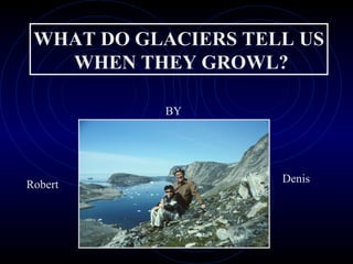
An overview of the early days of the Polar Continental Shelf Project, the science logistic support project for scientists working in the Canadian Arctic
The document provides an overview of the history and engineering details of the Panama Canal. It describes how the French initially tried but failed to build a sea-level canal in the 1880s. The US later took over the project, with chief engineer John Stevens deciding to build a lock canal with three sets of locks to lift ships 85 feet to a summit lake. A huge earthen dam was constructed to provide water for the locks from the newly created Lake Gatun, the world's largest man-made lake at the time. On average 14,000 ships transit the canal annually, with 52 million gallons of water used per large cruise ship passage.
The document provides an overview of the complex history of attempts to find the Northwest Passage by various explorers between the 16th and 19th centuries. It summarizes expeditions led by Martin Frobisher, William Baffin, John Ross, Edward Parry, Thomas Simpson, and Francis McClintock. It then focuses on the ill-fated expedition of Sir John Franklin in 1845 aboard HMS Erebus and HMS Terror, describing their disappearance and McClintock's 1859 discovery of clues to their fate, including abandoned materials and human remains.
This presentation was provided by Rebecca Benner, Ph.D., of the American Society of Anesthesiologists, for the second session of NISO's 2024 Training Series "DEIA in the Scholarly Landscape." Session Two: 'Expanding Pathways to Publishing Careers,' was held June 13, 2024.
🔥🔥🔥🔥🔥🔥🔥🔥🔥
إضغ بين إيديكم من أقوى الملازم التي صممتها
ملزمة تشريح الجهاز الهيكلي (نظري 3)
💀💀💀💀💀💀💀💀💀💀
تتميز هذهِ الملزمة بعِدة مُميزات :
1- مُترجمة ترجمة تُناسب جميع المستويات
2- تحتوي على 78 رسم توضيحي لكل كلمة موجودة بالملزمة (لكل كلمة !!!!)
#فهم_ماكو_درخ
3- دقة الكتابة والصور عالية جداً جداً جداً
4- هُنالك بعض المعلومات تم توضيحها بشكل تفصيلي جداً (تُعتبر لدى الطالب أو الطالبة بإنها معلومات مُبهمة ومع ذلك تم توضيح هذهِ المعلومات المُبهمة بشكل تفصيلي جداً
5- الملزمة تشرح نفسها ب نفسها بس تكلك تعال اقراني
6- تحتوي الملزمة في اول سلايد على خارطة تتضمن جميع تفرُعات معلومات الجهاز الهيكلي المذكورة في هذهِ الملزمة
واخيراً هذهِ الملزمة حلالٌ عليكم وإتمنى منكم إن تدعولي بالخير والصحة والعافية فقط
كل التوفيق زملائي وزميلاتي ، زميلكم محمد الذهبي 💊💊
🔥🔥🔥🔥🔥🔥🔥🔥🔥
How Barcodes Can Be Leveraged Within Odoo 17Celine George
In this presentation, we will explore how barcodes can be leveraged within Odoo 17 to streamline our manufacturing processes. We will cover the configuration steps, how to utilize barcodes in different manufacturing scenarios, and the overall benefits of implementing this technology.
Beyond Degrees - Empowering the Workforce in the Context of Skills-First.pptxEduSkills OECD
Iván Bornacelly, Policy Analyst at the OECD Centre for Skills, OECD, presents at the webinar 'Tackling job market gaps with a skills-first approach' on 12 June 2024
A Visual Guide to 1 Samuel | A Tale of Two HeartsSteve Thomason
These slides walk through the story of 1 Samuel. Samuel is the last judge of Israel. The people reject God and want a king. Saul is anointed as the first king, but he is not a good king. David, the shepherd boy is anointed and Saul is envious of him. David shows honor while Saul continues to self destruct.
Elevate Your Nonprofit's Online Presence_ A Guide to Effective SEO Strategies...TechSoup
Whether you're new to SEO or looking to refine your existing strategies, this webinar will provide you with actionable insights and practical tips to elevate your nonprofit's online presence.