This document summarizes a study analyzing a natural fault exposure along the Wasatch Fault Zone in Utah using digital remote logging techniques. The study identified at least two past seismic events between 500-3,000 years ago through 3D modeling of the fault plane, with estimated slip of 0.5-2.5 meters. While the amount of slip was relatively minor, the soil destabilization poses risks to nearby housing. Correlating these events to other sites may help determine if fault segment ruptures occurred simultaneously.
Glacial Lake Ontonagon and the Development of Large Scale LandslidesStan Vitton
Glacial Lake Ontonagon was one of the first pro-glacier lakes formed during the retreat of the Laurentide Ice Sheet during the end of the Wisconsin Glacial period. The lake was just south of present day Lake Superior but flowed westward toward the Mississippi River due to Lake Superior still being filled with ice. The lake form significant lacustrine deposit over lying a river sand. A recent large scale landslide occurred on an ox bow of the river, with the failure being generated by soil liquefaction in the lower sand unit.
Gigantic submarine landslides are among the most energetic events on the Earth surface. During the Late Pleistocene the Mediterranean Sea was the scenario of a 9 number of such events, some of whose geological fingerprints are the 500 km3 mass transport deposit SL2 at the Nile delta fan (dated at ca. 110 ka BP) and the Herodotus Basing Megaturbidite (HBM, a 400 ...
Telluric currents are the currents that are responsible for the generation of earth's magnetic field. Also the help the earth to bound onto the solar path around the sun.
Shear wave velocity and Geology Based Seismic Microzonation of Port-au-Prince...Johana Sharmin
This is a presentation entirely based on the paper published by Brady R. Cox and his team. I just focused on the key points of the paper in the presentation.
Remote Sensing Technique as Exploration Tool for Ground water in Parts of the...theijes
The study area lies within latitudes 8°00' – 9°00'N and longitudes 11°30' – 12°30'E. Analysis of remote sensing imageries of part of the Upper Benue Trough of Nigeria was carried out on a scale of 1:100,000. The aim of this study includes the structural interpretation of the remote sensing data and the identification of the lineament and drainage patterns associated with the area to infer the influence of such structures on the economic potential of the basin. Results of the structural analysis revealed numerous lineaments. Trend analysis of the lineaments plotted on a rose diagram using the strikes and lengths of the entire lineaments revealed structural trends predominating in the NE-SW direction. The absence of visible lineaments in parts of the area may not indicate absence of geological structures. Some of these lineaments were found on some drainages showing that the drainages in those areas are structurally and tectonically controlled. The areas where the lineaments cross each other are indicative of groundwater availability and there correspond to regions of mean topographic height of about 900m
NISAR
Oil, Gas, and Water Underground Reservoirs
NASA
National Aeronautics and Space Administration
NASA-ISRO Synthetic Aperture Radar (NISAR)
By
Dr. Pankaj Dhussa
-Examined features ranging from valley systems in Margaritifer Sinus to inverted topography in Aeolis/Zephyria Plana
-Studied and analyzed MOLA, THEMIS-VIS, OMEGA, MOC, CRISM, HRSC, and CTX imagery
The Ecuadorian shoreline is considered highly susceptible by impacts of tsunamis triggered by marine quakes or submarine landslides occurring close or nearby the subduction zone between the Nazca, Caribbean and South American plates. Since 1877 one dozen known tsunamis have been witnessed along this coast, mostly related to short-distanced seismic activities (earthquakes between Mw 6.9 to 8.8). However, no evidence of these impacts has been recorded in the sedimentary stratigraphy on the Ecuadorian platform so far. Nonetheless, in the southwestern
part of the Gulf of Guayaquil, due to a biological, chemical, stratigraphic and geochronologic study of a few cored samples an anomalous horizon to the other sedimentary layers has been identified and recognized as a paleo-tsunami deposit. This layer having a thickness of up to 10 cm and up to 1100 meters away from the actual shore, demonstrates various criteria which confirm its origin such as deep sea foraminifera like Pullenia bulloides, run-up and backwash features, fragments of molluscs, which are absent in other sedimentary levels, matrix of weathered chlorite potentially originated by glauconite besides other. Geocronologic evidence together with the calculated sedimentation rate, implies that a the tsunami surged the coastal lowlands around Villamil Playas about 1250 ± 50 yrs ago and must have been a major event originated from the western or northwestern direction.
Hydraulic fracturing has been inferred to trigger the majority of injection-induced earthquakes in western Canada, in contrast to the midwestern United States where massive saltwater disposal is the dominant triggering mechanism. A template-based earthquake catalog from a seismically active Canadian shale play, combined with comprehensive injection data during a 4-month interval, shows that earthquakes are tightly clustered in space and time near hydraulic fracturing sites. The largest event [moment magnitude (MW) 3.9] occurred several weeks after injection along a fault that appears to extend from the injection zone into crystalline basement. Patterns of seismicity indicate that stress changes during operations can activate fault slip to an offset distance of >1 km, whereas pressurization by hydraulic fracturing into a fault yields episodic seismicity that can persist for months.
Different Martian Crustal Seismic Velocities across the Dichotomy Boundary fr...Sérgio Sacani
Article This article is protected by copyright. All rights reserved.
Abstract
We have observed both minor-arc (R1) and major-arc (R2) Rayleigh waves for the largest marsquake (magnitude
of 4.7 ± 0.2) ever recorded. Along the R1 path (in the lowlands), inversion results show that a simple, two-layer
model with an interface located at 21 - 29 km and an upper crustal shear-wave velocity of 3.05 - 3.17 km/s can fit the
group velocity measurements. Along the R2 path, observations can be explained by upper crustal thickness models
constrained from gravity data and upper crustal shear-wave velocities of 2.61 - 3.27 km/s and 3.28 - 3.52 km/s in the
lowlands and highlands, respectively. The shear-wave velocity being faster in the highlands than in the lowlands
indicates the possible existence of sedimentary rocks, and relatively higher porosity in the lowlands.
It has been proposed that ~3.4 billion years ago an ocean fed by enormous catastrophic floods covered
most of the Martian northern lowlands. However, a persistent problem with this hypothesis is the
lack of definitive paleoshoreline features. Here, based on geomorphic and thermal image mapping in
the circum-Chryse and northwestern Arabia Terra regions of the northern plains, in combination with
numerical analyses, we show evidence for two enormous tsunami events possibly triggered by bolide
impacts, resulting in craters ~30km in diameter and occurring perhaps a few million years apart. The
tsunamis produced widespread littoral landforms, including run-up water-ice-rich and bouldery lobes,
which extended tens to hundreds of kilometers over gently sloping plains and boundary cratered
highlands, as well as backwash channels where wave retreat occurred on highland-boundary surfaces.
The ice-rich lobes formed in association with the younger tsunami, showing that their emplacement
took place following a transition into a colder global climatic regime that occurred after the older
tsunami event. We conclude that, on early Mars, tsunamis played a major role in generating and
resurfacing coastal terrains.
Student Name Bud BennemanGeology 105 Spring 2020Paper Outline.docxdeanmtaylor1545
Student Name: Bud Benneman
Geology 105 Spring 2020
Paper Outline
The Newport–Inglewood fault zone (NIFZ) of southern California.
I. The Newport–Inglewood fault zone (NIFZ) was first identified as a significant threat to southern California residents in 1933 when it generated the Magnitude 6.3 Long Beach Earthquake, killing 115 people.
A. The Newport Inglewood fault is located in southern Los Angeles County in the city of Inglewood and transverses south to Newport Beach in Orange County where it becomes an off shore fault.
B. The NIFZ then connects to the Rose Canyon Fault none, becomes a landward fault in San Diego County.
C. This is a stress reliever Strike-Slip Fault Zone associated with the San Andréas Fault Zone.
D. Ground water basins in Los Angeles County may be used as predictors of fault movement due to sudden changes in ground water level.
E. In southern California, tectonic deformation between
the Pacific and North American plates is accommodated primarily by a zone of strike-slip faults,
II. This fault is important to the exploration of Oil.
A. The NIFZ has been studied extensively in the Los Angeles basin by petroleum geologists.
B. The NIFZ overlies a major tectonic boundary separating eastern continental basement rocks of granitic and associated metamorphic rocks of Santa Catalina Island schist.
C. The NIFZ follows along a former Mesozoic subduction zone.
D. This fault is associated with several oil basins including Newport Beach, Huntington Beach, Seal Beach, Long Beach, and Signal Hill.
III. Earthquake Potential for Los Angeles, Orange and San Diego Counties.
A. The epicenter for the 1933 Long Beach Quake was located in Newport Beach just south of the Santa Ana River discharge into the Pacific Ocean.
B. Orange County in 1933 consisted of small farm-towns, cattle ranching and agricultural fields.
C. The closest city of significant development was Lang Beach, which was devastated by the 1933 6,3 quake.
D. Today cities of Newport Beach, Huntington Beach, Costa Mesa, are large population centers, which have replaced agriculture as the primary economic sector.
E. The rate of ground water basin contraction is important in determining possible earthquake releases in the Los Angeles Basin.
F. Many Orange and Los Angeles county buildings are located along high risk development zones during earthquakes.
IV. Earthquake Monitoring and Prediction
a. The location of the 2000 cluster is southwest of an area of active faulting from 1982 to 1990 along this zone and reported strike-slip offshore fault between Newport Beach and the San Joaquin Hills was traced from seismic activity.
b. Analyzed microseismicity from a cluster of epicenters between 2 and 2.5 km along the fault zone suggest potential earthquakes of higher magnitude are possible.
c. A possible 7.5 magnitude earthquake could result from rupture of the entire fault. The 6.5-km depth of the Newport Beach seismicity cluster does not provide informat.
Student Name Bud BennemanGeology 105 Spring 2020Paper Outline.docxcpatriciarpatricia
Student Name: Bud Benneman
Geology 105 Spring 2020
Paper Outline
The Newport–Inglewood fault zone (NIFZ) of southern California.
I. The Newport–Inglewood fault zone (NIFZ) was first identified as a significant threat to southern California residents in 1933 when it generated the Magnitude 6.3 Long Beach Earthquake, killing 115 people.
A. The Newport Inglewood fault is located in southern Los Angeles County in the city of Inglewood and transverses south to Newport Beach in Orange County where it becomes an off shore fault.
B. The NIFZ then connects to the Rose Canyon Fault none, becomes a landward fault in San Diego County.
C. This is a stress reliever Strike-Slip Fault Zone associated with the San Andréas Fault Zone.
D. Ground water basins in Los Angeles County may be used as predictors of fault movement due to sudden changes in ground water level.
E. In southern California, tectonic deformation between
the Pacific and North American plates is accommodated primarily by a zone of strike-slip faults,
II. This fault is important to the exploration of Oil.
A. The NIFZ has been studied extensively in the Los Angeles basin by petroleum geologists.
B. The NIFZ overlies a major tectonic boundary separating eastern continental basement rocks of granitic and associated metamorphic rocks of Santa Catalina Island schist.
C. The NIFZ follows along a former Mesozoic subduction zone.
D. This fault is associated with several oil basins including Newport Beach, Huntington Beach, Seal Beach, Long Beach, and Signal Hill.
III. Earthquake Potential for Los Angeles, Orange and San Diego Counties.
A. The epicenter for the 1933 Long Beach Quake was located in Newport Beach just south of the Santa Ana River discharge into the Pacific Ocean.
B. Orange County in 1933 consisted of small farm-towns, cattle ranching and agricultural fields.
C. The closest city of significant development was Lang Beach, which was devastated by the 1933 6,3 quake.
D. Today cities of Newport Beach, Huntington Beach, Costa Mesa, are large population centers, which have replaced agriculture as the primary economic sector.
E. The rate of ground water basin contraction is important in determining possible earthquake releases in the Los Angeles Basin.
F. Many Orange and Los Angeles county buildings are located along high risk development zones during earthquakes.
IV. Earthquake Monitoring and Prediction
a. The location of the 2000 cluster is southwest of an area of active faulting from 1982 to 1990 along this zone and reported strike-slip offshore fault between Newport Beach and the San Joaquin Hills was traced from seismic activity.
b. Analyzed microseismicity from a cluster of epicenters between 2 and 2.5 km along the fault zone suggest potential earthquakes of higher magnitude are possible.
c. A possible 7.5 magnitude earthquake could result from rupture of the entire fault. The 6.5-km depth of the Newport Beach seismicity cluster does not provide informat.
Formation of lunar surface water associated with high-energy electrons in Ear...Sérgio Sacani
Solar wind implantation is thought to be one of the primary mechanisms in
the formation of water (OH/H2O) on the surface of the Moon and possibly
on the surface of other airless bodies. The lunar nearside spends ~27% of
its daytime in Earth’s magnetotail where the solar wind flux is reduced
by as much as ~99%. However, no correlated decrease in surficial water
content has yet been seen on the lunar nearside. Here we report abundance
observations of lunar surficial water on the nearside at different stages
during the Moon’s passage through Earth’s magnetotail. We find that the
water abundance at lunar mid-latitudes substantially increases in the dusk
and dawn magnetosheath when the solar wind flux increases, yet remains
nearly constant across the central magnetotail. We suggest that although
we have confirmed the importance of the solar wind as a major source of
fast water production on the Moon, hitherto unobserved properties of the
plasma sheet properties may also play an important role.
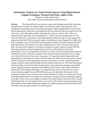
1. Paleoseismic Analysis of a Natural Fault Exposure Using Digital-Remote
Logging Techniques, Wasatch Fault Zone, Alpine, Utah.
Michael J. Arnoff, Nathan Toke
Utah Valley University Department of Earth Science
Abstract: The Wasatch Fault is an extensive, north-south trending normal fault stretching
throughout most of Utah and southern Idaho. The fault trace itself is discontinuous, and is
comprised of ten parallel segments previously thought to rupture independently of one another.
Recent paleoseismic studies have concluded that the Provo and Salt Lake City segments are the
most active, with radiocarbon samples indicating slip events as recent as 1kya. These two
segments border each other, but are separated by a ~10km, east-west trending stepover zone
where the fault trace is concealed. Trench data gathered within this stepover zone suggest that
segments within the WFZ may actually rupture simultaneously when triggered by a sufficiently
large earthquake event. The possibility of multisegment ruptures occurring along the WFZ has
great implications with respect to the safety and prosperity of Utah’s citizens living near the
fault. The goal of this research is to further investigate the rupture scheme along the WFZ by
observing quaternary sediment displacements and other surficial features that reflect
paleoseismic events. One such feature of interest is a small (~5x10m) channel located along the
northernmost portion of the Provo segment. The channel itself has experienced mass wasting
even within the last two to three years, exposing a ~2m long fault plane striking north-south
(perpendicular to the direction of mass wasting). Plant roots observed along this newly exposed
surface are aligned with the general slip direction of the fault as a whole, a phenomenon that
strongly indicates recent normal-oblique fault movement within the area. The short-lived nature
of this naturally-cut trench provided an opportunity to log sedimentary packages using digital-
remote logging techniques, primarily 3D modelling of the exposure using Agisoft Photoscan
Professional. The resulting 3D imagery was logged by hand, and no fewer than two seismic
events occurring roughly between 500-3000 years ago were identified. The amount of slip
resulting from these events was relatively minimal (between 0.5m &2.5m, respectively), but the
resulting destabilization of overlying soil is alarming to housing divisions immediately adjacent
to the fault. These events were roughly correlated with similar features observed within a nearby
USGS-dug trench. It is still unclear if these two events are the result of energy translating across
fault segments, and reliable radiocarbon samples are needed to properly date and correlate them
with slip events along the Salt Lake City fault segment.