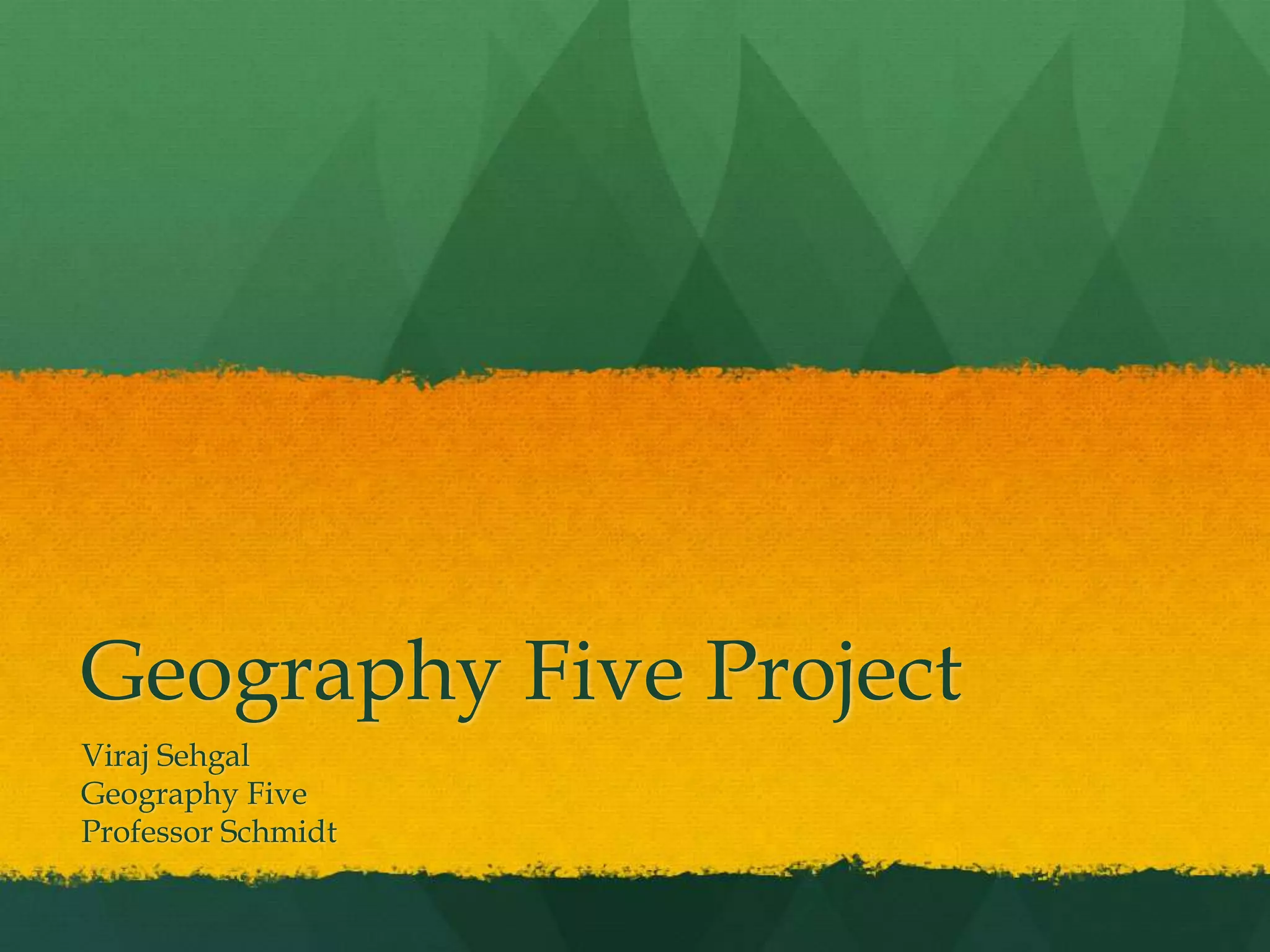
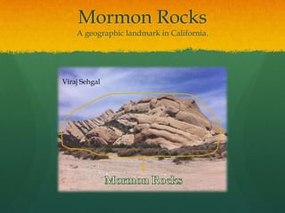
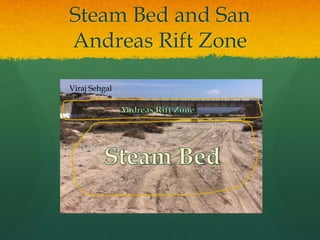
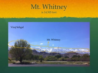
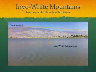
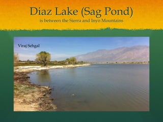
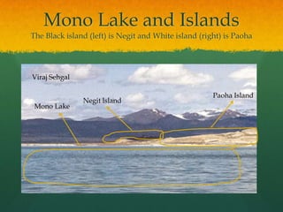
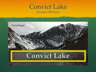
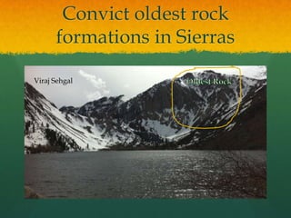
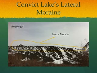
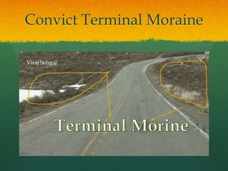
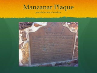
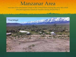
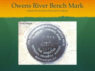
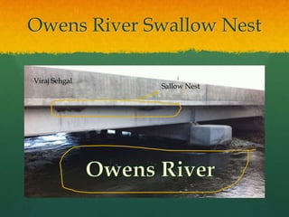
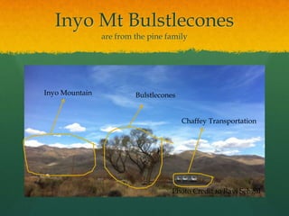
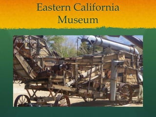
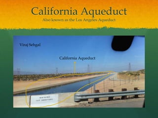
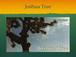
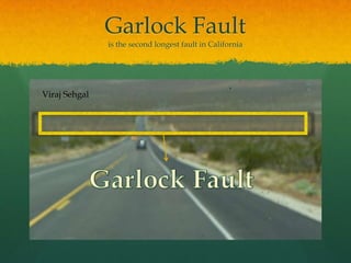
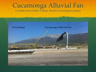
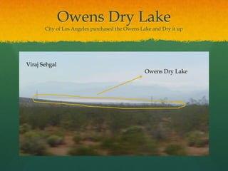
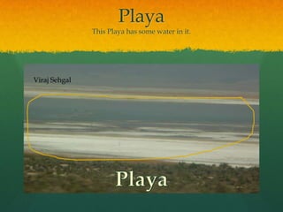
Geography Five Project Viraj SehgalGeography FiveProfessor Schmidt
Mormon RocksA geographic landmark in California.Viraj SehgalMormon Rocks
Granular StructureThey are small sandstone up close. Viraj SehgalGranular Structure
Steam Bed and San Andreas Rift ZoneViraj SehgalAndreas Rift ZoneSteam Bed
Mt. Whitneyis 14,505 feetViraj SehgalMt. Whitney
Inyo-White Mountainshave lower elevation than the SierrasViraj SehgalInyo-White Mountains
Alluvial FanNamed after the fanned-out shape!Viraj SehgalAlluvial Fan
Diaz Lake (Sag Pond)is between the Sierra and Inyo MountainsViraj Sehgal
Lone Pine Faultis at the base of the Alabama HillsViraj SehgalLone Pine Fault
Keoughs Hot SpringsHot StreamThey are hot because of volcano under the steam Viraj Sehgal
Mono Lake and IslandsThe Black island (left) is Negit and White island (right) is PaohaViraj SehgalPaoha IslandNegitlslandMono Lake
Mono Lake’s Former ShorelinesViraj SehgalFormer Shorelines
Mono Lake TufaIs basely a limestone  Viraj SehgalTufa
Mono CreatorNorth American New MountainViraj SehgalMono Creator
Panum Crater Glaciated U Shape Valley and Moraine Viraj Sehgal“U” Shape ValleyMoraine
Convict Lakeelevation 7850 feet!!Viraj SehgalConvict Lake
Convict oldest rock formations in SierrasViraj SehgalOldest Rock
Convict Lake’s Lateral MoraineViraj SehgalLateral Moraine
Convict Terminal MoraineViraj SehgalTerminal Morine
ManzanarThe War Relocation CenterViraj Sehgal
Manzanar Plaquepeaceful words of wisdom.Viraj Sehgal
Manzanar Areawas one of ten internment camps in the United States during the early-40s which relocated Japanese-American families during World War 2.Viraj Sehgal
Owens River Bench Markindicate the elevation of the area it is placed. Viraj Sehgal
Owens River Swallow NestViraj SehgalSallow NestOwens River
Inyo Mt Bulstleconesare from the pine familyInyo MountainBulstleconesChaffey TransportationPhoto Credit to Ravi Sehgal
Eastern California MuseumViraj SehgalViraj Sehgal
California AqueductAlso known as the Los Angeles AqueductViraj SehgalCalifornia Aqueduct
Joshua TreeViraj SehgalJoshua Tree
SETI Towersstands for Search For Terrestrial Intelligence!Viraj SehgalSETI Towers
Doppler Radar Toweris used to make weather predictions Viraj SehgalDoppler Radar Tower
Cinder HillAlso known as Red HillViraj SehgalCinder Hill
Solar Power Plantare by Kramer JunctionViraj SehgalSolar Power Plant
Mine Tailingsthey seems like White HillsViraj SehgalMine Tailings
Garlock Faultis the second longest fault in CaliforniaViraj SehgalGarlock Fault
Cucamonga Alluvial Fanis visible from Chaffey College  Rancho Cucamonga Campus!Viraj SehgalCucamonga Alluvial Fan
Owens Dry LakeCity of Los Angeles purchased the Owens Lake and Dry it upViraj SehgalOwens Dry Lake
PlayaThis Playa has some water in it.Viraj SehgalPlaya

Viraj Sehgal Geography Five Project 63650

Editor's Notes

  • #5 In the Stream bed water flows when it rains.
  • #12 The Small Black island is Negit Island and the Big White one is Paoha island. The water in the picture is mono lake
  • #13 Mono Former Shorelines is the mountains
  • #15 North American New Mountain
  • #16 Panum Crater Glaciated Valley is the U shape in the snowing mountains and the Moraine is the black mountain under it.
  • #18 Convict oldest rock formations in Sierras IS ON THE Right side of the mountain the biggest mountain!
  • #19 1000-foot-high lateral moraine extending east-northeast!
  • #22 Manzanar was one of ten internment camps in the United States during the early-40s which relocated Japanese-American families during World War 2.
  • #24 indicate the elevation of the area it is placed.
  • #26 Photo Credit to Ravi Sehgal
  • #27 This Picture was taken at the Eastern Californian Museum I chosen this because this how they used to farm. It’s a master piece.
  • #28 The California Aqueduct is also known as the Los Angeles Aqueduct is not a favorite is by the Eastern Californian
  • #29 The name Joshua Tree was given by a group of Mormon settlers who crossed the Mojave Desert in the mid-19th century. (Wikipedia)
  • #30 The SETI Towers stands for Search For Terrestrial Intelligence!
  • #31 The Doppler Radar Tower is used to make weather predictions
  • #32 Cinder Hill is also known as Red Hill.
  • #33 The Solar Power Plant are by Kramer Junction!
  • #34 The small mountain in this picture are Mine Tailings!
  • #35 This picture isn’t the best. However, the Garlock Fault is the second longest fault in California!
  • #36 The Alluvial fan is visible from Chaffey College Rancho Cucamonga!
  • #37 City of Los Angeles purchased the Owens Lake and Dry it up!
  • #38 This Playa has some water in it.