Download to read offline


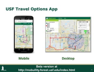


The USF Travel Options App aims to assist students, staff, and visitors with navigation around the University of South Florida campus by providing real-time information on various transportation modes such as driving, biking, and public transit. Funded initially by the USF Student Green Energy Fund, the app features functionalities like locating buildings, bike share availability, and routing based on campus infrastructure. Developed by the Center for Urban Transportation Research, the app is open-source and can be adapted for use at different university campuses.