Download to read offline

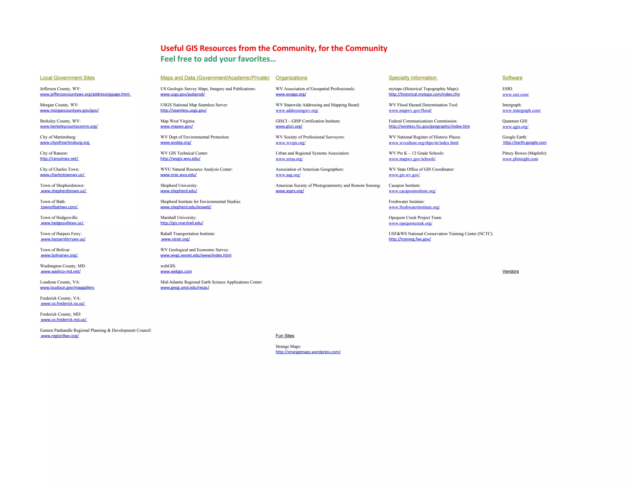

This document provides a list of useful GIS resources from various categories including local government sites, maps and data sources, organizations, specialty information, software, and fun sites. Resources are included from federal, state, local, academic and private entities. The broad range of resources covered in the short list are meant to be helpful for GIS professionals and users in the community.


![[COSCUP x GNOME.Asia x openSUSE 2018] Support to Korean language on GNOME CJ...](https://cdn.slidesharecdn.com/ss_thumbnails/20180811supportforkoreanlanguagecjkissues-180811031315-thumbnail.jpg?width=640&height=640&fit=bounds)


