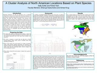
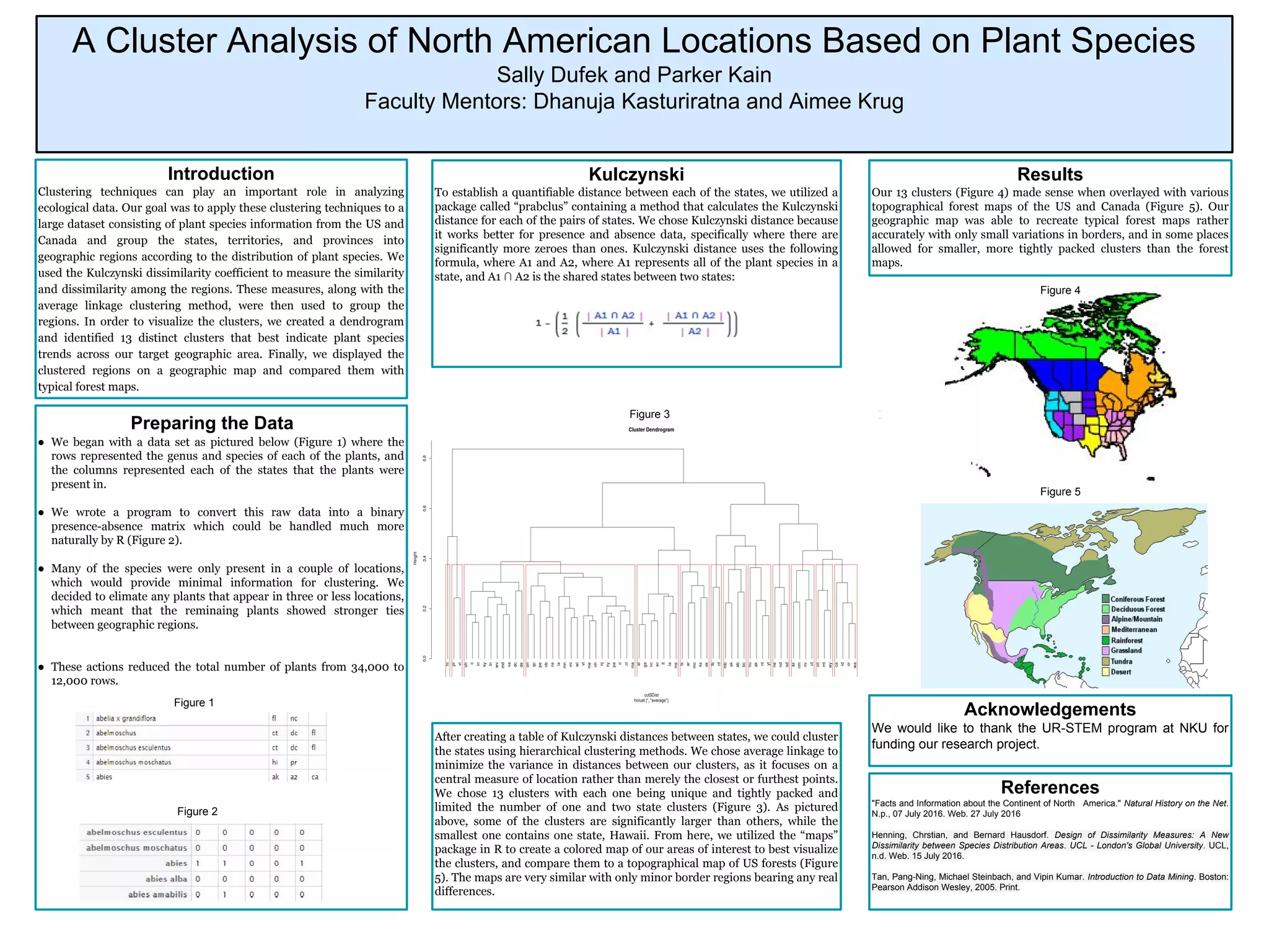
This document summarizes a study that used clustering techniques to group US and Canadian states, territories, and provinces into geographic regions based on the distribution of plant species. The researchers used a dataset of 34,000 plant species occurrences across locations in North America. They calculated distances between locations using the Kulczynski dissimilarity coefficient and performed average linkage clustering. This identified 13 distinct clusters of regions on a dendrogram. A geographic map of the clustered regions closely matched typical forest maps, suggesting the analysis successfully grouped areas with similar plant distributions.