![Open Source Geospatial Foundation (OSGeo) : Exploring the cross-roads of organization, integration, and acceptance of OS Geospatial in the real world Presented at OSCON 2007 by Aaron Racicot – GIS Programmer, GISP Ecotrust (www.ecotrust.org) [email_address] Z-Pulley Inc. (www.reprojected.com) [email_address]](https://image.slidesharecdn.com/open-source-geospatial-foundation-osgeo-1194299744976931-1/85/Open-Source-Geospatial-Foundation-OSGeo-1-320.jpg)
![Open Source Geospatial Foundation (OSGeo) : Exploring the cross-roads of organization, integration, and acceptance of OS Geospatial in the real world Presented at OSCON 2007 by Aaron Racicot – GIS Programmer, GISP Ecotrust (www.ecotrust.org) [email_address] Z-Pulley Inc. (www.reprojected.com) [email_address]](https://image.slidesharecdn.com/open-source-geospatial-foundation-osgeo-1194299744976931-1/75/Open-Source-Geospatial-Foundation-OSGeo-1-2048.jpg)


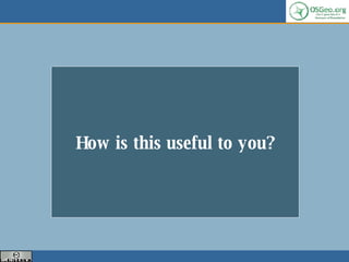
![Spatially enable your database…. How to select data within a polygon area? Intersects Geometry Definition Distance(geometry, geometry) Equals(geometry, geometry) Disjoint(geometry, geometry) Intersects(geometry, geometry) Touches(geometry, geometry) Crosses(geometry, geometry) Within(geometry A, geometry B) Overlaps(geometry, geometry) Contains(geometry A, geometry B) Intersects(geometry, geometry) Relate(geometry, geometry, intersectionPatternMatrix) Relate(geometry, geometry) Centroid(geometry) Area(geometry) Length(geometry) PointOnSurface(geometry) Boundary(geometry) Buffer(geometry, double, [integer]) ConvexHull(geometry) Intersection(geometry, geometry) SymDifference(geometry A, geometry B) Difference(geometry A, geometry B) GeomUnion(geometry, geometry) GeomUnion(geometry set) MemGeomUnion(geometry set)](https://image.slidesharecdn.com/open-source-geospatial-foundation-osgeo-1194299744976931-1/85/Open-Source-Geospatial-Foundation-OSGeo-18-320.jpg)
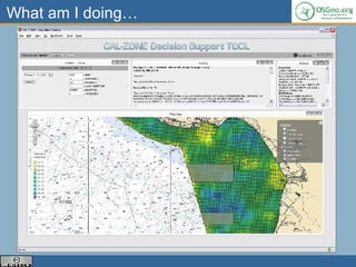

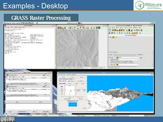
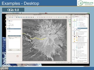
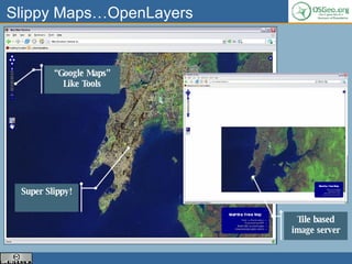
The document discusses the Open Source Geospatial Foundation (OSGeo), its mission to support open source geospatial software and promote its use. OSGeo provides resources for projects, promotes open data and standards, and ensures quality of software. It also aims to make software more accessible through documentation and education. Examples are given of using open source geospatial software for desktop mapping, web mapping, and spatially enabling databases.