The document discusses requirements, opportunities, and barriers related to implementing a common conceptual framework for spatial information across different domains. A conceptual framework provides a shared understanding of key concepts and their relationships in a domain. For spatial information, a common framework could define common spatial concepts, representations, and services. This would allow for integrated digital twins and greater data sharing, reuse, and analysis across domains like transportation, infrastructure, and environmental monitoring. However, barriers include existing fragmented systems, technical challenges in representation, and cultural barriers to cross-domain collaboration. Overcoming these would require strategies like prototyping and gaining experience with generic technologies.
Integrating spatial and thematic data: the CRISOLA case for Malta and the Eur...Beniamino Murgante
Integrating spatial and thematic data: the CRISOLA case for Malta and the European project Plan4all
Saviour Formosa - Institute of Criminology, University of Malta
Vincent Magri - Fondazzjoni Temi Zammit, University of Malta
Julia Neuschmid, Manfred Schrenk - Department for Urbanism, Transport, Environment and Information Society, Central European Institute of Technology, Austria
Integrating Web Services With Geospatial Data Mining Disaster Management for ...Waqas Tariq
Data Mining (DM) and Geographical Information Systems (GIS) are complementary techniques for describing, transforming, analyzing and modeling data about real world system. GIS and DM are naturally synergistic technologies that can be joined to produce powerful market insight from a sea of disparate data. Web Services would greatly simplify the development of many kinds of data integration and knowledge management applications. This research aims to develop a Spatial DM web service. It integrates state of the art GIS and DM functionality in an open, highly extensible, web-based architecture. The Interoperability of geospatial data previously focus just on data formats and standards. The recent popularity and adoption of Web Services has provided new means of interoperability for geospatial information not just for exchanging data but for analyzing these data during exchange as well. An integrated, user friendly Spatial DM System available on the internet via a web service offers exciting new possibilities for geo-spatial analysis to be ready for decision making and geographical research to a wide range of potential users.
Environmental Information: The Roles of Experts and the PublicMuki Haklay
Slides from a talk at Wilson Center, Washington DC, April 2014
Access to environmental information and use of it for environmental decision making are central pillars of environmental democracy. Yet, not much attention is paid to the question of who is producing it, and for whom? By examining the history of environmental information, since NEPA in 1969, three eras can be identified: information produced by experts, for experts (1969-1992); information produced by experts, to be shared by experts and the public (1992-2011); and finally, information produced by experts and the public to be shared by experts and the public.
Underlying these are changes in access to information, rise in levels of education and rapid change due to digital technologies. The three eras and their implication to environmental decision making will be explored, with special attention to the role of geographical information and geographical information systems and to citizen science.
Data fusion for city live event detectionAlket Cecaj
Event detection in urban context by using aggregated mobile activity as for example CDR data and social network data in this case geo-referenced Twitter data. The experiments show that the two datasets - CDR and social data - used, complement each other by providing better event detection results and event detscription.
Big data: uncovering new mobility patterns and redefining planning practicesMickael Pero
Using representations and data that are digital, we can create images about what happens where and when in cities, including mobility patterns that remained unaccounted until now. If properly analysed, big data for mobility can radically improve the socioeconomic and environmental analysis of public and sustainable transport. This session will discuss how big data is affecting mobility in terms of new travel behaviour and transport planning. At the user level, the relations between social networks, social media usage and travel behaviour in EU countries will be discussed. Scientific insight on the social media usage of millennial students in EU countries to understand their impact on social activities and mobility in urban areas will be presented. At the planer level, responses to changes in mobility patterns or unaccounted needs given by the analysis of public transport smart data will be presented. Advances on an integrated accessibility index will be discussed as a way for policy makers to improve current transport planning practices. Yet, big data in transport is not immune from some problems, especially those relating to statistical validity, bias and incorrectly imputed causality. This point will be discussed alongside liability, since Big data is gathered and manipulated by many different stakeholders. The proposed panel discussion therefore aims to provide to the audience a clear understanding on ways in which big data affects travel behaviour and transport planning, while accounting for data quality and pan European standardisation aspects.
Exploring Leadership in Third Industrial Revolution TeiglandRobin Teigland
My presentation at "Leadership in Complex Orgnizations" workshop in Oslo Nov 2013 organized by NHH Focus: http://www.nhh.no/no/forskning-og-fagmilj%C3%B8/handlingsprogrammet-nhh-2021/nhh-2021/focus.aspx
Big Data for the Social Sciences - David De Roure - Jisc Digital Festival 2014Jisc
The analysis of government data, data held by business, the web, social science survey data will support new research directions and findings. Big Data is one of David Willetts’ 8 great technologies, and in order to secure the UK’s competitive advantage new investments have been made by the Economic Social Science Research Council ( ESRC) in Big Data, for example the Business Datasafe and Understanding Populations investments. In this session the benefits of the use of Big Data in social science , and the ESRCs Big Data strategy will be explained by Professor David De Roure.of the Oxford e-Research Centre and advisor to the ESRC.
AAG Session
4204 Data-based living: peopling and placing ‘big data
Tampa, Florida, April 11 2014
Tracey P. Lauriault and Rob Kitchin
National Institute for Regional and Spatial Analysis (NIRSA)
National University of Ireland at Maynooth (NUIM)
PrepData4Mobilty First Expert workshop, Lucie Kirstein, Project Coordinator.pptxFIWARE
Europe is on its way to generate and make use of more data than ever. The project PrepDSpace4Mobility aims at contributing to the development of the common European mobility data space by supporting the creation of a technical infrastructure that will facilitate easy, cross-border access to key data for both passengers and freight. Given the enormous potential of data and digital technologies, the project is expected to have a positive impact on European competitiveness, society, and the environment.
We invited experts in the field of mobility, transport and data space technology to join PrepDSpace4Mobility expert workshop #1 to learn more about the preliminary results of the project and give early feedback in order to sharpen the focus as needed and requested from the real market.
Project PrepDSpace4Mobility is Funded by the European Union and coordinated by acatech (Germany), activities are carried out by Amadeus SAS (France), EIT Urban Mobility, an initiative of the European Institute of Innovation and Technology, a body of the European Union, (Spain), FIWARE (Germany), FhG (Germany), IDSA (Germany), iSHARE (Netherlands), TNO (Netherlands), USI (Germany), VTT (Finland), EMTA (France), Group ADP (France), KU Leuven (Belgium), ERTICO (Belgium), BAST (Germany), UIH (Hungary), and MDS (Germany).
TOGETHER: TOpology GEneration THrough HEuRisticsSubin Mathew
Network Virtualization is a growing technological process that combines the hardware and software elements in the physical networks and brings it together on a software level. The aim of this project is to develop the process of deploying virtual networks easily. The project involves a software developed by us called “TOGETHER: TOpology GEneration THrough HEuRistics"written in Perl in its simplest form without dependencies so that it could be deployed on any environment. TOGETHER is an isomorphic graph modelling solution used to allow users to make use of topology generators and software like AutoNetkit to make topologies that work on virtual systems.TOGETHER is designed to work in Juniper Networks Virtual Private Cloud architecture and has possibilities for supporting much more. TOGETHER also manages how multiple topologies are interconnected and aims to help researchers work with network virtualization.
FIWARE Global Summit - The Digital Single Market - Benefits and Solutions for...FIWARE
Presentation by Daniele Rizzi
Principal Administrator and Policy Officer, Connecting Europe Facility Program, European Commission
FIWARE Global Summit
27-28 November 2018
Malaga, Spain
Russian anarchist and anti-war movement in the third year of full-scale warAntti Rautiainen
Anarchist group ANA Regensburg hosted my online-presentation on 16th of May 2024, in which I discussed tactics of anti-war activism in Russia, and reasons why the anti-war movement has not been able to make an impact to change the course of events yet. Cases of anarchists repressed for anti-war activities are presented, as well as strategies of support for political prisoners, and modest successes in supporting their struggles.
Thumbnail picture is by MediaZona, you may read their report on anti-war arson attacks in Russia here: https://en.zona.media/article/2022/10/13/burn-map
Links:
Autonomous Action
http://Avtonom.org
Anarchist Black Cross Moscow
http://Avtonom.org/abc
Solidarity Zone
https://t.me/solidarity_zone
Memorial
https://memopzk.org/, https://t.me/pzk_memorial
OVD-Info
https://en.ovdinfo.org/antiwar-ovd-info-guide
RosUznik
https://rosuznik.org/
Uznik Online
http://uznikonline.tilda.ws/
Russian Reader
https://therussianreader.com/
ABC Irkutsk
https://abc38.noblogs.org/
Send mail to prisoners from abroad:
http://Prisonmail.online
YouTube: https://youtu.be/c5nSOdU48O8
Spotify: https://podcasters.spotify.com/pod/show/libertarianlifecoach/episodes/Russian-anarchist-and-anti-war-movement-in-the-third-year-of-full-scale-war-e2k8ai4
Many ways to support street children.pptxSERUDS INDIA
By raising awareness, providing support, advocating for change, and offering assistance to children in need, individuals can play a crucial role in improving the lives of street children and helping them realize their full potential
Donate Us
https://serudsindia.org/how-individuals-can-support-street-children-in-india/
#donatefororphan, #donateforhomelesschildren, #childeducation, #ngochildeducation, #donateforeducation, #donationforchildeducation, #sponsorforpoorchild, #sponsororphanage #sponsororphanchild, #donation, #education, #charity, #educationforchild, #seruds, #kurnool, #joyhome
ZGB - The Role of Generative AI in Government transformation.pdfSaeed Al Dhaheri
This keynote was presented during the the 7th edition of the UAE Hackathon 2024. It highlights the role of AI and Generative AI in addressing government transformation to achieve zero government bureaucracy
Understanding the Challenges of Street ChildrenSERUDS INDIA
By raising awareness, providing support, advocating for change, and offering assistance to children in need, individuals can play a crucial role in improving the lives of street children and helping them realize their full potential
Donate Us
https://serudsindia.org/how-individuals-can-support-street-children-in-india/
#donatefororphan, #donateforhomelesschildren, #childeducation, #ngochildeducation, #donateforeducation, #donationforchildeducation, #sponsorforpoorchild, #sponsororphanage #sponsororphanchild, #donation, #education, #charity, #educationforchild, #seruds, #kurnool, #joyhome
What is the point of small housing associations.pptxPaul Smith
Given the small scale of housing associations and their relative high cost per home what is the point of them and how do we justify their continued existance
Jennifer Schaus and Associates hosts a complimentary webinar series on The FAR in 2024. Join the webinars on Wednesdays and Fridays at noon, eastern.
Recordings are on YouTube and the company website.
https://www.youtube.com/@jenniferschaus/videos
Jennifer Schaus and Associates hosts a complimentary webinar series on The FAR in 2024. Join the webinars on Wednesdays and Fridays at noon, eastern.
Recordings are on YouTube and the company website.
https://www.youtube.com/@jenniferschaus/videos
2024: The FAR - Federal Acquisition Regulations, Part 37
Trial lecture
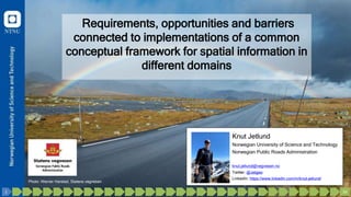
1. Requirements, opportunities and barriers
connected to implementations of a common
conceptual framework for spatial information in
different domains
Knut Jetlund
Norwegian University of Science and Technology
Norwegian Public Roads Administration
knut.jetlund@vegvesen.no
Twitter: @Jetgeo
LinkedIn: https://www.linkedin.com/in/knut-jetlund/
Photo: Werner Harstad, Statens vegvesen
34
33
32
31
30
29
28
27
26
25
24
23
22
21
20
19
18
17
16
15
14
13
12
11
10
9
8
7
6
5
4
3
2
1
2. Breaking down the subject
«Requirements, opportunities and barriers connected to
implementations of a common conceptual framework for
spatial information in different domains»
• What is a conceptual framework, and why do we need it?
• What is special with a conceptual framework for spatial
information?
• Which domains are relevant for a common conceptual
framework for spatial information?
• Opportunities, barriers and requirements connected to
implementation
34
33
32
31
30
29
28
27
26
25
24
23
22
21
20
19
18
17
16
15
14
13
12
11
10
9
8
7
6
5
4
3
2
1
3. Conceptual framework
Jabareen, Y. (2009):
“… a network … of interlinked concepts that
together provide a comprehensive understanding
of a phenomenon or phenomena”
Emans, R. (1970):
«a statement of central concepts and of the system
for organizing thinking about a complex
phenomena.»
Kresse, W., D. M. Danko and K. Fadaie (2012):
“a frame of concepts, ideas, terms, definitions, and
the interdependence between those.”
34
33
32
31
30
29
28
27
26
25
24
23
22
21
20
19
18
17
16
15
14
13
12
11
10
9
8
7
6
5
4
3
2
1
4. Building blocks in a conceptual framework
ISO 19101-1:2014 Geographic Information — Reference model — Part 1: Fundamentals.
34
33
32
31
30
29
28
27
26
25
24
23
22
21
20
19
18
17
16
15
14
13
12
11
10
9
8
7
6
5
4
3
2
1
6. 6
• BIM – for AR and navigation inside the
Louvre and the Eiffel Tower
• Where is the Mona Lisa?
• Where are the steps?
• ITS and Smart Cities
• Where to drive and park
• Metro lines and schedules
• Meteorology
• The Louvre or the Eiffel Tower today?
• Social media
• Share the experience!
Other domains where spatial is a part
(examples)
34
33
32
31
30
29
28
27
26
25
24
23
22
21
20
19
18
17
16
15
14
13
12
11
10
9
8
7
6
5
4
3
2
1
7. 7
Everything happens somewhere…
Example from Lifecycle Assessment : Production and use of concrete
…and where it
happens matter!
Vardeman et al. 2017
34
33
32
31
30
29
28
27
26
25
24
23
22
21
20
19
18
17
16
15
14
13
12
11
10
9
8
7
6
5
4
3
2
1
8. “The key problem lies in the
integration of data coming
from different sources in
different formats.”
Beetz, et al. (2020).
Enabling an Ecosystem of Digital Twins.
An ecosystem of digital twins
“The integration of multiple digital twins allows the creation of
an ecosystem of digital twins.“
34
33
32
31
30
29
28
27
26
25
24
23
22
21
20
19
18
17
16
15
14
13
12
11
10
9
8
7
6
5
4
3
2
1
9. 9
The British National Digital Twin
Hetherington, J. and M. West (2020).
The pathway towards an Information Management Framework. A ‘Commons’ for Digital Built Britain, Digital Built Britain.
“…requires information to be compatible
across the built and natural
environment, presented in consistent
formats to allow for sharing and
integration between different digital
twins.”
34
33
32
31
30
29
28
27
26
25
24
23
22
21
20
19
18
17
16
15
14
13
12
11
10
9
8
7
6
5
4
3
2
1
“The integration of multiple digital twins allows the creation of
an ecosystem of digital twins.“
10. Evans, S., C. Savian, a. Burns and C. Cooper (2019).
Digital twins for the built environment.
“Long-term we’ll need interoperability
between digital twins, facilitated through a
common language and standards and a
robust governance framework.”
34
33
32
31
30
29
28
27
26
25
24
23
22
21
20
19
18
17
16
15
14
13
12
11
10
9
8
7
6
5
4
3
2
1
11. 11
A common conceptual framework for
spatial information
• Common generic concepts and their relations - semantics
– Generic spatial concepts, their representations, and mathematical descriptions
• Common use of languages for describing and implementing
concepts and data - syntactics
• Common generic concepts for services
34
33
32
31
30
29
28
27
26
25
24
23
22
21
20
19
18
17
16
15
14
13
12
11
10
9
8
7
6
5
4
3
2
1
12. 12
Spatial concepts in a common framework
for spatial information
• Location referencing – «where»
– Different levels of complexity
and accuracy
• Geometry – shape and extent
– Different levels of complexity
• Spatial relations – topology
• Spatial operations
– Intersects, buffer etc.
Photo: Knut Opeide, Statens vegvesen
34
33
32
31
30
29
28
27
26
25
24
23
22
21
20
19
18
17
16
15
14
13
12
11
10
9
8
7
6
5
4
3
2
1
14. Opportunities
Integrated digital twins based on a
common conceptual framework
• More information accessible for all
– Compabillity and accessibillity
• Interpret and use data correctly
– Understanding
• Collect data once, use many times, by many
• Improved quality and consistency
– Share and improve data
• Combine information and gain new
knowledge
• Better informed decissions
34
33
32
31
30
29
28
27
26
25
24
23
22
21
20
19
18
17
16
15
14
13
12
11
10
9
8
7
6
5
4
3
2
1
Photo: Anja Kristin Bakken, Statens vegvesen
15. Evans, S., C. Savian, a. Burns and C. Cooper (2019).
Digital twins for the built environment.
34
33
32
31
30
29
28
27
26
25
24
23
22
21
20
19
18
17
16
15
14
13
12
11
10
9
8
7
6
5
4
3
2
1
16. “… give access to integrated data,
updated regularly, making information
visible that is currently unknown.
… the basis for better-informed
decisions that will lead to improved
outcomes and overall better quality
of life.”
Beetz, et al. (2020).
Enabling an Ecosystem of Digital Twins.
34
33
32
31
30
29
28
27
26
25
24
23
22
21
20
19
18
17
16
15
14
13
12
11
10
9
8
7
6
5
4
3
2
1
17. 17
Hetherington, J. and M. West (2020).
The pathway towards an Information Management Framework. A ‘Commons’ for Digital Built Britain, Digital Built Britain.
“… could provide insights that enable
investment and/or changes to
increase infrastructure resilience,
reduce disruption and delays,
optimise our use of resources and
boost quality of life for citizens.”
34
33
32
31
30
29
28
27
26
25
24
23
22
21
20
19
18
17
16
15
14
13
12
11
10
9
8
7
6
5
4
3
2
1
18. 18
Hubertus, P. et al. (2019). The Benefits of a Common Map Data Standard for Autonomous Driving.
• Data compatibility
• Ease of access
• Increased data quality
• Improved consistency of data
• Increased road safety
“When cars can communicate with each other
regardless of make, model or origin,
accidents can be prevented, our roads become
safer and everyone benefits, whether you
are a driver, passenger, cyclist or pedestrian.”
34
33
32
31
30
29
28
27
26
25
24
23
22
21
20
19
18
17
16
15
14
13
12
11
10
9
8
7
6
5
4
3
2
1
20. 20
General barriers to
IT implementation
Stewart et al., 2004
34
33
32
31
30
29
28
27
26
25
24
23
22
21
20
19
18
17
16
15
14
13
12
11
10
9
8
7
6
5
4
3
2
1
21. 21
Classification of barriers
• Beatty and Gordon, 1988
– Structural, human and
technical
• Bond and Houston, 2003
– Technology and market,
strategy and structure,
social and cultural
• Bernhardsen 1992
34
33
32
31
30
29
28
27
26
25
24
23
22
21
20
19
18
17
16
15
14
13
12
11
10
9
8
7
6
5
4
3
2
1
22. 22
A fundamental barrier may
also be an opprotunity
• Existing applications and systems
– In each domain or more fragmented
– Con: Why change if it’s working within
the scope of the domain?
– Pro: Technological mature organizations
and persons
https://www.redbubble.com/
34
33
32
31
30
29
28
27
26
25
24
23
22
21
20
19
18
17
16
15
14
13
12
11
10
9
8
7
6
5
4
3
2
1
23. Strategy and structure barriers
• Industry and organization
stakeholders:
– Standardization organizations,
software vendors, constructor clients,
constructors, consultants …
• Awareness and relation to the
world outside of the domain silo
– Understanding the benefits of
integration
– Willingness to adapt and invest in
integration
– Agree on a common
framework
34
33
32
31
30
29
28
27
26
25
24
23
22
21
20
19
18
17
16
15
14
13
12
11
10
9
8
7
6
5
4
3
2
1
24. 24
Social and cultural barriers
• Standardization experts,
developers and users
– High expertice within each domain
– Much effort put into the development of
optimized domain-specific frameworks.
– Willingness to adapt to other domains
• Agreeing on a common framework
– Different cultures and technologies
– Cooperation across domains
34
33
32
31
30
29
28
27
26
25
24
23
22
21
20
19
18
17
16
15
14
13
12
11
10
9
8
7
6
5
4
3
2
1
25. Technical barriers
• The framework
– Flexibility for adaption in different technologies
• Existing applications and systems
– Flexibility for for adapting to change
• Domain-specific concepts
– Specific domains need specific
representations of the real world
• Geometry and location referencing
– How common can a framework be?
https://store.forskerfabrikken.no/
34
33
32
31
30
29
28
27
26
25
24
23
22
21
20
19
18
17
16
15
14
13
12
11
10
9
8
7
6
5
4
3
2
1
27. 27
Structural and human requirements
- Strategies to overcome barriers
34
33
32
31
30
29
28
27
26
25
24
23
22
21
20
19
18
17
16
15
14
13
12
11
10
9
8
7
6
5
4
3
2
1
• Look across domain borders
– Understand the value of shared
information
• Culture for adapting to change
• Willingness to invest for integration
Stewart et al., 2004
28. 28
Hetherington, J. and M. West (2020)
Gilbert, T. et al. (2020)
34
33
32
31
30
29
28
27
26
25
24
23
22
21
20
19
18
17
16
15
14
13
12
11
10
9
8
7
6
5
4
3
2
1
Hubertus, P. et al. (2019)
29. 29
Technical requirements for the
framework
• Content
– Semantic and syntactic
• Spatial concepts
– Common services – query from
multiple sources
• Must be proved useful
– Prototype implementations
• Generic and independent of
implementation technology
– General IT technology, not domain-
specific
https://store.forskerfabrikken.no/
34
33
32
31
30
29
28
27
26
25
24
23
22
21
20
19
18
17
16
15
14
13
12
11
10
9
8
7
6
5
4
3
2
1
30. 30
Generic technologies
“The main goal of the short term is to move from bespoke solutions and
technology to technologies and solutions that are scalable, widely adopted
and work in a broad range of tools.”
buildingSMART International (2020).
Technical Roadmap buildingSMART - Getting ready for the future
34
33
32
31
30
29
28
27
26
25
24
23
22
21
20
19
18
17
16
15
14
13
12
11
10
9
8
7
6
5
4
3
2
1
32. 32
Discussion
• Given the barriers, can a common conceptual
framework for spatial information be established and
implemented for use across multiple domains?
– Depends on the organizations
– Semantic web technologies
• Opportunities now
– Established joint work on standardization
– Planned modernization of core standards
– ITS and Smart Cities will push the integration of information
from multiple sources
34
33
32
31
30
29
28
27
26
25
24
23
22
21
20
19
18
17
16
15
14
13
12
11
10
9
8
7
6
5
4
3
2
1
33. 33
Concluding remarks
• Authority organizations like the NPRA have a multi-
domain responsibility.
– Will depend upon an ecosystem of digital twins
– Need to set requirements for software and specifications
• Software vendors have a key role
– Are they willing to look outside domain silos and invest in
integration?
Hetherington, J. and M. West (2020)
34
33
32
31
30
29
28
27
26
25
24
23
22
21
20
19
18
17
16
15
14
13
12
11
10
9
8
7
6
5
4
3
2
1
34. 34
• Beatty, CA, and Gordon, JRM, 1988. Barriers To The Implementation Of CAD/CAM Systems. Sloan Management Review, 29 (4):25.
• Beetz, J, van Berlo, L, Borrman, nA, et al., 2020. Enabling an Ecosystem of Digital Twins. A buildingSMART International Positioning Paper.
https://www.buildingsmart.org/wp-content/uploads/2020/05/Enabling-Digital-Twins-Positioning-Paper-Final.pdf.
• Bernhardsen, T, 1992. Geographic information systems. Arendal: Viak IT.
• Boje, C, Guerriero, A, Kubicki, S, et al., 2020. Towards a semantic Construction Digital Twin: Directions for future research. Automation in Construction,
114:103179, doi: 10.1016/j.autcon.2020.103179.
• Bond, EU, and Houston, MB, 2003. Barriers to Matching New Technologies and Market Opportunities in Established Firms. Journal of Product Innovation
Management, 20 (2):120-135, doi: 10.1111/1540-5885.2002005.
• buildingSMART International, 2020. Technical Roadmap buildingSMART - Getting ready for the future.
• Emans, R, 1970. A Schema for the Classification of Conceptual Frameworks Involving Reading. Journal of Literacy Research, 3 (2):15-21.
• Evans, S, Savian, C, Burns, a, et al., 2019. Digital twins for the built environment. https://www.theiet.org/media/4719/digital-twins-for-the-built-
environment.pdf.
• Gilbert, T, Rönsdorf, C, Plume, J, et al., 2020. Built environment data standards and their integration: an analysis of IFC, CityGML and LandInfra. Open
Geospatial Consortium: Wayland, MA, USA, buildingSMART International: London, UK,, https://www.ogc.org/docs/discussion-papers.
• Hetherington, J, and West, M, 2020. The pathway towards an Information ManagementFramework. A ‘Commons’ for Digital Built Britain. Digital Built
Britain.
• Hubertus, P, Schleicher, M, Klebert, F, et al., 2019. The Benefits of a Common Map Data Standard for Autonomous Driving. Navigation Data Standard
e. V.,.
• IEC, 2019. Semantic interoperability: challenges in the digital transformation age. International Electrotechnical Commission,
https://basecamp.iec.ch/download/iec-white-paper-semantic-interoperability-challenges-in-the-digital-transformation-age-en/.
• ISO/TC 211, 2014. ISO 19101-1:2014 Geographic Information — Reference model — Part 1: Fundamentals.
• Jabareen, Y, 2009. Building a Conceptual Framework: Philosophy, Definitions, and Procedure. International Journal of Qualitative Methods, 8 (4):49-62,
doi: 10.1177/160940690900800406.
• Kresse, W, Danko, DM, and Fadaie, K, 2012. Standardization. In Springer Handbook of Geographic Information, edited by Kresse and Danko, 245-271.
Berlin, Heidelberg: Springer Berlin Heidelberg.
• Liu, S, Xie, B, Tivendal, L, et al., 2015. Critical barriers to BIM implementation in the AEC industry. International Journal of Marketing Studies, 7 (6):162.
• Stewart, RA, Mohamed, S, and Marosszeky, M, 2004. An empirical investigation into the link between information technology implementation barriers and
coping strategies in the Australian construction industry. Construction Innovation, 4 (3):155-171, doi: 10.1108/14714170410815079.
• Tao, F, Cheng, J, Qi, Q, et al., 2018. Digital twin-driven product design, manufacturing and service with big data. The International Journal of Advanced
Manufacturing Technology, 94 (9-12):3563-3576, doi: 10.1007/s00170-017-0233-1.
• Vardeman, I, Charles, F, Krisnadhi, AA, et al., 2017. An Ontology Design Pattern and its use case for modeling material transformation. Semantic Web, 8
(5):719-731.
34
33
32
31
30
29
28
27
26
25
24
23
22
21
20
19
18
17
16
15
14
13
12
11
10
9
8
7
6
5
4
3
2
1