A line-simplifying and line-rectifying toolGiuliano Curti
The document describes the author's process in developing a Python script to simplify and rectify SHP linestring layers by removing unnecessary points. The author's initial goal was to clean contour line data obtained from a DEM, but they later learned this could be done in QGIS using fTools. Testing showed the author's script performed similarly to fTools at reducing points while also removing some points fTools retained. The author analyzes differences in the algorithms and shares their experimental script and approach in simplifying and rectifying linestring layers.
(1) This chapter discusses trees, which are subgraphs of graphs that connect all vertices with the minimum number of edges.
(2) Three important trees are analyzed: breath first search (BFS) trees, depth first search (DFS) trees, and minimum spanning trees (MST). BFS starts from a root vertex and explores neighboring vertices level-by-level.
(3) The plugin allows generating and visualizing different trees for a graph, and displays properties of the trees like predecessor vertices and exploration levels. This helps learn graph theory concepts in an interactive way.
This document discusses stress experienced by students and provides tips for managing it. It defines stress as the body and mind's response to emotional, physical, or mental demands or changes. The document notes that while stress can be harmful if prolonged, it can also be beneficial in short term. It then outlines a 5-step process for helping students address the sources of their anxiety which includes letting them articulate concerns, identifying challenges, reassuring them of support, showing love and encouragement, and suggesting stress-relieving activities. The document concludes by recommending recognizing physiological impacts of unresolved stress, assessing students, encouraging breaks, using humor as a coping mechanism, and referring for counseling if needed.
This document outlines a proposed smartphone app called ZOOE that would help visitors navigate and learn at zoos. The app would provide maps, information on animal habitats, donations, social features, quizzes and augmented reality. It aims to partner with zoos who would promote the app, gaining visitor analytics in return. The app would be free but generate revenue through in-app purchases, ticket commissions, retail ads and donations. The goal is to launch in 2013 with one zoo and expand to 50 zoos by end of 2014.
La situación de los microemprendimientos en la ciudad de TrelewLucas Orozco
Presentación de la investigación realizada en la cátedra Enfoque de Sistemas durante la "III Jornada de divulgación de proyectos de Investigación y de Extensión en el marco de las Cátedras".
Customer Satisfaction in Retail Banks- Empirical Studyprem velpula
This document summarizes a study on customer satisfaction with retail banking services at selected private banks in Ghana. The study assessed customer satisfaction across five dimensions of service quality: reliability, responsiveness, assurance, empathy, and tangibles. A questionnaire was administered to 140 customers across five banks to understand their satisfaction levels. The results found that responsiveness and assurance had the highest levels of customer satisfaction, while tangibles had the lowest. The study concluded that banks should focus on improving factors that increase customer satisfaction and loyalty in order to reduce customer attrition.
This document discusses tools used by meteorologists to measure weather conditions. It describes how thermometers measure temperature, wind vanes measure wind direction, anemometers measure wind speed, barometers measure air pressure, hygrometers measure humidity, and rain gauges measure precipitation. Meteorologists use these tools to study and report on weather.
This document summarizes a technology for producing functional thin-film coatings directly on metal strain elements. It can produce a wide variety of sensors for industrial use with high radiation resistance and operating temperatures from -196 to +360 °C. The technology offers original and universal sensitive elements and has primary markets in high-technology fields like nuclear, aviation, space, and oil and gas industries estimated at $140-150 million annually in Russia. It identifies applications at gas turbine and helicopter engine manufacturers and goals of further enhancing the technology.
This document contains the resume of Yogesh Raghunath Surve. It summarizes his contact information, objective, qualifications, skills, experience and projects. He has over 5 years of experience as a software developer working with technologies like C#, SQL Server and Oracle. His experience includes projects in areas like agriculture information systems, online video platforms and HR/Payroll management systems.
This document provides a biography and career overview of Bollywood actor Aamir Khan in multiple phases from 1965-2013. It details his childhood and family background, early work as a child actor in his uncle's films, breakthrough role in Qayamat Se Qayamat Tak in 1988 that launched his career as a lead actor, several commercially unsuccessful films from 1988-1992 that led to doubts about his longevity, and his decision in 1992 to focus more carefully on roles and only take on one film per year.
Program Basikal Lasak UTM merupakan program sukan dan rekreasi yang diadakan oleh Jawatankuasa Mahasiswa Kolej 10 UTM pada 20 Mac 2011 di sekitar Trail Kelapa Sawit UTM. Program ini bertujuan untuk mempromosikan aktiviti lasak dan mengeratkan hubungan persahabatan antara mahasiswa UTM melalui aktiviti berbasikal sejauh 10 km. Dianggarkan seramai 100 orang mahasiswa akan mengambil bahagian dalam program ini.
Dokumen tersebut membahas prinsip-prinsip dasar pelatihan olahraga yang meliputi prinsip beban berlebih, perkembangan menyeluruh, spesialisasi, individualisasi, intensitas latihan, kembali asal, pulih-asal, overkompensasi, spesifik, kualitas, lama, variasi, volume, dan densitas latihan.
Strumenti Open Source per la gestione delle reti urbaneAndrea Antonello
Presentation of the Nettools extensions for uDig at the GFOSSDAY 2011 in Foggia. The presentation gives an insight on possible workflows for professionals that are involved in water management systems and stormwaters.
Sviluppare funzionalità aggiuntive di utilizzo comune centralizzandone il codice. Realizzare vere e proprie applicazioni mantenendo separati codice e dati. Creare strumenti di sviluppo personalizzati estendendo le potenzialità del Lotus Domino Designer. Integrare Symphony nelle applicazioni Notes.
Sono solo alcune delle opportunità offerte agli sviluppatori Domino dall'ambiente Eclipse.
Per chi, come chi scrive (classe Lotus Notes 4.5), fa parte della vecchia guardia "LotusScript & Formule" può non essere così spontaneo abbandonare tecniche consolidate cercando nuove soluzioni a necessità note (il lato oscuro della retrocompatibilità) ma le potenzialità offerte dal lunare e multipiattaforma IDE sono tali da meritare, demo alla mano, ben più di una possibilità.
Ripetete con me: Nooootes Moooon Attaaaack!
Progetto Pilota presso l'ufficio tecnico di Gabiley (Somaliland) per il rilie...Maurizio Foderà
Lavoro presentato Giovedì 30 maggio 2013, presso l'Auditorium dell' Istituto Tecnico Statale “V.Accardi” - Settore tecnologico Costruzioni Ambiente e Territorio - di Campobello di Mazara in collaborazione con il Collegio Provinciale Geometri e Geometri Laureati di Trapani, in occasione del convegno: "LE INNOVAZIONI DELLA GEOMATICA A SUPPORTO DEI PROFESSIONISTI E DELLE ISTITUZIONI".
2. topog4qgis
L'idea è nata dalla passione per la topografia e da tutto ciò, principalmente scienza
e tecnica delle costruzioni, che applica le scienze matematiche nella mia attività
professionale.
Per la topografia in particolare, che in realtà non ho mai praticato
professionalmente se non in sporadiche occasioni, ho subito la contagiosa
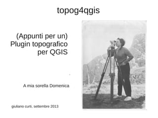
passione di mia sorella Domenica; questo contagio costituisce un legame, ormai
solo ideale, ma prezioso con la sua memoria.
Un altro legame, ben più concreto, mi lega a Giuseppe Patti (Tirano-SO) che si è
sobbarcato la scomoda attività di test, controllo e verifica, senza dimenticarsi mai di
sostenere con i suoi consigli e contributi lo sviluppo del plugin.
3. topog4qgis
Avvertenza:
●
●
●
L'applicativo qui presentato è un plugin per QGIS v.2.0 per il trattamento di
rilievi topografici orientati all'aggiornamento catastale.
Non costituisce ancora un applicativo completo, ma semmai un 'proof of
concept' per verificare la fattibilità dell'idea iniziale e soprattutto per raccogliere
consigli e critiche da coloro che intendono condividere gli obiettivi iniziali.
L'applicativo non si pone in alternativa o concorrenza con altri prodotti analoghi,
in particolare l'applicativo citato nel seguito.
4. topog4qgis
Sommario
●
●
●
●
Il plugin consente la lettura ed il trattamento di rilievi topografici
consegnati in libretti conformi alla sintassi di pregeo.
Elabora il rilievo operando le necessarie operazioni geometriche per
la collimazione e connessione delle differenti stazioni e lo restituisce
sotto forma di layer SHPlike, in particolare i layer dei vertici misurati e
del vertici ribattuti.
Il plugin consente anche la lettura dell'Estratto di Mappa in formato
digitale (*.emp) fornito dall'AdT.
La preventiva lettura dell'EdM trasforma il rilievo nello spazio dei punti
fiduciali consentendo il controllo di qualità del rilievo stesso; in tale
caso viene generato anche il layer dei punti collimati.
La procedura conterrà innumerevoli doppioni ed errori; per qualsiasi
suggerimento, consiglio e critica siete pregati di contattarmi all'indirizzo
giulianc51 at gmail dot it, non prima però di aver preso nota che non vi
è alcuna garanzia, implicita od esplicita, connessa all'uso del
presente software che installate sul vostro computer ed eseguite
per vostra unilaterale decisione a vostro totale rischio.
5. topog4qgis
Abstract
The procedure allows reading EdM files of the Italian Cadastral Service and the
'Libretto di campagna' of the user.
The imported maps are displayed on QGIS canvas; the user can use there all the tools
provided by QGIS, saving them in different formats too.
This procedure is EXPERIMENTAL; it might contains many bugs, few duplications and
some mistakes, only in part known to the author;
please let us know about any encountered problems (giulianc51 at gmail dot it)
9. Dialogo per la selezione dell'estratto
di mappa digitale (*.emp)
10. Attuali limiti nella lettura dell'EdM
Al momento legge:
●
Punti fiduciali (righe 8)
●
Vertici di particella/fabbricato (righe 8)
●
Contorni di particella/fabbricato (righe 7)
Vengono generati i layer:
●
EdM_pf (point)
●
EdM_vertici (point)
●
EdM_contorni(linestring)
16. Attuali limiti nella lettura del rilievo
Allo stato attuale il plugin tratta
–
le misure celerimetriche (linee 1 e 2),
–
gli allineamenti e squadri (linee 4 e 5) e
–
i contorni delle particelle/fabbricati (linee 7).
È fornito un supporto sperimentale alle misure gps (linee
1 e 2).
Vengono generati i layer:
●
Misurati (point)
●
Ribattuti (point)
●
Collimati (point) se è stato caricato l'EdM
●
Contorni (linestring).
19. Gestione del rilievo
●
●
●
●
●
A seguito della lettura di ogni stazione successiva alla prima o alla
baseline GPS, vengono individuate le due stazioni coinvolte
Successivamente viene calcolata la matrice di trasformazione per
trasferire i punti rilevati dalla stazione in esame nel riferimento della
prima stazione(o della baseline)
A questo punto vengono trattati gli allineamenti e squadri
In caso di disponibilità dell'EdM digitale viene controllata la presenza di
almeno 3 punti fiduciali nel rilievo
Quindi viene calcolata la matrice di trasformazione per georiferire tutto
il rilievo nel sistema di riferimento catastale
25. Inquiry: elenco delle distanze ridotte
(l'elenco è visualizzato nella console python che risulta uno strumento molto
utile durante l'esecuzione del plugin)
33. Precisazione sulle distanze
In realtà il sistema confronta le distanze fra le
coordinate misurate e quelle in archivio;
ovviamente nulla impedisce di attingere
direttamente al file DIS fornito dall'Agenzia del
Territorio.
34. Integrazione con QGIS
L'ambiente ospite di QGIS consente di:
●
●
sfruttare le capacità di visualizzazione e la simbologia
sovrapporre il rilievo, opportunamente settato il CRS, ad altre sorgenti
WMS/WFS
●
trasferire i dati nei vari formati (Shp, Postgis, Spatialite, ecc.)
●
salvare/recuperare su/da supporto magnetico.
Prevedo di rendere disponibili quanto prima per la vers. 2.0 di QGIS i
plugin cad4qgis per editing di punti, linee e poligoni in mododa
consentire altre elaborazioni sul rilievo.
35. Qualcosa è già possibile fare da subito... ad es. sovrapporre il
rilievo alla ortofoto del Portale Cartografico Nazionale o a
layer messi a disposizione da vari servizi WMS/WFS