The Use of HPC to Model the California Wildfires
•
1 like•798 views

Ilkay Altintas from the San Diego Supercomputer Center gave this talk at the HPC User Forum. "WIFIRE is an integrated system for wildfire analysis, with specific regard to changing urban dynamics and climate. The system integrates networked observations such as heterogeneous satellite data and real-time remote sensor data, with computational techniques in signal processing, visualization, modeling, and data assimilation to provide a scalable method to monitor such phenomena as weather patterns that can help predict a wildfire's rate of spread." Watch the video: https://wp.me/p3RLHQ-inQ Learn more: https://wifire.ucsd.edu/https://wifire.ucsd.edu/ Sign up for our insideHPC Newsletter: http://insidehpc.com/newsletter

Recommended
Recommended
More Related Content
What's hot
What's hot (15)
Similar to The Use of HPC to Model the California Wildfires
Similar to The Use of HPC to Model the California Wildfires (20)
More from inside-BigData.com
More from inside-BigData.com (20)
Recently uploaded
Recently uploaded (20)
The Use of HPC to Model the California Wildfires
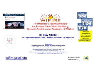
- 1. WIFIRE is funded by NSF 1331615 WIFIRE is funded by NSF 1331615 An Integrated Cyberinfrastructure for Scalable Data-Driven Monitoring, Dynamic Prediction and Resilience of Wildfires Dr. Ilkay Altintas San Diego Supercomputer Center, University of California San Diego, U.S.A. Collaborators: Jessica Block, Daniel Crawl, Raymond de Callafon, Hans-Werner Braun, Michael Gollner, Larry Smarr, Jurgen Schulze and Arnaud Trouve San Diego Supercomputer Center, University of California San Diego, U.S.A. Qualcomm Institute, University of California San Diego, U.S.A. 3Dept. of Mechanical and Aerospace Engineering, University of California San Diego, U.S.A. 4Fire Protection Engineering Dept., University of Maryland, U.S.A. wifire.ucsd.edu ICCS 2015 Best Paper CENIC 2018 Innovations in Networking Award for Experimental Applications
- 2. WIFIRE is funded by NSF 1331615 How do we Better Predict Wildfire Behavior? Photo of Harris Fire (2007) by former Fire Captain Bill Clayton Situational awareness of and preparedness for wildfires heavily relies on understanding their Direction and Rate of Spread (RoS).
- 3. WIFIRE is funded by NSF 1331615 A dynamic system integration of real-time sensor networks, satellite imagery, near-real time data management tools, wildfire simulation tools, and connectivity to emergency command centers . …. before, during and after a firestorm.
- 4. WIFIRE is funded by NSF 1331615 High Performance Wireless Research and Education Network FARSITE http://hpwren.ucsd.edu/cameras >160 Meteorological Sensors and Growing Major success to bring internet to incident command in the field. Used in over 20 fires over time. Most popular operational fire behavior modeling system.
- 5. WIFIRE is funded by NSF 1331615 Research Questions • Make sensor data useful – Large dimension to levels ingestible by analytical and visual platforms • Combine real-time data with physical models – Data-driven predictive and preventive capabilities • Risk assessment, training and dissemination using developed tools – Both municipal and firefighting
- 6. WIFIRE is funded by NSF 1331615 Videoavailableat: https://www.youtube.com/watch?v=N4LAROiW5c8&t=2s
- 7. WIFIRE is funded by NSF 1331615 Data Fire Modeling Visualization Monitoring WIFIRE: A Scalable Data-Driven Monitoring, Dynamic Prediction and Resilience Cyberinfrastructure for Wildfires
- 8. WIFIRE is funded by NSF 1331615 Modeling More accurate situational awareness using data Real-time remote data –> Modeling, data assimilation and dynamic wildfire behavior prediction
- 9. WIFIRE is funded by NSF 1331615 Need to improve programmability to build such data-driven models!
- 10. WIFIRE is funded by NSF 1331615 System Integration of sensor data, data assimilation, dynamic models and fire direction and RoS predictions (computations) is based on Scientific and Engineering Workflows (Kepler) • Visual programming • Scalable parallel execution • Standardized data interfaces • Reuse and reproducibility WIFIRE System Integration
- 11. WIFIRE is funded by NSF 1331615 Kepler Workflows for WIFIRE Use Cases • Kepler is an open source, graphical environment for combining and automating Cyberinfrastructure components – Execute models – Read real-time and archived weather station measurements – GIS components to pre- and post-process data – Parallel execution – Provenance for execution history www.kepler-project.org
- 12. WIFIRE is funded by NSF 1331615 Fire Modeling in WIFIRE Real-time sensors Weather forecast Fire perimeter Landscape data Monitoring & fire mapping
- 13. WIFIRE is funded by NSF 1331615 Putting it all together! -- Wildfire Behavior Modeling and Data Assimilation -- • Computational costs for existing models too high for real-time analysis • a priori -> a posteriori – Parameter estimation to make adjustments to the (input) parameters – State estimation to adjust the simulated fire front location with an a posteriori update/measurement of the actual fire front locationConceptual Data Assimilation Workflow with Prediction and Update Steps using Sensor Data
- 14. WIFIRE is funded by NSF 1331615 Use Case: Santa Ana Conditions • Santa Ana winds lead to dangerous fire conditions in San Diego County – Oct. 2003: >700,000 acres burned – Oct. 2007: >500,000 acres burned Santa Ana defined by: Wind direction > 10° and < 110° Wind speed > 25mph Relative humidity < 25% • Goal: determine regions in San Diego County experiencing Santa Ana Winds • Solution: Use WindNinja to compute wind conditions, post-process to find Santa Ana regions
- 15. WIFIRE is funded by NSF 1331615 HPWREN Real-Time Weather Alerts • Weather stations measurements monitored Santa Ana conditions • Alerts sent via email
- 16. WIFIRE is funded by NSF 1331615 Spatial Coverage • WindNinja run on domain size up to 50x50km – Split SD County into tiles – Run WindNinja for each tile WindNinja WindNinja WindNinja
- 17. WIFIRE is funded by NSF 1331615 Temporal Coverage • WindNinja calculates wind conditions for specific point in time – Run WindNinja for each timestamp WindNinja WindNinja WindNinja WindNinja WindNinja WindNinja WindNinja WindNinja WindNinja 1:00pm, May 14 1:10pm, May 14 6:00pm, May 14
- 18. WIFIRE is funded by NSF 1331615 Execute in Parallel • Run WindNinja for each tile • Run WindNinja for each timestamp • Each execution is independent, so can be done in parallel WindNinja WindNinja WindNinja WindNinja WindNinja WindNinja Compute Compute Compute Compute Compute Compute Compute Compute Compute
- 19. WIFIRE is funded by NSF 1331615 Post-Processing WindNinja Output • WindNinja outputs wind direction and speed • Process these outputs to find regions with Santa Ana winds Union Filter Rasterize Find Polygons
- 20. WIFIRE is funded by NSF 1331615 Application Outputs • Output shows Santa Ana regions • Often much larger area surrounding weather station
- 21. WIFIRE is funded by NSF 1331615 Some Machine Learning Case Studies • Prediction of Santa Ana and fire conditions specific to location • Smoke and fire perimeter detection based on imagery • Prediction of fuel build up based on fire and weather history • NLP for understanding local conditions based on radio communications • Deep learning on multi-spectra imagery for high resolution fuel maps • Classification project to generate more accurate fuel maps (using Planet Labs satellite data)
- 22. WIFIRE is funded by NSF 1331615 Classification project to generate more accurate fuel maps • Accurate and up-to-date fuel maps are critical for modeling wildfire rate of speed and potential burn areas. • Challenge: – USGS Landfire provides the best available fuel maps every two years. – The WIFIRE system is limited by these potentially 2-year old inputs. Fuel maps created at a higher temporal frequency is desired. • Approach: – Using high-resolution satellite imagery and deep learning methods, produce surface fuel maps of San Diego County and other regions in Southern California. – Use LandFire fuel maps as the target variable, the objective is create a classification model that will provide fuel maps at greater frequency with a measure of uncertainty. Cluster 1: Short Grass
- 23. WIFIRE is funded by NSF 1331615 Firemap Tool • A web-based GIS environment: – access information related to fire behavior – analyze what-if scenarios – model real-time fire behavior – generate reports • Powered by WIFIRE • Developed in partnership with LAFD Firemap Web Interface WIFIRE Data Interfaces WIFIRE Workflows Computing Infrastructure http://firemap.sdsc.edu
- 24. WIFIRE is funded by NSF 1331615 Firemap Overview PostGIS Vector Data File System Raster Data GeoServer WMS WFS WCS REST External Services UCSD Services and Data FARSITE Vert.x Kepler RESTREST Pylaski Firemap Services Data SourcesApplications Architecture
- 25. WIFIRE is funded by NSF 1331615 Firemap Layers GeoServer WMS WFS WCS REST Vert.x Kepler RESTREST Pylaski ServicesMap Layers Historical Fires Satellite Detections Cameras LAFD regions Census Blocks UCSD regions Shared Fires Red Flag Areas Smoke Areas Canopy Cover Surface Fuels Camera Viewsheds Fire Model Perimeters Weather Stations Air Quality Stations PostGIS Vector Data File System Raster Data External Services UCSD Services and Data FARSITE Data Sources Firemap: A Dynamic Data-Driven Predictive Wildfire Modeling and. . . Crawl, Block, Lin, and Altintas (a) (b) (c) (d) Figure 2: Firemap layers: (a) Weather Stations Layer showing MesoWest stations in San Diego County during Santa Ana conditions on 26 September, 2016; (b) VIIRS Layer showing 7 days of thermal detections of the Rey Fire, north of Santa Barbara, CA, during 14-21 August, 2016; (c) Historical Fires layer showing wildfires in San Diego County during 1970-2015; and (d) Surface Fuels Layer showing the vegetation fuels for the canyons northwest of Los Angeles in 2014. Since the datasets accessible by Pylaski are very large, the REST query parameters primarily limit the data spatially, temporally, by type, or by some combination of these. Spatial queries find the measurements nearest to a specific set of latitude and longitude coordinates, or retrieve measurements taken within a bounding box. Data can also be filtered temporally by requesting the latest data or archived data within a specific time frame. Finally, the data to retrieve can be limited to a specified set of types, e.g., to run the wildfire model, we can limit the results to air temperature, wind speed and direction, and relative humidity. The following describes the data sources provided by Pylaski and how they are used in Firemap: • Weather stations: MesoWest and Synoptics Labs [13] provide observations of over 30,000 weather stations primarily located throughout North America. The Weather Stations Layer shows the locations and latest measurements from these stations as shown in Figure 2 (a). Additionally, these stations can provide the wildfire model with the current or historical weather conditions at the station nearest the initial fire perimeter.
- 26. WIFIRE is funded by NSF 1331615 Kepler WebView • REST service to run Kepler workflows • FARSITE workflow – Inputs: ignition, weather, wind, landscape – Outputs: perimeters FARSITE Vert.x Kepler REST
- 27. WIFIRE is funded by NSF 1331615 Firemap Predictive Modeling Firemap: A Dynamic Data-Driven Predictive Wildfire Modeling and. . . Crawl, Block, Lin, and Altintas (a) (b) Figure 3: Firemap predictive modeling: (a) the configuration dialog specifying the simulation time, and weather conditions; (b) predicted fire spread for the Blue Cut Fire showing the weather conditions, fire perimeters, area, and arrival times. MesoWest Weather Stations AlertTahoe Camera Metadata Camera Images NOAA NWS Weather Forecast UCSD EDEX HRRRX Weather Forecast HPWREN Camera Images SDSC HPWREN Client OpenAQ Air Quality Stations Pylaski (a) (b)
- 28. WIFIRE is funded by NSF 1331615
- 29. WIFIRE is funded by NSF 1331615 Data-Driven Fire Progression Prediction Over Three Hours Collaboration with LA and SD Fire Departments http://firemap.sdsc.edu August 2016 – Blue Cut Fire Tahoe and Nevada Bureau of Land Management Cameras: 20 cameras added with field-of-view
- 30. WIFIRE is funded by NSF 1331615 CA Fires 10/2017 through 12/2017 800K+ unique visitors and 8M+ hits http://firemap.sdsc.edu
- 31. WIFIRE is funded by NSF 1331615 LA County Fires in December 2017 Creek Fire (December 5, 2017) Skirball Fire (December 6, 2017)
- 32. WIFIRE is funded by NSF 1331615 San Diego Airborne Intelligence Reconnaissance System (SDAIRS) – Lilac Fire (Dec 7-16, 2017) 3. Final Lilac Fire Perimeter in comparison to the WIFIRE Fire Progression Model in SCOUT 1. SDAIRS team at work at the SDFD Emergency Command and Dispatch Center 2. Lilac Fire Perimeter Capture through the GA Aircraft and Assimilation of Perimeters into WIFIRE Fire Models
- 33. WIFIRE is funded by NSF 1331615 Initial Assessment 12/7/2017 9:45am By Rob DeCamp Captain, North County Fire
- 34. WIFIRE is funded by NSF 1331615 First General Atomics Perimeter 12/7/2017 12:45pm
- 35. WIFIRE is funded by NSF 1331615 First General Atomics Perimeter 12/7/2017 12:45pm
- 36. WIFIRE is funded by NSF 1331615 Lost IR 12/7/2017 3:00pm
- 37. WIFIRE is funded by NSF 1331615 GA Perimeter 12/7/2017 7:00pm
- 38. WIFIRE is funded by NSF 1331615 GA Perimeter 12/8/2017 12:00am
- 39. WIFIRE is funded by NSF 1331615 GA Perimeter 12/8/2017 1:55am
- 40. WIFIRE is funded by NSF 1331615 GA Perimeter 12/8/2017 1:55am
- 41. WIFIRE is funded by NSF 1331615 GA Perimeter 12/8/2017 3:30am
- 42. WIFIRE is funded by NSF 1331615 SCOUT
- 43. WIFIRE is funded by NSF 1331615 SCOUT
- 44. WIFIRE is funded by NSF 1331615
- 45. WIFIRE is funded by NSF 1331615
- 46. WIFIRE is funded by NSF 1331615
- 47. WIFIRE is funded by NSF 1331615 Thomas Fire: 12/04/2017- 01/12/2018 December 10, 2017 December 17, 2017
- 48. WIFIRE is funded by NSF 1331615 Real-time Satellite Detections During Thomas Fire: 12/04/2017- 01/12/2018
- 49. WIFIRE is funded by NSF 1331615 Some Machine Learning Case Studies • Smoke and fire perimeter detection based on imagery • Prediction of Santa Ana and fire conditions specific to location • Prediction of fuel build up based on fire and weather history • NLP for understanding local conditions based on radio communications • Deep learning on multi-spectra imagery for high resolution fuel maps • Classification project to generate more accurate fuel maps (using Planet Labs satellite data)
- 50. WIFIRE is funded by NSF 1331615 Classification project to generate more accurate fuel maps • Accurate and up-to-date fuel maps are critical for modeling wildfire rate of speed and potential burn areas. • Challenge: – USGS Landfire provides the best available fuel maps every two years. – The WIFIRE system is limited by these potentially 2-year old inputs. Fuel maps created at a higher temporal frequency is desired. • Approach: – Using high-resolution satellite imagery and deep learning methods, produce surface fuel maps of San Diego County and other regions in Southern California. – Use LandFire fuel maps as the target variable, the objective is create a classification model that will provide fuel maps at greater frequency with a measure of uncertainty. Cluster 1: Short Grass
- 51. WIFIRE is funded by NSF 1331615 Subscriptions and Extensions to Mudslides and Other Related Hazards • The system is built for expansion – Diverse geospatial data streams – Many geographical areas – Multiple hazards, including mudslides and floods • A new proposal was submitted to the National Science Foundation to extend the system to mudslides • Looking for: Partnerships through annual subscriptions to WIFIRE Firemap and special engagement projects • Subscriptions include hosting, user support, training and data upgrades
- 52. WIFIRE is funded by NSF 1331615 WIFIRE Team: It takes a village! • PhD level researchers • Professional software developers • 24 undergraduate students – UC San Diego – UC Merced – MURPA University – University of Queensland • 1 high school student • 4 MSc and 5 MAS students • 2 PhD students (UMD) • 1 postdoctoral researcher • Partnership of LAFD, SDFD and GA • Advisory board with diverse expertise and affiliations, including CALFIRE UMD - Fire modeling UCSD MAE - Data assimilation SDSC - Cyberinfrastructure, Workflows, Data engineering, Machine Learning, Information Visualization, HPWREN Calit2/QI- Cyberinfrastructure, GIS, Advanced Visualization, Machine Learning, Urban Sustainability, HPWREN SIO - HPWREN http://wifire.ucsd.edu
- 53. WIFIRE is funded by NSF 1331615 Questions? CONTACT Dr. Ilkay Altintas Email: ialtintas@ucsd.edu Parts of the presented work is funded by US NSF, US DOE, UC San Diego and various industry partners.