Download to read offline


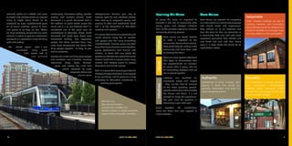
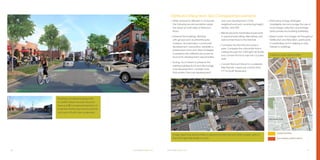
![18 SOUTH END VISION PLAN
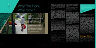
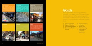
VISION
South End is a people-first,
walkable urban district of
vibrant neighborhoods, built on
transit, and fueled with energy
and innovation from some of
Charlotte’s most diverse and
creative people.
Where We Want
To Go
2
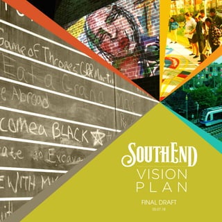
SOUTH END VISION PLAN 19
“...people
make[cities]and
it is to them, not
buildings, that we
must fit our
plans."
—Jane
Jacobs
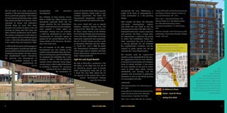
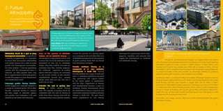
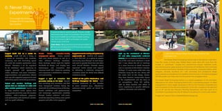
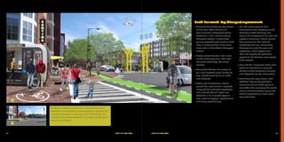
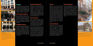
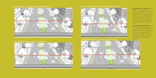
In 2030, South End will be the vibrant center
of many surrounding neighborhoods.
Residents of Dilworth, Wilmore and
Sedgefield will be able to safely and
enjoyably walk to and cross South
Boulevard and South Tryon Street - their
main streets - to shop, to meet friends,
and to experience all that Charlotte has
to offer.
Tens of thousands will live in this place
where stepping onto a train or catching
a ride on an automated vehicle will be as
comfortable and convenient as walking
and biking. Wide sidewalks will be alive
with activity, shaded by street trees, and
anchored by the beautiful South End
skyline. It is a skyline that has embraced its
industrial roots through preservation and
re-use alongside new towers overlooking
grand urban parks and transit stations and
mid-rise buildings for modern workplaces
and housing for people of many lifestyles
and economic means.
Public space will define each of South
End's neighborhoods. The ever-increasing
popularity of the Rail Trail, South End's
linear park will continue to grow as new
connections are made, narrow spots are](https://image.slidesharecdn.com/southendvisionplandraft2018may-180619055746/85/The-Southend-Vision-Plan-Final-2018-15-320.jpg)
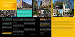
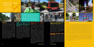


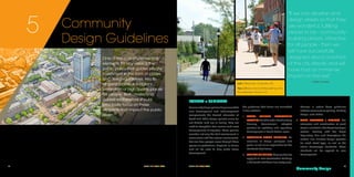
![86 SOUTH END VISION PLAN
(Caption]
Los, que virmand
essimanum, nosula re, ut virmil
hos, quodiu virmaccis cor que. Ibus
vendebis as volorit audis es aspit duntori
busaest, se vitis rehendia nimperumquatMo
ernatiusamus ant aut ute
SOUTH END VISION PLAN 86
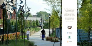
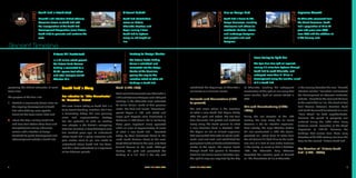
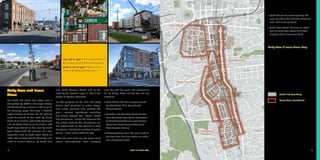
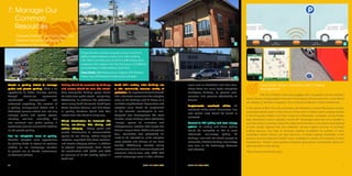
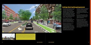
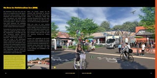
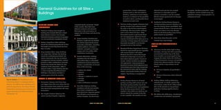
6’ 6’5’min 5’min16’ 16’
6’ 6’15’ 15’10’ 10’~16’~16’
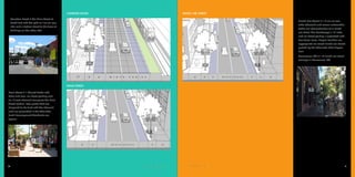
RAIL TRAIL
Rail Trail / 1 Standard Cross Section
A wide walkable, bikeable trail that
connects South End to Uptown. 16
feet wide gives the trail the width
necessary to accommodate current
foot and bike traffic, while also
including additional space for growth.
The tree grates shown can also be
interspersed with low landscaping
when appropriate and at the discretion
of the review team.
Rail Trail / 2 Light Rail Station
Platform Cross Section Width for the
trail and platform increase needed
space as one approaches the light
rail platform. Widening the trail to 10
feet allows for passing for different user
types, while also accommodating the
typical platform traffic.
REMOUNT ROAD: SOUTH BOULEVARD TO SOUTH TRYON STREET
SOUTH END VISION PLAN 87
W I D T H V A R I E S10’ 6’ 10’6’
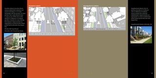
EAST/WEST BOULEVARD
Remount Road/ 1 Standard Cross
Section A wide walkable, bikeable
trail that connects South End to
Uptown. 16 feet wide gives the trail
the width necessary to accommodate
current foot and bike traffic, while also
including additional space for growth.
The tree grates shown can also be
interspersed with low landscaping
when appropriate and at the discretion
of the review team.
Rail Trail / 2 Light Rail Station
Platform Cross Section Width for the
trail and platform increase needed
space as one approaches the light
rail platform. Widening the trail to 10
feet allows for passing for different user
types, while also accommodating the
typical platform traffic.10' 10'
Building between the sidewalk/
trail edge a minimum of 8 feet in
depth that includes landscaping,
paving, porches, stoops,
canopies, street trees, benches,
pedestrian kiosks, bicycle rack or
services, and pedestrian lighting
as appropriate.
Street Sections](https://image.slidesharecdn.com/southendvisionplandraft2018may-180619055746/85/The-Southend-Vision-Plan-Final-2018-49-320.jpg)


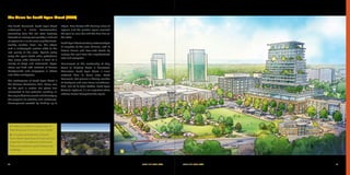
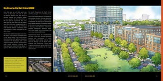
The South End Vision Plan outlines a strategic framework for the development of Charlotte's South End neighborhood, transforming it into a vibrant, walkable, and transit-oriented urban district over the next 25 years. Key goals include enhancing urban design, ensuring diverse housing options, and fostering community engagement through public spaces and local businesses. The plan emphasizes sustainability, inclusivity, and historical preservation, reflecting the community's grassroots efforts and aspirations for future growth.