SlideShare a Scribd company logo
1 of 121
BASICS OF SURVEYING
WHAT IS SURVEYING
• Surveying is the engineering of determining
the relative positions of objects (distinctive
features) on, above or beneath the surface of
earth by means of direct or indirect
measurements of distance, direction and
elevation. It also establishes the points in the
field by predetermined angular and linear
measurements.
OBJECT OF SURVEYING
• The aim of surveying is to prepare a
map, to show the relative positions
of the object on the surface of the
earth. The map is drawn to some
suitable scale. It show the natural
features of the country such as
towns, villages, roads, railways,
rivers, etc.
USES OF SURVEYING
• 1-To prepare a topographical
map which show the hills,
village, rivers, valleys, towns,
forest, etc. of a country.
USES OF SURVEYING
• 2-To prepare a cadastral map
showing the boundaries of
fields , houses and other
properties.
USES OF SURVEYING
• 3- To prepare an engineering
map which show the details
of engineering works such as
roads, railways, irrigation,
canal, reservoirs.
USES OF SURVEYING
• 4- To prepare a military map
showing the road and railway
communication with different
parts of country. Showing the
different strategic points
important for defence of
country.
USES OF SURVEYING
• 5- To prepare the contour map –
To determine the capacity of a
reservoir and to find the best
possible routes for roads,
railways, etc.
USES OF SURVEYING
• 6- Geological Map – Showing
areas including underground
resources.
USES OF SURVEYING
• 7- To prepare an archaeological
map including places where
ANCIENT relics exists.
Types of Surveying
• 1. Primary Surveying :-
• Plane Surveying
• Geodetic Surveying
• 2. Secondary Surveying
• Based on Instrument
• Chain Survey
• Compass Survey
• Plane Table Survey
• Theodolite Survey
• Tachometric Survey
• Photographic Survey
• Based on Methods
• Triangulation Survey
• Traverse Survey
• Based on Objects
• Geological Survey
• Mine Survey
• Archeological Survey
• Military Survey
• Based on Nature of field
• Land Surveying
• Topographical Survey
• Cadastral Survey
• City Survey
• Engineering Survey
• Marine Surveying
• Astronomical Surveying
Surveying Instruments
• Surveying instruments are tools or devices
used by surveyors to measure and gather data
about the Earth’s surface and its features.
These instruments help in determining
positions, distances, angles, elevations, and
other relevant information for mapping and
construction purposes.
Surveying Chains
ARROWS
PEGS
RANGING RODS
PLUMB BOB
CROSS STAFF
OPTICAL SQUARE
PRISM SQUARE
PRISMATIC COMPASS
SURVEYOR’S COMPASS
THEODOLITE
TOTAL STATION
• A total station is an advanced surveying
instrument that combines electronic
theodolite and distance measuring
capabilities. It is used to measure angles,
distances, and elevations with high accuracy.
Total stations are commonly used in land
surveying, construction layout, and mapping.
TOTAL STATION
PLANE TABLE
DUMPY LEVEL
LEVELING STAFF
AT A GLANCE
• 1. Measuring tape To measure linear
distances
• 2. Chain To measure linear distances
with precision
• 3. Arrow To mark a single chain distance
• 4. Peg To fix points on the ground To mark
the terminal points of survey lines on the
ground
• 5. Ranging rods To mark the position of
stations To sight the stations To range straight
lines
• 6. Plumb bobTo establish a vertical line
• 7. Cross StaffTo set out a right angle from a
survey line
• 8. Optical Staff To set out a right angle
from a survey line
• 9. Prism Square To set out a right angle
from a survey line
• 10. Site Square To set out a right angle
from a survey line
• 11. Prismatic Compass To find the bearing
of traversing To find included angles
• 12. Surveyor’s Compass To find a bearing and
angles between two survey lines in a traverse
• 13.LevelTo establish relative heights of points
with the help of leveling staff
• 14. Leveling Staff To determine the
height difference between two points To
measure the height or depth of a point with
respect to the datum
• 15. Theodolite To measure the angle
between two pre-decided visible points in
either a horizontal or vertical plane.
• 16. Total Station To measure horizontal
angle To measure vertical angle To measure
slope distance
• 17. Tripod To support surveying instruments
like a compass, level, theodolite, or total station
• 18. Plane table To provide a solid and level
surface to make field drawings
• 19. Alidade To sight a distant object and
establish a line of sight in a plane table surveying
• 20. Plumbing fork For centering of alidade in
plane table surveying
• 21. Spirit Level To level the table in plane
table surveying
• 22. Trough Compass To set the
orientation towards magnetic north in plane
table surveying
• 23. Drawing Paper To note field points on
paper in a plane table surveying
Latest advancement in surveying
Photogrammetry
• Photogrammetry is a technique of surveying
and mapping by using photographs or aerial
images. Photogrammetry instruments are
used to measure distances, angles, and
positions from overlapping images. This
technique is particularly useful for large-scale
mapping, topographic surveys, and creating
orthophotos.
Laser Scanner
• A laser scanner is a device that emits laser
beams and captures the reflected data to
create detailed 3D models of the surrounding
environment. Laser scanners are used in
surveying for high-precision mapping, as-built
documentation, and capturing accurate
measurements of complex structures or
terrains.
TOTAL STATION
ELECTRONIC DISTANCE METER
SURVEYING.pptx
SURVEYING.pptx
SURVEYING.pptx
SURVEYING.pptx
SURVEYING.pptx
SURVEYING.pptx
SURVEYING.pptx
SURVEYING.pptx
SURVEYING.pptx
SURVEYING.pptx
SURVEYING.pptx
SURVEYING.pptx
SURVEYING.pptx
SURVEYING.pptx
SURVEYING.pptx
SURVEYING.pptx
SURVEYING.pptx
SURVEYING.pptx
SURVEYING.pptx
SURVEYING.pptx
SURVEYING.pptx
SURVEYING.pptx
SURVEYING.pptx
SURVEYING.pptx
SURVEYING.pptx
SURVEYING.pptx
SURVEYING.pptx
SURVEYING.pptx
SURVEYING.pptx
SURVEYING.pptx
SURVEYING.pptx
SURVEYING.pptx
SURVEYING.pptx
SURVEYING.pptx
SURVEYING.pptx
SURVEYING.pptx
SURVEYING.pptx
SURVEYING.pptx
SURVEYING.pptx
SURVEYING.pptx
SURVEYING.pptx
SURVEYING.pptx
SURVEYING.pptx
SURVEYING.pptx
SURVEYING.pptx
SURVEYING.pptx
SURVEYING.pptx
SURVEYING.pptx
SURVEYING.pptx
SURVEYING.pptx
SURVEYING.pptx
SURVEYING.pptx
SURVEYING.pptx
SURVEYING.pptx
SURVEYING.pptx
SURVEYING.pptx
SURVEYING.pptx
SURVEYING.pptx
SURVEYING.pptx
SURVEYING.pptx
SURVEYING.pptx
SURVEYING.pptx
SURVEYING.pptx
SURVEYING.pptx
SURVEYING.pptx
SURVEYING.pptx
SURVEYING.pptx
SURVEYING.pptx
SURVEYING.pptx
SURVEYING.pptx
SURVEYING.pptx
SURVEYING.pptx
SURVEYING.pptx
SURVEYING.pptx
SURVEYING.pptx
SURVEYING.pptx
SURVEYING.pptx

More Related Content

Similar to SURVEYING.pptx

Introduction to Surveying
Introduction to SurveyingIntroduction to Surveying
Introduction to SurveyingPhurba Tamang
 
Introduction of surveying_Surveying, Civil Engineering
Introduction of surveying_Surveying, Civil EngineeringIntroduction of surveying_Surveying, Civil Engineering
Introduction of surveying_Surveying, Civil EngineeringA Makwana
 
01 - Introduction to Instruments Used in Surveying.pptx
01 - Introduction to Instruments Used in Surveying.pptx01 - Introduction to Instruments Used in Surveying.pptx
01 - Introduction to Instruments Used in Surveying.pptxhassan140063
 
site analysis and planning
site analysis and planningsite analysis and planning
site analysis and planningshami udeen
 
2.1 surveying, levelling and mapping
2.1 surveying, levelling and mapping2.1 surveying, levelling and mapping
2.1 surveying, levelling and mappingDigvijaysinh Gohil
 
A Intro LS PLF.pptx
A Intro LS PLF.pptxA Intro LS PLF.pptx
A Intro LS PLF.pptxalex15509
 
planetablesurvey-131027094131-phpapp01.pdf
planetablesurvey-131027094131-phpapp01.pdfplanetablesurvey-131027094131-phpapp01.pdf
planetablesurvey-131027094131-phpapp01.pdfssuser23e4af
 
planetablesurvey-131027094131-phpapp01 (1).pdf
planetablesurvey-131027094131-phpapp01 (1).pdfplanetablesurvey-131027094131-phpapp01 (1).pdf
planetablesurvey-131027094131-phpapp01 (1).pdfPotterheadKevin
 
planetablesurvey-131027094131-phpapp01.pdf
planetablesurvey-131027094131-phpapp01.pdfplanetablesurvey-131027094131-phpapp01.pdf
planetablesurvey-131027094131-phpapp01.pdfRinsaFebin
 
Module 4 Introduction to Surveying and Levelling.pptx
Module 4 Introduction to Surveying and Levelling.pptxModule 4 Introduction to Surveying and Levelling.pptx
Module 4 Introduction to Surveying and Levelling.pptxSilasChaudhari
 

Similar to SURVEYING.pptx (20)

Surveying
Surveying Surveying
Surveying
 
Introduction to Surveying
Introduction to SurveyingIntroduction to Surveying
Introduction to Surveying
 
Survey Equipments
Survey EquipmentsSurvey Equipments
Survey Equipments
 
Serveying
ServeyingServeying
Serveying
 
Introduction of surveying_Surveying, Civil Engineering
Introduction of surveying_Surveying, Civil EngineeringIntroduction of surveying_Surveying, Civil Engineering
Introduction of surveying_Surveying, Civil Engineering
 
Engineering survey
Engineering surveyEngineering survey
Engineering survey
 
01 - Introduction to Instruments Used in Surveying.pptx
01 - Introduction to Instruments Used in Surveying.pptx01 - Introduction to Instruments Used in Surveying.pptx
01 - Introduction to Instruments Used in Surveying.pptx
 
Application of surveying
Application of surveyingApplication of surveying
Application of surveying
 
site analysis and planning
site analysis and planningsite analysis and planning
site analysis and planning
 
Class 1_Surveying.pdf
Class 1_Surveying.pdfClass 1_Surveying.pdf
Class 1_Surveying.pdf
 
2.1 surveying, levelling and mapping
2.1 surveying, levelling and mapping2.1 surveying, levelling and mapping
2.1 surveying, levelling and mapping
 
surveying.ppt
surveying.pptsurveying.ppt
surveying.ppt
 
Introduction to survey
Introduction to surveyIntroduction to survey
Introduction to survey
 
A Intro LS PLF.pptx
A Intro LS PLF.pptxA Intro LS PLF.pptx
A Intro LS PLF.pptx
 
planetablesurvey-131027094131-phpapp01.pdf
planetablesurvey-131027094131-phpapp01.pdfplanetablesurvey-131027094131-phpapp01.pdf
planetablesurvey-131027094131-phpapp01.pdf
 
planetablesurvey-131027094131-phpapp01 (1).pdf
planetablesurvey-131027094131-phpapp01 (1).pdfplanetablesurvey-131027094131-phpapp01 (1).pdf
planetablesurvey-131027094131-phpapp01 (1).pdf
 
planetablesurvey-131027094131-phpapp01.pdf
planetablesurvey-131027094131-phpapp01.pdfplanetablesurvey-131027094131-phpapp01.pdf
planetablesurvey-131027094131-phpapp01.pdf
 
Plane Table Survey
Plane Table SurveyPlane Table Survey
Plane Table Survey
 
Surveying (introduction)
Surveying (introduction)Surveying (introduction)
Surveying (introduction)
 
Module 4 Introduction to Surveying and Levelling.pptx
Module 4 Introduction to Surveying and Levelling.pptxModule 4 Introduction to Surveying and Levelling.pptx
Module 4 Introduction to Surveying and Levelling.pptx
 

Recently uploaded

Unleashing the Power of the SORA AI lastest leap
Unleashing the Power of the SORA AI lastest leapUnleashing the Power of the SORA AI lastest leap
Unleashing the Power of the SORA AI lastest leapRishantSharmaFr
 
2016EF22_0 solar project report rooftop projects
2016EF22_0 solar project report rooftop projects2016EF22_0 solar project report rooftop projects
2016EF22_0 solar project report rooftop projectssmsksolar
 
Introduction to Serverless with AWS Lambda
Introduction to Serverless with AWS LambdaIntroduction to Serverless with AWS Lambda
Introduction to Serverless with AWS LambdaOmar Fathy
 
XXXXXXXXXXXXXXXXXXXXXXXXXXXXXXXXXXXXXXXXXXXXXXXXXXXX
XXXXXXXXXXXXXXXXXXXXXXXXXXXXXXXXXXXXXXXXXXXXXXXXXXXXXXXXXXXXXXXXXXXXXXXXXXXXXXXXXXXXXXXXXXXXXXXXXXXXXXXX
XXXXXXXXXXXXXXXXXXXXXXXXXXXXXXXXXXXXXXXXXXXXXXXXXXXXssuser89054b
 
chapter 5.pptx: drainage and irrigation engineering
chapter 5.pptx: drainage and irrigation engineeringchapter 5.pptx: drainage and irrigation engineering
chapter 5.pptx: drainage and irrigation engineeringmulugeta48
 
Thermal Engineering Unit - I & II . ppt
Thermal Engineering  Unit - I & II . pptThermal Engineering  Unit - I & II . ppt
Thermal Engineering Unit - I & II . pptDineshKumar4165
 
Top Rated Call Girls In chittoor 📱 {7001035870} VIP Escorts chittoor
Top Rated Call Girls In chittoor 📱 {7001035870} VIP Escorts chittoorTop Rated Call Girls In chittoor 📱 {7001035870} VIP Escorts chittoor
Top Rated Call Girls In chittoor 📱 {7001035870} VIP Escorts chittoordharasingh5698
 
Thermal Engineering -unit - III & IV.ppt
Thermal Engineering -unit - III & IV.pptThermal Engineering -unit - III & IV.ppt
Thermal Engineering -unit - III & IV.pptDineshKumar4165
 
Block diagram reduction techniques in control systems.ppt
Block diagram reduction techniques in control systems.pptBlock diagram reduction techniques in control systems.ppt
Block diagram reduction techniques in control systems.pptNANDHAKUMARA10
 
VIP Model Call Girls Kothrud ( Pune ) Call ON 8005736733 Starting From 5K to ...
VIP Model Call Girls Kothrud ( Pune ) Call ON 8005736733 Starting From 5K to ...VIP Model Call Girls Kothrud ( Pune ) Call ON 8005736733 Starting From 5K to ...
VIP Model Call Girls Kothrud ( Pune ) Call ON 8005736733 Starting From 5K to ...SUHANI PANDEY
 
FULL ENJOY Call Girls In Mahipalpur Delhi Contact Us 8377877756
FULL ENJOY Call Girls In Mahipalpur Delhi Contact Us 8377877756FULL ENJOY Call Girls In Mahipalpur Delhi Contact Us 8377877756
FULL ENJOY Call Girls In Mahipalpur Delhi Contact Us 8377877756dollysharma2066
 
Bhosari ( Call Girls ) Pune 6297143586 Hot Model With Sexy Bhabi Ready For ...
Bhosari ( Call Girls ) Pune  6297143586  Hot Model With Sexy Bhabi Ready For ...Bhosari ( Call Girls ) Pune  6297143586  Hot Model With Sexy Bhabi Ready For ...
Bhosari ( Call Girls ) Pune 6297143586 Hot Model With Sexy Bhabi Ready For ...tanu pandey
 
Work-Permit-Receiver-in-Saudi-Aramco.pptx
Work-Permit-Receiver-in-Saudi-Aramco.pptxWork-Permit-Receiver-in-Saudi-Aramco.pptx
Work-Permit-Receiver-in-Saudi-Aramco.pptxJuliansyahHarahap1
 
COST-EFFETIVE and Energy Efficient BUILDINGS ptx
COST-EFFETIVE  and Energy Efficient BUILDINGS ptxCOST-EFFETIVE  and Energy Efficient BUILDINGS ptx
COST-EFFETIVE and Energy Efficient BUILDINGS ptxJIT KUMAR GUPTA
 

Recently uploaded (20)
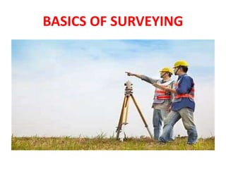
Unleashing the Power of the SORA AI lastest leap
Unleashing the Power of the SORA AI lastest leapUnleashing the Power of the SORA AI lastest leap
Unleashing the Power of the SORA AI lastest leap
 
2016EF22_0 solar project report rooftop projects
2016EF22_0 solar project report rooftop projects2016EF22_0 solar project report rooftop projects
2016EF22_0 solar project report rooftop projects
 
Introduction to Serverless with AWS Lambda
Introduction to Serverless with AWS LambdaIntroduction to Serverless with AWS Lambda
Introduction to Serverless with AWS Lambda
 
XXXXXXXXXXXXXXXXXXXXXXXXXXXXXXXXXXXXXXXXXXXXXXXXXXXX
XXXXXXXXXXXXXXXXXXXXXXXXXXXXXXXXXXXXXXXXXXXXXXXXXXXXXXXXXXXXXXXXXXXXXXXXXXXXXXXXXXXXXXXXXXXXXXXXXXXXXXXX
XXXXXXXXXXXXXXXXXXXXXXXXXXXXXXXXXXXXXXXXXXXXXXXXXXXX
 
chapter 5.pptx: drainage and irrigation engineering
chapter 5.pptx: drainage and irrigation engineeringchapter 5.pptx: drainage and irrigation engineering
chapter 5.pptx: drainage and irrigation engineering
 
Thermal Engineering Unit - I & II . ppt
Thermal Engineering  Unit - I & II . pptThermal Engineering  Unit - I & II . ppt
Thermal Engineering Unit - I & II . ppt
 
Top Rated Call Girls In chittoor 📱 {7001035870} VIP Escorts chittoor
Top Rated Call Girls In chittoor 📱 {7001035870} VIP Escorts chittoorTop Rated Call Girls In chittoor 📱 {7001035870} VIP Escorts chittoor
Top Rated Call Girls In chittoor 📱 {7001035870} VIP Escorts chittoor
 
Cara Menggugurkan Sperma Yang Masuk Rahim Biyar Tidak Hamil
Cara Menggugurkan Sperma Yang Masuk Rahim Biyar Tidak HamilCara Menggugurkan Sperma Yang Masuk Rahim Biyar Tidak Hamil
Cara Menggugurkan Sperma Yang Masuk Rahim Biyar Tidak Hamil
 
Thermal Engineering -unit - III & IV.ppt
Thermal Engineering -unit - III & IV.pptThermal Engineering -unit - III & IV.ppt
Thermal Engineering -unit - III & IV.ppt
 
Block diagram reduction techniques in control systems.ppt
Block diagram reduction techniques in control systems.pptBlock diagram reduction techniques in control systems.ppt
Block diagram reduction techniques in control systems.ppt
 
(INDIRA) Call Girl Aurangabad Call Now 8617697112 Aurangabad Escorts 24x7
(INDIRA) Call Girl Aurangabad Call Now 8617697112 Aurangabad Escorts 24x7(INDIRA) Call Girl Aurangabad Call Now 8617697112 Aurangabad Escorts 24x7
(INDIRA) Call Girl Aurangabad Call Now 8617697112 Aurangabad Escorts 24x7
 
(INDIRA) Call Girl Meerut Call Now 8617697112 Meerut Escorts 24x7
(INDIRA) Call Girl Meerut Call Now 8617697112 Meerut Escorts 24x7(INDIRA) Call Girl Meerut Call Now 8617697112 Meerut Escorts 24x7
(INDIRA) Call Girl Meerut Call Now 8617697112 Meerut Escorts 24x7
 
VIP Model Call Girls Kothrud ( Pune ) Call ON 8005736733 Starting From 5K to ...
VIP Model Call Girls Kothrud ( Pune ) Call ON 8005736733 Starting From 5K to ...VIP Model Call Girls Kothrud ( Pune ) Call ON 8005736733 Starting From 5K to ...
VIP Model Call Girls Kothrud ( Pune ) Call ON 8005736733 Starting From 5K to ...
 
FULL ENJOY Call Girls In Mahipalpur Delhi Contact Us 8377877756
FULL ENJOY Call Girls In Mahipalpur Delhi Contact Us 8377877756FULL ENJOY Call Girls In Mahipalpur Delhi Contact Us 8377877756
FULL ENJOY Call Girls In Mahipalpur Delhi Contact Us 8377877756
 
Bhosari ( Call Girls ) Pune 6297143586 Hot Model With Sexy Bhabi Ready For ...
Bhosari ( Call Girls ) Pune  6297143586  Hot Model With Sexy Bhabi Ready For ...Bhosari ( Call Girls ) Pune  6297143586  Hot Model With Sexy Bhabi Ready For ...
Bhosari ( Call Girls ) Pune 6297143586 Hot Model With Sexy Bhabi Ready For ...
 
Work-Permit-Receiver-in-Saudi-Aramco.pptx
Work-Permit-Receiver-in-Saudi-Aramco.pptxWork-Permit-Receiver-in-Saudi-Aramco.pptx
Work-Permit-Receiver-in-Saudi-Aramco.pptx
 
Call Now ≽ 9953056974 ≼🔝 Call Girls In New Ashok Nagar ≼🔝 Delhi door step de...
Call Now ≽ 9953056974 ≼🔝 Call Girls In New Ashok Nagar  ≼🔝 Delhi door step de...Call Now ≽ 9953056974 ≼🔝 Call Girls In New Ashok Nagar  ≼🔝 Delhi door step de...
Call Now ≽ 9953056974 ≼🔝 Call Girls In New Ashok Nagar ≼🔝 Delhi door step de...
 
FEA Based Level 3 Assessment of Deformed Tanks with Fluid Induced Loads
FEA Based Level 3 Assessment of Deformed Tanks with Fluid Induced LoadsFEA Based Level 3 Assessment of Deformed Tanks with Fluid Induced Loads
FEA Based Level 3 Assessment of Deformed Tanks with Fluid Induced Loads
 
(INDIRA) Call Girl Bhosari Call Now 8617697112 Bhosari Escorts 24x7
(INDIRA) Call Girl Bhosari Call Now 8617697112 Bhosari Escorts 24x7(INDIRA) Call Girl Bhosari Call Now 8617697112 Bhosari Escorts 24x7
(INDIRA) Call Girl Bhosari Call Now 8617697112 Bhosari Escorts 24x7
 
COST-EFFETIVE and Energy Efficient BUILDINGS ptx
COST-EFFETIVE  and Energy Efficient BUILDINGS ptxCOST-EFFETIVE  and Energy Efficient BUILDINGS ptx
COST-EFFETIVE and Energy Efficient BUILDINGS ptx
 

SURVEYING.pptx

  • 2. WHAT IS SURVEYING • Surveying is the engineering of determining the relative positions of objects (distinctive features) on, above or beneath the surface of earth by means of direct or indirect measurements of distance, direction and elevation. It also establishes the points in the field by predetermined angular and linear measurements.
  • 3. OBJECT OF SURVEYING • The aim of surveying is to prepare a map, to show the relative positions of the object on the surface of the earth. The map is drawn to some suitable scale. It show the natural features of the country such as towns, villages, roads, railways, rivers, etc.
  • 4. USES OF SURVEYING • 1-To prepare a topographical map which show the hills, village, rivers, valleys, towns, forest, etc. of a country.
  • 5. USES OF SURVEYING • 2-To prepare a cadastral map showing the boundaries of fields , houses and other properties.
  • 6. USES OF SURVEYING • 3- To prepare an engineering map which show the details of engineering works such as roads, railways, irrigation, canal, reservoirs.
  • 7. USES OF SURVEYING • 4- To prepare a military map showing the road and railway communication with different parts of country. Showing the different strategic points important for defence of country.
  • 8. USES OF SURVEYING • 5- To prepare the contour map – To determine the capacity of a reservoir and to find the best possible routes for roads, railways, etc.
  • 9. USES OF SURVEYING • 6- Geological Map – Showing areas including underground resources.
  • 10. USES OF SURVEYING • 7- To prepare an archaeological map including places where ANCIENT relics exists.
  • 11. Types of Surveying • 1. Primary Surveying :- • Plane Surveying • Geodetic Surveying
  • 12. • 2. Secondary Surveying • Based on Instrument • Chain Survey • Compass Survey • Plane Table Survey • Theodolite Survey • Tachometric Survey • Photographic Survey
  • 13. • Based on Methods • Triangulation Survey • Traverse Survey
  • 14. • Based on Objects • Geological Survey • Mine Survey • Archeological Survey • Military Survey
  • 15. • Based on Nature of field • Land Surveying • Topographical Survey • Cadastral Survey • City Survey • Engineering Survey • Marine Surveying • Astronomical Surveying
  • 16. Surveying Instruments • Surveying instruments are tools or devices used by surveyors to measure and gather data about the Earth’s surface and its features. These instruments help in determining positions, distances, angles, elevations, and other relevant information for mapping and construction purposes.
  • 19. PEGS
  • 28. TOTAL STATION • A total station is an advanced surveying instrument that combines electronic theodolite and distance measuring capabilities. It is used to measure angles, distances, and elevations with high accuracy. Total stations are commonly used in land surveying, construction layout, and mapping.
  • 33. AT A GLANCE • 1. Measuring tape To measure linear distances • 2. Chain To measure linear distances with precision • 3. Arrow To mark a single chain distance • 4. Peg To fix points on the ground To mark the terminal points of survey lines on the ground
  • 34. • 5. Ranging rods To mark the position of stations To sight the stations To range straight lines • 6. Plumb bobTo establish a vertical line • 7. Cross StaffTo set out a right angle from a survey line • 8. Optical Staff To set out a right angle from a survey line
  • 35. • 9. Prism Square To set out a right angle from a survey line • 10. Site Square To set out a right angle from a survey line • 11. Prismatic Compass To find the bearing of traversing To find included angles • 12. Surveyor’s Compass To find a bearing and angles between two survey lines in a traverse
  • 36. • 13.LevelTo establish relative heights of points with the help of leveling staff • 14. Leveling Staff To determine the height difference between two points To measure the height or depth of a point with respect to the datum
  • 37. • 15. Theodolite To measure the angle between two pre-decided visible points in either a horizontal or vertical plane. • 16. Total Station To measure horizontal angle To measure vertical angle To measure slope distance
  • 38. • 17. Tripod To support surveying instruments like a compass, level, theodolite, or total station • 18. Plane table To provide a solid and level surface to make field drawings • 19. Alidade To sight a distant object and establish a line of sight in a plane table surveying • 20. Plumbing fork For centering of alidade in plane table surveying
  • 39. • 21. Spirit Level To level the table in plane table surveying • 22. Trough Compass To set the orientation towards magnetic north in plane table surveying • 23. Drawing Paper To note field points on paper in a plane table surveying
  • 41. Photogrammetry • Photogrammetry is a technique of surveying and mapping by using photographs or aerial images. Photogrammetry instruments are used to measure distances, angles, and positions from overlapping images. This technique is particularly useful for large-scale mapping, topographic surveys, and creating orthophotos.
  • 42. Laser Scanner • A laser scanner is a device that emits laser beams and captures the reflected data to create detailed 3D models of the surrounding environment. Laser scanners are used in surveying for high-precision mapping, as-built documentation, and capturing accurate measurements of complex structures or terrains.