SlideShare a Scribd company logo
ARCHITECTURE OF A TIDE-DOMINATED SHOREFACE SYSTEM IN THE LOWER CRETACEOUS KOOTENAI FORMATION, WEST-CENTRAL MONTANA
STATZA, Mary, TAKACH, Marie, and SCHWARTZ, Robert K.,
Department of Geology, Allegheny College,Meadville, PA 16335
ABSTRACT
Integrated long-distance, high-resolution photography and detailed outcrop analysis were
used to document the architecture of a tide-dominated, low wave-energy, shoreface lithosome
along the Missouri River Gorge near Great Falls, Montana.
The lithosome (~18 m thick) consists of five vertically stacked, widespread, tabular units and
scattered channel bodies. Internally, the tabular units (~2-4 m thick) coarsen upwards and the
architecture of a representative unit includes a thin basal mudstone or heterolithic interval
changing upward to a thicker bedded, amalgamated, fine- to rarely medium-grained sand-
stone. However, the full vertical succession of five units are stacked in a net upward-coarsening
succession in which the basal unit is mudstone dominated and successive units contain less
mud. Sand fractions are quartzose, very well rounded, and very well sorted. Rhythmic bedding
is characteristic and ranges from horizontal to convex on the tidal bar scale (dm wavelength).
Scattered medium-scale trough cross-stratification and thin channel-shaped lenses (~1-15 m
wide) indicate episodic current activity. Widespread erosional surfaces separate the units, as
well as occur internally, causing localized discordances between units or the amalgamation of
sandstone-dominated units. The channel bodies are relatively large (50-100's m wide, 5-10 m
thick), contain heterolithic fill similar in composition to the tabular units, and transect one or
more of the tabular units, documenting the coexistence of cross-shore channels.
Diagnostic structures of tidal origin include mud couplets, neap-spring lamination sets, flaser-
to-lenticular bedding, amalgamated ripple beds separated by reactivation surfaces, rhythmi-
cally alternating ripple beds and parallel-laminations, mm-scale clay drapes, and lateral sets of
small-scale ripple bundles. Small-scale wave-ripples (~ 4 cm spacing) are present on some sur-
faces and hummocky cross-stratification is exceptionally rare. Trace fossils include Arenicolites,
Ophiomorpha (very rare), Macaronichnus, Planolites, Piscichnus, horseshoe crab-like resting
traces, and bivalve crawling traces indicating marine to slightly brackish conditions. Bioturba-
tion index typically ranges between 3 and 6. A Glossifungites ichnofacies caps the succession.
BACKGROUND
0
.5
1
1.5
2
2.5
3
3.5
4
4.5
5
md st vfg fg mg cg vcg
MASSIVE
SANDSTONE
BEDDED
SANDSTONE
CROSS-BEDDED
SANDSTONE
RIPPLE-BEDDED
SANDSTONE
MAROON
MUDSTONE
GRAY
MUDSTONE
BIPOLAR
FORESETS
TROUGH
CROSS-BEDDING
FLASER
BEDDING
LEGEND
(1)
(2-3)
(4-5)
(6)
LOW
BIOTURBATION
SOME
BIOTURBATION
MODERATE
BIOTURBATION
HIGH
BIOTURBATION
(4-5)
(1)
(2-3)
5.5
6
6.5
7
7.5
8
8.5
9
9.5
10
10.5
11
11.5
12
12.5
13
13.5
14
14.5
15
15.5
16
16.5
17
17.5
18
(2-3)
(1)
(2-3)
(4-5)
(6)
(2-3)
(6)
ACKNOWLEDGEMENTS
This project would not have been possible without financial assistance from the
Christine Scott Nelson Faculty Support Fund.
Special thanks must be given to Susan Vuke for her selfless support, endless supply of
encouragements and camping supplies (especially bear-spray), and for sheltering us
Cowgirls and (old) Indians from the volatile Montana weather.
An even special-er thanks to Bob Schwartz for his infinite support, encouragement,
and supply of stories and falsehoods that kept us infinitely entertained/disgruntled.
Sugar and FooFoo love ya, Old Man.
CONCLUSIONS
REFERENCES
U
N
I
T
1
U
N
I
T
2
U
N
I
T
3
U
N
I
T
4
U
N
I
T
5
Thickness(m)
Three weeks of field research included outcrop analysis
and Gigapan photo technology.
The study area is located in western Montana, northeast of the city of Great Falls.
The outcrop is exposed along the eastern bank of the Missouri River flowing north
out of Morony Dam.
Figure illustrating theorized southern extent
of Cretaceous Barremian transgression into
Montana. Arrows indicate tidal currents.
Morony Dam outcrop represented by red
circle. (Schwartz, 2007)
Correlative stratigraphic column showing location
of Sunburst Formation, primary constituent of
tidal-shoreface outcrop along Missouri River.
(Schwartz, 2007)
Overview of basal, upward-coarsening unit 1 (~2.2m). Tabular, mud-dominant beds transition
upward into sand-dominant, wavy bedding. Mudstone grades from maroon in color, due to
reworking of underlying Kk2, to gray in upper part of the unit. An erosional scour surface
separates unit 1 from overlying unit 2. 1.5m staff for scale.
Beds transition from tabular to increasingly wavy-bedding up-unit. Scale is 15cm.
Close up of maroon tidal bundles. Mudstone layers deposited during periods of
reduced tidal current energy, while fine-grained sandstone beds deposited
during periods of higher energy. Scale is 5cm.
3 cm
Close up of sandstone beds displaying small-scale foresets, demonstrating kinematics
of tidal current event (see arrow) Upper flow regime parallel laminations are followed
by lower flow regime ripple bedding and muddy sand suspension fall out. Scale is 3cm.
Overview of sandstone dominant unit 2 (~3.3m),
consisting of several erosionally-based beds of ripple-
to-crossbedded sandstone, capped by a muddy layer.
Overall upward coarsening. 1.5m staff for scale.
U
N
I
T
1
U
N
I
T
2
Mud-filled scour surface between units 1 and 2.
Overall, bed set contacts within unit 2 are sharp,
and are either amalgamated or separated by thin
mudstone.
A
B
A) Stacked small-scale ripple-bedding with bidirectional foresets, indicating
reversing tidal currents. Relict bedding due to moderate bioturbation. Scale is
15cm. B) Close up of bedding with opposite foreset directions.
A B
C D
Flaser bedding. Small-scale troughs are mantled by mm-scale mud-drapes.
Scale is 15cm.
Mottled sandstone fabric due to bioturbation. A) Biogenically deformed ripple-bedding.
B) Relict stacked-ripple bedding. C) Relict small-scale troughs. D) Heavily ripple-bedded
sandstone due to bioturbation.
Horizontal and vertical trace fossils on sole of sandstone bed.
UNIT 2
UNIT 3
2m
Overview of sandstone dominant unit 3 (~3.5m), coarsening
upward from interbedded mud and sandstone, into fine grained,
amalgamated,wavy bedded sandstone beds.
Well-defined, medium-scale foresets documenting reversing tidal currents.
Scale is 15cm.
A
B
A) Burrowed, ripple-bedded, fine-grained
sandstone beds. B) Enlarged view of
sandstone beds, showing small-scale foresets.
A
B
C
15 cm
UNIT 2
Schwartz, R. K., Vuke, S. M., 2007, Tide-Dominated Facies Complex at Southern Terminus of Sunburst Sea, Cretaceous Kootenai
Formation, Great Falls, Montana: http://www.searchanddiscovery.com/documents/2007/07036schwartz
(accessed July 2014).
Overview of upward-coarsening unit 5 (~4.5m), composed of basal maroon
mudstone containing fine-grained lenses of sandstone, transitioning up-
unit into amalgamated sandstone. Some relict ripple-bedding, but sandstone
beds are typically massive due to bioturbation. The unit is capped by highly-
deformed, oxidized sandstone, most likely containing Glossifungites
ichnofacies, indicating a firm ground setting. Black triangle indicates textural
trend. 1.5m staff for scale.
Overview of unit 4 (~4.3m). Unit coarsens upward from a base of
alternating very-fine-grained sandstone and mudstone, into thicker,
bioturbated sandstone beds. The unit contains a capping reddish-brown,
oxidized bed of highly bioturbated sandstone, most likely containing a
Glossifungites ichnofacies assemblage, indicating a firm ground setting.
10 cm
10 cm
Interbedded sandstone and mudstone at base of unit 4. Scale is 20 cm.
Localized, isolated lense of organic-rich mudstone, preserved by rapid
deposition and deformed by compaction and/or dewatering.
A
A
B
B
A) Massive sandstone beds. Scale is 15cm. B) Close up of sandstone bed showing biogenically caused absence
of sedimentary structures.
A) Tan, fine-grained sandstone with bioturbated, relict, subhorizontal laminations. Scale is 5cm. B) Close up of
bioturbated laminations in A.
5 cm
B
A
A) Possible load casts on underside of heavily bioturbated, oxidized, reddish
sandstone bed. Scale is 50cm. B) Close up of load casts
50 cm
sandstone
mudstone
A B
C D
A) Float block from highly oxidized, brown capping layer, showing heavy bioturbation and burrowing.
B) Float block from red, oxidized sandstone bed. Moderate bioturbation and burrows.
C) Float block. Bioturbation and burrowing.
D) Float block. Bioturbation and burrowing.
Fine to medium grained, oxidized, brown capping sandstone bed. Bed most likely
contains Glossifungites ichnofacies, indicating firm ground settings during and after
depositon.
A) Large, ripple-bedded sandstone beds with amalgamated surfaces. Human scale is 1.57m. B) Side view of block in A,
showing geometry of erosional surfaces. 1.5m staff for scale. C) Massive, highly bioturbated capping bed of unit 3.
Location shown by yellow arrow in B. Wavy bedding, indicative of fluctuating tidal energy levels. Scale is 15cm.
A
B
A) Flaser bedding. Small-scale troughs are mantled by mm-scale mud-drapes.
Scale is 15cm. B) Close up of flaser bedding.
15 cm
Paired- burrows. Arenicolites.
Small, unlined, rarely branched Planolites.
The five upward coarsening units represent shoreface tidal parasequences.
The typical vertical succession of a shoreface parasequence consists of a mudstone
dominant base, coarsening upwards into thicker, sometimes amalgamated ripple-
bedded sandstone beds.
The maroon mudstone within unit 1 is due to ravinement and reworking of the
underlying maroon estuarine mudstone facies of Kk2 (Kootenai Formation). Similarly,
reworking of the adjacent coastal plain mud, such as occurs in the overlying Kk4 unit
(red mudstone coastal plain facies) could have contributed to the abundance of maroon
mudstone within the capping Sunburst unit at
Morony Dam (unit 5).
Units 1 through 3 show an upwards net coarsening, where mudstone is replaced
by sandstone as the dominant constituent. Following this net coarsening is a net fining
trend from units 3 through 5, where mudstone becomes more prevalent with each
successive unit, before overlapping of the mudstone-dominant Kk4 coastal plain system.
The large quantity of tidal features, such as rhythmic bedding, tidal laminations,
flaser-to-wavy bedding, amalgamated ripple-beds with erosional surfaces, and degree
of bioturbation indicate the depositional environment was tidal dominated. An
absence of features associated with wave-dominated shorefaces, such as wave-ripple
cross-lamination, hummocky cross-stratificationand surf-zone related trough
cross-stratification further supports this hypothesis.
The limited diversity of the abundant trace fossils found within the units indicates
a shallow water, brackish-marine setting.
5 cm
Stratigraphic column detailing grain size, thickness (m), and
sedimentary structures of five units studied at Morony Dam.
U
N
I
T
1
Close up of rhythmic mud-sand couplets, indicative of
alternating suspension fallout-tractive flow conditions.
U
N
I
T
2
scour surface scour surface scour surface scour surface
U
N
I
T
3
U
N
I
T
4
U
N
I
T
5
Gigapan image of tidal shoreface succession in the Sunburst Member near Morony Dam.

More Related Content

What's hot

Modelling the Distribution of Karst Topography, Nova Scotia, Canada
Modelling the Distribution of Karst Topography, Nova Scotia, CanadaModelling the Distribution of Karst Topography, Nova Scotia, Canada
Modelling the Distribution of Karst Topography, Nova Scotia, CanadaCOGS Presentations
 
Sedimentary basins
Sedimentary basinsSedimentary basins
Sedimentary basins
Sohail Nawab
 
Distinguishing gas bearing sandstone reservoirs within mixed siliciclastic-ca...
Distinguishing gas bearing sandstone reservoirs within mixed siliciclastic-ca...Distinguishing gas bearing sandstone reservoirs within mixed siliciclastic-ca...
Distinguishing gas bearing sandstone reservoirs within mixed siliciclastic-ca...
Ahmed Hafez
 
Geological Map of Strath, Isle of Skye
Geological Map of Strath, Isle of SkyeGeological Map of Strath, Isle of Skye
Geological Map of Strath, Isle of Skye
Christian Garvey
 
Petroleum geology
Petroleum geologyPetroleum geology
Petroleum geology
Ubaidullah Shalmani
 
2. apllied-hydrogeology-fetter- 2--315-324
2. apllied-hydrogeology-fetter- 2--315-3242. apllied-hydrogeology-fetter- 2--315-324
2. apllied-hydrogeology-fetter- 2--315-324
massiel mamani marquez
 
1. article azojete vol. 12 1 16 shettima
1. article azojete vol. 12 1 16 shettima1. article azojete vol. 12 1 16 shettima
1. article azojete vol. 12 1 16 shettima
Oyeniyi Samuel
 
Mapping Report Lucas Jacobs
Mapping Report Lucas JacobsMapping Report Lucas Jacobs
Mapping Report Lucas JacobsLucas Jacobs
 
B05611017
B05611017B05611017
B05611017
IOSR-JEN
 
McKechnie and Annesley GSA 2014 Presentation
McKechnie and Annesley GSA 2014 PresentationMcKechnie and Annesley GSA 2014 Presentation
McKechnie and Annesley GSA 2014 Presentation
Christine McKechnie
 
Sedimentology application in petroleum industry
Sedimentology application in petroleum industrySedimentology application in petroleum industry
Sedimentology application in petroleum industry
Andi Anriansyah
 
McKechnie et al. GAC-MAC 2013 Presentation
McKechnie et al. GAC-MAC 2013 PresentationMcKechnie et al. GAC-MAC 2013 Presentation
McKechnie et al. GAC-MAC 2013 Presentation
Christine McKechnie
 
Facies term
Facies termFacies term
Facies term
Cyprian Ozigbo
 
Climbing ripple laminations
Climbing ripple laminationsClimbing ripple laminations
Climbing ripple laminations
Prathamesh Pawar
 
Karst topography
Karst topographyKarst topography
Karst topography
GCUF
 

What's hot (20)

Modelling the Distribution of Karst Topography, Nova Scotia, Canada
Modelling the Distribution of Karst Topography, Nova Scotia, CanadaModelling the Distribution of Karst Topography, Nova Scotia, Canada
Modelling the Distribution of Karst Topography, Nova Scotia, Canada
 
Sedimentary basins
Sedimentary basinsSedimentary basins
Sedimentary basins
 
Distinguishing gas bearing sandstone reservoirs within mixed siliciclastic-ca...
Distinguishing gas bearing sandstone reservoirs within mixed siliciclastic-ca...Distinguishing gas bearing sandstone reservoirs within mixed siliciclastic-ca...
Distinguishing gas bearing sandstone reservoirs within mixed siliciclastic-ca...
 
Structural Geology II
Structural Geology IIStructural Geology II
Structural Geology II
 
Geological Map of Strath, Isle of Skye
Geological Map of Strath, Isle of SkyeGeological Map of Strath, Isle of Skye
Geological Map of Strath, Isle of Skye
 
Petroleum geology
Petroleum geologyPetroleum geology
Petroleum geology
 
2. apllied-hydrogeology-fetter- 2--315-324
2. apllied-hydrogeology-fetter- 2--315-3242. apllied-hydrogeology-fetter- 2--315-324
2. apllied-hydrogeology-fetter- 2--315-324
 
1. article azojete vol. 12 1 16 shettima
1. article azojete vol. 12 1 16 shettima1. article azojete vol. 12 1 16 shettima
1. article azojete vol. 12 1 16 shettima
 
Mapping Report Lucas Jacobs
Mapping Report Lucas JacobsMapping Report Lucas Jacobs
Mapping Report Lucas Jacobs
 
B05611017
B05611017B05611017
B05611017
 
McKechnie and Annesley GSA 2014 Presentation
McKechnie and Annesley GSA 2014 PresentationMcKechnie and Annesley GSA 2014 Presentation
McKechnie and Annesley GSA 2014 Presentation
 
Sedimentology application in petroleum industry
Sedimentology application in petroleum industrySedimentology application in petroleum industry
Sedimentology application in petroleum industry
 
McKechnie et al. GAC-MAC 2013 Presentation
McKechnie et al. GAC-MAC 2013 PresentationMcKechnie et al. GAC-MAC 2013 Presentation
McKechnie et al. GAC-MAC 2013 Presentation
 
Facies term
Facies termFacies term
Facies term
 
Zuni spring inventory publication
Zuni spring inventory publicationZuni spring inventory publication
Zuni spring inventory publication
 
GL4023 Mapping Report finalised
GL4023 Mapping Report finalisedGL4023 Mapping Report finalised
GL4023 Mapping Report finalised
 
Climbing ripple laminations
Climbing ripple laminationsClimbing ripple laminations
Climbing ripple laminations
 
Karst topography
Karst topographyKarst topography
Karst topography
 
Thesis BSc Geology.docx
Thesis BSc Geology.docxThesis BSc Geology.docx
Thesis BSc Geology.docx
 
Dissertation
DissertationDissertation
Dissertation
 

Similar to Statza, Takatch, Schwartz_2014_Architecture Tide-Dom Shoreface (1)

Source-Reservoir and Delta Trap.pptx
Source-Reservoir and Delta Trap.pptxSource-Reservoir and Delta Trap.pptx
Source-Reservoir and Delta Trap.pptx
SaadTaman
 
Delta Lithologic Facies Classification.pptx
Delta Lithologic Facies Classification.pptxDelta Lithologic Facies Classification.pptx
Delta Lithologic Facies Classification.pptx
SaadTaman
 
Mudstone facies.pptx
Mudstone facies.pptxMudstone facies.pptx
Mudstone facies.pptx
SaadTaman
 
channel deposit.pptx
channel deposit.pptxchannel deposit.pptx
channel deposit.pptx
SaadTaman
 
conglomerate facies.pptx
conglomerate facies.pptxconglomerate facies.pptx
conglomerate facies.pptx
SaadTaman
 
single braided river deltas.pptx
single braided river deltas.pptxsingle braided river deltas.pptx
single braided river deltas.pptx
SaadTaman
 
sequence characteristic.pptx
sequence characteristic.pptxsequence characteristic.pptx
sequence characteristic.pptx
SaadTaman
 
Delta Lithologic Facies Classification.pptx
Delta Lithologic Facies Classification.pptxDelta Lithologic Facies Classification.pptx
Delta Lithologic Facies Classification.pptx
SaadTaman
 
type of coarse-grained delta.pptx
type of coarse-grained delta.pptxtype of coarse-grained delta.pptx
type of coarse-grained delta.pptx
SaadTaman
 
delta plain, delta front, and prodelta sedimentation.pptx
delta plain, delta front, and prodelta sedimentation.pptxdelta plain, delta front, and prodelta sedimentation.pptx
delta plain, delta front, and prodelta sedimentation.pptx
SaadTaman
 
Fan delta front.pptx
Fan delta front.pptxFan delta front.pptx
Fan delta front.pptx
SaadTaman
 
Saltmarsh dynamics
Saltmarsh dynamicsSaltmarsh dynamics
Saltmarsh dynamics
Prof Simon Haslett
 
Geological Digressions.pptx
Geological Digressions.pptxGeological Digressions.pptx
Geological Digressions.pptx
SaadTaman
 
Thakkhola –mustang garben sediments
Thakkhola –mustang garben sedimentsThakkhola –mustang garben sediments
Thakkhola –mustang garben sediments
Jyoti Khatiwada
 
The study of sequence stratigraphy and sedimentary system in Muglad Basin
The study of sequence stratigraphy and sedimentary system in Muglad BasinThe study of sequence stratigraphy and sedimentary system in Muglad Basin
The study of sequence stratigraphy and sedimentary system in Muglad Basin
iosrjce
 
The study of sequence stratigraphy and sedimentary system in Muglad Basin
The study of sequence stratigraphy and sedimentary system in Muglad BasinThe study of sequence stratigraphy and sedimentary system in Muglad Basin
The study of sequence stratigraphy and sedimentary system in Muglad Basin
iosrjce
 
Reeffacies ppt
Reeffacies pptReeffacies ppt
Reeffacies ppt
Kristin
 
Sedimentary questions
Sedimentary questions Sedimentary questions
Sedimentary questions
PurvaPandey3
 
Sedimentology and Stratigraphy of a Large, Pre-Vegatation Deltaic Complex.pptx
Sedimentology and Stratigraphy of a Large, Pre-Vegatation Deltaic Complex.pptxSedimentology and Stratigraphy of a Large, Pre-Vegatation Deltaic Complex.pptx
Sedimentology and Stratigraphy of a Large, Pre-Vegatation Deltaic Complex.pptx
SaadTaman
 
Grahn & Bosetti 2010
Grahn & Bosetti 2010Grahn & Bosetti 2010
Grahn & Bosetti 2010
Elvio Hellbilly Bosetti
 

Similar to Statza, Takatch, Schwartz_2014_Architecture Tide-Dom Shoreface (1) (20)

Source-Reservoir and Delta Trap.pptx
Source-Reservoir and Delta Trap.pptxSource-Reservoir and Delta Trap.pptx
Source-Reservoir and Delta Trap.pptx
 
Delta Lithologic Facies Classification.pptx
Delta Lithologic Facies Classification.pptxDelta Lithologic Facies Classification.pptx
Delta Lithologic Facies Classification.pptx
 
Mudstone facies.pptx
Mudstone facies.pptxMudstone facies.pptx
Mudstone facies.pptx
 
channel deposit.pptx
channel deposit.pptxchannel deposit.pptx
channel deposit.pptx
 
conglomerate facies.pptx
conglomerate facies.pptxconglomerate facies.pptx
conglomerate facies.pptx
 
single braided river deltas.pptx
single braided river deltas.pptxsingle braided river deltas.pptx
single braided river deltas.pptx
 
sequence characteristic.pptx
sequence characteristic.pptxsequence characteristic.pptx
sequence characteristic.pptx
 
Delta Lithologic Facies Classification.pptx
Delta Lithologic Facies Classification.pptxDelta Lithologic Facies Classification.pptx
Delta Lithologic Facies Classification.pptx
 
type of coarse-grained delta.pptx
type of coarse-grained delta.pptxtype of coarse-grained delta.pptx
type of coarse-grained delta.pptx
 
delta plain, delta front, and prodelta sedimentation.pptx
delta plain, delta front, and prodelta sedimentation.pptxdelta plain, delta front, and prodelta sedimentation.pptx
delta plain, delta front, and prodelta sedimentation.pptx
 
Fan delta front.pptx
Fan delta front.pptxFan delta front.pptx
Fan delta front.pptx
 
Saltmarsh dynamics
Saltmarsh dynamicsSaltmarsh dynamics
Saltmarsh dynamics
 
Geological Digressions.pptx
Geological Digressions.pptxGeological Digressions.pptx
Geological Digressions.pptx
 
Thakkhola –mustang garben sediments
Thakkhola –mustang garben sedimentsThakkhola –mustang garben sediments
Thakkhola –mustang garben sediments
 
The study of sequence stratigraphy and sedimentary system in Muglad Basin
The study of sequence stratigraphy and sedimentary system in Muglad BasinThe study of sequence stratigraphy and sedimentary system in Muglad Basin
The study of sequence stratigraphy and sedimentary system in Muglad Basin
 
The study of sequence stratigraphy and sedimentary system in Muglad Basin
The study of sequence stratigraphy and sedimentary system in Muglad BasinThe study of sequence stratigraphy and sedimentary system in Muglad Basin
The study of sequence stratigraphy and sedimentary system in Muglad Basin
 
Reeffacies ppt
Reeffacies pptReeffacies ppt
Reeffacies ppt
 
Sedimentary questions
Sedimentary questions Sedimentary questions
Sedimentary questions
 
Sedimentology and Stratigraphy of a Large, Pre-Vegatation Deltaic Complex.pptx
Sedimentology and Stratigraphy of a Large, Pre-Vegatation Deltaic Complex.pptxSedimentology and Stratigraphy of a Large, Pre-Vegatation Deltaic Complex.pptx
Sedimentology and Stratigraphy of a Large, Pre-Vegatation Deltaic Complex.pptx
 
Grahn & Bosetti 2010
Grahn & Bosetti 2010Grahn & Bosetti 2010
Grahn & Bosetti 2010
 

Statza, Takatch, Schwartz_2014_Architecture Tide-Dom Shoreface (1)

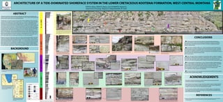
  • 1. ARCHITECTURE OF A TIDE-DOMINATED SHOREFACE SYSTEM IN THE LOWER CRETACEOUS KOOTENAI FORMATION, WEST-CENTRAL MONTANA STATZA, Mary, TAKACH, Marie, and SCHWARTZ, Robert K., Department of Geology, Allegheny College,Meadville, PA 16335 ABSTRACT Integrated long-distance, high-resolution photography and detailed outcrop analysis were used to document the architecture of a tide-dominated, low wave-energy, shoreface lithosome along the Missouri River Gorge near Great Falls, Montana. The lithosome (~18 m thick) consists of five vertically stacked, widespread, tabular units and scattered channel bodies. Internally, the tabular units (~2-4 m thick) coarsen upwards and the architecture of a representative unit includes a thin basal mudstone or heterolithic interval changing upward to a thicker bedded, amalgamated, fine- to rarely medium-grained sand- stone. However, the full vertical succession of five units are stacked in a net upward-coarsening succession in which the basal unit is mudstone dominated and successive units contain less mud. Sand fractions are quartzose, very well rounded, and very well sorted. Rhythmic bedding is characteristic and ranges from horizontal to convex on the tidal bar scale (dm wavelength). Scattered medium-scale trough cross-stratification and thin channel-shaped lenses (~1-15 m wide) indicate episodic current activity. Widespread erosional surfaces separate the units, as well as occur internally, causing localized discordances between units or the amalgamation of sandstone-dominated units. The channel bodies are relatively large (50-100's m wide, 5-10 m thick), contain heterolithic fill similar in composition to the tabular units, and transect one or more of the tabular units, documenting the coexistence of cross-shore channels. Diagnostic structures of tidal origin include mud couplets, neap-spring lamination sets, flaser- to-lenticular bedding, amalgamated ripple beds separated by reactivation surfaces, rhythmi- cally alternating ripple beds and parallel-laminations, mm-scale clay drapes, and lateral sets of small-scale ripple bundles. Small-scale wave-ripples (~ 4 cm spacing) are present on some sur- faces and hummocky cross-stratification is exceptionally rare. Trace fossils include Arenicolites, Ophiomorpha (very rare), Macaronichnus, Planolites, Piscichnus, horseshoe crab-like resting traces, and bivalve crawling traces indicating marine to slightly brackish conditions. Bioturba- tion index typically ranges between 3 and 6. A Glossifungites ichnofacies caps the succession. BACKGROUND 0 .5 1 1.5 2 2.5 3 3.5 4 4.5 5 md st vfg fg mg cg vcg MASSIVE SANDSTONE BEDDED SANDSTONE CROSS-BEDDED SANDSTONE RIPPLE-BEDDED SANDSTONE MAROON MUDSTONE GRAY MUDSTONE BIPOLAR FORESETS TROUGH CROSS-BEDDING FLASER BEDDING LEGEND (1) (2-3) (4-5) (6) LOW BIOTURBATION SOME BIOTURBATION MODERATE BIOTURBATION HIGH BIOTURBATION (4-5) (1) (2-3) 5.5 6 6.5 7 7.5 8 8.5 9 9.5 10 10.5 11 11.5 12 12.5 13 13.5 14 14.5 15 15.5 16 16.5 17 17.5 18 (2-3) (1) (2-3) (4-5) (6) (2-3) (6) ACKNOWLEDGEMENTS This project would not have been possible without financial assistance from the Christine Scott Nelson Faculty Support Fund. Special thanks must be given to Susan Vuke for her selfless support, endless supply of encouragements and camping supplies (especially bear-spray), and for sheltering us Cowgirls and (old) Indians from the volatile Montana weather. An even special-er thanks to Bob Schwartz for his infinite support, encouragement, and supply of stories and falsehoods that kept us infinitely entertained/disgruntled. Sugar and FooFoo love ya, Old Man. CONCLUSIONS REFERENCES U N I T 1 U N I T 2 U N I T 3 U N I T 4 U N I T 5 Thickness(m) Three weeks of field research included outcrop analysis and Gigapan photo technology. The study area is located in western Montana, northeast of the city of Great Falls. The outcrop is exposed along the eastern bank of the Missouri River flowing north out of Morony Dam. Figure illustrating theorized southern extent of Cretaceous Barremian transgression into Montana. Arrows indicate tidal currents. Morony Dam outcrop represented by red circle. (Schwartz, 2007) Correlative stratigraphic column showing location of Sunburst Formation, primary constituent of tidal-shoreface outcrop along Missouri River. (Schwartz, 2007) Overview of basal, upward-coarsening unit 1 (~2.2m). Tabular, mud-dominant beds transition upward into sand-dominant, wavy bedding. Mudstone grades from maroon in color, due to reworking of underlying Kk2, to gray in upper part of the unit. An erosional scour surface separates unit 1 from overlying unit 2. 1.5m staff for scale. Beds transition from tabular to increasingly wavy-bedding up-unit. Scale is 15cm. Close up of maroon tidal bundles. Mudstone layers deposited during periods of reduced tidal current energy, while fine-grained sandstone beds deposited during periods of higher energy. Scale is 5cm. 3 cm Close up of sandstone beds displaying small-scale foresets, demonstrating kinematics of tidal current event (see arrow) Upper flow regime parallel laminations are followed by lower flow regime ripple bedding and muddy sand suspension fall out. Scale is 3cm. Overview of sandstone dominant unit 2 (~3.3m), consisting of several erosionally-based beds of ripple- to-crossbedded sandstone, capped by a muddy layer. Overall upward coarsening. 1.5m staff for scale. U N I T 1 U N I T 2 Mud-filled scour surface between units 1 and 2. Overall, bed set contacts within unit 2 are sharp, and are either amalgamated or separated by thin mudstone. A B A) Stacked small-scale ripple-bedding with bidirectional foresets, indicating reversing tidal currents. Relict bedding due to moderate bioturbation. Scale is 15cm. B) Close up of bedding with opposite foreset directions. A B C D Flaser bedding. Small-scale troughs are mantled by mm-scale mud-drapes. Scale is 15cm. Mottled sandstone fabric due to bioturbation. A) Biogenically deformed ripple-bedding. B) Relict stacked-ripple bedding. C) Relict small-scale troughs. D) Heavily ripple-bedded sandstone due to bioturbation. Horizontal and vertical trace fossils on sole of sandstone bed. UNIT 2 UNIT 3 2m Overview of sandstone dominant unit 3 (~3.5m), coarsening upward from interbedded mud and sandstone, into fine grained, amalgamated,wavy bedded sandstone beds. Well-defined, medium-scale foresets documenting reversing tidal currents. Scale is 15cm. A B A) Burrowed, ripple-bedded, fine-grained sandstone beds. B) Enlarged view of sandstone beds, showing small-scale foresets. A B C 15 cm UNIT 2 Schwartz, R. K., Vuke, S. M., 2007, Tide-Dominated Facies Complex at Southern Terminus of Sunburst Sea, Cretaceous Kootenai Formation, Great Falls, Montana: http://www.searchanddiscovery.com/documents/2007/07036schwartz (accessed July 2014). Overview of upward-coarsening unit 5 (~4.5m), composed of basal maroon mudstone containing fine-grained lenses of sandstone, transitioning up- unit into amalgamated sandstone. Some relict ripple-bedding, but sandstone beds are typically massive due to bioturbation. The unit is capped by highly- deformed, oxidized sandstone, most likely containing Glossifungites ichnofacies, indicating a firm ground setting. Black triangle indicates textural trend. 1.5m staff for scale. Overview of unit 4 (~4.3m). Unit coarsens upward from a base of alternating very-fine-grained sandstone and mudstone, into thicker, bioturbated sandstone beds. The unit contains a capping reddish-brown, oxidized bed of highly bioturbated sandstone, most likely containing a Glossifungites ichnofacies assemblage, indicating a firm ground setting. 10 cm 10 cm Interbedded sandstone and mudstone at base of unit 4. Scale is 20 cm. Localized, isolated lense of organic-rich mudstone, preserved by rapid deposition and deformed by compaction and/or dewatering. A A B B A) Massive sandstone beds. Scale is 15cm. B) Close up of sandstone bed showing biogenically caused absence of sedimentary structures. A) Tan, fine-grained sandstone with bioturbated, relict, subhorizontal laminations. Scale is 5cm. B) Close up of bioturbated laminations in A. 5 cm B A A) Possible load casts on underside of heavily bioturbated, oxidized, reddish sandstone bed. Scale is 50cm. B) Close up of load casts 50 cm sandstone mudstone A B C D A) Float block from highly oxidized, brown capping layer, showing heavy bioturbation and burrowing. B) Float block from red, oxidized sandstone bed. Moderate bioturbation and burrows. C) Float block. Bioturbation and burrowing. D) Float block. Bioturbation and burrowing. Fine to medium grained, oxidized, brown capping sandstone bed. Bed most likely contains Glossifungites ichnofacies, indicating firm ground settings during and after depositon. A) Large, ripple-bedded sandstone beds with amalgamated surfaces. Human scale is 1.57m. B) Side view of block in A, showing geometry of erosional surfaces. 1.5m staff for scale. C) Massive, highly bioturbated capping bed of unit 3. Location shown by yellow arrow in B. Wavy bedding, indicative of fluctuating tidal energy levels. Scale is 15cm. A B A) Flaser bedding. Small-scale troughs are mantled by mm-scale mud-drapes. Scale is 15cm. B) Close up of flaser bedding. 15 cm Paired- burrows. Arenicolites. Small, unlined, rarely branched Planolites. The five upward coarsening units represent shoreface tidal parasequences. The typical vertical succession of a shoreface parasequence consists of a mudstone dominant base, coarsening upwards into thicker, sometimes amalgamated ripple- bedded sandstone beds. The maroon mudstone within unit 1 is due to ravinement and reworking of the underlying maroon estuarine mudstone facies of Kk2 (Kootenai Formation). Similarly, reworking of the adjacent coastal plain mud, such as occurs in the overlying Kk4 unit (red mudstone coastal plain facies) could have contributed to the abundance of maroon mudstone within the capping Sunburst unit at Morony Dam (unit 5). Units 1 through 3 show an upwards net coarsening, where mudstone is replaced by sandstone as the dominant constituent. Following this net coarsening is a net fining trend from units 3 through 5, where mudstone becomes more prevalent with each successive unit, before overlapping of the mudstone-dominant Kk4 coastal plain system. The large quantity of tidal features, such as rhythmic bedding, tidal laminations, flaser-to-wavy bedding, amalgamated ripple-beds with erosional surfaces, and degree of bioturbation indicate the depositional environment was tidal dominated. An absence of features associated with wave-dominated shorefaces, such as wave-ripple cross-lamination, hummocky cross-stratificationand surf-zone related trough cross-stratification further supports this hypothesis. The limited diversity of the abundant trace fossils found within the units indicates a shallow water, brackish-marine setting. 5 cm Stratigraphic column detailing grain size, thickness (m), and sedimentary structures of five units studied at Morony Dam. U N I T 1 Close up of rhythmic mud-sand couplets, indicative of alternating suspension fallout-tractive flow conditions. U N I T 2 scour surface scour surface scour surface scour surface U N I T 3 U N I T 4 U N I T 5 Gigapan image of tidal shoreface succession in the Sunburst Member near Morony Dam.