Recommended
Recommended
NO1 Pakistan Amil Baba In Bahawalpur, Sargodha, Sialkot, Sheikhupura, Rahim Yar Khan, Jhang, Dera Ghazi Khan, Gujrat, Sahiwal, Okara, Hafizabad, Mandi Bahauddin, Jhelum, Jaranwala, Wazirabad, Taxila
NO1 Pakistan Amil Baba In Bahawalpur, Sargodha, Sialkot, Sheikhupura, Rahim Y...
NO1 Pakistan Amil Baba In Bahawalpur, Sargodha, Sialkot, Sheikhupura, Rahim Y...Amil Baba Dawood bangali
Exquisite Culinary Journey: Chaîne des Rôtisseurs Cambodia Chapitre Dinner Menu 2024
Dive into the luxurious dining experience of the Chaîne des Rôtisseurs Bailliage Cambodia Chapitre Dinner, held on May 25th, 2024, at the prestigious Topaz Restaurant. This meticulously crafted menu showcases a symphony of flavors, blending local ingredients with global gourmet standards. From the delicate warmth of Gillardeau oysters to the rich, buttery textures of Tajima Wagyu, each course is paired perfectly with a selection of fine wines. Explore the full menu that promises a sensory journey through the finest culinary traditions and innovations. Perfect for gastronomy enthusiasts and members of the Chaîne des Rôtisseurs who appreciate the art of fine dining. Join us in celebrating a night of elegance, exceptional cuisine, and unforgettable memories.Chaine des Rotisseurs Gala Dinner Menu May 25 2024 Cambodia
Chaine des Rotisseurs Gala Dinner Menu May 25 2024 CambodiaChaîne des Rôtisseurs Bailliage National du Vietnam
More Related Content
Recently uploaded
NO1 Pakistan Amil Baba In Bahawalpur, Sargodha, Sialkot, Sheikhupura, Rahim Yar Khan, Jhang, Dera Ghazi Khan, Gujrat, Sahiwal, Okara, Hafizabad, Mandi Bahauddin, Jhelum, Jaranwala, Wazirabad, Taxila
NO1 Pakistan Amil Baba In Bahawalpur, Sargodha, Sialkot, Sheikhupura, Rahim Y...
NO1 Pakistan Amil Baba In Bahawalpur, Sargodha, Sialkot, Sheikhupura, Rahim Y...Amil Baba Dawood bangali
Exquisite Culinary Journey: Chaîne des Rôtisseurs Cambodia Chapitre Dinner Menu 2024
Dive into the luxurious dining experience of the Chaîne des Rôtisseurs Bailliage Cambodia Chapitre Dinner, held on May 25th, 2024, at the prestigious Topaz Restaurant. This meticulously crafted menu showcases a symphony of flavors, blending local ingredients with global gourmet standards. From the delicate warmth of Gillardeau oysters to the rich, buttery textures of Tajima Wagyu, each course is paired perfectly with a selection of fine wines. Explore the full menu that promises a sensory journey through the finest culinary traditions and innovations. Perfect for gastronomy enthusiasts and members of the Chaîne des Rôtisseurs who appreciate the art of fine dining. Join us in celebrating a night of elegance, exceptional cuisine, and unforgettable memories.Chaine des Rotisseurs Gala Dinner Menu May 25 2024 Cambodia
Chaine des Rotisseurs Gala Dinner Menu May 25 2024 CambodiaChaîne des Rôtisseurs Bailliage National du Vietnam
Recently uploaded (12)
NO1 Pakistan Amil Baba In Bahawalpur, Sargodha, Sialkot, Sheikhupura, Rahim Y...
NO1 Pakistan Amil Baba In Bahawalpur, Sargodha, Sialkot, Sheikhupura, Rahim Y...
Chaine des Rotisseurs Gala Dinner Menu May 25 2024 Cambodia
Chaine des Rotisseurs Gala Dinner Menu May 25 2024 Cambodia
NO1 Top Black Magic Expert Specialist In UK Black Magic Expert Specialist In ...
NO1 Top Black Magic Expert Specialist In UK Black Magic Expert Specialist In ...
Medical Foods final.ppt (Regulatory Aspects of Food & Nutraceiticals)
Medical Foods final.ppt (Regulatory Aspects of Food & Nutraceiticals)
100^%)( FORDSBURG))(*((+27838792658))*))௹ )Abortion Pills for Sale in Benoni,...
100^%)( FORDSBURG))(*((+27838792658))*))௹ )Abortion Pills for Sale in Benoni,...
Featured
More than Just Lines on a Map: Best Practices for U.S Bike Routes
This session highlights best practices and lessons learned for U.S. Bike Route System designation, as well as how and why these routes should be integrated into bicycle planning at the local and regional level.
Presenters:
Presenter: Kevin Luecke Toole Design Group
Co-Presenter: Virginia Sullivan Adventure Cycling AssociationMore than Just Lines on a Map: Best Practices for U.S Bike Routes
More than Just Lines on a Map: Best Practices for U.S Bike RoutesProject for Public Spaces & National Center for Biking and Walking
Featured (20)
Content Methodology: A Best Practices Report (Webinar)
Content Methodology: A Best Practices Report (Webinar)
How to Prepare For a Successful Job Search for 2024
How to Prepare For a Successful Job Search for 2024
Social Media Marketing Trends 2024 // The Global Indie Insights
Social Media Marketing Trends 2024 // The Global Indie Insights
Trends In Paid Search: Navigating The Digital Landscape In 2024
Trends In Paid Search: Navigating The Digital Landscape In 2024
5 Public speaking tips from TED - Visualized summary
5 Public speaking tips from TED - Visualized summary
Google's Just Not That Into You: Understanding Core Updates & Search Intent
Google's Just Not That Into You: Understanding Core Updates & Search Intent
The six step guide to practical project management
The six step guide to practical project management
Beginners Guide to TikTok for Search - Rachel Pearson - We are Tilt __ Bright...
Beginners Guide to TikTok for Search - Rachel Pearson - We are Tilt __ Bright...
Unlocking the Power of ChatGPT and AI in Testing - A Real-World Look, present...
Unlocking the Power of ChatGPT and AI in Testing - A Real-World Look, present...
More than Just Lines on a Map: Best Practices for U.S Bike Routes
More than Just Lines on a Map: Best Practices for U.S Bike Routes
Ride the Storm: Navigating Through Unstable Periods / Katerina Rudko (Belka G...
Ride the Storm: Navigating Through Unstable Periods / Katerina Rudko (Belka G...
Good Stuff Happens in 1:1 Meetings: Why you need them and how to do them well
Good Stuff Happens in 1:1 Meetings: Why you need them and how to do them well
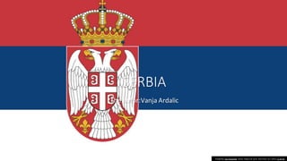
serbia
- 1. SERBIA The autor:Vanja Ardalic Fotografija Ova fotografija autora Nepoznat autor licencirana je u okviru CC BY-SA.
- 2. Capital Belgrad • Belgrade (/bɛlˈɡreɪd/ bel-GRAYD, /ˈbɛlɡreɪd/ BEL- grayd;[note 1] Serbian:Београд/ Beograd,lit. 'White City', pronounced [beǒɡrad](listen);names in other languages)is the capital and largest city of Serbia. It is located at the confluence of the Sava and Danube rivers and at the crossroads of the PannonianPlain and the Balkan Peninsula.[10] The populationofthe Belgrade metropolitanarea is 1,685,563, accordingto the 2022 census.[4] It is the third most populated ofall cities on the Danube river.
- 3. The lergest bulding in Serbia Fotografija Ova fotografija autora Nepoznat autor licencirana je u okviru CC BY-NC-ND.
- 4. vojvodina • Vojvodina(Serbian Cyrillic: Војводина), officially the Autonomous Province of Vojvodina, is an autonomous province that occupies the northernmost part of Serbia. It lies within the Pannonian Basin, bordered to the south by the national capital Belgrade and the Sava and Danube Rivers. The administrative center, Novi Sad, is the second-largest city in Serbia Fotografija Ova fotografija autora Nepoznat autor licencirana je u okviru CC BY-SA.
- 5. Novi Sad • Novi Sad (Serbian Cyrillic: Нови Сад, pronounced [nôʋiː sâːd] (listen); Hungarian: Újvidék, pron ounced [ˈuːjvideːk]; see below for other names) is the second largest city in Serbia and the capital of the autonomous province of Vojvodina. Novi Sad is home for 367,121 inhabitants.It is located in the southern portion of the Pannonian Plain on the border of the Bačka and Syrmia geographical regions. Lying on the banks of the Danube river, the city faces the northern slopes of Fruška Gora. Fotografija Ova fotografija autora Nepoznat autor licencirana je u okviru CC BY-SA.
- 6. The highest mountain • Kopaonik (Serbian Cyrillic: Копаоник, pronounced [k ɔpaɔ̌niːk]; Albanian: Kopaoniku)is a mountain range located in Serbia. The highest point is the Pančić's Peak with 2,017 m (6,617 ft). The central part of the Kopaonik plateau was declared a national park in 1981 which today covers an area of 121.06 km2 (46.74 sq mi). Fotografija Ova fotografija autora Nepoznat autor licencirana je u okviru CC BY-NC-ND. Fotografija Ova fotografija autora Nepoznat autor licencirana je u okviru CC BY-NC-ND.
- 7. PANCEVO • Pančevo (Serbian Cyrillic: Панчево, pronounced [pâːntʃeʋo]; Ge rman: Pantschowa;Hungarian:Pancso va; Romanian: Panciova;Slovak: Pánče vo) is a city and the administrative center of the South BanatDistrict in the autonomous province of Vojvodina, Serbia. It is located on the shores of rivers Tamiš and Danube, in the southern part of Banatregion. Since the 2011census 123,414people have been living in the Pančevo administrative area. Pančevo is the fourth largest city in Vojvodina and the ninth largest in Serbia by population.[7] Fotografija Ova fotografija autora Nepoznat autor licencirana je u okviru CC BY-SA.
- 8. ZLATIBOR • Zlatibor (Serbian Cyrillic: Златибoр pronounced [zlǎtibɔːr]) is a mountainous region situated in the western part of Serbia. • Among the most popular places in Serbia for tourism, Zlatibor's main attractionsinclude health tourism, skiing, and hiking[1] and the longest panoramic gondola lift in the world.[2][3] Tornik ski resort is located in the area. Fotografija Ova fotografija autora Nepoznat autor licencirana je u okviru CC BY-SA.
- 9. NIS • Niš (/ˈniːʃ/; Serbian Cyrillic:Ниш, Serbian pronunciation:[nîːʃ] (listen); names in other languages) is the third largest city in Serbia and the administrativecenter of the NišavaDistrict. It is located in southern part of Serbia. According to the 2011 census, the city proper has a population of 183,164, while its administrativearea (City of Niš) has a populationof 260,237 inhabitants.[3 Fotografija Ova fotografija autora Nepoznat autor licencirana je u okviru CC BY-SA.