The document discusses what causes the seasons on Earth. It explains that Earth's axial tilt of 23.5 degrees, combined with its orbit around the sun, results in the hemispheres receiving different amounts of sunlight over the course of a year. This causes the seasons to change as the northern and southern hemispheres alternately tilt towards and away from the sun.
The Rosetta mission orbited and landed modules on the comet 67P/Churyumov–Gerasimenko. It launched in 2004 and performed flybys of Earth, Mars and asteroids before entering hibernation and waking to approach the comet in 2014. In November 2014, the Philae lander separated from Rosetta and landed on the comet, where it conducted science measurements for 3 days before losing power. Rosetta continued orbiting and observing the comet.
IRJET- Automatic Water, Land and Vegetation Boundary Detection using Machine ...IRJET Journal
This document summarizes research on using machine learning to automatically detect water, land, and vegetation boundaries in satellite images. Researchers collected raw satellite imagery data and used sorting, clustering, and ant colony optimization algorithms in MATLAB to analyze the images. They were able to successfully distinguish boundaries between different geological features, like land, sea, and greenery, in test images and real satellite data of an area in Odisha, India. The results identified boundaries with 95.5% accuracy and allowed analysis of patterns like precipitation and groundwater intrusion. The technique can potentially help with applications like disaster management and monitoring deforestation.
1. The document describes the masses, diameters, and gravitational forces of the planets in our solar system, listing them from Jupiter down to Pluto.
2. It then provides a diagram showing the relationship between the sun and the planets, with the sun's gravitational force equal to the sum of the gravitational forces of the planets.
3. The diagram also depicts the planets as waveforms in a "wave train" representing the planetary system, with the sun at one end and Pluto at the other.
The Voyager flights to Jupiter and Saturn were NASA missions launched in 1977 that took advantage of a rare planetary alignment to visit multiple outer planets using gravitational assists. Voyager 1 and 2 were each complex, long-lived spacecraft carrying instruments to study the planets, rings, moons, and environments. Voyager 1's encounter with Jupiter in 1979 revealed active volcanoes on Io and details of Jupiter's atmosphere, while both probes provided the first close images of Jupiter's moons."
Nobres amigos (as)!
Novamente tenho a alegria de informar-lhes que já se encontra disponível para download na Home Page do Centro de Estudos Astronômicos de Minas Gerais - CEAMIG, o "Almanaque Astronômico - 2013".
O endereço é:
http://www.ceamig.org.br/5_divu/alma2013.pdf
Aproveito a oportunidade para agradecer as manifestações recebidas pelas edições anteriormente publicadas, bem como agradecer as diversas sugestões recebidas. É importante informar que algumas já foram inseridas, outras (ainda) encontra-se em fase de estudos para implantação.
Funcionando sempre como um valioso canal de divulgação dessas efemérides e informações, as notas mensalmente postadas no blog Sky and Observers (http://skyandobservers.blogspot.com/), vem atuando como um elo valioso para consultas e complementação dos elementos deste Almanaque Astronômico que agora está disponível. Assim nele as freqüentes consultas para os fenômenos visíveis além das fronteiras do Brasil, já começam a ganhar o contorno americano e ruma para uma contemplação maior dos que também tenham visibilidade nos demais continentes, muito embora não sejam todos os fenômenos abordados, mas que não deixarão de ser mencionados de alguma forma.
Earth observation satellites monitor Earth from orbit and are used for environmental monitoring, meteorology, and terrain mapping. The ASTER satellite collects visible, near infrared, and thermal infrared imagery at 15-90m resolution for monitoring clouds, glaciers, land, temperature, sea ice, and snow cover. Landsat-8 collects operational land imagery and thermal data at 30-90m resolution for uses including oceanography, vegetation, and biomass mapping. SPOT-5 collects high resolution geometric data at 5-20m for environmental assessment, agriculture, and marine studies.
The document discusses factors that influence the distribution of life on Earth. Climate patterns are determined by variables like sunlight, atmosphere, oceans currents, elevation, and continent positions. These factors create different biomes across the planet based on temperature and rainfall levels. Biomes include tropical rainforests, savannas, deserts, grasslands, temperate forests, tundras, and aquatic ecosystems in rivers, lakes, oceans, and hydrothermal vents. The distribution of species is limited by the availability of water, nutrients, temperatures, and other conditions within each biome.
The Mars Exploration Rovers Spirit and Opportunity were sent to Mars in 2004 to determine if life ever existed there, describe the Martian climate and geology, and prepare for future human exploration. Spirit landed in Gusev Crater and Opportunity landed in Meridiani Planum, sites thought to have once held water. Both rovers far exceeded their planned 90-day missions, with Spirit operating for over 1,000 days and Opportunity still active after over 1,000 days. The rovers used instruments such as cameras and spectrometers to analyze rocks and soil, finding evidence that water once shaped the landscape. Although the missions faced challenges like dust storms, the exploration of Mars continues to this day and has provided insights into the planet
The tilt of the Earth's axis of rotation relative to its orbit around the Sun causes the seasons, as different hemispheres receive more or less direct sunlight and daylight throughout the year. Warmer seasons occur when a hemisphere is tilted toward the Sun and cooler seasons when it is tilted away. The Earth's elliptical orbit also means it is closest to the Sun in January and farthest in July, but this small variation does not significantly impact seasonal changes.
The document discusses the causes of Earth's seasons. It notes that Earth's axis is tilted 23.5 degrees and always points to the North Star as Earth orbits the Sun. This tilt causes the hemispheres to receive different amounts of sunlight throughout the year. During summer in the Northern Hemisphere, there are more daylight hours and the sun's rays strike Earth more directly, while winter brings less sunlight and the sun remains lower in the sky. The document explores how Earth's distance from the Sun and its axial tilt interact to produce seasonal changes, and examines the factors that influence seasons on other planets like Mars as well.
Transit of Venus Teacher Training Secondary School Session - History and ScienceSze-leung Cheung
The document provides details about a teacher training workshop on observing the transit of Venus. It includes the schedule, topics to be covered in lectures and demonstrations, and objectives of the workshop. The workshop aims to help teachers understand the importance of the transit, learn how to observe it safely and hold related activities, and discuss support options. It will cover the science and history of transits, observation techniques, and making observation equipment.
The document discusses celestial coordinates and navigation using stars. It describes the celestial equator, celestial poles, ecliptic plane, right ascension and declination coordinates. It explains how measuring the altitude of celestial objects like the pole star can be used to determine latitude on Earth and navigate.
1) The Earth's axis is tilted 23.5 degrees, which causes the hemispheres to receive different amounts of sunlight throughout the year, leading to seasons.
2) In summer, the hemisphere tilted toward the Sun receives more direct sunlight and experiences warmer temperatures, while the opposite hemisphere experiences winter.
3) Common misconceptions are that the Earth is closer to the Sun in summer and farther in winter, but the Earth's orbit is nearly circular and the distance variation is small compared to the tilt's effect.
1) The Earth's axis is tilted 23.5 degrees, which causes the hemispheres to receive different amounts of sunlight throughout the year, leading to seasons.
2) In summer, the hemisphere tilted toward the Sun receives more direct sunlight and experiences warmer temperatures, while the opposite hemisphere experiences winter.
3) Common misconceptions are that the Earth's distance from the Sun or elliptical orbit cause seasons, but the Earth is actually closest to the Sun in January and farthest in July with little effect on seasons.
Our solar system consists of the Sun and everything that orbits around it, including 8 planets. The inner planets are Mercury, Venus, Earth, and Mars. They are smaller and closer to the Sun. The outer planets are Jupiter, Saturn, Uranus, and Neptune. They are larger, gaseous planets farther from the Sun. Pluto, though no longer classified as a planet, is also part of our solar system.
- A day on Earth was much shorter in the past due to the Moon being closer and Earth's rotation being faster. Evidence suggests a day was around 6 hours long 700 million years ago.
- The Moon was formed by a giant impact between the early Earth and a Mars-sized body. It originally orbited much closer to Earth.
- The Moon is gradually moving away from Earth over time as angular momentum is transferred between their rotation and orbit via tidal interactions.
The document provides information about astrophysics and the universe. It discusses the solar system including the sun and planets. It then discusses galaxies including spiral, elliptical, and irregular galaxies. It also covers constellations, nebulae such as the Eagle Nebula and Crab Nebula, and supernovas.
This document provides an overview of concepts related to the shape and structure of planet Earth. It discusses key ideas like:
1) Uniformitarianism, the theory that present geological processes can explain the past.
2) Eratosthenes calculated the circumference of Earth in 247 BC using geometry, arriving at a fairly accurate measurement.
3) Earth is not a perfect sphere but rather an oblate ellipsoid due to centrifugal forces from its rotation and revolution around the sun.
4) Navigation relies on understanding latitude, longitude, time zones, and great circles, which provide the shortest path between two points on a globe. Determining longitude precisely was historically very challenging without accurate timekeeping devices.
1) The document describes a classroom activity where students track sunspots over a period of days using real images from NASA to determine the sun's rotation rate.
2) By observing and recording the movement in longitude of three marked sunspot groups (A, B, C) each day, students calculate the average daily movement of the spots.
3) Factoring in the earth's orbital motion around the sun, students conclude that it takes the sun approximately 27 days to complete a full rotation on its axis in the middle.
IB Astrophysics - intro to the universe - Flippingphysics by nothingnerdyNothingnerdy
This document provides an introduction to the universe through 3 sentences: It begins with an overview of the contents of the universe from asteroids and comets to galaxies and galaxy clusters. Next, it describes our solar system and includes data on planets, their orbits, and surface temperatures. Finally, it discusses astronomical units of distance such as light years and compares the relative distances of objects in our solar system and galaxies.
This document provides materials for a lesson on how latitude affects the seasonal path of the sun. It includes an overview, objectives, preparation needed, and a procedure for an activity using hemisphere models. Students will study the sun's path above the Arctic Circle and compare it to locations at 42°N and the equator. They will explain how latitude impacts the duration of sunlight throughout the year. The activity aims to help students understand concepts like celestial motions, seasons, and how the sun's path varies with latitude.
Scale Properties in the Solar System Presentation.pptxkuldeep Birwal
The solar system is a vast and complex entity, with each celestial body adhering to its unique scale properties. Understanding these properties provides profound insights into the workings of our cosmic neighborhood. The scale of the solar system is not merely a matter of distance; it encompasses a variety of factors, including size, mass, and the relative spacing between planets and other objects.
#SolarSystem
#SpaceExploration
#Astronomy
#ScaleOfTheSolarSystem
#PlanetaryScience
#Astrophysics
#Space
#Cosmology
#InterplanetaryDistances
#AstronomicalUnits
#PlanetSizes
#OrbitalDynamics
#GravitationalForce
#SpaceResearch
#AsteroidsAndComets
#KuiperBelt
#OortCloud
#TerrestrialPlanets
#GasGiants
#NaturalSatellites
The document summarizes Astronomers Without Borders' (AWB) involvement in the 2012 European Week of Astronomy and Space Science and Global Astronomy Month (GAM). AWB promotes sharing astronomy resources internationally to foster understanding. In 2012, GAM included over 30 global programs in 90 countries, receiving over 2.8 million website visits and 150,000 social media views. Programs included observing, art, music, poetry and remote observing events across Europe.
The document discusses the sun and its daily movement across the sky due to the Earth's rotation. It provides background information on the sun and activities for students to observe and track the sun's changing position using a model. Students are asked to mark the shadow of a sun stick at different times of day to demonstrate how the sun appears to move although its position remains unchanged.
The document discusses the sun and its daily movement across the sky due to the Earth's rotation. It provides background information on the sun and activities for students to observe and track the sun's changing position using a model. Students are asked to mark the shadow of a sun stick at different times of day to demonstrate how the sun appears to move although its position does not actually change.
Comet Neowise is a photographer's dream: How to capture it before it fizzlesRam Chary Everi
This article provides tips for photographing Comet Neowise before it fizzles out, including choosing a location away from light pollution, using appropriate equipment like a telephoto lens and tripod, experimenting with exposure settings and composition, and processing images to enhance the comet's appearance. Key details are to look for the comet in the northwestern sky after sunset, use a 4-second exposure, and zoom in to isolate the comet against the landscape. Images should be shared online to allow others to enjoy the comet.
The document discusses the history of models of the solar system. For thousands of years, the geocentric model placed Earth at the center. Ptolemy created an influential geocentric model in the 2nd century AD. In 1543, Copernicus published a heliocentric model placing the Sun at the center, though he was afraid to publish it while alive due to religious opposition. Galileo's observations of Jupiter's moons in 1609 provided further evidence supporting the heliocentric model.
Measure Earth's Circumference with a ShadowPaulaJLomasney
Eratosthenes calculated the circumference of Earth over 2000 years ago using simple geometry and measurements. He observed that on the summer solstice, the sun was directly overhead at Syene but cast a shadow at Alexandria. Using the angle of the shadow and distance between the cities, he derived an equation to calculate the circumference. This document explains how to replicate Eratosthenes' experiment near an equinox by measuring the angle of a meter stick's shadow and determining Earth's circumference from those values and your distance from the equator. With accurate measurements, the result should be close to Earth's actual circumference of around 40,000 kilometers.
In the rapidly evolving landscape of technologies, XML continues to play a vital role in structuring, storing, and transporting data across diverse systems. The recent advancements in artificial intelligence (AI) present new methodologies for enhancing XML development workflows, introducing efficiency, automation, and intelligent capabilities. This presentation will outline the scope and perspective of utilizing AI in XML development. The potential benefits and the possible pitfalls will be highlighted, providing a balanced view of the subject.
We will explore the capabilities of AI in understanding XML markup languages and autonomously creating structured XML content. Additionally, we will examine the capacity of AI to enrich plain text with appropriate XML markup. Practical examples and methodological guidelines will be provided to elucidate how AI can be effectively prompted to interpret and generate accurate XML markup.
Further emphasis will be placed on the role of AI in developing XSLT, or schemas such as XSD and Schematron. We will address the techniques and strategies adopted to create prompts for generating code, explaining code, or refactoring the code, and the results achieved.
The discussion will extend to how AI can be used to transform XML content. In particular, the focus will be on the use of AI XPath extension functions in XSLT, Schematron, Schematron Quick Fixes, or for XML content refactoring.
The presentation aims to deliver a comprehensive overview of AI usage in XML development, providing attendees with the necessary knowledge to make informed decisions. Whether you’re at the early stages of adopting AI or considering integrating it in advanced XML development, this presentation will cover all levels of expertise.
By highlighting the potential advantages and challenges of integrating AI with XML development tools and languages, the presentation seeks to inspire thoughtful conversation around the future of XML development. We’ll not only delve into the technical aspects of AI-powered XML development but also discuss practical implications and possible future directions.
How to Get CNIC Information System with Paksim Ga.pptxdanishmna97
Pakdata Cf is a groundbreaking system designed to streamline and facilitate access to CNIC information. This innovative platform leverages advanced technology to provide users with efficient and secure access to their CNIC details.
For the full video of this presentation, please visit: https://www.edge-ai-vision.com/2024/06/building-and-scaling-ai-applications-with-the-nx-ai-manager-a-presentation-from-network-optix/
Robin van Emden, Senior Director of Data Science at Network Optix, presents the “Building and Scaling AI Applications with the Nx AI Manager,” tutorial at the May 2024 Embedded Vision Summit.
In this presentation, van Emden covers the basics of scaling edge AI solutions using the Nx tool kit. He emphasizes the process of developing AI models and deploying them globally. He also showcases the conversion of AI models and the creation of effective edge AI pipelines, with a focus on pre-processing, model conversion, selecting the appropriate inference engine for the target hardware and post-processing.
van Emden shows how Nx can simplify the developer’s life and facilitate a rapid transition from concept to production-ready applications.He provides valuable insights into developing scalable and efficient edge AI solutions, with a strong focus on practical implementation.
Observability Concepts EVERY Developer Should Know -- DeveloperWeek Europe.pdfPaige Cruz
Monitoring and observability aren’t traditionally found in software curriculums and many of us cobble this knowledge together from whatever vendor or ecosystem we were first introduced to and whatever is a part of your current company’s observability stack.
While the dev and ops silo continues to crumble….many organizations still relegate monitoring & observability as the purview of ops, infra and SRE teams. This is a mistake - achieving a highly observable system requires collaboration up and down the stack.
I, a former op, would like to extend an invitation to all application developers to join the observability party will share these foundational concepts to build on:
HCL Notes and Domino License Cost Reduction in the World of DLAUpanagenda
Webinar Recording: https://www.panagenda.com/webinars/hcl-notes-and-domino-license-cost-reduction-in-the-world-of-dlau/
The introduction of DLAU and the CCB & CCX licensing model caused quite a stir in the HCL community. As a Notes and Domino customer, you may have faced challenges with unexpected user counts and license costs. You probably have questions on how this new licensing approach works and how to benefit from it. Most importantly, you likely have budget constraints and want to save money where possible. Don’t worry, we can help with all of this!
We’ll show you how to fix common misconfigurations that cause higher-than-expected user counts, and how to identify accounts which you can deactivate to save money. There are also frequent patterns that can cause unnecessary cost, like using a person document instead of a mail-in for shared mailboxes. We’ll provide examples and solutions for those as well. And naturally we’ll explain the new licensing model.
Join HCL Ambassador Marc Thomas in this webinar with a special guest appearance from Franz Walder. It will give you the tools and know-how to stay on top of what is going on with Domino licensing. You will be able lower your cost through an optimized configuration and keep it low going forward.
These topics will be covered
- Reducing license cost by finding and fixing misconfigurations and superfluous accounts
- How do CCB and CCX licenses really work?
- Understanding the DLAU tool and how to best utilize it
- Tips for common problem areas, like team mailboxes, functional/test users, etc
- Practical examples and best practices to implement right away
Maruthi Prithivirajan, Head of ASEAN & IN Solution Architecture, Neo4j
Get an inside look at the latest Neo4j innovations that enable relationship-driven intelligence at scale. Learn more about the newest cloud integrations and product enhancements that make Neo4j an essential choice for developers building apps with interconnected data and generative AI.
AI 101: An Introduction to the Basics and Impact of Artificial IntelligenceIndexBug
Imagine a world where machines not only perform tasks but also learn, adapt, and make decisions. This is the promise of Artificial Intelligence (AI), a technology that's not just enhancing our lives but revolutionizing entire industries.
Let's Integrate MuleSoft RPA, COMPOSER, APM with AWS IDP along with Slackshyamraj55
Discover the seamless integration of RPA (Robotic Process Automation), COMPOSER, and APM with AWS IDP enhanced with Slack notifications. Explore how these technologies converge to streamline workflows, optimize performance, and ensure secure access, all while leveraging the power of AWS IDP and real-time communication via Slack notifications.
TrustArc Webinar - 2024 Global Privacy SurveyTrustArc
How does your privacy program stack up against your peers? What challenges are privacy teams tackling and prioritizing in 2024?
In the fifth annual Global Privacy Benchmarks Survey, we asked over 1,800 global privacy professionals and business executives to share their perspectives on the current state of privacy inside and outside of their organizations. This year’s report focused on emerging areas of importance for privacy and compliance professionals, including considerations and implications of Artificial Intelligence (AI) technologies, building brand trust, and different approaches for achieving higher privacy competence scores.
See how organizational priorities and strategic approaches to data security and privacy are evolving around the globe.
This webinar will review:
- The top 10 privacy insights from the fifth annual Global Privacy Benchmarks Survey
- The top challenges for privacy leaders, practitioners, and organizations in 2024
- Key themes to consider in developing and maintaining your privacy program
Threats to mobile devices are more prevalent and increasing in scope and complexity. Users of mobile devices desire to take full advantage of the features
available on those devices, but many of the features provide convenience and capability but sacrifice security. This best practices guide outlines steps the users can take to better protect personal devices and information.
Essentials of Automations: The Art of Triggers and Actions in FMESafe Software
In this second installment of our Essentials of Automations webinar series, we’ll explore the landscape of triggers and actions, guiding you through the nuances of authoring and adapting workspaces for seamless automations. Gain an understanding of the full spectrum of triggers and actions available in FME, empowering you to enhance your workspaces for efficient automation.
We’ll kick things off by showcasing the most commonly used event-based triggers, introducing you to various automation workflows like manual triggers, schedules, directory watchers, and more. Plus, see how these elements play out in real scenarios.
Whether you’re tweaking your current setup or building from the ground up, this session will arm you with the tools and insights needed to transform your FME usage into a powerhouse of productivity. Join us to discover effective strategies that simplify complex processes, enhancing your productivity and transforming your data management practices with FME. Let’s turn complexity into clarity and make your workspaces work wonders!
Full-RAG: A modern architecture for hyper-personalizationZilliz
Mike Del Balso, CEO & Co-Founder at Tecton, presents "Full RAG," a novel approach to AI recommendation systems, aiming to push beyond the limitations of traditional models through a deep integration of contextual insights and real-time data, leveraging the Retrieval-Augmented Generation architecture. This talk will outline Full RAG's potential to significantly enhance personalization, address engineering challenges such as data management and model training, and introduce data enrichment with reranking as a key solution. Attendees will gain crucial insights into the importance of hyperpersonalization in AI, the capabilities of Full RAG for advanced personalization, and strategies for managing complex data integrations for deploying cutting-edge AI solutions.
Driving Business Innovation: Latest Generative AI Advancements & Success StorySafe Software
Are you ready to revolutionize how you handle data? Join us for a webinar where we’ll bring you up to speed with the latest advancements in Generative AI technology and discover how leveraging FME with tools from giants like Google Gemini, Amazon, and Microsoft OpenAI can supercharge your workflow efficiency.
During the hour, we’ll take you through:
Guest Speaker Segment with Hannah Barrington: Dive into the world of dynamic real estate marketing with Hannah, the Marketing Manager at Workspace Group. Hear firsthand how their team generates engaging descriptions for thousands of office units by integrating diverse data sources—from PDF floorplans to web pages—using FME transformers, like OpenAIVisionConnector and AnthropicVisionConnector. This use case will show you how GenAI can streamline content creation for marketing across the board.
Ollama Use Case: Learn how Scenario Specialist Dmitri Bagh has utilized Ollama within FME to input data, create custom models, and enhance security protocols. This segment will include demos to illustrate the full capabilities of FME in AI-driven processes.
Custom AI Models: Discover how to leverage FME to build personalized AI models using your data. Whether it’s populating a model with local data for added security or integrating public AI tools, find out how FME facilitates a versatile and secure approach to AI.
We’ll wrap up with a live Q&A session where you can engage with our experts on your specific use cases, and learn more about optimizing your data workflows with AI.
This webinar is ideal for professionals seeking to harness the power of AI within their data management systems while ensuring high levels of customization and security. Whether you're a novice or an expert, gain actionable insights and strategies to elevate your data processes. Join us to see how FME and AI can revolutionize how you work with data!
Best 20 SEO Techniques To Improve Website Visibility In SERPPixlogix Infotech
Boost your website's visibility with proven SEO techniques! Our latest blog dives into essential strategies to enhance your online presence, increase traffic, and rank higher on search engines. From keyword optimization to quality content creation, learn how to make your site stand out in the crowded digital landscape. Discover actionable tips and expert insights to elevate your SEO game.
Infrastructure Challenges in Scaling RAG with Custom AI modelsZilliz
Building Retrieval-Augmented Generation (RAG) systems with open-source and custom AI models is a complex task. This talk explores the challenges in productionizing RAG systems, including retrieval performance, response synthesis, and evaluation. We’ll discuss how to leverage open-source models like text embeddings, language models, and custom fine-tuned models to enhance RAG performance. Additionally, we’ll cover how BentoML can help orchestrate and scale these AI components efficiently, ensuring seamless deployment and management of RAG systems in the cloud.
Infrastructure Challenges in Scaling RAG with Custom AI models
Seasons
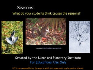
1. Seasons
What do your students think causes the seasons?
Images at http://nix.ksc.nasa.gov/info
Created by the Lunar and Planetary Institute
For Educational Use Only
LPI is not responsible for the ways in which this powerpoint may be used or altered.
2. Let’s Look at Some Data!
• Temperatures around the World
• Daylight hours
3. Average Daily Temperatures (°F) in Tourist Cities
(from http://www.infoplease.com/ipa/A0004587.html ))
January April July October
Cape Town (South Africa) 69 66 60 65
Caracas (Venezuela) 75 81 78 79
London (United Kingdom) 44 56 73 58
Mexico City (Mexico) 66 77 73 70
Montreal (Canada) 22 51 79 56
Moscow (Russia) 21 47 76 46
Nairobi (Kenya) 77 75 69 77
Paris (France) 42 60 76 59
San José (Costa Rica) 75 79 77 77
Seoul (Korea) 33 62 84 67
Singapore 86 89 87 88
Stockholm (Sweden) 31 45 70 48
Sydney (Australia) 79 73 62 72
Tokyo (Japan) 48 64 84 70
4. True color images
December
March
June
September
Images at http://www.nasa.gov/vision/earth/features/blue_marble.html
6. Daylight Hours Across the Globe
Time is indicated as number of hours (h)
Jan Feb Mar Apr May Jun Jul Aug Sep Oct Nov Dec
Miami
10.5 h 11 h 12 h 12.5 h 13 h 14 h 14.5 h 14 h 12.5 h 12.5 h 11 h 11.5 h
Brisbane
14.5 h 13.5 h 13.5 h 12.5 h 11 h 11 h 11 h 11.5 h 11.5 h 12.5 h 14 h 14.5 h
Nairobi
12 h 12 h 12 h 12 h 12 h 12 h 12 h 12 h 12 h 12 h 12 h 12 h
Punta Arenas 17.5 h 15.5 h 13.5 h 11.5 h 10 h 8.5 h 8.5 h 9.5 h 11.5 h 13 h 15 h 16.5 h
Nome 5h 7h 10 h 13.5 h 17.5 h 21.5 h 22 h 18 h 15.5 h 11.5 h 8.5 h 5.5 h
Singapore 12 h 12 h 12 h 12 h 13 h 13 h 12 h 12 h 12 h 12 h 12 h 12 h
Cape Town 15 h 14 h 13.5 h 12.5 h 11.5 h 10 h 10.5 h 11 h 11.5 h 12.5 h 14 h 14 h
Seattle 9h 10 h 11 h 13.5 h 15 h 17 h 16.5 h 15.5 h 13.5 h 11.5 h 10.5 h 9.5 h
Vostok 24 h 24 h 19 h 14.5 h 0h 0h 0h 0h 7h 15 h 24 h 24 h
http://www.lpi.usra.edu/education/skytellers/seasons/activities/light.shtml
7. Let’s Start with some Observations
• Using free downloaded computer program,
Stellarium: http://www.stellarium.org/
– Stellarium is planetarium software that shows exactly what
you see when you look up at the stars. It's easy to use, and
free.
• Let’s look at sunrise & sunset, and Sun’s height in the
sky.
8. Height of Sun for USA
Winter: The Sun rises in the southeast, stays
low in the sky, and sets in the southwest.
Spring: The Sun rises due east, moves higher
in the sky than in winter, and sets due west.
Summer: The Sun rises in the northeast,
travels high (near zenith), and sets in the
northwest.
Fall: The Sun rises due east, travels to a
medium-height in the sky, and sets due west.
9. What Causes Earth’s Seasons?
• Earth’s axis is tilted 23.5 degrees – it always points in
the same direction (Polaris, the North Star) as we
orbit our Sun once a year
• This tilt causes the hemispheres to alternate in the
amount of our Sun’s light and heat they receive
through the year
Image at http://www.lpi.usra.edu/education/skytellers/seasons/about.shtml
10. Northern Hemisphere Summer
More daylight hours, more direct sunlight
Image at http://www.lpi.usra.edu/education/skytellers/seasons/about.shtml
11. Earth’s orbit is almost a perfect circle
• Earth is CLOSEST to our Sun (91 million
miles) in winter—January 3
• Earth is farthest from on our Sun (94
million miles) in summer –July 4
12. Seasons on Other Planets
• In some cases, the changing distances from the Sun
will affect the seasons.
• In others, the axial tilt will make a huge difference!
Image at http://photojournal.jpl.nasa.gov/catalog/PIA02963 Image at http://photojournal.jpl.nasa.gov/catalog/PIA01589
13. Seasons on Planets
Planet Axial Tilt Eccent. Orbit Perihelion Aphelion
Mercury 0° 0.21 88 days 28 mill. Miles 43 mill. miles
Venus 177° 0.01 224 days
Earth 23° 0.02 365 days 91 mill. miles 94 mill. miles
Mars 25° 0.09 686 days 129 mill. miles 155 mill. miles
Jupiter 3° 0.05 12 years
Saturn 27° 0.06 30 years
Uranus 98° 0.05 84 years
Neptune 30° 0.01 165 years
14. Mars’ Orbit and Seasons
At vernal equinox, Mars is 145
million miles from the Sun
At winter solstice, Mars is 128
million miles from the Sun
At summer solstice, Mars is 153
million miles from the Sun
At autumnal equinox, Mars is
134 million miles from the Sun
Original images from http://photojournal.jpl.nasa.gov/index.html
Editor's Notes
We begin our workshop with a discussion of some of the misconceptions about seasons. Squirrel image taken at Kennedy Space Center http://nix.ksc.nasa.gov/info;jsessionid=as5nrgqin0a7k?id=KSC-99PC-0137&orgid=5 Blue Heron also taken at Kennedy Space Center http://mediaarchive.ksc.nasa.gov/detail.cfm?mediaid=27144
An understanding of seasons can begin with observations. What is it like here in December? In June? What is it like in other cities? In other countries? Teachers can use satellite photos like these, or look at newspapers with temperatures for various cities around the world throughout the year. Photos from http://www.nasa.gov/vision/earth/features/blue_marble.html Using data from the Moderate Resolution Imaging Spectroradiometer (MODIS) aboard NASA’s Terra satellite, scientists and data visualizers stitched together a full year’s worth of monthly observations of the land surface, coastal oceans, sea ice, and clouds into a seamless, photo-like mosaic of every square kilometer (.386 square mile) of our planet. Changes in ice are most obvious for the northern hemisphere; changes in vegetation can be seen in Africa and South America. A separate animation can be downloaded and played here: http://library01.gsfc.nasa.gov/svs/html/SVS000435.html
http://svs.gsfc.nasa.gov/vis/a000000/a000400/a000435/index.html SeaWiFS false color data showing seasonal change in the oceans and on land for the entire globe. The data is seasonally averaged, and shows the sequence: fall, winter, spring, summer, fall, winter, spring (for the Northern Hemisphere).
Once the reason for seasons has been demonstrated, the concepts can be mastered with further activities. For instance, the participants may be able to predict the location of various cities (far north, north, equatorial, south, or far south) from the pattern of daylight hours throughout the year. From SkyTellers activity Seasons Across the Continents http://www.lpi.usra.edu/education/skytellers/seasons/activities/light.shtml
During this section, we demonstrate physically, using a planetarium or the horizon or the walls of the classroom, the location of the Sun’s path across the sky for each of the seasons, and ask the participants to predict how high the Sun rises in the sky and where it will set.
More information is at http://www.lpi.usra.edu/education/skytellers/seasons/about.shtml This image shows the reason Earth experiences seasons. Points we discuss using this image are: 1) Earth’s orbit around the Sun is only slightly elliptical 2) Earth’s path around the Sun brings us closer to the Sun in January. Many students think we have seasons because Earth is sometimes closer and sometimes farther from the Sun. This is correct, however, we actually are closer to the Sun in January in the Northern Hemisphere! 3) Earth’s seasons are caused by Earth’s tilt on its axis (~23 degrees). Earth’s axis essentially is fixed - it always points to the same place in the sky (on the celestial sphere) – towards Polaris. As we orbit the Sun each year, first one polar region is tilted toward the Sun, and then the other is tilted toward the Sun. When the north polar region is tilted toward the Sun (summer) the south polar region is tilted away (winter). Notes: Earth’s tilt does change over very long time periods, but for the most part, it moves between 22 and 23 degrees. Earth’s axis also wobble a bit, but over time periods of thousands of years, pointing toward different stars.
At this point, we have participants use styrofoam balls with sticks and a bright lamp to model the seasons on the Earth, with the axis of the “Earth” tilted toward a “North Star” that has been placed high in the corner of the room. For part of our orbit the northern half of Earth is tilted toward the Sun. This is summer in the northern hemisphere; there are longer periods of daylight, the Sun is higher in the sky, and the Sun's rays strike the surface more directly, giving us warmer temperatures. The north pole is in constant daylight! When the northern half of Earth is tilted toward the Sun, the southern hemisphere is tilted away. People in the southern hemisphere experience the shorter day lengths and colder temperatures of winter. During winter in the northern hemisphere, our northern axis continues to point to the North Star, but, because we have moved in our orbit around the Sun, our northern hemisphere now points away from our Sun. The north pole is completely dark and other places in the northern hemisphere experience the shorter day lengths and colder temperatures of winter as the Sun traces a lower arc across the southern sky and the Sun's rays strike the surface at a lower angle. When it is winter in the northern half of Earth, the southern hemisphere, tilted toward our Sun, has summer. During fall and spring, some locations on Earth experience similar, milder, conditions. Earth has moved to a position in its orbit where its axis is more or less perpendicular to the incoming rays of the Sun. The durations of daylight and darkness are more equally distributed across all latitudes of the globe. Solstices occur when Earth's axis is pointed directly toward our Sun. This happens twice a year during Earth's orbit. Near June 21 the north pole is tilted 23.5 degrees toward our Sun and the northern hemisphere experiences summer solstice, the longest day of the northern hemisphere year. On that same day, the southern hemisphere is tilted 23.5 degrees away from our Sun and the southern regions of Earth experience the shortest day of the year — the winter solstice. The second solstice occurs on December 21 or 22 when the north pole is tilting 23.5 degrees away from our Sun and the south pole is inclined toward it. This is the shortest day of the year in the northern hemisphere — the northern hemisphere winter solstice. Twice each year, during the equinoxes (“equal nights”), Earth's axis is not pointed toward our Sun, but is perpendicular to the incoming rays. During the equinoxes every location on our Earth (except the extreme poles) experiences 12 hours of daylight and 12 hours of darkness. The vernal or spring equinox occurs in the northern hemisphere on March 21 or 22 (the fall equinox of the southern hemisphere). September 22 or 23 marks the northern hemisphere autumnal or fall equinox. As Earth orbits our Sun, the position of its axis relative to the Sun changes. This results in a change in the observed height of our Sun above the horizon. For any given location on Earth, our Sun is observed to trace a higher path above the horizon in the summer, and a lower path in the winter. During spring and fall, it traces an intermediate path. This means that our Sun takes a greater amount of time tocross the sky in the summer and a shorter amount of time in the winter. This effect is greater as you move toward the poles; people living near the equator experience only small changes in daylight during the year. The change is more extreme toward the poles. From the National Maritime Museum During the northern hemisphere summer solstice, Earth is tilted such that the Sun's rays strike perpendicular to the surface at the Tropic of Cancer (23.5 degrees north latitude, corresponding to the tilt of Earth's axis). At (solar) noon, our Sun is directly overhead in this location (and at a decreasing height above the horizon north and south of the Tropic of Cancer). At locations north, our Sun will be at its highest position above the horizon and will take the greatest amount of time to cross the sky. All northern locations have more than 12 hours of daylight. All locations south experience less than 12 hours of daylight. Locations above the Arctic Circle (north of 66.5 degrees latitude; 90 degrees minus the tilt of Earth's axis) receive 24 hours of sunlight. Locations below the Antarctic Circle (66.5 degrees south latitude) experience 24 hours of darkness. During the northern hemisphere winter solstice, the Sun's incoming rays are perpendicular to the Tropic of Capricorn at 23.5 degrees south latitude. The Sun's path is the lowest above the horizon in locations north of the equator, and these regions experience the shortest day of the year. Between the winter and summer solstices, daylight increases as Earth continues its orbit around our Sun. During the equinoxes, sunlight strikes perpendicular to the surface at Earth's equator. All locations on Earth, regardless of latitude, experience 12 hours of daylight and 12 hours of darkness. The spring equinox marks the change from 24 hours of darkness to 24 hours of daylight at Earth's poles . In these extreme locations, our Sun moves above the horizon at the spring equinox and does not go below the horizon until the fall equinox.
More information at http://www.physicalgeography.net/fundamentals/6h.html
After seasons on Earth have been mastered, the subject can be further extended by examining the seasons on other planets. Mars image from http://photojournal.jpl.nasa.gov/catalog/PIA01589 and taken by the Hubble Space Telescope Uranus image from http://photojournal.jpl.nasa.gov/catalog/PIA02963 and taken by the Hubble Space Telescope
Mars and Uranus are two extreme cases that students may wish to consider. Mars has an eccentric orbit that brings it closer and further from the Sun, making one hemisphere’s seasonal changes more extreme than the other hemisphere. Uranus is tilted over completely on its side—what will that do to its day and night? Its seasons?
When Mars’ south pole is tilted toward the Sun, Mars is many millions of miles closer to the Sun; when Mars’ south pole is tilted away from the Sun, it is much further from the Sun. So the south pole experiences more extreme changes in the seasons than the north pole does. The image of Mars was taken by the Hubble Space Telescope and can be found at http://photojournal.jpl.nasa.gov/jpegMod/PIA03154_modest.jpg; it was edited for this diagram by the staff of LPI. More information on Mars’ seasons is at http://barsoom.msss.com/http/ps/seasons/seasons.html