SlideShare a Scribd company logo
Terrestrial Laser and Drone
Scanning Provide the Perfect
Combination
Lidar and Drone Data Provide More Accurate Complete Scene Capture
Created by AVT Drones | Krucial Engineering
Why Merge Terrestrial Laser
Scanning With UAV Scans?
• Terrestrial laser scanning provides accurate capture of
complex spaces, such as the interior of factories,
hospitals, construction processes, and other
commercial infrastructure facilities requiring such
specialized equipment.
• Reconstruction of 3D twin models and appearance
from unmanned aerial vehicle (UAV)-based
photogrammetry enables operators to rapidly capture
exterior structures and their surrounding
environment.
• Merging these technologies together is extremely
beneficial, it helps users quickly and accurately
capture their entire facility—including impractical
areas such as rooftops, cliffs, waterways elevated
structures—and provide outdoor context to be
merged with indoor scans for complete site mapping.
Photo Credit Autodesk
Without UAV Scan
With UAV Scan
When Can Drones and
Laser Scanners be Used
Together?
• Accident, Crime and Fire Scene Documentation and
reconstruction
• When taking measurements from point clouds and
orthophotos
• When using a laser scanner is unsafe or the area is inaccessible
• When roadways or sites cannot be closed for traditional
scanning
• When Documenting Large scenes and projects
• When an accident occurs on a waterway
• For the creation of scaled 2D and 3D images, animations and
video
• Collecting data from busy roadways or highways
Created by AVT Drones | Krucial Engineering
Advantages of Combining
Dual Technologies
• Achieve greater levels of accuracy at final
output
• Reach areas that would normally be
inaccessible to traditional ground-based
laser scanning.
• Reduce the number of people and
resources needed for a project.
• Millions of measurable geo-tagged points
are produced into twin 3D models and
Point Clouds
• Faster data capture and processing time
equals less time on scene
• Ease of Accessing inaccessible areas, just
fly a drone
• Safer working environments for client’s
and personnel
Created by AVT Drones | Krucial Engineering
What can you expect from incorporating a
drone scan with Laser Scanning?
• Topographical Surveys with =/> accuracy as traditional equipment in a fraction of the time.
• Each image is geo-tagged with a specific set of coordinates.
• Reduction in cost for performing a site survey and workload of people in the field.
• Generation of 3D models with measurable geo-data/ dense point clouds.
• Ability to reach areas that many not be accessible by traditional survey instruments
• Generation of high-resolution ortho and cadastral maps and models.
• Photogrammetry files can be measured on later and transferred to CAD.
Created by AVT Drones | Krucial Engineering
How does a drone
survey work?
• Ground control points are placed
throughout the area in
conjunction with survey data.
• The target area is flown with a
drone using a double grid pattern.
• Photos are captured and
uploaded to specialized
photogrammetry software.
• Project is completed resulting in
high-resolution Ortho maps, 3D
models/Point Clouds and GIS
data.
Created by AVT Drones | Krucial Engineering
Time Savings with a
UAV Addition
An area that would normally take days or
weeks to survey only using traditional
methods can now be flown and mapped
in minutes to hours depending on the
project size.
Less time surveying at a project site
translates to cost savings for our clients
and helps to speed the entire
construction timeline. Adding a UAV
scan in many projects may be the only
scan needed, thus saving time and cost.
Created by AVT Drones | Krucial Engineering
Using drone scans for urban
development planning
• Drone surveys help urban planners get huge
amounts of real-time data in a shorter period than
with a total station.
• Acquire real-time existing social and environmental
conditions of each site to evaluate the impact of
variants.
• DEM’s can be overlayed onto their environments
giving planners an experimental perspective.
• Gain above ground topographic information
accurately in a fraction of the time, and
substantially reduce associated field cost.
Created by AVT Drones | Krucial Engineering
Applications for
Combining Drone and
Laser Scanning
• Urban Planning and Land Management – digital
surface and terrain models
• Construction – as-built aerial surveys reduce the
need to physically access job sites on foot
• Engineering – from measuring cut and fill volumes,
to inspecting crucial infrastructure drones offer
faster more accurate solutions
• BIM – data can be used to generate highly detailed
and accurate 3D models and point cloud scans to
compare as-built
• Energy and Infrastructure –inspect linear assets
such as pipelines, powerlines, rail routes
waterways, wind and solar.
• Accident Reconstruction and modeling.
Created by AVT Drones | Krucial Engineering
Take The Next Step and Speak With Us
For Questions or Service Please Reach Out to Us
Robert Nicholson
robert.nicholson@avtdrones.com
Stephanie Gandy
sgandy@avtdrones.com
Kurt Whitling
kurt@krucialengineering.com
Click here to schedule an appointment
Created by AVT Drones | Krucial Engineering

More Related Content

What's hot

Texas Surveys April 2010
Texas Surveys April 2010Texas Surveys April 2010
Texas Surveys April 2010
simontown
 
Coastway SCAN to BIM Presentation may 25th cita
Coastway SCAN to BIM Presentation may 25th citaCoastway SCAN to BIM Presentation may 25th cita
Coastway SCAN to BIM Presentation may 25th cita
Coastway
 
GEOSPATIALLY ENHANCED SNOW REMOVAL OPERATIONS
GEOSPATIALLY ENHANCED SNOW REMOVAL OPERATIONSGEOSPATIALLY ENHANCED SNOW REMOVAL OPERATIONS
GEOSPATIALLY ENHANCED SNOW REMOVAL OPERATIONS
Civil Solutions, a division of ARH Assoiates
 
Mobile Options for ArcGIS – Selecting Your Solution
Mobile Options for ArcGIS – Selecting Your SolutionMobile Options for ArcGIS – Selecting Your Solution
Mobile Options for ArcGIS – Selecting Your Solution
WV Assocation of Geospatial Professionals
 
Leveraging 3D Scanned Stat in a Biulding Information Model (BIM) by MasterGra...
Leveraging 3D Scanned Stat in a Biulding Information Model (BIM) by MasterGra...Leveraging 3D Scanned Stat in a Biulding Information Model (BIM) by MasterGra...
Leveraging 3D Scanned Stat in a Biulding Information Model (BIM) by MasterGra...
Ian Manger, MBA
 
Using Scan Data of an Accident Scene and Involved Vehicles to Assist in Compl...
Using Scan Data of an Accident Scene and Involved Vehicles to Assist in Compl...Using Scan Data of an Accident Scene and Involved Vehicles to Assist in Compl...
Using Scan Data of an Accident Scene and Involved Vehicles to Assist in Compl...
Melissa Tiffany
 
Spatial Analyzer 26 Jun2011
Spatial Analyzer 26 Jun2011Spatial Analyzer 26 Jun2011
Spatial Analyzer 26 Jun2011
PaulOberle
 
2016 MATC Intern Program - Andrei Frausto - Alfred Benesch & Company
2016 MATC Intern Program - Andrei Frausto - Alfred Benesch & Company2016 MATC Intern Program - Andrei Frausto - Alfred Benesch & Company
2016 MATC Intern Program - Andrei Frausto - Alfred Benesch & Company
Mid-America Transportation Center
 
Unleash Workflow Within Plant Design Processes with Laser Scans and Autodesk ...
Unleash Workflow Within Plant Design Processes with Laser Scans and Autodesk ...Unleash Workflow Within Plant Design Processes with Laser Scans and Autodesk ...
Unleash Workflow Within Plant Design Processes with Laser Scans and Autodesk ...
Melissa Tiffany
 
Cloud Testing Solutions- BugRaptors
Cloud Testing Solutions- BugRaptorsCloud Testing Solutions- BugRaptors
Cloud Testing Solutions- BugRaptors
BugRaptors
 
Newton software Pvt Ltd
Newton software Pvt LtdNewton software Pvt Ltd
Newton software Pvt Ltd
Praveen Palkhade
 
What's new in Vectorworks 2016
What's new in Vectorworks 2016What's new in Vectorworks 2016
What's new in Vectorworks 2016
elinapaul
 

What's hot (12)

Texas Surveys April 2010
Texas Surveys April 2010Texas Surveys April 2010
Texas Surveys April 2010
 
Coastway SCAN to BIM Presentation may 25th cita
Coastway SCAN to BIM Presentation may 25th citaCoastway SCAN to BIM Presentation may 25th cita
Coastway SCAN to BIM Presentation may 25th cita
 
GEOSPATIALLY ENHANCED SNOW REMOVAL OPERATIONS
GEOSPATIALLY ENHANCED SNOW REMOVAL OPERATIONSGEOSPATIALLY ENHANCED SNOW REMOVAL OPERATIONS
GEOSPATIALLY ENHANCED SNOW REMOVAL OPERATIONS
 
Mobile Options for ArcGIS – Selecting Your Solution
Mobile Options for ArcGIS – Selecting Your SolutionMobile Options for ArcGIS – Selecting Your Solution
Mobile Options for ArcGIS – Selecting Your Solution
 
Leveraging 3D Scanned Stat in a Biulding Information Model (BIM) by MasterGra...
Leveraging 3D Scanned Stat in a Biulding Information Model (BIM) by MasterGra...Leveraging 3D Scanned Stat in a Biulding Information Model (BIM) by MasterGra...
Leveraging 3D Scanned Stat in a Biulding Information Model (BIM) by MasterGra...
 
Using Scan Data of an Accident Scene and Involved Vehicles to Assist in Compl...
Using Scan Data of an Accident Scene and Involved Vehicles to Assist in Compl...Using Scan Data of an Accident Scene and Involved Vehicles to Assist in Compl...
Using Scan Data of an Accident Scene and Involved Vehicles to Assist in Compl...
 
Spatial Analyzer 26 Jun2011
Spatial Analyzer 26 Jun2011Spatial Analyzer 26 Jun2011
Spatial Analyzer 26 Jun2011
 
2016 MATC Intern Program - Andrei Frausto - Alfred Benesch & Company
2016 MATC Intern Program - Andrei Frausto - Alfred Benesch & Company2016 MATC Intern Program - Andrei Frausto - Alfred Benesch & Company
2016 MATC Intern Program - Andrei Frausto - Alfred Benesch & Company
 
Unleash Workflow Within Plant Design Processes with Laser Scans and Autodesk ...
Unleash Workflow Within Plant Design Processes with Laser Scans and Autodesk ...Unleash Workflow Within Plant Design Processes with Laser Scans and Autodesk ...
Unleash Workflow Within Plant Design Processes with Laser Scans and Autodesk ...
 
Cloud Testing Solutions- BugRaptors
Cloud Testing Solutions- BugRaptorsCloud Testing Solutions- BugRaptors
Cloud Testing Solutions- BugRaptors
 
Newton software Pvt Ltd
Newton software Pvt LtdNewton software Pvt Ltd
Newton software Pvt Ltd
 
What's new in Vectorworks 2016
What's new in Vectorworks 2016What's new in Vectorworks 2016
What's new in Vectorworks 2016
 

Similar to Scanning with drones

Drones Usage in AEC
Drones Usage in AECDrones Usage in AEC
Drones Usage in AEC
RobertNicholson9
 
Time & Money Saving with 3D Laser Scanning
Time & Money Saving with 3D Laser ScanningTime & Money Saving with 3D Laser Scanning
Time & Money Saving with 3D Laser Scanning
Top BIM Company
 
Mekanchi - Work @ heights - Drone Services
Mekanchi - Work @ heights - Drone ServicesMekanchi - Work @ heights - Drone Services
Mekanchi - Work @ heights - Drone Services
Shashank Arya
 
3D Laser Scanning for Oil & Gas Facilities
3D Laser Scanning for Oil & Gas Facilities3D Laser Scanning for Oil & Gas Facilities
3D Laser Scanning for Oil & Gas Facilities
Yasser Eldegwy
 
Coastway SCAN to BIM Presentation may 25th cita
Coastway SCAN to BIM Presentation may 25th citaCoastway SCAN to BIM Presentation may 25th cita
Coastway SCAN to BIM Presentation may 25th cita
Coastway
 
7 use cases for drones in construction
7 use cases for drones in construction7 use cases for drones in construction
7 use cases for drones in construction
RobertNicholson9
 
Introduction of construction management
Introduction of construction managementIntroduction of construction management
Introduction of construction management
rajlaxmipardeshi
 
EN_3DLS_Oil_Gas_Offshore
EN_3DLS_Oil_Gas_OffshoreEN_3DLS_Oil_Gas_Offshore
EN_3DLS_Oil_Gas_Offshore
Marian Radoi / 3D Laser Scanning
 
5 Remarkable Benefits of Using Drone Surveying and Mapping
5 Remarkable Benefits of Using Drone Surveying and Mapping5 Remarkable Benefits of Using Drone Surveying and Mapping
5 Remarkable Benefits of Using Drone Surveying and Mapping
Eye-bot
 
Technology that Enhances Accident & Injury Litigation Processes
Technology that Enhances Accident & Injury Litigation Processes Technology that Enhances Accident & Injury Litigation Processes
Technology that Enhances Accident & Injury Litigation Processes
Aerial Visual Technologies LLC
 
Laser Scanning: The Future Trend
Laser Scanning: The Future TrendLaser Scanning: The Future Trend
Laser Scanning: The Future Trend
Fishbeck, Thompson, Carr & Huber, Inc.
 
DroneSurveyingPresentation2.pdf
DroneSurveyingPresentation2.pdfDroneSurveyingPresentation2.pdf
DroneSurveyingPresentation2.pdf
FaizanSolanki1
 
Drone Surveying in Civil Engineering pptx
Drone Surveying in Civil Engineering pptxDrone Surveying in Civil Engineering pptx
Drone Surveying in Civil Engineering pptx
surekha1287
 
3D Laser Scanning – All You Should Know About
3D Laser Scanning – All You Should Know About3D Laser Scanning – All You Should Know About
3D Laser Scanning – All You Should Know About
KevinSmith511452
 
How unmanned aerial vehicles can help manage my construction?
How unmanned aerial vehicles can help manage my construction?How unmanned aerial vehicles can help manage my construction?
How unmanned aerial vehicles can help manage my construction?
Cascadian Aerial Robotics LLC
 
Augview UK distributor Select Surveys talks about augmented reality in the field
Augview UK distributor Select Surveys talks about augmented reality in the fieldAugview UK distributor Select Surveys talks about augmented reality in the field
Augview UK distributor Select Surveys talks about augmented reality in the field
Geo AR Games
 
Mobile Mapping Technology and Applications.pdf
Mobile Mapping Technology and Applications.pdfMobile Mapping Technology and Applications.pdf
Mobile Mapping Technology and Applications.pdf
sooryaK18
 
3D Laser Scanning FPSO Mystras
3D Laser Scanning FPSO Mystras3D Laser Scanning FPSO Mystras
3D Laser Scanning FPSO Mystras
Marian Radoi / 3D Laser Scanning
 
introduction to Reverse Engineering.pptx
introduction to Reverse Engineering.pptxintroduction to Reverse Engineering.pptx
introduction to Reverse Engineering.pptx
GRajesh21
 
3 d laser scanning
3 d laser scanning3 d laser scanning
3 d laser scanning
Ankit Singhai
 

Similar to Scanning with drones (20)

Drones Usage in AEC
Drones Usage in AECDrones Usage in AEC
Drones Usage in AEC
 
Time & Money Saving with 3D Laser Scanning
Time & Money Saving with 3D Laser ScanningTime & Money Saving with 3D Laser Scanning
Time & Money Saving with 3D Laser Scanning
 
Mekanchi - Work @ heights - Drone Services
Mekanchi - Work @ heights - Drone ServicesMekanchi - Work @ heights - Drone Services
Mekanchi - Work @ heights - Drone Services
 
3D Laser Scanning for Oil & Gas Facilities
3D Laser Scanning for Oil & Gas Facilities3D Laser Scanning for Oil & Gas Facilities
3D Laser Scanning for Oil & Gas Facilities
 
Coastway SCAN to BIM Presentation may 25th cita
Coastway SCAN to BIM Presentation may 25th citaCoastway SCAN to BIM Presentation may 25th cita
Coastway SCAN to BIM Presentation may 25th cita
 
7 use cases for drones in construction
7 use cases for drones in construction7 use cases for drones in construction
7 use cases for drones in construction
 
Introduction of construction management
Introduction of construction managementIntroduction of construction management
Introduction of construction management
 
EN_3DLS_Oil_Gas_Offshore
EN_3DLS_Oil_Gas_OffshoreEN_3DLS_Oil_Gas_Offshore
EN_3DLS_Oil_Gas_Offshore
 
5 Remarkable Benefits of Using Drone Surveying and Mapping
5 Remarkable Benefits of Using Drone Surveying and Mapping5 Remarkable Benefits of Using Drone Surveying and Mapping
5 Remarkable Benefits of Using Drone Surveying and Mapping
 
Technology that Enhances Accident & Injury Litigation Processes
Technology that Enhances Accident & Injury Litigation Processes Technology that Enhances Accident & Injury Litigation Processes
Technology that Enhances Accident & Injury Litigation Processes
 
Laser Scanning: The Future Trend
Laser Scanning: The Future TrendLaser Scanning: The Future Trend
Laser Scanning: The Future Trend
 
DroneSurveyingPresentation2.pdf
DroneSurveyingPresentation2.pdfDroneSurveyingPresentation2.pdf
DroneSurveyingPresentation2.pdf
 
Drone Surveying in Civil Engineering pptx
Drone Surveying in Civil Engineering pptxDrone Surveying in Civil Engineering pptx
Drone Surveying in Civil Engineering pptx
 
3D Laser Scanning – All You Should Know About
3D Laser Scanning – All You Should Know About3D Laser Scanning – All You Should Know About
3D Laser Scanning – All You Should Know About
 
How unmanned aerial vehicles can help manage my construction?
How unmanned aerial vehicles can help manage my construction?How unmanned aerial vehicles can help manage my construction?
How unmanned aerial vehicles can help manage my construction?
 
Augview UK distributor Select Surveys talks about augmented reality in the field
Augview UK distributor Select Surveys talks about augmented reality in the fieldAugview UK distributor Select Surveys talks about augmented reality in the field
Augview UK distributor Select Surveys talks about augmented reality in the field
 
Mobile Mapping Technology and Applications.pdf
Mobile Mapping Technology and Applications.pdfMobile Mapping Technology and Applications.pdf
Mobile Mapping Technology and Applications.pdf
 
3D Laser Scanning FPSO Mystras
3D Laser Scanning FPSO Mystras3D Laser Scanning FPSO Mystras
3D Laser Scanning FPSO Mystras
 
introduction to Reverse Engineering.pptx
introduction to Reverse Engineering.pptxintroduction to Reverse Engineering.pptx
introduction to Reverse Engineering.pptx
 
3 d laser scanning
3 d laser scanning3 d laser scanning
3 d laser scanning
 

Recently uploaded

AI 101: An Introduction to the Basics and Impact of Artificial Intelligence
AI 101: An Introduction to the Basics and Impact of Artificial IntelligenceAI 101: An Introduction to the Basics and Impact of Artificial Intelligence
AI 101: An Introduction to the Basics and Impact of Artificial Intelligence
IndexBug
 
HCL Notes and Domino License Cost Reduction in the World of DLAU
HCL Notes and Domino License Cost Reduction in the World of DLAUHCL Notes and Domino License Cost Reduction in the World of DLAU
HCL Notes and Domino License Cost Reduction in the World of DLAU
panagenda
 
Best 20 SEO Techniques To Improve Website Visibility In SERP
Best 20 SEO Techniques To Improve Website Visibility In SERPBest 20 SEO Techniques To Improve Website Visibility In SERP
Best 20 SEO Techniques To Improve Website Visibility In SERP
Pixlogix Infotech
 
Infrastructure Challenges in Scaling RAG with Custom AI models
Infrastructure Challenges in Scaling RAG with Custom AI modelsInfrastructure Challenges in Scaling RAG with Custom AI models
Infrastructure Challenges in Scaling RAG with Custom AI models
Zilliz
 
Cosa hanno in comune un mattoncino Lego e la backdoor XZ?
Cosa hanno in comune un mattoncino Lego e la backdoor XZ?Cosa hanno in comune un mattoncino Lego e la backdoor XZ?
Cosa hanno in comune un mattoncino Lego e la backdoor XZ?
Speck&Tech
 
20240605 QFM017 Machine Intelligence Reading List May 2024
20240605 QFM017 Machine Intelligence Reading List May 202420240605 QFM017 Machine Intelligence Reading List May 2024
20240605 QFM017 Machine Intelligence Reading List May 2024
Matthew Sinclair
 
Goodbye Windows 11: Make Way for Nitrux Linux 3.5.0!
Goodbye Windows 11: Make Way for Nitrux Linux 3.5.0!Goodbye Windows 11: Make Way for Nitrux Linux 3.5.0!
Goodbye Windows 11: Make Way for Nitrux Linux 3.5.0!
SOFTTECHHUB
 
Mariano G Tinti - Decoding SpaceX
Mariano G Tinti - Decoding SpaceXMariano G Tinti - Decoding SpaceX
Mariano G Tinti - Decoding SpaceX
Mariano Tinti
 
Observability Concepts EVERY Developer Should Know -- DeveloperWeek Europe.pdf
Observability Concepts EVERY Developer Should Know -- DeveloperWeek Europe.pdfObservability Concepts EVERY Developer Should Know -- DeveloperWeek Europe.pdf
Observability Concepts EVERY Developer Should Know -- DeveloperWeek Europe.pdf
Paige Cruz
 
Climate Impact of Software Testing at Nordic Testing Days
Climate Impact of Software Testing at Nordic Testing DaysClimate Impact of Software Testing at Nordic Testing Days
Climate Impact of Software Testing at Nordic Testing Days
Kari Kakkonen
 
HCL Notes und Domino Lizenzkostenreduzierung in der Welt von DLAU
HCL Notes und Domino Lizenzkostenreduzierung in der Welt von DLAUHCL Notes und Domino Lizenzkostenreduzierung in der Welt von DLAU
HCL Notes und Domino Lizenzkostenreduzierung in der Welt von DLAU
panagenda
 
GraphSummit Singapore | Enhancing Changi Airport Group's Passenger Experience...
GraphSummit Singapore | Enhancing Changi Airport Group's Passenger Experience...GraphSummit Singapore | Enhancing Changi Airport Group's Passenger Experience...
GraphSummit Singapore | Enhancing Changi Airport Group's Passenger Experience...
Neo4j
 
Mind map of terminologies used in context of Generative AI
Mind map of terminologies used in context of Generative AIMind map of terminologies used in context of Generative AI
Mind map of terminologies used in context of Generative AI
Kumud Singh
 
Communications Mining Series - Zero to Hero - Session 1
Communications Mining Series - Zero to Hero - Session 1Communications Mining Series - Zero to Hero - Session 1
Communications Mining Series - Zero to Hero - Session 1
DianaGray10
 
Full-RAG: A modern architecture for hyper-personalization
Full-RAG: A modern architecture for hyper-personalizationFull-RAG: A modern architecture for hyper-personalization
Full-RAG: A modern architecture for hyper-personalization
Zilliz
 
GraphSummit Singapore | The Future of Agility: Supercharging Digital Transfor...
GraphSummit Singapore | The Future of Agility: Supercharging Digital Transfor...GraphSummit Singapore | The Future of Agility: Supercharging Digital Transfor...
GraphSummit Singapore | The Future of Agility: Supercharging Digital Transfor...
Neo4j
 
RESUME BUILDER APPLICATION Project for students
RESUME BUILDER APPLICATION Project for studentsRESUME BUILDER APPLICATION Project for students
RESUME BUILDER APPLICATION Project for students
KAMESHS29
 
GenAI Pilot Implementation in the organizations
GenAI Pilot Implementation in the organizationsGenAI Pilot Implementation in the organizations
GenAI Pilot Implementation in the organizations
kumardaparthi1024
 
GraphSummit Singapore | Neo4j Product Vision & Roadmap - Q2 2024
GraphSummit Singapore | Neo4j Product Vision & Roadmap - Q2 2024GraphSummit Singapore | Neo4j Product Vision & Roadmap - Q2 2024
GraphSummit Singapore | Neo4j Product Vision & Roadmap - Q2 2024
Neo4j
 
Video Streaming: Then, Now, and in the Future
Video Streaming: Then, Now, and in the FutureVideo Streaming: Then, Now, and in the Future
Video Streaming: Then, Now, and in the Future
Alpen-Adria-Universität
 

Recently uploaded (20)

AI 101: An Introduction to the Basics and Impact of Artificial Intelligence
AI 101: An Introduction to the Basics and Impact of Artificial IntelligenceAI 101: An Introduction to the Basics and Impact of Artificial Intelligence
AI 101: An Introduction to the Basics and Impact of Artificial Intelligence
 
HCL Notes and Domino License Cost Reduction in the World of DLAU
HCL Notes and Domino License Cost Reduction in the World of DLAUHCL Notes and Domino License Cost Reduction in the World of DLAU
HCL Notes and Domino License Cost Reduction in the World of DLAU
 
Best 20 SEO Techniques To Improve Website Visibility In SERP
Best 20 SEO Techniques To Improve Website Visibility In SERPBest 20 SEO Techniques To Improve Website Visibility In SERP
Best 20 SEO Techniques To Improve Website Visibility In SERP
 
Infrastructure Challenges in Scaling RAG with Custom AI models
Infrastructure Challenges in Scaling RAG with Custom AI modelsInfrastructure Challenges in Scaling RAG with Custom AI models
Infrastructure Challenges in Scaling RAG with Custom AI models
 
Cosa hanno in comune un mattoncino Lego e la backdoor XZ?
Cosa hanno in comune un mattoncino Lego e la backdoor XZ?Cosa hanno in comune un mattoncino Lego e la backdoor XZ?
Cosa hanno in comune un mattoncino Lego e la backdoor XZ?
 
20240605 QFM017 Machine Intelligence Reading List May 2024
20240605 QFM017 Machine Intelligence Reading List May 202420240605 QFM017 Machine Intelligence Reading List May 2024
20240605 QFM017 Machine Intelligence Reading List May 2024
 
Goodbye Windows 11: Make Way for Nitrux Linux 3.5.0!
Goodbye Windows 11: Make Way for Nitrux Linux 3.5.0!Goodbye Windows 11: Make Way for Nitrux Linux 3.5.0!
Goodbye Windows 11: Make Way for Nitrux Linux 3.5.0!
 
Mariano G Tinti - Decoding SpaceX
Mariano G Tinti - Decoding SpaceXMariano G Tinti - Decoding SpaceX
Mariano G Tinti - Decoding SpaceX
 
Observability Concepts EVERY Developer Should Know -- DeveloperWeek Europe.pdf
Observability Concepts EVERY Developer Should Know -- DeveloperWeek Europe.pdfObservability Concepts EVERY Developer Should Know -- DeveloperWeek Europe.pdf
Observability Concepts EVERY Developer Should Know -- DeveloperWeek Europe.pdf
 
Climate Impact of Software Testing at Nordic Testing Days
Climate Impact of Software Testing at Nordic Testing DaysClimate Impact of Software Testing at Nordic Testing Days
Climate Impact of Software Testing at Nordic Testing Days
 
HCL Notes und Domino Lizenzkostenreduzierung in der Welt von DLAU
HCL Notes und Domino Lizenzkostenreduzierung in der Welt von DLAUHCL Notes und Domino Lizenzkostenreduzierung in der Welt von DLAU
HCL Notes und Domino Lizenzkostenreduzierung in der Welt von DLAU
 
GraphSummit Singapore | Enhancing Changi Airport Group's Passenger Experience...
GraphSummit Singapore | Enhancing Changi Airport Group's Passenger Experience...GraphSummit Singapore | Enhancing Changi Airport Group's Passenger Experience...
GraphSummit Singapore | Enhancing Changi Airport Group's Passenger Experience...
 
Mind map of terminologies used in context of Generative AI
Mind map of terminologies used in context of Generative AIMind map of terminologies used in context of Generative AI
Mind map of terminologies used in context of Generative AI
 
Communications Mining Series - Zero to Hero - Session 1
Communications Mining Series - Zero to Hero - Session 1Communications Mining Series - Zero to Hero - Session 1
Communications Mining Series - Zero to Hero - Session 1
 
Full-RAG: A modern architecture for hyper-personalization
Full-RAG: A modern architecture for hyper-personalizationFull-RAG: A modern architecture for hyper-personalization
Full-RAG: A modern architecture for hyper-personalization
 
GraphSummit Singapore | The Future of Agility: Supercharging Digital Transfor...
GraphSummit Singapore | The Future of Agility: Supercharging Digital Transfor...GraphSummit Singapore | The Future of Agility: Supercharging Digital Transfor...
GraphSummit Singapore | The Future of Agility: Supercharging Digital Transfor...
 
RESUME BUILDER APPLICATION Project for students
RESUME BUILDER APPLICATION Project for studentsRESUME BUILDER APPLICATION Project for students
RESUME BUILDER APPLICATION Project for students
 
GenAI Pilot Implementation in the organizations
GenAI Pilot Implementation in the organizationsGenAI Pilot Implementation in the organizations
GenAI Pilot Implementation in the organizations
 
GraphSummit Singapore | Neo4j Product Vision & Roadmap - Q2 2024
GraphSummit Singapore | Neo4j Product Vision & Roadmap - Q2 2024GraphSummit Singapore | Neo4j Product Vision & Roadmap - Q2 2024
GraphSummit Singapore | Neo4j Product Vision & Roadmap - Q2 2024
 
Video Streaming: Then, Now, and in the Future
Video Streaming: Then, Now, and in the FutureVideo Streaming: Then, Now, and in the Future
Video Streaming: Then, Now, and in the Future
 

Scanning with drones

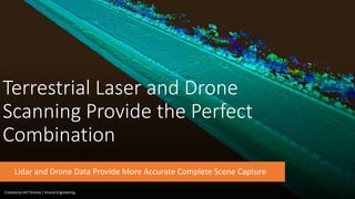
  • 1. Terrestrial Laser and Drone Scanning Provide the Perfect Combination Lidar and Drone Data Provide More Accurate Complete Scene Capture Created by AVT Drones | Krucial Engineering
  • 2. Why Merge Terrestrial Laser Scanning With UAV Scans? • Terrestrial laser scanning provides accurate capture of complex spaces, such as the interior of factories, hospitals, construction processes, and other commercial infrastructure facilities requiring such specialized equipment. • Reconstruction of 3D twin models and appearance from unmanned aerial vehicle (UAV)-based photogrammetry enables operators to rapidly capture exterior structures and their surrounding environment. • Merging these technologies together is extremely beneficial, it helps users quickly and accurately capture their entire facility—including impractical areas such as rooftops, cliffs, waterways elevated structures—and provide outdoor context to be merged with indoor scans for complete site mapping. Photo Credit Autodesk Without UAV Scan With UAV Scan
  • 3. When Can Drones and Laser Scanners be Used Together? • Accident, Crime and Fire Scene Documentation and reconstruction • When taking measurements from point clouds and orthophotos • When using a laser scanner is unsafe or the area is inaccessible • When roadways or sites cannot be closed for traditional scanning • When Documenting Large scenes and projects • When an accident occurs on a waterway • For the creation of scaled 2D and 3D images, animations and video • Collecting data from busy roadways or highways Created by AVT Drones | Krucial Engineering
  • 4. Advantages of Combining Dual Technologies • Achieve greater levels of accuracy at final output • Reach areas that would normally be inaccessible to traditional ground-based laser scanning. • Reduce the number of people and resources needed for a project. • Millions of measurable geo-tagged points are produced into twin 3D models and Point Clouds • Faster data capture and processing time equals less time on scene • Ease of Accessing inaccessible areas, just fly a drone • Safer working environments for client’s and personnel Created by AVT Drones | Krucial Engineering
  • 5. What can you expect from incorporating a drone scan with Laser Scanning? • Topographical Surveys with =/> accuracy as traditional equipment in a fraction of the time. • Each image is geo-tagged with a specific set of coordinates. • Reduction in cost for performing a site survey and workload of people in the field. • Generation of 3D models with measurable geo-data/ dense point clouds. • Ability to reach areas that many not be accessible by traditional survey instruments • Generation of high-resolution ortho and cadastral maps and models. • Photogrammetry files can be measured on later and transferred to CAD. Created by AVT Drones | Krucial Engineering
  • 6. How does a drone survey work? • Ground control points are placed throughout the area in conjunction with survey data. • The target area is flown with a drone using a double grid pattern. • Photos are captured and uploaded to specialized photogrammetry software. • Project is completed resulting in high-resolution Ortho maps, 3D models/Point Clouds and GIS data. Created by AVT Drones | Krucial Engineering
  • 7. Time Savings with a UAV Addition An area that would normally take days or weeks to survey only using traditional methods can now be flown and mapped in minutes to hours depending on the project size. Less time surveying at a project site translates to cost savings for our clients and helps to speed the entire construction timeline. Adding a UAV scan in many projects may be the only scan needed, thus saving time and cost. Created by AVT Drones | Krucial Engineering
  • 8. Using drone scans for urban development planning • Drone surveys help urban planners get huge amounts of real-time data in a shorter period than with a total station. • Acquire real-time existing social and environmental conditions of each site to evaluate the impact of variants. • DEM’s can be overlayed onto their environments giving planners an experimental perspective. • Gain above ground topographic information accurately in a fraction of the time, and substantially reduce associated field cost. Created by AVT Drones | Krucial Engineering
  • 9. Applications for Combining Drone and Laser Scanning • Urban Planning and Land Management – digital surface and terrain models • Construction – as-built aerial surveys reduce the need to physically access job sites on foot • Engineering – from measuring cut and fill volumes, to inspecting crucial infrastructure drones offer faster more accurate solutions • BIM – data can be used to generate highly detailed and accurate 3D models and point cloud scans to compare as-built • Energy and Infrastructure –inspect linear assets such as pipelines, powerlines, rail routes waterways, wind and solar. • Accident Reconstruction and modeling. Created by AVT Drones | Krucial Engineering
  • 10. Take The Next Step and Speak With Us For Questions or Service Please Reach Out to Us Robert Nicholson robert.nicholson@avtdrones.com Stephanie Gandy sgandy@avtdrones.com Kurt Whitling kurt@krucialengineering.com Click here to schedule an appointment Created by AVT Drones | Krucial Engineering