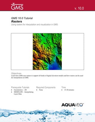
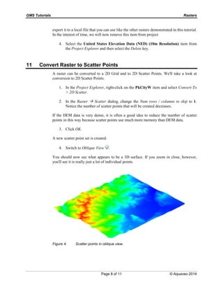
This document provides an overview of using rasters in GMS. It discusses importing LiDAR and other DEM data, changing raster display options like hill shading, converting rasters to scatter points and vice versa, and interpolating raster data to TINs, feature objects, and MODFLOW layers. The tutorial outlines importing multiple DEM files, viewing their properties, downloading elevation data online, and manipulating rasters in various ways to support modeling and visualization in GMS.