Download as PDF, PPTX
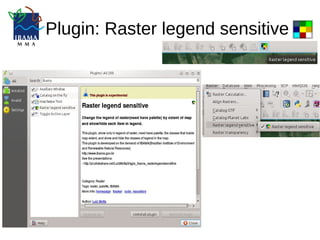
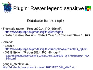
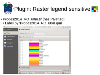

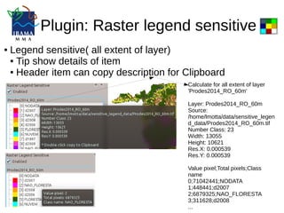
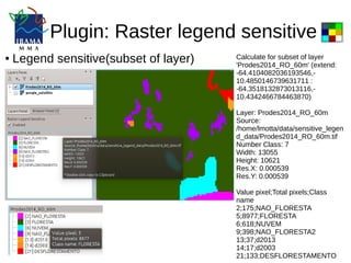
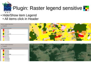
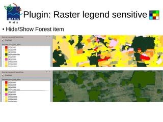

This document describes a QGIS plugin called "Raster legend sensitive" that changes the legend of raster layers with a palette based on the extent of the map. It calculates and displays the number of pixels and class name for each raster value within the visible extent. The user can also hide or show individual legend items and view details on each class. An example is provided using a PRODES deforestation raster for Rondonia, Brazil.