This document provides an overview of geological services offered by Daniel Linder and RJ Lee Group for the mining industry. These services include mineralogical site assessments, 3D geological block modeling, regional geological exploration, and merger and acquisition due diligence. The document also outlines the basic steps for geological modeling and exploration, which include gathering data, critical analysis, mapping, digital database creation, computer modeling, and using the results to support mining engineers, geologists, marketing, and materials analysis.
Finding Fallopia: detection of Japanese Knotweed s.l. taxa in the UK using re...Daniel Jones
Poster presentation delivered at the 11th International Conference on the Ecology and Management of Alien Plant Invasions (EMAPi) 2011 on the 30/08/11 in Szombathely (Hungary).
Assessment, Monitoring and Managing SOC for Climate Change Mitigation and Ada...ExternalEvents
This presentation was presented during the 3 Parallel session on Theme 1, Monitoring, mapping, measuring, reporting and verification (MRV) of SOC, of the Global Symposium on Soil Organic Carbon that took place in Rome 21-23 March 2017. The presentation was made by Mr. K. Suresh Chaudhari, from ICAR - India, in FAO Hq, Rome
Modeling and inversion related activities at Geoscience Australia - September...Richard Lane
Presented at the ASEG (WA Branch) "Geophysical inversion for mineral explorers" on 20140902.
At Geoscience Australia, we service many applications, and modeling and inversion of geophysical data is in widespread use throughout these.
We principally deal with the following data types:
Gravity, Magnetics, AEM, MT, and Seismic.
Ghrelin mathematical modeling and beyond (The big glucose model: the quest fo...Jorge Pires
This is a set of slides used on my talk about ghrelin mathematical modeling. Ghrelin is a hormone produced by the stomach and other parts of the body, it has been shown to be correlated with several physiological functions; herein we exploit the orexigenic ones (i.e. appetite stimulant).
PetroSync - Fractured Reservoir Modeling with Application to Fractured BasementPetroSync
This course provides a unique opportunity to learn all the aspects related to the understanding and modeling of fractured reservoirs. Participants will gain knowledge of how fractured reservoirs differ from conventional reservoirs, and how to approach their fractured reservoir projects in a systematic manner.
Graphical 3D Modeling of Molecules and Nanostructures in Sub-nanometer Scale ...Stoyan Sarg Sargoytchev
The Basic Structures of Matter – Supergravitation Unified Theory (BSM-SG) reveals non-spherical shapes of the stable elementary particles, composed of two types of helical structures with opposite twisting. Proton and neutron have one and the same toroidal sub-structure, but the shape of proton is a twisted torus like the figure 8, while the neutron is a double folded. The shape of proton permits modulation of the space fabrics creating a positive E-field. At neutron such modulation is locked in the near field, so it is not detectable, but when in motion it creates a magnetic field. Due to it’s near E-field the neutron is stable over the proton, forming a deuteron. The electron is a different three body system with two intrinsic frequencies. Its structure and dynamic properties provide classical explanations of: Compton frequency, anomalous magnetic moment, spin and relativistic effect of mass increase. The near Coulomb field of the proton defines the trace of orbiting electron. The atomic nuclei are 3D compositions of protons and neutrons, kept by the attractive supergravitational forces, while balancing the repulsive forces between protons. The increase of number of protons reveals the build-up trend of the atomic nuclei showing a perfect match with the pattern of the Periodic Table. The features defining the valences and the angular restrictions of the chemical bonds are apparent. The rotational freedom of neutrons over protons is behind the nuclear magnetic moment. The BSM-SG atomic models are convenient for 3D graphical modeling of complex molecules and nanostructures with sub-nanometer resolution.
Mathematical Modeling for Practical ProblemsLiwei Ren任力偉
Mathematical modeling is an important step for developing many advanced technologies in various domains such as network security, data mining and etc… This lecture introduces a process that the speaker summarizes from his past practice of mathematical modeling and algorithmic solutions in IT industry, as an applied mathematician, algorithm specialist or software engineer , and even as an entrepreneur. A practical problem from DLP system will be used as an example for creating math models and providing algorithmic solutions.
Types of Financial Model - Financial Modeling by EduCBAeduCBA
https://www.educorporatebridge.com/financial-modeling/types-of-financial-model/
Learn the different types of Financial model like DCF Model, Comparative Company Analysis model, Sum-of-the-parts model, LBO Model, M&A model and Option Pricing Model
DepthInsight Geoscience Geomodeling Software Technology IntroductionBo Sun
DepthInsight is a geoscience geomodeling software platform including the following modules:
Structural Modeling Module: efficiently and stably build any complex models.
Velocity and Attribute Modeling;
Reservoir Modeling;
Geomechanics: finite element based; A direct calculation based on the structural models, and no need to export structural models into other software;
3D Paleo-Structural Restoration: finite element and geomechanics based;
Enormous Modeling Platform:distributed modeling with multiple users working in individual sub regions simultaneously and then update and seamlessly embed back into the master model.
On February 12, 2013, the Canada Mining Innovation Council held its 2nd Annual Signature Event, a mining conference bringing representatives from industry, government, academia, and other sectors together in Toronto to discuss the role of innovation in the industry's future. The VP and Chief Geologist of Global Exploration at Barrick, Francois Robert, and the Research Director for CMIC, Alan Galley, shared the plans, programs and projects being carried out by CMIC's Exploration Innovation Consortium.
John McGaughey, CEO/President of Mira Geoscience offers his thoughts and the practices of integrated geophysical interpretation at the 3D Interest Group
Application of Modern Geographical Tools & Techniques in Planning and Develo...Prof Ashis Sarkar
GIS is a modern technology. It can handle spatial as well as attribute data available at all scale and format. Therefore, it can well be used in the national planning and development.
GIS in Mining and Exploration 2011 BrochureIQPC Australia
Uncovering Technologies and Strategies for Exploration and Mine Advancement Using Geographic Information Systems
Optimising the use of GIS on mine sites and in mineral exploration
Following its great success in Perth, Mining IQ's GIS in Mining and Exploration 2011 is coming to Queensland!
GIS in Mining and Exploration 2011 QLD is about advancing the knowledge base of all those who interact with GIS. This event has been developed specifically with your challenges in mind, providing you with the critical updates you need in a dynamic and demanding field.
For more information about the event, please visit http://www.gisinmining.com.au or call us on 61 2 9229 1000
Methods and stages of Mineral Exploration: Adaptive Resource Management PlanNgatcha Bryan
Exploration can be divided into a number of interlinked and sequential stages which involve increasing
expenditure and decreasing risk. Early stages of exploration are planning and prospecting. The planning
stage covers the selection of commodity, type of deposit, exploration methods, and the seĴing up of an
exploration entity. Prospecting covers activities leading to the selection of an area for detailed ground
work; this is the point at which land is acquired. The subsequent stages involve targeted prospecting and
exploration in order to quantify and qualify the mineral resources. Pre-feasibility study is then
performed for evaluating the commercial viability of the deposit (Adapted from Moon et al., 2006).
University of Nottingham - NGI Geospatial Science Example ActivitiesJeremy Morley
An overview of some of the projects and activities of the Geospatial Science research theme of the Nottingham Geospatial Institute, a research institute of the University of Nottingham.
ExtremeEarth Data Science Pipeline for Linked Earth Observation DataExtremeEarth
Presentation in Data Week 2021. The main objective of this workshop is to bring together four pioneer H2020 projects that are at the frontier of European research and innovation and are developing Artificial Intelligence and Big Data technologies for Copernicus data. These projects are ExtremeEarth (http://earthanalytics.eu/), AI4Copernicus (https://ai4copernicus-project.eu/), DeepCube (https://deepcube-h2020.eu/) and CALLISTO (https://callisto-h2020.eu/). The first two of the projects have been funded by ICT calls while the other two have been funded by DT-SPACE calls.
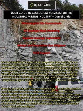
1. YOUR GUIDE TO GEOLOGICAL SERVICES FOR THE
INDUSTRIAL MINING INDUSTRY – Daniel Linder
Mineralogical Site Assessments
3D Geologic Block Modeling
Regional Geologic Exploration
Merger and Acquisition Due Diligence
Field Support
Prior to joining RJ Lee Group, Mr. Linder was previously employed by Vulcan
Materials Company where he most recently served as Manager of Geological
and Mine Planning Services. His duties included scheduling geologic and mine
planning projects, evaluating potential acquisitions, and ensuring compliance
with federal regulations. Mr. Linder holds an M.S. in Economic Geology and
Mineralogy as well as from the University of Maryland College Park, and an
undergraduate degree in Geology from the University of Maryland College Park.
RJ Lee Group is an industrial forensics laboratory that is recognized as a leader in
providing innovative solutions to challenges in materials characterization,
forensic engineering, and information management. For 30 years, we have been
using our scientific expertise, instrumentation and technology to offer support
strategies and provide solutions to our customers. RJ Lee Group is a 300-person
company with headquarters located in Monroeville, PA. For more information
visit our website at www.rjlg.com.
2. MAJOR ISSUES
Overburden & Weathered Rock Distribution and Thickness
Ensuring Material Meets State Specifications
Discovery and Avoidance of Asbestos, Heavy Metals
Water Inflow to Pit or Quarry
Growth and Exploration for New Opportunities
3. Basic Steps and Purpose of Modeling/Exploration
1) Information & Data Gathering - Search for all sources of
information related to the site to be modeled or area to be
explored for new opportunities.
2) Forensic Geology – Assemble all collected data regardless of
condition into a complete, comprehensive, and internally
consistent digital database.
3) Critical Thinking - Evaluation of data and preparation of
graphical displays of data for mapping purposes.
Old Core Hole Location Maps
Old Literature Hand Sketches
Core Evaluation and Sampling
Old & New Aerial Photography
Old & New Geologic Mapping
4. Basic Steps and Purpose of Modeling/Exploration
1) Hand Mapping – Initial basic geologic mapping of any sort,
e.g. structural, thickness, quality, etc. is done by hand using all
available collected information and data and by using
advanced knowledge of geologic principles.
2) Creation of a Digital Database– Digitization of one’s
mapping enables transformation into a digital format. By
deriving this digital mapping from hand made maps and critical
geologic thinking, there now exists a much more thorough and
refined understanding of the issue at hand than using
scattered and inconsistent pieces of data.
1) Computer Modeling – Once mapping exists as digital data,
maps and/or cross-sections can be generated and customized
depending on need. This data can also be used to generate 3D
digital geologic block models.
5. Basic Steps and Purpose of Modeling/Exploration
1) Support for Mining Engineers- With a geologic block
model complete, multiple scenarios can be generated to most
closely estimate the total reserve which can be extracted.
Additionally, the most cost effective progression of mining can
be determined.
2) Support for Geologists – These models and the graphical
products that can be generated aid geologists in further
mapping, prediction and adjustment or quality checking of the
subsurface model.
3) Support for Marketing and Sales – With detailed exploration
maps in hand, the search for new growth opportunities is
made easier. The compilation of multiple data types enhances
the ability to strategically seek out greenfields, acquisition
targets, or company mergers.
4) Support for RJ Lee Group Understanding of the sub-surface
geology will greatly enhance the ability for proper sampling of
ledge rock, stockpiles, dust, etc. for materials determined to
be deleterious to one’s health. This includes, but is not limited
to asbestos, silica, heavy metals.