Stonehenge is a prehistoric monument located in Wiltshire, England consisting of a ring of standing stones set within earthworks. Archaeologists believe it was constructed between 3000 BC to 2000 BC, with the earliest earthworks dated to around 3100 BC. It is one of the most famous landmarks in the UK and is regarded as a culturally significant site, protected as an ancient monument.
2010 10 Archaeology around the Severn Estuary – Andy Marvell SevernEstuary
This document provides contact information for local archaeological curators and national bodies that oversee archaeology around the Severn Estuary, which separates England from Wales. It lists the city and county archaeologists for Bristol, Gloucestershire, North Somerset, and South Gloucestershire in England who can provide information on archaeology in their regions. It also includes the contact information for the Archaeological Planning Manager at GGAT who oversees archaeology in South Wales.
Stonehenge was built over 2000 years starting in 3000 BC. It was constructed in phases, with the first phase involving digging wells and erecting 80 standing stones known as blue stones that were brought from Wales. Later phases involved rebuilding the monument with larger sarsen stones weighing up to 30 tons brought from nearby. Archaeologists believe Stonehenge may have functioned as an astronomical observatory or religious site, and was part of a ritual landscape connecting it to other monuments.
Scowlitz VMC Project Presentation at UBC Archaeology Day, March 15, 2014 ScowlitzVMCProject
Archaeologists from UBC and members of the Scowlitz First Nation have been collaborating on archaeological research and heritage projects at the Qithyl site near Chilliwack since 1992. The projects involve excavating burial mounds and house features, bringing students to learn, and creating a virtual museum exhibit to share Scowlitz history and culture. Scowlitz community members guide the research and teach traditional practices like making red ochre paint. The collaboration aims to preserve Scowlitz heritage and pass knowledge to new generations.
The British Science Festival, organized by the British Science Association and Swansea University, was held September 6-9, 2016 at Swansea University's Singleton Park campus. Thousands of visitors attended talks, debates, tours and workshops given by hundreds of leading scientists from around the world. The festival provided an opportunity to showcase Swansea University's research and put the university on the world stage. Academics from Swansea University discussed their research topics. Alumnus Lyn Evans and Honorary Fellow George Abbey also spoke. The festival was followed by family-oriented activities at the National Waterfront Museum. The event aimed to inspire attendees about the importance and prevalence of science.
Daisy May Bates was an Irish immigrant who traveled from Tipperary, Ireland to Queensland, Australia. She was the subject of a biographical article that referenced her place of birth in Ireland and relocation to Australia, as well as included links to maps and websites about those locations. The article did not provide many details about Bates or her life, but referenced her place of origin and subsequent destination after leaving Ireland.
Archaeology is the study of human history and prehistory through the excavation of sites and the analysis of artifacts and other physical remains. Archaeologists study human prehistory and history, from the development of the first stone tools by early humans to the historic period, to gain understanding of societies and cultures. Their work involves surveying, excavating and analyzing materials to document and interpret past human lives and activities.
24 parishes were surveyed from August 2014 to August 2015, recording 415 features. Surveys are still required in 12 parishes. Field trips and surveys helped identify features missed in initial surveys. Upcoming events include a workshop on rock art carvings at Grosvenor Museum and potential excavation of "Mad Allen's Hole" on Bickerton Hill.
The document summarizes a hydrogeology workshop covering the introduction to geology. It includes sections on the aims of the workshop, the different types of rocks, sedimentary deposits relevant to the area, how sediments are deposited and form beds, geological structures like folds and faults, and an overview of geological history starting with the formation of Pangaea.
This document summarizes a water features survey report for a site called The Rectory in Delamere, Cheshire. It provides details on a borehole source such as its location coordinates, construction date, depths, aquifer type, and occupier information. Maps and photos are also included to illustrate the site location and features. Links are provided to online resources from the British Geological Survey to view geological maps and identify other nearby wells/boreholes.
This document discusses groundwater flow and hydrogeology of the Sandstone Ridge Area. It provides a conceptual model of the local hydrogeology, including:
- Recharge from precipitation that flows through permeable sandstones in a westerly direction towards rivers and streams.
- Springs and shallow wells tap small localized perched aquifers. Deeper boreholes access main sandstone aquifers and can have moderate to high yields.
- The document also outlines sources of information on local hydrogeology and an exercise to catalogue well/borehole details from logs and maps.
1. Prior to 18,000 years ago, the entire area was covered by an ice sheet up to 400 meters thick.
2. As the ice sheet retreated north of Norley/Cuddington, it deposited boulder clay and then stopped, unable to retreat further west due to pressure from ice flows from the Welsh highlands.
3. Outwash from the static ice front deposited glacial sands and gravels north of Norley/Cuddington and through gaps in the sandstone ridge.
4. Final retreat of the ice sheet left further extensive deposits of boulder clay across the area.
The document describes the geological history of an area from the Permian to Triassic periods, approximately 290 to 230 million years ago. The area was located 15-20 degrees north of the equator in a desert climate, surrounded by higher ground. Braided rivers flowed from south to north, carrying large amounts of eroded sediment from the higher ground which was deposited in the subsiding basin to the north. This created a succession of sandstone and mudstone formations. During the Middle Triassic, the landscape became more subdued and fine-grained sediments like mudstone and siltstone were deposited along with evaporites such as gypsum and halite deposits from isolated saline lakes.
The document discusses a project to survey and study graffiti and potential rock art along a ridge. It aims to identify locations with significant graffiti densities and dates, names, or images carved into the stone. The project has two stages: an initial broad survey of the ridge to identify sites of interest, followed by more detailed examination of selected sites. Recording will note location details, take photos, and complete a survey form. Comparisons will be made between modern graffiti, graffiti on the ridge, and ancient rock art in terms of location, subjects, recorded events, tools used, and artist attributes. Common purposes like decoration, ideology, therapy, and fame will also be considered.
The document discusses the advantages of using digital archives and online sharing platforms like Dropbox and Google Forms for recording and storing volunteer data. Key benefits include making all data instantly accessible to those with permission, reducing paper usage, and allowing digital display and analysis of information. Instructions are provided on setting up Dropbox accounts to invite volunteers to share data folders for a recording and reporting system.
This document provides information about various water sources and characteristics. It discusses modern water usage and consumption rates. It then describes different types of water sources like dew ponds, wells, springs and reservoirs. It provides data on rainfall amounts in different regions of the UK. It also discusses water quality indicators and contaminants. Case studies are presented on outbreaks of cholera from contaminated water. Details are given about specific mineral water sources from locations in the UK, Georgia and France.
United Nations World Oceans Day 2024; June 8th " Awaken new dephts".Christina Parmionova
The program will expand our perspectives and appreciation for our blue planet, build new foundations for our relationship to the ocean, and ignite a wave of action toward necessary change.
Monitoring Health for the SDGs - Global Health Statistics 2024 - WHOChristina Parmionova
The 2024 World Health Statistics edition reviews more than 50 health-related indicators from the Sustainable Development Goals and WHO’s Thirteenth General Programme of Work. It also highlights the findings from the Global health estimates 2021, notably the impact of the COVID-19 pandemic on life expectancy and healthy life expectancy.
This report explores the significance of border towns and spaces for strengthening responses to young people on the move. In particular it explores the linkages of young people to local service centres with the aim of further developing service, protection, and support strategies for migrant children in border areas across the region. The report is based on a small-scale fieldwork study in the border towns of Chipata and Katete in Zambia conducted in July 2023. Border towns and spaces provide a rich source of information about issues related to the informal or irregular movement of young people across borders, including smuggling and trafficking. They can help build a picture of the nature and scope of the type of movement young migrants undertake and also the forms of protection available to them. Border towns and spaces also provide a lens through which we can better understand the vulnerabilities of young people on the move and, critically, the strategies they use to navigate challenges and access support.
The findings in this report highlight some of the key factors shaping the experiences and vulnerabilities of young people on the move – particularly their proximity to border spaces and how this affects the risks that they face. The report describes strategies that young people on the move employ to remain below the radar of visibility to state and non-state actors due to fear of arrest, detention, and deportation while also trying to keep themselves safe and access support in border towns. These strategies of (in)visibility provide a way to protect themselves yet at the same time also heighten some of the risks young people face as their vulnerabilities are not always recognised by those who could offer support.
In this report we show that the realities and challenges of life and migration in this region and in Zambia need to be better understood for support to be strengthened and tuned to meet the specific needs of young people on the move. This includes understanding the role of state and non-state stakeholders, the impact of laws and policies and, critically, the experiences of the young people themselves. We provide recommendations for immediate action, recommendations for programming to support young people on the move in the two towns that would reduce risk for young people in this area, and recommendations for longer term policy advocacy.
About Potato, The scientific name of the plant is Solanum tuberosum (L).Christina Parmionova
The potato is a starchy root vegetable native to the Americas that is consumed as a staple food in many parts of the world. Potatoes are tubers of the plant Solanum tuberosum, a perennial in the nightshade family Solanaceae. Wild potato species can be found from the southern United States to southern Chile
Synopsis (short abstract) In December 2023, the UN General Assembly proclaimed 30 May as the International Day of Potato.
UN WOD 2024 will take us on a journey of discovery through the ocean's vastness, tapping into the wisdom and expertise of global policy-makers, scientists, managers, thought leaders, and artists to awaken new depths of understanding, compassion, collaboration and commitment for the ocean and all it sustains. The program will expand our perspectives and appreciation for our blue planet, build new foundations for our relationship to the ocean, and ignite a wave of action toward necessary change.
RFP for Reno's Community Assistance CenterThis Is Reno
Property appraisals completed in May for downtown Reno’s Community Assistance and Triage Centers (CAC) reveal that repairing the buildings to bring them back into service would cost an estimated $10.1 million—nearly four times the amount previously reported by city staff.
Jennifer Schaus and Associates hosts a complimentary webinar series on The FAR in 2024. Join the webinars on Wednesdays and Fridays at noon, eastern.
Recordings are on YouTube and the company website.
https://www.youtube.com/@jenniferschaus/videos
Food safety, prepare for the unexpected - So what can be done in order to be ready to address food safety, food Consumers, food producers and manufacturers, food transporters, food businesses, food retailers can ...
World Food Safety Day 2024- Communication-toolkit.
Digital Photography in Archaeology
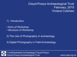
1. Ymddiriedolaeth Archaeolegol Clwyd-Powys
Clwyd-Powys Archaeological Trust www.cpat.org.uk
1) Introduction
• Aims of Workshop
• Structure of Workshop
2) The Use of Photography in archaeology
3) Digital Photography in Field Archaeology
Clwyd-Powys Archaeological Trust
February, 2015
Viviana Culshaw
28. Ymddiriedolaeth Archaeolegol Clwyd-Powys
Clwyd-Powys Archaeological Trust www.cpat.org.uk
Artefact photography.
The Burton Hoard,
Bronze Age
metalwork
Copyright Amgueddfa Cymru / National
Museum Wales
The Use of Photography in Archaeology
Viviana Culshaw